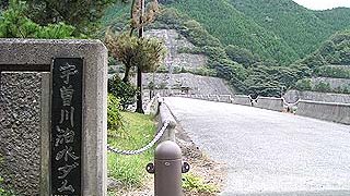
2009

Nara Prefecture Dam

1568-Murodam

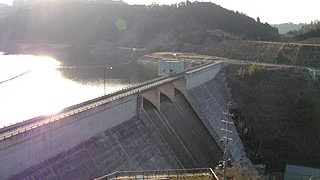
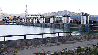
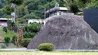
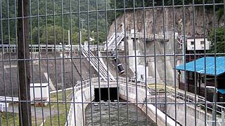
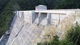
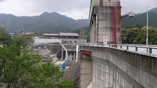
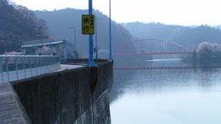
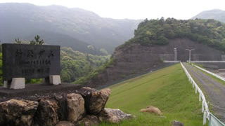
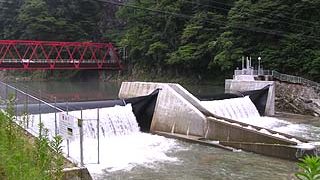
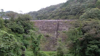
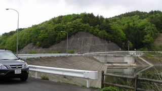
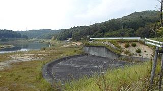
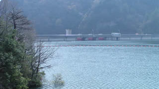
Muro Village is dotted with famous old temples, Muro-ji, Ono-ji, and Hase-ji. In the midst of these temples is this huge man-made structure, the Muro Dam. The crimson gate of the dam is very impressive, but the sights are a bit scarce. / Gravity Concrete / 63.5m
Nara Prefecture Dam

1577-Kamitsu Dam / Nara Pref.

I took Meihan National Highway (Route 25) to visit Universal Studios Japan, and I stopped by on my way home. The approach to the site is relatively easy to find, as you can see the signboard when you get off the Yamazoe IC of the Meihan National Highway and drive west on Nara Prefectural Road No. 80. / Gravity Concrete / 63.5m
Dam in Shiga Prefecture

0000-Setagawaraizeki

The history of the Seta River, including Lake Biwa, is the history of flood control. The history of the Seta River, including that of Lake Biwa, is a history of flood control, and it is a very complicated one, so I cannot talk about it eloquently. There is Ishiyama Temple near the Seta River weir, which is associated with Murasaki Shikibu, and further upstream, the remains of the old Seta River weir (Nango weir) still remain on the left bank of the river.
Dam in Shiga Prefecture

1361-Eigenji Dam / Shiga Prefecture

Eigenji-cho, where Eigenji Dam is located, is home to Eigenji Temple, which gave the dam its name, and is also famous for its autumn foliage. On the day of our visit, it was still too early to call it autumn, and the leaves were just beginning to change color. Eigenji Dam is also located along the Happu Highway R421. / Gravity concrete-fill combined dam / 73.5m
Dam in Shiga Prefecture

1351-Inukami River Dam

From the Hikone IC, take National Route 306 south, pass through Taga-taisha Shrine, and drive along a long, narrow prefectural road until you see the Inukami Dam. The village downstream of the Inukami Dam has a very nice atmosphere. However, despite the atmosphere, there are about three men on a motor scooter blowing a cigarette on the embankment... / Gravity Concrete / 45m
Dam in Shiga Prefecture

0000-kyokutani dam/magatani dam

Located downstream of the Anegawa Dam, it can be found on the way to the downstream park of the Anegawa Dam. I originally did not know this dam existed, but it is as if I discovered it during my coverage of the Anegawa Dam. However, it is well fenced in and quite closed. / Gravity concrete / 9.9m
Dam in Shiga Prefecture

1365-Anegawa Dam

Ibuki-cho is located at the foot of the famous Mt. Ibuki, and the Anegawa Dam is deep within the town. As you can see, the silver grass was growing taller and the autumn leaves were just starting to change color on the mountains, making it a bit chilly. / Gravity Concrete Dam / 80.5m
Dam in Shiga Prefecture

1362-Usogawa Dam / Shiga Prefecture

Uzogawa Dam is located among the "Koto Sanzan" (three mountains in the Koto area): Ryueizan "Seimyoji Temple," Shobozan "Kongorinji Temple," and Shakayama "Hyakusaiji Temple," which are also famous for their autumn leaves. It may be a good idea to visit these temples when visiting the dam. Also, there are many national treasures and important cultural assets in the Koto Sanzan. / Rock fill / 56m
Dam in Mie Prefecture

1314-Misetani Dam

We had heard that the dam was devastated by Typhoon No. 21 that struck in 2004. We conducted our interview under cloudy skies that seemed to bring back memories of the past. The building that was once the control center has completely rotted away. / Gravity Concrete / 39m
Dam in Mie Prefecture

1330-Hinachi Dam

It is a thick-boned dam. But it is also somewhat feminine. It is a motherly dam. Well, here we are, at a dam in Mie Prefecture after a long absence, and it's 7:30 in the morning. It was 7:30 in the morning, and it had been a long time since I visited a dam in the morning. It was when the cherry blossoms were about to fall. Anyway, it is huge. It's been a long time since I've seen a gravity dam this big. / Gravity concrete / 70.5m
Dam in Mie Prefecture

1316-Shorenji Dam

If you want a clear view downstream, bring your own stepladder. But be careful not to be mistaken for the Seirenji Dam. It looks somewhat like the slightly smaller Yahagi Dam or Amagase Dam. / Arch / 82m
Dam in Mie Prefecture

3263-Saingu Adjustment Pond

The Saigu Regulating Pond is planned to increase the water storage capacity by combining the Saigu Pond with the adjacent Soda Pond, which is scheduled to be completed by 2010, but at the time of this interview, construction had not yet begun. / Earth / 16m
Dam in Mie Prefecture

1318-Kamiji Dam

Amano-Iwato, where Amaterasu is said to have shut herself away, is located further upstream from this dam. The weather is so bad that we think Amaterasu must have retreated to Amano-Iwato at this very moment.... / earth / 29.6m
Dam in Mie Prefecture

1311-Yamasato Oike/Yamasato Oike

In the dam handbook, the location is listed as "Hokusei-cho Yamago," and the name of the place did not exist due to rezoning or something, but if you trace the name of the nearby Yamago Elementary School and pond on the map, the characters are different, but it is "皷" which probably refers to this place. / Earth / 22m
Dam in Mie Prefecture

1300-Inabe Oike

The height of the embankment is just 15 meters, which is just barely the standard for a dam, but it exists as a place of recreation for the citizens of Inabe. Therefore, there were many visitors and many fishermen. I am very envious that there is such a park in the town. / Earth / 15m
Dam in Mie Prefecture

1323-Nakazato Dam

Nakasato Dam is located near the source of water for the Mie Water Supply under the control of the Japan Water Agency (former Japan Water Development Corporation), and serves to guide water when the water in the Miyagawa, Komono, and Kasato dams' regulating reservoirs is insufficient. In other words, it is the parent of these dams. / Earth / 46m
Dam in Gifu Prefecture

0000-Shimomura Dam

Kamiyasaki-cho was hit hard by the Tokai torrential rainfall in September 2000 (also known as the Enan torrential rainfall in some areas). The Shimomura Dam was originally a fixed weir, but it was replaced by a rubber dam after it was breached in addition to causing more damage from the torrential rain in Tokai. The height of the embankment is less than 15 meters, so technically it is not a dam, but we decided to include it here because it is rare. / Rubber dam / 4.3m
Dam in Gifu Prefecture

1074-Obuchi disaster prevention reservoir/Kobuchi Bousai Tameike

The prime minister is "Obuchi," but the dam is "Kobuchi. Moreover, on the map, it is called "Obuchi Dam," but in the dam handbook, it is called "Obuchi Disaster Prevention Reservoir. Incidentally, there is a dam called "Koizumi Dam" in Tajimi City, a neighbor of Kani City. And, to make matters tougher, there are two dams, No. 1 and No. 2. (This has nothing to do with this issue...) / Rockfill / 18.38m
Dam in Gifu Prefecture

1124-Tazawa disaster prevention dam

I am not sure if fishing is prohibited or not, but the bank is basically a no-go area. However, I don't think there are that many fish... This is a free overflow type of overflow discharge. It is a relatively simple structure. / earth / 29.5m
Dam in Gifu Prefecture

1098-Sakashima River Disaster Prevention Dam (Ryugin Dam)

It is like a large park and there are many things to see and do around the area. There is a waterfall, a cart driving range a short distance away, and the sound of explosions echoing all the way around the dam. I actually went to see the cart driving range, and when I found out it was a cart driving range, I thought, "What the heck...," but it was quite interesting just to watch. I highly recommend going to see it in combination with a visit to the dam. / Earth / 19.7m
Copied title and URL