
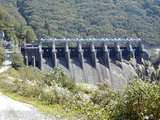
Location: Aza Shintaki, Oaza Koshirakawa, Shirakawa Village, Ono-gun, Gifu Prefecture
View of the embankment from the right bank

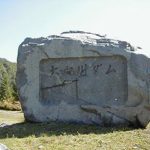
It is located on the border between Gifu and Toyama prefectures, northward on Route 156. We suddenly came across this dam during a trip in Kanazawa.
It is a pleasure to discover an unfamiliar dam like this because it is not on the maps I have.
This area is intermingled with Gifu and Toyama prefectures, so the national highway changes prefectures frequently. This is an interesting experience that is difficult to experience if you live on the plains.
dam characteristics
| da mu | form (something takes) | gravity-fed concrete dam |
|---|---|---|
| Bank height | 53.2m | |
| Bank length | 190.0m | |
| Dam volume | 103,000m3 | |
| savings water (esp. cool, fresh water, e.g. drinking water) pond | Watershed Area | 762.3 km2 |
| Reservoir area | 62ha | |
| Total storage capacity | 7,909,000m3 | |
| Effective water storage capacity | 3,186,000m3 | |
| Year Completed | 1951 | |
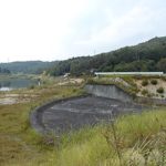
Other facilities/observations
| Parking lot | × | Like the Tsubakihara and Omaki dams, I was only able to take one picture of this dam.... This dam was not on our schedule, and we were running out of time.... |
|---|---|---|
| Toilet | × | |
| Park | × | |
| PR Exhibition Hall | × |
Comment