
Date of interview: Monday, 7/29/2023
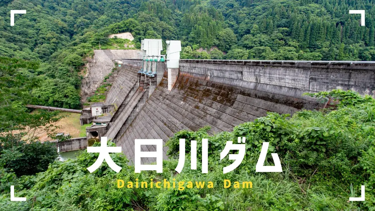
After visiting the Managawa, Sasagawa, and Kumogawa dams for the Forest and Lake Friendship Seasonal Event, we took advantage of the free time we had before leaving to travel to Ishikawa Prefecture to visit the Akase Dam, followed by a visit to the Dainichigawa Dam. This would be the last dam of the day.
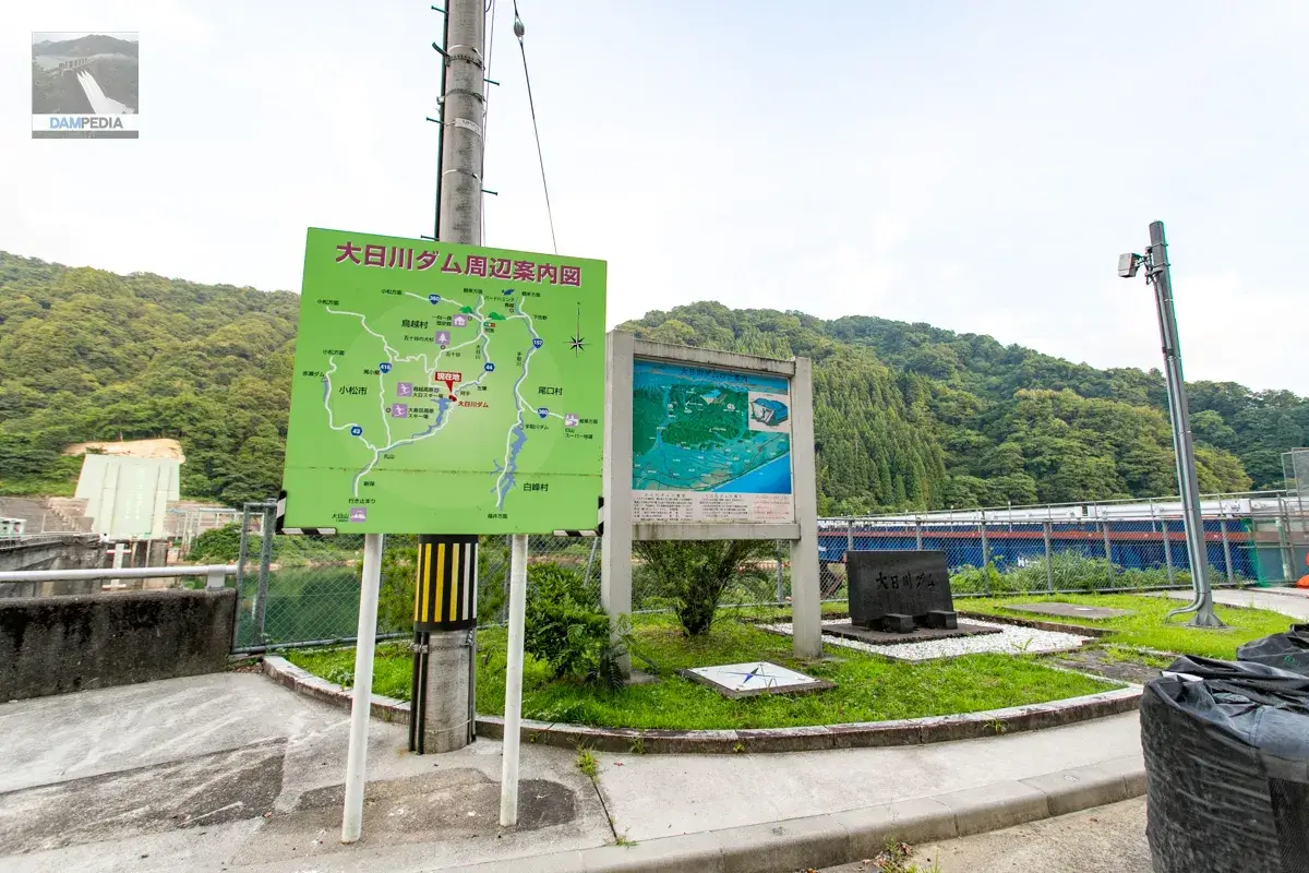
First, visit from the left bank.
We moved from Akase Dam, where Prefectural Road 109 is quite narrow and full of unexplored places, and we arrived at a hand-carved tunnel that suddenly appeared, a fairy-tale building on a former ski resort site, and a village that suddenly appeared, all of which surprised us from start to finish. As you can see, there are toilets at the dam site.
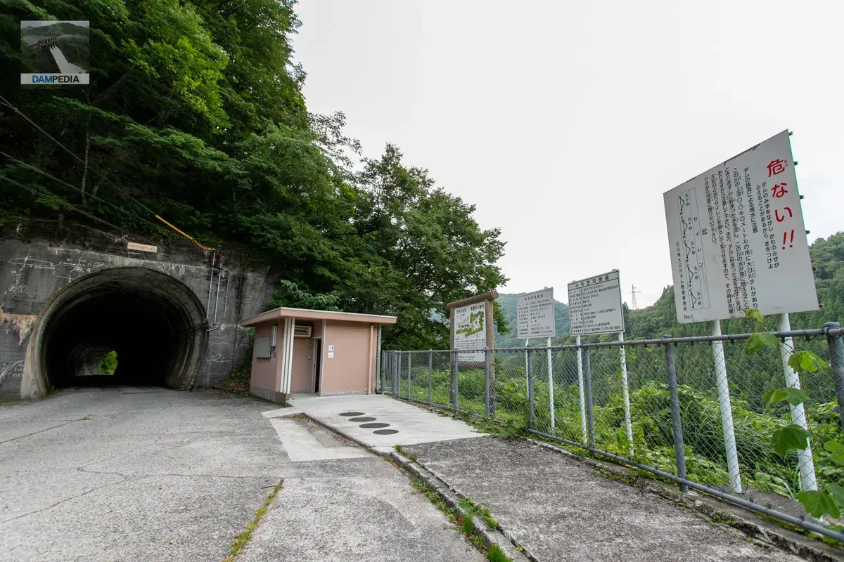
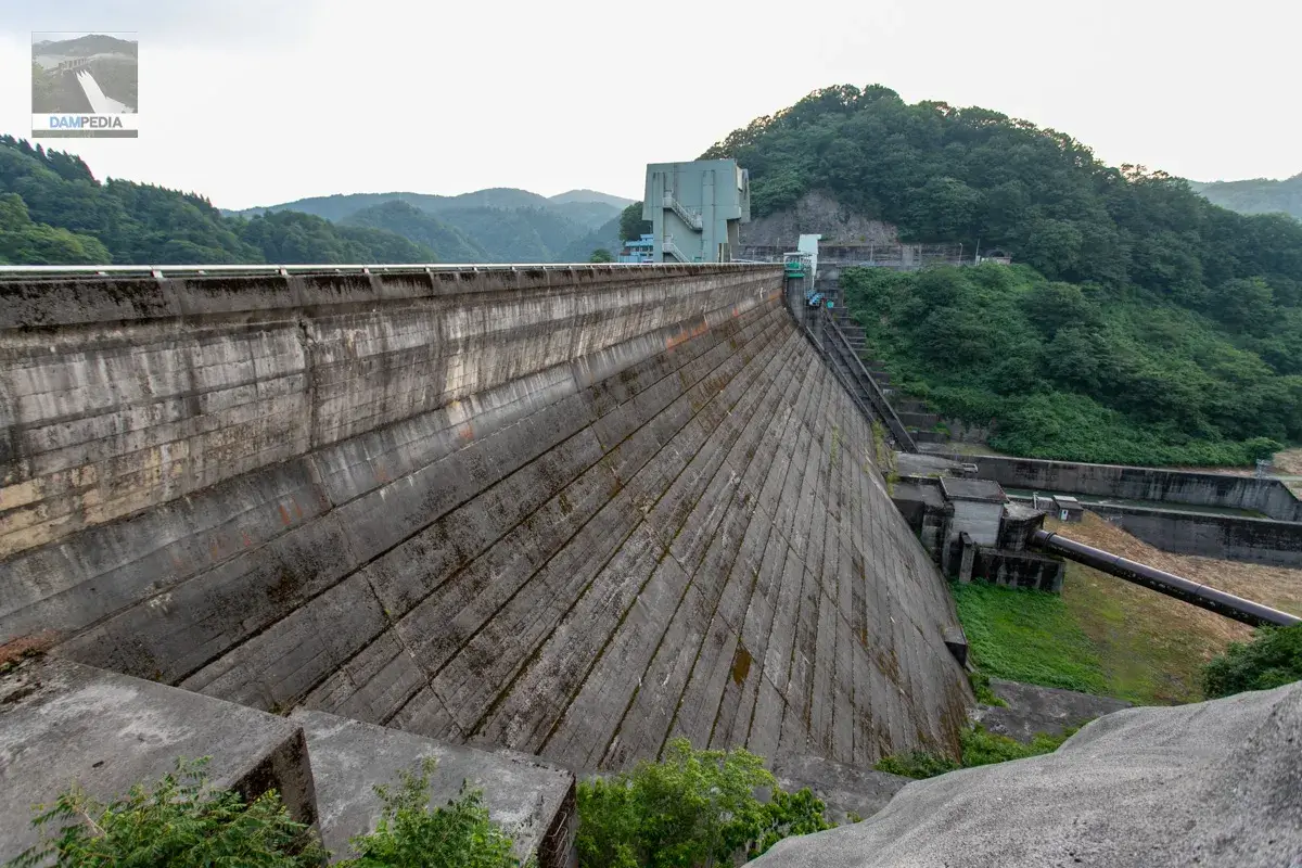
When you arrive at the dam site, you can suddenly see the downstream face of the embankment on your left. Incidentally, there was a path on the way to the downstream side of the dam, but it was marked as off-limits, so we gave up 💦.
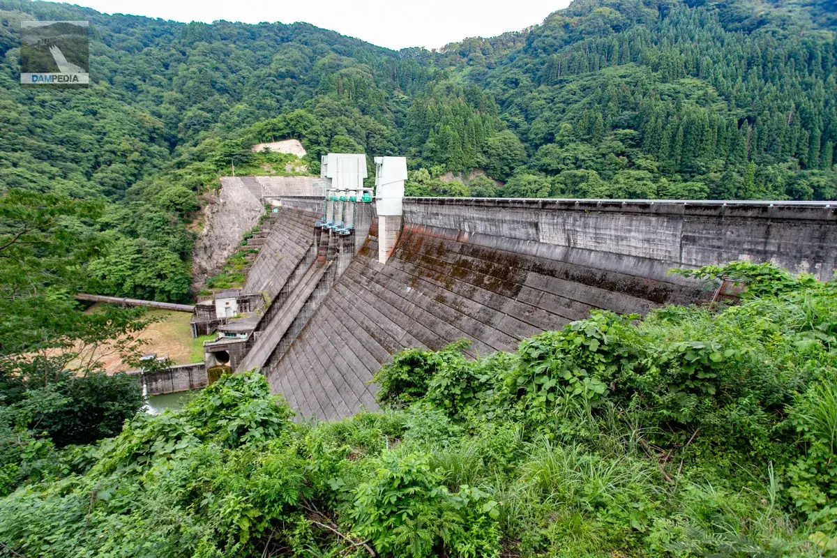
The top end is served by Prefectural Road 44, which is open to automobile traffic.
A well-stocked sign. At a quick glance, the sign on the right looks older, but the left one mentions Torigoe, Oguchi, and Shiramine villages before they were merged into Hakusan City, and the right one, which mentions Hakusan City, is actually newer.
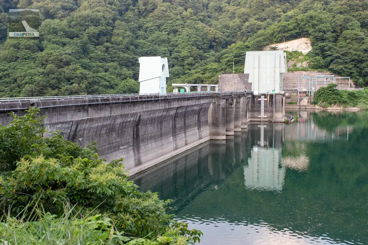
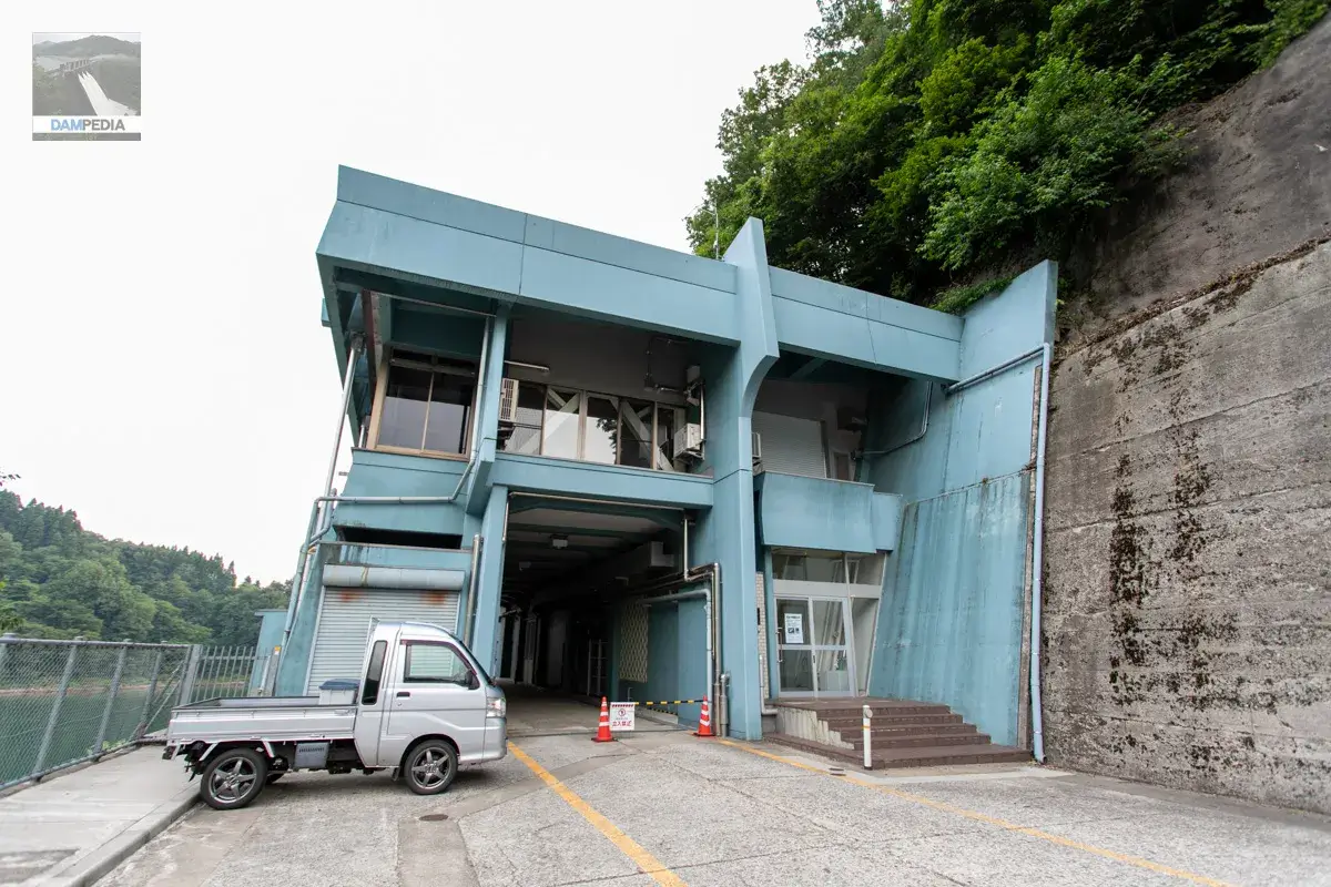
This is a view of the upstream side of the embankment from the left bank. Although this is a prefectural dam, it has various facilities and is a bit luxurious.
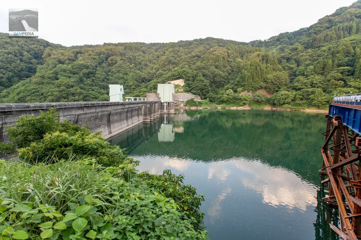
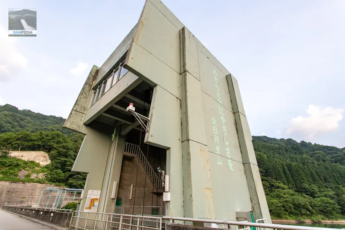
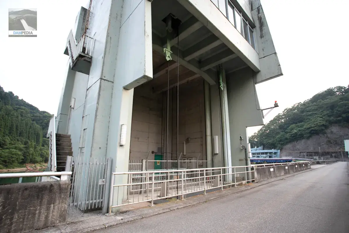
In front of the upstream face is the crest gate, and behind it is the water intake facility. On the downstream side is the elevator tower. Both the water intake facility and the elevator tower have a slightly different design.
Incidentally, Crestgate has three radial gates and the specifications are as follows
| Net Diameter x Vertical Height | 7.000x6.086m |
| Opening and closing speed | 0.3m/min |
| door weight | 9.400t |
| Date of manufacture | June 1967 |
| production | Oshima Kogyo Co. |
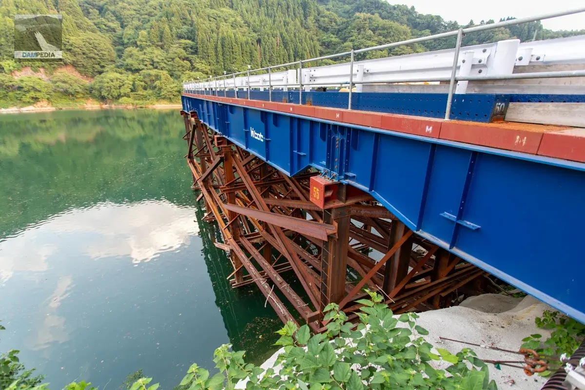
At the time of our visit, the water intake facility was under construction and a temporary structure had been set up on the left bank.
At the Dainichigawa Dam, dam cards are distributed, but unfortunately time was running out.
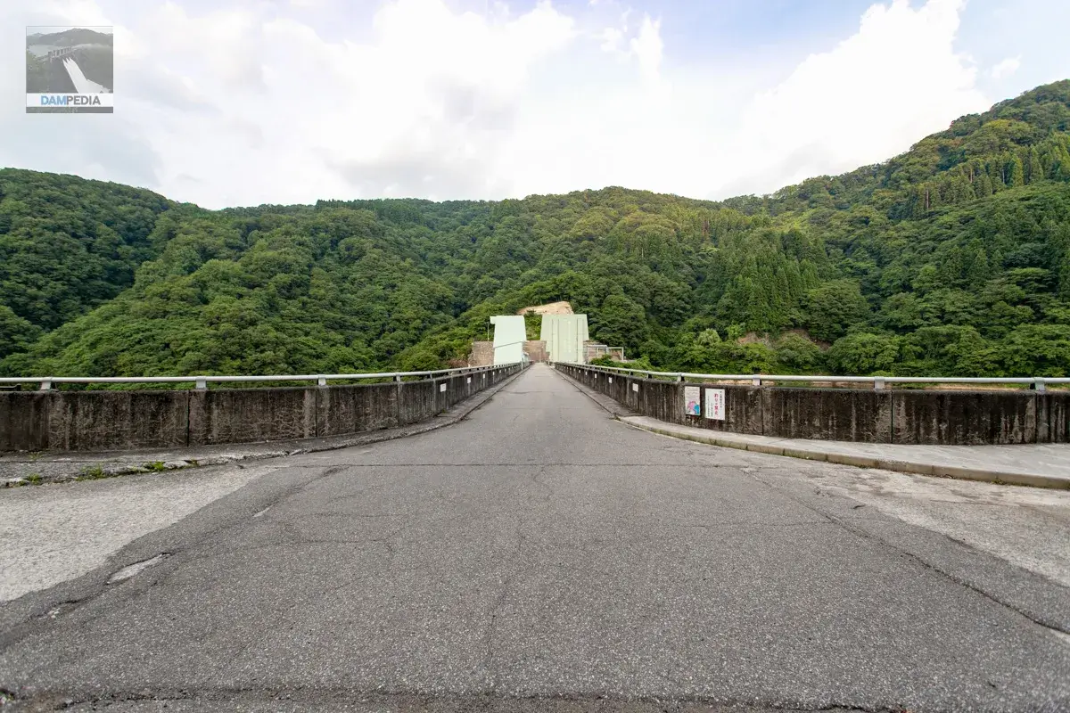
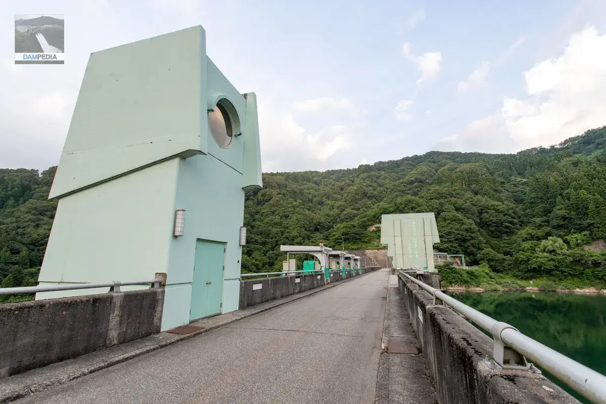
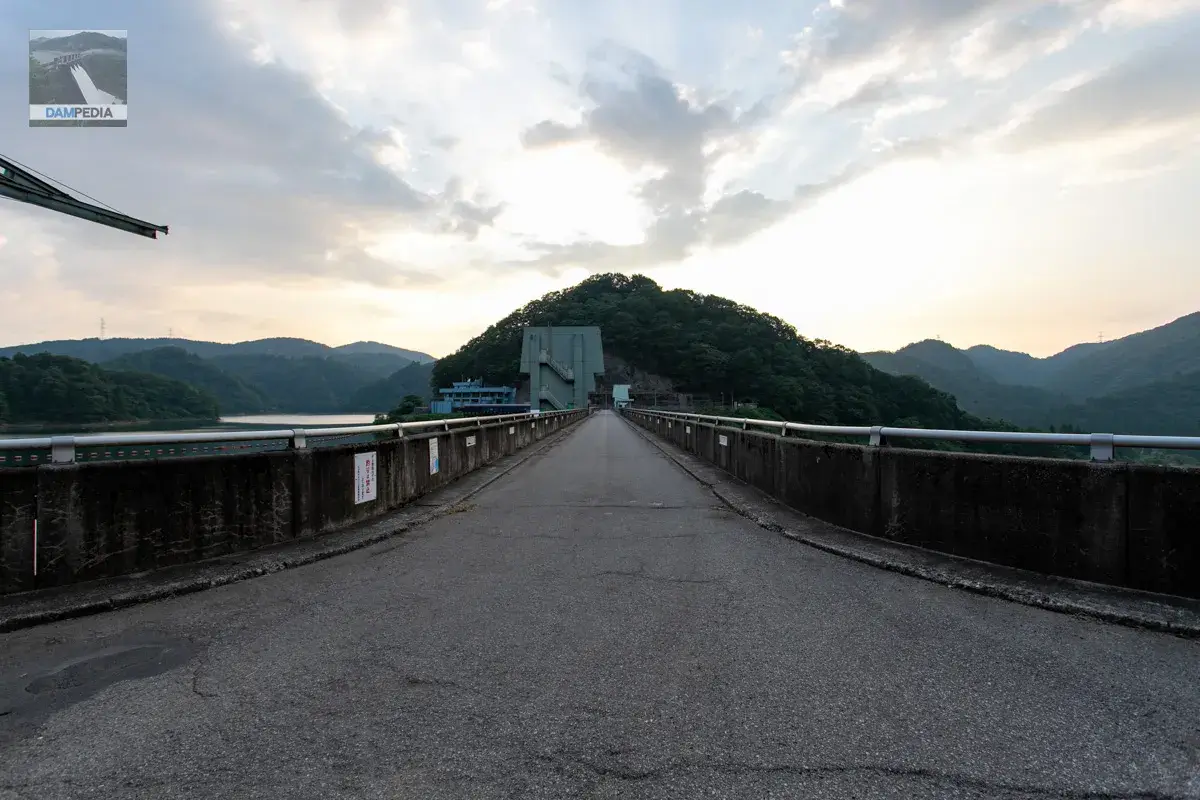
To the top
View of the elevator tower from the top. It is a very strange design. The second floor, where the elevator machine room is supposed to be located, has a round window, like a small boy with one eye. The color of the tower is light green, just as the control center was light blue.
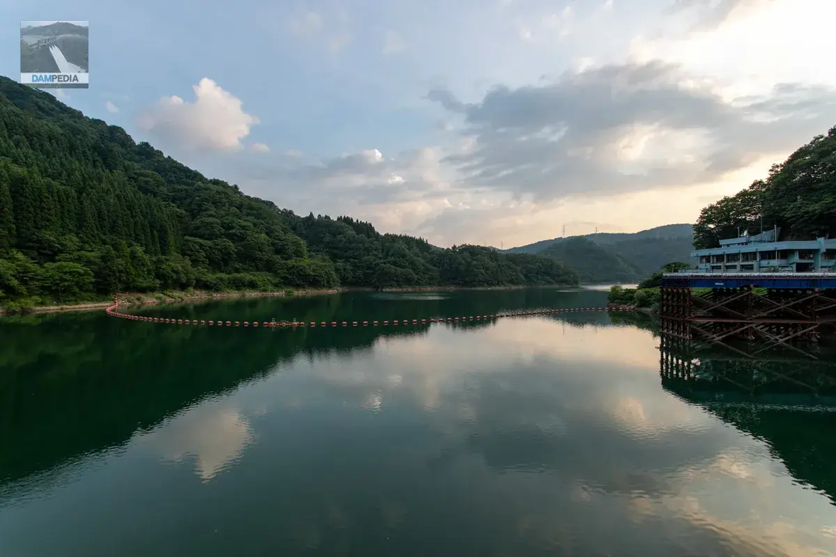
The dam lake at dusk.
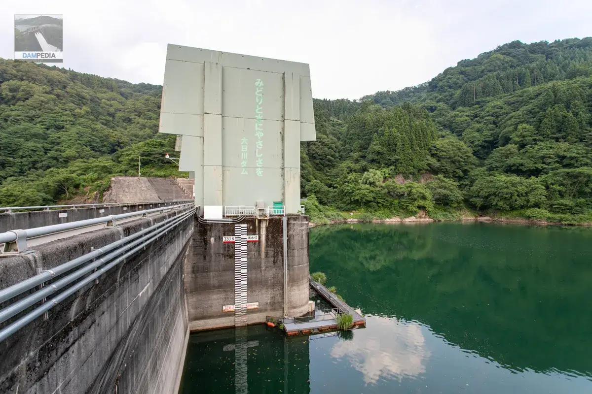
It says "Gentleness to the greenery and water, Ohigawa Dam." Why did they write it in the same color 💦 Incidentally, the water level at this time was EL323.3m. Also, the Dainichigawa Damsurcharge water level(the highest water level during flooding) is 330.6 meters and the flood stage limit is 324.7 meters.
I don't have detailed specs, but it looks like a multi-stage surface intake system. This one is designed to look somewhat like a robot head.
Wires can be seen suspended.
Go to the right bank.
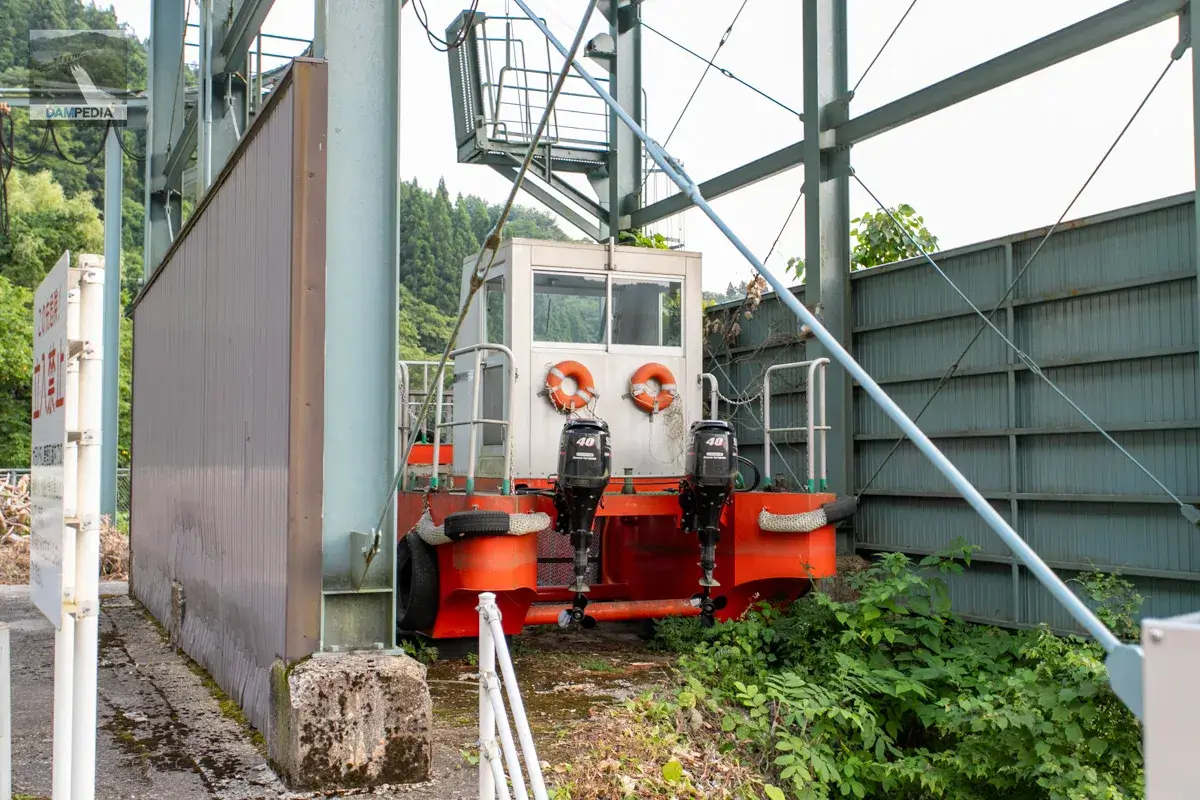
These boats are used to collect driftwood and trash from the reservoir.
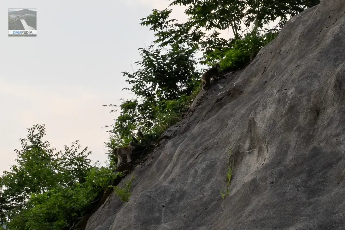
It may be a little hard to see, but a family of monkeys came to visit the dam.
There was also a baby monkey. Cute.
There is actually an observation deck at the back of the mountain, but unfortunately it was off-limits due to the danger of collapse.
We are looking just to the west, but the sun is hidden by the mountains and the area is getting completely dark.
To the top again
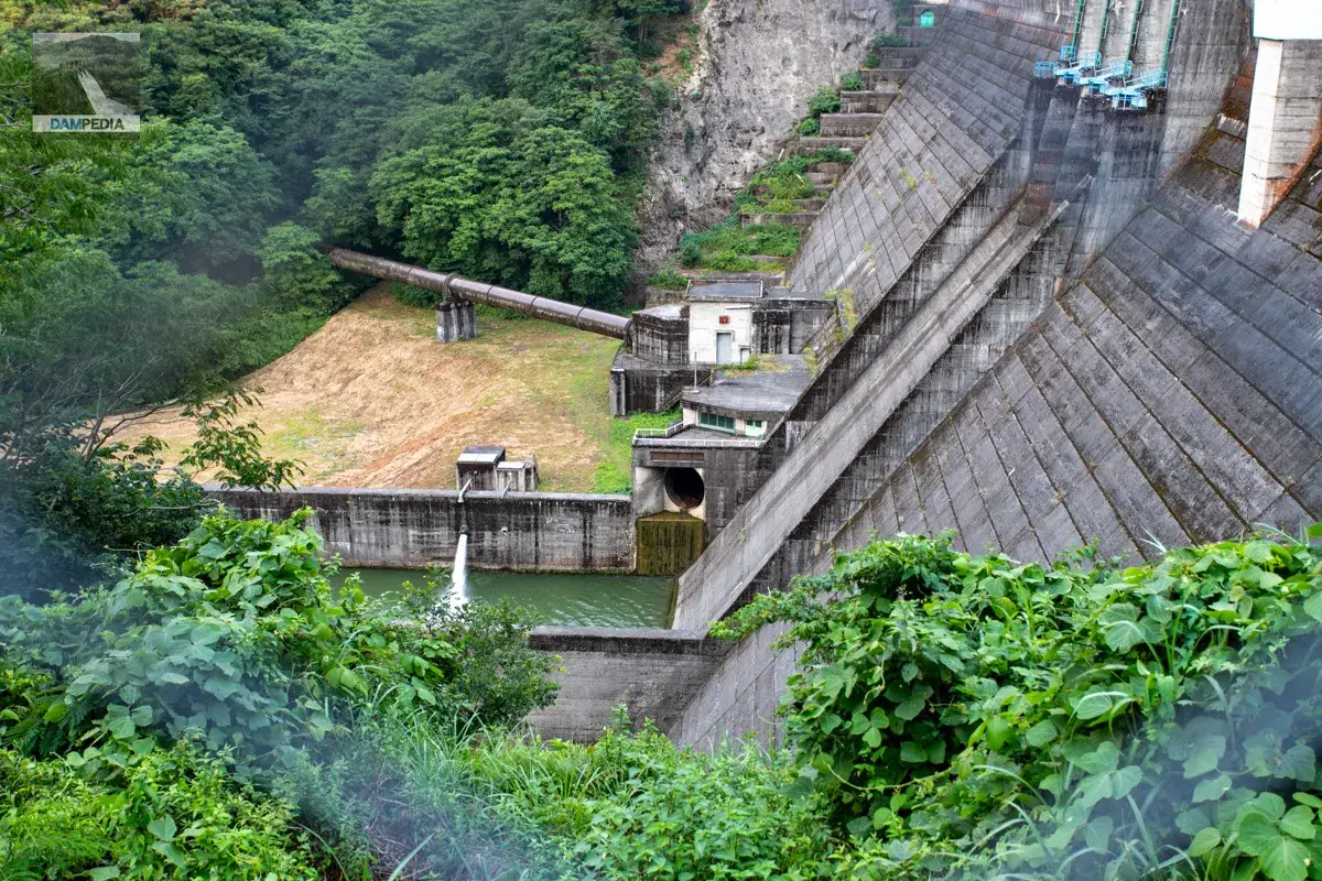
As seen in the photo from the right bank, you can see a brown pipe extending from downstream of the embankment into the forest. This is a hydraulic iron pipe for hydroelectric power generation, through which water taken from the intake tower is used to generate electricity at the Dainichi River No. 1 Power Plant located downstream.
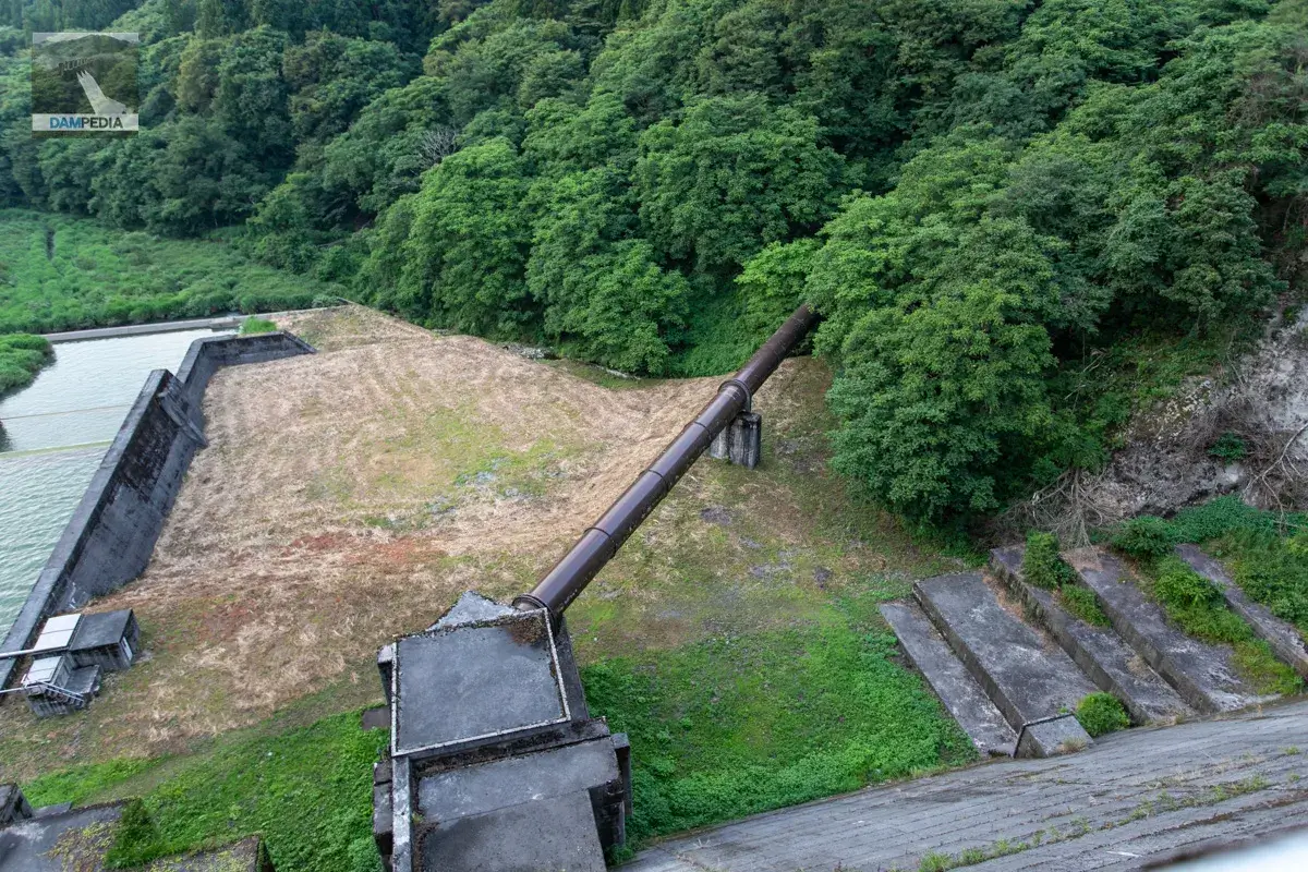
In addition, water used at the Dainichigawa No. 1 Power Plant is used at the Kamikoshimizu Power Plant, and then taken at the Torigoe Dam, an intake weir, and used at the Dainichigawa No. 2 Power Plant located beyond the pass.
The shaft of the radial gate is in the way. Beyond the reduction works, the river seems to be left to nature, and although it is difficult to tell the flow path, the river flows toward the left.
To the left bank again.
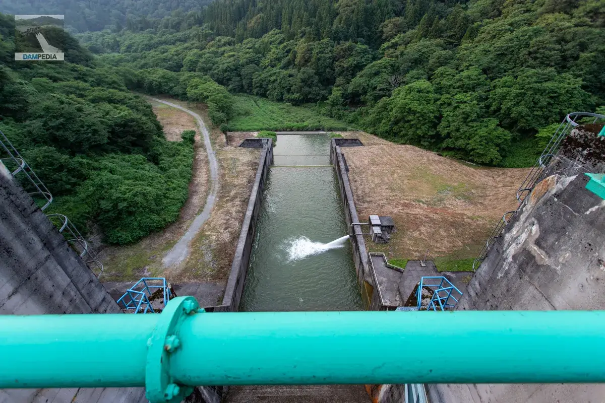
The lens is attached to the wire mesh fence. In the back is a valve chamber and hydraulic pipe for power generation, the large hole in the foreground is a Howell Bunger valve used for irrigation and flood control, and downstream of that is a discharge facility for river maintenance, which appears to be spewing water.
As written in the Akase Dam page, the Dainichigawa Dam was in more trouble than the Akase Dam when it was built, but today it is a dam that is relied upon for flood control, irrigation, and power generation deep in the mountains of Hakusan City.
Dainichigawa Dam Specifications
| Location | Ade, Hakusan City, Ishikawa Prefecture |
| River Name | Dainichi River, Tedori River System |
| Objective | F (flood control, agricultural disaster prevention) A (irrigation water) P(Power generation) |
| Model | G(gravity-fed concrete dam) |
| Bank height | 59.9m |
| Bank length | 238m |
| Dam volume | 309,000 m3 |
| Watershed Area | 83.9k㎡ (Direct: 56.5k㎡, Indirect: 27.4k㎡) |
| Reservoir area | 132ha |
| Total storage capacity | 27,200,000 m3 |
| Effective water storage capacity | 23,900,000 m3 |
| Dam operator | Ishikawa prefecture (Hokuriku area) |
| Main body constructor | Kajima Construction |
| Year of launch | 1952 |
| Year Completed | 1967. |
| Name of Dam Lake | Lake Dainichiko |
Other facilities/observations
| Parking lot | ○ |
| Toilet | ○ |
| Park | × |
| PR Exhibition Hall | × |
| Fishing | ○○ (excluding no-take zones) |
| Viewing platform | × |
Map around Dainichigawa Dam
Weather around Dainichigawa Dam
Accommodations that may be close to Dainichigawa Dam
Comment