

Location: Kugari, Kani-cho, Kani-shi, Gifu
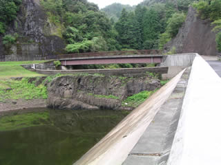
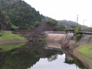
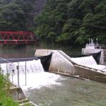
Downstream view of the levee from the right bank

Whenever I see this dam, I am reminded of Prime Minister Obuchi, who died of illness in the middle of his term. Without him, the prosperity of IT would not have been possible. Good people die early. Especially in these times.
Now, to get back on track, here is a dam. The prime minister is "Obuchi," but the dam is "Kobuchi. Moreover, on the map, it is called "Obuchi Dam," but in the dam handbook, it is called "Obuchi Disaster Prevention Reservoir.
Incidentally, there is a dam called "Koizumi Dam" in Tajimi City, a neighbor of Kani City. And, to make matters tougher, there are two dams, No. 1 and No. 2. This has nothing to do with this issue.
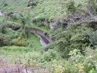
drainage channel
It was difficult to see downstream because of the overgrown vegetation.
Water conduit tunnels
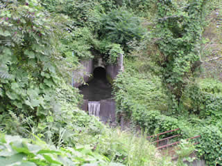
It was difficult to see downstream because of the overgrown vegetation.
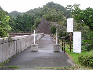
View of the top edge from the right bank
Ah, yes. It is a small dam, but it is the first rockfill dam in Japan in terms of "year of completion. In terms of "year of start of construction," it is the Ishibuchi Dam in Iwate Prefecture. Well, that's how old this rock-fill dam is.
View of the left bank from the center of the top edge
A flood discharge is located on the left bank, but it is quite high.
View of the drainage channel downstream from the top
It was difficult to see downstream because of the overgrown vegetation.
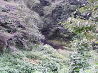
View of the dam lake from the top
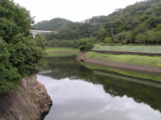
The white bridge in the upper left corner is the Tokai Ring Expressway (MAG Road), which just opened in 2005. Thanks to the construction of this road, access to this region has become much easier.
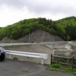
View of the embankment (lake side) from the right bank
The area around this area is a walking trail, and I heard that cherry blossoms and autumn leaves can be enjoyed depending on the season. Some people were fishing in the dam lake. Unfortunately, the weather was unfavorable, but I guess fishing is more active in this weather. Certainly, it seemed that they were catching fish.
dam characteristics
| dam | form (something takes) | Concrete surface barrier type rockfill dam |
|---|---|---|
| Objective | Flood control, agricultural disaster prevention | |
| Bank height | 18.38m | |
| Bank length | 53m | |
| levee length and width | 3m | |
| Dam volume | 119,000m3 | |
| reservoir | Watershed Area | 7.5km2 |
| Reservoir area | 9ha | |
| Total storage capacity | 552,000m3 | |
| Effective water storage capacity | 552,000m3 | |
| Ceiling elevation | EL 156.75m | |
| River Name | Kisogawa River System Kugari River | |
| Year of launch | 1949 | |
| Year Completed | 1951 | |
| Access | The Tokai Ring Expressway (MAG Road) was just completed in 2005. It is convenient to use the Kani Mitake IC. Exit the interchange and turn right. Turn left at Kakita Nishi signal intersection Passing Hana Festa Memorial Park on the left. Turn left at the Futano/Hasaki signal intersection Go east for about 3 km and you will reach it. | |
Other facilities/observations
| Parking lot | ○ | Kani City Tourism Association websiteIt has even been introduced in The dam is a tourist attraction in Kani City. There is a parking lot with space for 15 cars. |
|---|---|---|
| Toilet | ○ | |
| Park | ○ | |
| PR Exhibition Hall | × | |
| Fishing | ○ |
Comment