
Location: 2039-5 Kamekubo, Oaza-Igawa, Aoi-ku, Shizuoka City, Shizuoka Prefecture
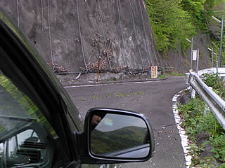
Dead end...

Like the Oigawa Dam and the Sunmatagawa Dam, the road and the embankment were far apart as far as the map showed, so I had half given up looking at the Okuizumi Dam from a rule of thumb. However, on the way from Nagashima Dam to Igawa Dam, we suddenly found a sign that read "Okuizumi Dam ↓" and decided to go down the hill anyway, even though it was a suspiciously hilly road...
As expected, an off-limits chain-link fence blocked our way. It is thought that if you go over this fence, you can enter the Igawa line, and if you go over it, you can go to the embankment, but I was too small-minded to go that far....
Igawa line and embankment
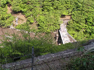
I looked directly down and there it was! The dike! However, I could only see the top edge... We only confirmed that it was there, and quickly went back the way we came.
By the way, the track in front is the rail of the railroad in the Igawa line in the Oigawa river. The left is for the Igawa dam and the right is for the precipice.
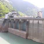
dam characteristics
| da mu | Model | gravity-fed concrete dam |
|---|---|---|
| Objective | generation (e.g. power) | |
| Bank height | 44.5m | |
| Bank length | 75.6m | |
| Dam volume | 35,000m3 | |
| savings water (esp. cool, fresh water, e.g. drinking water) pond | Watershed Area | 464.6 km2 |
| Reservoir area | 20 ha | |
| Total storage capacity | 3,150,000m3 | |
| Effective water storage capacity | 600,000m3 | |
| River Name | Oigawa River System Oigawa River | |
| Year of launch | 1952 | |
| Year Completed | 1955 | |
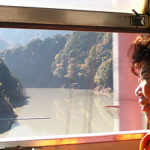
| Access to D@M | Get off at Sagara Makinohara IC of Tomei Expressway The rest of the way is National Route 473 heading north toward Kawane Town. After entering Kawane Town and eating taiyaki at Ieyama, head north again on Route 473. After driving for a while, you will hit a T intersection with Route 362. Turn right at the intersection and go north on Route 362. There is a road that enters Prefectural Route 77 near Chigashira, so turn onto that road and continue north. When you pass the Okuizumi station in the Igawa line in the railroad, you will see the fork of the Sunmatakyo and the Precipice. Turn right onto Prefectural Route 388 toward the precipice. From here on, we will rely on our intuition (not much) and head for the Igawa Dam. Turn right at the sign modestly marked "Okuizumi Dam" on the right before the dam. | |
Other facilities/observations
| Parking lot | × | The surrounding roads are really narrow and the dam is hard to find, The road dead-ends, and only a small embankment can be seen many meters below. It's up to you to decide if it's worth it. |
|---|---|---|
| Toilet | × | |
| Park | × | |
| PR Exhibition Hall | × |
Comment