
Date of interview: Saturday, 1/4/2014
On this day, I was making my first dam visit to the dams in eastern Hyogo Prefecture and western Kyoto. I had visited Hiyoshi Dam several times, but I remembered that there was a dam upstream from Hiyoshi Dam that I had not yet visited, so I visited the Miki Dam.
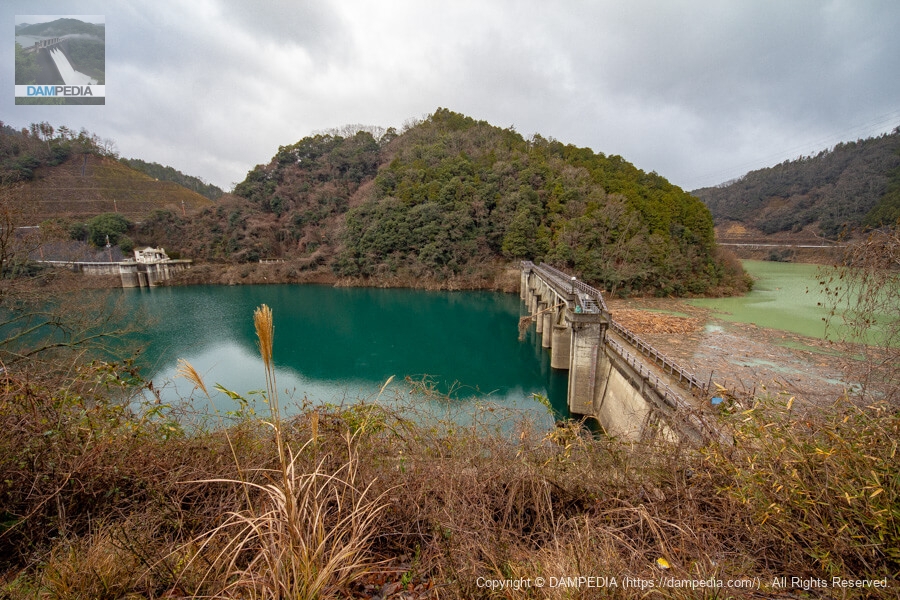
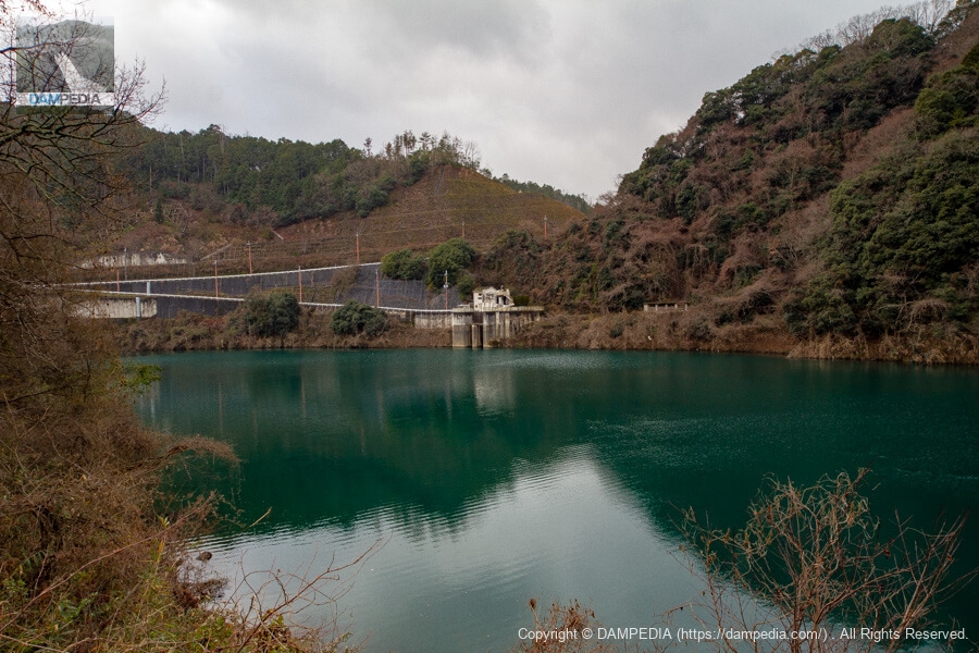
Although most of the Segi Dam has been submerged by the construction of the Hiyoshi Dam downstream, it is still an active working dam as an intake dam for the existing Shinjo Power Plant. It is also the new dam that will serve as the de facto sand storage dam for the Hiyoshi Dam.
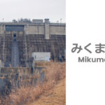
View of the dike and reservoir from the right bank
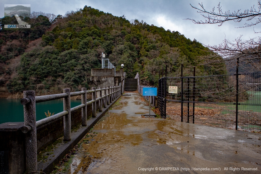
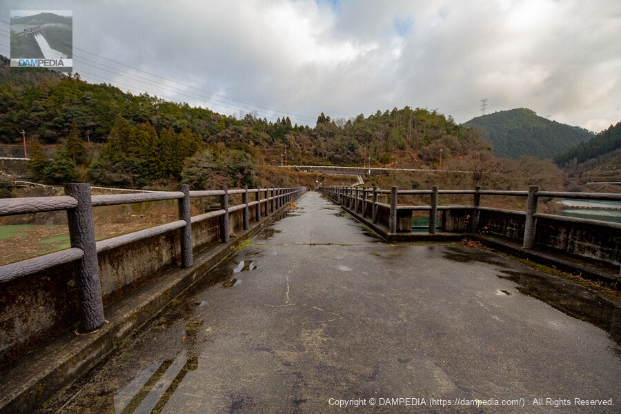
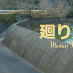
The Segi Dam is maintained as a walking trail, allowing visitors to freely walk along the top edge.

Looking upstream from the right bank
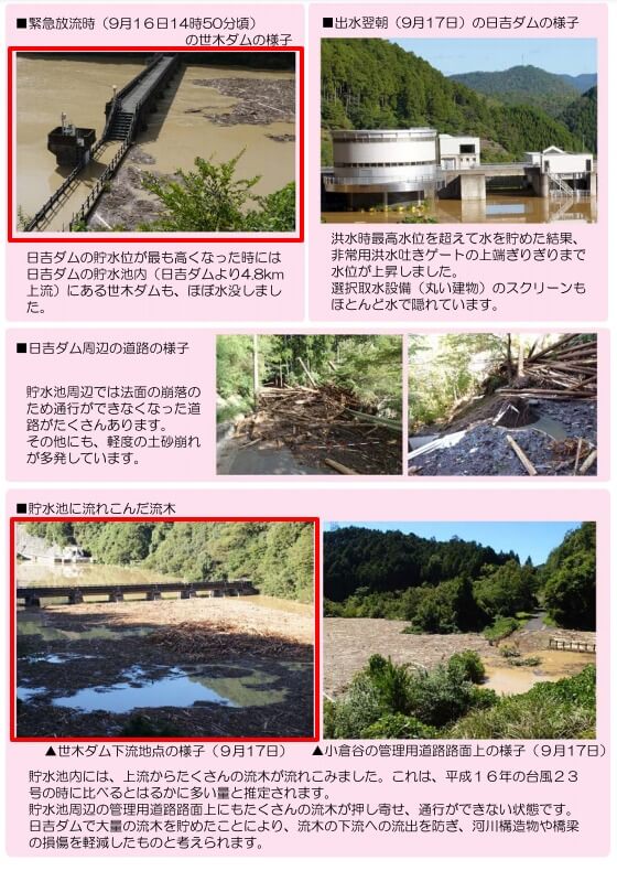
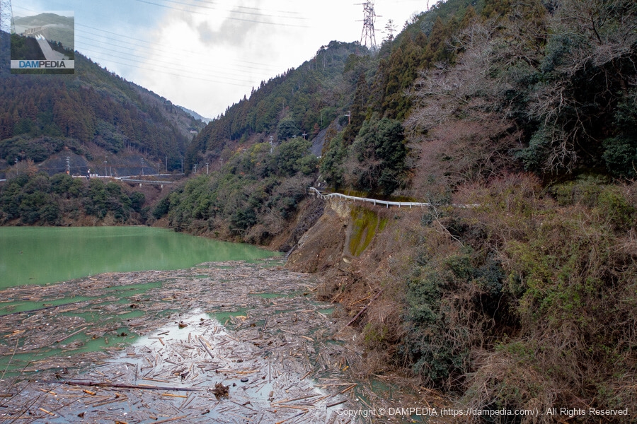
The year before, in September 2013, Typhoon No. 18 brought torrential rains and caused flood damage in various parts of Kyoto Prefecture, and the effects of the typhoon remained strong in the area around the Segi Dam even after the new year.
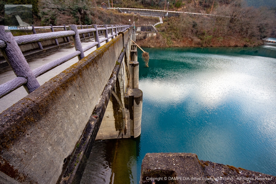
View of the upstream face of the embankment from the top level of the right bank
A long piece of driftwood can be seen poking through the top edge.
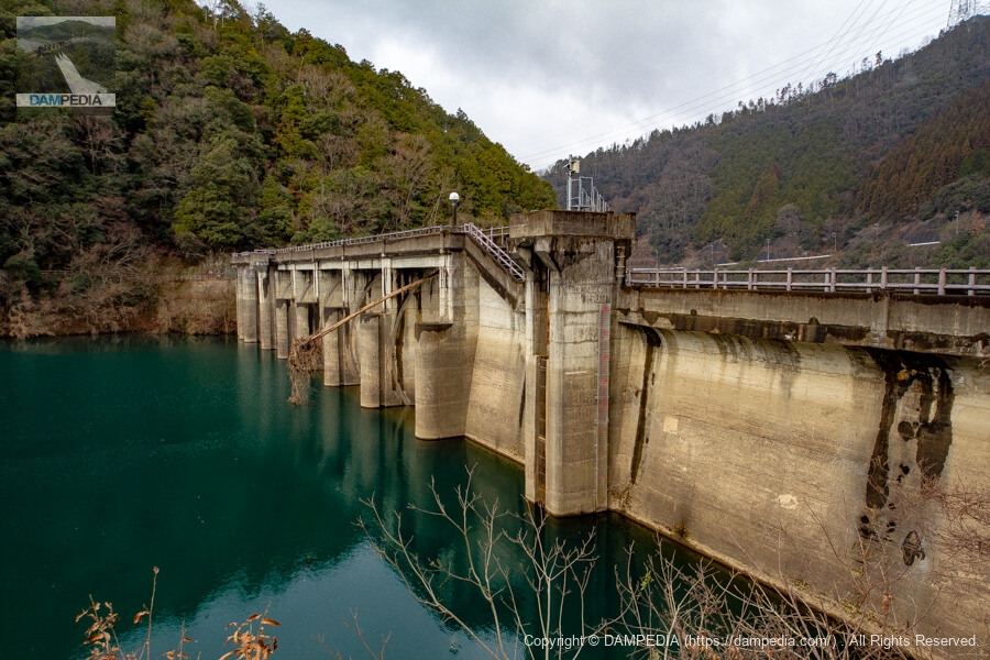
At the time of Hiyoshi Dam's highest water level, Segi Dam was almost submerged. It is no wonder that driftwood was stuck in the dam.
View of the Shinjo Power Plant intake from the right bank
Water is pumped through a conduit tunnel from the intake to the Shinjo Power Station, approximately 3.6 km downstream, to generate a maximum of 6,700 kW of electricity. Since the water is supplied by short-circuiting the Katsura River, it is necessary to travel more than 10 km by car to get to the power station from here.
View of the top edge from the right bank
The Segi Dam was completed in 1951, so it has a design with a raised gate, which is typical of dams of that era.
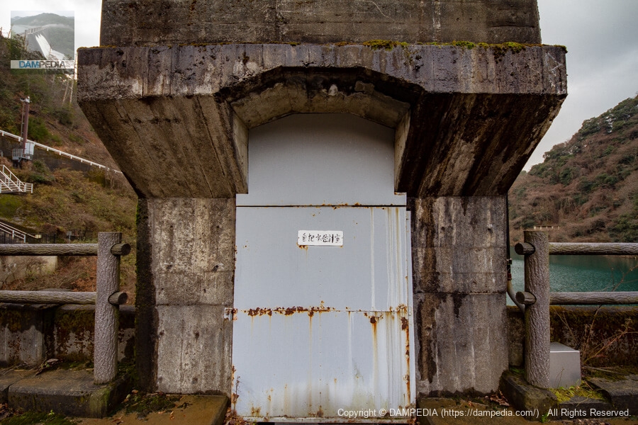
self-registering water gauge chamber
Self-describing water level gauge chamber with a stately design.
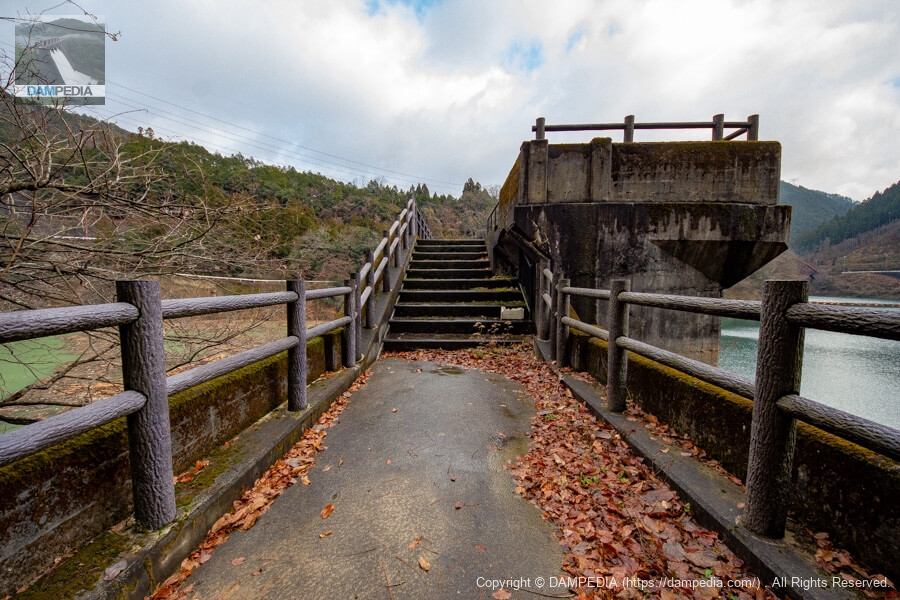
The promenade on the right bank from the top edge? View from the top
On the right bank, there is a road for cars as well as a trail or patrol path, but it was partially collapsed by the recent typhoon and is impassable. This cliff has been repaired, but the pathway seems to be completely blocked.
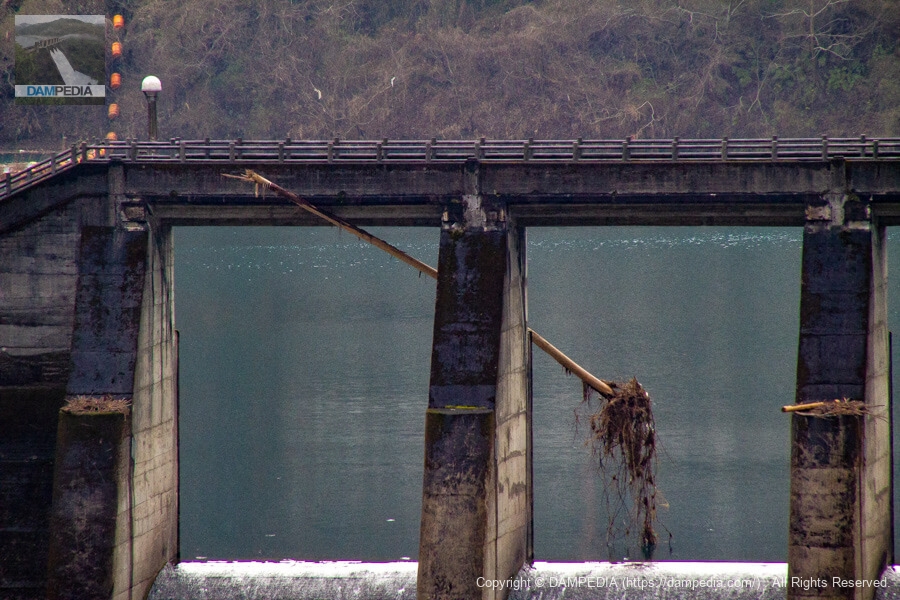
View of driftwood protruding downstream from the top
This is the power of nature. The photo shows the downstream side of the Segi Dam, but it is also the reservoir of the Hiyoshi Dam, so it looks as if it is the reservoir of the Segi Dam. Also, there is a large amount of driftwood, but the fact that it is staying in the Hiyoshi Dam reservoir means that it is not flowing downstream and is deterring the spread of damage.

Looking upstream from the left bank
Traces of where the radial gate used to be can still be seen on the gate pier. The radial gate was removed with the construction of Hiyoshi Dam, but I would have liked to have seen it. I imagine that there was probably a gate winder or other equipment at the top end, but I am concerned that I cannot find any trace of it.
It is hard to find photos of the Segi Dam at that time on the Internet, so I wanted to fish for various documents as I was writing this article. I wonder if there are any documents at the Hiyoshi Town Local History Museum...
View of the top edge from the left bank
The outside is the original railing, and a new railing with a false wood design is installed on the inside.
View of the top edge above the gate pier from the left bank
I really wonder what the gate winder was doing...
View of the downstream face of the dike
We left the top end and moved downstream. There is a viewing platform on the right bank road where you can get a good view of the downstream side of the river. Please come and see it from here.

Driftwood caught in the embankment
In this way, you can see that the driftwood sticks out in perfect balance.
The appearance of the Segi Dam would have been altered by the removal of the radial gate when the Hiyoshi Dam was constructed. Furthermore, the Segi Dam is submerged when the Hiyoshi Dam is full of water. Even so, it was never completely removed and assumed a new role as a dam for power generation and as a substantial sand storage dam, just like a first generation gentleman enjoying his second life.
Segi Dam Specifications
| Location | Aza Mukouyama, Amawaka, Hiyoshi-cho, Nantan-shi, Kyoto |
| River Name | Yodo River system Katsura River |
| Objective | P(Power generation) |
| Model | G(gravity-fed concrete dam) |
| Bank height | 35.5m |
| Bank length | 138.2m |
| Dam volume | 59,000 m3 |
| Watershed Area | 279km2 |
| Reservoir area | 48 ha |
| Total storage capacity | 5,595,000 m3 |
| Effective water storage capacity | 2,790,000 m3 |
| Dam operator | Kansai Electric Power Co. |
| Main body constructor | Kajima Construction |
| Year of launch | 1950. |
| Year Completed | 1951 |
| Name of Dam Lake | - |
Other facilities/observations
Parking is available on the shoulder of the road. Fishing is allowed, but 200m upstream and 100m downstream from the Segi Dam is a no-fishing zone.
| Parking lot | △ |
| Toilet | × |
| Park | × |
| PR Exhibition Hall | × |
| Fishing | ○ |
Comment