
Date of interview: Monday, 7/29/2023
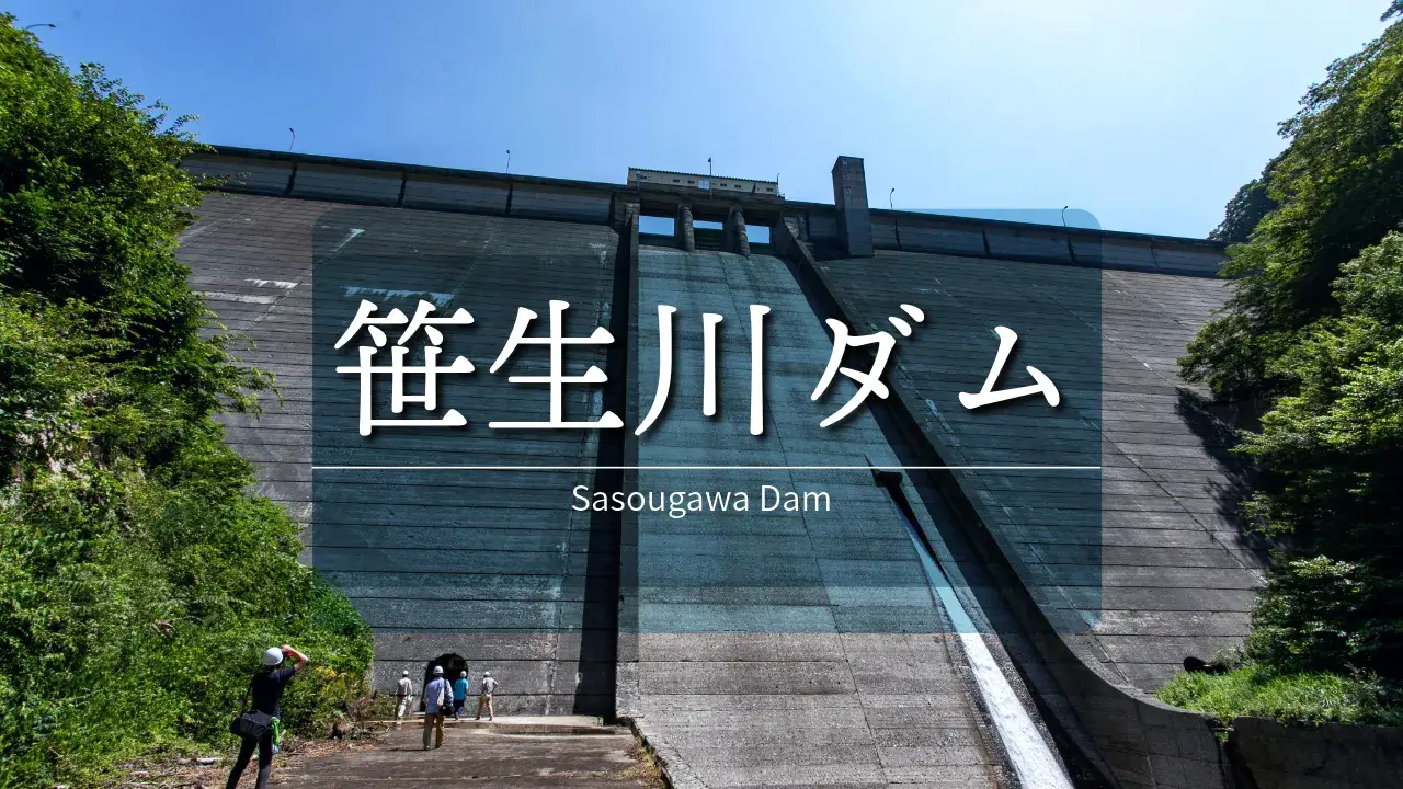
Sasao River Dam is located upstream of Managawa Dam on the Sasao River, the right branch of Managawa River. It was one of the dams we had always wanted to visit, but since the top edge is usually off-limits, we had no choice but to go there for a visit during the "Friendship with Forest and Lake" season. The first time, however, my son got drunk in the car and we had to give up before the Sasao River Dam, and the second time, a landslide blocked the road on the day of the visit, and several years passed without us being able to visit the dam, and finally we were able to visit after the Corona disaster.
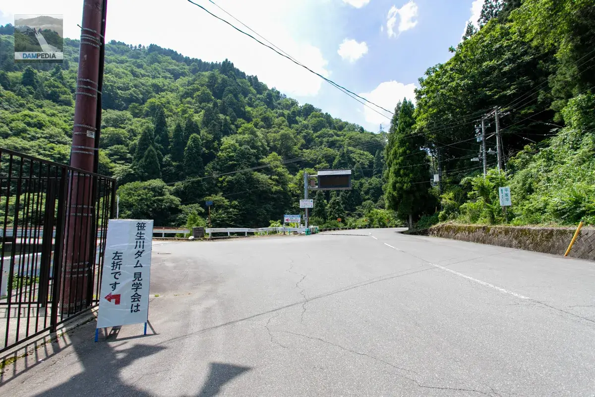
Intersection of National Road 157 and Prefectural Road 230
We were excited to finally be able to visit the Sasagawa Dam. A signboard was posted at the intersection of National Route 157 and Prefectural Route 230.
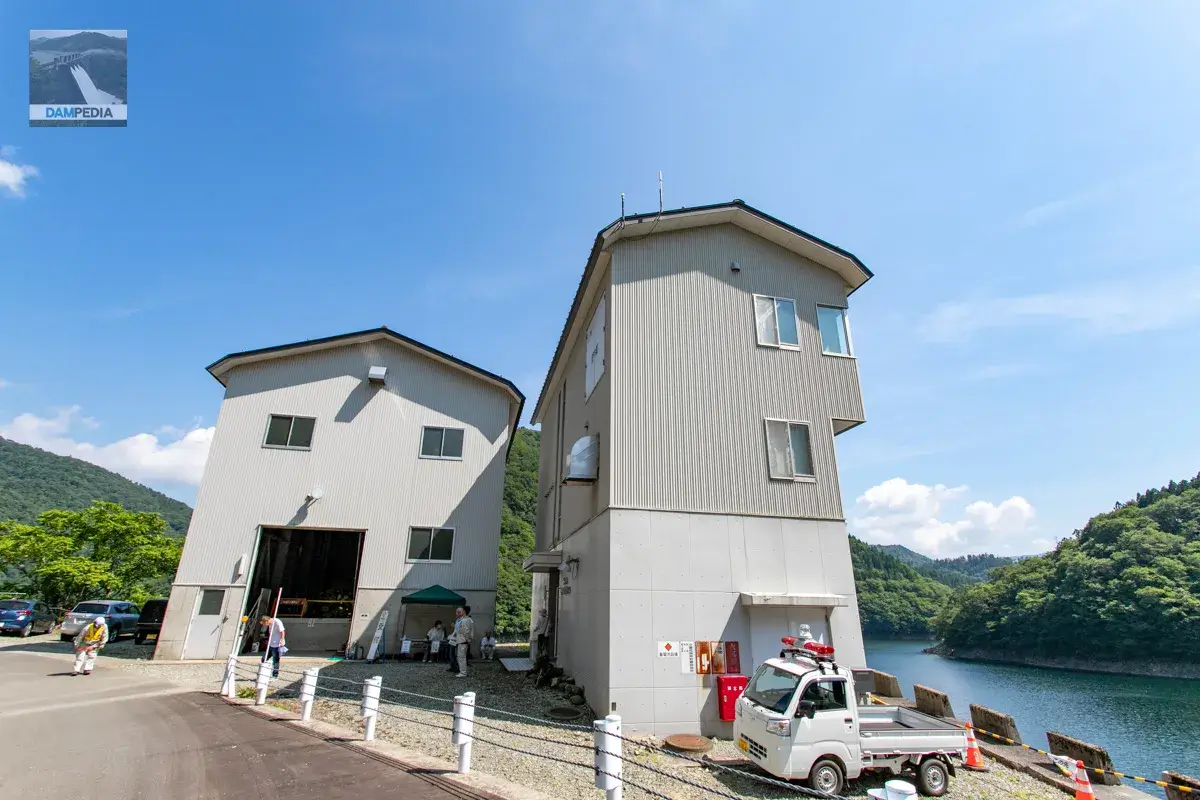
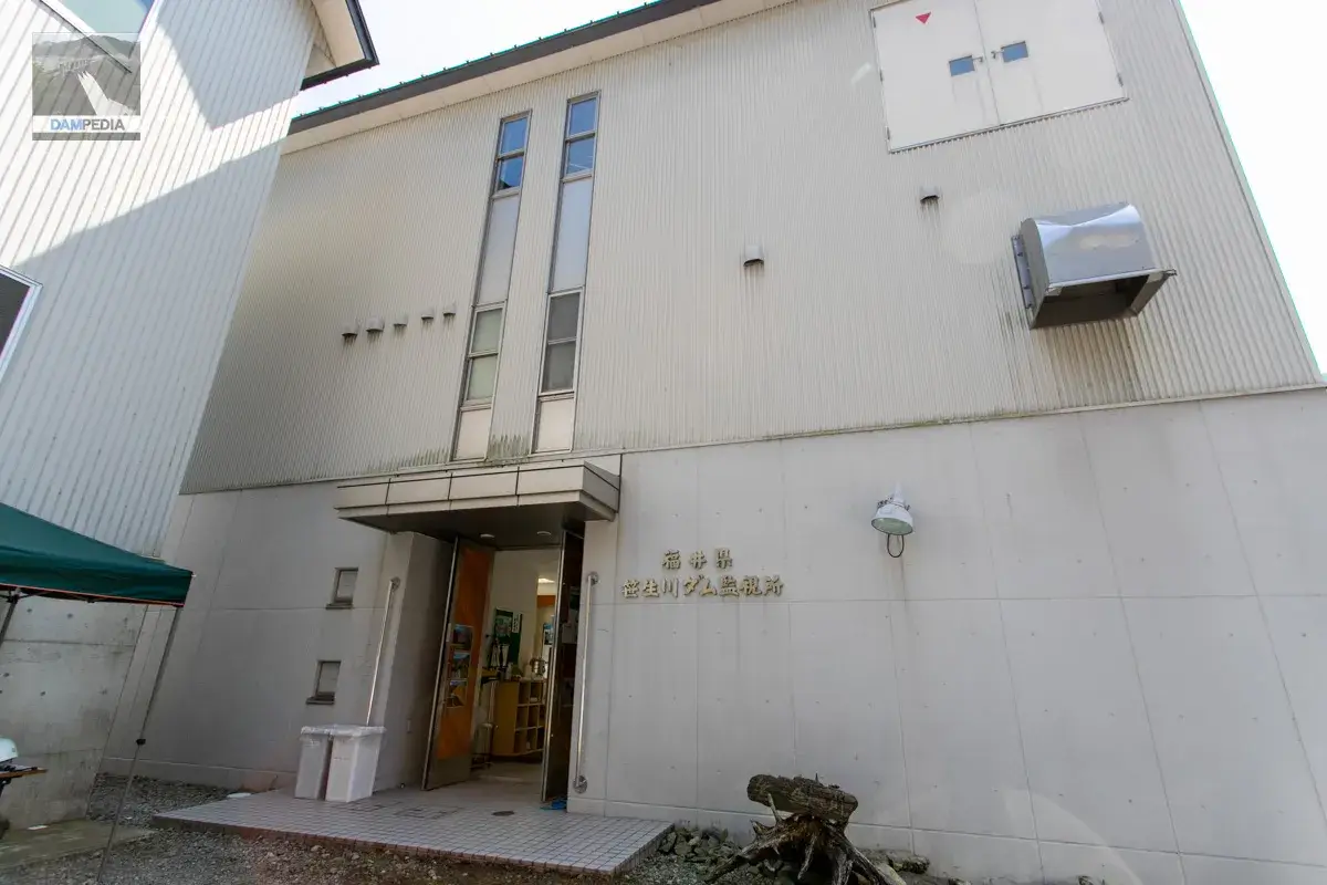
Arrival at Sasagawa Dam
Arrive at the Sasagawa Dam. We quickly check in at the reception desk.
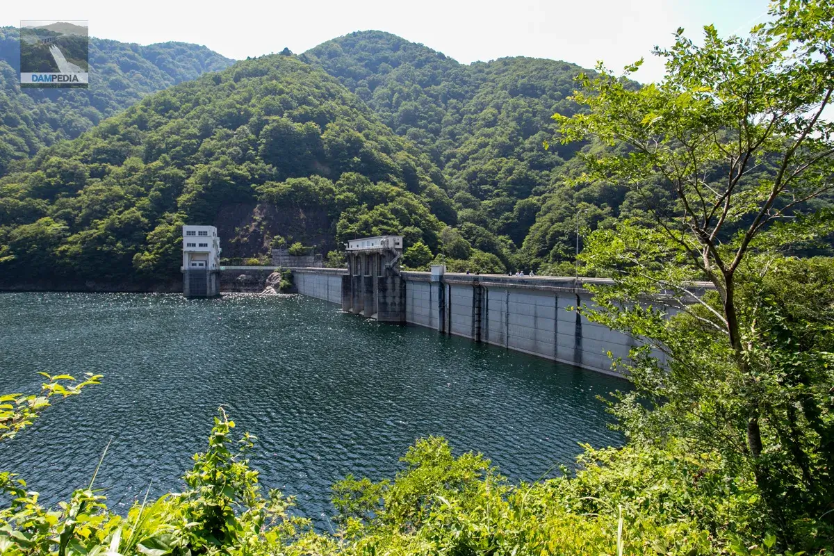
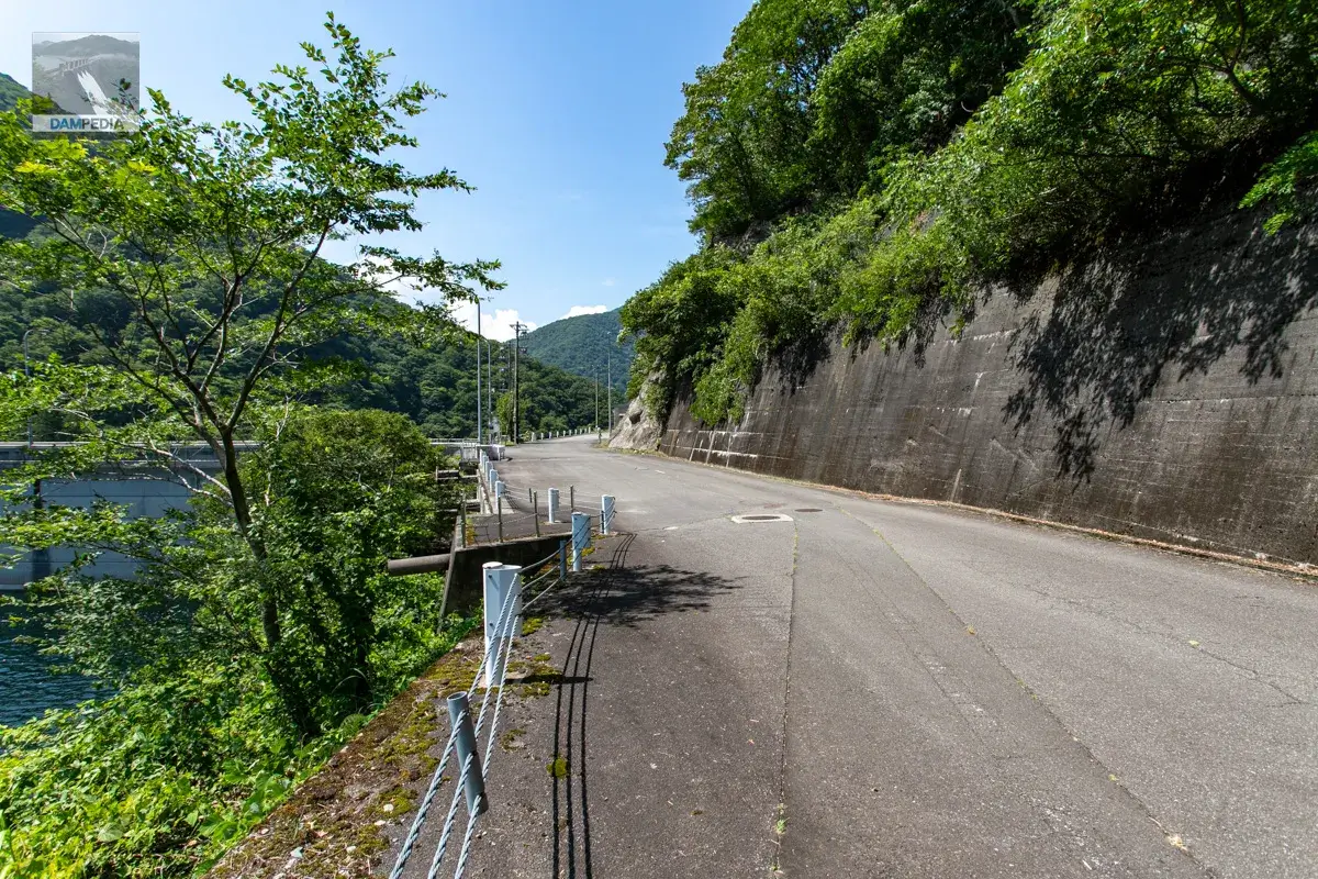
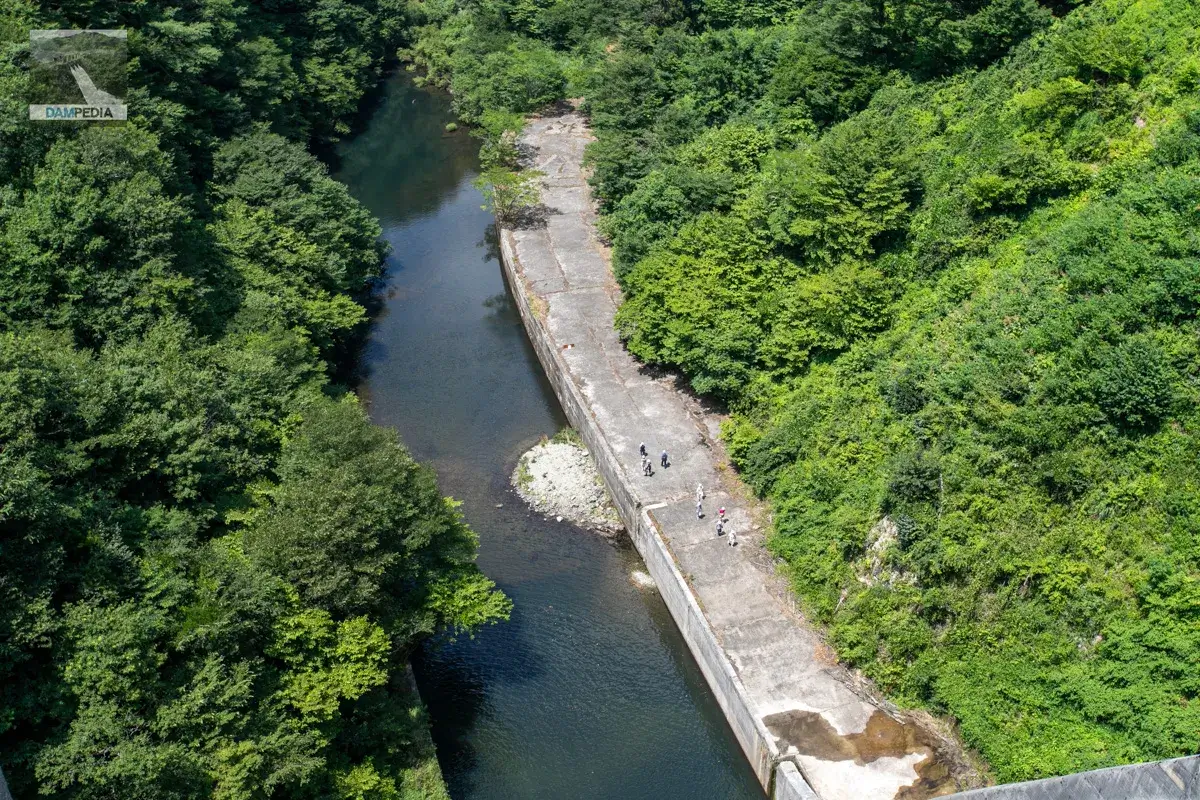
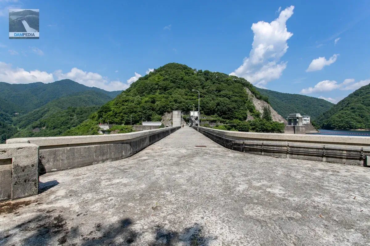
Heading to the levee.
After registration, we will move to the levee when we have a certain number of people. The distance from the control center to the levee is a little far, so we moved on foot. The photo below shows the upstream side of the dike.
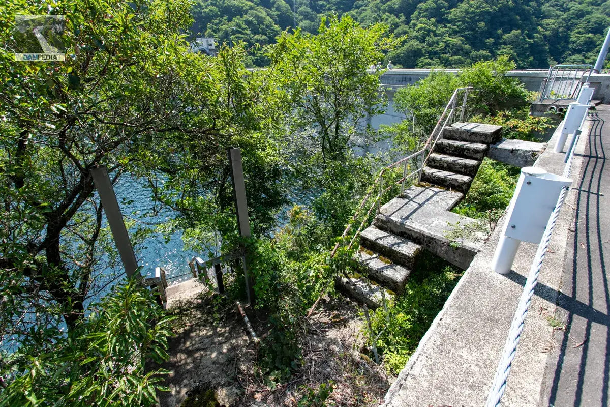
I wondered about this while driving the car, but the right bank dam site has a strange space.
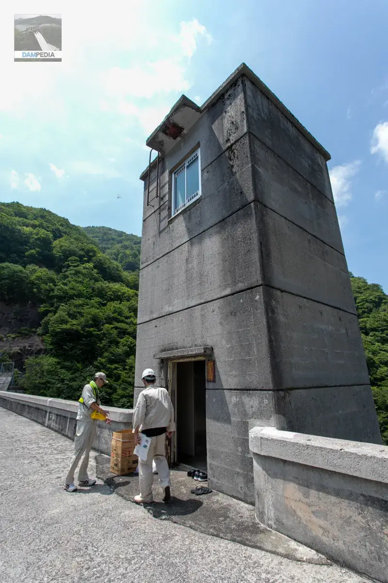
Next to this mysterious space is a staircase leading to the reservoir. As you may have already noticed, there used to be a management office here. You may want to take a look at the photo in the Dam Handbook that shows the old management office.
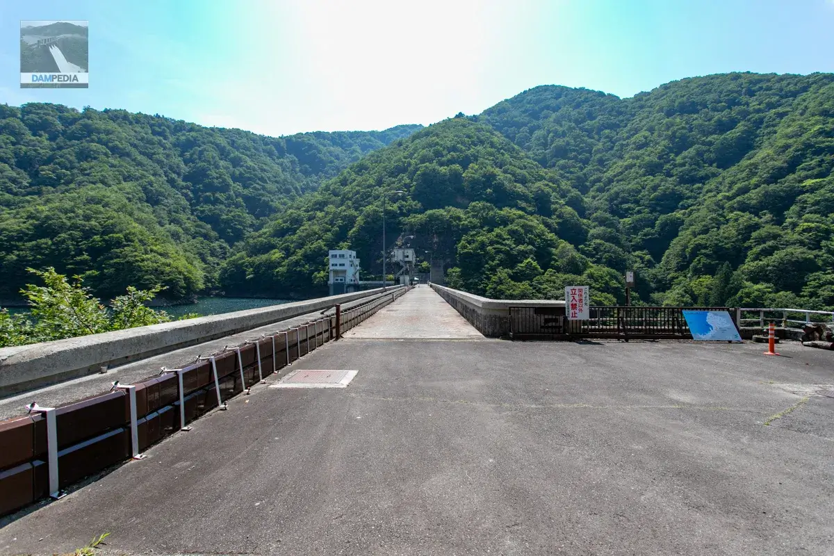
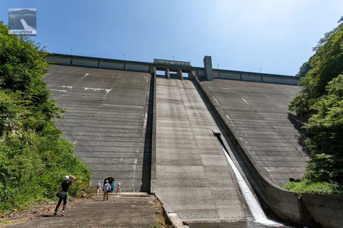
Normally, the top edge of the building is off-limits, but on this day of the tour, it is special. The gates will be opened and visitors will be able to tour freely.
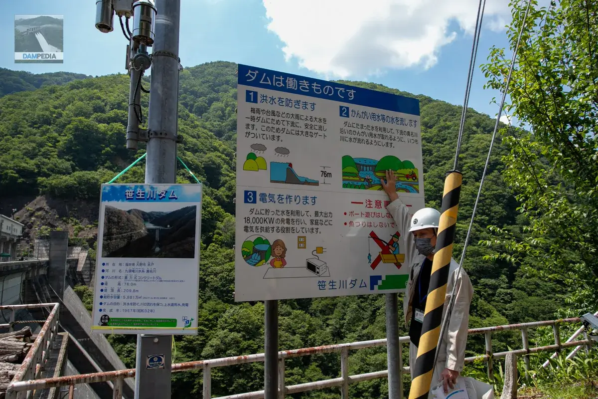
First, we were briefed on the basic specifications and purpose of the Sasagawa Dam. On the small panel, the purpose of the Sasao River Dam is described as "water supply for waterworks," but for some reason it is not written on the large signboard. In fact, in 1979, a part of the irrigation capacity of this dam was transferred to the water supply capacity. This transfer is rare because it is not often seen in other dams.
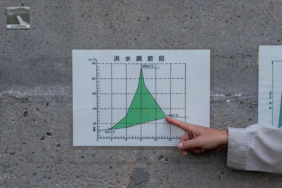
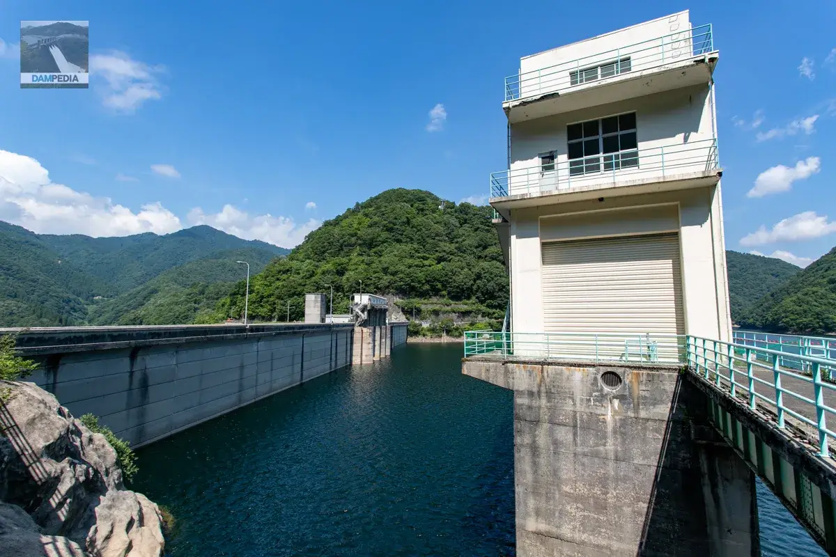
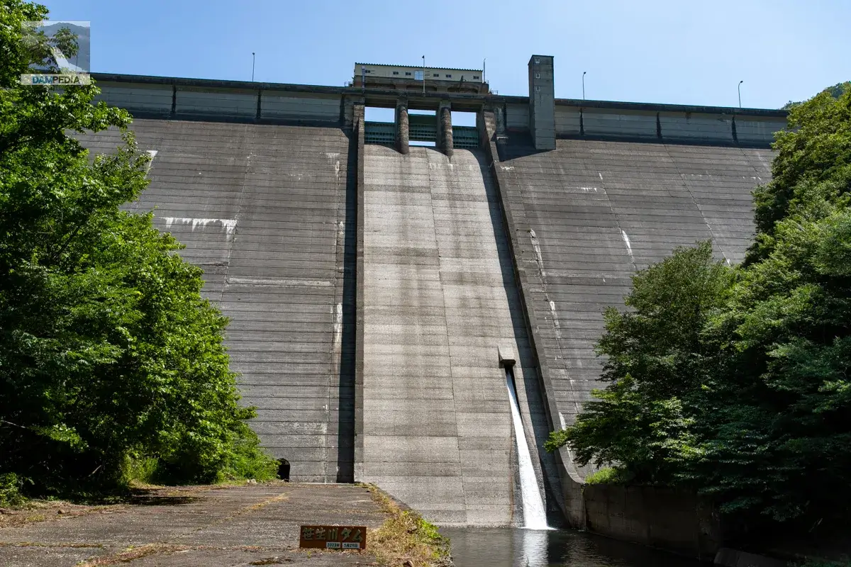
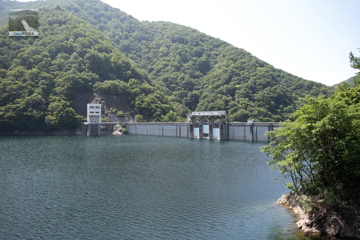
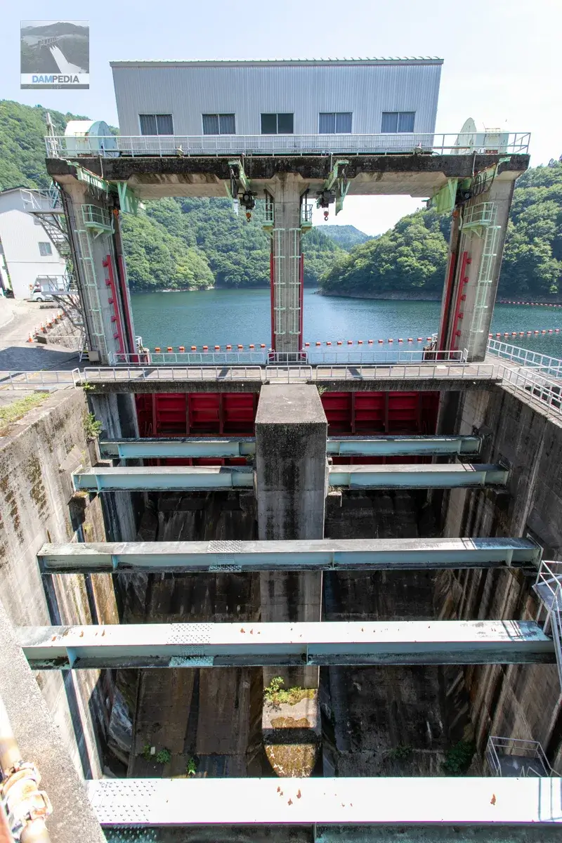
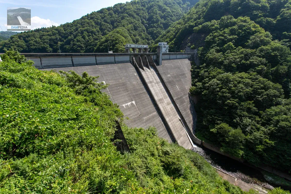
Then, while moving to the top end, look at the graph "Flood Control Chart" posted at the gate pier. The Saso River Dam will regulate 330 m3/s of the planned high water flow rate of 470 m3/s. The green area is the capacity to be stored in the dam lake.
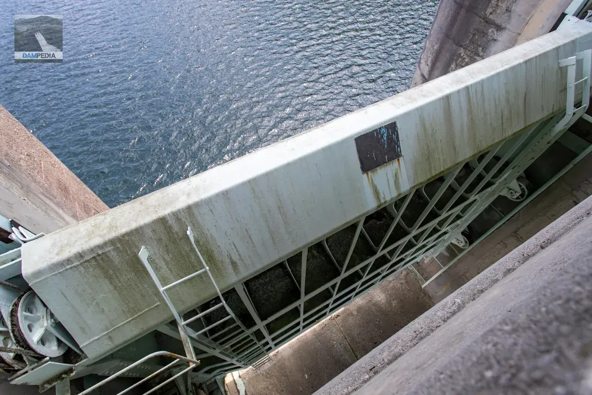
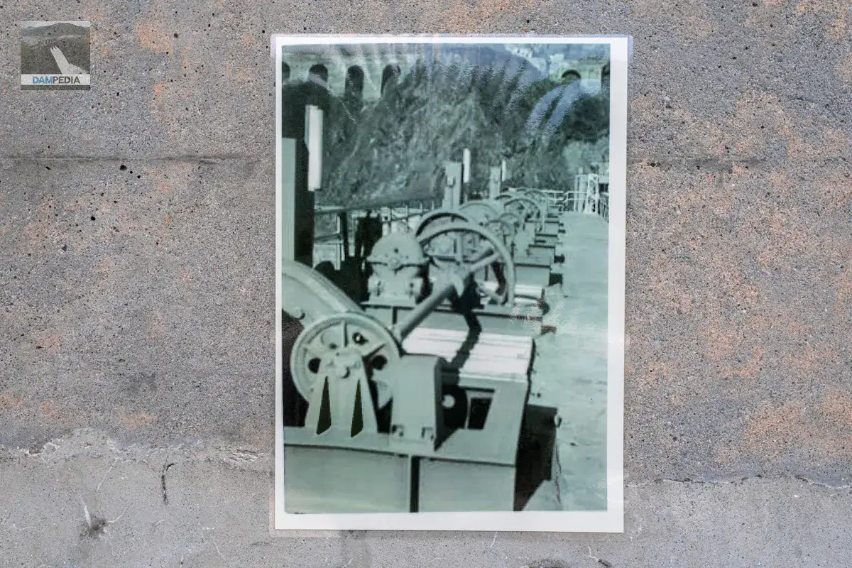
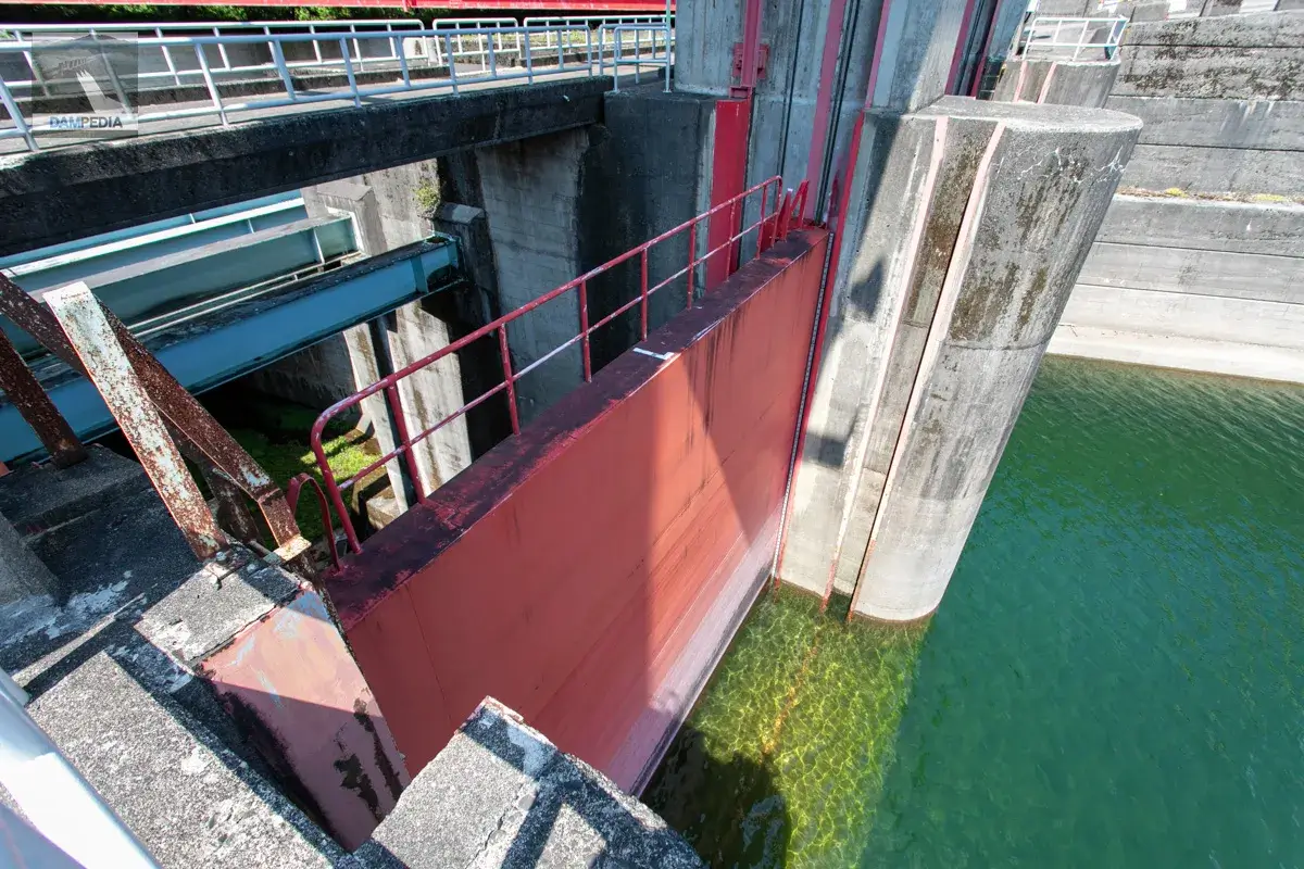
The crest gate of the Sasao River Dam is equipped with a roller gate. The gate was opened slightly on this day because of the event. The gate was manufactured by Nagoya Shipbuilding Corporation (later IHI Aichi Plant, now closed).
This is a photo of the machine room (gate winder room) of the crest gate.
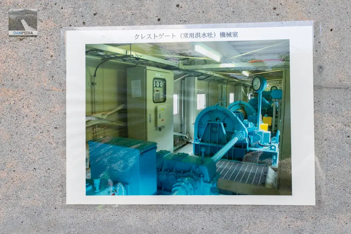
The machine room above the gate pier is not included in the tour course, so we are very grateful for the consideration of posting the photos.
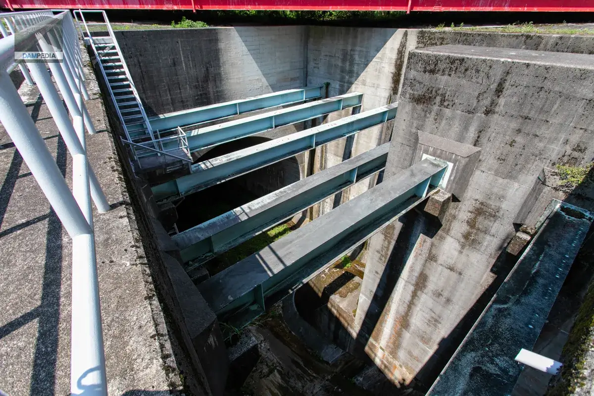
Looking through the crest gate at the discharge gate for the excess water discharge tunnel. What this is will be explained later.
There was also a photo of the top of the gate pier, probably shortly after its completion. There was no building and it was bare. It is hard to imagine in a region with heavy snowfall, but now a magnificent building has been installed, and I think that management has become much easier.
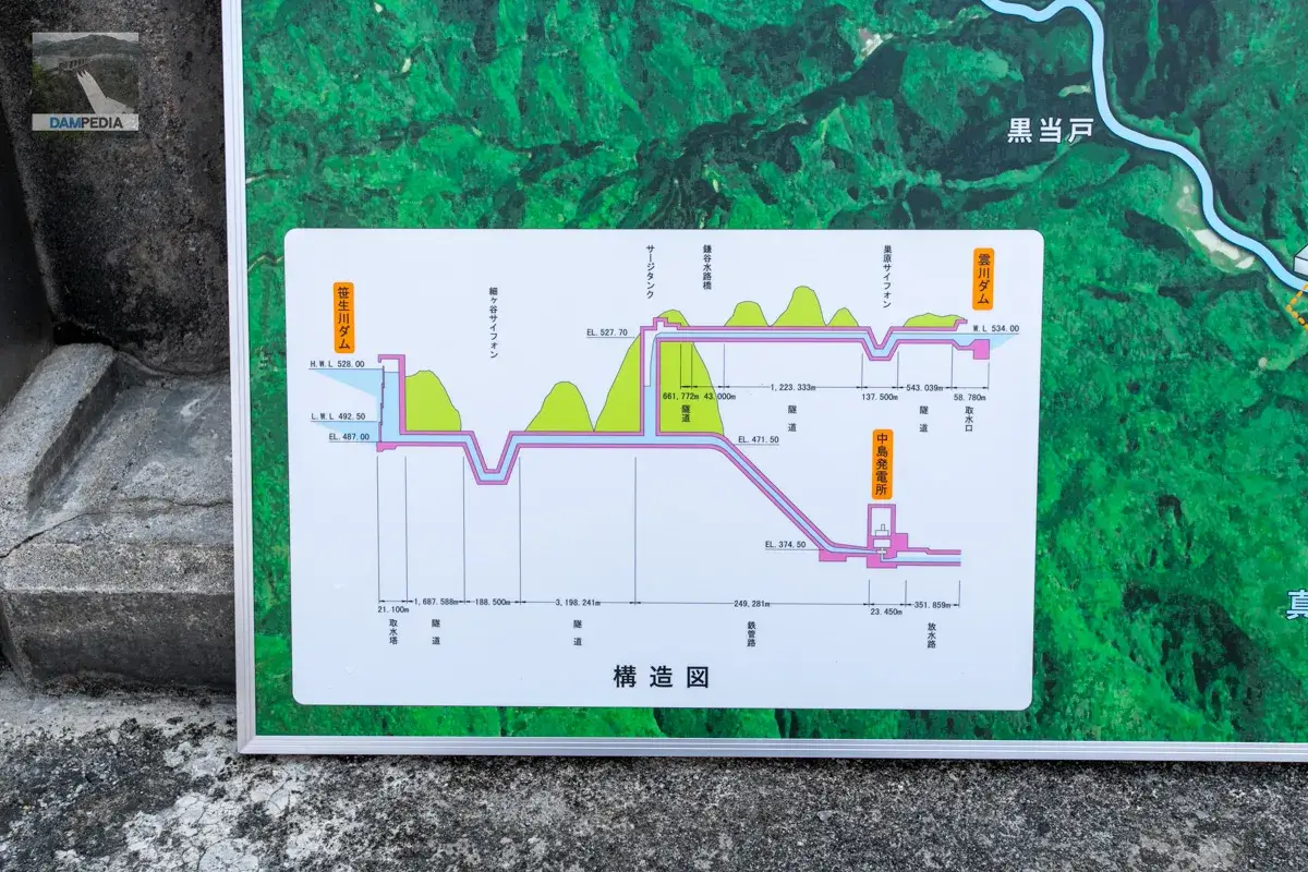
The Saso River Dam was built as part of the Mana River Comprehensive Development Project, but the Kumogawa Dam and Nakajima Power Plant were also constructed, as well as a tunnel to conduct water to each.
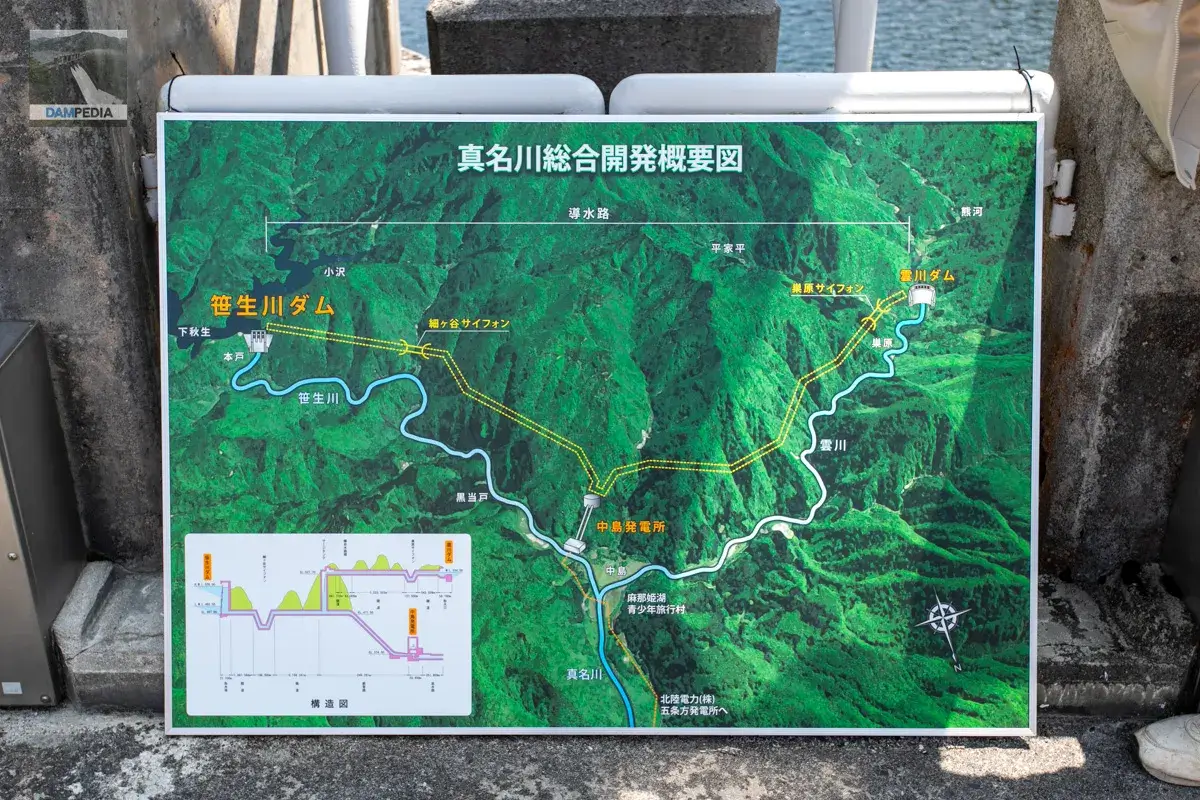
A structural drawing was also drawn showing the cross section of the conduit tunnel connecting the Sasao River Dam, Kumogawa Dam, and Nakajima Power Station. The drop-off is very easy to understand.
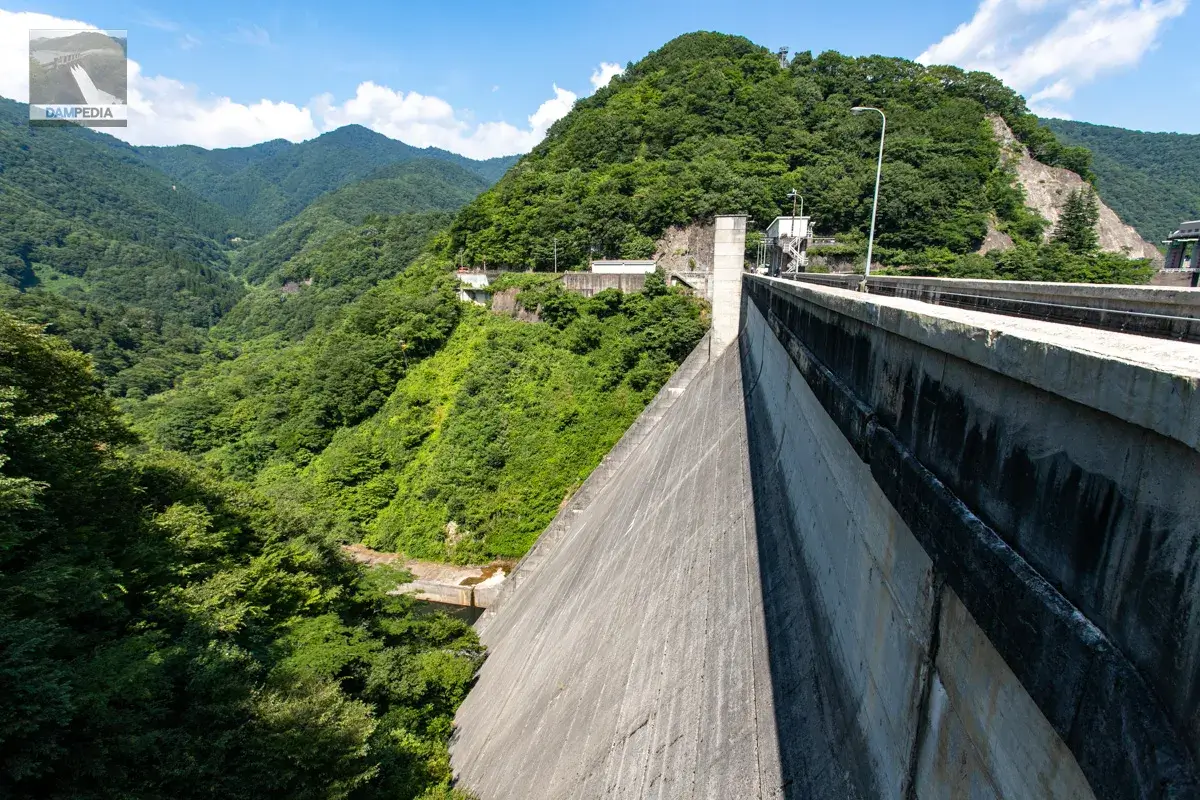
Check around the top edge and left bank.
From the skyline, we see a group of participants from the first group. The people are that small.
Go to the left bank.
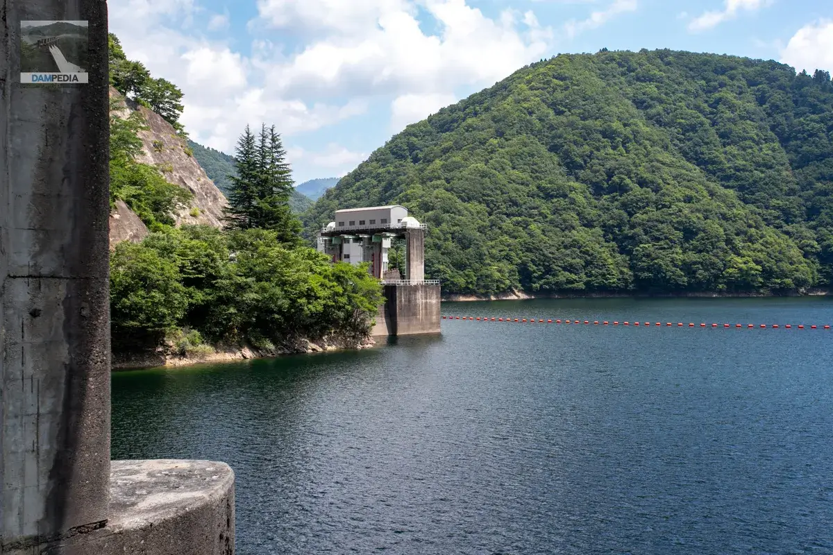
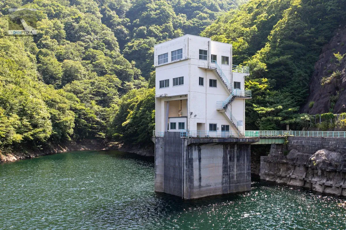
An intake tower is located on the left bank. Water taken from this tower is sent to the Nakajima Power Plant to be used for power generation.
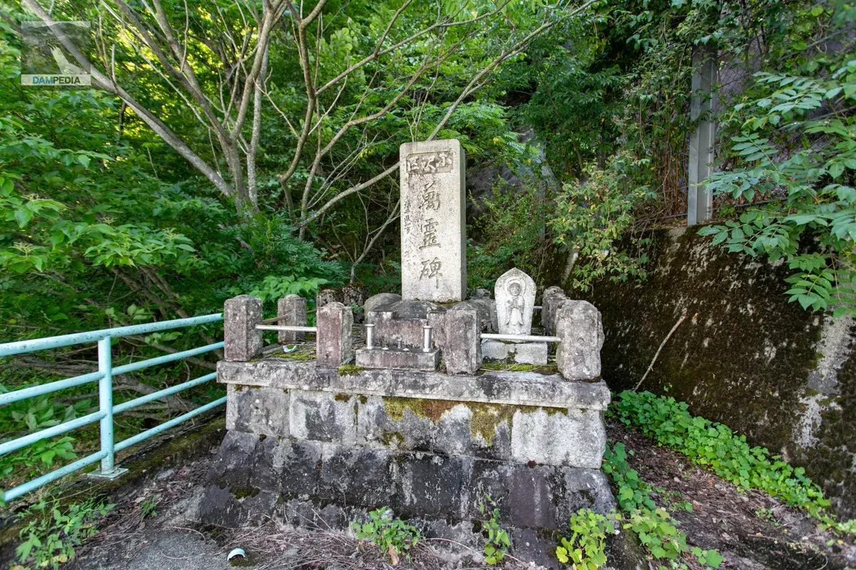
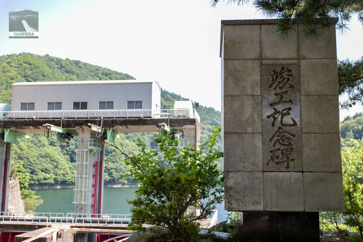
At the far end of the left bank, there is a stone monument called "All Souls Monument. I asked a staff member, "Is that monument a cenotaph?" He replied, "It is not a cenotaph.
The "Ozawa-ward" written on the top of the monument is one of the villages in the former Nishitani Village in Fukui Prefecture. Nishitani itself is a municipality that completely closed down after three rounds of separation from the village by the Tokiya family. The village of Ozawa was one of the first villages to leave the municipality, and it was the first village to leave the municipality following the construction of the Sasao River Dam. In addition to Ozawa, the other villages in the first round of displacement were Kamiakiu, Shimoakiu, and Motodo.
The monument is a stone monument that can be called a memorial to the people who left the village. It seems that the people who left the first wave of villages relocated to the areas of Kihonbaru, Chitose, and Minamikasugano in Ono City. Some of them even moved to Fukui City.
References:The Process of Complete Abolition of Nishitani Village in the Oetsu Mountains
This is a view of the intake tower and the upstream face of the embankment from across from the monument. This is a view that can only be seen on this day.
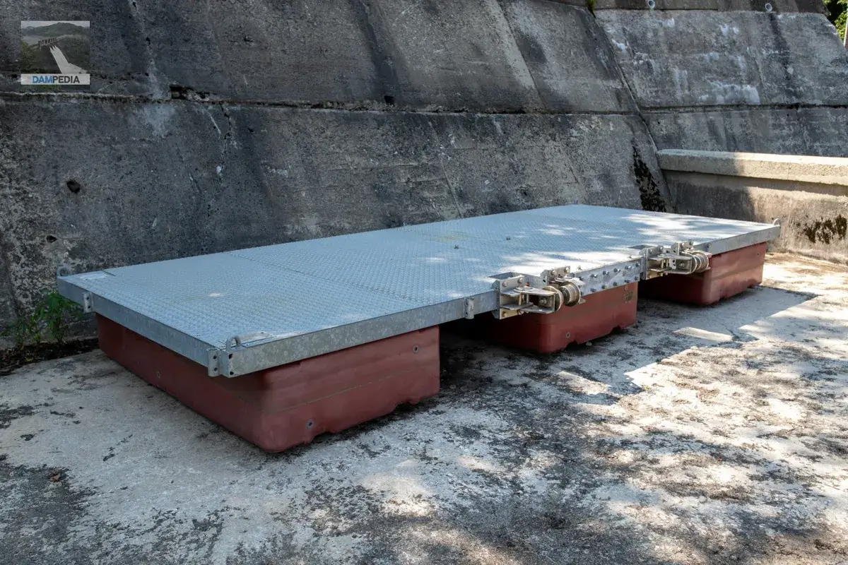
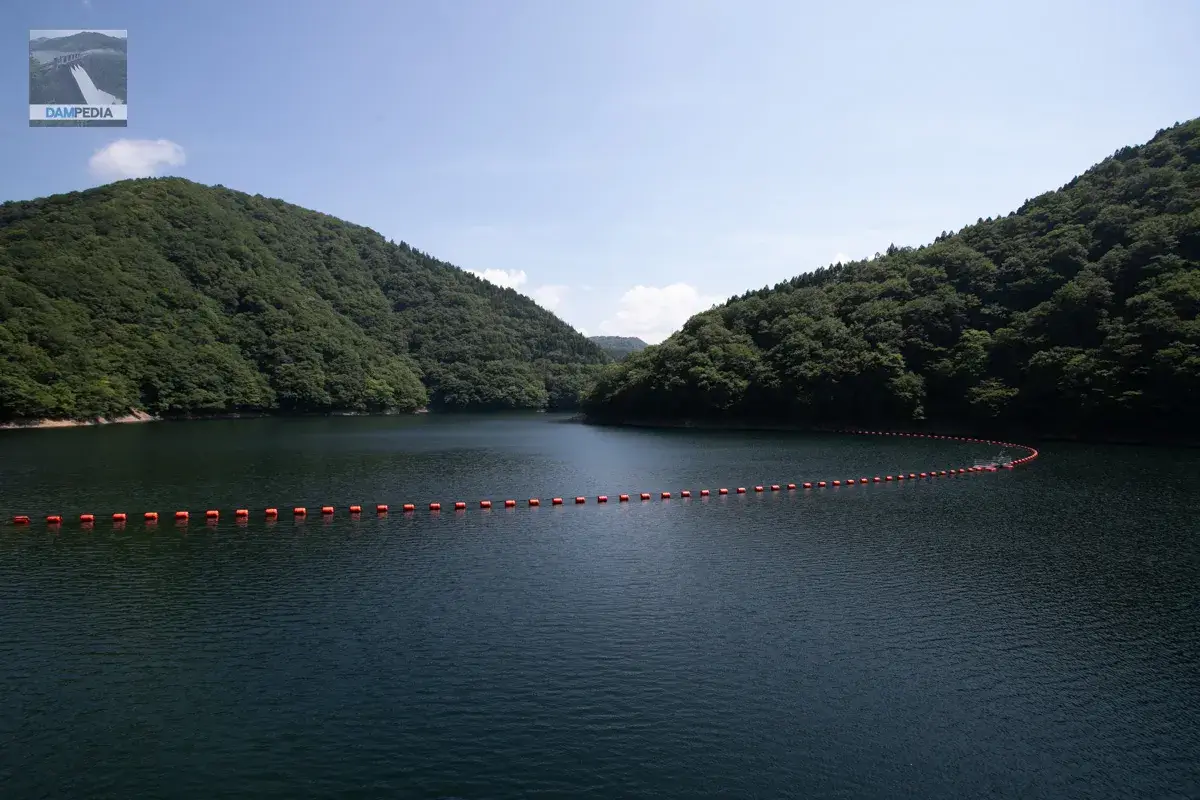
What was probably a float was placed on the left bank.
View from the left bankTop (Crest)This is also not usually seen. This is also not usually seen.
The Sasagawa Dam is located in a truly mountainous area. It is also located in an area with heavy snowfall, so life must have been very harsh, as you can see from the aforementioned data from Nishitani Village. Even so, the concrete itself shows no evidence of frost damage and is in such a beautiful condition that it is hard to believe that the embankment is over 60 years old. The construction and daily management must have been very good at the time of construction.
The water being discharged from the left bank side was originally a sand discharge pipe and is now utilized for river maintenance discharge. It is interesting to note that the sediment downstream is accumulating toward the right bank, perhaps due to the influence of the water discharged from there. Also, there appears to be no sub-dam, but a cross-sectional view shows that a 4-meter one has been installed. It is quite low and has sunk.
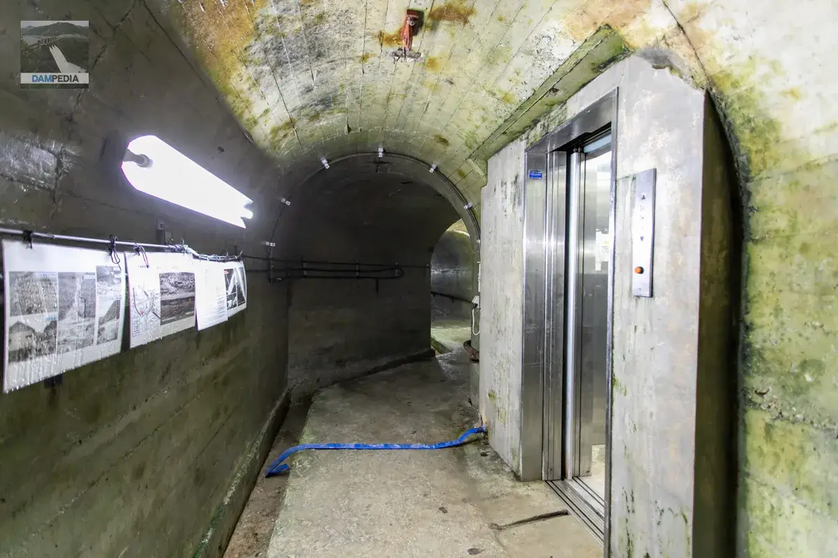
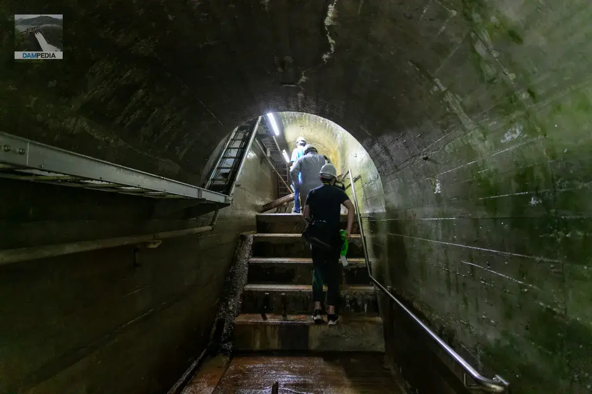
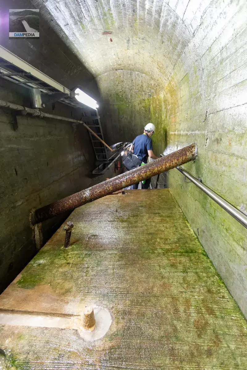
Finally, we go inside the dike.
Finally, we enter the dike.
Finally, the doors of the gaff were opened.
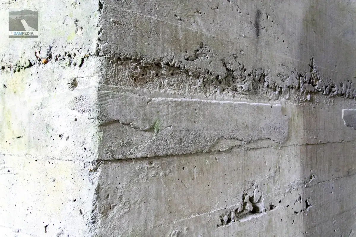
The walls of the auditorium were formed using wooden planks, and traces of these planks can be seen. This is completely different from today's precast construction, but this roughness, which reminds us of the past, is very pleasing to the eye.
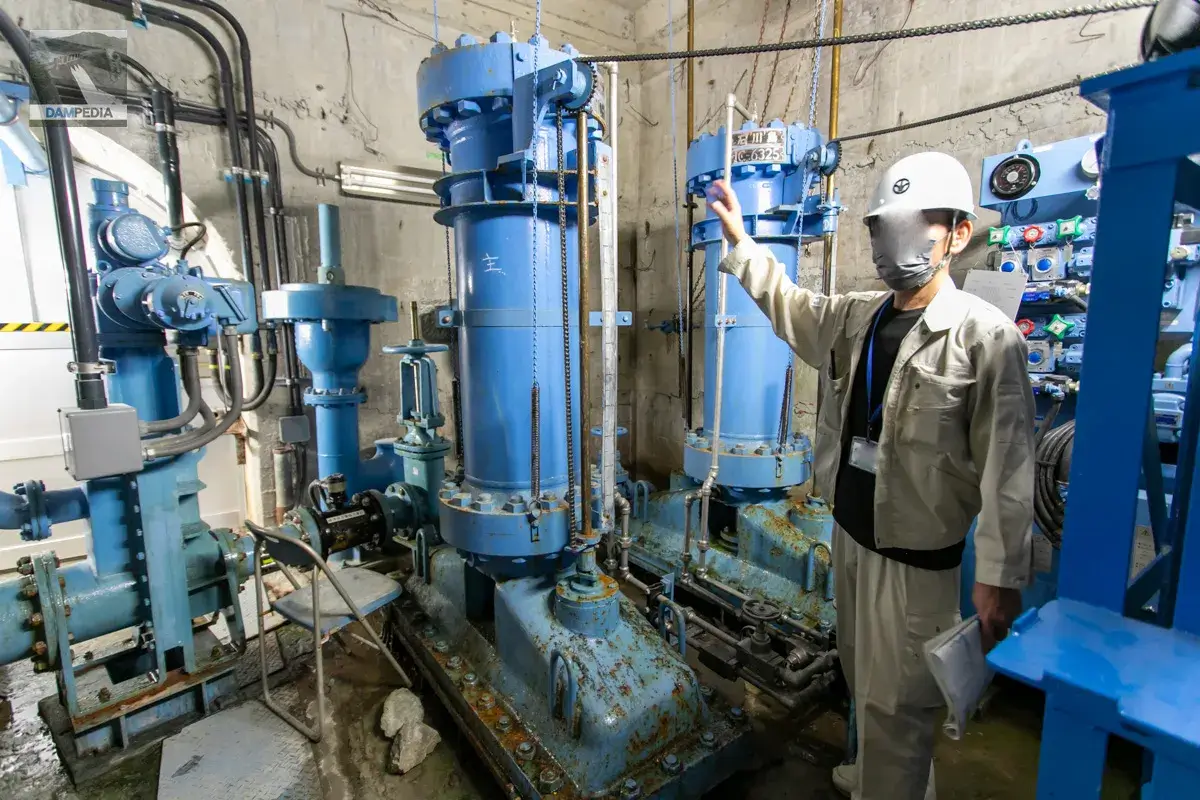
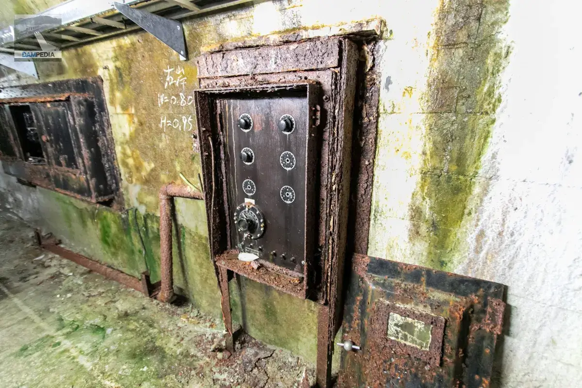
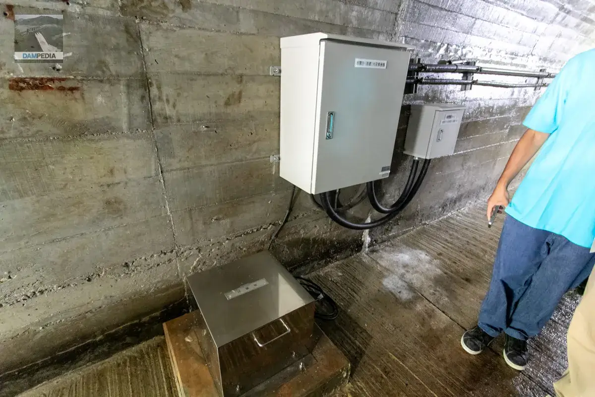
The first room we were taken to was the gate room. This is for the aforementioned river maintenance discharge (formerly for sand discharge). The brochure describes it as a ring flow gate, but it is also called a ring holower gate or ring holower gate. (One website also says it is a jet flow gate, but I'm not sure which is correct.)
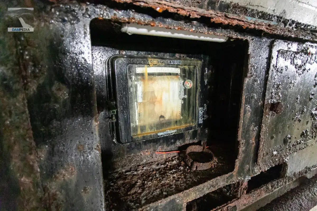
This very old device is used to measure the strain of the embankment. These vintage devices were everywhere and are still in use today.
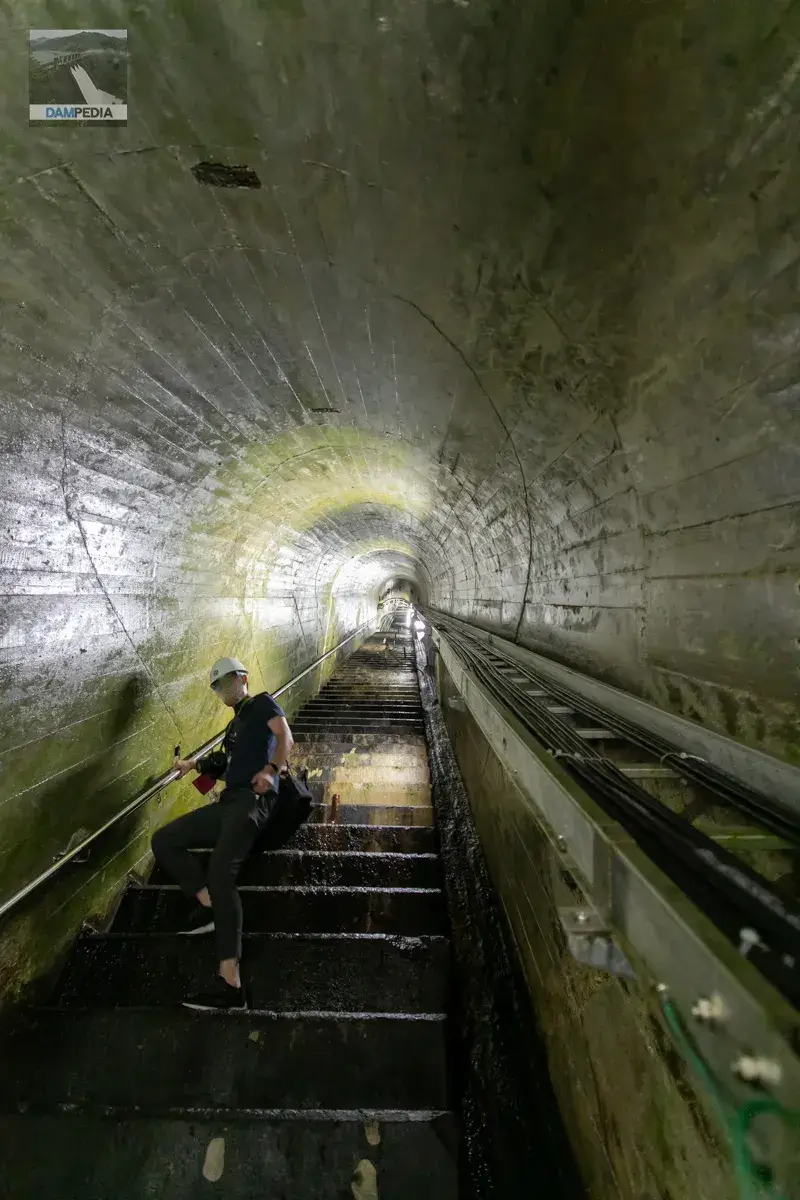
The audit corridor was cool but slightly humid, perhaps due to high leakage. This would probably cause the equipment to rust as well.
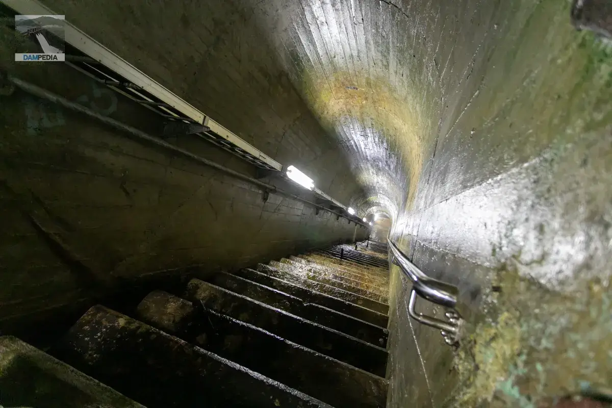
The stairway is quite high and looks like an old-fashioned auditorium staircase, and one has to climb up and down slowly.
Bourdon tube for measuring lift pressure.
The seismographs were relatively new.
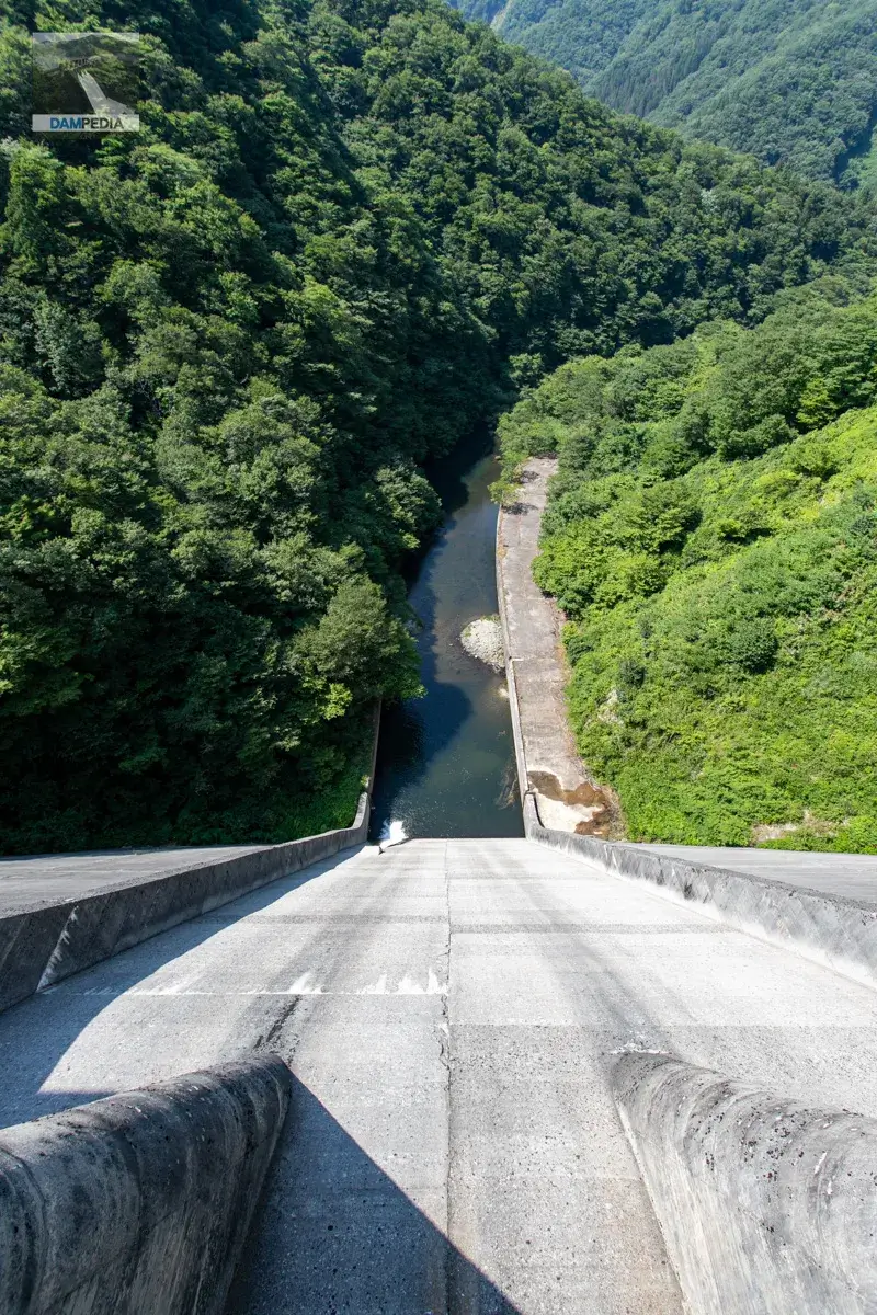
Finally downstream
After that, we went out from the entrance of the auditorium on the downstream face of the levee and finally looked up the levee from downstream. The people who participated in the tour with us all said "Oh, wow" in unison. There is a signboard with the date "Sasagawa Dam" written on it for commemorative photos. The staff will take your commemorative photo, and they are very generous with their service!
This photo is for comparison of the size of the levee and the person. How tiny mankind is.
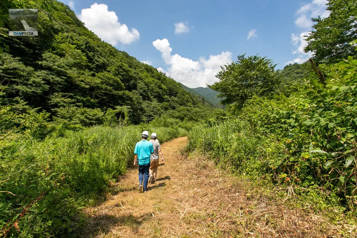
Then it pushes further downstream. It looks like the grass has been mowed to make it easier to walk. Thanks to the staff 🙏.
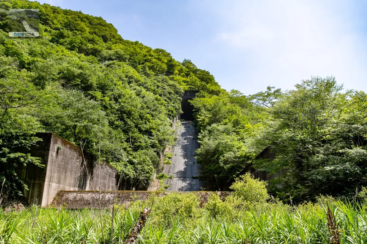
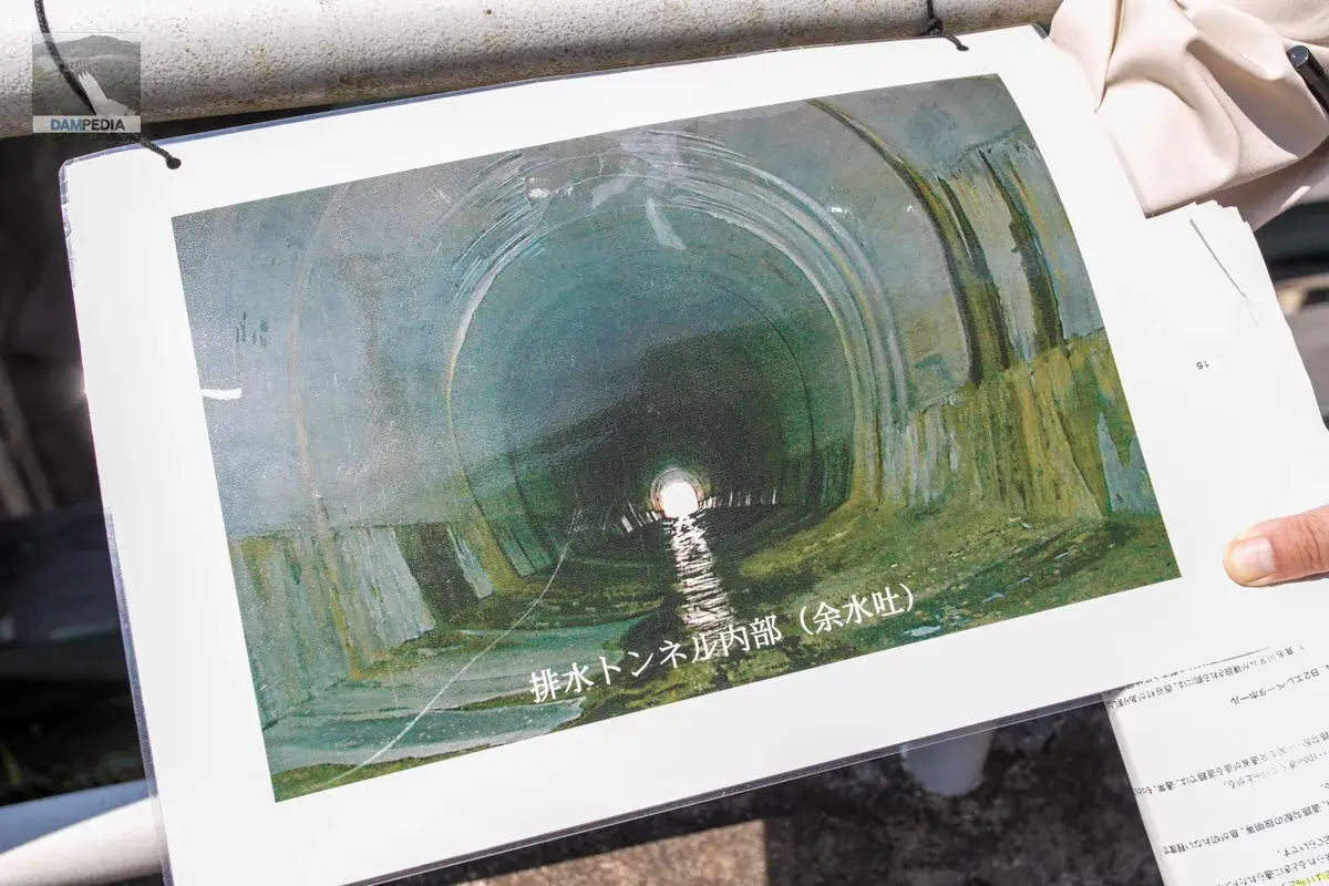
If you visit the Sasagawa Dam, you must see it. This is the tunnel for the after-water discharge. This is the exit side of the discharge gate for the after-water discharge tunnel that you saw through the crest gate mentioned above.
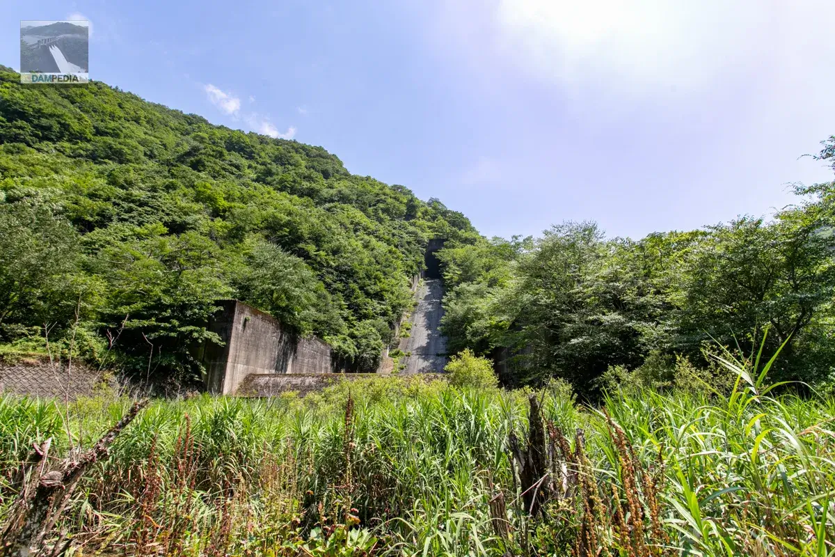
The Sasagawa Dam was designed to control 330 m3/s out of a planned high water flow rate of 470 m3/s at the dam, but in September 1965, a flood of 1,002.3 m3/s, far exceeding the plan, entered the reservoir during a heavy rainstorm in Oketsu. The floodwaters flowed out through the gap between the top of the dam and the old control center, and then down the slope on the right bank of the dam, which was on the verge of causing an overflow of the embankment.
Overtopping the levees meant a complete loss of flood control and the risk of a levee failure.
In order to increase the discharge capacity, construction of this excess water discharge tunnel (described in the pamphlet as a "drainage tunnel") began in June 1973, and was completed in October 1977. Incidentally, this construction project was the first dam rehabilitation project after the war.
Into the dike again
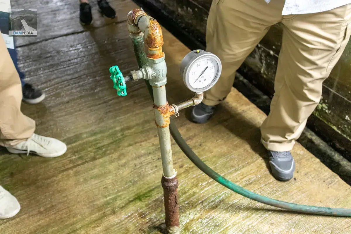
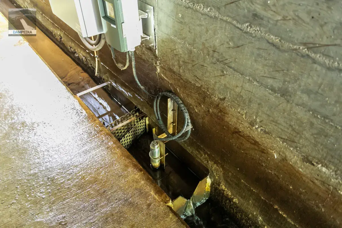
After a quick tour of the downstream side, we returned to the inside of the dike. The photo below shows the triangular weir used to measure the amount of water leakage.
Only this part of the dike is convex. I think I heard an explanation, but I completely forgot why. I guess I should take a note of it right away. I think it was because there is a sand drainage pipe here...
Hmmm, I forget what this tube was too💦.
We found another device that reminds us of the era. It is labeled "CHINO TEMPERATURE RECORDER," so it appears to be a temperature recorder made by Chino.
During the tour, we were given an explanation of the Oketsu torrential rainfall. Photos of the discharge were also displayed, but these photos conveyed "badness" rather than "awesomeness.
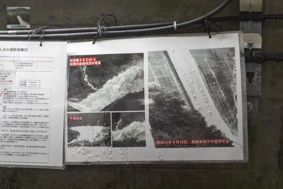
Flood control results of the Saso River Dam in the 1965 Oetsu heavy rainstorms
And this chart of flood control performance conveys the severity of the situation in numerical form. The text on the right also shows the urgent situation at that time. It may be difficult to read from the photo, so I will quote the text as follows.
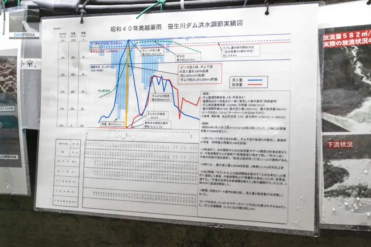
summary
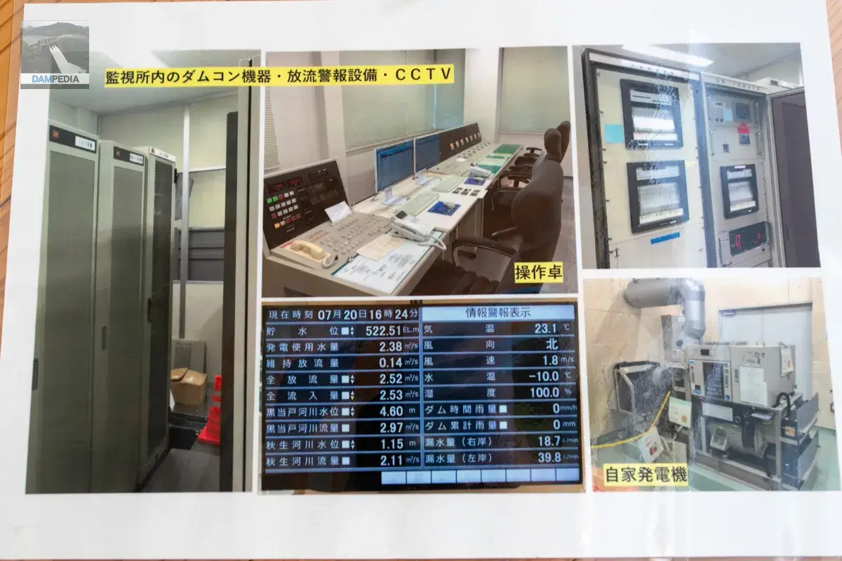
- Number of dam monitoring station staff: 6 (including the director)
- Concentrated heavy rain (localized heavy rain) fixed in the line from Nogo Hakusan to Arashima-dake
- Continuous rainfall at dam: 1,044 mm, daily rainfall: 844 mm (9/14)
- Maximum hourly rainfall 89.5 mm, maximum inflow 1,002 m3/s, maximum discharge 586 m3/s
- Peak water level EL.529.42 (surcharge level down 8 cm)
Reference Current plan Flood control safety level: 1/50 Base high water: 470 m3/s → 140 m3/s
how it started
- On September 14, 1965, it rained quite a bit in the morning, and by 16:00 the accumulated rainfall exceeded 100 mm.
- At 9:00 p.m., the rain continued to intensify, causing a landslide downstream of the dam and power outage at the office (maximum hourly rainfall of 89.5 mm was recorded).
- After 11:00 p.m., the calculation of the amount of discharge and gate opening for flood control was completed, but the Nakajima Power Station informed us that the switchboard room was on the verge of flooding, that a private house in Nakajima near the river was just about to be washed away, and that they would definitely like us to wait to discharge the water.
- At 24:00, a maximum inflow of 1,002 mm was recorded, and the water level rose 1.7 m per hour
- At around 2:00 on the 15th, immediately after notifying the prefectural office that the start of discharge could not be extended any longer, the Nakajima Power Plant informed us that "the power plant was flooded and all employees were evacuated" and that "all residents of Nakajima had been evacuated.
- Around 5:00, after repeated gate operations, the inflow and discharge were almost equal.
- The peak water level was EL.529.42 with a difference of only 8 cm from the surcharge level. (Dam top elevation (The difference between EL.531.0 and EL.531.0 is about 1.5 m)
Although the article is written in a straightforward manner and contains only the facts, it conveys the tense and urgent situation at that time. Incidentally, it says, "The discharge of water started at 2:20.Extreme Flood Disaster Prevention Operation(so-called emergency discharge), and as of May 2024, this is the only operation implemented in Fukui Prefecture.
In Nishitani Village, flooding of the Mana and Kumo Rivers was not limited to the Mana River and Kumo River, but also caused mountain collapses and mudslides in Kochidani, Kamadani, and Kowazodani. As a result, 86 houses in Nakajima village (where Lake Manahime Youth Travel Village is located today) were buried and 58 houses were lost. The Nishitani Village Office was located in Nakajima Village, but it was buried under 1.8 meters of floodwaters and sediment. In Kamisasamata village, downstream from Nakajima village, 21 out of 40 houses were swept away and 16 houses were buried.
Despite the damage to buildings, there were relatively few casualties, with only one person killed, one seriously injured, and two slightly injured, because in Nishitani Village, people were required to evacuate to Senkoji Temple on higher ground during flooding. One of the deceased was caught in a mudslide on his way back to the temple after returning home to retrieve a forgotten item.
This episode should be passed down to the next generation in Japan, a country that is known for its natural disasters. Dams can control most floods, but sometimes they cannot handle disaster-grade torrential rains. While dams can buy time to evacuate, they are not a panacea, and by always being aware of the need to evacuate to higher ground immediately, the synergistic effects of hardware and software can be achieved.
The damage was limited to this level due to the last-minute flood control by the Sasao River Dam, which allowed time for evacuation, and the high disaster prevention awareness of the residents of Nishitani Village. Unfortunately, however, this was to be the beginning of the end of Nishitani Village.
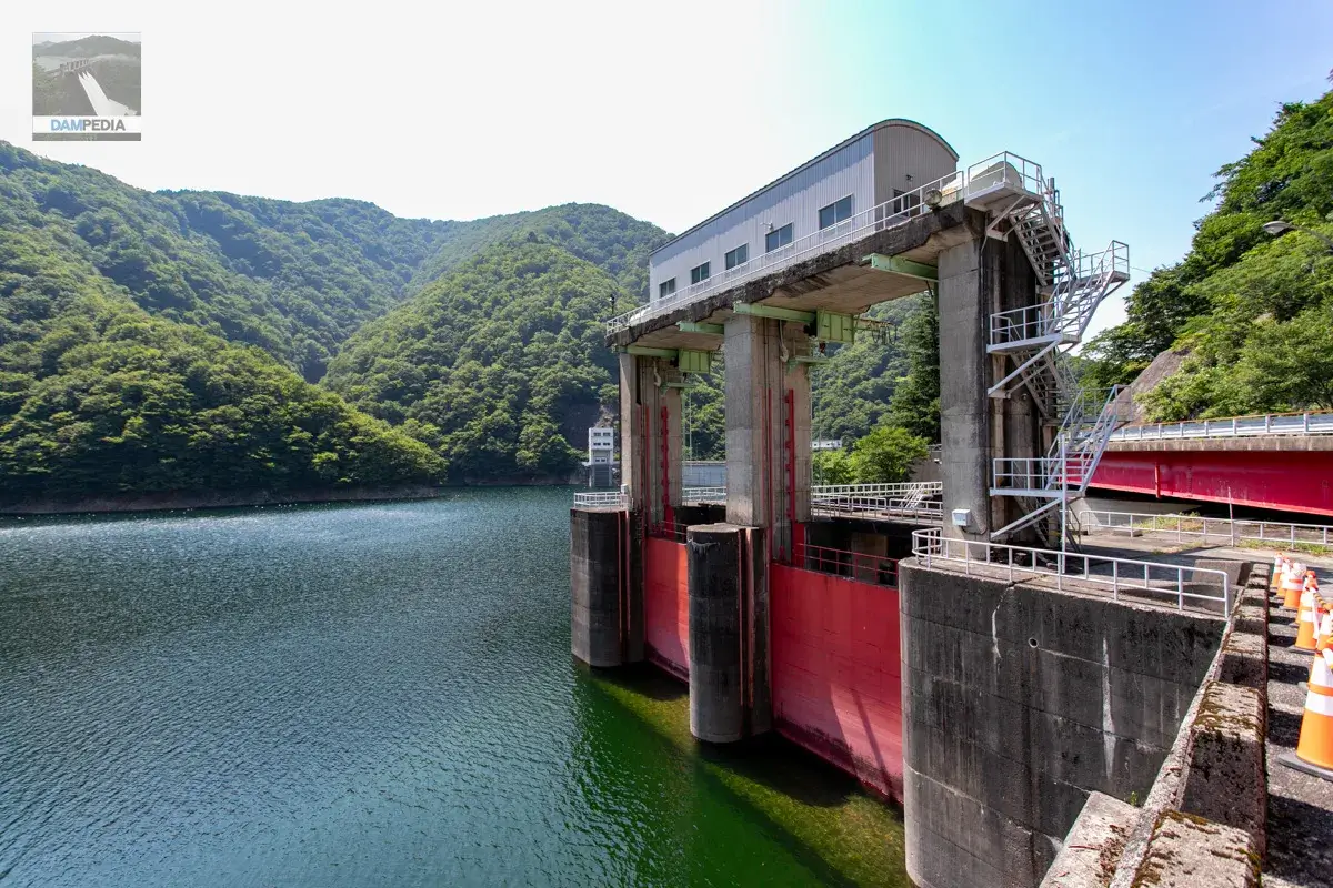
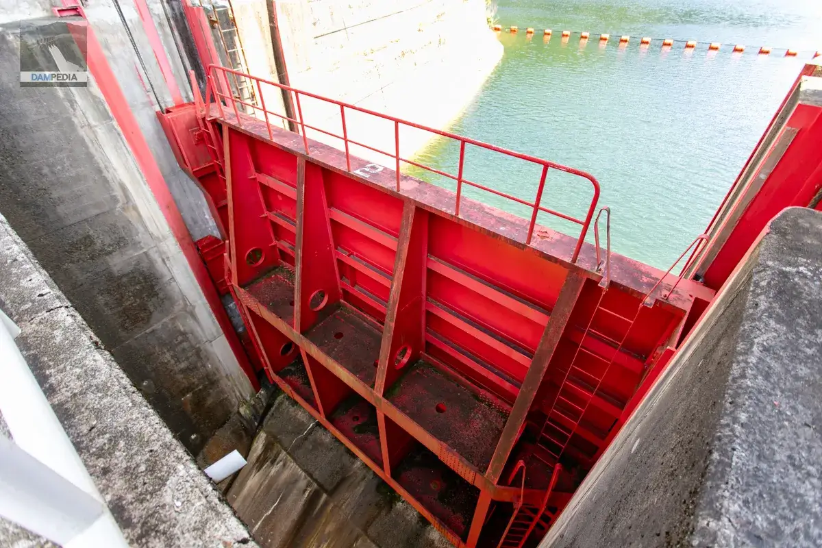
Discharge Gate for Residual Water Discharge Tunnel
After the tour inside the dike, we were guided to the discharge gate for the after-water discharge tunnel. This gate is probably off-limits as well. Incidentally, the height of this gate is EL.521.00m, and the crest gate of the embankment is EL.523.00mm, only 2m lower than the main body. I failed to ask why this is so, but I think it is probably to reduce the load on the levee side by draining it immediately.
Incidentally, the order of gate operation is that the crest gate of the embankment comes first, followed by the discharge gate for the afterdrainage tunnel.
As you can see in the picture below, the water is not reaching the crest gate. So we can open the gate in the middle.
The surface of the lake is so quiet under normal circumstances, but nature can be fierce at times.
The discharge gate for the residual water discharge tunnel is equipped with two 9.1m wide by 8.888m high roller gates.
There is not much of a feeling of being sucked in due to the beams.
I would like to see the water flowing, but it will be during a serious downpour at that time, so I will never be able to see it. The water is reaching the gate height, so it will flow when the gate is opened, but there is also a tour being held downstream on that day, lol ...but it is definitely better if this gate is not used, so I would like to keep it only for when the water flows for inspection, etc.
A monument commemorating the completion of the construction was erected near the place where the photo above can be seen.
A photo of the inside of the excess water discharge (drainage) tunnel was posted. This is truly a sight that can only be seen by the staff.
It is a perfectly normal roller gate. But why is this one bright red while the crest gate on the levee side is light blue?
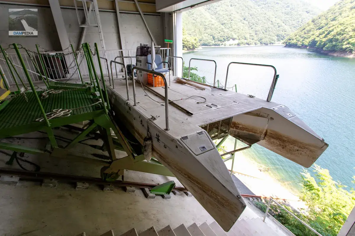
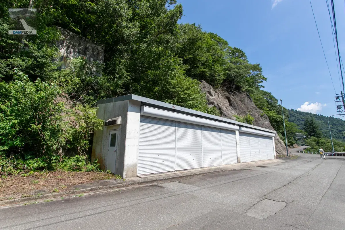
boathouse
Next, we visited the boatyard through the discharge gate for the after-water discharge tunnel. The boatyard is relatively new and appears to have been built in conjunction with the reconstruction of the administration office.
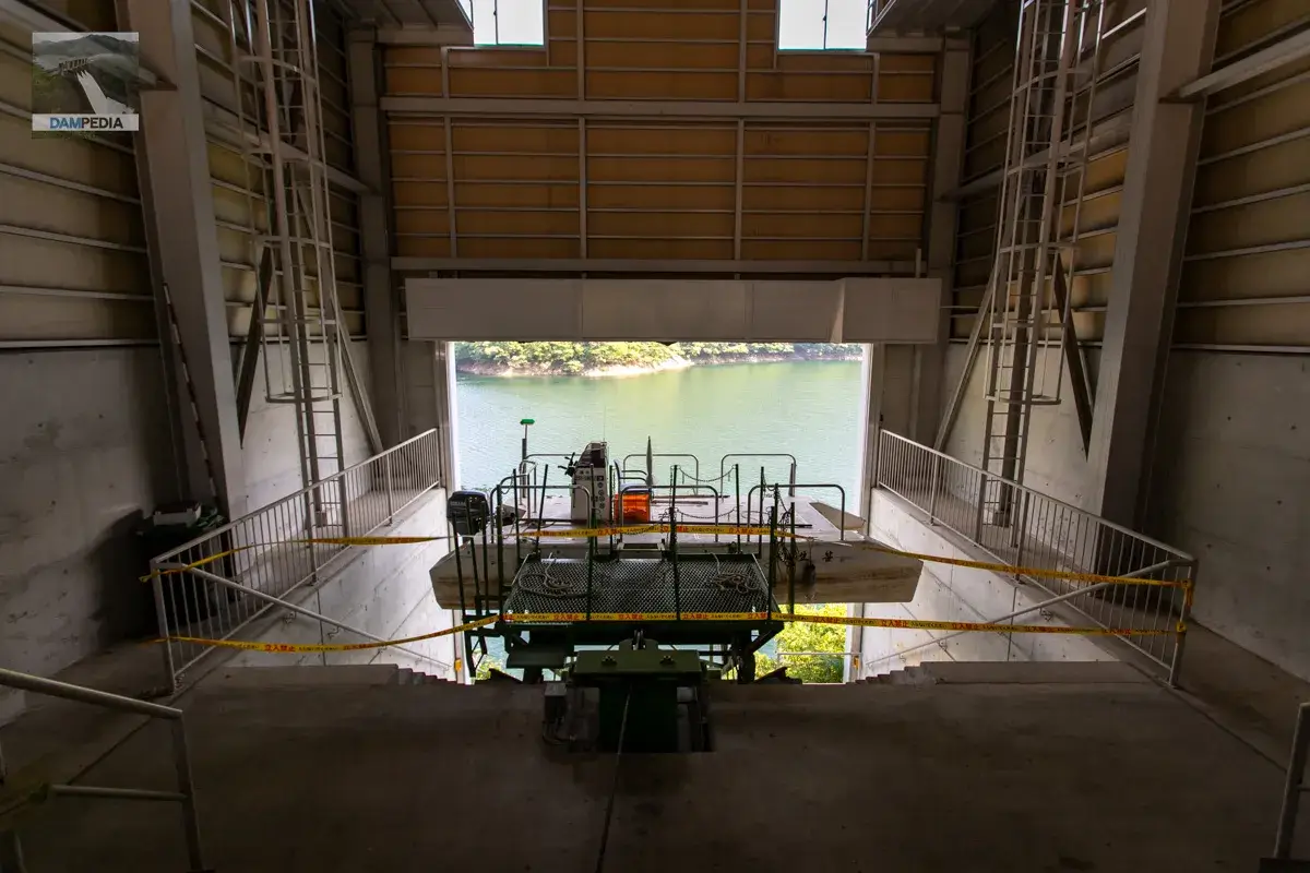
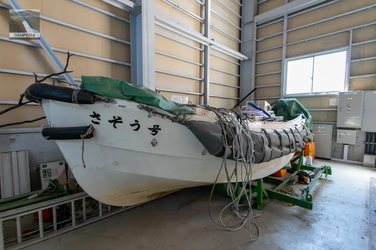
The boat on the incline is called Sasayu-maru. It seems to be used for collecting driftwood and other debris.
This is the Saso issue.
Again to the Fukui Sasagawa Dam monitoring station.
After a brief visit, we returned to the monitoring station. It was a hot day, but we were very grateful that barley tea was available inside for visitors.
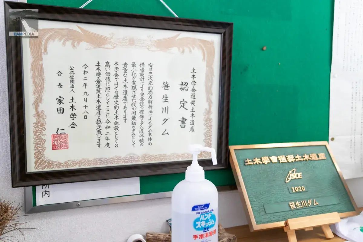
A relief and a certificate of JSCE recommended civil engineering heritage were displayed at the entrance of the monitoring station. The structural design of the Sasagawa Dam is based on a three-dimensional stress analysis method. The technical details are rather difficult to explain, so I will spare you the details, but it was possible to minimize the volume of the embankment while ensuring safety and saving construction costs. The dam was recognized as the first dam in Japan that made this possible, and in 2020 it was designated as a Civil Engineering Heritage Site recommended by the Japan Society of Civil Engineers (JSCE).
Its safety was also proven, oddly enough, in the subsequent torrential rains in Okuetsu.
I was only able to enter the rest area on the first floor of the monitoring station. I was only allowed to enter the actual office space, but I guess it is a consideration that it is presented in photos like this. This is also appreciated.
Walking around the dam
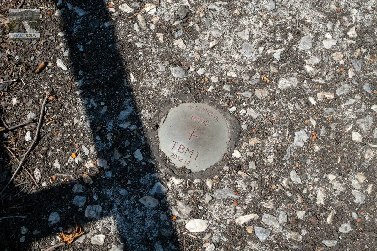
I believe this is the reference point for the Nakajima Power Plant, which was located on the right bank side of the road. I think it is used for surveying. (I don't know much about it.)
There are mysterious concrete remains by the right bank road of the Sasao River Dam. It appears to have been poured by a cable crane. The position is low for a cable crane, so is it part of a plant?
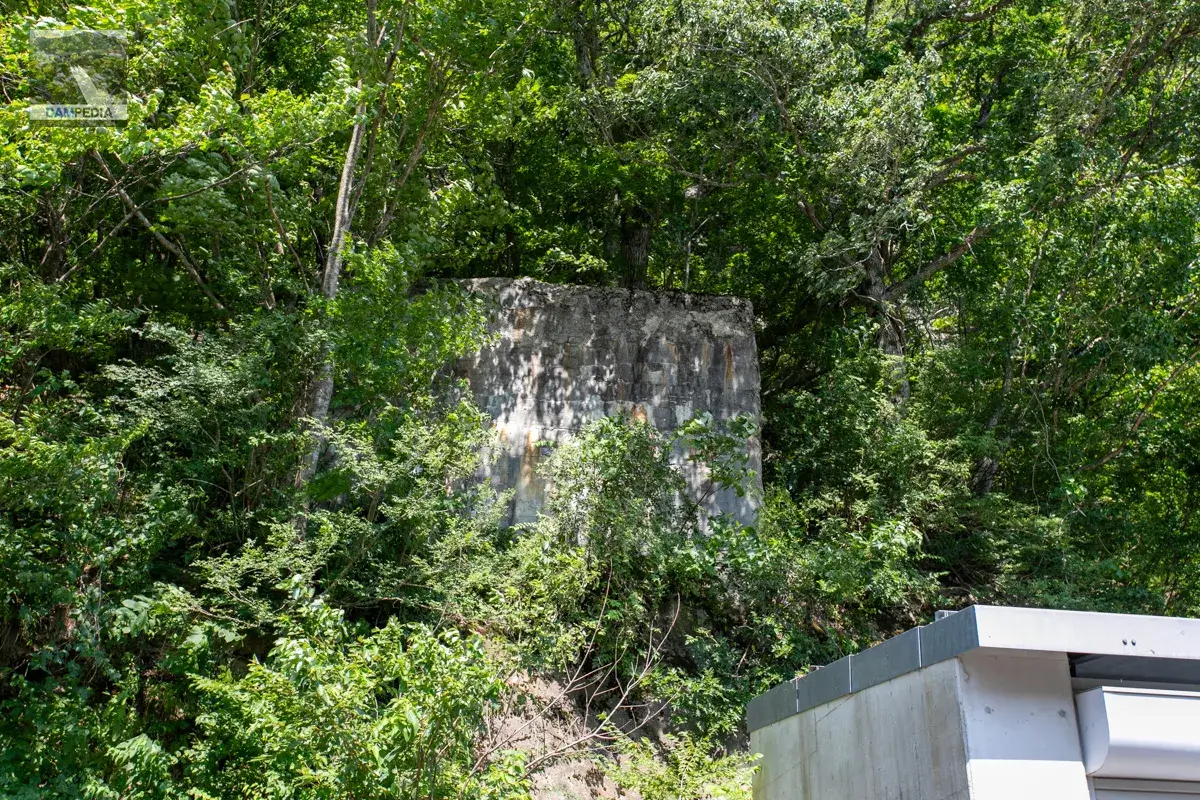
A warehouse on its side. Concrete remains can be seen in the upper left corner.
Other mysterious remains can be seen here and there.
I would like to ask the staff about that mystery on another occasion.
The Sasagawa Dam was the first postwar dam rehabilitation project in Japan to transfer water use capacity, which was rare in Japan; the first dam rehabilitation project in Japan to add a tunnel to accommodate the excess water discharge; the first in Japan to use a three-dimensional stress analysis method; and the first in Fukui Prefecture to implement disaster prevention operations during abnormal floods...and many other milestones were achieved.
Saso River Dam Specifications
| Location | Hondo, Ono-shi, Fukui |
| River Name | Mana River, Kuzuryu River System |
| Objective | F (flood control, agricultural disaster prevention) N (unspecified water, water for river maintenance) W(Water for water supply) P(Power generation) |
| Model | G(gravity-fed concrete dam) |
| Bank height | 76m |
| Bank length | 209.8m |
| Dam volume | 225,000 m3 |
| Watershed Area | 70.7km2 |
| Reservoir area | 234ha |
| Total storage capacity | 58,806,000 m3 |
| Effective water storage capacity | 52,244,000 m3 |
| Dam operator | Fukui prefecture (Hokuriku area) |
| Main body constructor | Kumagai Gumi |
| Year of launch | 1952 |
| Year Completed | 1957 |
| Name of Dam Lake | Sasagawa Dam Lake |
Other facilities/observations
| Parking lot | Fat. |
| Toilet | × |
| Park | × |
| PR Exhibition Hall | × |
| Fishing | × |
| Viewing platform | × |
Map around Sasagawa Dam
Weather around Sasagawa Dam
Lodging facilities that may be close to the Sasagawa Dam


Comment