

Location: Katsuma, Takato Town, Ina City, Nagano Prefecture
Official Web site:.Tenryu River Dam Integrated Management Office
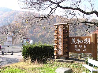
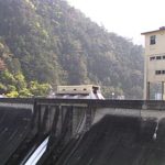
View of the sign from the right bank parking lot
This dam is located at the southern end of Takato Town, famous for its cherry blossoms. Like the Kosibu Dam, this dam also suffers from sedimentation, and a bypass tunnel for sand discharge and a diversion weir to discharge sand into the bypass tunnel were under construction.
We are sorry, but we have not been able to cover the bypass tunnel or the diversion weir. The construction of this project isMibugawa Comprehensive Development Construction OfficePlease refer to the website of the "Mazda Group" for more information.
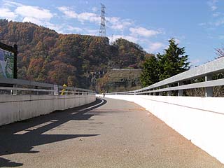
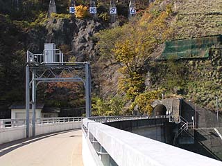
View of the top edge from the right bank
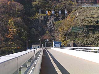
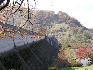
The top end is closed to vehicular traffic. It is a gravity concrete dam, although it has a gentle curve.
View upstream from the top
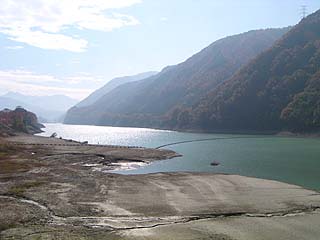
The lower right bank was completely dried up and what looked like an incline in the back was not functioning. Moreover, it is probably true that the sedimentation is worse than it is dry.
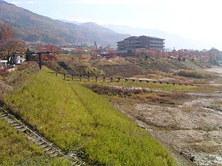
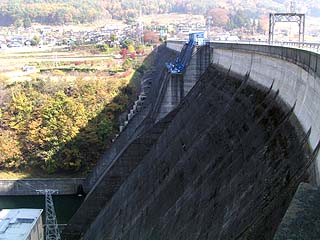
View of the downstream side of the levee from the top (right bank)
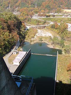
View of the dam lake from the top
You can see that the sand has been composted beautifully. It is more like a large river than a dam lake.
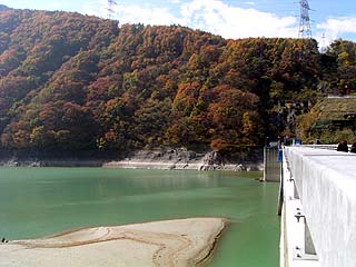
View of the lake side of the embankment dam from the top (right bank)
The water is slightly cloudy and white, probably due to the large amount of sand.
View of the left bank from the center of the top edge
There were quite a few public vehicles parked in the parking lot, but few people walking along the top edge. They just wandered around the right bank, and no one seemed to be thinking about walking to the left bank at all.
View of the water intake from the center of the top edge View from the center of the top edge
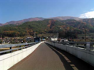
View downstream from the top
Beyond this point is the urban area of Takato Town.
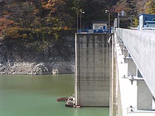
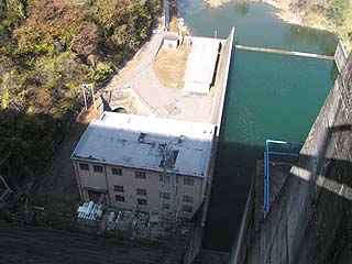
View of the power plant from the top
There was a power plant directly downstream and it was roaring.
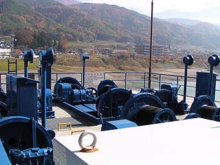
Gate Operator
The gate's actuators were exposed to the rain. It is usually in a prefab or other building, but it is rare to see it exposed.
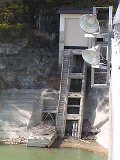
View of the Incline from the top
It is in a state of decay. However, the shutters and other items above appear to be relatively new, so they are being used to a point.
View of the left bank from the top
There is a tunnel ahead for some reason...
Mystery Tunnel
A "No Entry" sign.... I could understand if it was a no-entry sign, but why was it a roadblock? I turned back without understanding it well.
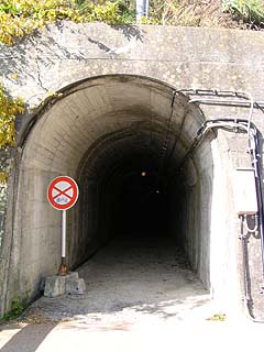
*Nobu gave us information about this tunnel! The following is a quote from that information.
This mysterious tunnel at Miwa Dam is a pedestrian tunnel leading to Katsuma. Inside the tunnel, it splits into two parts. Turning left takes you to the promenade on the left bank of the dam lake, and going straight ahead takes you to the village of Katsuma. Go straight through and up the stairs past the restrooms to the observation deck overlooking the dam. The road is closed to vehicles. Pedestrians, bicycles, and motorcycles can pass.
View of the embankment from the left bank
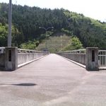
View of the top edge from the left bank
It looks like it is on a bridge, but it is on a dam. It looks as if it goes all the way to the other side.
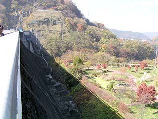
Downstream view of the levee from the right bank
We returned to the right bank and descended to the park downstream. It is reasonably well maintained, but no one comes here, so it is quiet. There is a private house immediately to the right, so it was like a backyard of the house.
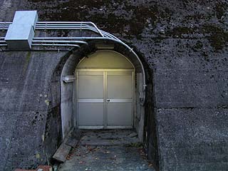
Entrance to the audit corridor?
Found a hidden door!
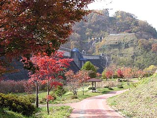
View of the dam from the park downstream
Can you feel the atmosphere of autumn leaves.... Hmmm...
Miwa Dam Specifications
| Model | gravity-fed concrete dam |
| Objective | Flood control, agricultural disaster prevention, unspecified water, river maintenance water, power generation |
| Bank height | 69.1m |
| Bank length | 367.5m |
| Dam volume | 286,000m3 |
| Elevation of non-overflow area | 817.6m |
| Watershed Area | 311.1 km2 |
| Reservoir area | 179 ha |
| Total storage capacity | 29,952,000m3 |
| Effective water storage capacity | 20,745,000m3 |
| Name of Dam Lake | Lake Biwa |
| River Name | Tenryu River System Mibugawa River |
| Year of launch | 1952 |
| Year Completed | 1959 |
| Access to D@M | Turn left on the Ina IC of the Chuo Expressway→Turn east on Prefectural Road No. 87→Turn right at the T (Ina Interchange entrance intersection)→Turn left at Sakashita Irifune onto National Road No. 361→After entering Takato Town, drive National Road No. 152 toward Hase Village and you will see it |
Other facilities/observations
I did not know where the PR Exhibition Hall was located at first, but a casual look on the Web revealed that the public relations office and exhibition room are located in the Miwa Dam Management Branch Office building. Therefore, I have not been able to cover the event... (Again?).
| Parking lot | ○ |
| Toilet | ○ |
| Park | ○ |
| PR Exhibition Hall | ○ |
Accommodations that may be close to Miwa Dam

Comment
[Auto-post] Damapedia Archives - Please take a look at it at your leisure - 1010 - Miwa Dam / Miwa Dam http://t.co/BuZodLxJhZ