
Location: 8181-27 Kami-Iida, Iida City, Nagano Prefecture
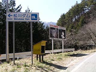
Information sign near the entrance to the dam site

Matsukawa Dam is located in Iida City, a major city in southern Nagano Prefecture. As you can see in the photo, there is a signboard to guide you, so you will not get lost if you come close to the dam. Incidentally, this time I stopped by on my way back from strawberry picking.
Matsukawa Dam Redevelopment Project signboard
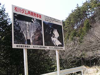
The composting problem unique to the Tenryu River system is also present in this Matsukawa Dam. Currently, the Matsukawa Dam redevelopment project is underway. There were signs everywhere along the road leading to the Matsukawa Dam.
The development project began in 1990 and is scheduled for completion in 2011. After the construction is completed, the total storage capacity will be 50,000 m3UP to 7,450,000m3The effective water storage capacity is 1,000,000 m3UP to 6,400,000m3will be.
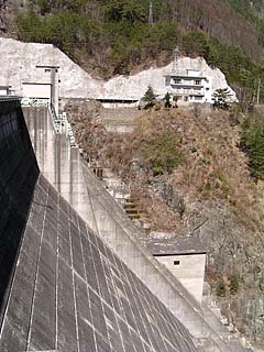
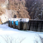
View of the levee from the downstream side of the left bank
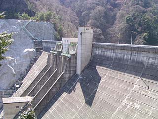
It is a standard gate configuration with two radial gates and one orifice.
Nameplate and introductory sign on the downstream side of the left bank
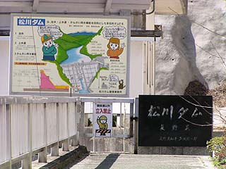
Signs for children are in place. I am glad to see these signs.
Audit corridor from downstream on left bank View of the entrance
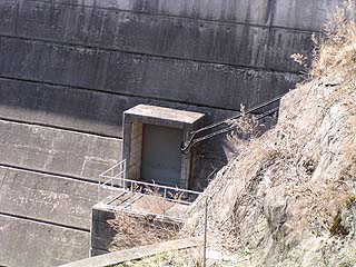
Probably the entrance to the audit corridor.
View of the levee from the downstream side of the left bank
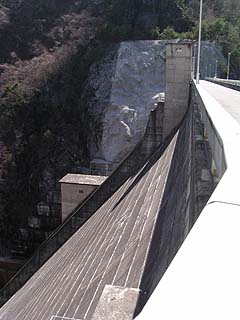
The height is there.
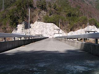
View of the top edge from the left bank
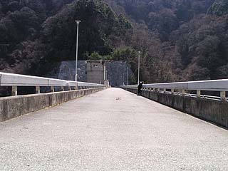
There is a parking lot in front of the administration office, from which vehicles are prohibited, so naturally the top of the mountain is closed to vehicular traffic.
Inclines and Warehouses
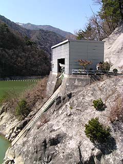
Ship moorings are located on the left bank. The incline of the incline appears to be built relatively steep.
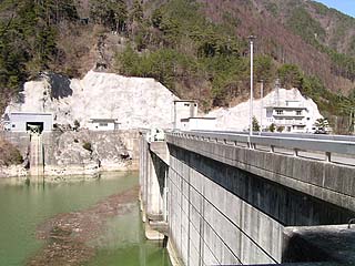
View downstream from the top
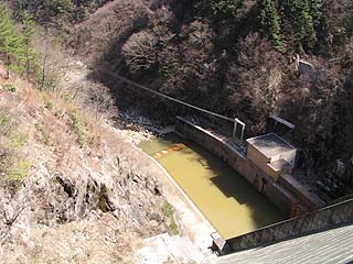
The camera is pointed at the abatement works. The water is muddy brown, perhaps due to the redevelopment project, or perhaps a ground-specific problem. The lower right corner appears to be a power plant facility, but since this dam was not originally designed for power generation, it does not appear to be in operation.
View of the dam lake from the top
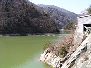
However, the water in the dam lake is relatively greenish.
Perhaps construction of a redevelopment project is underway upstream of here. I did not actually go upstream, so I am not sure....
View of the administration office and the Southern Alps from the top
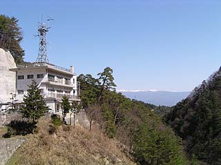
The downstream side was quite a nice view. The Southern Alps mountain range can be seen in the distance.
View of the Southern Alps from the top
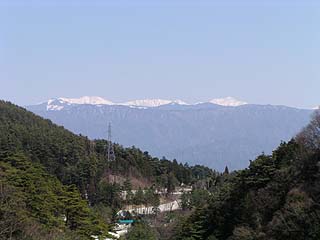
Maybe the rightmost peak is Seidake, and the middle one (maybe the left one) is Akaishidake... but I might be lying a lot.
incline
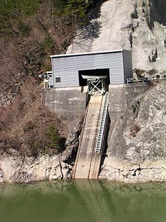
The incline is photographed from the front. The ship appears to be relatively small for a warehouse.
View of the right bank from the center of the top edge
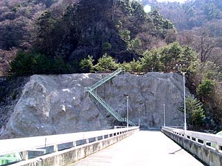
Oh, the stairs!"
I thought that if I went up there, I might be able to see the top edge from above... but unfortunately, the stairs were blocked by a no trespassing sign. Unfortunately, the stairs were blocked by a no-entry sign. I thought I could go there because the upper part is like a plaza, but alas.
View of the embankment from the lake side of the right bank
There are fish in the dam lake, but I wonder if we can catch them...
View of the levee from the downstream side of the right bank
View of the top edge from the right bank
administration office
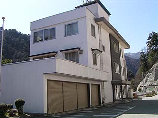
There was a dog behind the control center. It was a medium-sized dog, probably a mongrel. He (she?) went into the kennel and never came out. I couldn't make a treaty of friendship with him (her?). Come to think of it, it is rare to have a dog in a management office.
dam characteristics
| da mu | Model | gravity-fed concrete dam |
|---|---|---|
| Objective | Flood control, agricultural disaster prevention | |
| Bank height | 84.3m | |
| Bank length | 165m | |
| Dam volume | 263,000m3 | |
| Elevation of non-overflow area | 689.3m | |
| savings water (esp. cool, fresh water, e.g. drinking water) pond | Watershed Area | 60km2 |
| Reservoir area | 29 ha | |
| Total storage capacity | 7,450,000m3 | |
| Effective water storage capacity | 5,400,000m3 | |
| River Name | Tenryu River system Matsu River | |
| Year of launch | 1964 | |
| Year Completed | 1974 | |
| Access to D@M | Get off at Iida IC of Chuo Expressway Turn left at the "Iida Interchange" traffic light intersection Turn right at the next traffic light intersection, "Inter-iriguchi (entrance)," onto Route 256. It is a little difficult to understand, but cross the Matsukawa Bridge and go to the signal intersection "Matsukawa Bridge" not in the direction of the National Highway. Slightly to the left into a city street Cross the railroad crossing, and after a while, turn left at the T intersection. Iida Hospital will be on your right. Turn left at the signal intersection ahead of the hospital. Take Prefectural Road No. 8 and follow the road straight. | |
Other facilities/observations
| Parking lot | ○ | The park is downstream called Kazakoshi Park. It is not clear if the levee can be seen from here. Also, there seems to be a cart practice area between this Kazetsu Park and the embankment. The sound of the engine echoed around the dike. We have not seen either of these, so the atmosphere and other details are unknown. |
|---|---|---|
| Toilet | ○ | |
| Park | ○ | |
| PR Exhibition Hall | × |
Comment