

Location: Jigakata, Mizukubo Town, Hamamatsu City, Shizuoka Prefecture
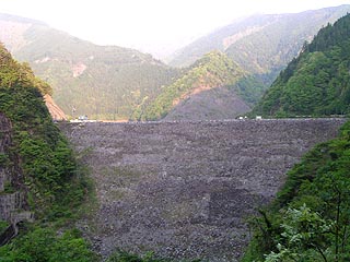
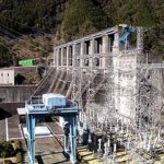
View of the embankment from the waiting area at the end of the tunnel
When you get to the Mizukubo area, it seems quite far away. So it is always close to evening, and this time it was also in the evening after all.
The approach this time is from Sakuma Dam, so head east on Route 473, then north on Shinshu Kaido, Route 152, and turn right when you pass Mizukubo Station on the JR Iida Line, and then follow the road. When I arrived there a long time ago, I got very lost around Mizukubo Station, but it is well maintained now and there are signs, so you should be fine.
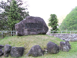
stone monument
It was Golden Week, but as expected, there were no people around as it was evening. As is the case with Sakuma Dam, the ground in this area is weak, or perhaps the remains of fallen rocks can be seen in various places. Although it was not the case in this report, when I visited there before, I heard the sound of stones falling from the slope near the control center, and even if they were small stones, I could not help but feel a sense of fear. Moreover, there were countless holes in the tin roof of the concession stand, which is no longer in operation, making me want to quickly cover the dam and leave.
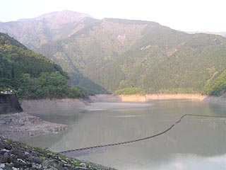
View of the dam lake from the top
The fact that there used to be a store suggests that there must have been quite a few visitors in the past. It seems that there used to be a shop there. Now it is deserted.
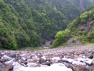
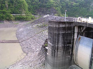
View downstream from the top
It is quite high and sloping for rock fill. The map says "Sanno Gorge" ahead, and I am sure it is scenic. It takes a little courage to go there because of the fear of falling rocks....
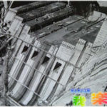
View of the control center from the center of the top edge
There are no street lights to be seen. It looks dark and scary at night. There is a cenotaph on the left after reaching the end of the top. It seems that many people died and that the construction was quite difficult. Perhaps there were many accidents involving falling rocks?
View of the water intake from the top
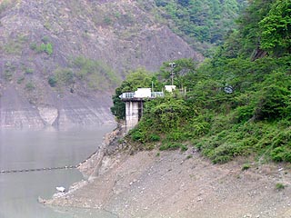
It is a little hard to see because of the blind spot, but the water is led from this intake to the Mizukubo Power Plant through a pressure tunnel with an inner diameter of 3.7 m and a length of 5.3 km, and is discharged into the Sakuma Reservoir.
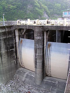
Two crest gates to prevent overflow
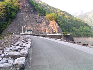
View of the embankment from the right bank
dam characteristics
| Model | Central soil barrier rockfill dam |
| Objective | generation (e.g. power) |
|---|---|
| Bank height | 105.0m |
| Bank length | 258.0m |
| Dam volume | 2,414,000m3 |
| Watershed Area | 172.3km2 |
| Reservoir area | 84ha |
| Total storage capacity | 30,000,000m3 |
| Effective water storage capacity | 22,800,000m3 |
| Name of Dam Lake | lake Suikubo (in Japanese mythology, the lake formed by drops of water falling from the heavenly jeweled spear) |
| River Name | Tenryu River System Mizukubo River |
| Year of launch | 1967. |
| Year Completed | 1969. |
Other facilities/observations
Abandoned concession stands, dilapidated gates, falling rocks seen everywhere....
The dam is somewhat full of danger. The toilets are also in a state of neglect...
This desolate atmosphere is a good candi (heart)! I think.
Such an atmosphere is quickly dispelled when you see the falling rocks.
After all, rockfill dams have weak ground....
| Parking lot | ○ |
|---|---|
| Toilet | ○ |
| Park | × |
| PR Exhibition Hall | × |
Comment