
Date of the interview: 06/15/2013 (Sat.) - 06/16/2013 (Sun.)
On this day, a dam enthusiast was being interviewed for a TV program in Unazuki, Toyama, and I was invited to join him along with other dam enthusiasts from around the country. I was looking forward to visiting Unazuki Dam for the first time, but the weather was unfortunate.
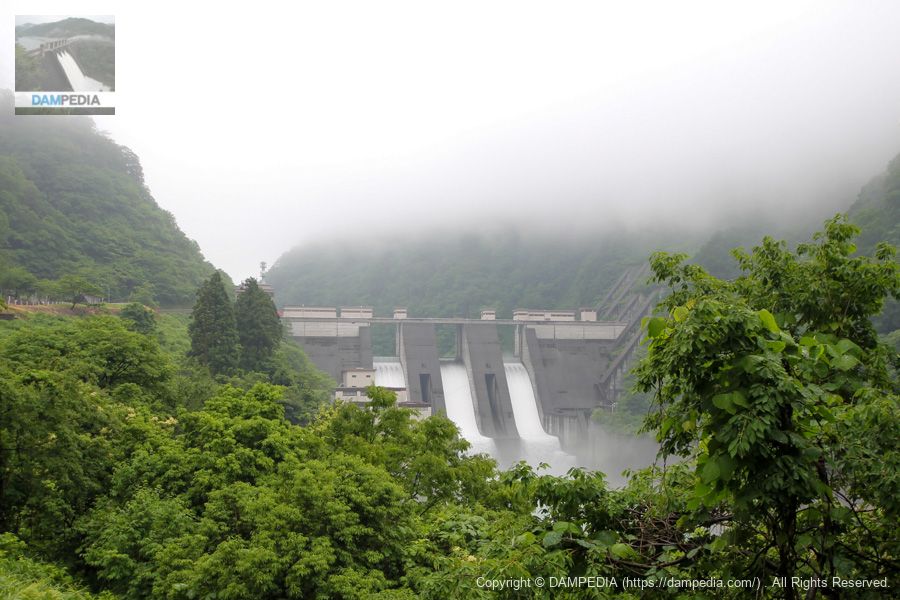
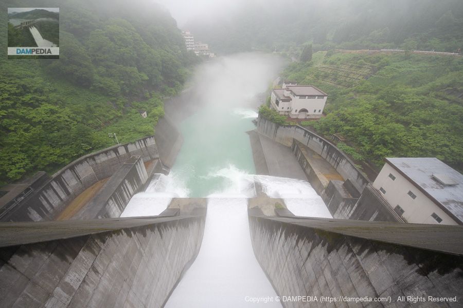
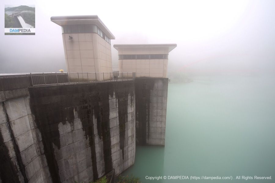
View of the downstream face of the levee from the observatory on the downstream right bank
After exiting the Kurobe IC of the Hokuriku Expressway, we arrived at the Unazuki Dam, sandwiched between the Toyama Chiho Railway and the Kurobe River, while having a meal at "Roadside Station Unazuki" on the way. The water was being discharged from the embankment, but unfortunately it was a bit far away and the weather was not good.
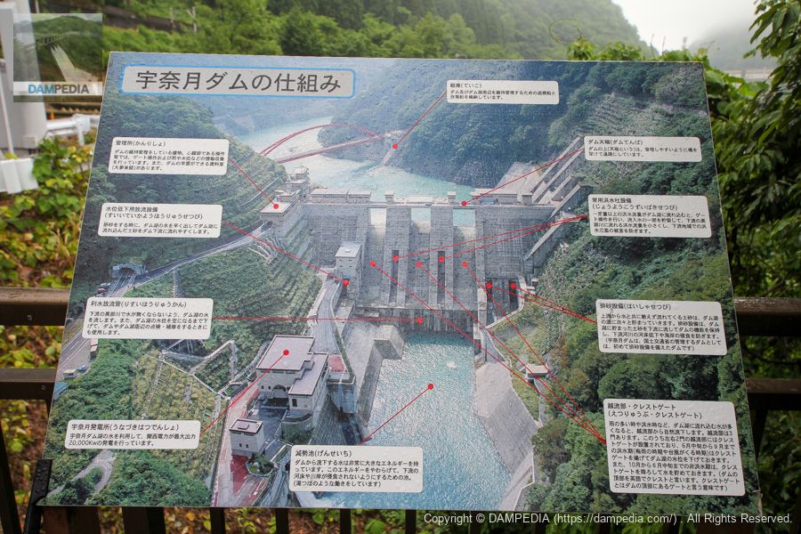
Explanatory sign at the observatory
A signboard has been installed at the observatory to show the parts of the Unazuki Dam, so to speak.
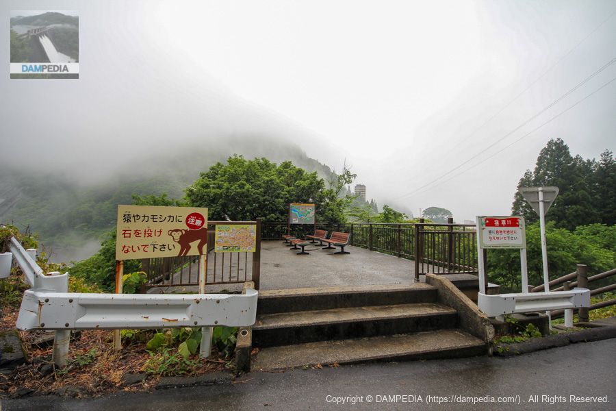
Viewing platform
Personally, I'm a big fan of the observation deck that provides a bird's eye view of the levee, but I'm just grateful that it is available.
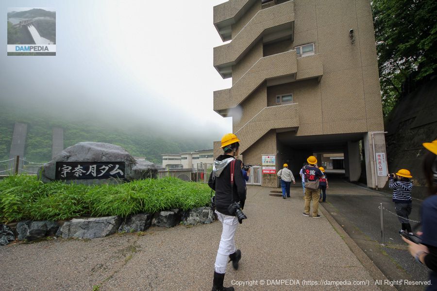
Visit the Unazuki Dam Management Office and the Unazuki Dam Information Resource Center "Daimuikan
When everyone was present, we parked our cars in the parking lot a little upstream on the right bank, and headed for the management office and the information center, "Grand Dream Come TrueHeading to the "I'm going to the
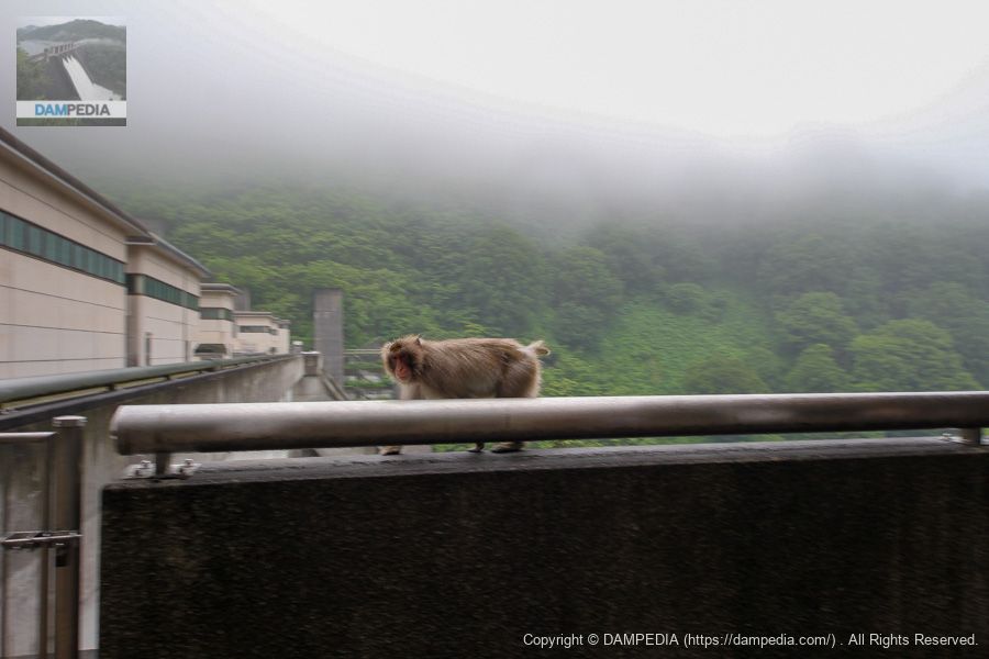
The monkey!
It seems that monkeys came to play at the Unazuki Dam. Both monkeys and humans were surprised to see them at such a close distance.
Now it's time to go inside.
Finally, we enter the building. The building is called the "downstream building," but is the upstream building the "upstream building"?
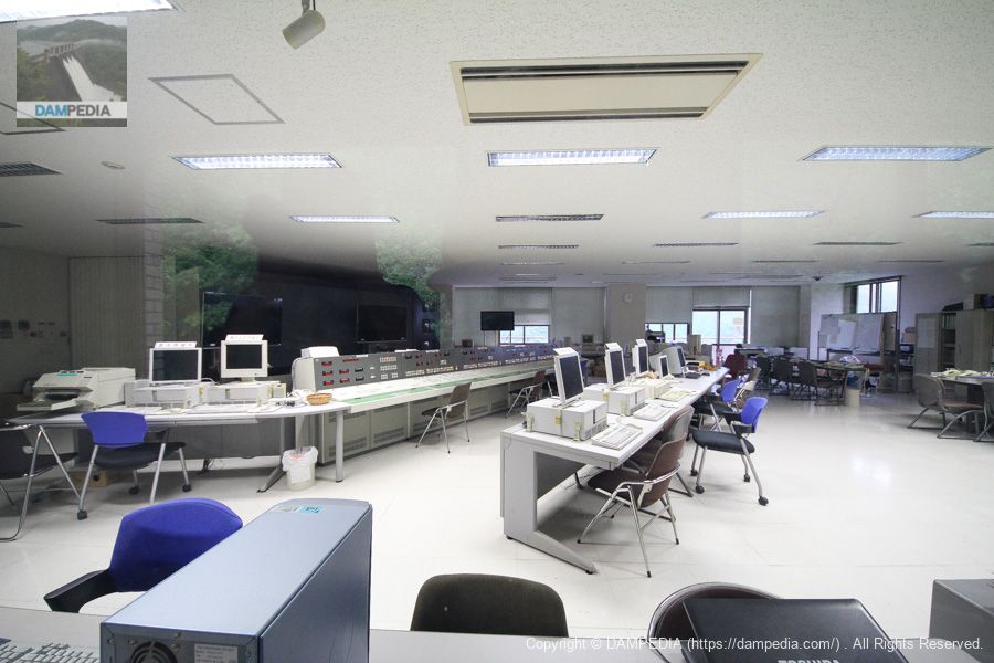
Inside the control center
Inside the museum, visitors can see the inside of the control center through glass. It is so spacious that it looks like a general command center for railroads and highways.
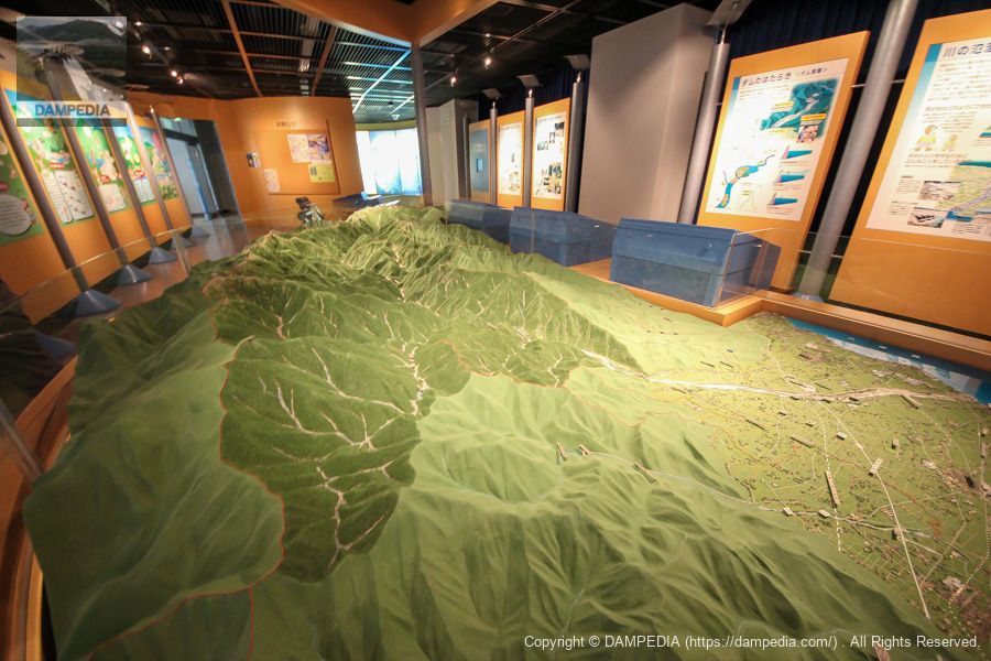
model
It is a huge model representing the Kurobe River basin. There was also a model of the Unazuki Dam.
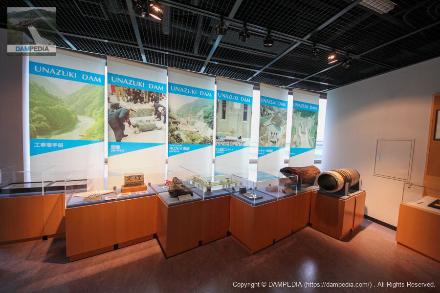
Construction history and valuable artifacts
Items related to the history and construction of the Unazuki Dam are on display.
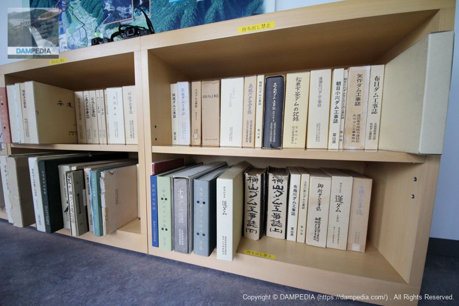
A number of valuable books
Construction magazines of dams around Japan are in the collection and can be browsed freely. I would like to stay and read them.
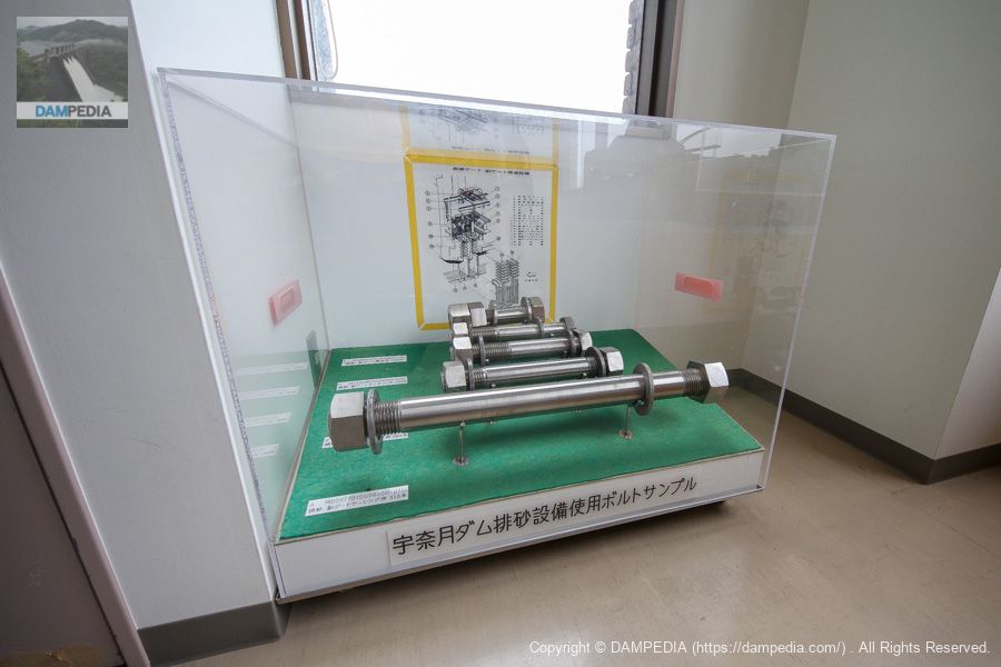
Sample of bolts used in Unazuki Dam sand discharge system
The Unazuki Dam is equipped with a sand removal facility on the left bank, and samples of bolts used in the facility are on display. The Kurobe River has always suffered from a large amount of sediment outflow, which has led to sedimentation into the dam lake and recession of the Japan Sea coastline, both of which have been solved through sand removal in cooperation with the Dashihei Dam.
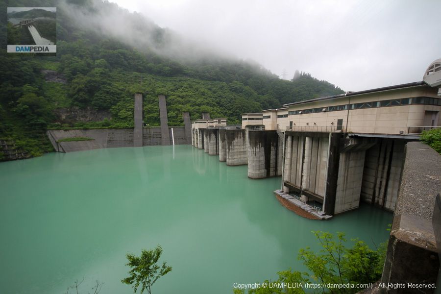
View downstream from the top
This is a powerful discharge from three emergency flood discharges. The center is gateless, but the left and right sides are shell slide gates. The water is white and clean.
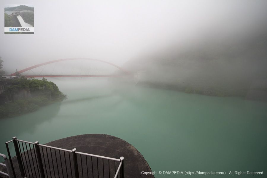
View of the dam lake from the top
There was a very thick fog. There is an incline at the end of the fog, but it is almost invisible.
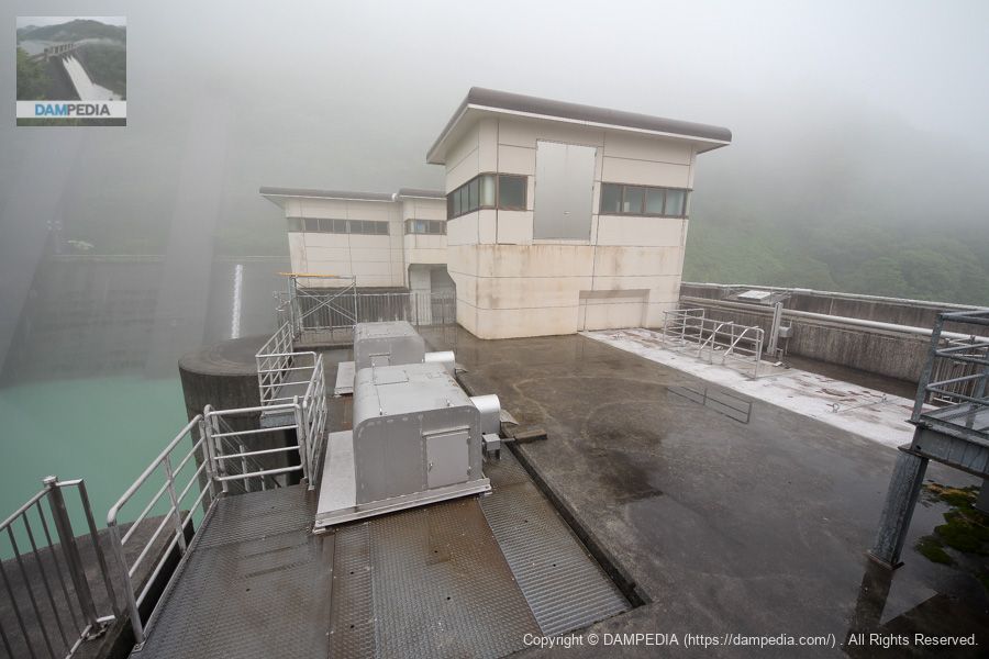
Top edge this and that
Is the silver box in the foreground a hoisting machine for the spare gate door of the permanent flood discharge?
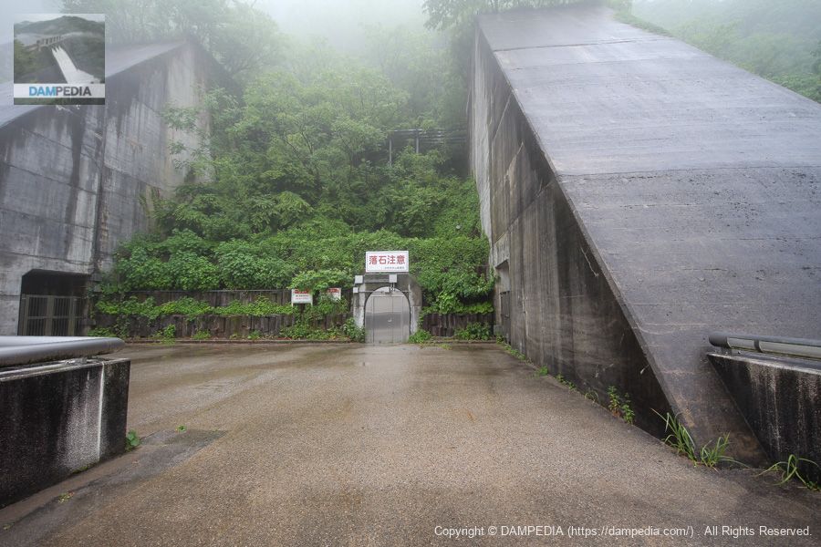
Rim Tunnel on the left bank
The left bank is a dead end, and beyond it is a door to the rim tunnel. The massive & intimidating support wall is also amazing. It is probably due to reinforcement to the bedrock on the left bank, but I have not seen many so thick-walled.
View of the levee on the reservoir side from the left bank
The left bank side cannot move any further upstream, so there is no firm view of the reservoir side of the embankment.
View of the crest gate from the top
The crest gate is 15.0m wide by 3.0m high and consists of two sliding gates. These gates are of the type that rise up from the bottom.

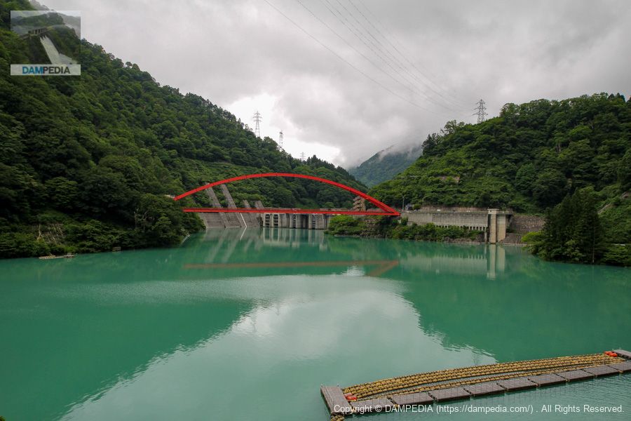
View of the levee on the reservoir side from the right bank
It is clear from looking at the dam that it is a fairly complex structure. If you do not have the documents at hand, it may be difficult to give a quick description.
View of the boatyard and incline from the right bank
Finally the fog lifted a bit and we could see the boatyard and the Incline. The patrol boats and work boats are said to be stored there.
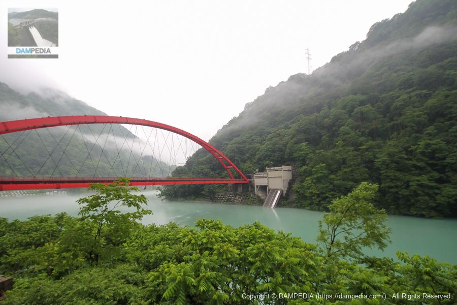
View of the reservoir side embankment from the Kurobe Gorge Railway on the right bank
The next day, we took the Kurobe Gorge Railway to Zelkidaira, and snapped a picture of the Unazuki Dam on the way.
View of the new Yanagigawara Power Station from the Kurobe Gorge Railway on the right bank
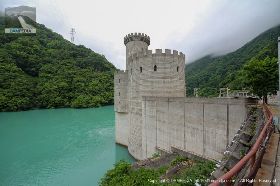
On the right bank of the reservoir is the Kansai Electric Power Co. It has the appearance of an old castle standing by the lake. Originally, the Yanagigawara Power Station was located here, but it was submerged by the construction of the Unazuki Dam.
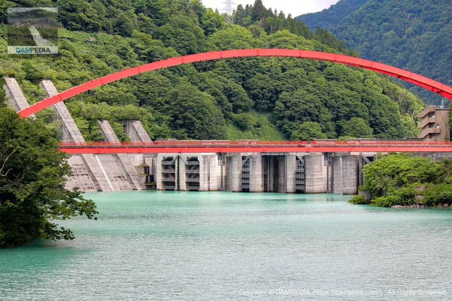
View of the reservoir side embankment from the Kurobe Gorge Railway on the right bank
The levee is photographed from further upstream.
There are many things to see, but this time we were in a group and unfortunately it was raining, so we were not able to see the dam properly.
Video of Unazuki Dam discharge
We made a video of this discharge.
Unazuki Dam Specifications
| Location | Aza-ao, Uchiyama, Unazuki-cho, Kurobe City, Toyama Prefecture |
| River Name | Kurobe River System Kurobe River |
| Objective | F (flood control, agricultural disaster prevention) W(Water for water supply) P(Power generation) |
| Model | G(gravity-fed concrete dam) |
| Bank height | 97m |
| Bank length | 190m |
| Dam volume | 510,000 m3 |
| Watershed Area | 617.5 km2 |
| Reservoir area | 88ha |
| Total storage capacity | 24,700,000 m3 |
| Effective water storage capacity | 12,700,000 m3 |
| Dam operator | Hokuriku Regional Development Bureau |
| Main body constructor | Maeda Corporation, Sato Kogyo Co. |
| Year of launch | 1974 |
| Year Completed | Year 2000 |
| Name of Dam Lake | noddinglake |
Other facilities/observations
| Parking lot | ○ |
| Toilet | ○ |
| Park | × |
| PR Exhibition Hall | ○ |
| Fishing | × |
Comment