
Date of interview: Wednesday, November 19, 2014
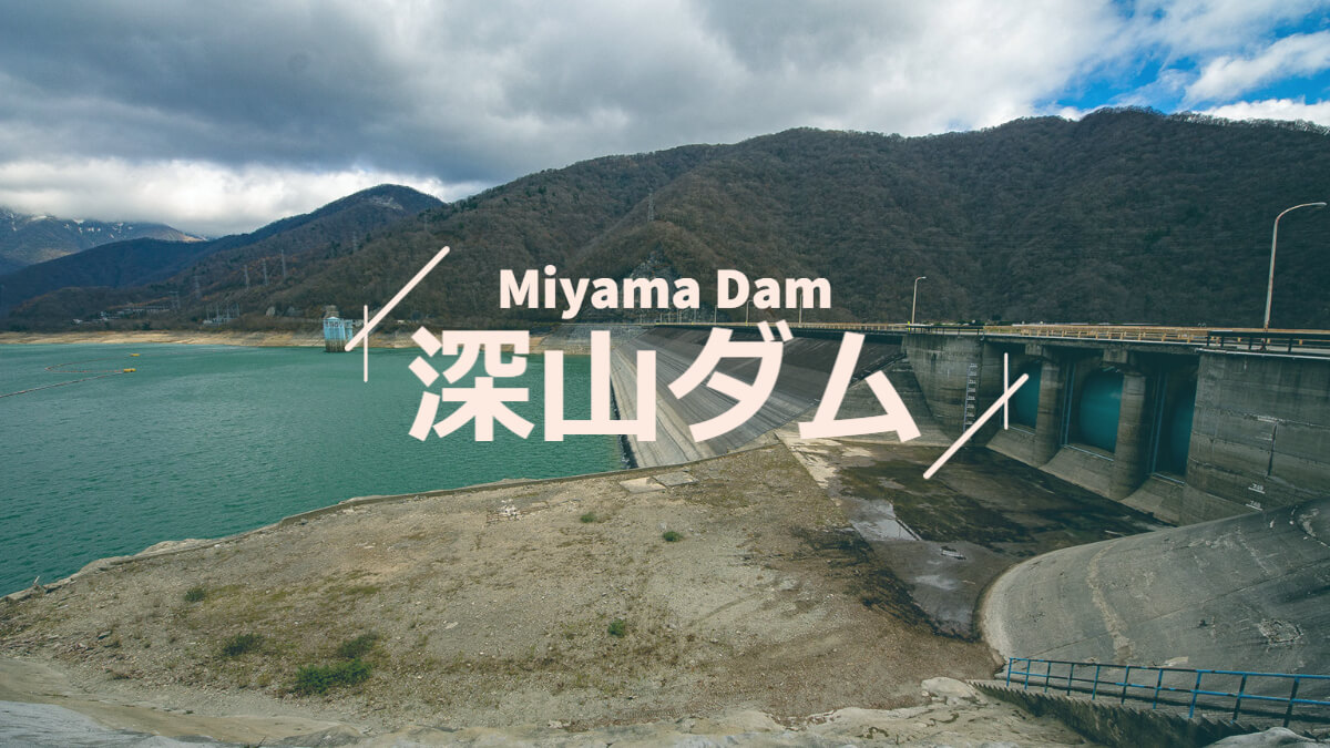
We came here via Shiobara Dam (glimpse only) and Itamuro Dam (entrance only). It was one of the main dishes of the day. The Fukayama Dam was constructed at the uppermost reaches of the Naka River as part of the state-run Nasunohara Development and Construction Project. In addition to agricultural water and water supply, water taken from the Fukayama Dam is used for hydroelectric power generation at the prefectural Itamuro Power Station. It also serves as the lower reservoir for pumped storage power generation at the Jensen Kaihatsu Numahara Power Station. The upper reservoir is the Numahara Dam.
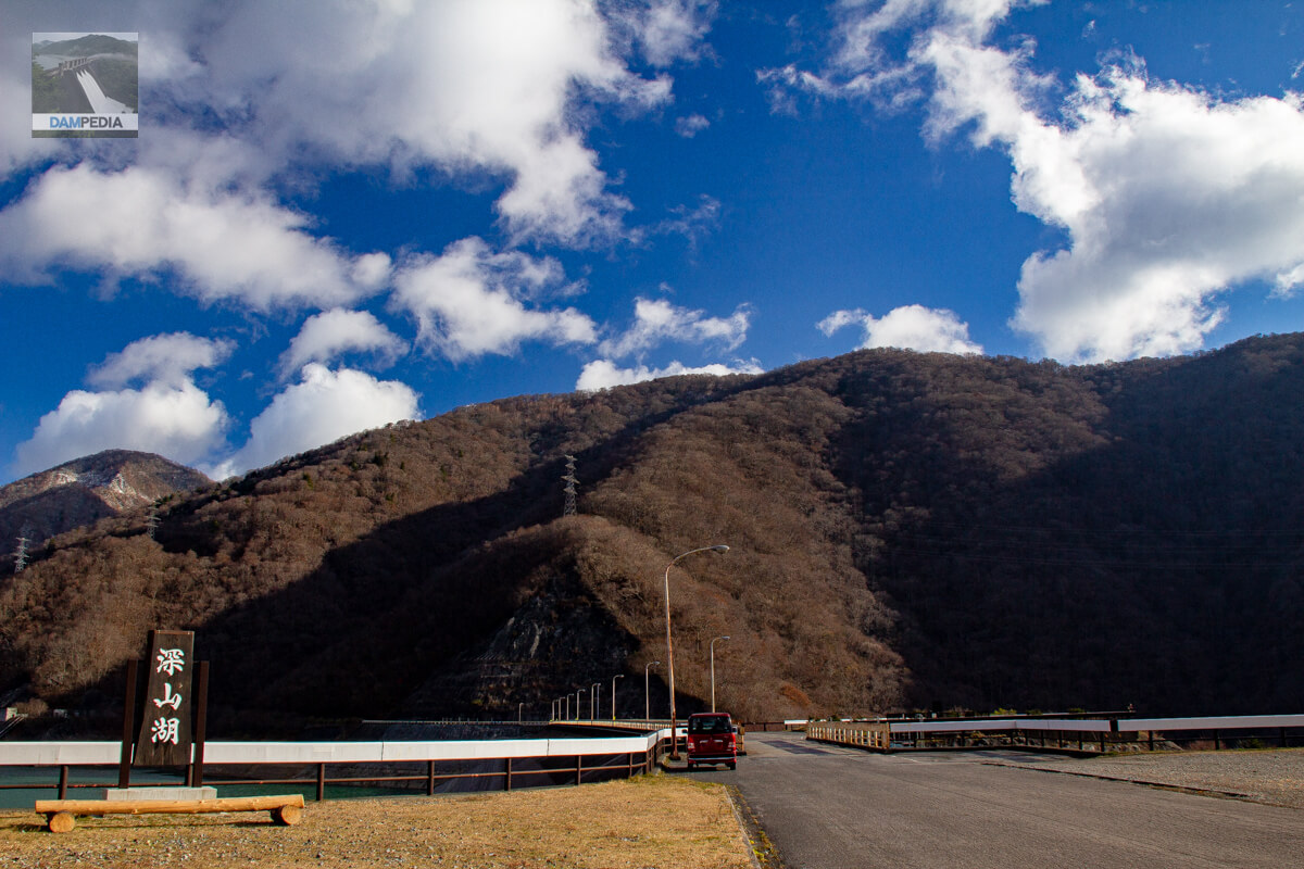
View of the top edge and wooden sign from the right bank
At Shiobara Dam, the autumn leaves were in full bloom, but the area looks a bit closer to winter, perhaps because it is further north and at a higher elevation.
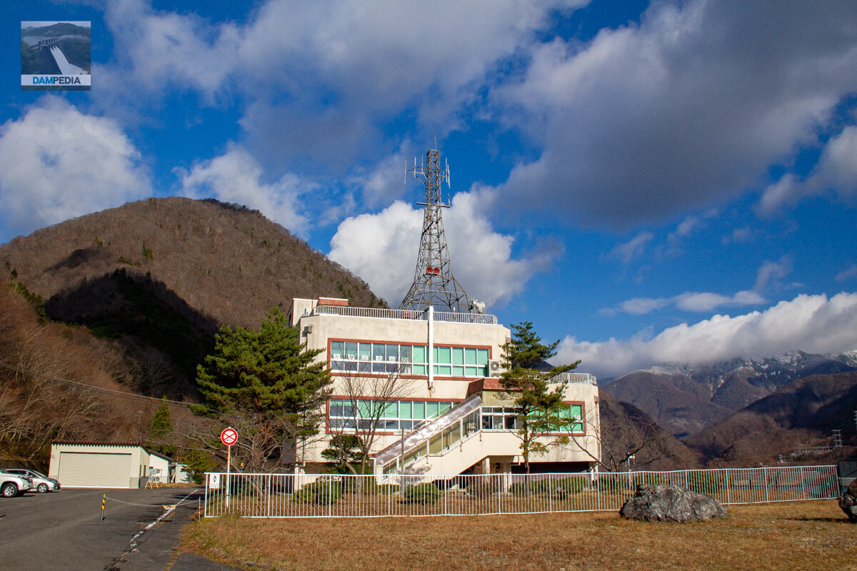
administration office
It is a large management center for a prefectural government-run facility.
View of the flood discharge from the right bank
When I first saw the downstream face of the Miyama Dam, my impression was that it was rough. Although it is an asphalt-faced fill dam, the downstream face is thickly wooded. In addition, the sprayed concrete around the flood discharge may have made it look even rougher than it was.

Toilets on the right bank
There is a public toilet on the downstream side of the right bank. However, it is said to be closed in winter, so please be careful in case of emergency 😁.
The right bank of the river is so wide that it looks like it could be used for a small festival. It is so wide that it looks like it could be used for a small festival. Also, I noticed from Google Maps that there is an observatory on the right bank called "Fukayama Dam Park" where you can see the embankment from a bird's eye view. I didn't know it existed at the time, but now I have an excuse to visit it again.

Looking downstream from the right bank
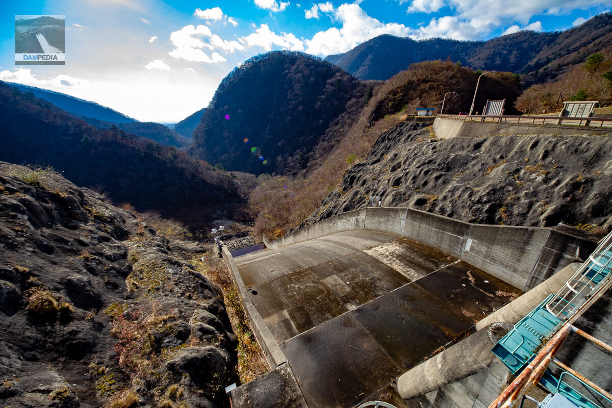
Another factor in the roughness of the area. The ski jump flood discharge is almost left in its natural state, with only concrete blocks laid under it. The fact that there is no water flowing in the river below the flood discharge may also contribute to the sense of roughness.
Across the valley, one can see Nasunogahara stretching out.

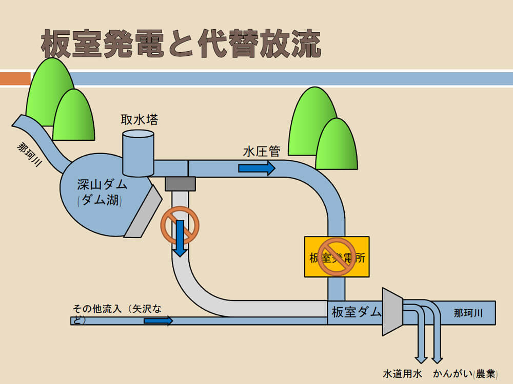
Water taken from the Fukayama Dam as agricultural water and tap water flows through a conduit to the Itamuro Power Plant. After being used for power generation, the water is back-conditioned at the Itamuro Dam, taken into the upper trunk canal as agricultural water and tap water, and the rest is discharged into the Naka River. The rest of the water is discharged into the Naka River. Because water is used without excess in this way, no water flows directly under the dam.
When we contacted the Tochigi Prefecture Nasu Agricultural Promotion Office and the Nasu Regional Dam Management Branch, we were given materials, which we have also included here. Tochimaru-kun is very cute. (We also received permission to post this information.)

However, it is not as if it is not always flowing. There is a branch in the middle of the water pipeline from the intake tower, and there is actually a Howell Bunger valve on the left bank side. When the Itamuro Power Plant is closed for inspection or construction, alternative discharge may be made from this valve. The valve was covered with trees and we did not notice its existence on the day we visited, but we were told that "after the leaves fall, you can see the alternative discharge from the top edge of the valve.
Incidentally, the Fukayama Dam actually has another discharge structure that is not normally visible, but you can guess that by looking at the GSI map. I hope this will not be used.
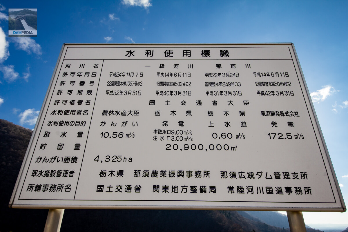
Water Use Signs
The water use signage is a single, easy-to-understand sign for irrigation by MAFF, power generation and water supply by Tochigi Prefecture, and power generation by Power Development Corporation.
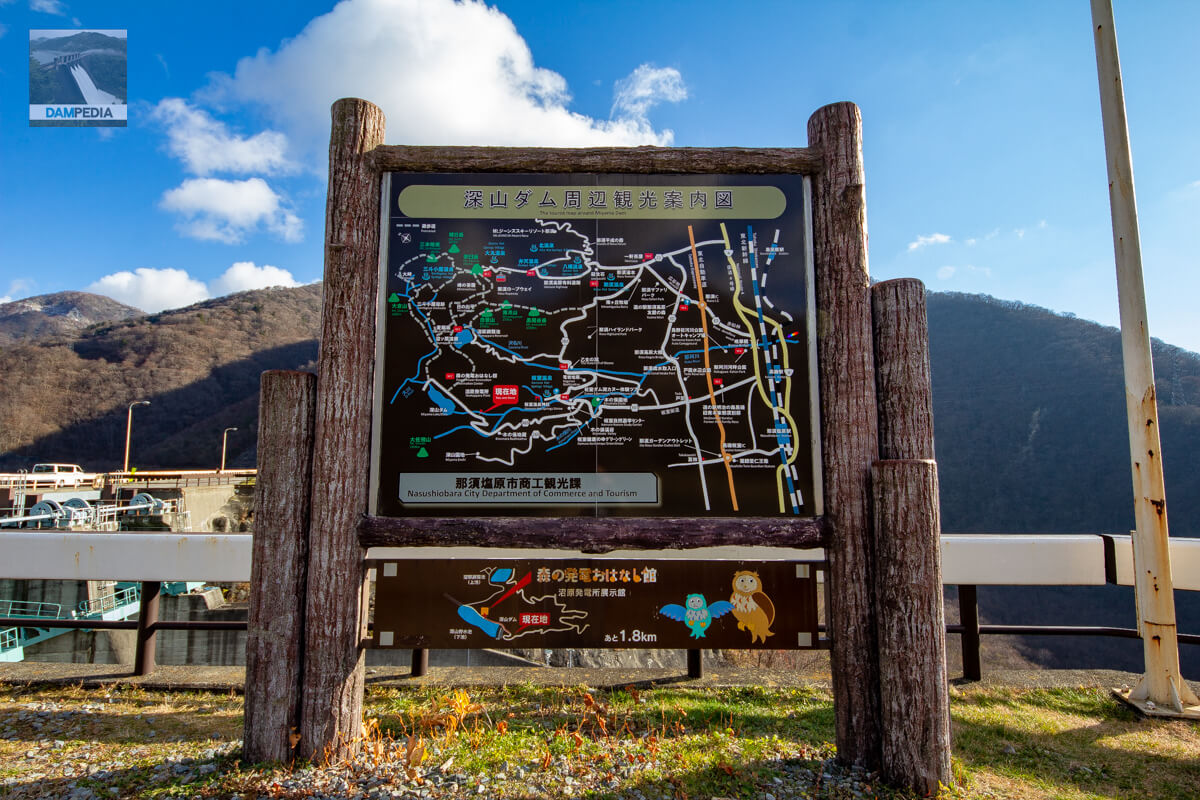
Tourist map of the area around the Miyama Dam
There are hiking and climbing routes around the Fukayama Dam, and the Fukayama Dam is also a tourist attraction. On this day, there was always someone visiting the site.
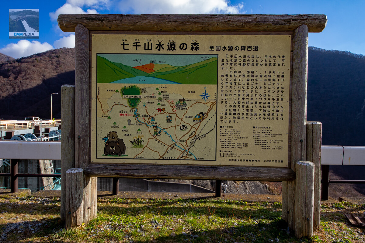
Nanasenzan Water Source Forest
The Nanasenzan Water Source Forest is recognized as one of the 100 best water source forests in Japan.
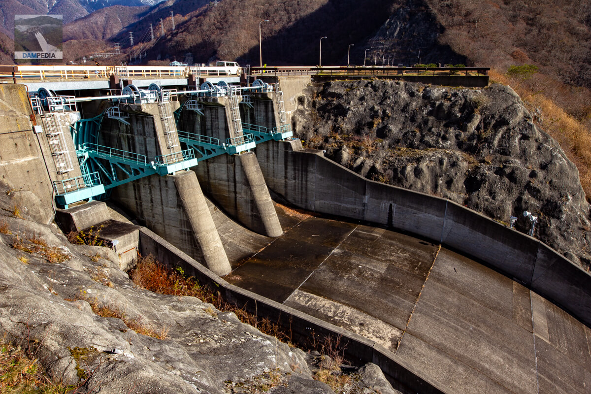
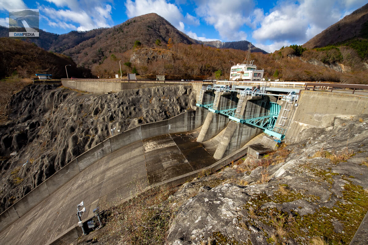
View of the crest gate from the right bank
The Fukayama Dam is equipped with three radial gates on the crest.
Looking downstream from above the flood discharge
It is the downstream direction that is still full of wildness.
View of the crest gate from another angle
The right bank dam site and part of the top edge protrude in the downstream direction, allowing the crest gate to be viewed from the downstream side.
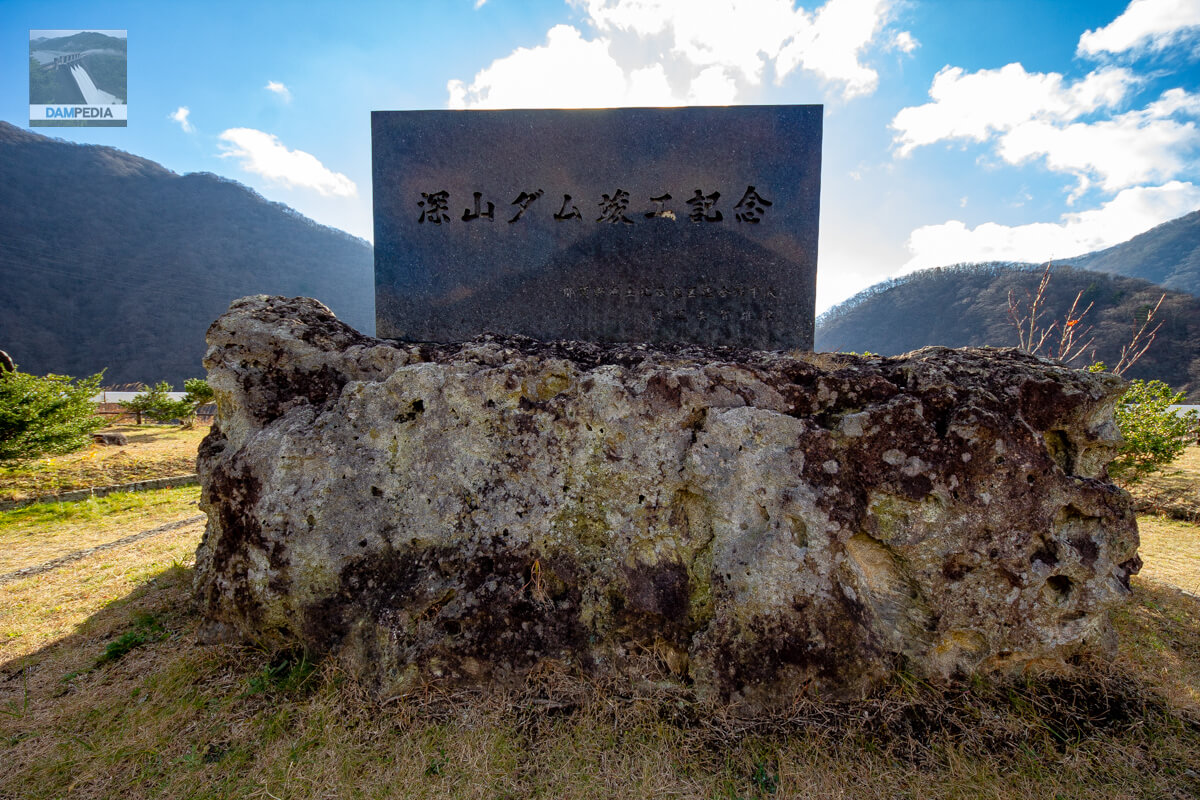
Commemorating the completion of the Fukayama Dam
A monument is placed on a landslide on the right bank.
View of the downstream face of the dike from the right bank landslide
The slope looks more like gravel than rock. The grass also grows on the slope, making it look like a rougher version of the Miho Dam.
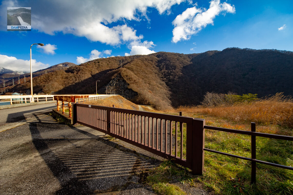
dog run entrance
Unlike the Miho Dam, Inunashiri is unfortunately off-limits.
Looking downstream from the left bank
It looks wild from every angle. Perhaps it looks that way because it is late fall.
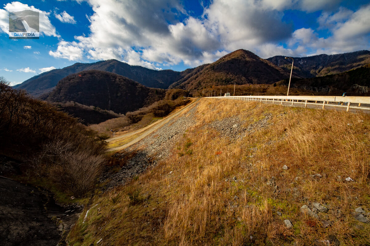
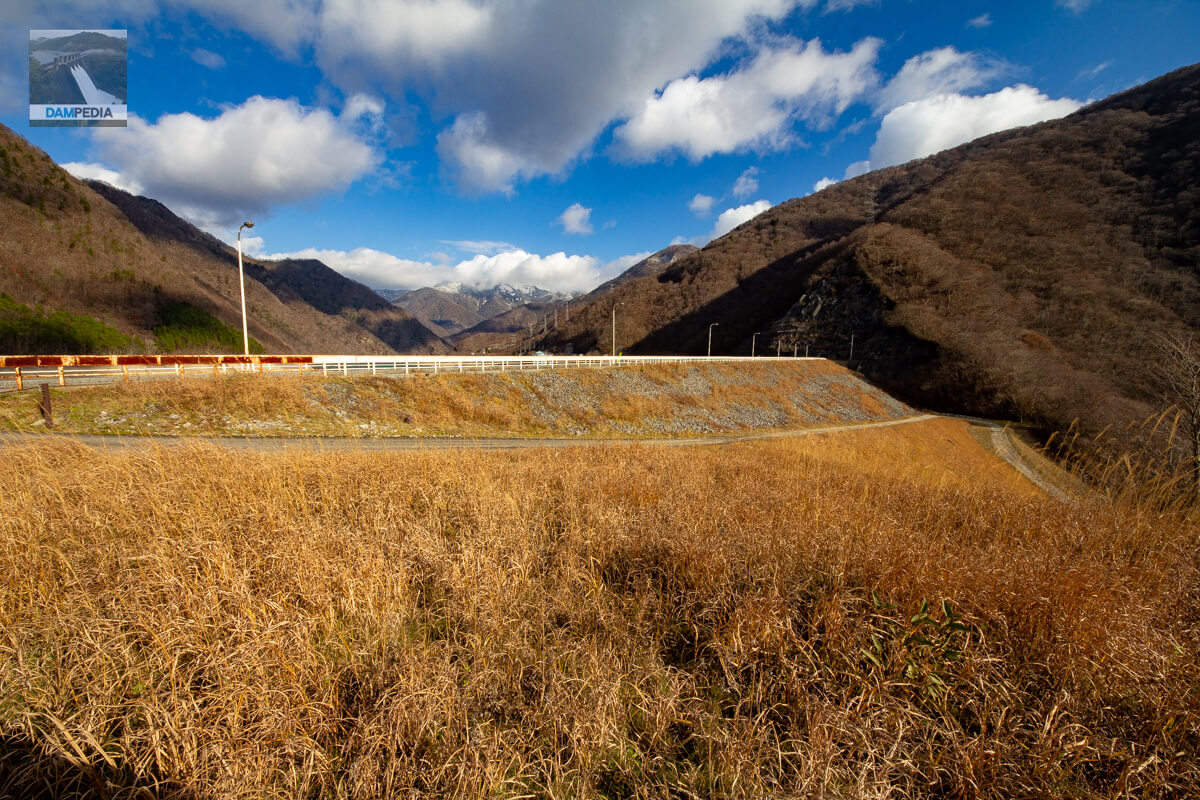
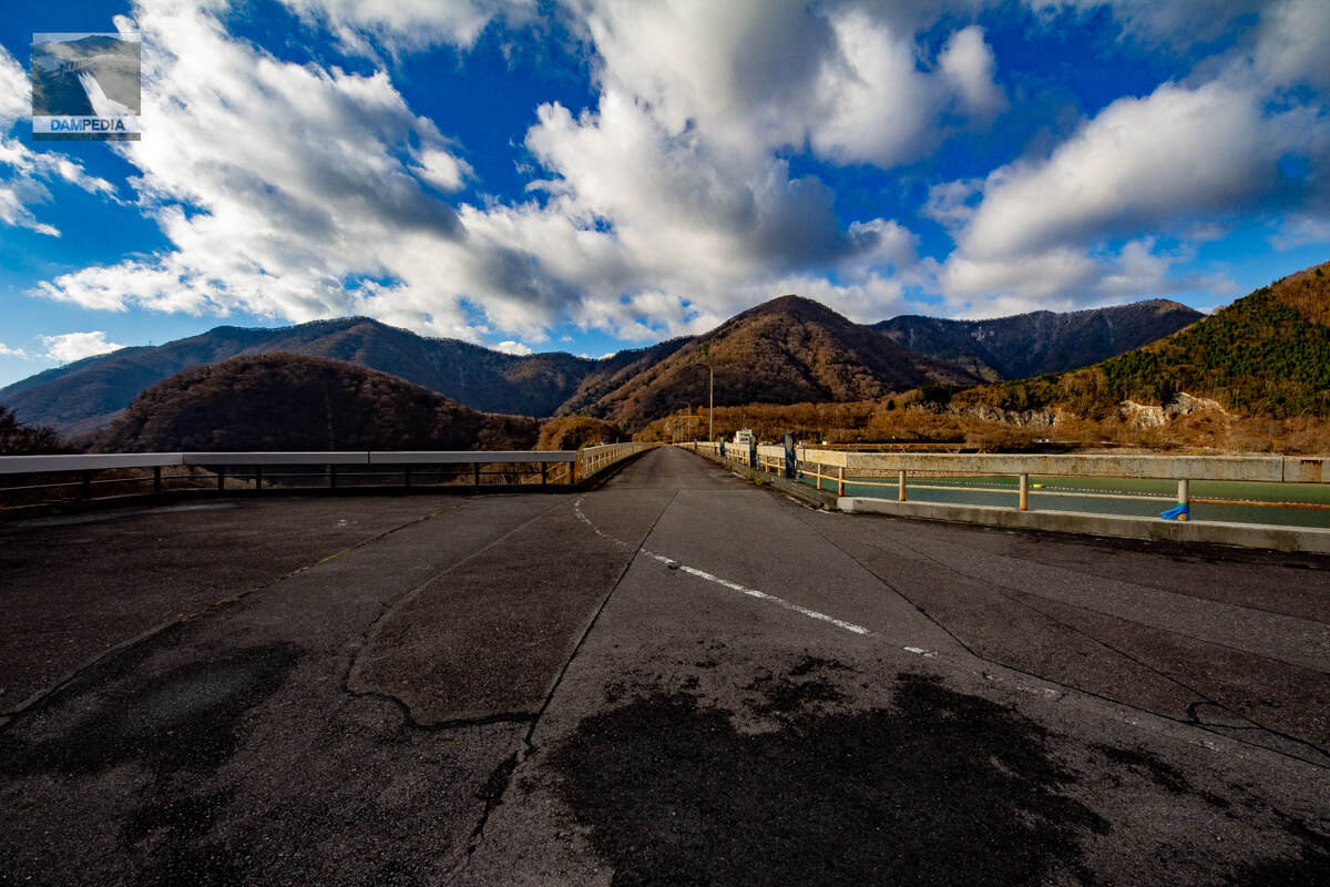
View of the top edge from the left bank
The top end of the road is open to automobile traffic and the road continues toward Fukushima Prefecture on the right side of the photo. However, because the road is blocked on the way, it is not possible to go to Fukushima Prefecture, but only to the Fukayama Power Station of the Tochigi Prefectural Enterprise Bureau, passing through the Numahara Power Station and the Forest Power Generation Ohanashi Kan.
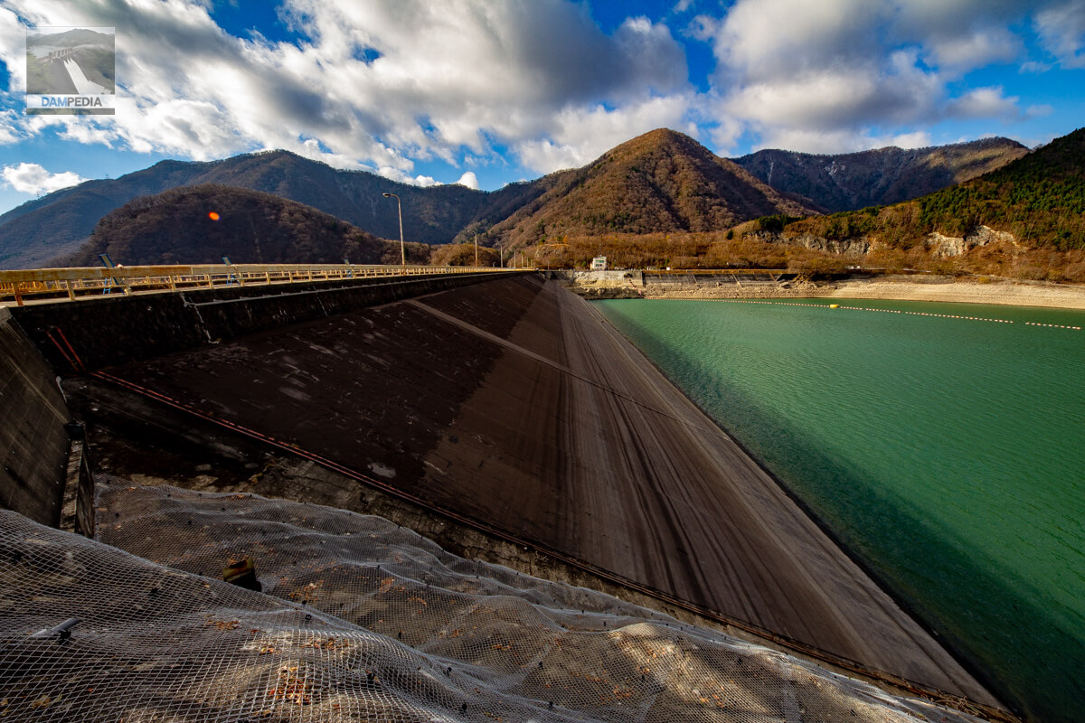
Looking upstream from the left bank
This is the part that most indicates that it is an asphalt-faced fill dam. It is interesting that the asphalt-faced area looks like a horizontal line drawn by the water level.
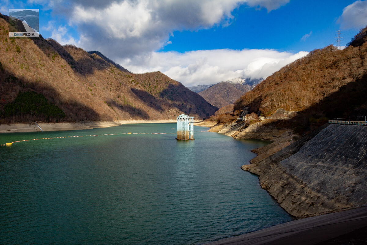
View of the intake tower from the top
This is the intake tower for delivering water to the Itamuro Power Plant. The tower has no control bridge and is independent.
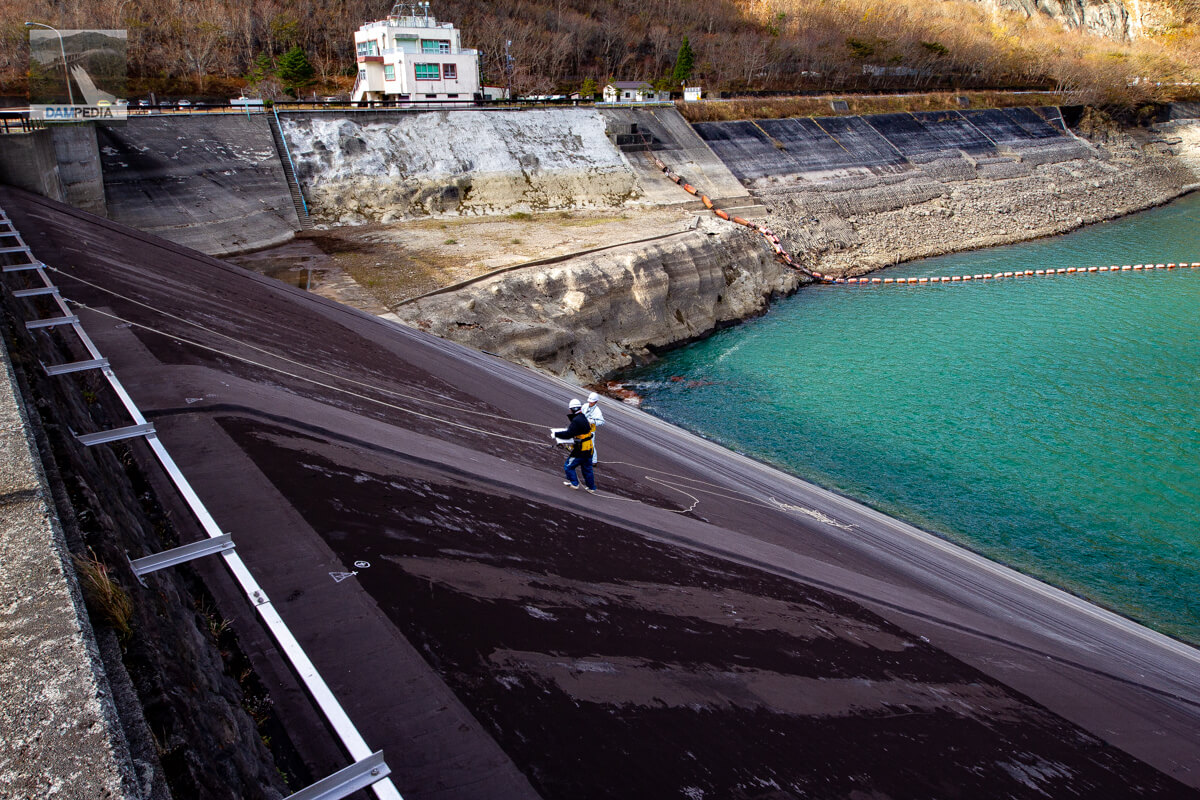
Workers working on the downstream face
There was a worker doing some kind of work on the downstream face of the dike. Is it an inspection?
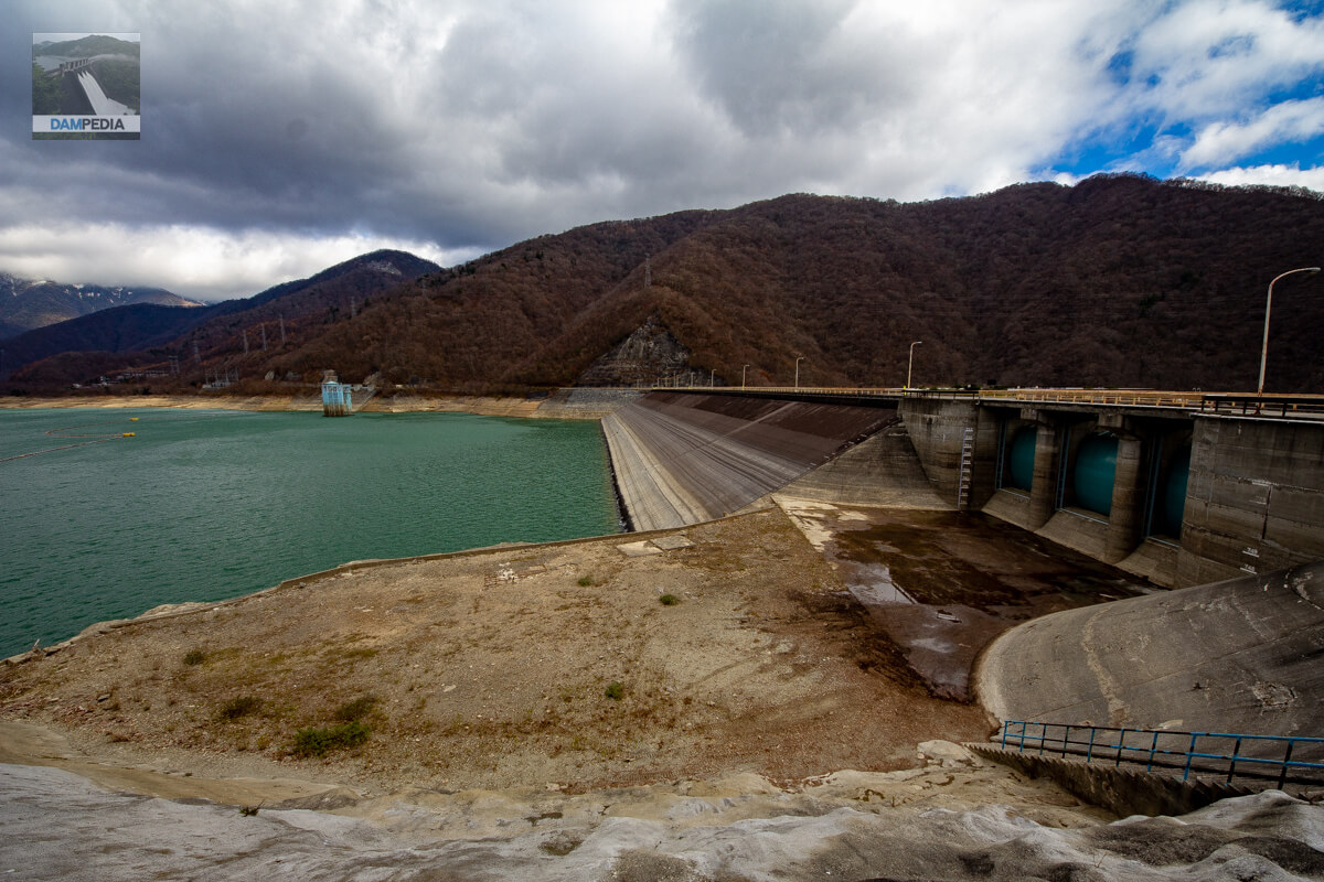
Downstream view of the levee and reservoir from the right bank
The water level was quite low on that day. I think the water level was low because water was sent to Numahara Dam during the night, but the situation at that time is not certain.

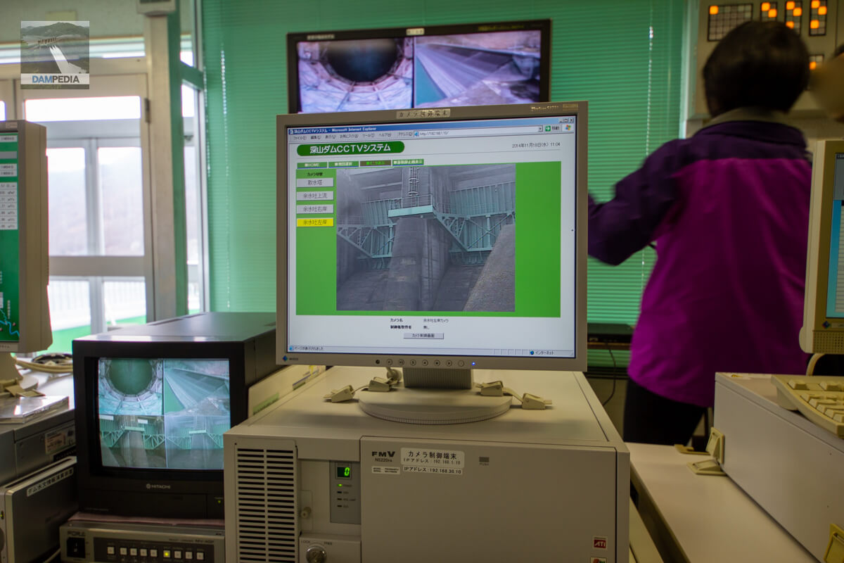
Deep mountain dam CCTV system
After a quick look at the embankment, it was time to assemble, so we moved to the control center and received various explanations from the staff. The photo below shows the CCTV monitors installed at various locations of the Fukayama Dam so that visitors can check the images.
Basin hydrography
This system indicates water levels and rainfall in the watershed of the Fukayama Dam.
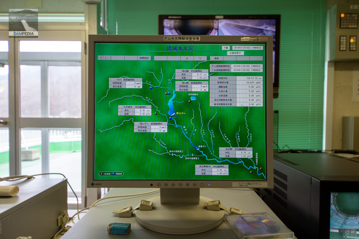
Diagram of dam discharge
This is a discharge status chart with a diagram that imitates the flood discharge of the Fukayama Dam. The color of the crest gate and the position of the Howell Banger valve are different, but the CG makes it easy to understand.

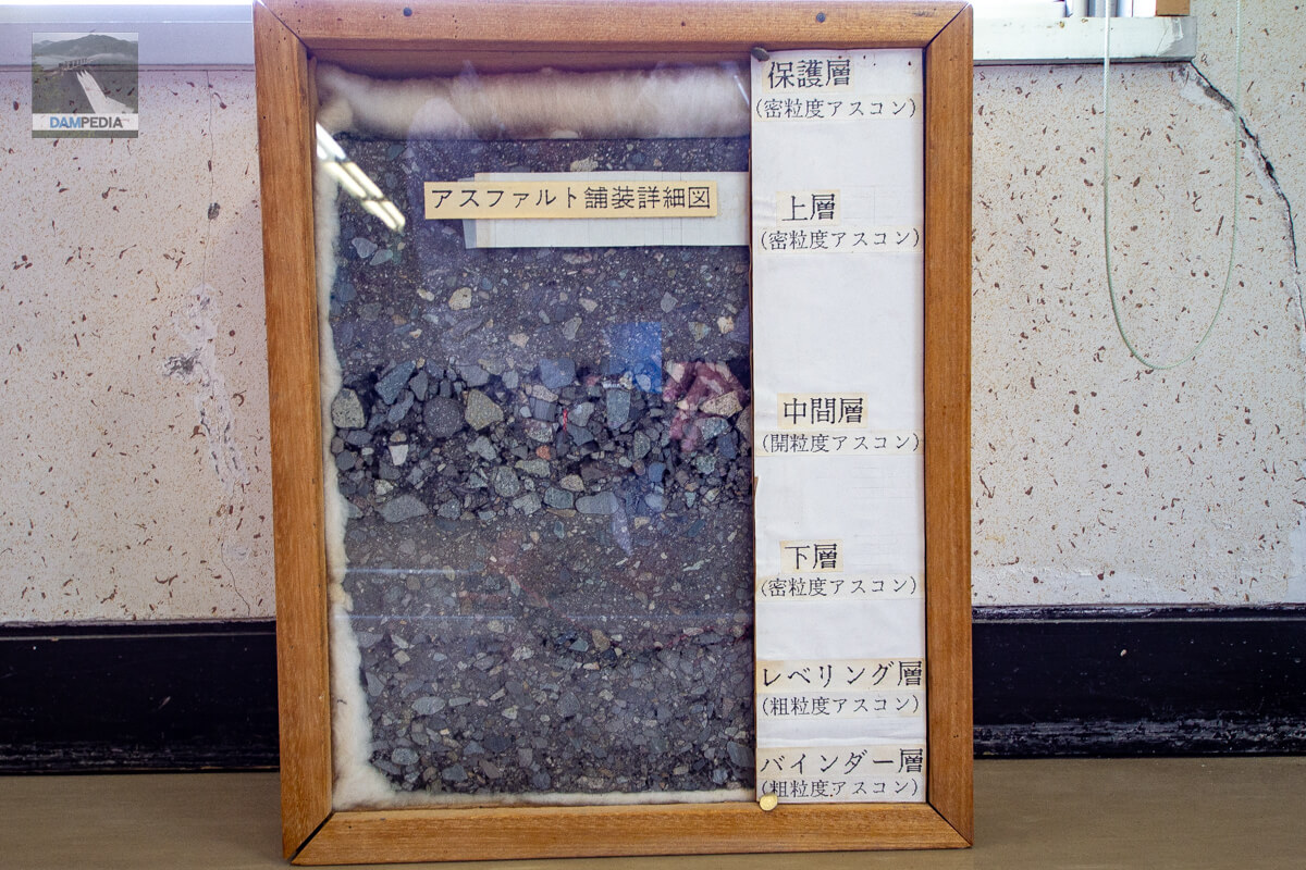
Detailed drawing of asphalt pavement
This figure shows a cross-section of the asphalt facing section of the Fukayama Dam. It can be seen that it is divided into several layers and is thick.
Water intake tower model
A 1/100 scale model of the intake tower was placed inside the control center. The cross-sectional view makes it easy to understand the structure.

Yurukyara!
Tochimaru-kun" from Tochigi Prefecture, "Ruri-chan" also from Tochigi Prefecture, "Cottonberry" from Moka City... and mascot characters were posted on the partitions. They are cute ☺.

Looking upstream from the side of the control center
Once you have been briefed at the control center, you will move on to your next destination.
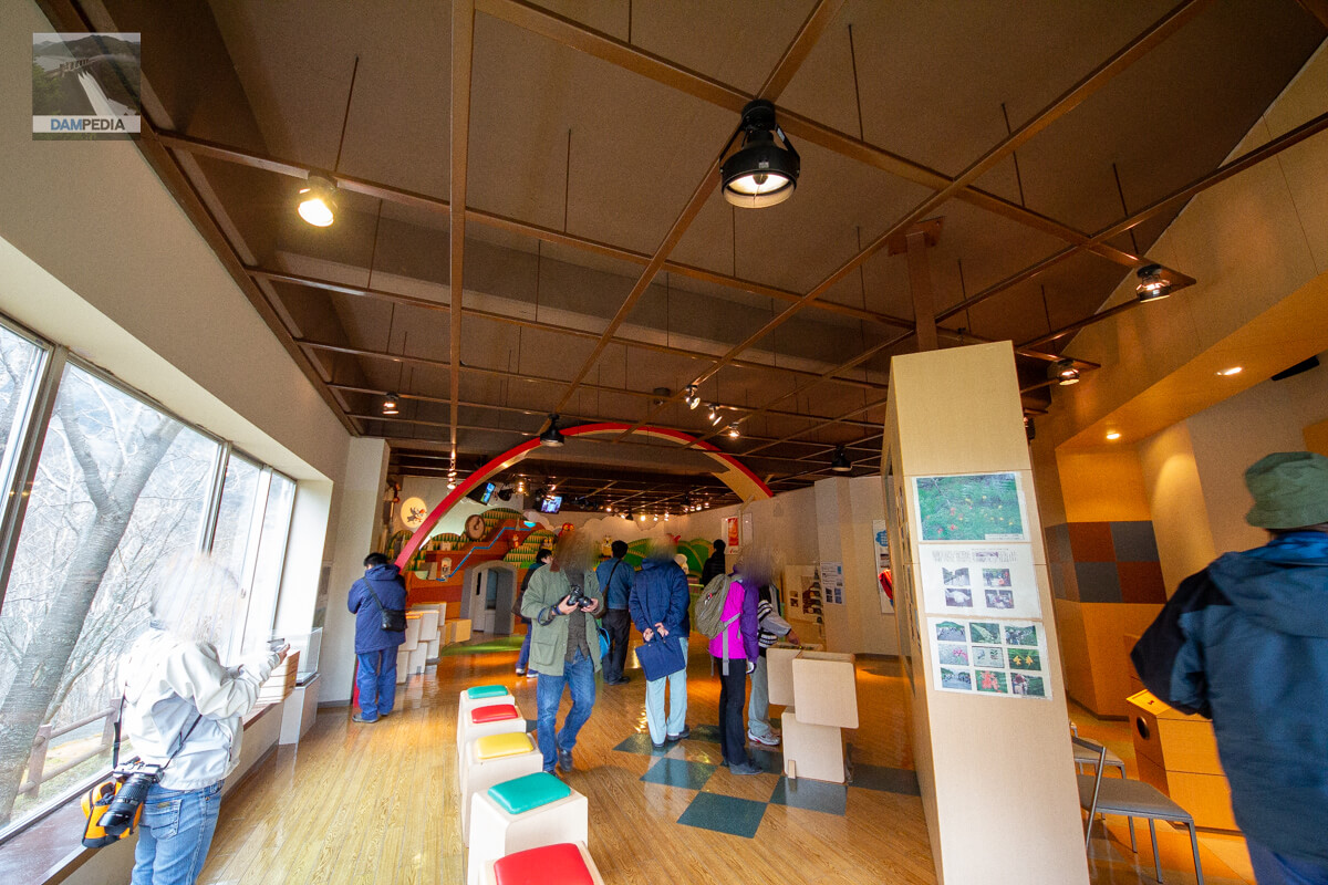
Forest Power Generation Story House
The next stop was the Mori no Denryoku Ohanashi Kan, an exhibition facility operated by Denpatsu Co. From here, we were to tour the Numahara Power Plant and other facilities.

Inside the Mori no Denryoku Ohanashi Kan
We will take a tour of the Forest Power Generation Museum. I remember that we were given a briefing by a person from Power Development...but it was 8 years ago, so my memory has faded considerably. I guess I should write about this kind of thing right away.
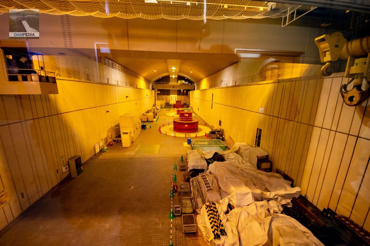
Inside Numahara Power Plant
Next, we will visit the Numahara Power Plant. Pumped storage power plants are underground, but I am always surprised every time I visit any power plant that such a large space is spread out underground.
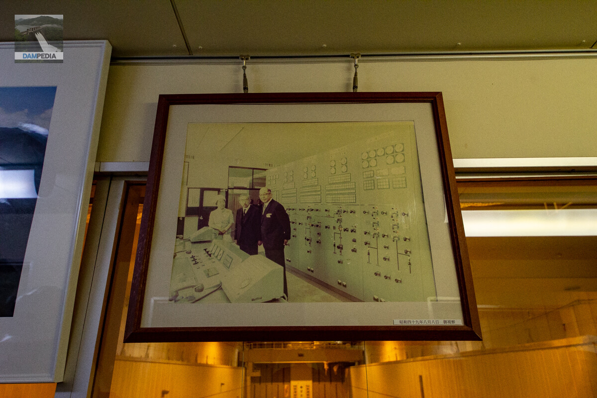
Emperor Showa and Empress Kajun visit
It seems that Emperor Showa and Empress Kajun visited Numahara Power Plant on August 8, 1974.
Generator Explanation Panel
A Power Supply Developer explains about the generator. It is amazing that this is buried underground.
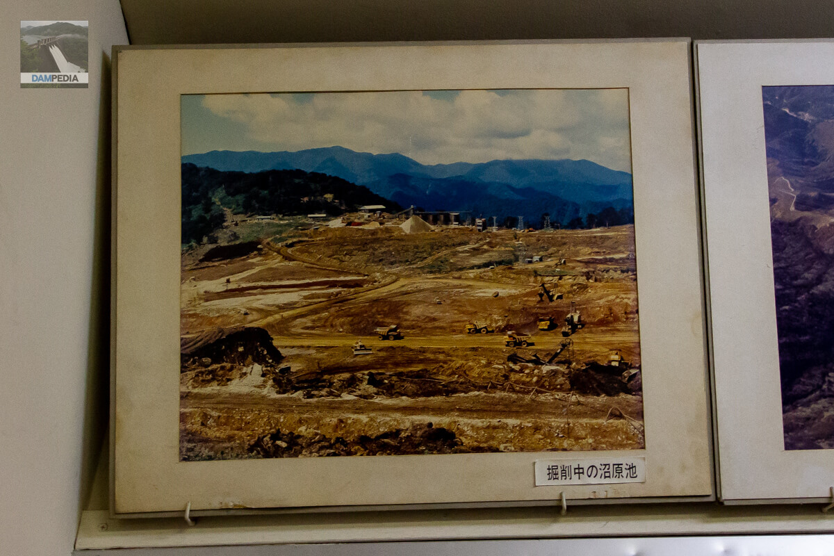
Numahara Pond under excavation
There were other valuable photos displayed in this room where we were briefed. It must have been soon after the construction of Numahara Dam started.
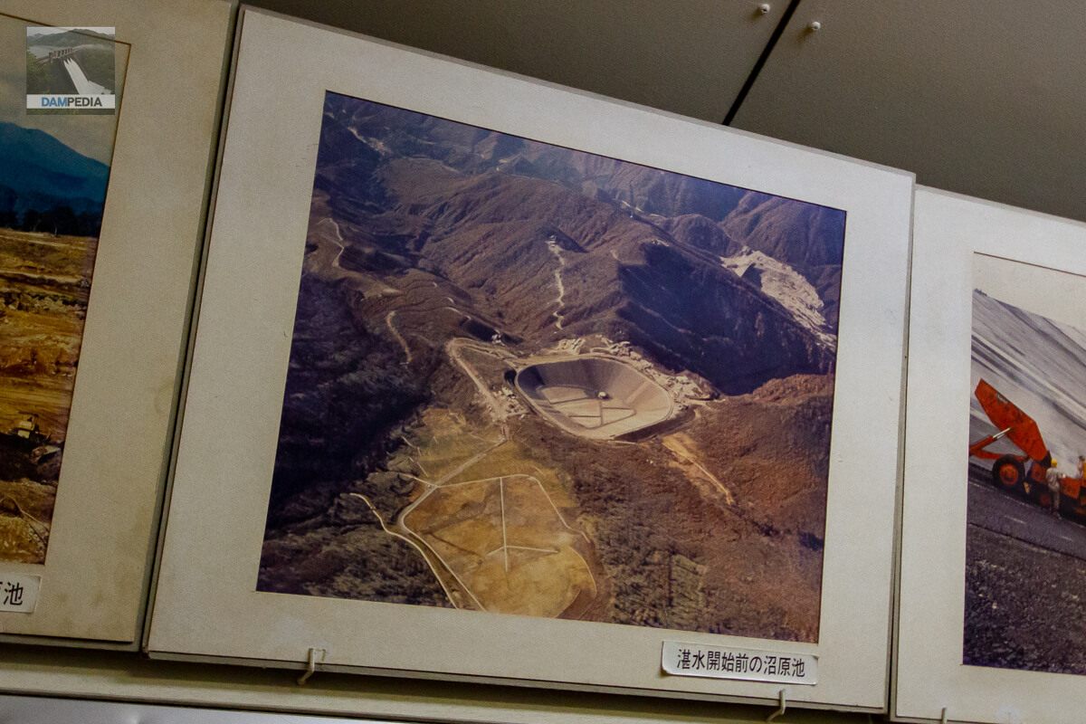
Numahara Pond before the start of waterlogging
The caption reads "Numahara Pond" rather than "Numahara Dam," perhaps out of pride in having rewritten the map by creating an artificial pond. If you look closely, you can also see the Fukayama Dam under construction in the upper right corner of this photo.
Asphalt paving of Numahara Pond
Like the Fukayama Dam, the Numahara Dam is also an asphalt-facing fill dam, and this is a rare photo of the asphalt paving in progress.

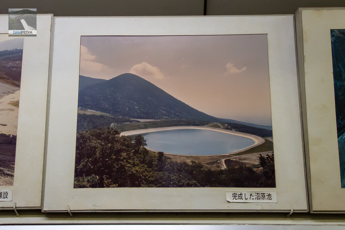
Completed Numahara Pond
New Numahara Dam. It is very beautiful.
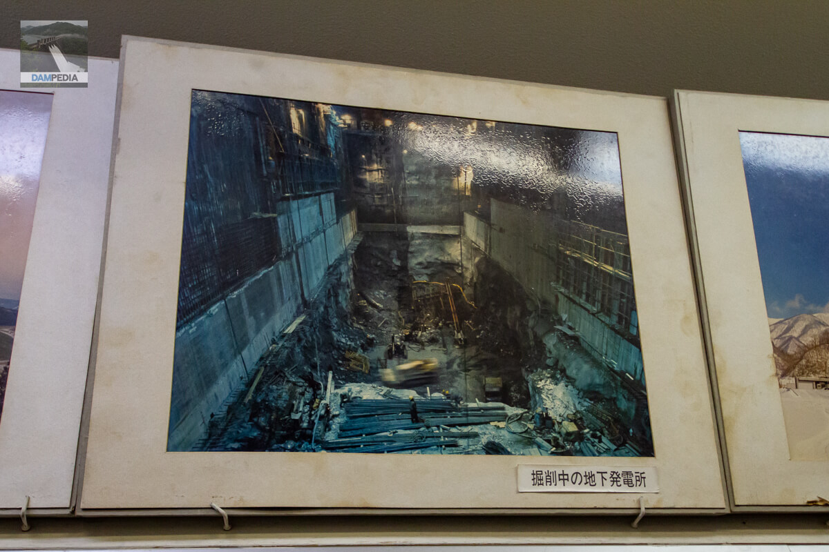
Underground power plant under excavation
Another precious photo.
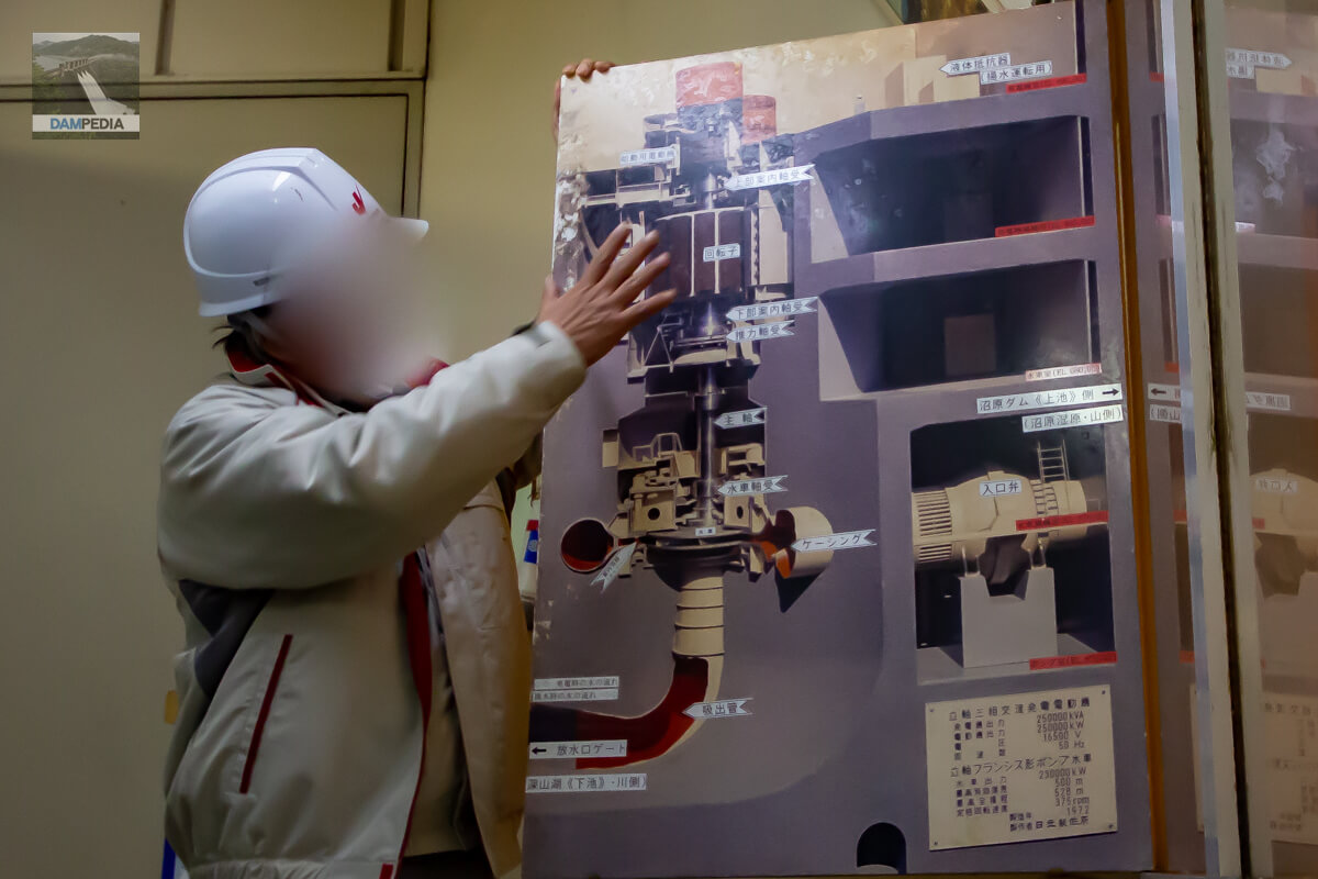
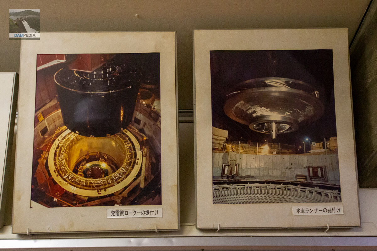
Installation of generator rotor and waterwheel runner
This is a view of the rotor and runner, the key components of the power plant, during installation.
underground power plant
Next, we enter the power plant. As I have said many times, it is always amazing to see such a large space spread out underground.

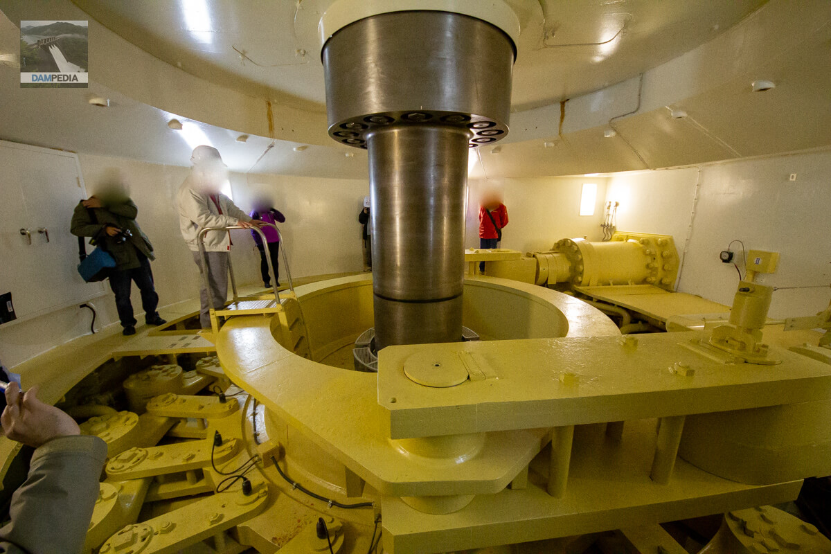
Generator No. 3
Generator manufactured by Hitachi, Ltd.
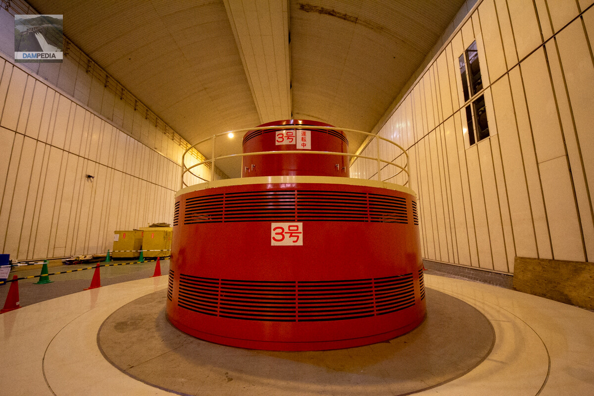
main shaft
The thick vertical silver bar is the main axis. This spins around when electricity is being generated. The waterwheel is housed under this rod.
The group then left the Fukayama Dam and the Numahara Power Plant behind, and after lunch moved on to their next destination, the Numahara Dam.
Miyama Dam Specifications
| Location | Fukayama area, Hyakumura, Nasushiobara City, Tochigi Prefecture |
| River Name | Naka River System Naka River |
| Objective | A (irrigation water) W(Water for water supply) P(Power generation) |
| Model | FA (Asphalt Facing Fill Dam) |
| Bank height | 75.5m |
| Bank length | 333.8m |
| Dam volume | 1,967,000 m3 |
| Watershed Area | 65.9 km2 (direct: 52.9 km2, indirect: 13 km2) |
| Reservoir area | 97 ha |
| Total storage capacity | 25,800,000 m3 |
| Effective water storage capacity | 20,900,000 m3 |
| Dam operator | Kanto Agricultural Administration Bureau, Ministry of Agriculture -> Tochigi Prefecture |
| Main body constructor | Taisei Corporation |
| Year of launch | 1968. |
| Year Completed | 1973 |
| Name of Dam Lake | Miyama Lake |
Other facilities/observations
Fishing is not allowed at Lake Miyama, but you can go mountain stream fishing in the Okawa River upstream. (There is a closed season for fishing.)
| Parking lot | ○ |
| Toilet | ○○ (closed in winter) |
| Park | × |
| PR Exhibition Hall | ○○ (Forest Power Generation Ohanashi Kan) |
| Fishing | × |
| Viewing platform | ○ |
Map of the area around the Miyama Dam
Weather around Fukayama Dam
Accommodations that may be close to the Miyama Dam

Comment