
Date of interview: Sunday, 08/04/2013
From Yatsuo Dam and Muromaki Dam, head further south on Route 471/472 (overlapping section) along the river as if you were traveling up the Ida River (Oo Hase River and Muromaki River). On the way, on your leftNipo TankThere is a hydroelectric dam operated by the Toyama Prefectural Government called the Nakayama Dam, but unfortunately there is no access road to the dam, so we will not be able to see it. After that, we will go further south and see the Nakayama Dam on the left.
Looking downstream from the left bank
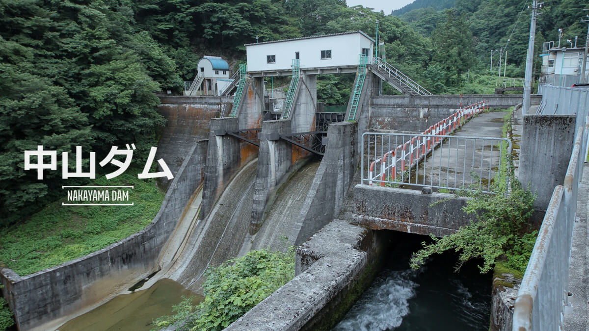
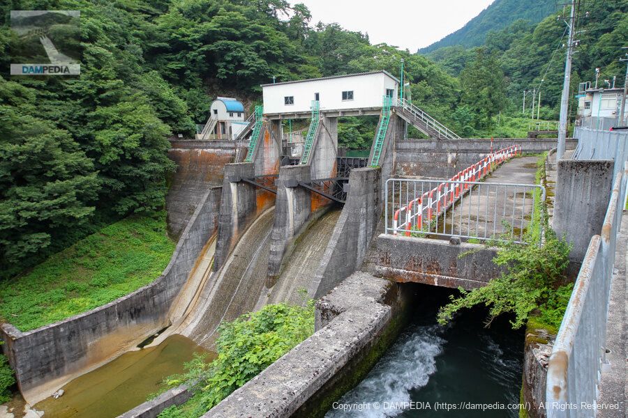
It is a small dam, but it is full of charm. The Nakayama Dam is a dedicated power generation dam operated by the Toyama Prefectural Bureau of Public Enterprises. Water taken from this dam is pumped 2.9 km in a straight line downstream to the Niibu Power Station, which produces up to 11,000 kW of electricity. The water is delivered 2.9 km downstream in a straight line to the Nibu Power Station, producing up to 11,000 kW of electricity. The Nibu Water Tank Dam, as its name implies, also serves as a pressure regulating reservoir while taking water from a mountain stream. It is a bit of a pity that we cannot see it, as it is interesting in itself.

Zoom in on Nakayama Dam
There are two radial gates on the crest, and it looks like there is another one hidden on the other side, which may be a sand discharge gate. The water flowing into the channel in the foreground of the photo appears to be a river maintenance discharge. Also, the vaulted roof of the operation room of the water intake seen in the back looks cute.
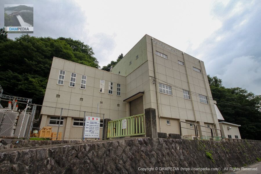
Prefectural Ohnagaya No. 2 Power Plant
On the other side of the national highway is the prefectural-owned Ohnagaya No. 2 Power Plant. This plant generates power using water taken from the Suganuma Dam, located in a valley across the ridge to the west from the Nakayama Dam. (Maximum output: 10,200 kW)
This time, we did not stop by Suganuma Dam because it was already around 4:00 p.m., but Toyama Prefecture is planning a large-scale renovation project to make Suganuma Dam gateless, so we would like to visit the dam before it goes gateless.
View of the top edge from the left bank
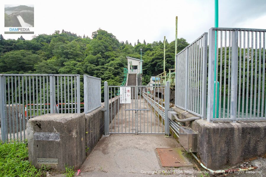
Unfortunately, the top edge is off-limits.
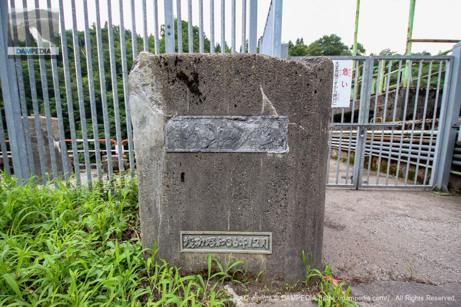
nameplate on the main pillar
The nameplate of the Nakayama Dam has been completely weathered, but it is also very tasteful. It is also nice that "Completion" is used instead of "Completion".
Looking upstream from the left bank
On the right is the water intake. The color of the reservoir is quite nice, more green than blue.
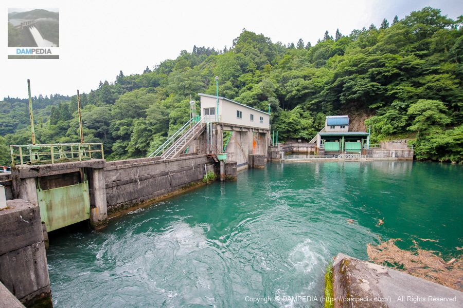
It is a small dam and there are not many points of interest to visit, but the more you look at it, the more you appreciate the Nakayama Dam.
Nakayama Dam Specifications
| Location | Kubokusoren, Nakayama, Yatsuo Town, Toyama City, Toyama Prefecture |
| River Name | Jinzu River System Ida River |
| Objective | P(Power generation) |
| Model | G(gravity-fed concrete dam) |
| Bank height | 24m |
| Bank length | 70.5m |
| Dam volume | 15,000 m3 |
| Watershed Area | 108.3 km2 (direct: 65.2 km2, indirect: 43 km2) |
| Reservoir area | 2 ha |
| Total storage capacity | 111,000 m3 |
| Effective water storage capacity | 69,000 m3 |
| Dam operator | Toyama prefecture (Hokuriku area) |
| Main body constructor | Sato Kogyo |
| Year of launch | 1960. |
| Year Completed | 1961 |
| Name of Dam Lake | - |
Other facilities/observations
There is no parking, but there is space to park somehow.
| Parking lot | × |
| Toilet | × |
| Park | × |
| PR Exhibition Hall | × |
| Fishing | ○ |
Map around Zhongshan Dam
Weather around Zhongshan Dam
Accommodations that may be close to Zhongshan Dam
The actual accommodations are listed below.


Comment