
Date of interview: Saturday, August 03, 2013
From the Arimine Dam, follow the Arimine Forest Road Oguchigawa Line westward, and you will see the Sukenobe Dam on your left. It is an illegible dam and is read as "Sukenobe. If you are not careful, it may look like "Sukenobe," so be careful. Incidentally, some materials say that it is sometimes called "Sukenobu," but I could not find out which one it is officially.
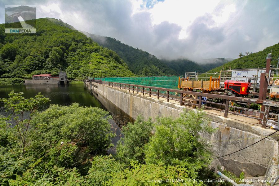
View of the top edge from the right bank
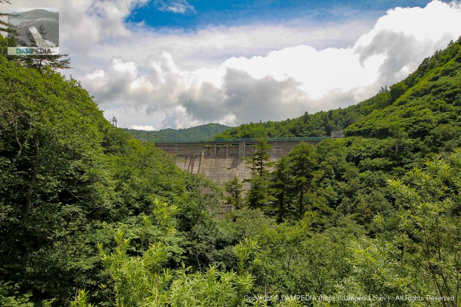
On this day, the dam was undergoing repair work and we had to visit from a little distance away. The top of the Sukenen Dam is usually off-limits to visitors.

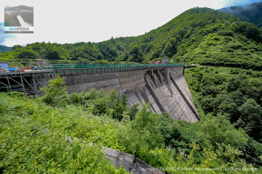
Looking upstream from the right bank
I thought that the appearance of the dam would change a lot due to the large-scale repair work. However, looking at the pictures of the Sukenobu Dam uploaded on the Internet afterward, I did not get the impression that much had changed, so it may have been repair work related to the water intake facilities and water pipeline, not the dam body. (At the time of our visit, the construction signboard had not been checked.)
A monorail for material delivery is laid at the top end, and power cars and baggage carriages are also visible. The rails can also be seen extending thinly in the Google Maps aerial photo.
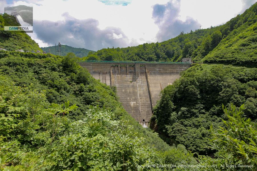
Looking downstream from the right bank
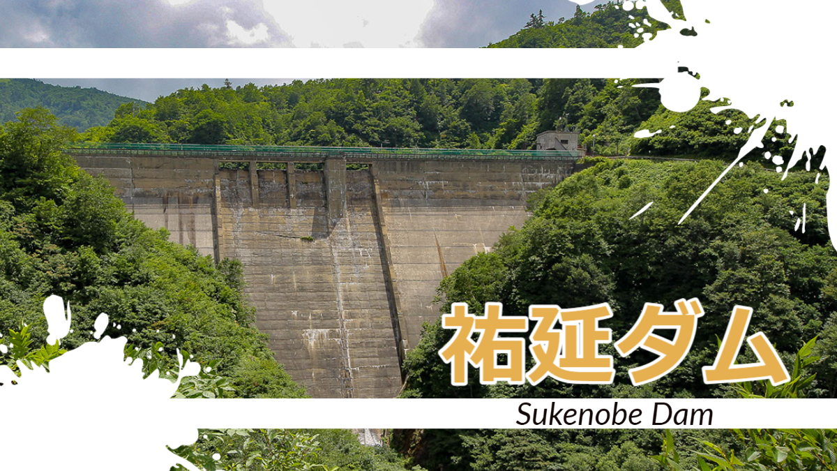
The Sukenobu Dam is an old prewar dam completed in 1931 by Nihonkai Electric, the predecessor of Hokuriku Electric Power Company. The concrete surface looks quite painful due to frost damage caused by the severe and snowy winters in this cold region. Although it is painful, the dam has a stately appearance, just like an old dam.
The painful condition is, of course, only affecting the surface of the embankment, and there is no immediate impact on dam management or safety, nor is there any problem with strength. It also appears that repair work has been carried out many times in the past.
Water taken from the Sukenobu Dam is used to generate electricity at the Oguchi River No. 3 Power Station, which has an effective drop-off of 621.2 m, the highest in Japan except for pumped-storage power generation. The generated water is discharged into the reservoir of the Manate Dam. The Manate Dam is a valuable buttress dam, but unfortunately it is not possible to visit because the area around it is deep in the mountains and off-limits to visitors. I would like to see it someday.
There is an interesting episode in 1934, when a pump was installed separately from the generator at the Yuen Dam, with the dam as the upper reservoir and the Manate Dam as the lower reservoir, and pumped storage power generation was conducted for the first time in Japan in 1934. The pump was removed in 1968, so pumped storage power generation is no longer in use.
In addition, according to a paper on the repair work using pre-pact concrete in 1969, probably at the time of completion, there is an episode in which the engineer Eikichi Arai's patent compressed air jetting was used to avoid ice pressure on the dike due to freezing of the reservoir during the winter.
The Yuenobu Dam uses Eikichi Arai's patented compressed air jetting method to prevent ice from forming on the embankment due to reservoir icing during winter. This method prevents icing on the water surface by blowing compressed air through φ38mm iron pipes, which are piped along the levee surface 9m below the water surface, with nozzles attached at intervals of about 1.5m. Mr. Tsuchiya said that this is the most appropriate anti-freezing device for a reservoir located deep in the mountains like this site.
Quote.Repair of Sukenobu Dam using pre-pact concrete
Downstream view of the levee from downstream
The crest gate appears to be a free overflow type, but it also appears that the sliding gate is stored behind the top edge, as what looks like a device to operate the gate is visible in the top edge, especially in the second photo. However, there is also information that it has now been removed, and since I have not visited the site since then, the details remain unknown.
A hole can be seen at the bottom of the dike, which may be a hole for sediment discharge.
Downstream view of the levee from downstream
I tried to find another good point where I could see the embankment, but this was the best I could do.
It was the Yuen Dam, an old dam with a wealth of episodes to tell.
Yuen Dam Specifications
| Location | Arimine, Toyama City, Toyama Prefecture |
| River Name | Joganji River system Oguchi River |
| Objective | P(Power generation) |
| Model | G(gravity-fed concrete dam) |
| Bank height | 45.45m |
| Bank length | 125.46m |
| Dam volume | 44,000 m3 |
| Watershed Area | 6.8km2 |
| Reservoir area | 60 ha |
| Total storage capacity | 8,786,000 m3 |
| Effective water storage capacity | 8,753,000 m3 |
| Dam operator | Hokuriku Electric Power Co. |
| Main body constructor | Sato Kogyo |
| Year of launch | 1928. |
| Year Completed | 1931. |
| Name of Dam Lake | Yuen Reservoir |
Other facilities/observations
There is parking space for several cars at the dam site. It is recommended to check road information in advance, as the Oguchigawa line of the Arimine Forest Road is often closed to traffic.
| Parking lot | ○ |
| Toilet | × |
| Park | × |
| PR Exhibition Hall | × |
| Fishing | ○? |
Comment