
Date of interview: Saturday, August 03, 2013
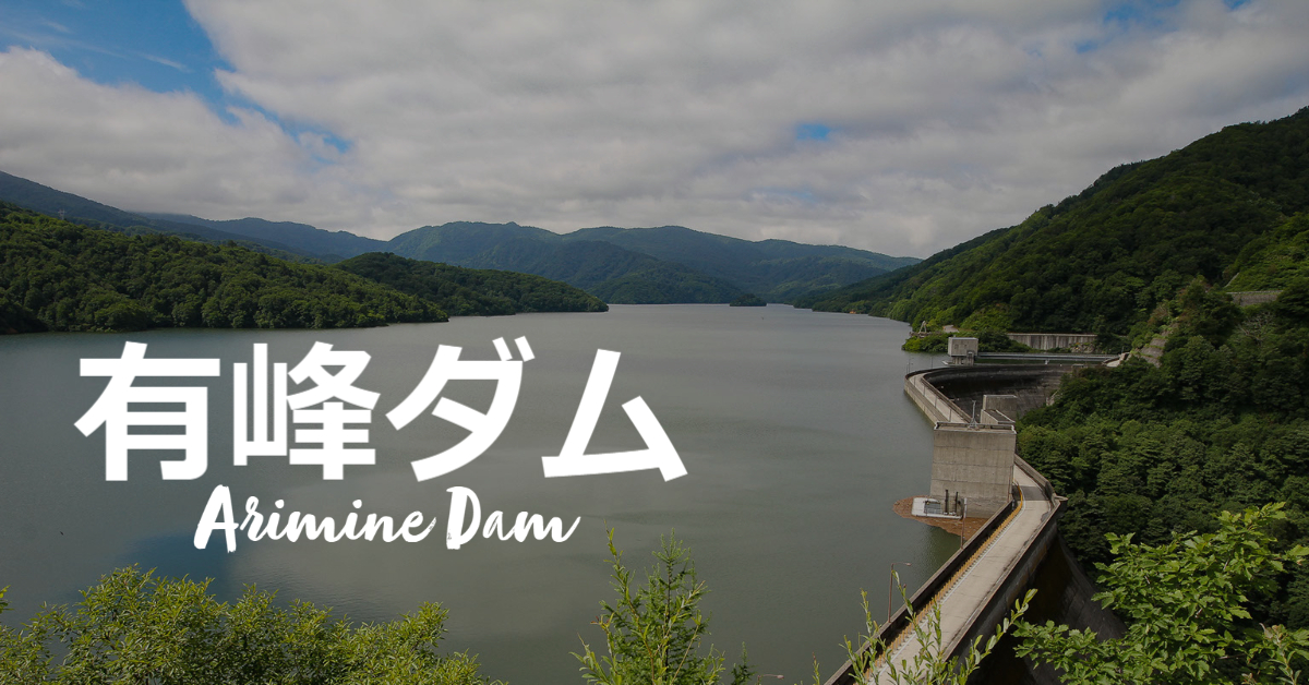
Speaking of Toyama, the Kurobe Dam (Toyama) is another dam that must not be missed. This is the Arimine Dam owned by Hokuriku Electric Power Co. A tour is held only once a year, and this year all dam enthusiasts gathered for the tour.
Get a flyer for free tolls!
To reach the Arimine Dam, visitors must pass through the Arimine Forest Road, a toll road built for the dam construction. The toll for a regular car costs 1,900 yen (as of 2021), but the toll is waived only on "Let's Play in Arimine" (the opening day of Arimine Forest Culture Village), when the tour is held. However, in order to get the free admission, you need to get a leaflet distributed at convenience stores, etc. in advance. (Please note that you need to obtain the flyer in advance.ariminet(You can also print the flyer data uploaded to the)
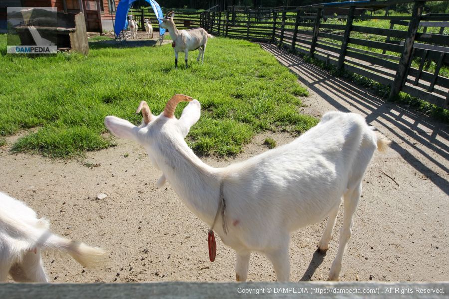
The photo shows goats in Aruppen Village.
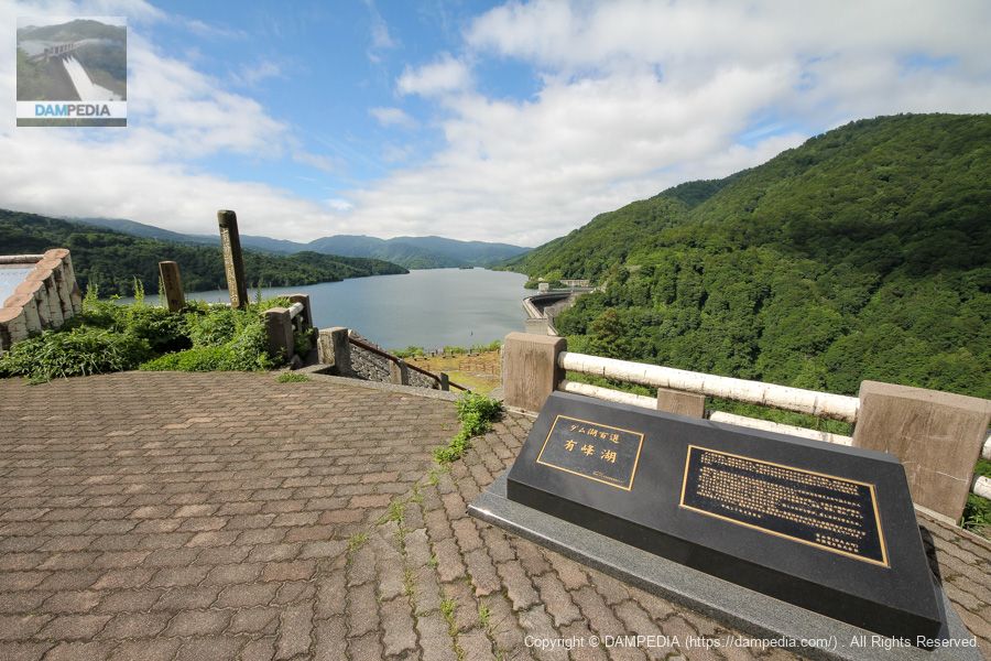
Right bank observation deck and relief of 100 dam lakes
On the right bank of the Arimine Dam, there is an observatory that utilizes the site of the construction plant and cable crane foundation, which provides a bird's eye view of the embankment. Lake Arimine, the dam lake of the Arimine Dam, has been selected as one of the 100 best dam lakes, and a relief plaque has been installed.
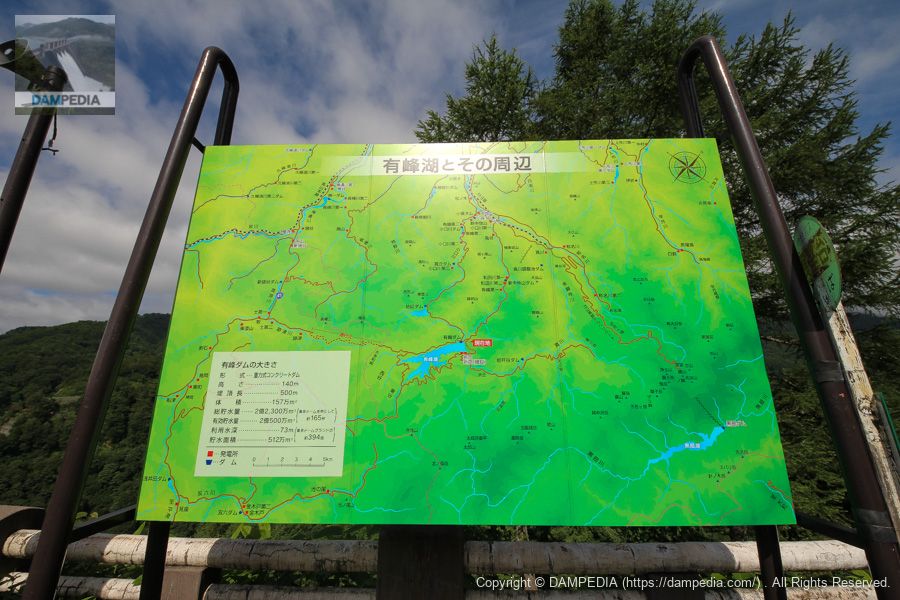
Lake Arimine and its surroundings
There are numerous hydroelectric power plants and dams in the vicinity of the Arimine Dam, and this guide map shows them. I think it shows how abundant the water supply is in this area.
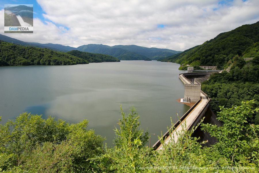
Levee and reservoir from the right bank observation deck
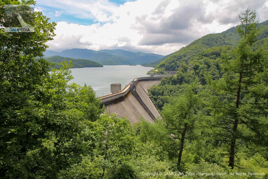
I went down to the lower level of the observatory. The reservoir is full of water, and the embankment of the Arimine Dam, which is bent into an S shape to support the reservoir, is clearly visible. The dam is about 1,100 meters above sea level, giving the impression of a dam on top of a mountain.
Viewing platform
It is imaginative to imagine what the plant and cable cranes looked like.

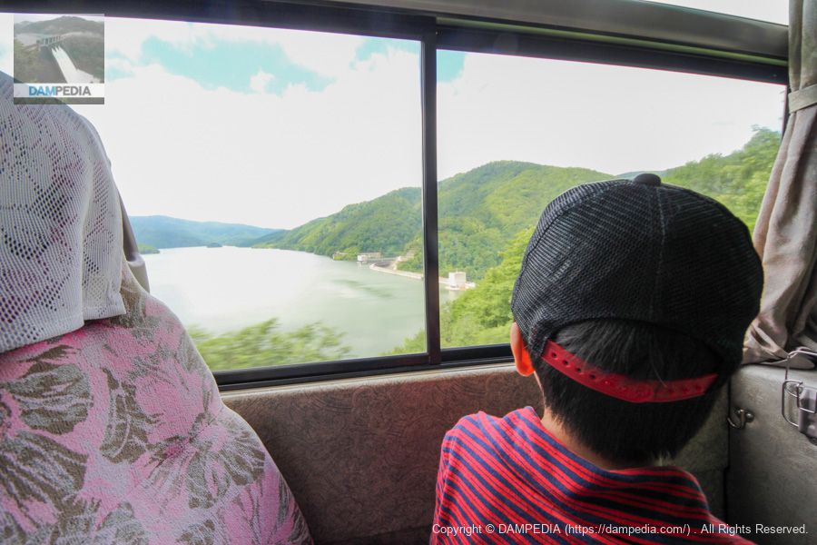
Bus ride to the dike
We gathered in front of Arimine House and took a bus to the dike. We could see the dike from the car, and our expectations were growing rapidly.
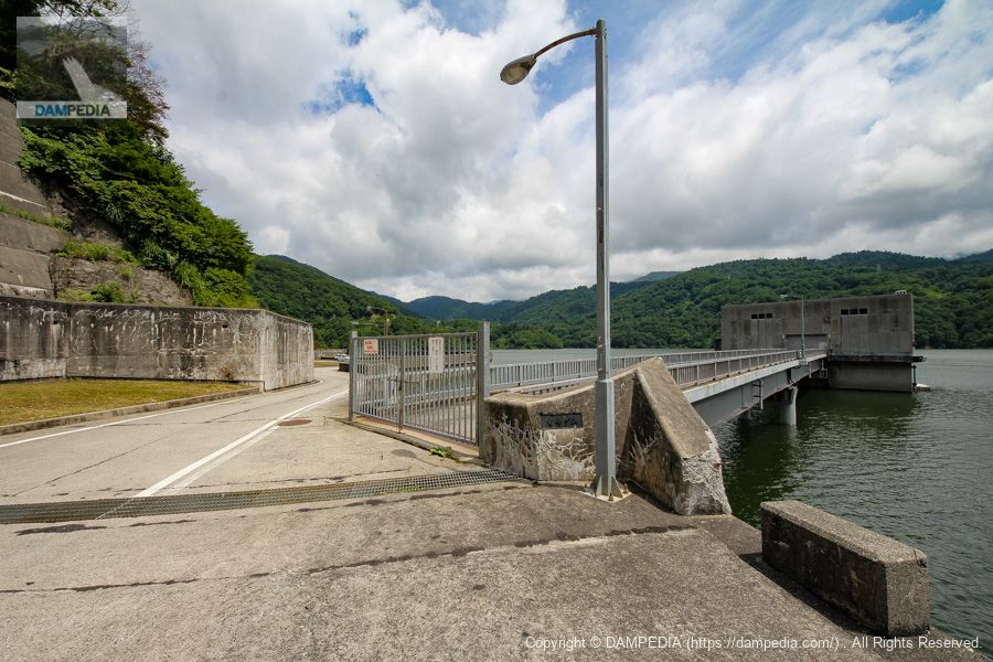
In front of the management office on the right bank
右岸の管理所前で下車しました。もう目の前が天端です。ちなみに天端は自動車の交互通行ができないため、左右両岸に設置された信号によって通行が制御されています。管理所は信号と信号の間にあるため、ここから出るときは写真中央に写っている信号に従って出られるのですが、「◀×▶」となっていて左右どちらに出られるかひと目で分かるようになっています。
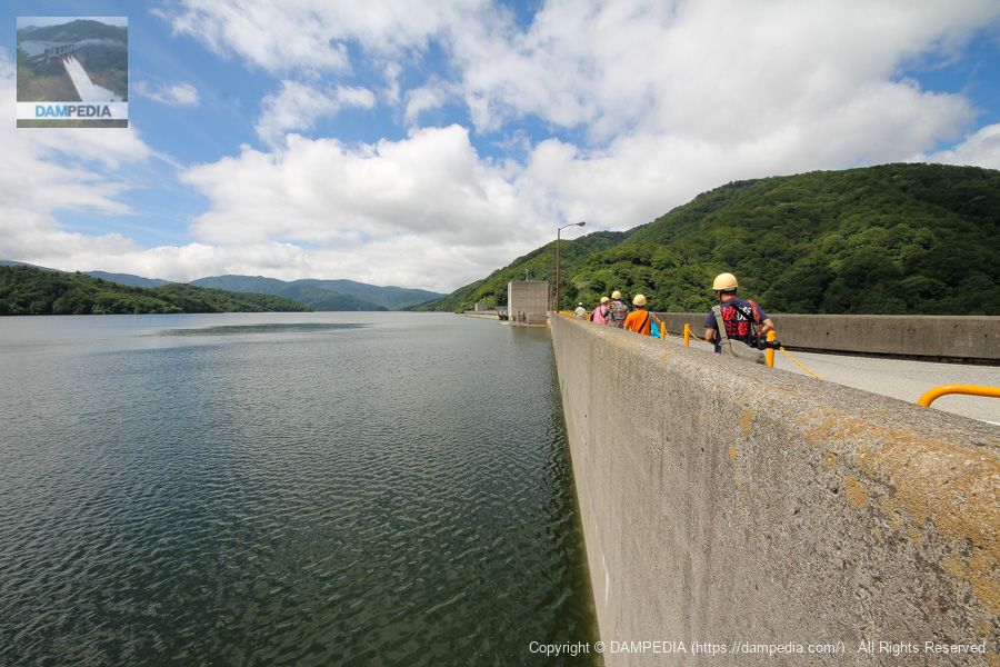
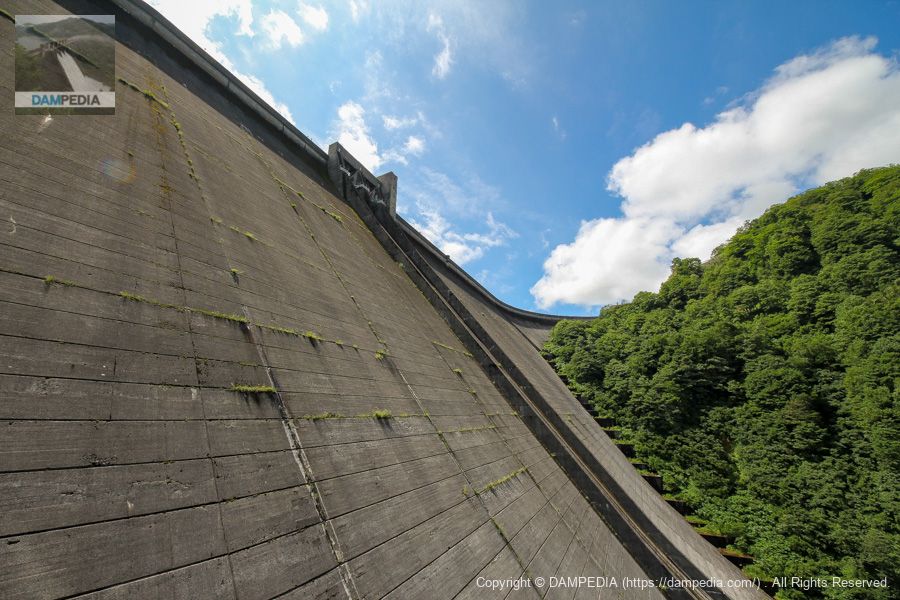
Upstream side of the embankment from the right bank
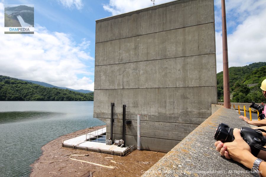
There is an elevator building in the center of the dike, so walk to it.
Wadagawa No. 1 and No. 2 power plants Water intake tower
The water stored by the Arimine Dam is used to power five power plants: Wada River Power Station No. 1 (27,000 kW), Wada River Power Station No. 2 (122,000 kW), Arimine Power Station No. 1 (265,000 kW), Arimine Power Station No. 2 (120,000 kW), and The electricity is provided by five power plants: the Arimine Dam Power Plant (170kW), which utilizes the river's maintained flow.
The photo shows the intake tower that supplies water to the Wadagawa No. 1 and No. 2 power plants.
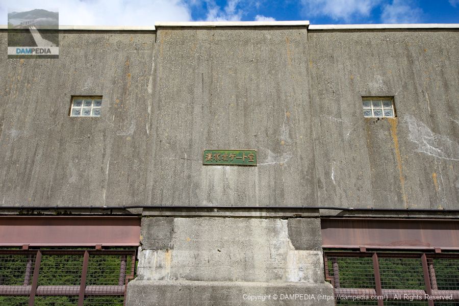
Crestgate Unwinder Room
Crest has two radial gates, and the photo shows the gate winder room. (In the back of the photo is the elevator building.)

Nameplate "Flood discharge gate chamber"
The local nameplate reads "Flood Discharge Gate Room". The font is austere!
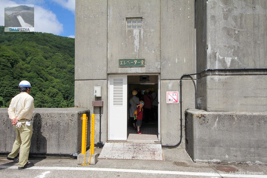
Elevator room
The elevator takes you into the dike. The nameplate "Elevator Room" is also austere.
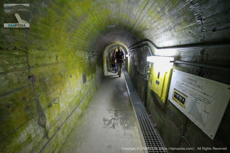
corridor connecting an annex to a pond-side building (in traditional palatial-style architecture)
We arrived at the B4 audit corridor (EL.1,010.50m). The temperature in the corridor was 8.9°C. It was hard to believe that it was August.
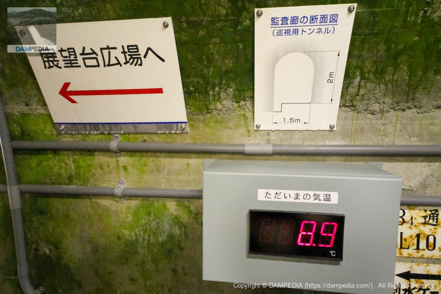
Audit Corridor #2
Continue further down the audit corridor. Installed on the right wall is a temperature monitoring device to check the temperature of the dam's concrete. Since the quality of concrete depends on its temperature, the temperature was strictly controlled during construction, and temperature monitoring has continued even after the completion of the dam.
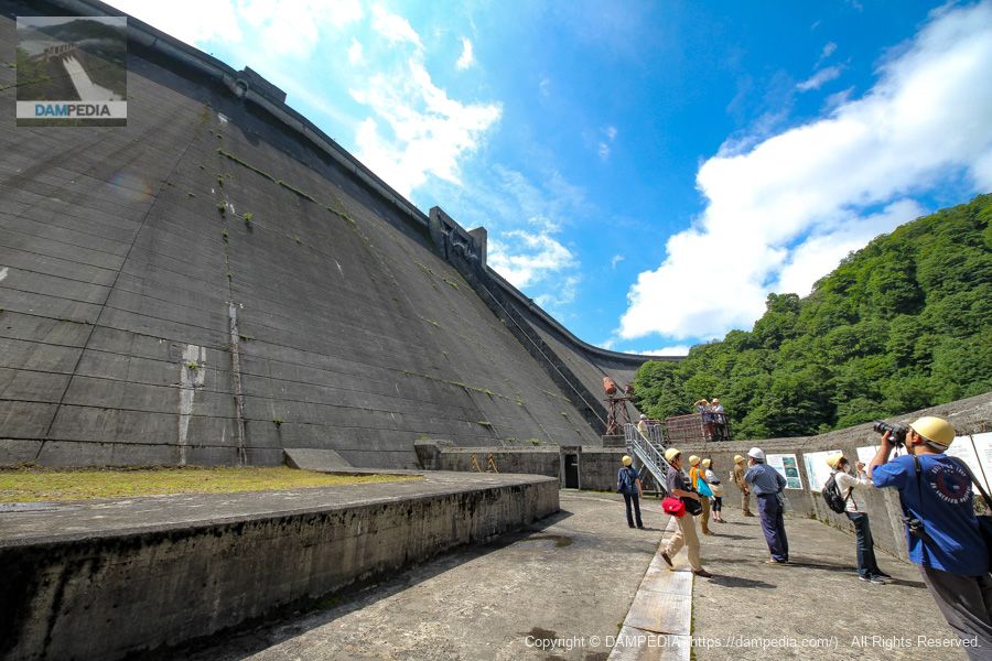
Observatory Plaza
We have arrived at the observatory plaza. We are in a position to look up at the huge levee, but it is surprising that we are still in the middle of the levee.
Dam enthusiasts enjoying each other's company
The concrete structure on the right is a passageway connected to the audit corridor, and is designed to cope with snow accumulation, which is unique to this area. The concrete structure on the left is the waterway leading to the aforementioned Wada River No. 1 and No. 2 power plants.
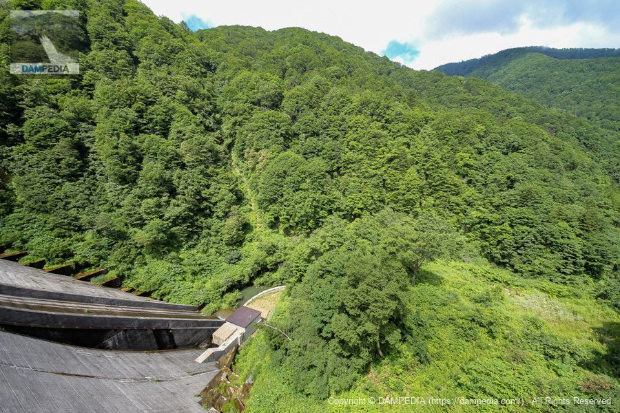
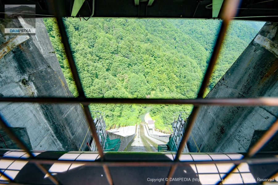
Downstream from the observatory
In the photo above, you might be mistaken for being directly downstream, but in this way you can see that you are still in the middle of the dike. The view is not from the top of the levee, nor is it a view from the top of the levee. The building directly below is the Arimine Dam Power Plant, which utilizes the aforementioned river maintenance flow. If it were possible, I would have liked to look up at the dam from around that building.
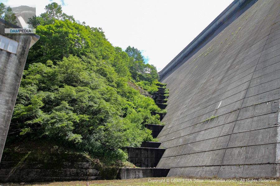
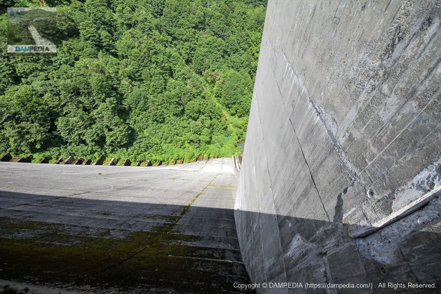
Downstream side of the levee from the observation platform
The flow-conducting wall seems thin for the size of the embankment, but this is probably sufficient. The thinness of the wall also gives it a clean, uncluttered impression.
right bank footing
Grass is growing from the joints of the embankment, but the footings are also greening up quite well.
Looking downstream from the crest gate
We are back to the top edge again. The top of the crest gate is fenced with wire mesh fence, but we look downstream for a gap. Apparently, the crest gate was undergoing renovation work at this time. (Maybe painting work?)
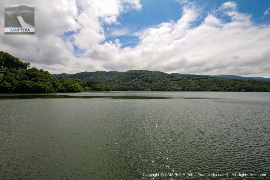
View of the dam lake from the top
The village of Arimine was located on the submerged land of the Arimine Dam and was a desolate mountain village with only a dozen or so households. Looking at the reservoir filled to the brim with water in this way, one can only feel grateful to those who came before us.
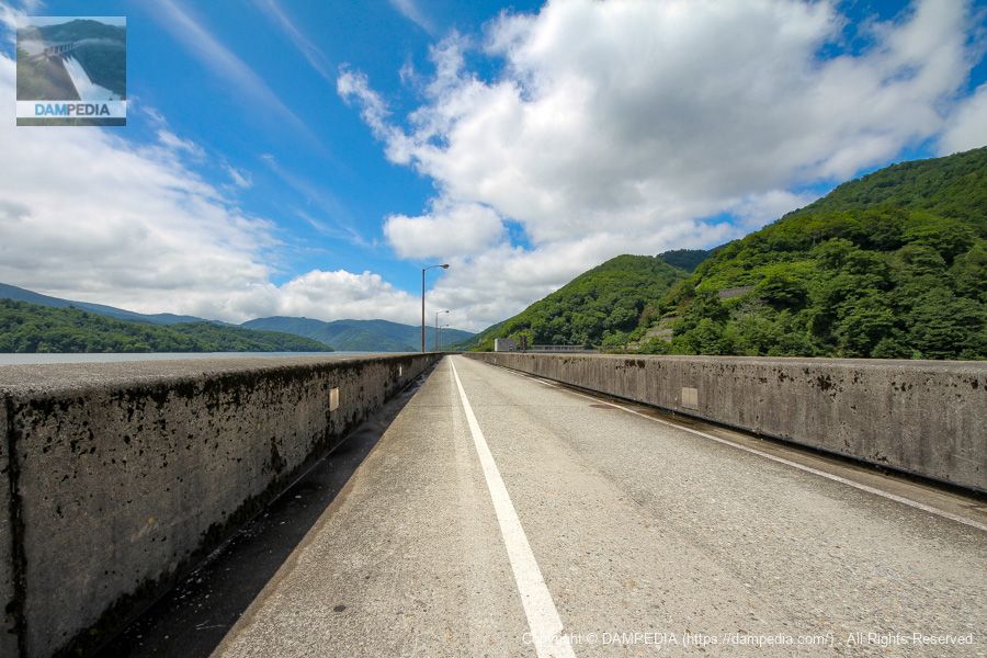
Looking toward the left bank from the center of the top edge
This is a simple sky edge. The clouds seem low due to the high altitude.
View downstream of the left bank from the center of the top edge
It is a gravity-type dike, but you can clearly see it bending toward the ground.

Looking downstream from the top
From the same position, we now look downstream. From this point, we can also see how thin and low the flow-conducting wall is.
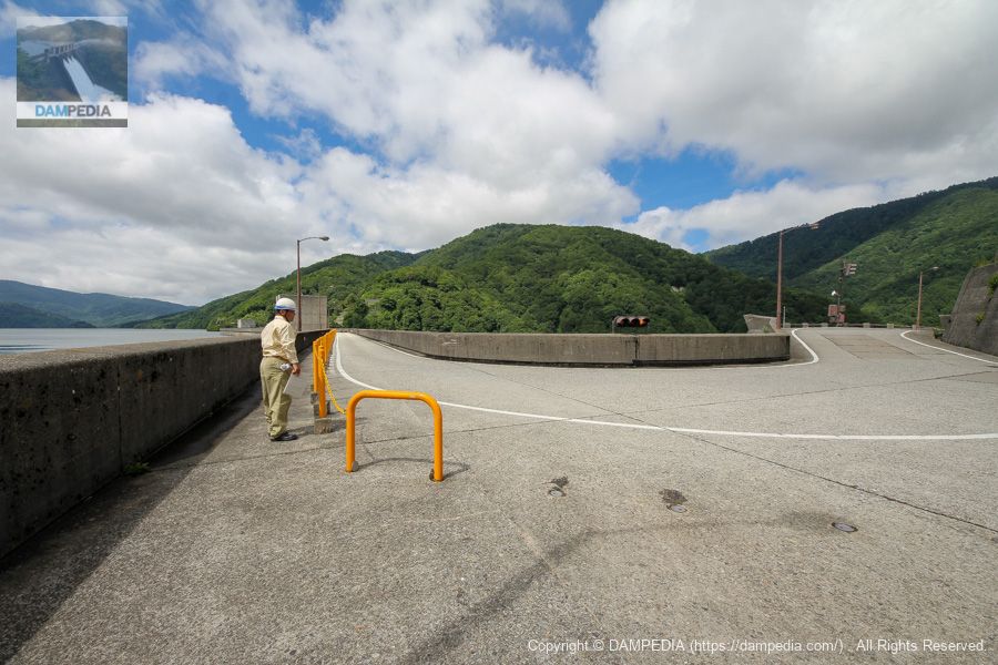
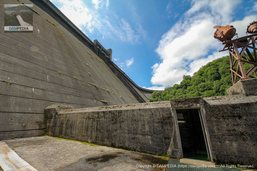
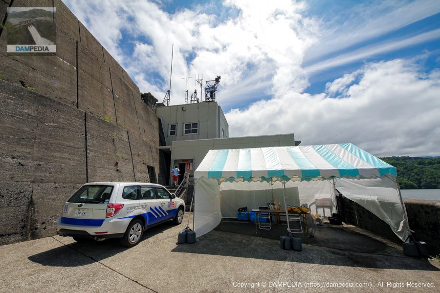
administration office
We returned to the front of the control center. I personally have no memory of the inside of the control center, but I wonder if it was just a bathroom break or something...
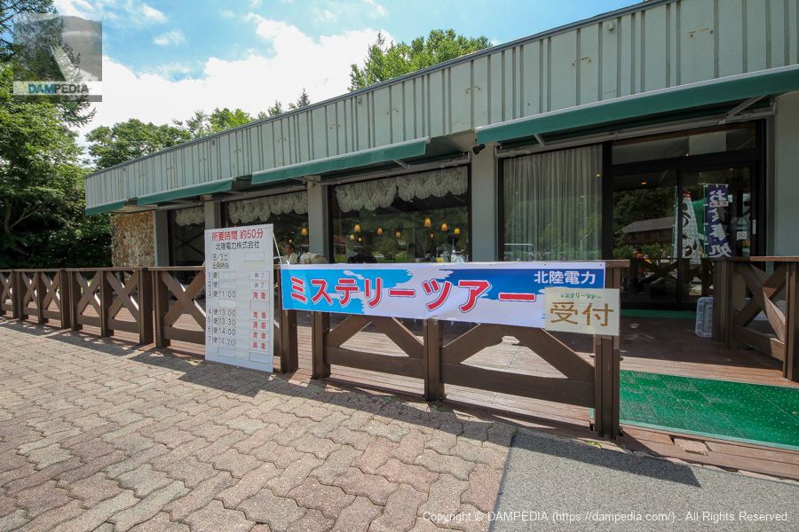
In front of Arimine Memorial Hall
The reception desk for the tour is in front of the Arimine Memorial Hall, but when we returned, all the flights were full and the reception desk was closed. Incidentally, the Arimine Memorial Museum also has a restaurant and a PR facility, Archives Arimine, which we recommend visiting in conjunction with the tour.
Arimine Memorial Hall Observation Deck
The Arimine Memorial Hall has a rooftop observation deck from which the Arimine Dam can be seen in the distance.
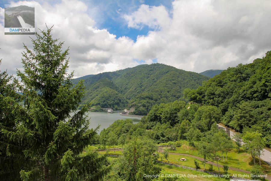
View of the reservoir from the rooftop observatory of the Arimine Memorial Hall
Looking toward the reservoir side. The floating island in the distance is called Horaishima, where the Arimine Shrine is enshrined. Incidentally, Mt. Yoshijiyama was originally located here, and the island became Horaishima when the reservoir was built.

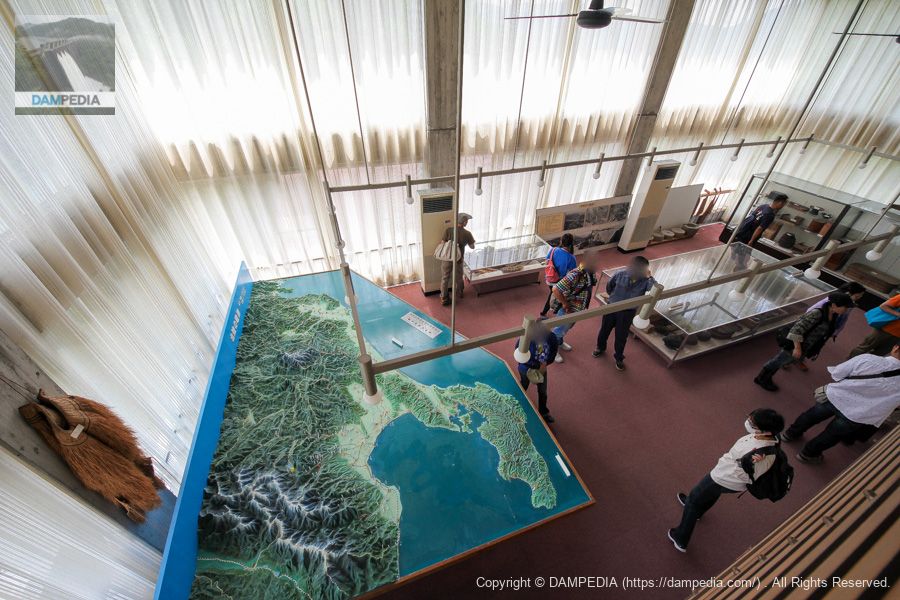
Archives Arimine
This is a view of the inside of Archives Arimine, a PR facility. Various materials, including dioramas, are on display.
Looking downstream from the right bank
After we broke up, we decided to go back to the levee and look at it from a point that we could not see during the tour. The photo below shows the area moved a little downstream from the observation point on the right bank. It is an amazing levee, no matter how many times I see it.
Intake tower on the left bank
Passing through the top edge, we came to the left bank. This intake tower is used to send water to the Arimine No. 1 Power Plant.
Looking downstream from the left bank
The curve is so amazing that it is hard to believe that it is a gravity concrete dam, even when viewed from the left bank. Incidentally, the concrete structure seen on the left is part of the winter passage.

Arimine No.1 Power Plant intake tower and upstream face of the embankment from the left bank
Mooring facilities are visible on the left. Unfortunately, the dike is a bit hidden by the water intake tower in the foreground. Looking at the map, it is unlikely that the embankment can be seen further upstream from here.
Downstream side of the levee from the observation platform on the left bank
Finally, it was time to return home, but there was also a good observation platform on the left bank. We could catch a magnificent view of the Arimine Dam filled with water.
There are many things to see and do at Arimine Dam, but you can see it differently not only during the summer "Arimine Forest Cultural Village Opening Day" but also during the season of autumn leaves. If you have a chance, please visit.
Arimine Dam Specifications
| Location | Arimine, Toyama City, Toyama Prefecture |
| River Name | Joganji River System Wada River |
| Objective | P(Power generation) |
| Model | G(gravity-fed concrete dam) |
| Bank height | 140m |
| Bank length | 500m |
| Dam volume | 1,568,000 m3 |
| Watershed Area | 219.9 km2 (direct: 49.9 km2, indirect: 170 km2) |
| Reservoir area | 512ha |
| Total storage capacity | 222,000,000 m3 |
| Effective water storage capacity | 204,000,000 m3 |
| Dam operator | Hokuriku Electric Power Co. |
| Main body constructor | Maeda Corporation |
| Year of launch | 1956 |
| Year Completed | 1959 |
| Name of Dam Lake | Lake Umino |
Other facilities/observations
| Parking lot | ○ |
| Toilet | ○ |
| Park | ○ |
| PR Exhibition Hall | ○ |
| Fishing | ○○ (No boats allowed) |
Comment