
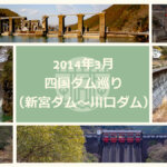
Date of interview: Sunday, 3/2/2014
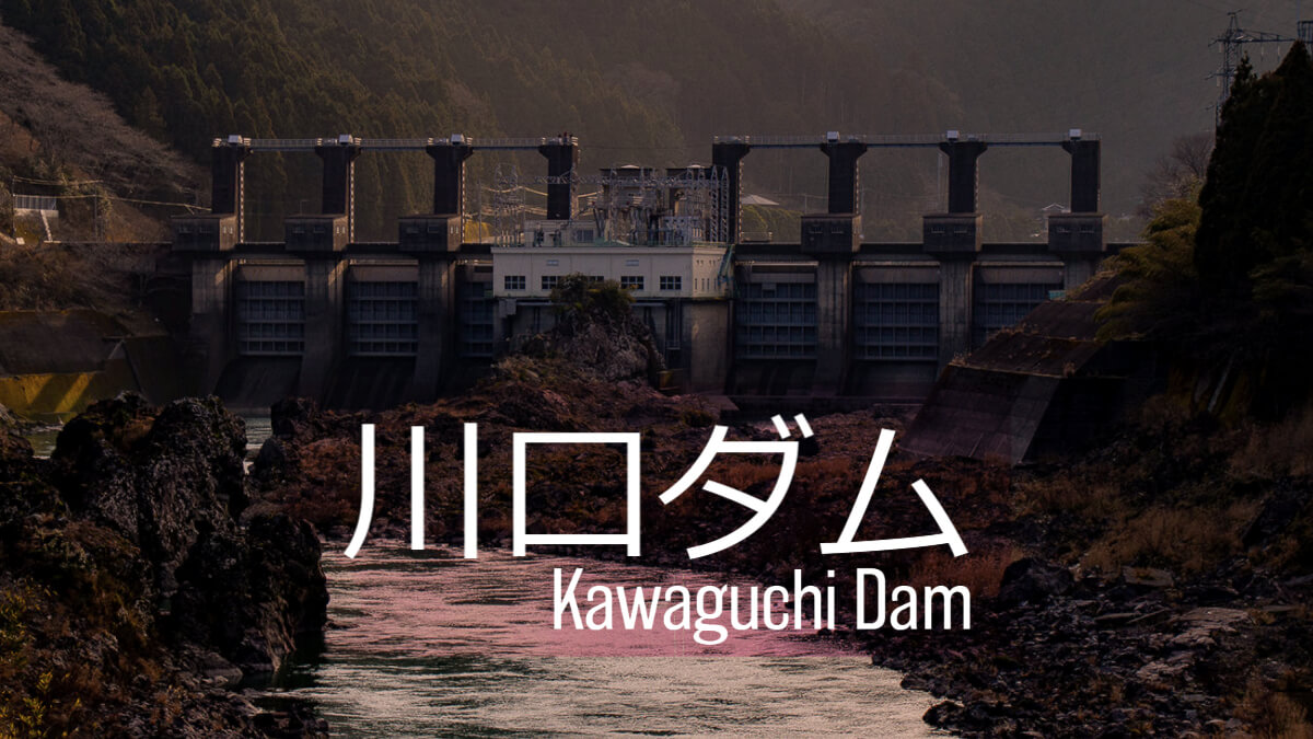
The last dam I chose for this day's Shikoku dam tour was Kawaguchi Dam, which is located at the downstream end of the Nagawa River. To tell the truth, I wanted to stop by the Fukui Dam and the Masaki Dam, but it was around 3:45 p.m. when we arrived at the Kawaguchi Dam. I thought it would not take us that long because of its low embankment height, but it turned out to be a dam that betrayed my expectations in a good way.
Kawaguchi Dam was constructed as part of the Nagawa River Comprehensive Development Project. It was constructed to serve as a reverse regulating reservoir to alleviate the fluctuations in the volume of water in the Naga River caused by the amount of power generated at the Hinotani Power Station, which is located between Kawaguchi Dam and the upstream Choyanguchi Dam. In addition, power is generated at the Kawaguchi Power Station using water discharged downstream from the Kawaguchi Dam.
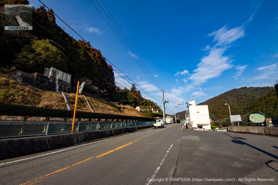
Approach from the national road on the left bank
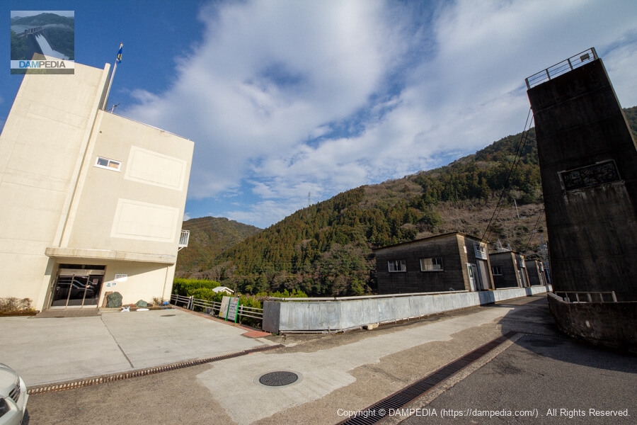
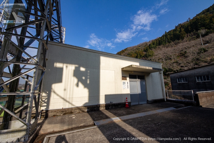
The entrance to the Kawaguchi Dam can be seen in this direction as it is moved from the Choyasukuchi Dam upstream. Incidentally, the administration office is now a science museum called "Kawaguchi Dam Natural Energy Museum (Kawaguchi Ene Mu)." The shape of the administration office building remains the same, but the atmosphere has changed considerably with the addition of signage.
By the way, at the time of this visit in 2014, in front of the management office, or rather on the left bank of the dikedam-site(There used to be a parking lot for visitors (just down the ramp on the right side of the photo), but now there is a space for 5 cars on the east side of the administration office (behind the white building in this photo). If the parking lot is full, visitors must park in the second parking lot on the right bank near the park.
Kawaguchi Dam information board
An information sign is placed on the left bank. The sign indicates that water is also taken from the tributary Akamatsu Dam (treated as a weir because its bank height is less than 15 m) and used for power generation. This sign seems to have been replaced by a new, larger one.

Water Use Signs
A water use sign was erected next to it.

View of the reservoir from the left bank
The white water flowing in on the left side is water from a branch canal from the Akamatsu Dam. On the right side, a little further away from there, you can see something light blue lying. What is that...?
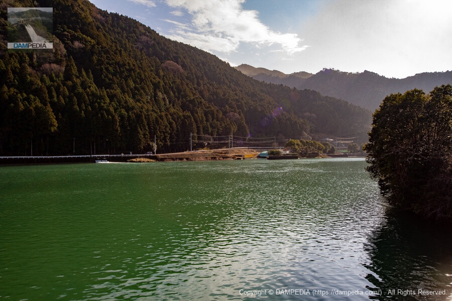
Looking upstream from the left bank
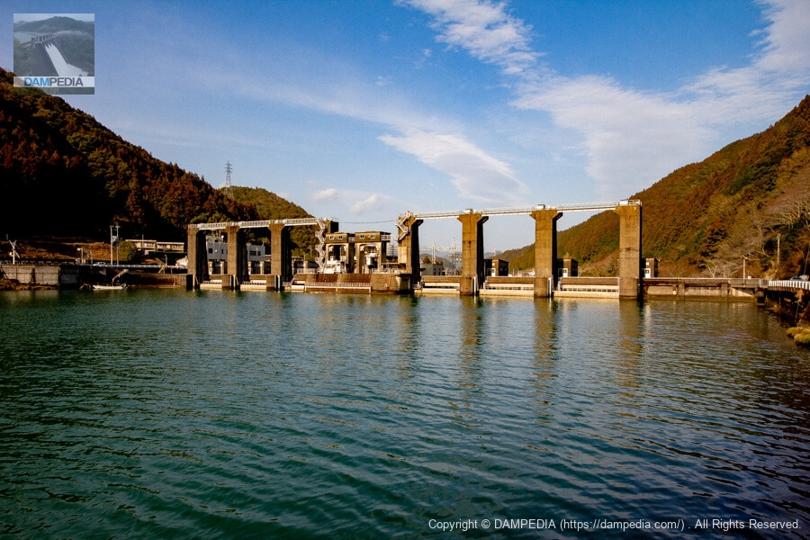
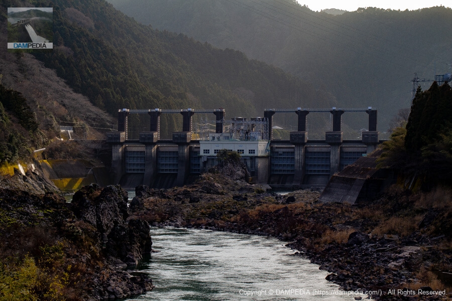
Kawaguchi Dam is a dedicated power generation dam owned by the Tokushima Prefectural Bureau of Public Enterprises, with an intake in the middle of the six crest gates, and produces up to 11,700 kW of electricity at the Kawaguchi Power Station just downstream.
View of the top edge and management office from the left bank
The white building on the left of the photo is the administration office, which is now the Kawaguchi Dam Natural Energy Museum (Kawaguchi Ene Mu). On the right is the top end.
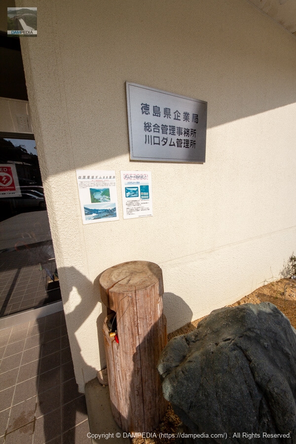
Kawaguchi Dam Management Office, Tokushima Prefectural Enterprise Bureau Integrated Management Office
I received a dam card at the management office. On the log below is a stamp of the 88 Shikoku weir dams.
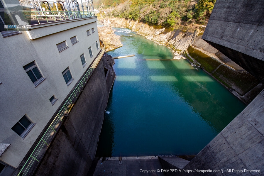
Looking downstream from the side of the control center
Kawaguchi Dam is one of the dams that are putting a lot of effort into public relations. The branches of the trees by the control center were pruned so that the levee could be easily seen. They must have pruned them for us to see!

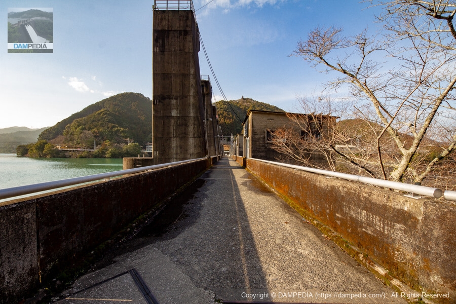
View of the top edge from the left bank
An austere "Kawaguchi Power Plant" nameplate is fitted on the gatepiers. The top end is open to automobile traffic, but be sure to pass safely as it is narrow and separation may be difficult.

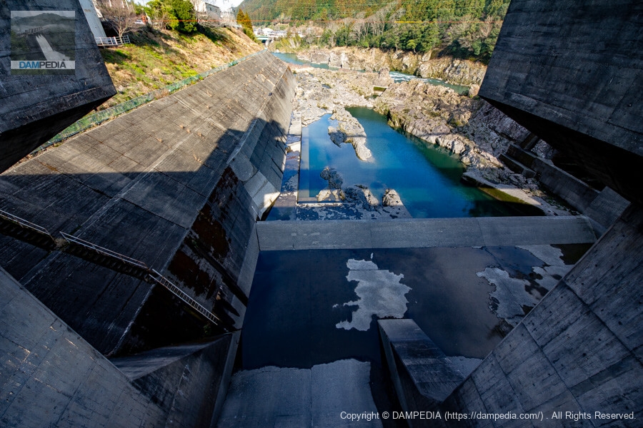
Looking downstream from the top through the leftmost gate
The rock surface is rough downstream. It is an amateur's visual impression, but it seems that the bedrock was bare and of good geological quality.
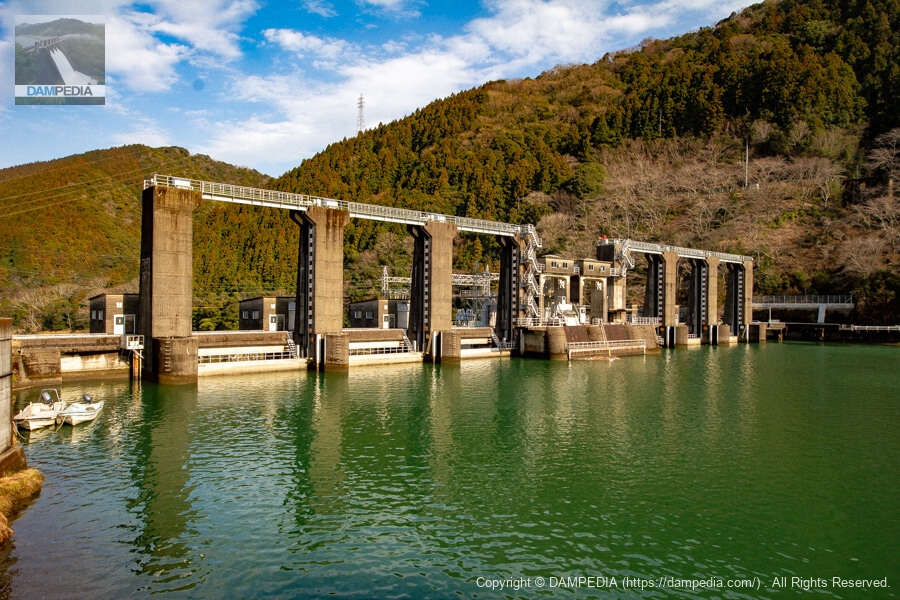
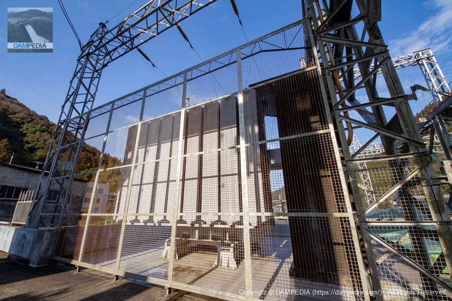
Roller gate
Kawaguchi Dam has six roller gates that are 13.80 m high and 13.00 m wide.
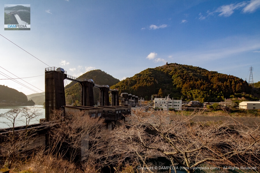
View of the power plant from the top of the left bank
The power plant building is located in the middle of the downstream side. Inside are two vertical-axis umbrella-type three-phase synchronous generators with vertical-shaft volute Kaplan turbines, generating up to 11,700 kW.

crane
There is a crane at the top end, which appears to be used during power plant inspections and maintenance. The pilot's seat is on top, which is kind of cool.
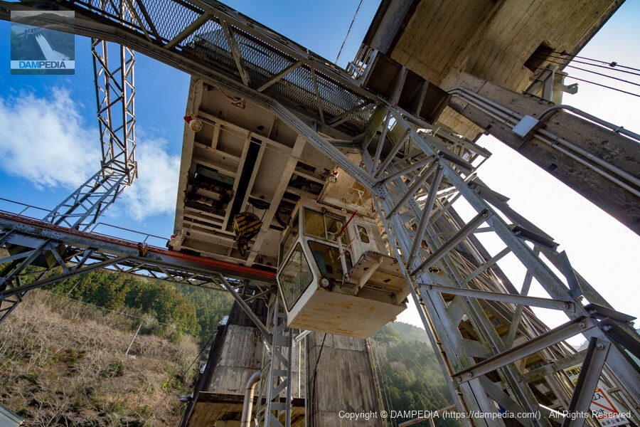
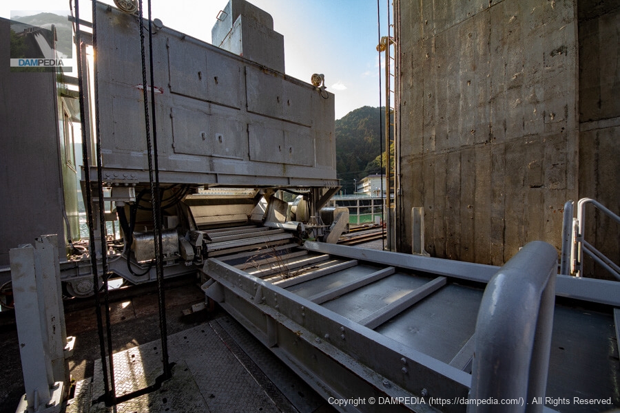
Dust remover bellcons?
I think they are probably a dust remover that removes debris from the intake screen and a conveyor belt that carries the debris. The dust remover is self-propelled so that it can come and go between the two intakes.
Transformer?
I don't know much about power generation, but is this a transformer? Anyway, there are many things to see at the top of Kawaguchi Dam.
Entrance to power plant building
There is an unnaturally square frame on the left side; was there an explanatory panel or something posted there?
Steel Structure Specifications
Dams often have nameplates showing gate specifications, but the Kawaguchi Dam has a nameplate showing the specifications of the steel structure.
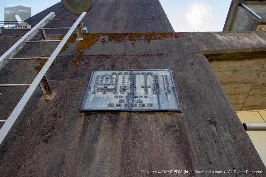
Steel Structure Specifications
From the local nameplate (old characters have been changed to new ones)
Weir gate: 13.0m wide, 13.8m high, 6 gates
attachedpurging panel (of a firearm)Width: 9.0 m, Height: 1.0 m, 2 gates
Water intake gates: 3.6 m wide, 4.3 m high, 2 gates
Water discharge gate: 3.5m wide, 2.3m high, 4 gates
Water intake debris grates: 6.0 m wide, 13.5 m high, 2 gates
Dust collector: Rake width 2.0 m, raking height 13.5 m, 1 unit
Unit No. 1 hydraulic iron pipe: inner diameter 3.6 m, length 25.2 m, 1 section
Unit No. 2 hydraulic iron pipe: inner diameter 3.6 m, length 25.0 m, 1 section
Floating gate: 13.0 m wide, 14.2 m high, 1 gate
Manufactured in 1960
Tokyo
Tahara Manufacturing Co.
It is rare to find such a detailed description. Even the rake of the dust remover is written. Also, I forgot to take a picture of it, but there are two flush boards attached to the gate.
Looking downstream from the top of the right bank
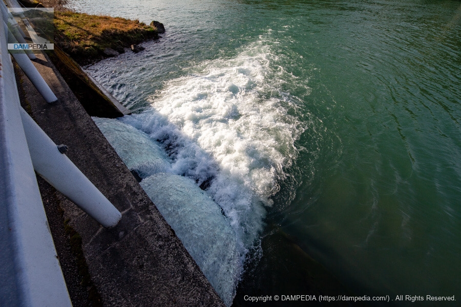
Compared to the left bank side, which is still slapped with water, the right bank side is a reduced flow pond that stores water like a pool. When I look at pictures of the discharge of the Kawaguchi Dam taken by various people, I feel that the right bank side is frequently discharged. I wonder if this is the reason why water tends to accumulate there.
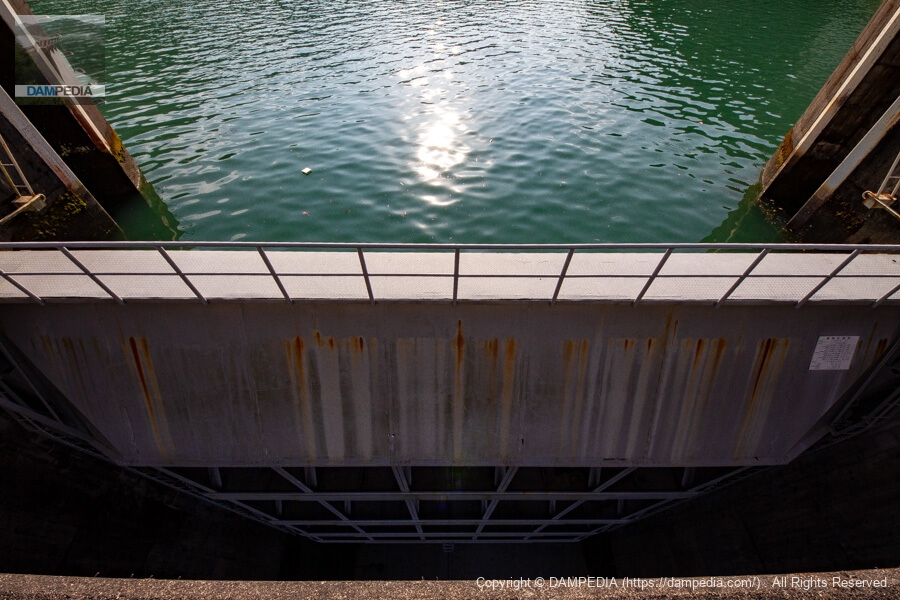
View of the reservoir from the top
The time is 16:00. The sun is setting.

View of the top edge from the right bank
We came to the right bank.
Downstream view of the levee from the high ground on the right bank
There is a little elevation on the right bank and stairs have been maintained, so we could see the embankment from a slightly higher position. It seems that the bank is now being further improved, including the slope, but I hope that access is not restricted.
Red Pine River Branch Canal Portal
Continue strolling upstream on the right bank. You will see the outlet of the branch canal where the water taken at the Akamatsu weir flows in on your left. Incidentally, it appears that a small hydroelectric power generation facility is currently installed here. It is amazing that even a little bit of water is not wasted and that it is used for education at the museum.
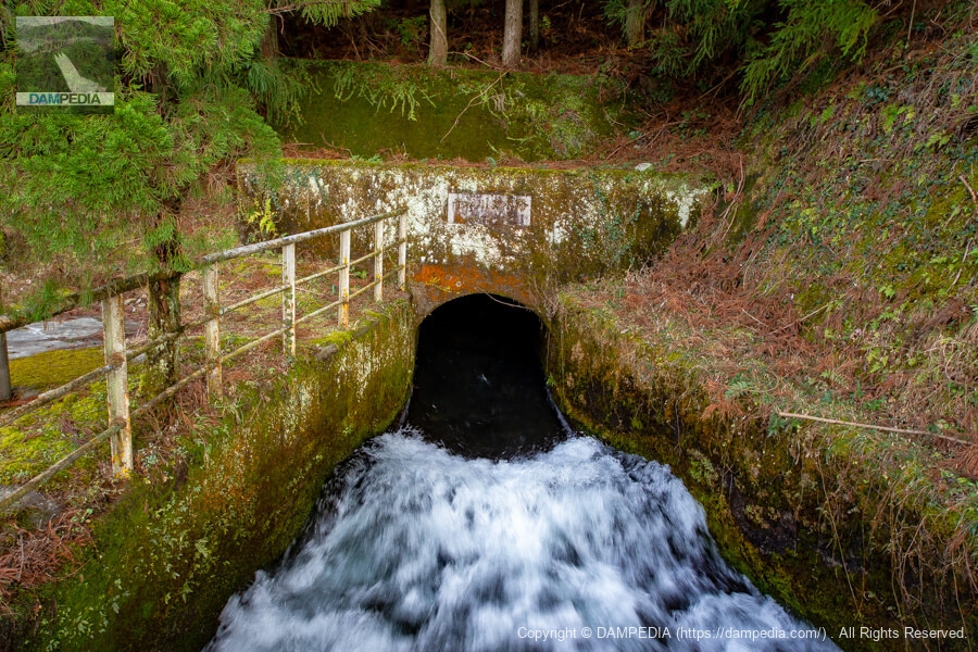
Water flowing into the reservoir from the Red Pine River branch canal
I wonder if it now flows into the reservoir after small hydroelectric generation has taken place.
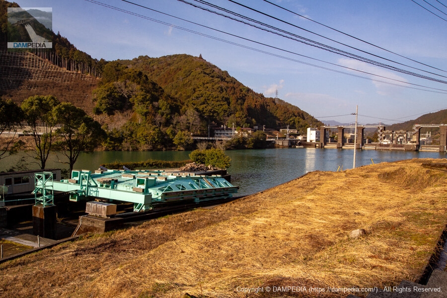
Looking upstream from the right bank
The embankment of Kawaguchi Dam illuminated by the setting sun.
Mysterious steel structure upstream
A mysterious structure visible from the left bank. When I first saw it, I thought it might be a water intake or something, but it is a "floating gate," which is what the aforementioned steel structure nameplate refers to as a "floating gate door. Floating gates are spare gates used for inspection and repair of the six flood discharge gates of the Kawaguchi Dam, and when actually used, they are filled with air and floated like a boat in the reservoir, carried close to the embankment, and fitted into a door slot in front of the flood discharge gates.
Floating gates are also available at the Akiba Dam in Shizuoka Prefecture, but I would love to see them actually being floated and moved.
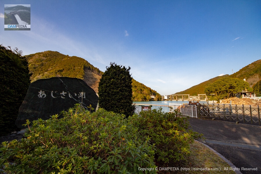
Stone monument with the name of the reservoir
The town flower of the former Aioi Town, before it became Naga Town, was the hydrangea, and in summer the lakeshore is said to be filled with hydrangeas in full bloom. The lake was named "Lake Hydrangea" by the public on the occasion of the "Lake and Forest Friendship Season" in 1989. In spring, cherry blossoms bloom and the lake is illuminated.
Downstream view of the levee from the Kawaguchi Bridge downstream
I moved to the Kawaguchi Bridge to view the levee from downstream. Too bad it is completely backlit and a bit far away.
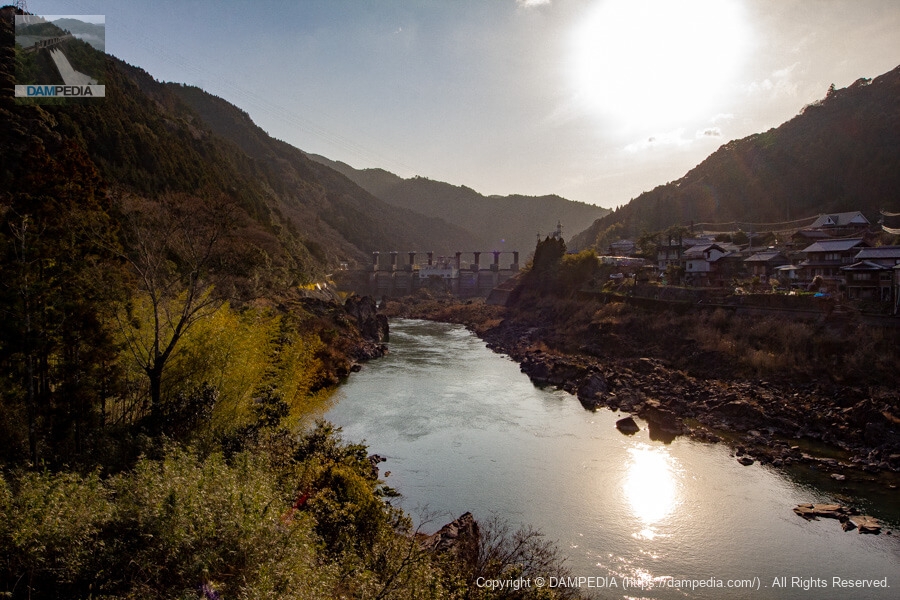
Zoom in to see the downstream face of the dike
Despite its small size, Kawaguchi Dam is a very enjoyable place with many attractions. Now that the Kawaguchi Dam Natural Energy Museum has been built, even small children can enjoy the dam, so why not visit with your family?
Kawaguchi Dam Specifications
| Location | Yoshino, Naga-cho, Naga-gun, Tokushima |
| River Name | Nagawa River System Nagawa River |
| Objective | P(Power generation) |
| Model | G(gravity-fed concrete dam) |
| Bank height | 30m |
| Bank length | 182.5m |
| Dam volume | 54,000m3 |
| Watershed Area | 656.7 km2 (direct: 616.7 km2, indirect: 40 km2) |
| Reservoir area | 87ha |
| Total storage capacity | 6,463,000 m3 |
| Effective water storage capacity | 950,000 m3 |
| Dam operator | Tokushima prefecture (Shikoku) |
| Main body constructor | Kajima Construction |
| Year of launch | 1956 |
| Year Completed | 1960. |
| Name of Dam Lake | Hydrangea Lake |
Other facilities/observations
| Parking lot | ○ |
| Toilet | ○ |
| Park | ○ |
| PR Exhibition Hall | ○ |
| Fishing | ○○ (excluding no-take zones) |
Map around Kawaguchi Dam
Weather around Kawaguchi Dam
Accommodations that may be close to Kawaguchi Dam
Comment