
Date of the interview: Sunday, September 16, 2012
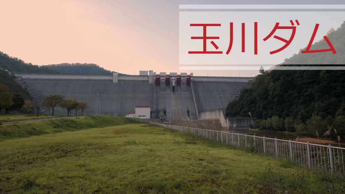
Further north from the Armorhata Dam, we came to the Tamagawa Dam. There is another dam of the same name in Ehime Prefecture, but this one is under the direct control of Akita Prefecture. Incidentally, as of January 2020, nearly seven and a half years after my visit, this Tamagawa Dam is the northernmost dam I have visited.
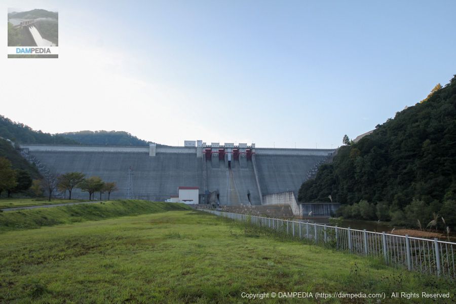
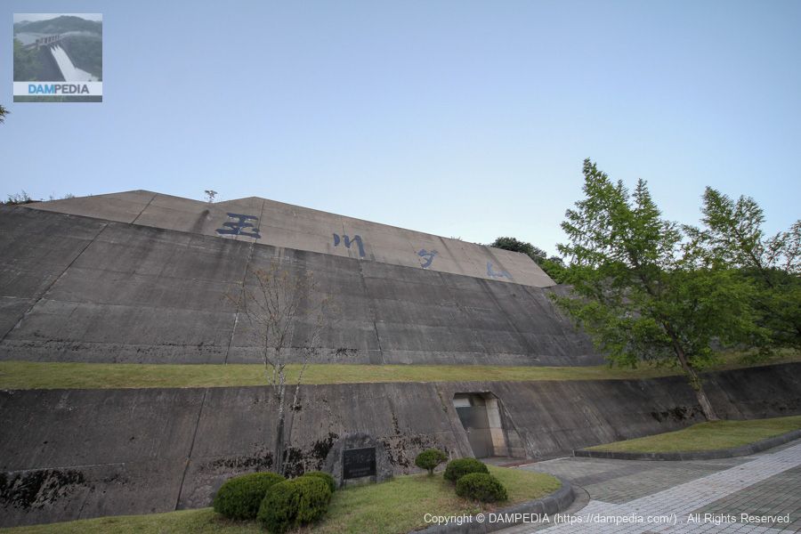
View of the levee from the downstream plaza on the right bank
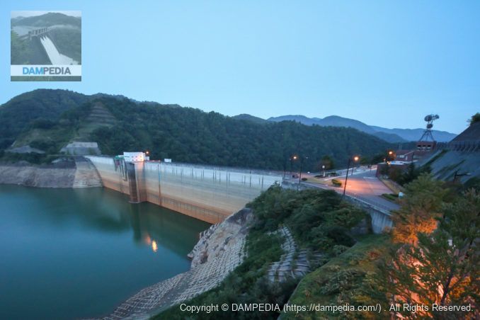
The Tamagawa Dam is a very large dam with a crest height of 100 meters and a crest length of 441.5 meters. It was completed in 1990, at the height of the bubble economy, and it is a dam that retains traces of the bubble economy here and there.
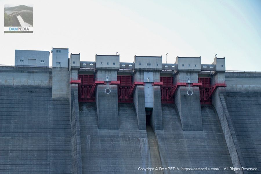
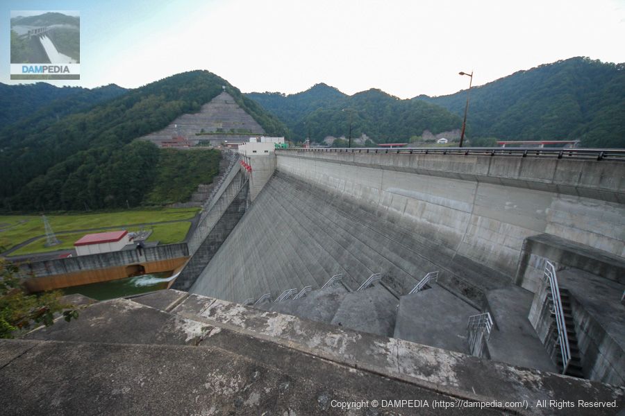
View of the crest from the downstream plaza on the right bank
The Tamagawa Dam has four radial gates, one orifice gate, and two conduit gates in the crest, which are not shown in this photo.
View of the conduit gate from the downstream plaza on the right bank
And why didn't I photograph both of the two conduit gates...

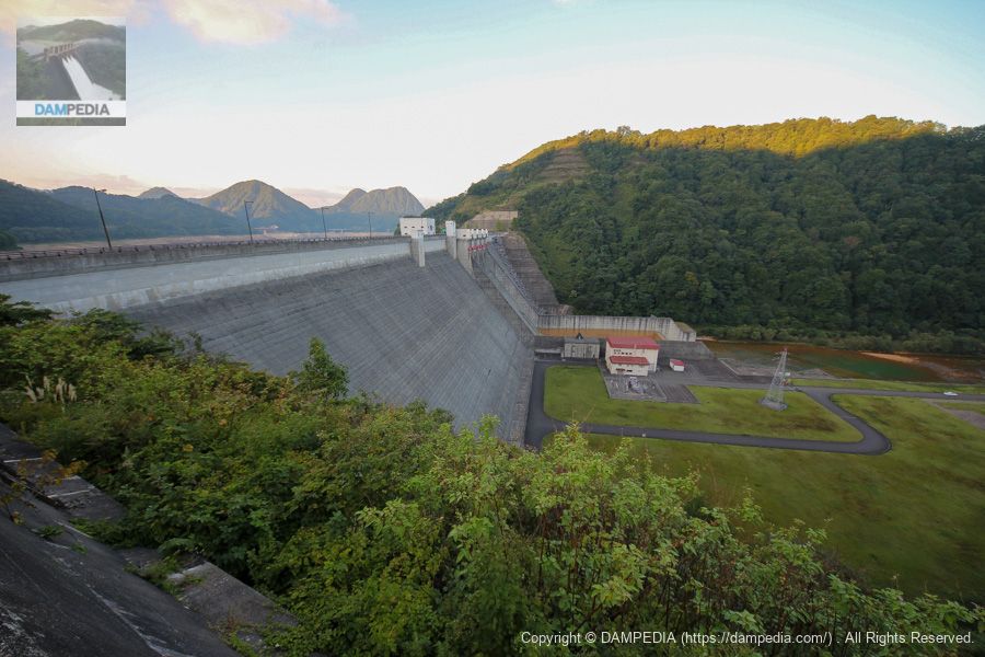
View of the levee downstream from the right bank dam site
We have moved to the top edge level. It is now completely dark, but we continue to photograph until the limit.
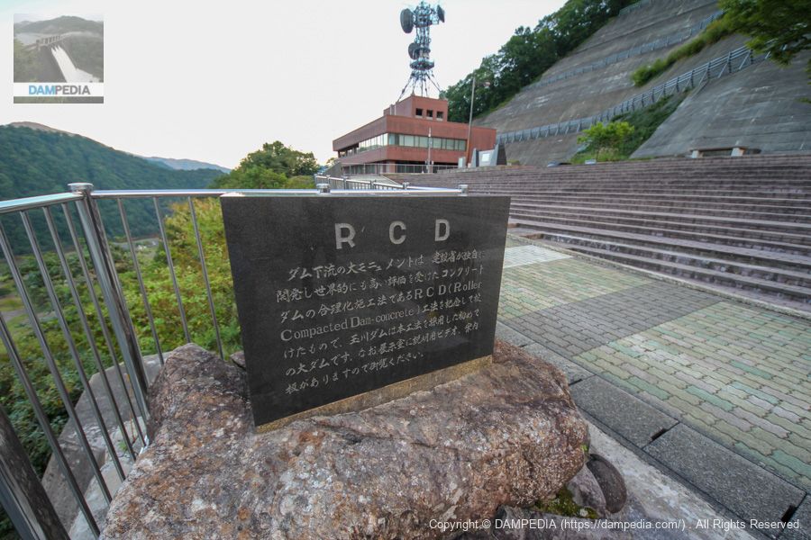
Monument commemorating the completion of Tamagawa Dam and the JSCE Engineering Award
It is a magnificent stone monument. The JSCE monument is a stone monument in recognition of the rationalization of dam construction work through the use of the RCD method, which was groundbreaking at the time.

RCD stone monument
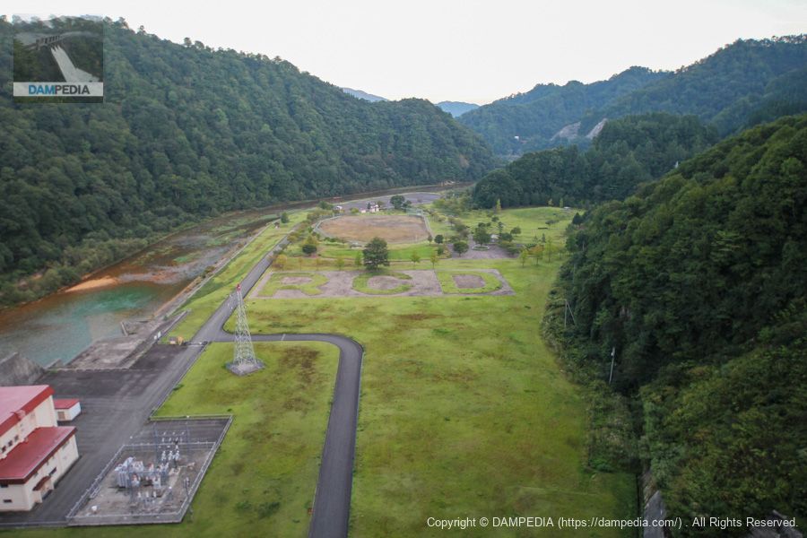
So there are things all over the Tamagawa Dam that honor the RCD. Like this one.
RCD planting
Like this one. It is well known among dam enthusiasts that the Tamagawa Dam is pushing for RCD, but I can't quite figure out what's so great about it. However, it is said that the RCD method has a proven track record of reducing work-related accidents. For more information, please seeThe Dam Handbook has an interview with Toshio Hirose, who developed the RCD construction method.Please see there for more information.
I'm not dissing you. Just for the record.
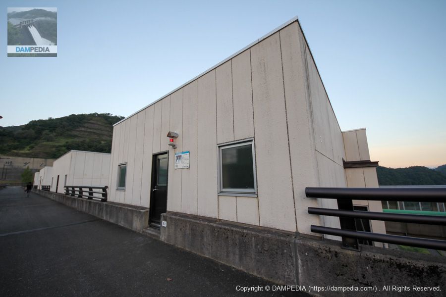
Tamagawa Dam Museum
The Tamagawa Dam has this magnificent museum attached to it. I wanted to look inside, but unfortunately it was after closing time and I could not see the museum.
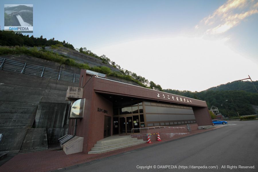
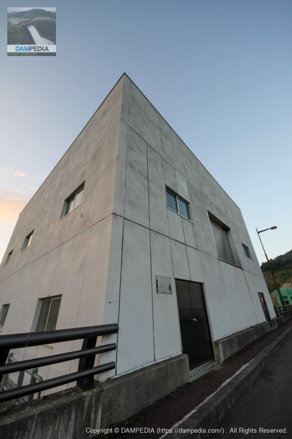
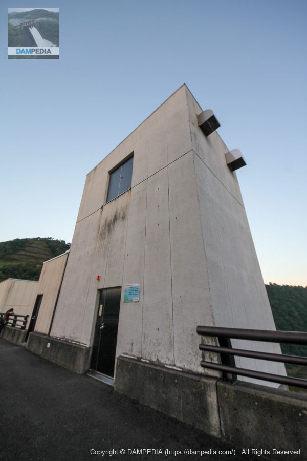
Tamagawa Dam Management Office
The design of this management center is in line with that of the archives. Or perhaps the museum is matching the control center. It was after hours, but a commissioned officer happened to come back from a patrol, and we were able to receive a dam card.

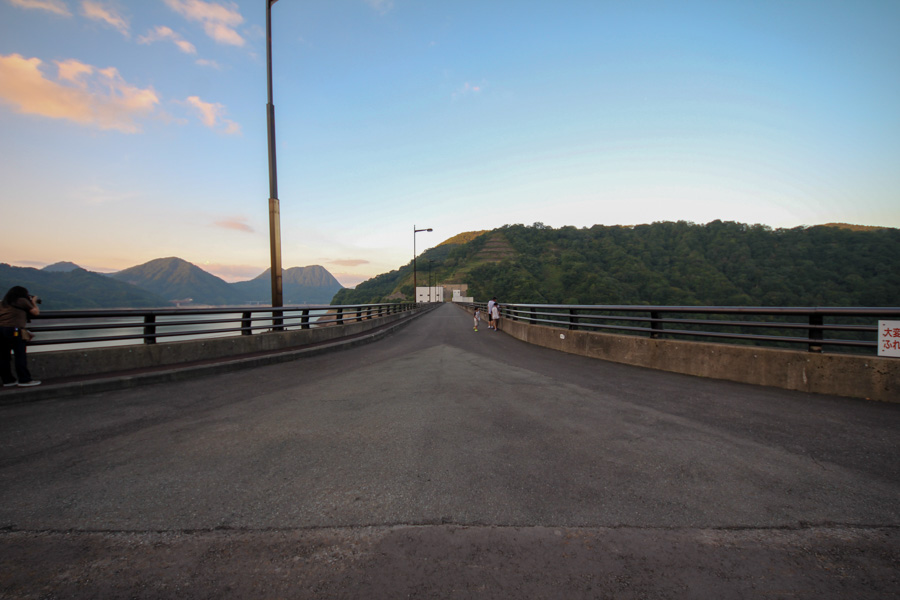
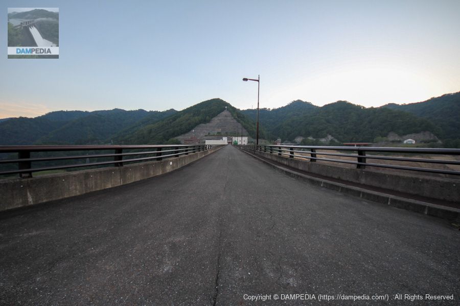
View of the top edge from the right bank
We found a family who had come to visit the dam.
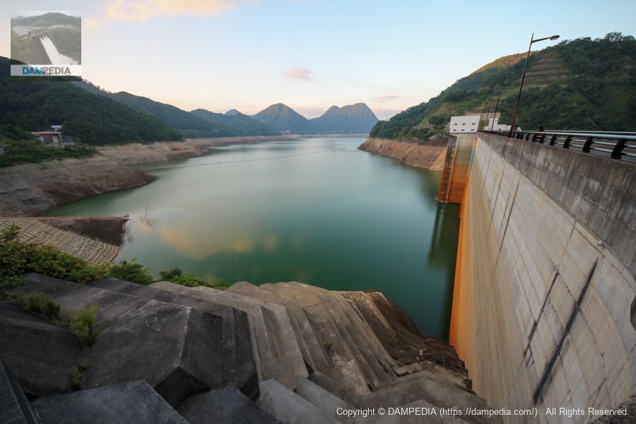
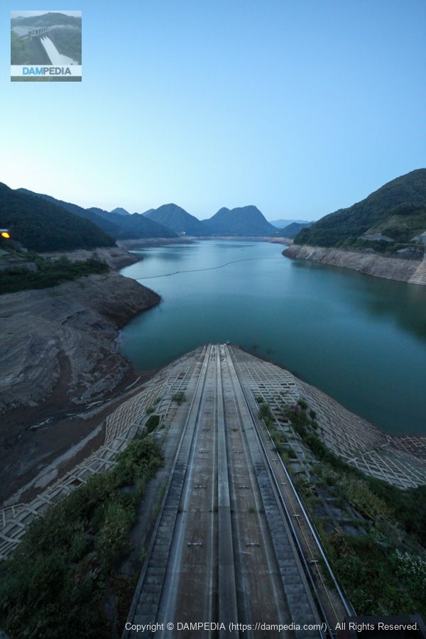
View of the dam lake and embankment from the right bank
The water level was also low at the Tamagawa Dam. Is the brownish color of the embankment due to the acid? Incidentally, as mentioned in the Armorhata Dam, the Tamagawa River flowing into the Tamagawa Dam is originally a highly acidic river, and is being neutralized near the Tamagawa Hot Springs located upstream. Due to time constraints, we were not able to visit the neutralization treatment plant, but it might be a good idea to take a tour in combination with the hot springs.
The acidic water with a pH of 1.1 that gushes out from the Tamagawa Onsen hot spring is also called "poison water," and was so highly acidic that it greatly affected agriculture.
View of the right bank upstream from the right bank
The upstream side of the Tamagawa Dam is well maintained and park-like, just as the downstream side was as well.

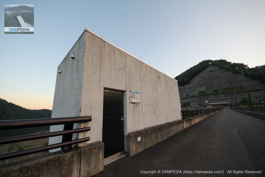
Observation Instrument Room
It appears to house a water level gauge and plumb line.
Surface Water Intake Facility Intake Gate Upper Building
This is the upper building of the surface intake facility intake gate. The specifications of the surface water intake facility are as follows
Model: Steel multi-stage roller gate with bell mouth
Maximum water intake: 66.1 m3/s
Water intake range: EL.397.400-357.700
Number of gates: 1
Dimensions: 7.0m wide by 43.15m high
Opening/closing speed: 0.3m/min
Door weight: 182.8t
Completion date: October 1988
Produced by: Hitachi Zosen Corporation
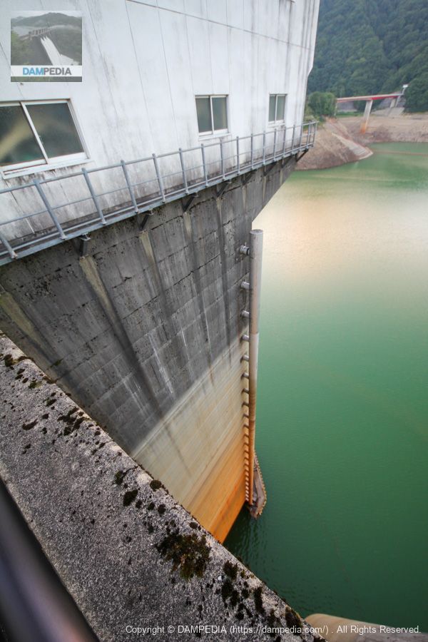
Surface water intake system
It is so high that it seems to suck you in. The gradation is still amazing.
elevator house
It is also called an elevator tower, but since the name "Elevator House" was used on the local information sign, we use it as it is on this page. You can see the maintenance door on the second floor.
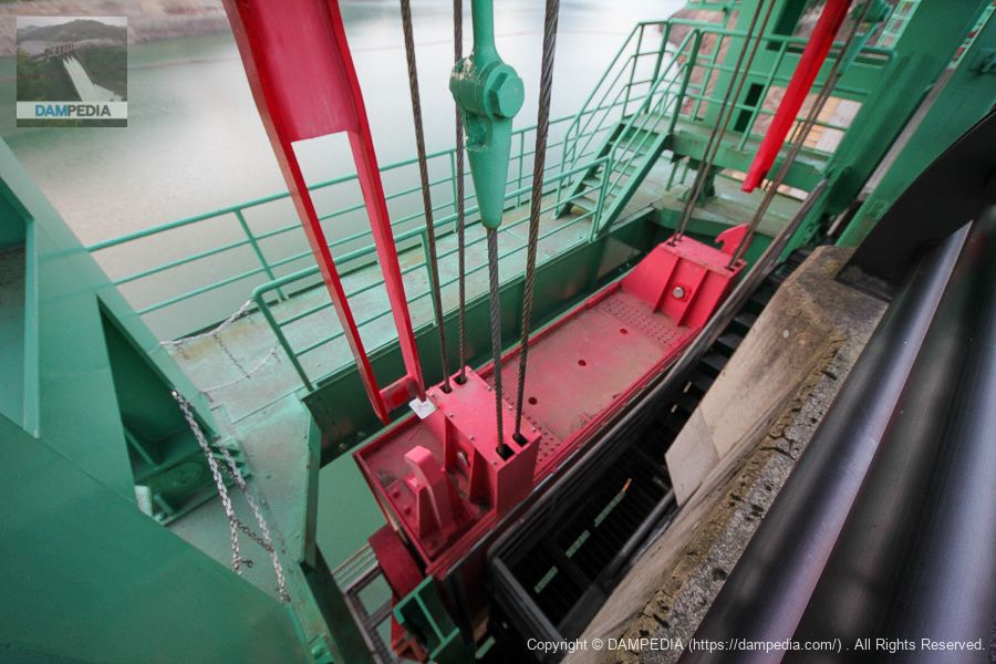
gatehouse
The gate winder room, but the name "gatehouse" was used.
View downstream from the crest gate
Perhaps it is because I live in the service area of Chubu Electric Power Company, but the red gate gives me a strange sense of security.
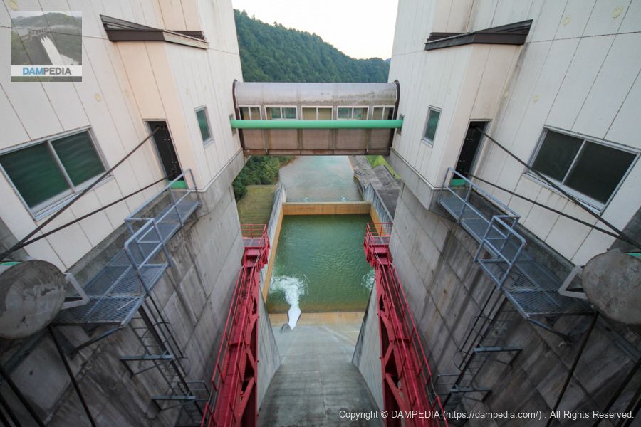
conduit sub-gate
The conduit main gate is a high-pressure radial gate that is housed inside the dike and cannot be seen from the outside, but this is a secondary gate installed on the dam lake side.
The conduit gates themselves have a capacity to regulate 2,600 m3/s of the planned high water flow rate of 2,800 m3/s with two gates and a discharge capacity of 200 m3/s. They also have a capacity of 200% in case of emergency.
View of the top edge from the left bank
You can see that the dam is so large that the other side of the river seems far away.
left bank (slope)
Slope from the abutment. It is a great slope with concrete on all sides.
View of the levee downstream from the left bank
It is also nice to be able to view the embankment from various locations.
View of the embankment on the lake side from the left bank
The sun set further as I was touring. It was a hot day despite being in the Tohoku region, but it also felt a little like autumn.

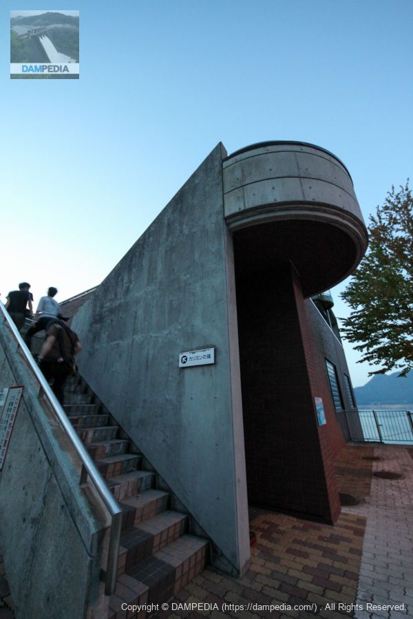
Carillon Bell
The top of the boatyard is an observation deck, and there is an electric bell that plays automatically every hour called the "Bell of the Carillon". There is also a bell that can be freely rung manually.
View of the Incline from the observation deck at the Bell of Carillon
The incline is also relatively large and splendid.
View of the embankment on the lake side of the dam from the observation platform at the Bell of Carillon
It was getting dark enough for the lights to come on. The Tamagawa Dam is a bubbly dam that has everything and moreover, all of it is magnificent, because it was built during the bubble era, but it was a dam with a lot of attractions that kept me occupied.
Also, Tamagawa Dam is one of the dams I would like to visit again someday, although it is too far from my house and I rarely go there. I have not been able to visit Akita Prefecture itself since then, but I would like to go there to eat Kiritanpo.
Tamagawa Dam Specifications
| Location | Tazawako Tazawa, Senboku City, Akita Prefecture |
| River Name | Tamagawa River, Yubutsu River system |
| Objective | F (flood control, agricultural disaster prevention) N (unspecified water, water for river maintenance) A (irrigation water) W(Water for water supply) I (industrial water) P(Power generation) |
| Model | G(gravity-fed concrete dam) |
| Bank height | 100m |
| Bank length | 441.5m |
| Dam volume | 1,150,000m3 |
| Watershed Area | 287km2 |
| Reservoir area | 830ha |
| Total storage capacity | 254,000,000m3 |
| Effective water storage capacity | 229,000,000m3 |
| Dam operator | Tohoku Regional Construction Bureau |
| Main body constructor | Kajima Corporation, Okumura Corporation, Jisaki Kogyo Co. |
| Year of launch | 1973 |
| Year Completed | 1990 |
| Name of Dam Lake | Hosen Lake |
Other facilities/observations
| Parking lot | ○ |
| Toilet | ○ |
| Park | ○ |
| PR Exhibition Hall | ○ |
| Fishing | × |

Comment