
Location: Okusa, Koda-cho, Nukata-gun, Aichi, Japan
Date of interview: Saturday, February 26, 2011
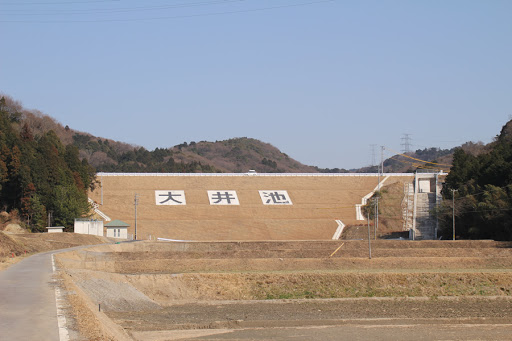
View of the levee from the downstream side of the right bank

Oi Ike is an irrigation-only earth dam located in Koda-cho, Nukata-gun, and has been recently renovated. The grass on the surface of the embankment is very beautiful. I visited in winter, but I wonder if the embankment will be lush in summer. According to the Aichi Prefecture Tourism Association, "It is one of the largest agricultural reservoirs in the prefecture. Many cherry trees are planted along the lakeside, making it a popular cherry blossom viewing spot.
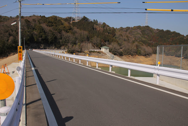
View of the top edge from the right bank
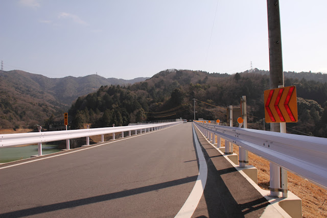
The top end is open to automobile traffic. There is a road that goes from Koda Town to Okazaki City, and there was a fair amount of traffic there.
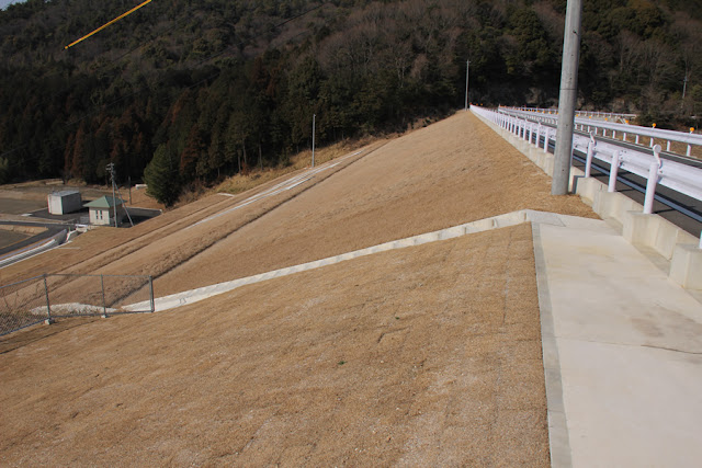
View of the embankment on the lake side from the right bank
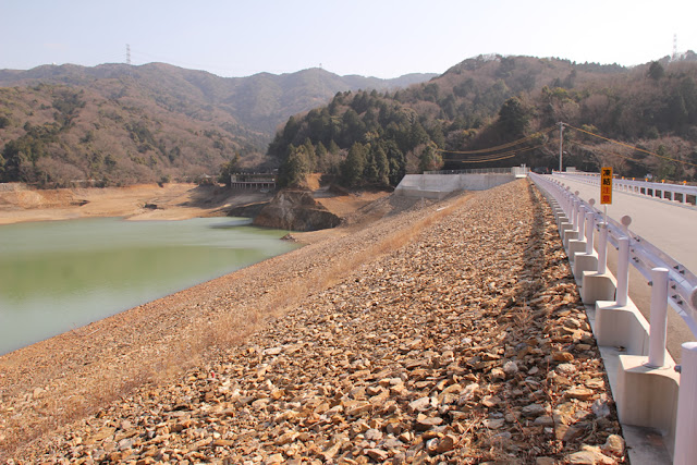
The embankment on the dam lake side also has a very clean surface.
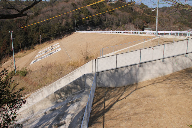
View of the driving range facilities from the right bank
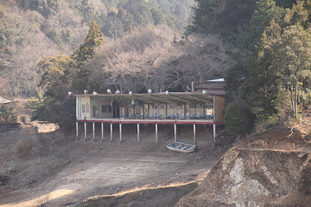
This dam is unusual in that it has a driving range for golfers. However, at this time it is still under renovation, so it is not open for business. By the way, I wonder if golf balls can affect the water intake.
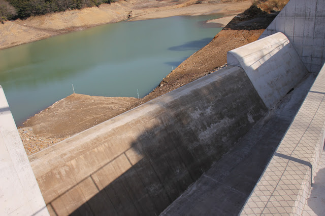
View of the flood discharge from the right bank

The white of the concrete is dazzling. This is a relatively large flood discharge. Let's take a closer look later.
View of the dam lake from the top
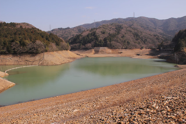
In hindsight, it may have been test waterlogging. However, as usual, I visited the site without doing my homework, so it is unclear whether the water is being stored or whether it is in the process of being lowered.
View of the water intake system from the top

The water intake system seems to have been renewed. The building is also tiny and cute.
View downstream from the top

Various facilities downstream also appear to be new. There seems to be a path downstream, so let's look at it from downstream later.
Free overflow flood discharge
I would like to see this inflow. It may not look that dynamic, though.
water-level map

A simplified water level map was posted on the fence, perhaps used during a local information session.
View of water intake facilities from the left bank

I just couldn't pinpoint the water level by looking at the diagram (laughs).
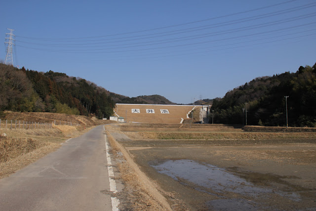
View of the monument and the levee downstream
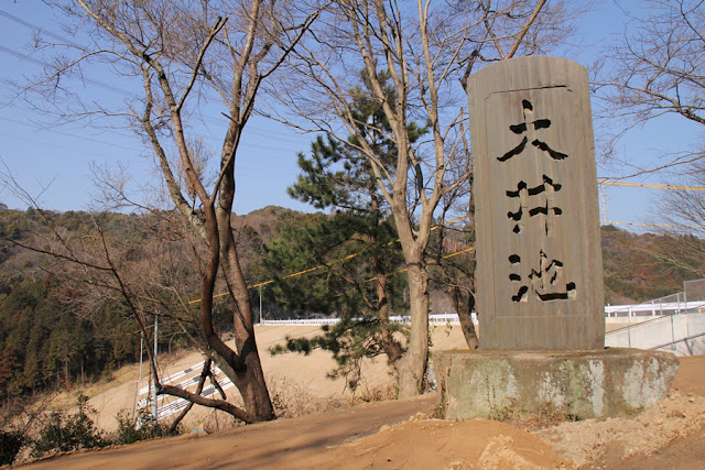
It is quite a magnificent monument.
From the photos taken by a recent visitor, it appears that the area around this monument has also been improved a great deal.
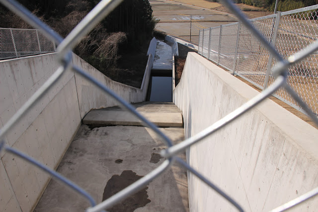
View of the levee downstream through the conduit
If I could get a little closer to the downstream side of the river, I would have been able to get a clear shot, but it was a little tough to take a picture, lol.
View of the flow-conducting section and force-reducing structure from the top edge
I don't think it will flow very often, but I wonder how powerful it will be if it does flow over. Personally, I don't think it will be as powerful as we can expect....
View of the levee downstream from the left bank
Anyway, it is beautiful. However, it is too neat and uninteresting for a "vegetable"....
View of the top edge from the left bank
It's nice that it's beautiful, but if it's not, it looks like a dike....
View of the levee from downstream
We then moved downstream. However, a pylon was set up here and no further entry was allowed.
View of the flood discharge from downstream
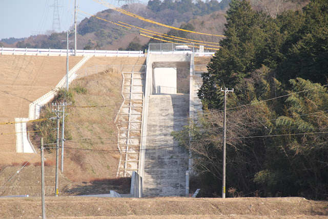
In this way, you may be able to see a surprisingly dynamic discharge. If you can keep the front of the building close by, that is.... The only drawback is that there are many power lines.
View of the levee from downstream

It has just been renovated and is beautiful and also has this assertive dam on the embankment. I hope the local farmers will continue to do their best in the future.
Oi Pond Specifications
*The following is the data before the renovation.
| River Name | Yahagigawa River System Hirota River |
|---|---|
| Objective | outside the control or jurisdiction (of) |
| Model | earth dam |
| Bank height | 31m |
| Bank length | 140m |
| Dam volume | 145,000m3 |
| Watershed Area | -km2 |
| Reservoir area | 9ha |
| Total storage capacity | 806,000m3 |
| Effective water storage capacity | 806,000m3 |
| Dam operator | Oi Pond Land Improvement District |
| Main body constructor | Directly managed by Aichi Prefecture |
| Year of launch | - |
| Year Completed | 1943. |
Other facilities/observations
| Parking lot | △ | I think it was on the left bank, on the lake side of the dam site... Sorry, I vaguely remember. |
|---|---|---|
| Toilet | × | |
| Park | × | |
| PR Exhibition Hall | × | |
| Fishing | △? |
Comment