
Location: Higashiyama, Karasubara-cho, Hyogo-ku, Kobe City, Hyogo Prefecture
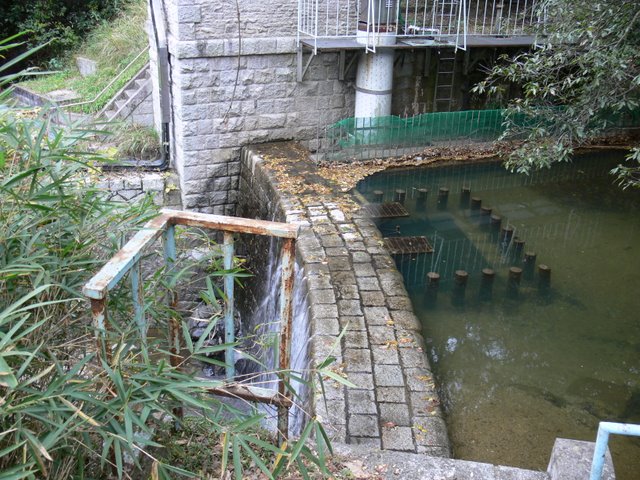
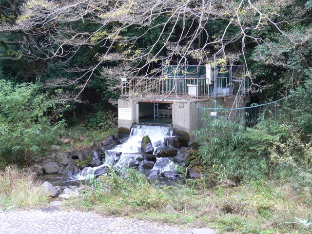
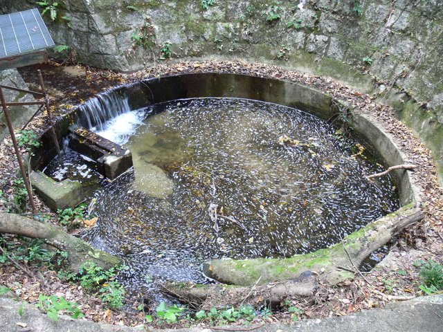
View of the intake weir
After visiting Ishii Dam (1519-Ishii Dam/Ishii Dam) at the 8th Dam Web Ring off-line meeting [off-line tour of dams on the Karasubara River by Shintetsu], we headed to Tachigahata Dam. However, I was very impressed that the interesting properties were scattered before reaching the embankment, and the highlight of the tour was not only the embankment.
So, first of all, this is the water intake located upstream of the Tachigahata Dam.weirThe Tachigahata Dam was built in the Meiji period (1868-1912). Since the Tachigahata Dam was built in the Meiji era (1868-1912), the surrounding facilities are masonry piles that are reminiscent of the Meiji era (1868-1912), creating an old but very nice atmosphere.
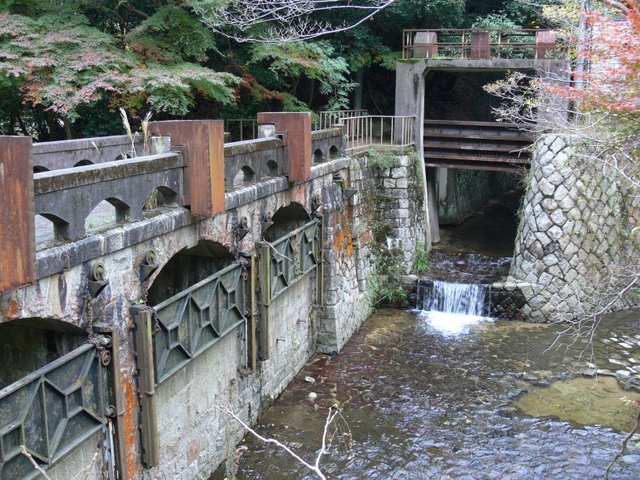
View of the cutoff weir (upstream side)
Because it is so old, some parts are rusted and deteriorated, but this also gives it a good taste. Rather than "rusty," "deserted" is a better word to describe it.
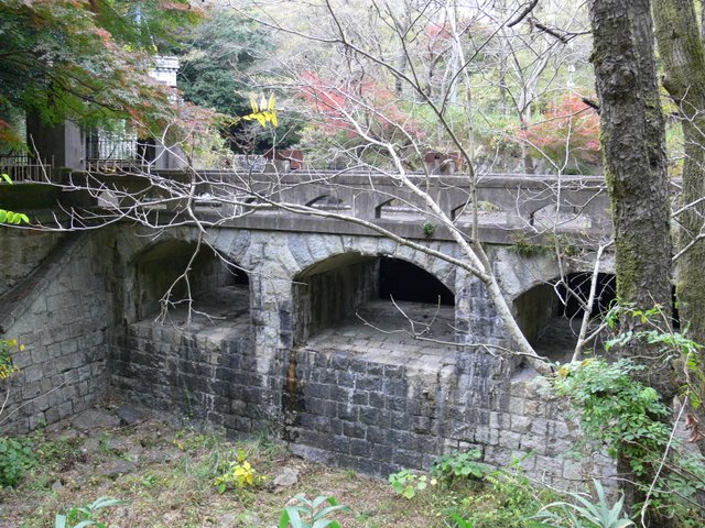
View of the floodgate

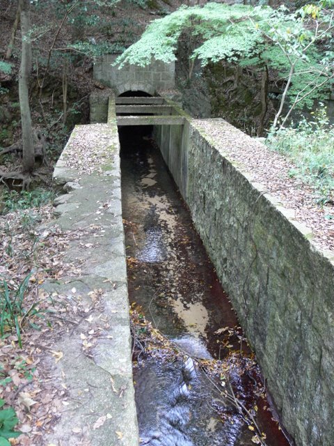
The floor, walls, and even the ceiling of the culvert are made of stone. Even though it was built in the Meiji era, I am impressed by the uncompromising construction. Or perhaps it is because it is the Meiji era.
View of the top of the cut-off weir

The atmosphere around this area must be the same as it was in the Meiji era.
View of the cutoff weir (downstream side)
The atmosphere is not much used, but that is also a good thing.
View of the exit from the cutoff weir
The facilities around the Tachigahata Dam are complicated in many ways, and I cannot explain them well, but they are simply amazing.
View of the portal of the water discharge gate
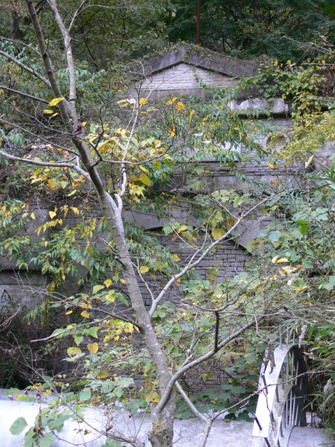
It is regrettable that you cannot see the whole surface of the building due to overgrown trees, but please take a look at the actual building from various angles. Please take a look at the actual building from various angles to get a feel for the style of the Meiji era.
View of the spillway
You will never see anything like this in your neighborhood. Kobe is a good place to visit, but you should also see this kind of historical infrastructure.
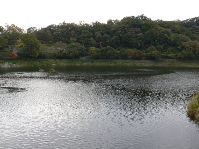
View of the dam lake
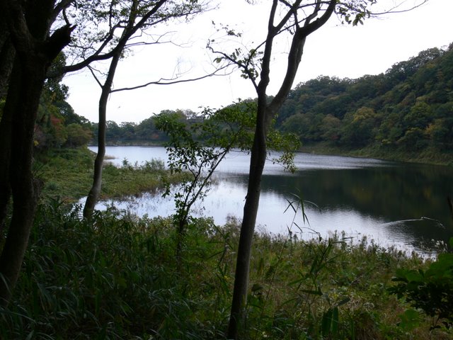
And finally, the dam lake came into view. It is a quiet dam lake.
The area around the dam lake is also a walking course for neighborhood residents, and we frequently saw people taking a walk there. The trail around the dam lake is named "Water and Forest Walkway" and is made of soil, not concrete or asphalt pavement, so it was easy on my knees.
settling well
There is a side road of the Water and Forest Trail that is off-limits to visitors, but we were allowed to take a special look at it this time. This "settling well" is located at the end of the path.
For a moment, one might think it was a cylindrical diversion. It is said to be a structure that once stores the water led from the Tennozani River and leads it to the Tachigahata Dam.
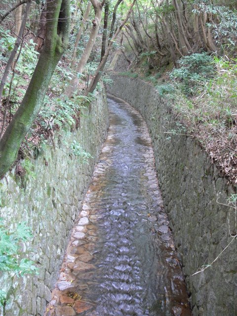
Culvert of water conduit from Tennozani River (there is a spillway under the culvert and it is a multi-level intersection)
Coming from the culvert in the back to the front is a conduit from the Tennozani River, and although it is not visible in this photo, the discharge canal that came through the portal earlier flows under this conduit on both sides. These two cross each other, and such crossings can be seen in various parts of the facilities in this vicinity.
The lid of the canal, called a "culvert draw."
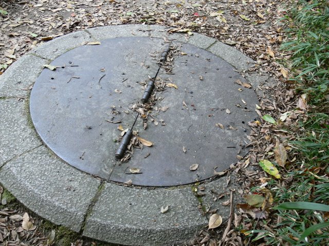
It looks like just a manhole cover, but it is a "culvert draw water" cover, which is a route for water from the Tennozani River mentioned earlier to go through the Tachigahata Dam and directly to the water purification plant.
surface aeration
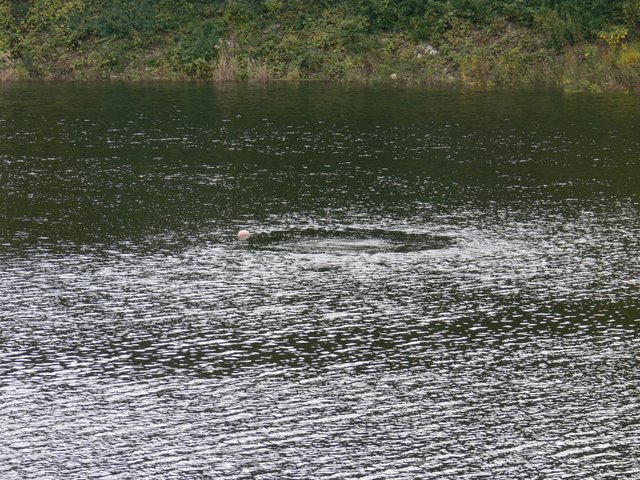
And so, after visiting such an unfamiliar structure, we went back to the dam lake. I was already full. When I looked at the dam lake, I found a device that seemed to be a surface aeration system.
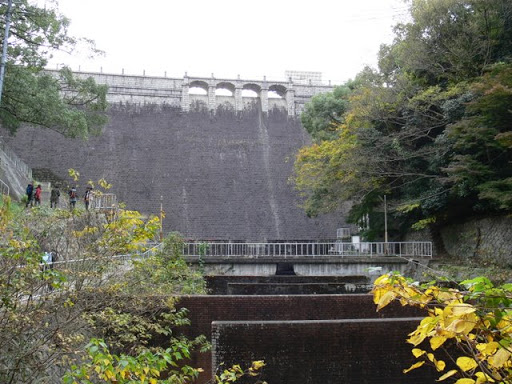
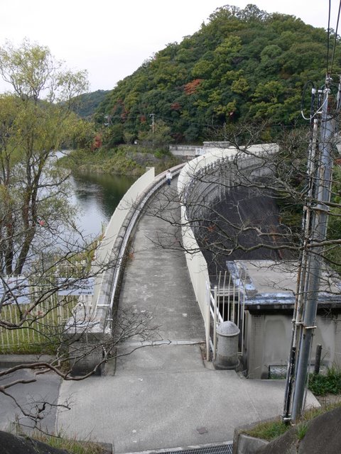
View of the embankment on the lake side of the dam from the left bank
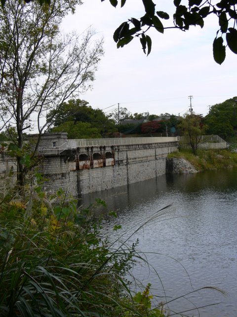
The embankment finally came into view. The stone dam is clearly distinct from the concrete dams we have seen before. It finally came into view.
View of the embankment on the lake side of the dam from the left bank
The cylindrical building in the center is a water intake tower. It looks like a tower on the lake.
View of the top edge from the left bank

The towering fence is a bit of a disappointment, but you don't want to be held responsible for a fall, so it can't be helped.
View of the dam lake from the top
Surely the people of the Meiji period must have seen a landscape not much different from the one in this photo. You may think that such a feeling can be experienced at Meiji-mura in Inuyama City, but unfortunately, there is no dam in Meiji-mura. Iruka Ike (1242-Iruka Ike/Irukaike) is located in close proximity to Meiji-mura, but it is nothing like that.
View of the entrance to the intake tower
What a stylish intake tower! Similar to the buildings seen at the Old Settlement in Kobe, this is the first time I have seen a dam with a Western-style design on its ancillary facilities.
Inside the intake tower

We were given a tour of the inside of the intake tower. The tower is designed to allow water intake from the upper, middle, and lower levels, giving the impression that this is what a modern dam would look like if the selective intake facilities were simplified.
View downstream from the top

Looking downstream from the top, you will see a structure that you have never seen before installed in a zigzag pattern in the so-called "flow reducer" area. This structure, which is no longer used, is said to have the effect of precipitating impurities by making water flow in a zigzag pattern.
There is also a pipe running diagonally at the far end, which is said to be a pipe from the culvert draw water mentioned earlier.
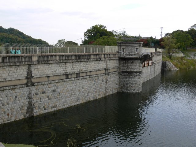
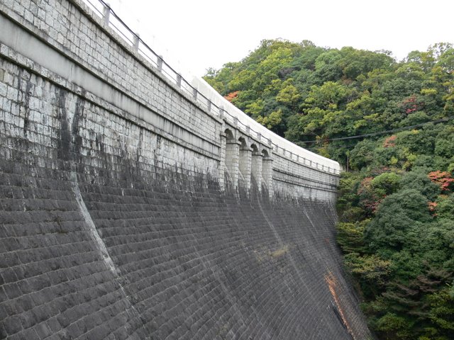
View of the embankment from the right bank
Although you can see a slight arch in this view, the Tachigahata Dam is a gravity-type concrete dam. It is not a gravity arch dam, much less an arch dam.
View of the levee from the downstream side of the right bank
We have come to the very bottom of the historic and stately dam. This is a sacred and inviolable place that only those with special permission can enter. Oh, no, you simply need to get permission from the water department. I'm not saying that if you don't like the dam, you can't enter! I am not saying that you have to like the dam to enter!
View of the levee from the downstream side of the right bank

If the weather were a little better and my photographic skills were better, the photos would be even more interesting, but I can only curse my own skills. It would be a shame to waste such a wonderful subject.
View of the levee from downstream

The barrier standing like a monolith in front of the embankment was a very impressive angle, something I had never seen before.
View of Suidobashi Bridge
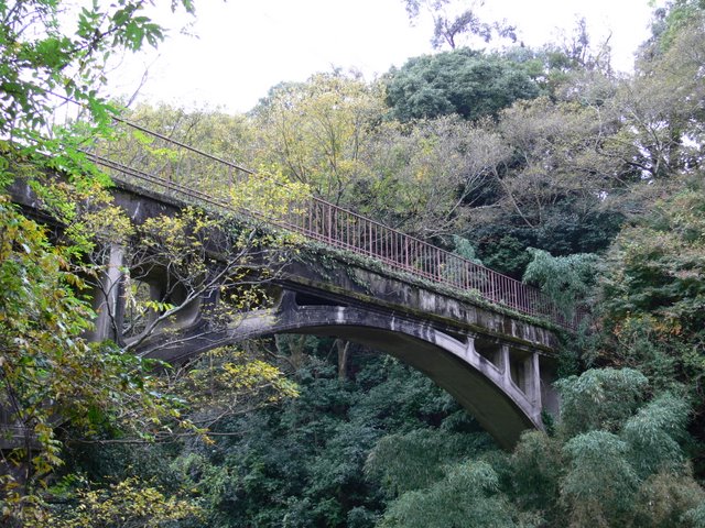
After leaving the embankment, we will head back to the city center, but there is also a tasteful aqueduct like this one around the Tachigahata Dam. Indeed, such structures are often seen in this area. Just strolling around the area is fun enough, isn't it?
View of Kobe City

As you head further into the city center, you will see the center of Kobe City. If the view were a little better, the night view would probably be beautiful. The Port Tower is also clearly visible.
lower reaches of the Wuhara River

We then descended into the city center. Here, I suddenly noticed this scenery. A shocking image I saw on the news a few years ago. A child playing in the river was swept away in no time due to a sudden rise in water caused by a guerrilla downpour. The accident itself was not in the Karasubara River, but in the Tsuga River, which flows through the same city of Kobe, but I couldn't help but be reminded of it and couldn't help but snap my shutter.
I was in a backwoods area just a few minutes ago, but now I am on level ground. Walking here made me realize just how narrow Kobe is between the mountains and the sea, and how steep the rivers are.
flood warning device
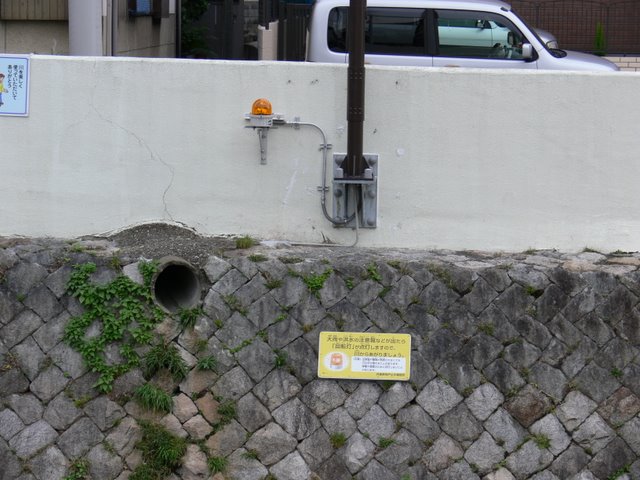
Perhaps the alarm system was installed based on the lessons learned from that accident.
The Tachigahata Dam we saw earlier is a water supply dam and has no flood control function, but just by walking here, you can see why the Ishii Dam and Tenno Dam (1507-Tenno Dam), located just to the north of it, are necessary. Although those dams do not normally store water, they surely help the 1.5 million people of Kobe City in times of heavy rain.
dam characteristics
| River Name | Shin-Minato River System Ishii River |
|---|---|
| Objective | water for drinking water |
| Model | gravity-fed concrete dam |
| Bank height | 33.3m |
| Bank length | 122.4m |
| Dam volume | 26,000m3 |
| Watershed Area | 18.9 km2 |
| Reservoir area | 11 ha |
| Total storage capacity | 1,248,000m3 |
| Effective water storage capacity | 1,213,000m3 |
| Dam operator | Kobe City |
| Main body constructor | Directly managed by Kobe City |
| Year of launch | 1901. |
| Year Completed | 1905. |
| Name of Dam Lake | Karasuhara Reservoir |
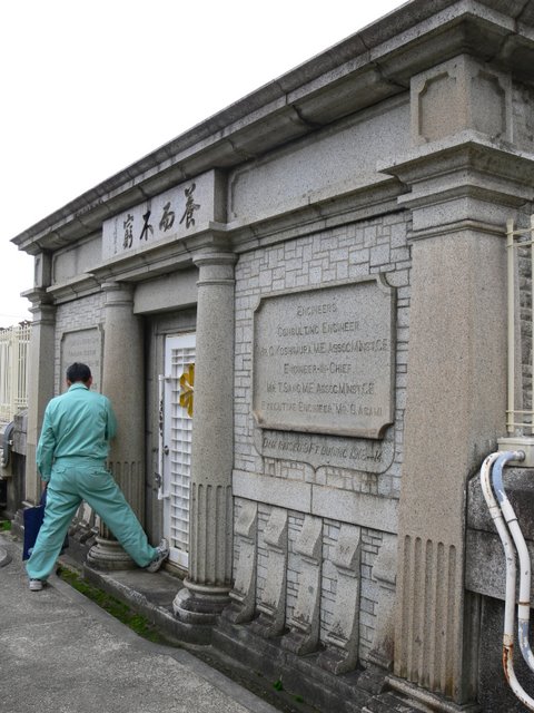
Other facilities/observations
Like the Ishii Dam, it can only be reached on foot. However, there is a walking path that will surely provide you with good exercise. Check out the surrounding facilities! Oh, it seems that you can borrow toilets at the Suzurandai Processing Plant. Also, there is a PR exhibition hall called the Water Science Museum located east of the dam.
| Parking lot | × |
|---|---|
| Toilet | × |
| Park | ○ |
| PR Exhibition Hall | × |
| Fishing | × |

Comment