

Date of interview: 2005/4/16
Location: Ono, Muroku, Uda City, Nara Prefecture
Official Web site:.Yodogawa Dam Integrated Management Office, ,Kizugawa Dam General Management Office
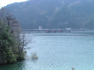
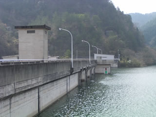
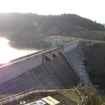
View of the embankment from the left bank of the dam lake
Muro Village is dotted with famous old temples, Muro-ji, Ono-ji, and Hase-ji. In the midst of these temples is this huge man-made structure, the Muro Dam.
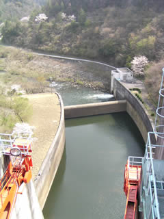
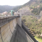
View of the downstream bank from the left bank
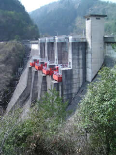
The crimson gate of this dam is very impressive, but the sights are a bit limited.
View of the top edge from the right bank
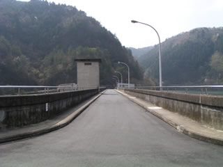
The top end is open to automobile traffic. The parking lot is very large. There was a couple who parked their car here and went trekking. The cherry blossoms were still in bloom, so it could be a good trek.
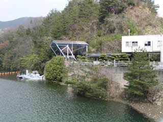
View of the suspension bridge from the top
I wonder where that suspension bridge leads to....
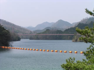
View of the embankment (lake side) from the right bank
It is not known if the water was discharged after this, but it is almost full.
View of the Incline from the top
I wrote this, but I doubt if it was really an incline.
View of the reduction work from the top edge
The Left Turn Dundee (Mystery)
View of the levee from downstream
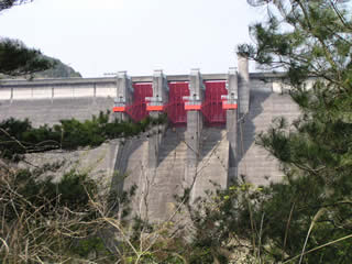
The dam has to be seen from downstream! So, I was looking for a good spot to take pictures, but as you can see........
But they say there really is a way to get to the nadir....
dam characteristics
| River Name | Yodo River System Uji River |
|---|---|
| Model | Gravity Concrete |
| Objective | Flood control and agricultural disaster prevention / unspecified water and river maintenance water / water supply water |
| Bank height | 63.5m |
| Bank length | 175m |
| Dam volume | 153,000m3 |
| Watershed Area | 169km2 |
| Reservoir area | 105ha |
| Total storage capacity | 16,900,000m3 |
| Effective water storage capacity | 14,300,000m3 |
| Dam operator | Public corporation for water resources development, one construction |
| Main body constructor | Okumura group |
| Name of Dam Lake | Lake Murou |
| Year of launch | 1966 |
| Year Completed | 1973 |
| Access | Take Meihan National Highway (R25) and get off at Hari IC. Heading south on Route 369 Drive 10 km and turn left at the Fukuchi intersection with Route 165. Pass under the elevated Kintetsu Osaka Line and turn right at the first signal intersection with the fire station. We'll know the rest soon enough. |
Other facilities/observations
It may be beneficial to visit in combination with an old and famous temple!
| Parking lot | ○ |
|---|---|
| Toilet | × |
| Park | ○ |
| PR Exhibition Hall | × |
| Fishing | ? |
Comment