
Date of interview: Sunday, March 24, 2013
This Sarutani Dam was the next dam we visited after Ichinoki Dam for our mission to pick up the dam enthusiast helmets that had been completed to Nanashiki Dam.
From Ichinoki Dam, drive south on National Route 168 and as you get deeper and deeper into the mountains, you will come across the Sarutani Dam.
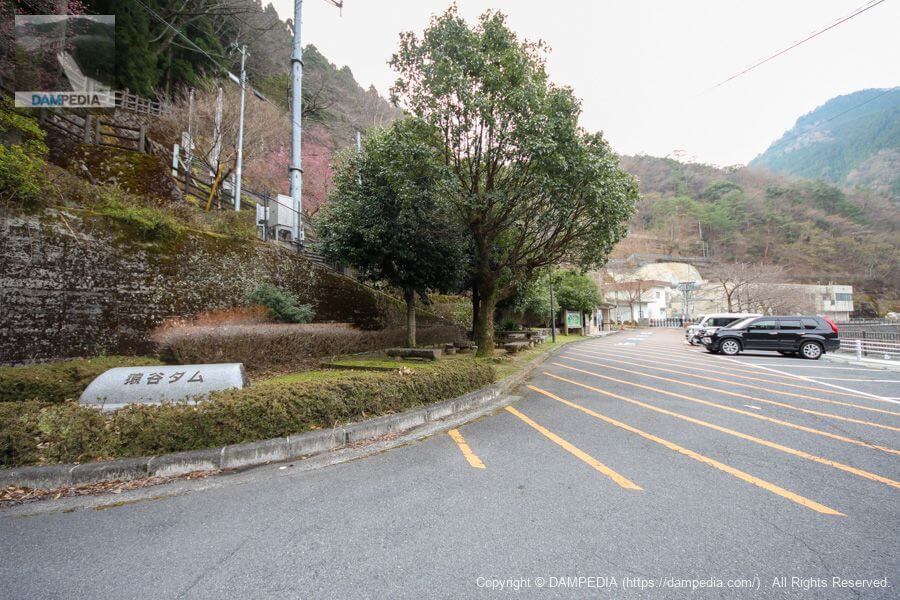
Entrance to Sarutani Dam Parking Lot
When we visited in 2013, there was no bypass, and if you go through a rather narrow winding road, you will see the parking lot of the Sarutani Dam before the Sarutani Tunnel and arrive at the dam on your own.
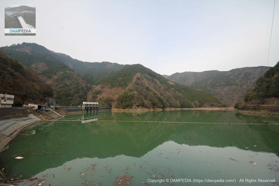
View of the dam lake and embankment from the parking lot on the left bank
When you get out of the car, you can see the dam lake and the embankment at a glance. You can also see a boatyard on the left bank.
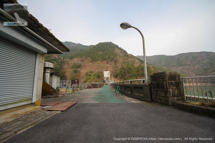
Gate of the Sarutani Dam Management Branch Office and walking trail
For a moment, I thought, "Huh! I can't go any further!" but the walking path on the right side is open, so keep going to the right.

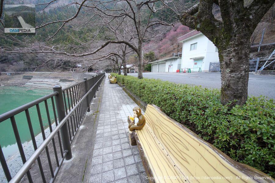
Benches and monkeys
A monkey is sitting on a bench eating a banana. The name "Sarutani Dam" is appealing to monkeys.
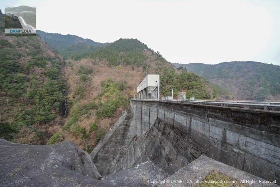
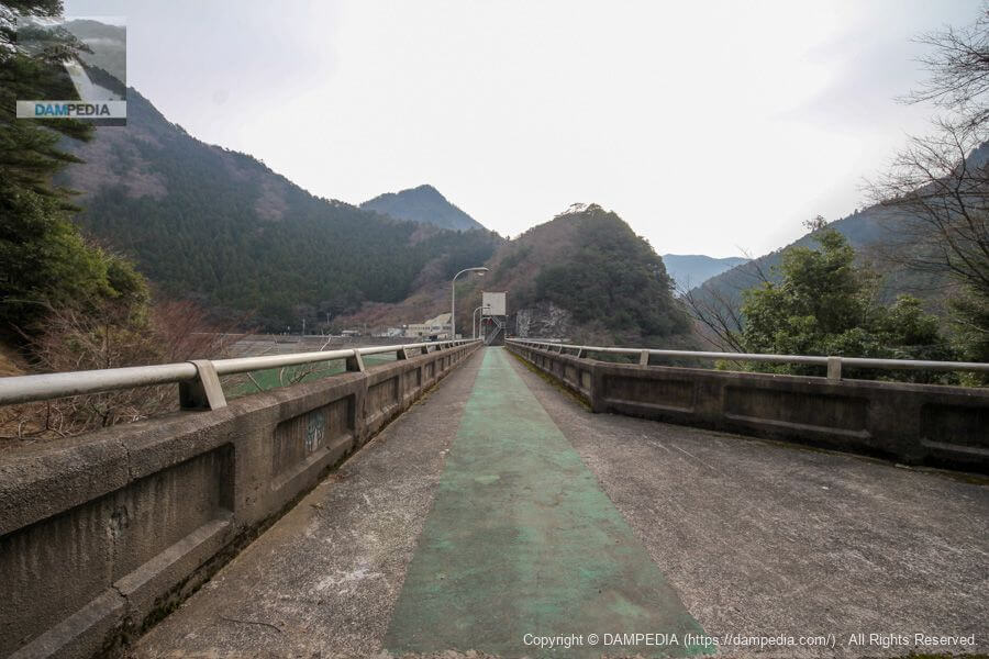
View of the top edge from the left bank
Finally, the top of the dam came into view. I thought that the smokey silver atmosphere was somewhat similar to that of the Maruyama Dam (Gifu), but the Sarutani Dam was completed in 1957 and the Maruyama Dam in 1955, so it seems that they were of the same generation.
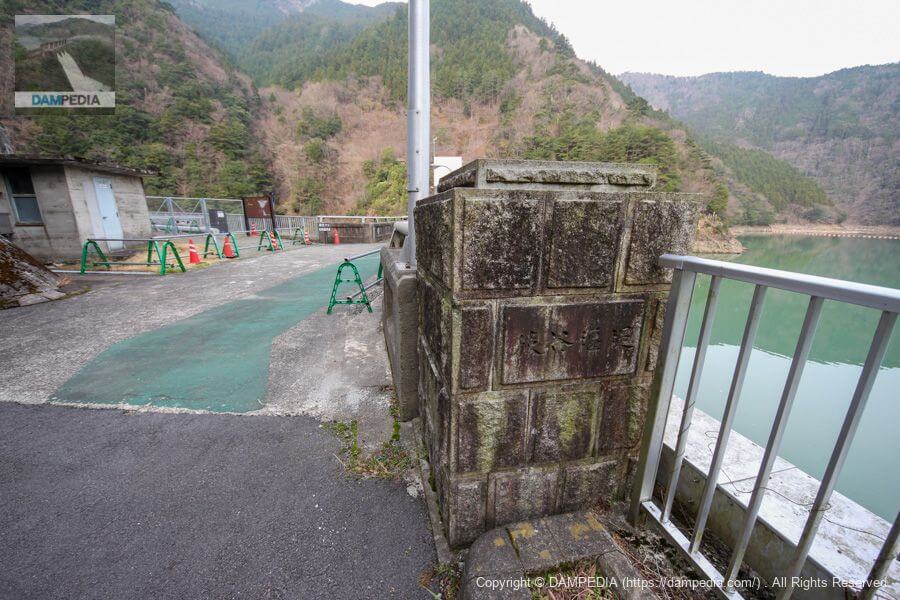
nameplate on the main pillar
The nameplate on the main pillar reads "SarutaniweirThe words "The.
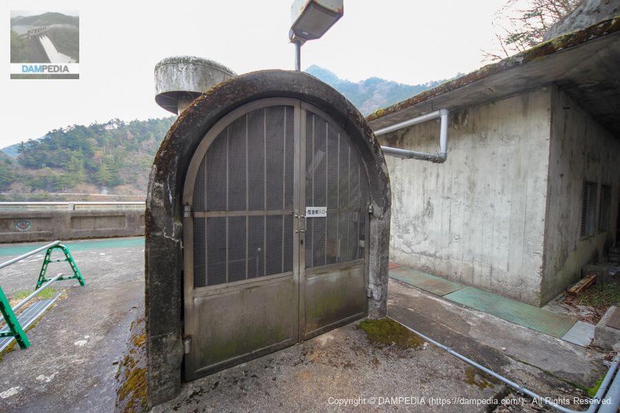
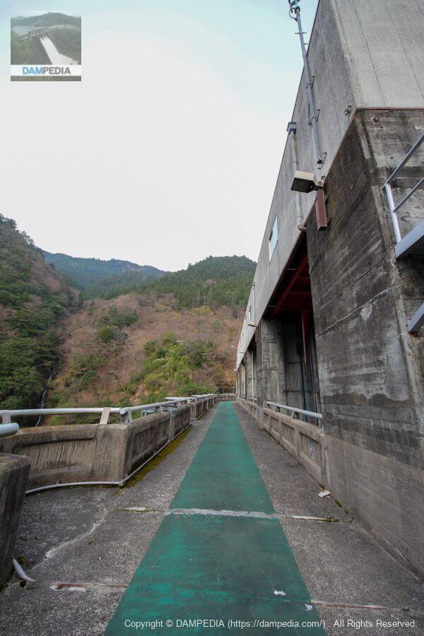
entrance to the audit corridor
This is another austere-looking audit corridor entrance.
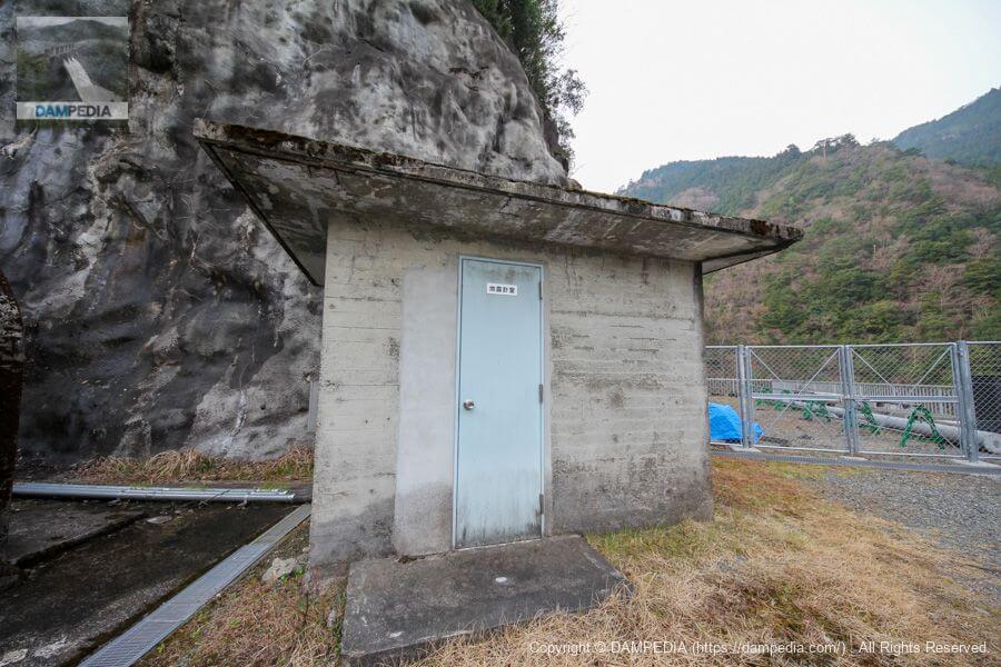
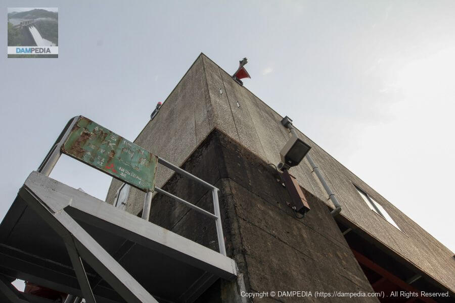
Seismograph Room
The seismograph room is located next to the entrance to the audit corridor.
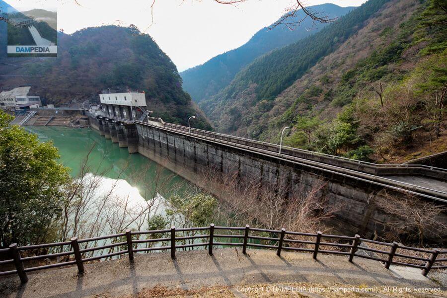
Downstream view of the levee from the left bank
Finally, we catch a glimpse of the smoldering downstream face. However, because of the fence, we can only view it from a slight profile.
View of Crestgate Pier
It is a stately and sturdy top end.
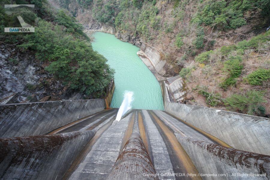
View of the crest gate from the top
The crest is equipped with four 10.5m x 7.5m two-stage roller gates.

View downstream from the top
It is also equipped with one Φ1050mm jet flow gate as a conduit gate. The maximum discharge rate is 16.3 m3/s.
The Kumano River turns at a right angle to the left just below the embankment, and there is no road, so it is not possible to look up at the embankment from downstream.
incidentallyKumano Riverbut when the river was first designated as a first-class river, it was calledriver in which worshippers wash their hands (and rinse their mouth) prior to entering a shrineThe name "Kumano River" was officially changed in 1998, as the name "Kumano River" had been established locally.
Also, to complicate matters, in Gojo CityMilky Wayand furthermore, in Totsukawa VillageTotsukawaTherefore, this river has several names for one river.
Gate Pier nameplate
Another austere-looking nameplate is affixed to the railing of the gate piers.
Downstream view of the levee from the right bank
It would be nice if we could go a little further downstream, but this is the limit on the right bank side as well. But the mossy bank looks very nice.

View of the top edge from the right bank
Deep in the mountains and with the time as early as 8:30 a.m., we have the embankment all to ourselves.
View of the upstream face of the embankment from the right bank on the way to the observation area
According to the local information sign, there seems to be a viewing area on the right bank, so we decide to climb up.
View of the downstream face of the levee from the picnic area on the right bank
We have arrived. It is not a viewing plaza, but a picnic area a little further downstream...well, that's about it. If possible, we would like to see the levee maintained so that we can see the levee properly...!

Unusually for a dam under the jurisdiction of the Ministry of Land, Infrastructure, Transport and Tourism, the Sarutani Dam is a water use-only dam that does not have the purpose of flood control. The project was originally initiated as a prefectural project, but due to the large scale of the project, including changes to the watershed, it was decided that the project would be carried out under direct control.
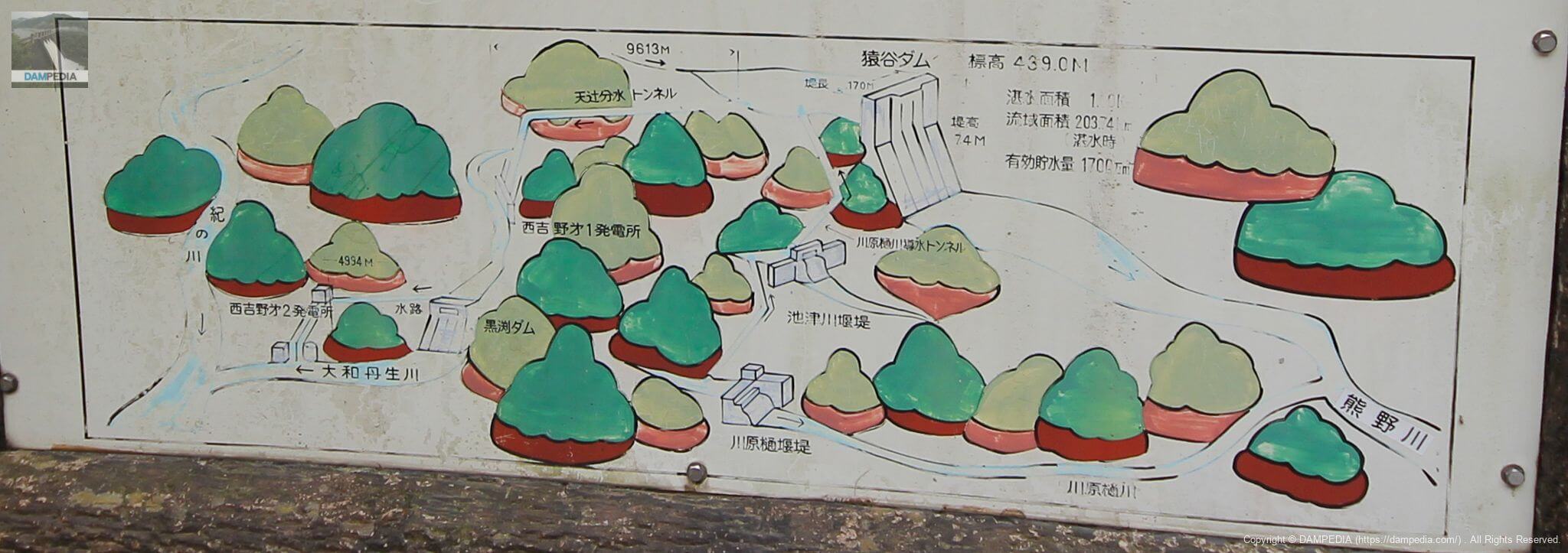
In addition to the inflow from the main stream of the Kumano River, water is taken from the Kawahara-Hi River, which is a right tributary of the Kumano River downstream of the dam, and from its tributaries, the Ikezu River, Oe Valley, and Kirikidani, and is then conveyed to the dam lake for storage through the Kawahara-Hi River water-conducting tunnel.
On the other hand, the Amatsuji Diversion Tunnel (also called the Sakamoto Diversion Tunnel) changes the basin to the Yamato Tanbo River in the Kino River system, and after power is generated at the Nishi-Yoshino No. 1 and No. 2 power plants using a 300m drop, the water is used for irrigation of the Kino River.
It is complicated to explain in writing, so it may be quicker to look at the diagram in the photo on the local sign.
Although the Kumano River does not have a single dam with flood control functions, it continues to respond to the demands of the times by lowering its reservoir level and securing available capacity on a trial basis in order to reduce the amount of water released during floods in response to frequent major floods and other damage.
The Sarutani Dam is active in complex irrigation and power generation, and we hope to see more and more of it in the future...it was such an ironic dam.
Extra Photos
I was heading for the Ikezu River Intake Dam from the Sarutani Dam to see the 16.8 m high dam, but the damage caused by the flooding in the Kii Peninsula was much worse and more serious than seen on TV. (We could not reach the Ikezu River Intake Dam due to road closures.)
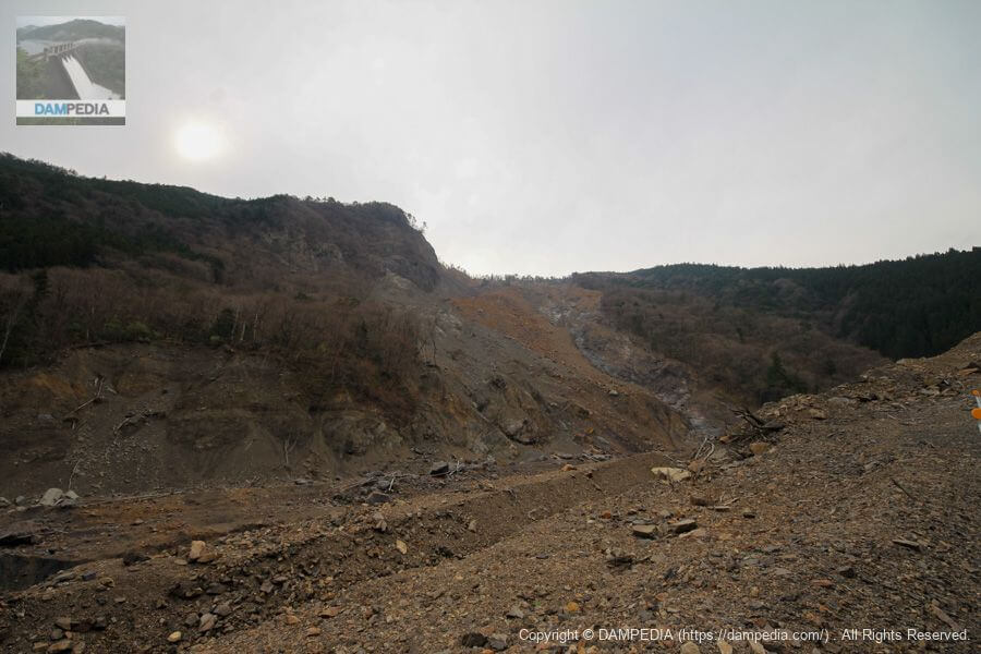
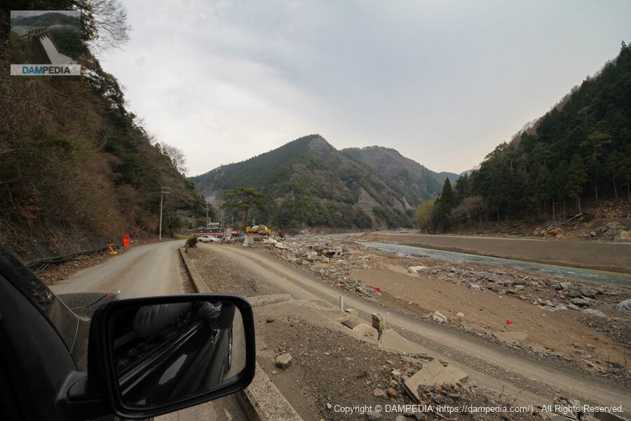
It had been a year and a half since the Kishu Flood, and I was speechless at the severity of the damage. However, the local people are still working hard for recovery, and at the roadside station Totsukawa-go, a pamphlet titled "Record of the 2011 Typhoon No. 12 'Kii Peninsula Flood' - Totsukawa Village Flood Damage" was on sale, which I purchased to support the recovery efforts. I am not sure if it is still being sold as I write this article, but if it is, I would recommend purchasing it.
Sarutani Dam Specifications
The watershed area is based on local signage. As a supplement from the local signboard, the overflow crest is 425.5 m E.L, the full water level is 436.0 m E.L, the minimum water level is 412.0 m E.L, the effective water depth is 24 m, the maximum diversion is 16.7 m3/s, and the planned flood discharge is 2.060 m3/s.
| Location | Tsujido Owada, Oto-machi, Gojo City, Nara Prefecture |
| River Name | Shingu River System Kumano River |
| Objective | N (unspecified water, water for river maintenance) P(Power generation) |
| Model | G(gravity-fed concrete dam) |
| Bank height | 74m |
| Bank length | 170m |
| Dam volume | 174,000m3 |
| Watershed Area | Flood: 203.74 km2 (Direct: 82.85 km2 Upstream area of Kuo Dam: 120.89 km2) Flat water: 215.18 km2 (direct: 82.85 km2 indirect (Kawarahi River) basin: 132.33 km2) |
| Reservoir area | 100 ha |
| Total storage capacity | 23,300,000m3 |
| Effective water storage capacity | 17,300,000m3 |
| Dam operator | Kinki Regional Construction Bureau |
| Main body constructor | Nishimatsu Construction |
| Year of launch | 1950. |
| Year Completed | 1957 |
| Name of Dam Lake | Sarutani Reservoir |
Other facilities/observations
| Parking lot | ○ |
| Toilet | ○ |
| Park | ○ |
| PR Exhibition Hall | × |
| Fishing | ○(Except in prohibited areas, entry fee required) |

Comment