
Date of interview: Friday, August 16, 2013
On this day, I was back home with my wife's family for the Obon vacation. I decided to visit a dam I had not yet visited in the Seino region of Gifu Prefecture, so I first went to the Fujikogawa Dam and then moved to this Ijira Reservoir. Both dams are a bit far from each other, but according to the Exif record, it took me about an hour to get there.
The name "Ijira" is a little unusual, but it is said that the area was once called "Ishimura," meaning "stone puddle," because there were many stones in the area. (There are various theories).
Downstream Plaza
I wrote that it is a plaza, but it actually looks like a bus turnaround area. There is a bus stop called Ijirako-muchi.

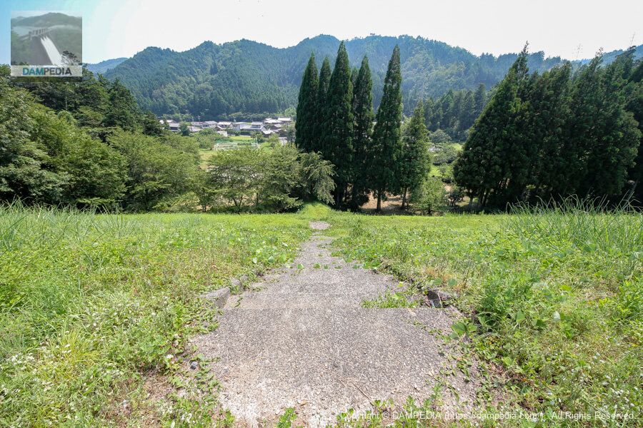
Path to the downstream face of the dike
There is a path leading to the embankment, although it looks like a footpath. You don't have to go this way, but you can get to the right bank by following the prefectural road, but I dare you to choose this path.

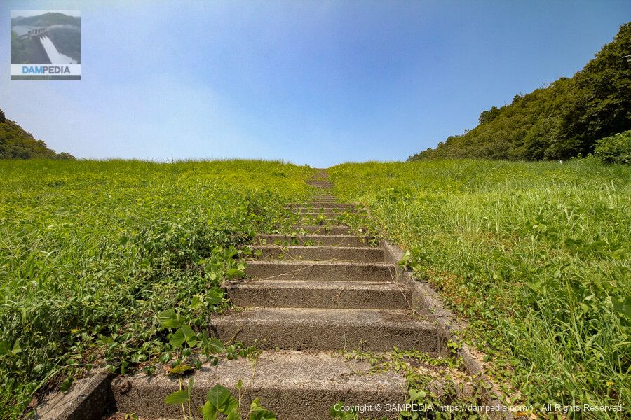
Levee stairs
There did not seem to be anything in particular that was off-limits, and the stairs were free to ascend and descend.
Looking toward the right bank from the stairs on the downstream side of the embankment
Standard earth dam. It is not a river bank.

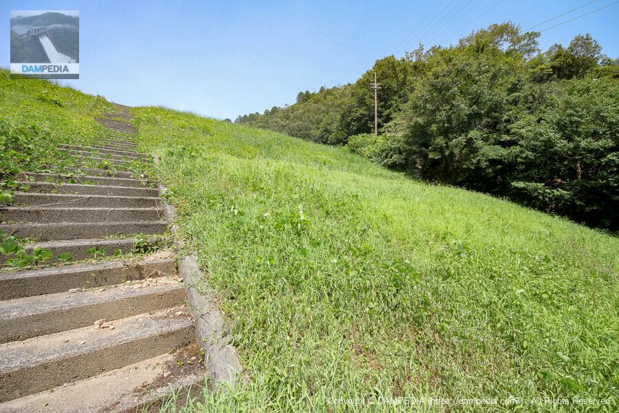
Looking toward the left bank from the stairs on the downstream side of the embankment
As expected, the grass is growing since it is mid-summer, but in this situation, mowing is probably done frequently on a regular basis.
Looking toward the right bank from the top
We climbed up to the top edge. Of course, the top edge is also free for walking.

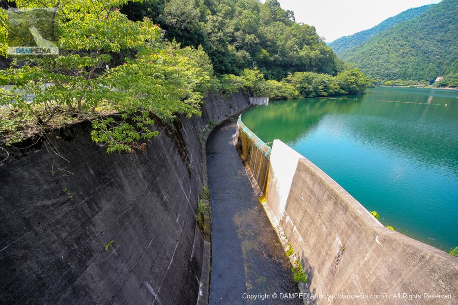
View of the levee on the reservoir side from the top edge
The reservoir side is a slope protection construction with concrete blocks. Seismic work seems to have been done around 2016, so the atmosphere may be a little different now.

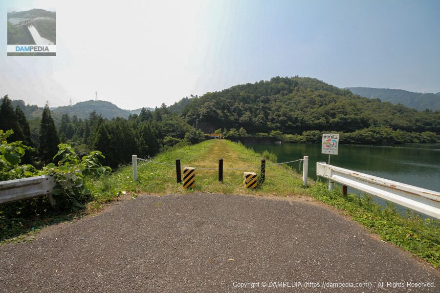
View of the top edge from the left bank
Naturally, the top edge is closed to automobile traffic.
Welcome to Lake Ijirako
The reservoir name of Ijira Reservoir is Lake Ijira, and this name is more readily understood by locals and fishermen. The character in the lower right is Natchol-kun.
Speaking of Lake Ijirako, you need to be a little careful because its name is similar to Irago, which is located on the Atsumi Peninsula in Aichi Prefecture.
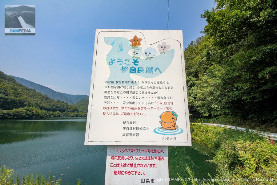
The origin of Natchol-kun's name was written on the website of Yamagata City.
Natchol-kun" is "a charming persimmon monster (kai) beast that appears in Lake Ijirako. (The persimmon is based on the dried persimmon (Ijira daijimi), a specialty of the Ijira region.) The name "Natchor-kun" comes from both "Kaki-ga-naruchoru (persimmon becomes)" in the Gifu dialect and "natural" in English. Since April 2011, he has been appointed as a tourism ambassador by the "Yamagata City Tourism Association" and has been promoting tourism at various events.
https://www.city.yamagata.gifu.jp/site/yamanavi/1116.html
Looking down the stairs from the top
The embankment height is 18 meters, but it still seems high.
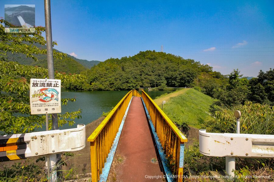
Bridge over the spillway
A humanitarian bridge is built over the residual water discharge from the top end to the prefectural road. The coloring is quite gaudy.
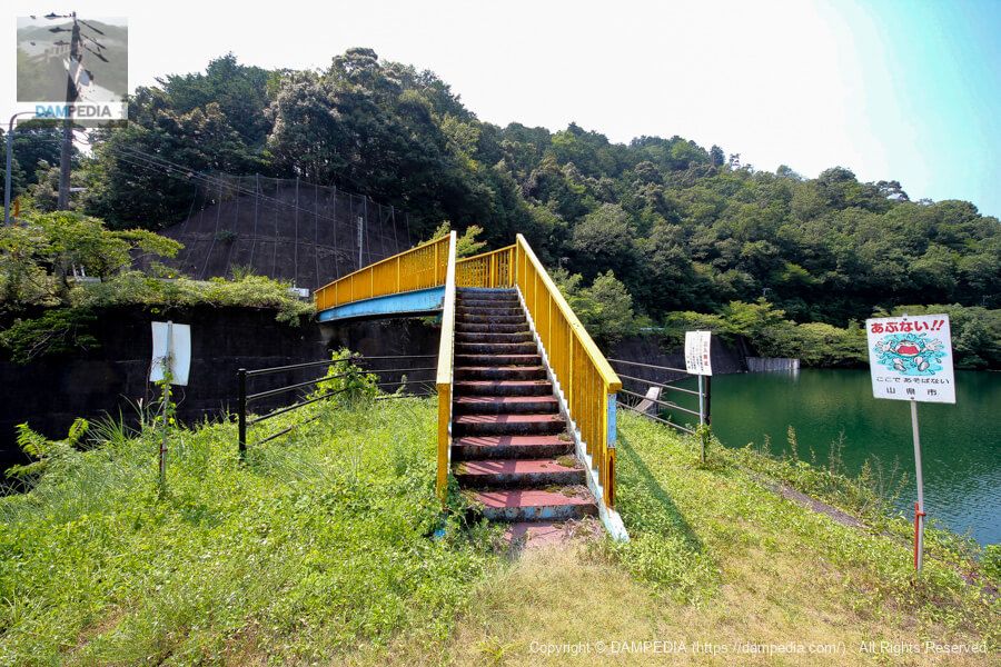
tertiary reference point
A third-class reference point was established at the foot of the Humanitarian Bridge.

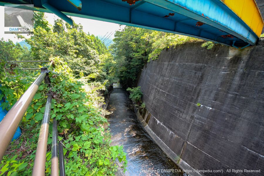
View of the conduit from under the Humanitarian Bridge
You can see the after-water discharge from under the Humanitarian Bridge. There is not much, but you can see the water flowing.
View of the overflow portion of the spillway from the Humanitarian Bridge
This is a side channel type overflow discharge, which is common in earth dams and rockfill dams, but I would like to see what the overflow discharge looks like when the water level is low. Usually, the overflow portion is rounded, but in the case of Ijira Reservoir, it looks as if the reservoir side is cut off vertically.
Ijira Tameike Overflow Painting
The water was full on that day, but we captured the overflow on video.
View of the embankment from the right bank
The name of the humanitarian bridge is Ijira Bridge. It is a humanitarian bridge that utilizes flashy yellow and light blue colors, but when seen in this way, it seems to match the green color of the embankment and trees.
stairs
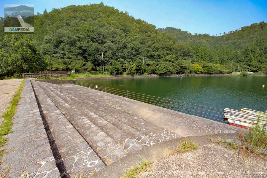
The upstream end of Ijira Tameike is maintained as a park, with steps like these.
duck
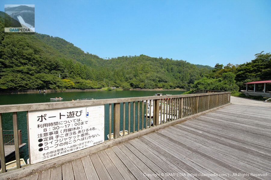
Several ducks were nice on the stairs. There are also swan boats and other small boats for boating at Ijara Tameike. On this day, families and couples were boating. Incidentally, in 2016, Ijira Tameike was certified as a "holy place for lovers" by the NPO Regional Activation Support Center.
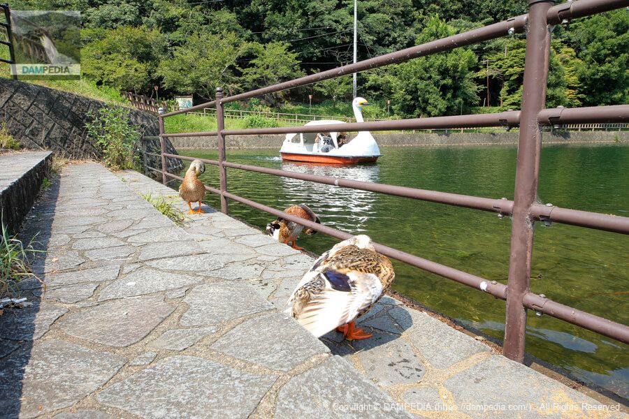
boating
Not only boating, but also wakasagi fishing and other activities can be enjoyed.
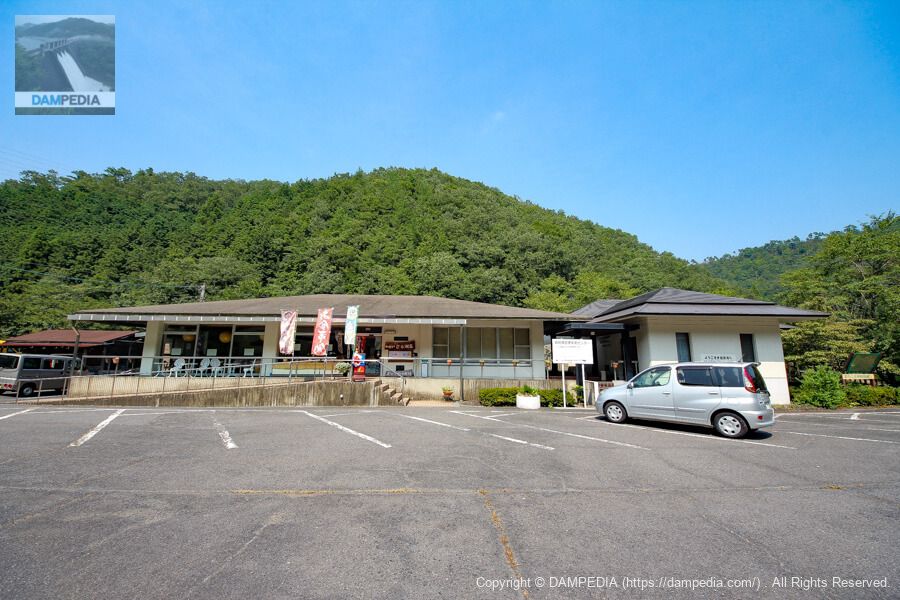
Lake Ijirako Villa (now Love Lake)
以前はいじら湖荘というお店だったのですが、恋人の聖地の認定を受けてオシャレに大規模改装されて「ラブレイク」というおじさんが行くにはちょっと恥ずかしい名称になってしまいました。飲食もカフェになりましたので、若い女性なども入りやすくなったのではないでしょうか。(あれから再訪していないので写真差し替えたいですね😓)
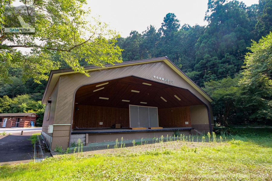
Lake Ijirako Stage
This one seems to exist, and from what I can see on SNS, Hatsune Miku fan events are also held there. I think I saw a poster of Hatsune Miku at this time as well.
View of the boat ramp and the upstream face of the embankment from upstream on the left bank
The area around the lake was also like a walking trail, and there were pavilions and other places to take pictures.
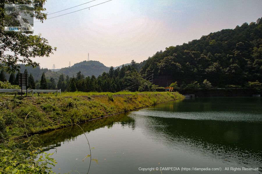
View of the upstream face of the embankment
The levee seems to blend in with the landscape.

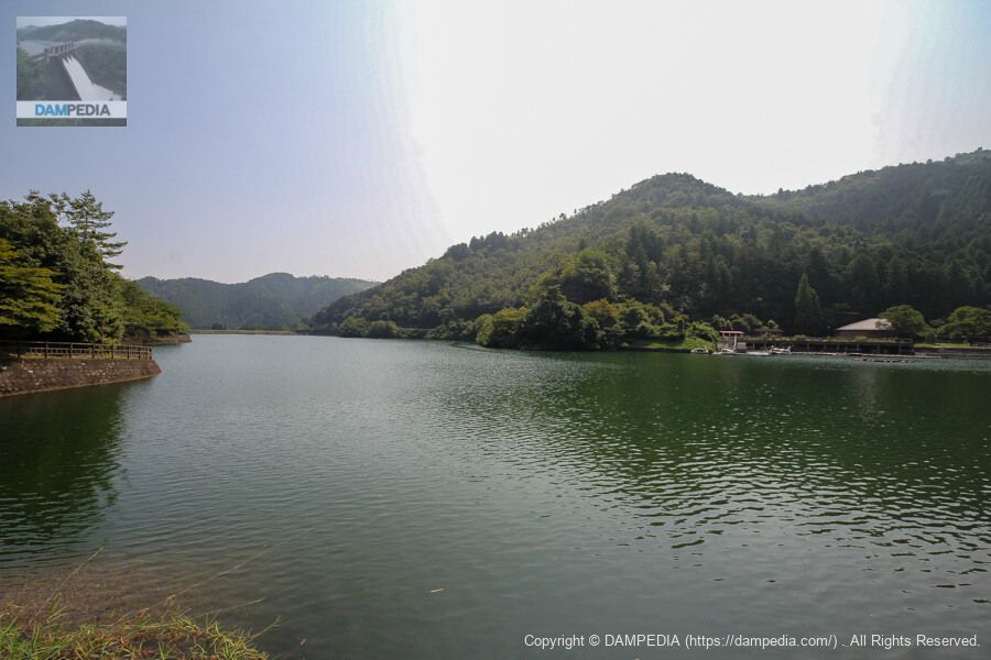
Looking upstream from the left bank
We circled the reservoir by car. The embankment itself is an ordinary earth dam, but it was the Ijara Reservoir, which is a sacred place for lovers and a tourist attraction.
Ijira Reservoir
| Location | Nagataki, Yamagata City, Gifu Prefecture |
| River Name | Kiso River System Ijira River |
| Objective | A (irrigation water) |
| Model | E(earth dam) |
| Bank height | 18m |
| Bank length | 126m |
| Dam volume | 72,000 m3 |
| Watershed Area | 5.4 km2 |
| Reservoir area | 10 ha |
| Total storage capacity | 540,000 m3 |
| Effective water storage capacity | 540,000 m3 |
| Dam operator | Gifu prefecture (Chuubu area) |
| Main body constructor | - |
| Year of launch | 1958 |
| Year Completed | 1966 |
| Name of Dam Lake | Lake Ijirako |
Other facilities/observations
Ijara Tameike is a tourist attraction and has everything you need except for an exhibition hall. Fishing is also available at Love Lake, where you can rent equipment.
| Parking lot | ○ |
| Toilet | ○ |
| Park | ○ |
| PR Exhibition Hall | × |
| Fishing | ○ |
Comment