
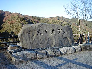
Location: Hagiwara-cho, Gifu Prefecture, Gero City, Gifu Prefecture, Japan
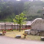
stone monument

From the direction of Nagoya, take National Route 41 past Gero, follow the signs, and follow the road the rest of the way.
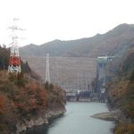
View of the dam lake from the right bank of the embankment
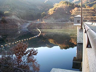
This time, the photo shoot is a struggle against backlighting. I was reminded once again that it becomes difficult to take pictures if you don't consider the time and direction.... The parapets of the embankment were frozen, probably because it was late autumn.
View of the dam lake from the right bank of the embankment
It is a new dam and is very beautifully maintained. The way this dam is maintained reminds me of the Kise Dam in Toyota City, Aichi Prefecture. Come to think of it, the shape of the embankment is very similar, and it looks like a larger version of the Kise Dam. Is this dam also designated as a "dam open to the community"?
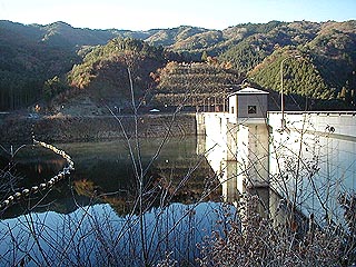
View of the embankment from the right bank
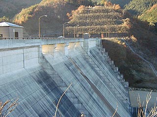
View of the levee from downstream
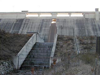
It was backlit to the hilt, but I managed to process it. It was backlit to the hilt, but I managed to process it.
dam characteristics
| da mu | form (something takes) | gravity-fed concrete dam |
|---|---|---|
| Objective | Flood control, agricultural disaster prevention, unspecified water, river maintenance water, water supply water | |
| Bank height | 42.5m | |
| Bank length | 238m | |
| levee length and width | 4.0m | |
| Dam volume | 128,000m3 | |
| Dam top elevation | EL697.5m | |
| Planned high water flow rate | 51m3/s | |
| Maximum discharge | 39m3/s | |
| Planned Flood Flow | 180m3/s | |
| casting off one's attachments (in Zen) method of facilities equipment | ordinary flood discharge | Natural regulation by orifice 2.45mD*2.45mB*1 gate |
| emergency flood discharge | Crest Free Overflow 1.4mH*12.5mB*4 radius | |
| Low water discharge system (Functional Maintenance) | Jet Flow Gate Φ250mm | |
| savings water (esp. cool, fresh water, e.g. drinking water) pond | Watershed Area | 4.4km2 |
| Reservoir area | 2 ha | |
| Total storage capacity | 450,000m3 | |
| Effective water storage capacity | 340,000m3 | |
| Composting capacity | 110,000m3 | |
| design flood level | EL695.7m | |
| surcharge water level | EL694.3m | |
| normal level of water supply | EL687.1m | |
| minimum water level | EL681.2m | |
| Name of Dam Lake | Hagi Lake | |
| River Name | Kiso River System Ohgadogawa River | |
| Year of launch | 1988 | |
| Year Completed | 1998 | |
Other facilities/observations
| Parking lot | ○ | The parks and such are very well maintained, but Even though it's close to the national highway, the access road isn't very good. I doubt there will be many tourists. Also, for a narrow access road, the I felt that the dam site was over maintained and not a place to enjoy nature. |
|---|---|---|
| Toilet | ○ | |
| Park | ○ | |
| PR Exhibition Hall | × |
Comment