
Dam dedicated to power generation along Route 19.
Location: Urasaka, Ikusaka-mura, Higashi-Chikuma-gun, Nagano Prefecture
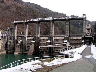
View of the levee from the downstream side of the left bank
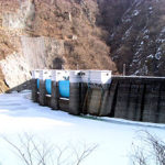
It was not on the map, but it is easily found because it is on Route 19. The flat dam has five roller gates.

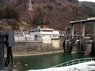
Power generation facility (?) from left bank View of power generation facility (?) from left bank
dam characteristics
| Model | gravity-fed concrete dam |
| Objective | generation (e.g. power) |
| Bank height | 20m |
| Bank length | 87.8m |
| Dam volume | 17,000m3 |
| Watershed Area | 2,466.7 km2 |
| Reservoir area | 58 ha |
| Total storage capacity | 3,033,000m3 |
| Effective water storage capacity | 1,273,000m3 |
| River Name | Shinano River System Saigawa River |
| Year of launch | 1953. |
| Year Completed | 1957 |
| Access to D@M | Get off at the Nagano IC of Joshinetsu Expressway and turn left at the Nagano Interchange signal intersection→turn north on Prefectural Route 35→turn left at the signal intersection with National Route 19→take National Route 19 in the direction of Toyoshina→enter Ikusaka Village and drive for a while and you will see it on your left |
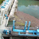
Other facilities/observations
Hmmm. Sometimes there is nothing special about a dam that is worth mentioning. If I knew more about power generation, I would think there is something...
| Parking lot | × |
| Toilet | × |
| Park | × |
| PR Exhibition Hall | × |
Comment