
Date of interview: Saturday, August 03, 2013
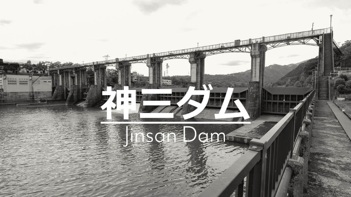
This is the Jinzan Dam, the third son of the three Jinzu River brothers. This dam is located at the downstream end of the Jinzu River.
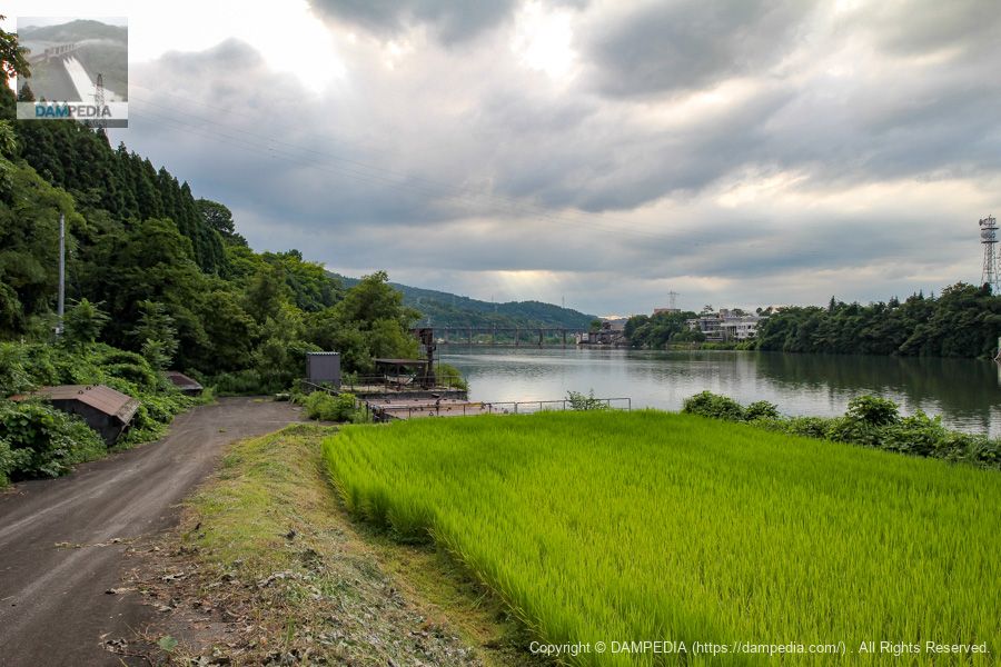
Looking upstream from the left bank
The upstream face can be captured, although it is a little farther from the dike.
Incidentally, as I was checking the photos again, I realized that the facility at the far end of the road on the left is a spare gate for the Jinzan Dam. At the time of my visit, I had no knowledge about it and thought it was completely unrelated to the Shin-san Dam, but like the Kawaguchi Dam in Tokushima Prefecture and the Akiba Dam in Shizuoka Prefecture, it is also called a floating gate, in which a gate is floated in the reservoir and towed to the embankment.
When I looked at this photo again, I wondered if it was a water intake for agricultural use. However, there was nothing that looked like a waterway, and a question mark was floating around in my brain, but then I looked at the Google Maps street view and suddenly realized.
Two door bodies are placed on the left side in addition to the one on the shore. There is also a boat placed in the back, perhaps for towing.
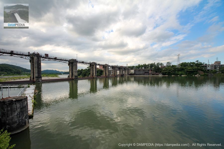
Upstream view of the embankment from the left bank
Like the third son, it is the smallest dam of the three with an embankment height of 15.5 meters.
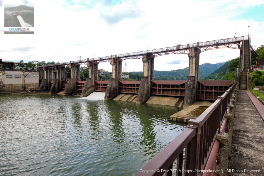
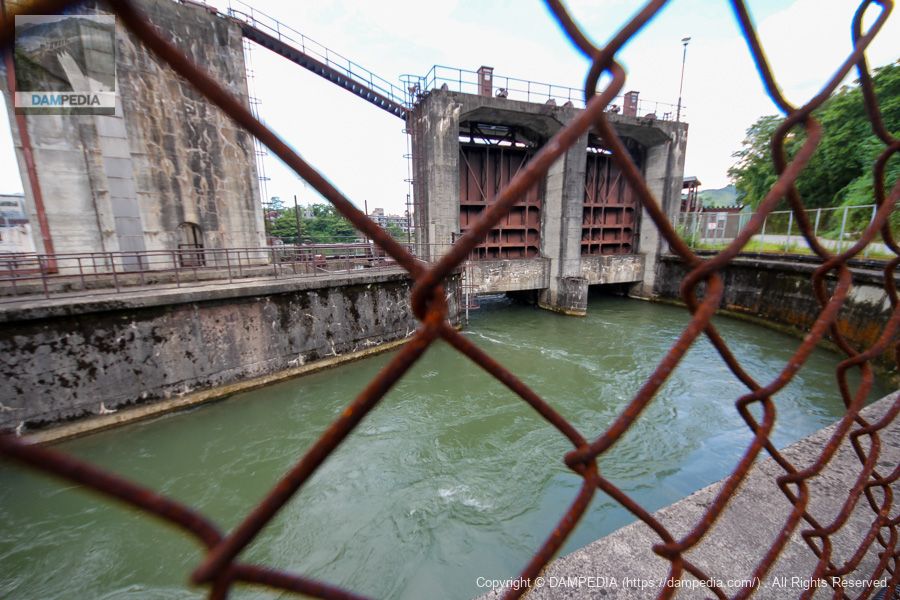
Looking downstream from the left bank
Even though it is a small dam, it is quite austere, just like the Kami I and Kami II dams. The same is true of all the metal parts, which are all brown.
Water taken in from the intake
The water taken in from the left bank side is used to generate up to 7,100 kW of electricity through a culverted channel, which is located approximately 1.7 km downstream in a straight line at the aptly named Jinzu River Third Left Bank Power Plant. The Jinzu River Third Left Bank Power Plant is located on the left bank of the river, hence the name "Jinzu River Third Left Bank Power Plant. The name is easy to understand.
View of the sediment pond from the top
The top edge is accessible on foot. It is like looking down from above at the location in the photo above.

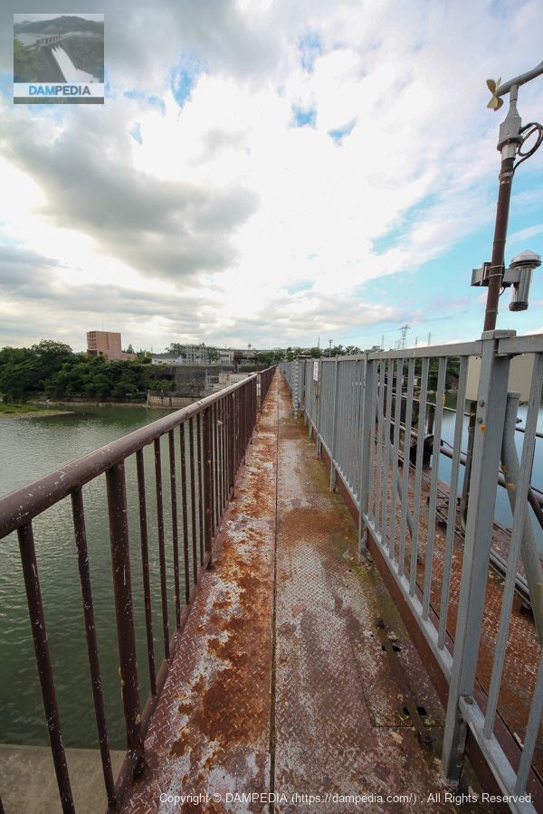
View of the top edge from the left bank
It is now possible to cross to the other side of the Shin-san Dam on foot. The Kami San Dam, like the Kami I and Kami II dams, is surely used by the local people as a humanitarian bridge.
Incidentally, on the right bank, which is the opposite bank from the location in the photo, there is Kasuga Hot Spring and a complex facility called "Osawano Wellness Resort Windy" that includes hot springs, swimming pools, verde, and training gyms.
View of the reservoir from the top
You can't look directly into the reservoir from the top of Shinzo Dam because of the gate winder and other equipment upstream, but I should have taken more pictures of the gate winder and other equipment💦.

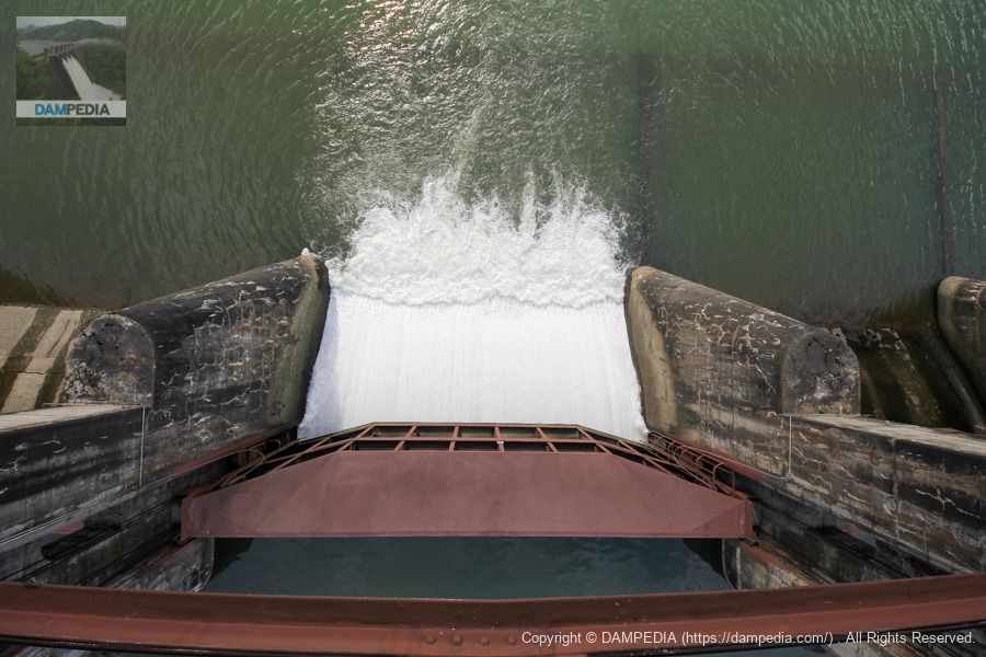
View of the gate discharging from the top edge
Only one gate was discharged, so we looked down on the gate from directly above.
Shinzo Dam discharge animation
We also recorded a video of the discharge from Shinzo Dam, which is a short video of less than one minute, but we hope it conveys the atmosphere.

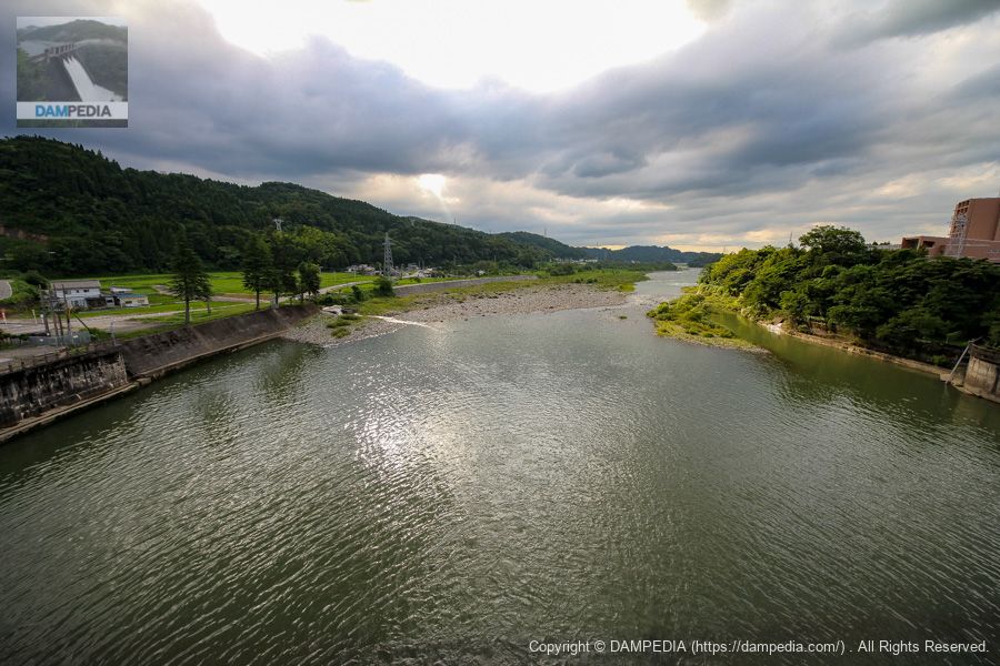
Looking downstream from the top
The Toyama Plain spreads out from this area, and the topography tells us how much flood damage occurred in the past because the Jinzu River meanders quite a bit when you look at its flow path.
View of the reservoir from the top near the right bank
In addition to the Jinzang Dam, there is another power plant on the right bank of the Jinzu River, which is a dam-type power plant and is called the Jinzang River No. 3 Power Plant.
In addition, water taken from the right bank passes through a channel that combines the Okubo and Shinbo water for agricultural use (multiple water intakes are combined into one to distribute the appropriate amount of water for each use), and produces up to 500 kW of electricity at the Okubo Power Plant located 3.6 km downstream in a straight line.
that (something or someone distant from the speaker, close to the listener)right bank (shore)(The water intake can be seen on the left side of the photo. The one in the foreground appears to be the intake for the Jinzu River No. 3 Power Plant, but the intake upstream (in the back) may be the intake for the combined use of the Okubo and Shinbo water. (Unconfirmed).

The Okubo Power Station was built in 1899 by Toyama Dento Co., Ltd. and was the first hydroelectric power station in Toyama Prefecture and the third in Japan, bringing electricity to Toyama City for the first time. The water used at the Okubo Power Plant is used for the Shinbo water supply mentioned above, making it a very rational and economical way to use water from the Jinzu River.
Looking downstream from the stairs on the right bank
The fact that the lower part of the top passage is constructed of trusses seems to enhance the flavor of this Shinzo Dam. If the top passageway had been made of concrete, it might not have been as appealing as it was.

View of the sedimentation basin from the stairs on the right bank
I still think the front side is for power generation and the back side is an intake for agricultural water. Again, since I left my family in the car, I had to turn around here, but I wanted to take a good look at the right bank side again.
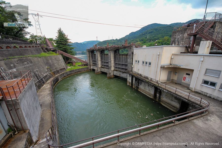
It was the Shinzo Dam that delighted visitors with its stunning collaboration of concrete gate piers and iron top passageways.
Jinsan Dam Specifications
| Location | Suhara, Toyama City, Toyama Prefecture |
| River Name | Jinzu River system Jinzu River |
| Objective | P(Power generation) |
| Model | G(gravity-fed concrete dam) |
| Bank height | 15.5m |
| Bank length | 242m |
| Dam volume | 23,000 m3 |
| Watershed Area | 2,063 km2 |
| Reservoir area | 26 ha |
| Total storage capacity | 1,455,000 m3 |
| Effective water storage capacity | 806,000 m3 |
| Dam operator | Hokuriku Electric Power Co. |
| Main body constructor | Maeda Corporation |
| Year of launch | 1953. |
| Year Completed | 1954 |
| Name of Dam Lake | - |
Other facilities/observations
There are several parking spaces on the left bank. As for parks, there is the Kasuga Kenko Fureai Park on the right bank, but it is not attached to the dam, so it is rated "x". As for fishing, the area from the downstream end of Shinzo Dam to a line connecting a point 360 meters downstream from the downstream end of the dam on the right bank and a point 570 meters downstream from the downstream end of the dam on the left bank is a no-fishing zone.
| Parking lot | ○ |
| Toilet | × |
| Park | × |
| PR Exhibition Hall | ○ |
| Fishing | ○○ (excluding no-take zones) |
Map around Jinzo Dam
Weather around Jinsan Dam
Accommodations that may be close to Jinzo Dam
By the way, the actual facilities where we stayed on this day are as follows.


Comment