
Date of interview: Wednesday, 12/10/2014
Following the Tsugawa Dam, we came to the Kuroki Dam. The name of the dam is not "Kuroki" but "Kurogi. Like the Tsugawa Dam, the Kuroki Dam is also an Okayama Prefecture-operated dam and is the same gravity-type concrete dam, but it is 29 years older than the Tsugawa Dam.
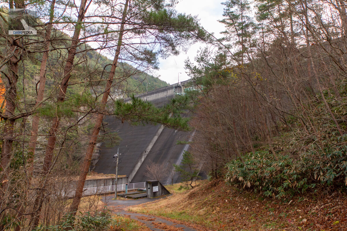
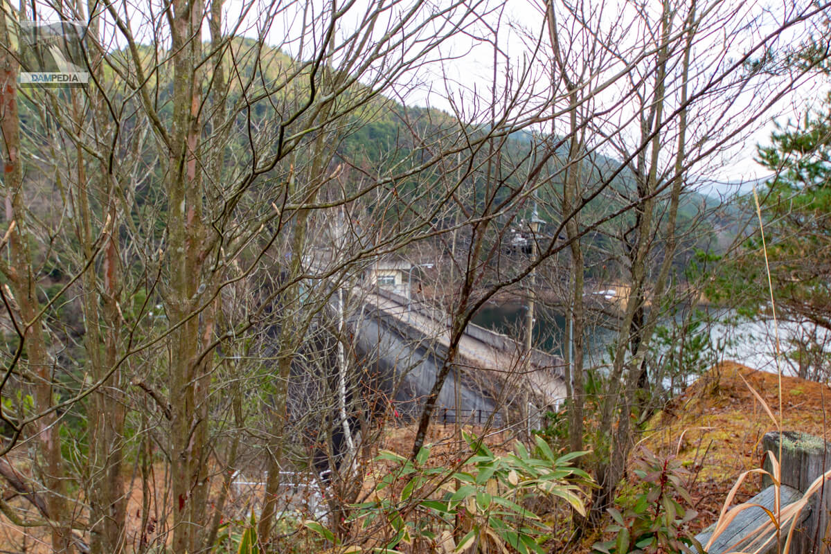
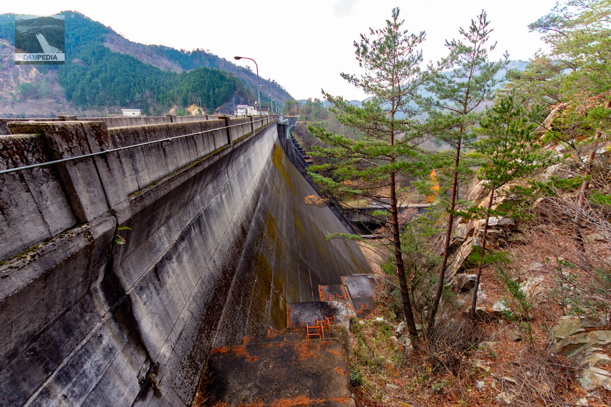
View of the levee from downstream on the left bank
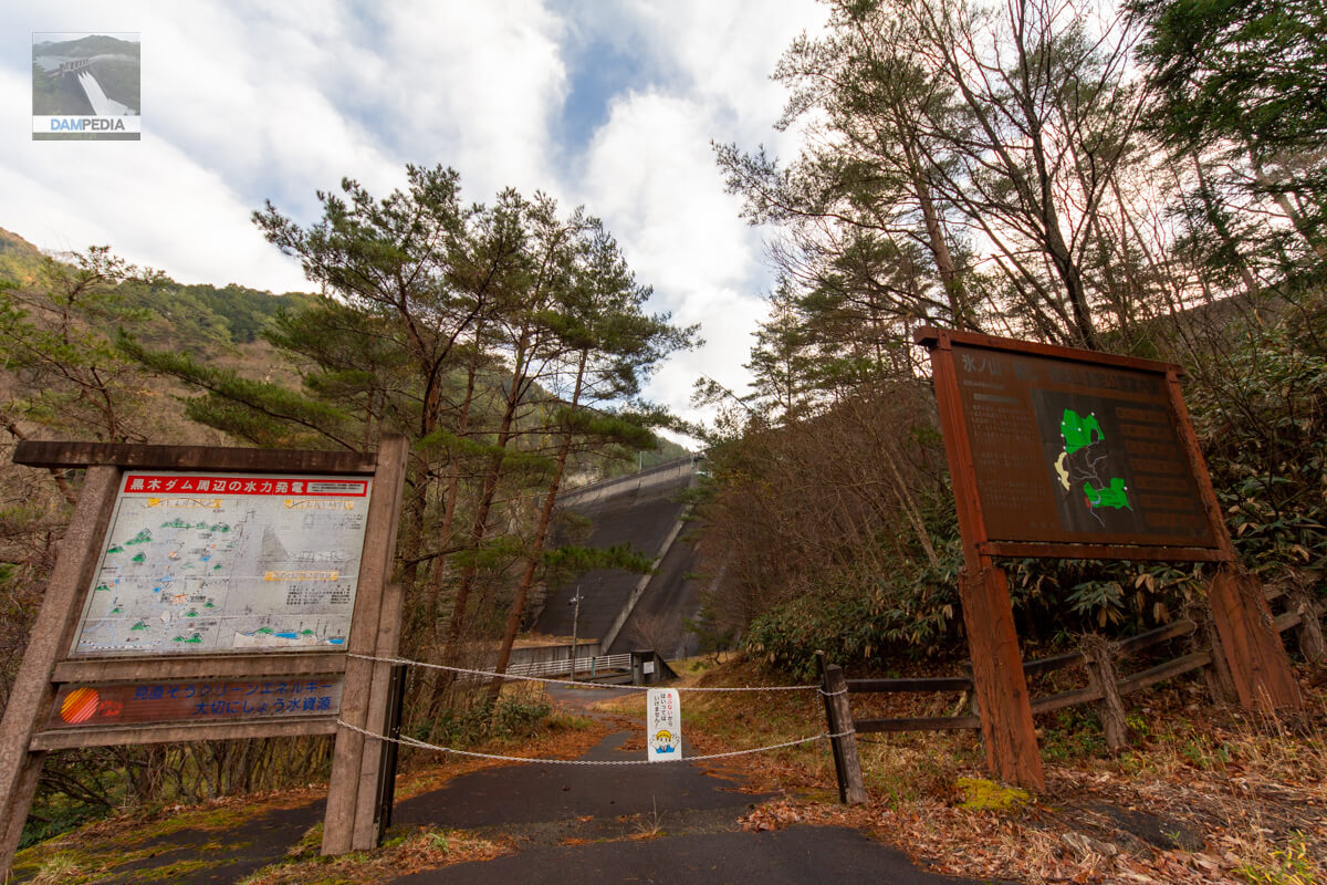
Unfortunately, the area directly downstream from the Kuroki Dam is closed to visitors.
Downstream view of the levee from downstream of the left bank
I tried to take pictures from the off-limits ropes, but the trees blocked my view and this was the best I could do...
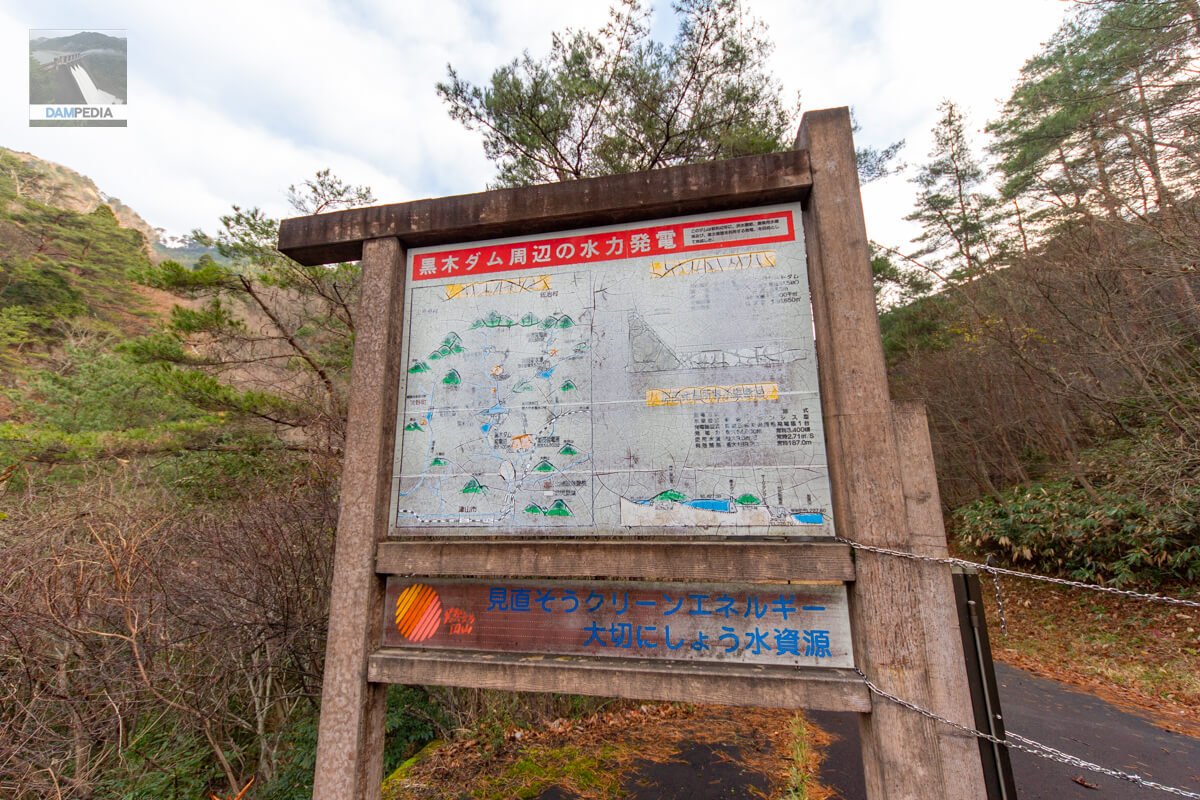
Hydroelectric power generation around Kuroki Dam
At Kuroki Dam, water is pumped to the Kuroki Dam Power Plant (sometimes referred to as the Kuroki Entei Power Plant), a dam-type power plant that generates up to 100 kW of power using water for river maintenance, and to the Kamo Power Plant, a dam canal-type power plant that generates up to 14,000 kW of power via the Kamo Canal.
In addition, up to 5.0 m3 of water is taken from the Kamo River at the Awa intake weir and flows into the Kuroki Dam reservoir via the Awa branch canal.
The purpose of Kuroki Dam is not only power generation, but also flood control, irrigation, and water supply, but this sign is written mainly for hydroelectric power generation.
Incidentally, Google Street View shows that as of 2021, this sign has been removed, leaving only the frame. Also, the trees in the back seem to have been cut down and the view has improved a bit.
Hyonosen-Gozan-Nagisan National Park Guide Map
The upper reaches of Kuroki Dam are a national park rich in nature. There is also a campground upstream of Kuroki Dam.

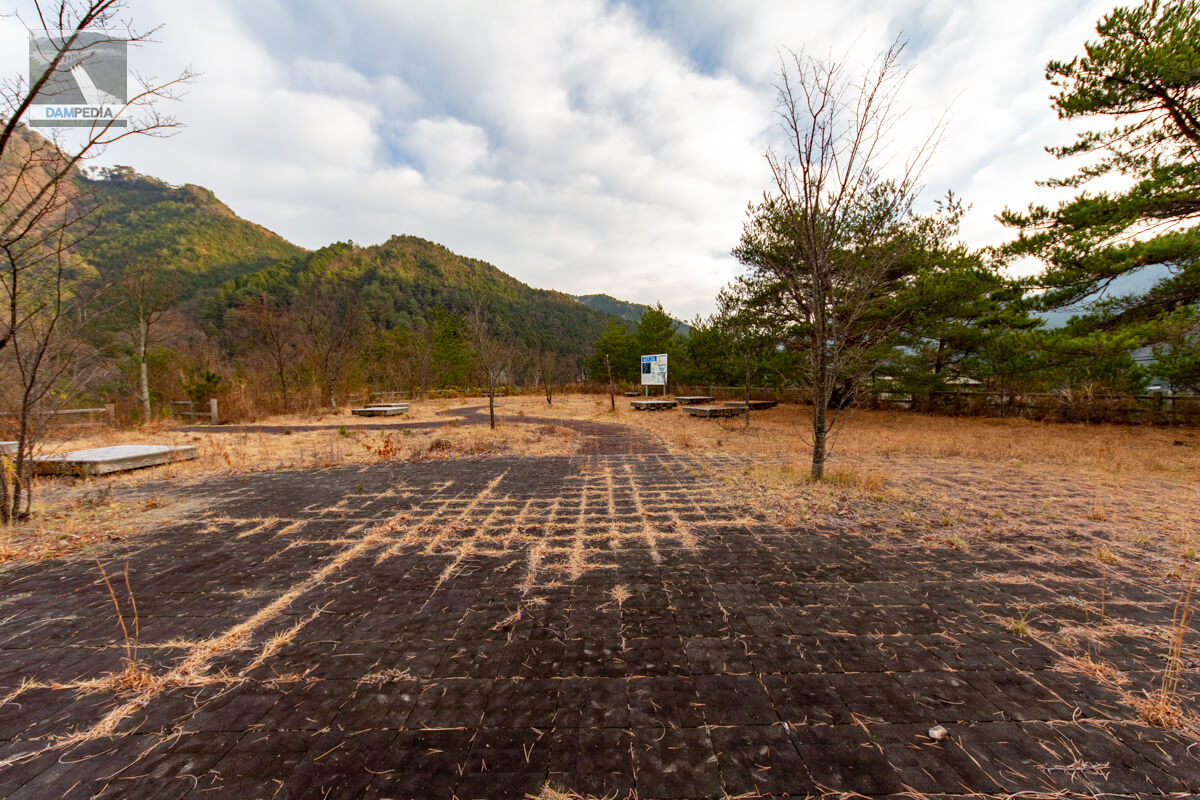
From the left bank observatory...
The levee seems to be visible from the left bank observation platform, but unfortunately, trees are in the way here as well. The photo in the dam handbook suggests that there is a higher vantage point, but at the time I did not understand it well.
Viewing platform
It is a very spacious observatory. There are also benches where you can take a rest. Unfortunately, the trees have grown so thick that it is difficult to see the embankment. The most recent SNS postings about the Kuroki Dam show no photos from this observation deck, so the view seems to be as poor as ever. By the way, could this observation deck be the remains of a plant? I think so from the location and size of the site, but I doubt it.
View of the top edge from the left bank
It may be a little dark and hard to see, but "Kuroki" written on the main pillarweirThe ""is very austere and very nice. The top end of the road is accessible to automobiles because of Prefectural Route 336. However, on this day, there seemed to be construction going on upstream, and dump trucks were coming and going with some frequency.

Looking downstream from the left bank
The dike, born in 1966, is quite austere. The mossy look makes it even better.
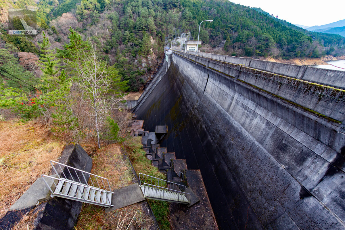
Looking upstream from the left bank
The upstream side of the embankment remains relatively white, probably because it is structurally difficult for rain to hit it.

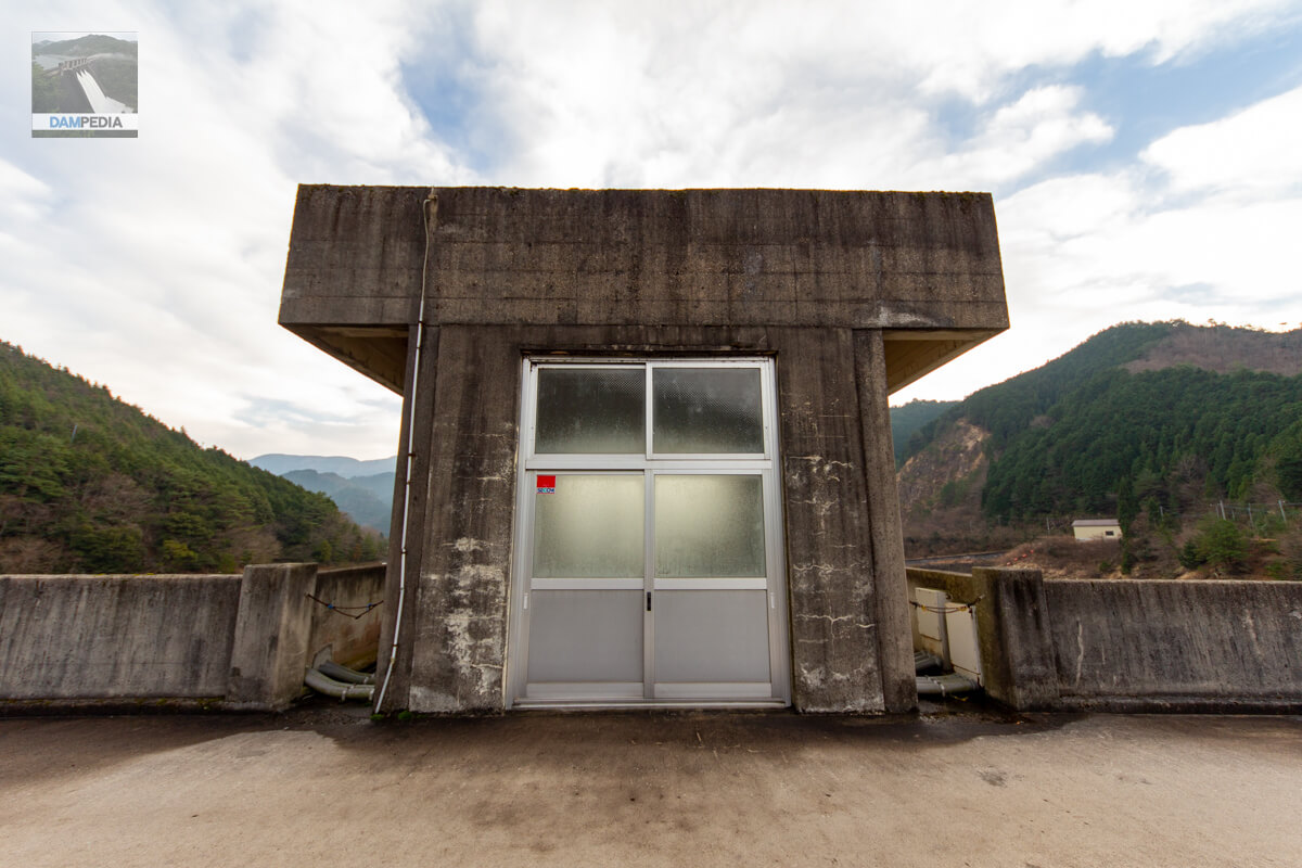
Intake tower operation room
It is a simple T-shaped intake tower.
Mystery valve by the water intake tower
There was a mysterious valve by the intake tower. Is it for draining water stored in the intake tower?

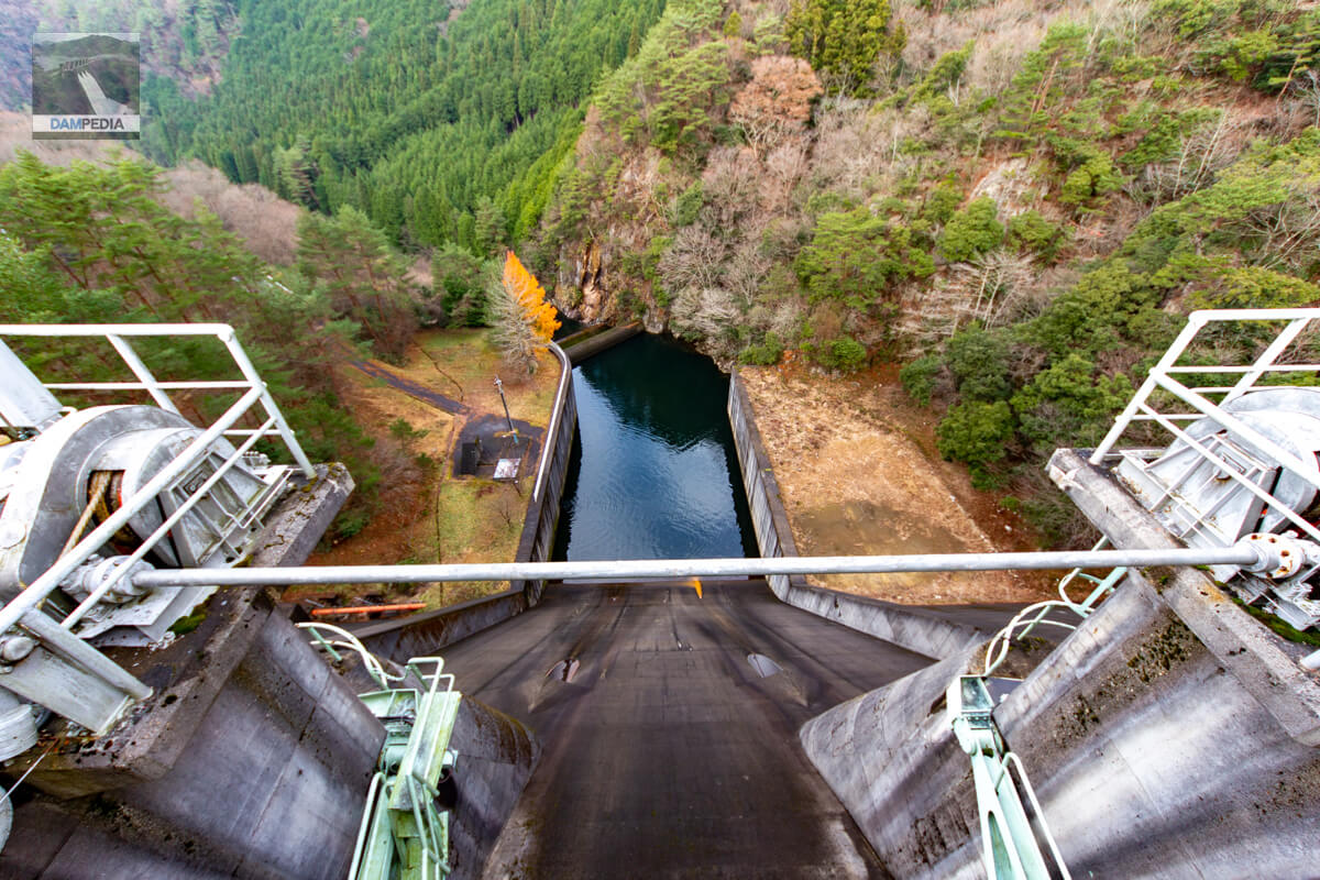
View of the reservoir from the top
The white building on the right is the boatyard, and the incline extends toward the reservoir, which cannot be seen from here.

Looking upstream from the right bank
The surface of the embankment is blackened by water marks, but the rest of the embankment is relatively white and the upstream face does not look very old.

View of the top edge from the right bank
On the right bank, the road makes a right-angle curve.

Looking downstream from the right bank
The downstream side is still better, with a more smoldering silver feel.
Looking downstream from the top
Kuroki Dam has three 7.0m wide by 5.0m high radial gates in the emergency flood discharge and two Φ1,100mm discharge pipes in the normal flood discharge. I thought they were conduit gates since they are officially described as "discharge pipes," but they appear to be orifice gates in terms of location. Which one will it be?
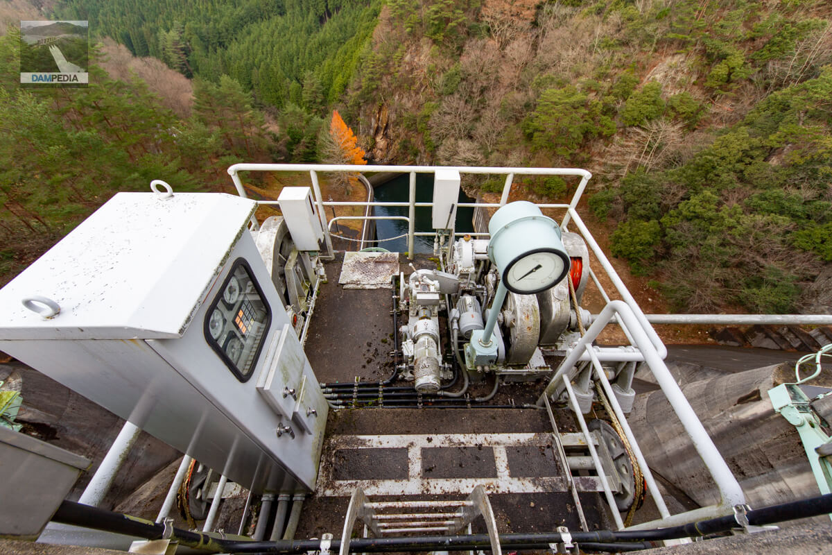
Gate winder
The gate winder is exposed. Personally, I prefer it this way because it offers a better view downstream and the mechanism is easier to understand, but I wonder how it would look from the management side. Even though it will basically be operated remotely, in the event of an emergency, you will probably have to operate the machine side in heavy rain. (I would think it would be rare to operate it on a snowy day, so it should be fine)
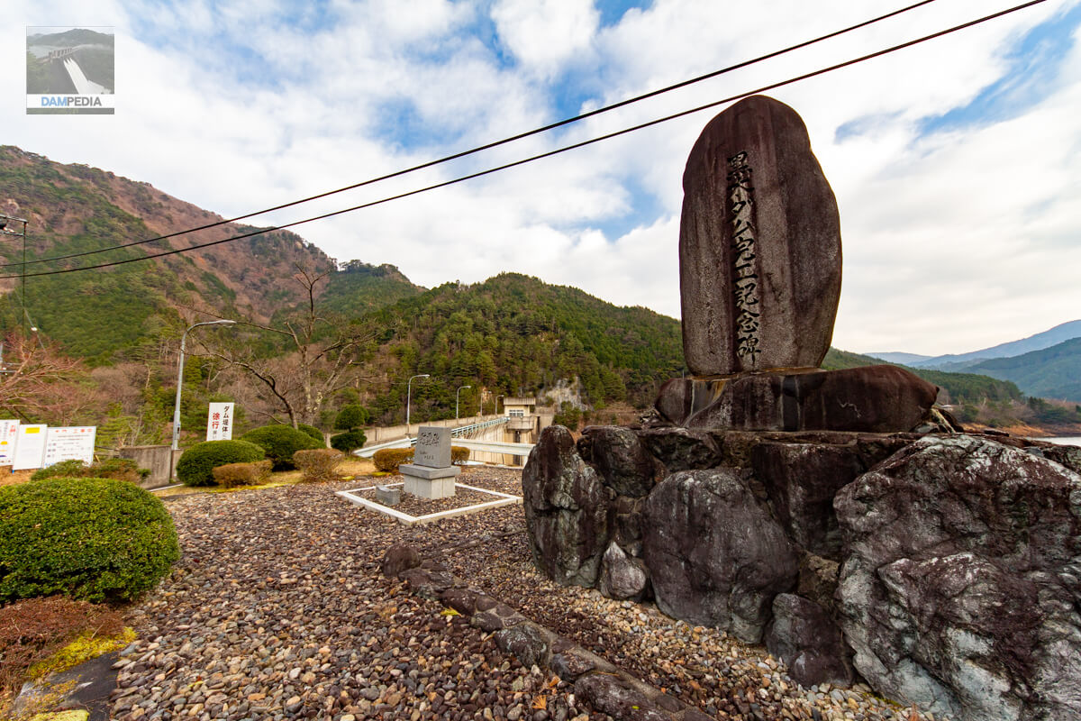
Kuroki Dam Completion Monument and Cenotaph
A memorial and a cenotaph are set up in front of the management office on the left bank, guarding the levee. The monument is inscribed by Takenori Kato, the governor of Okayama Prefecture at that time.
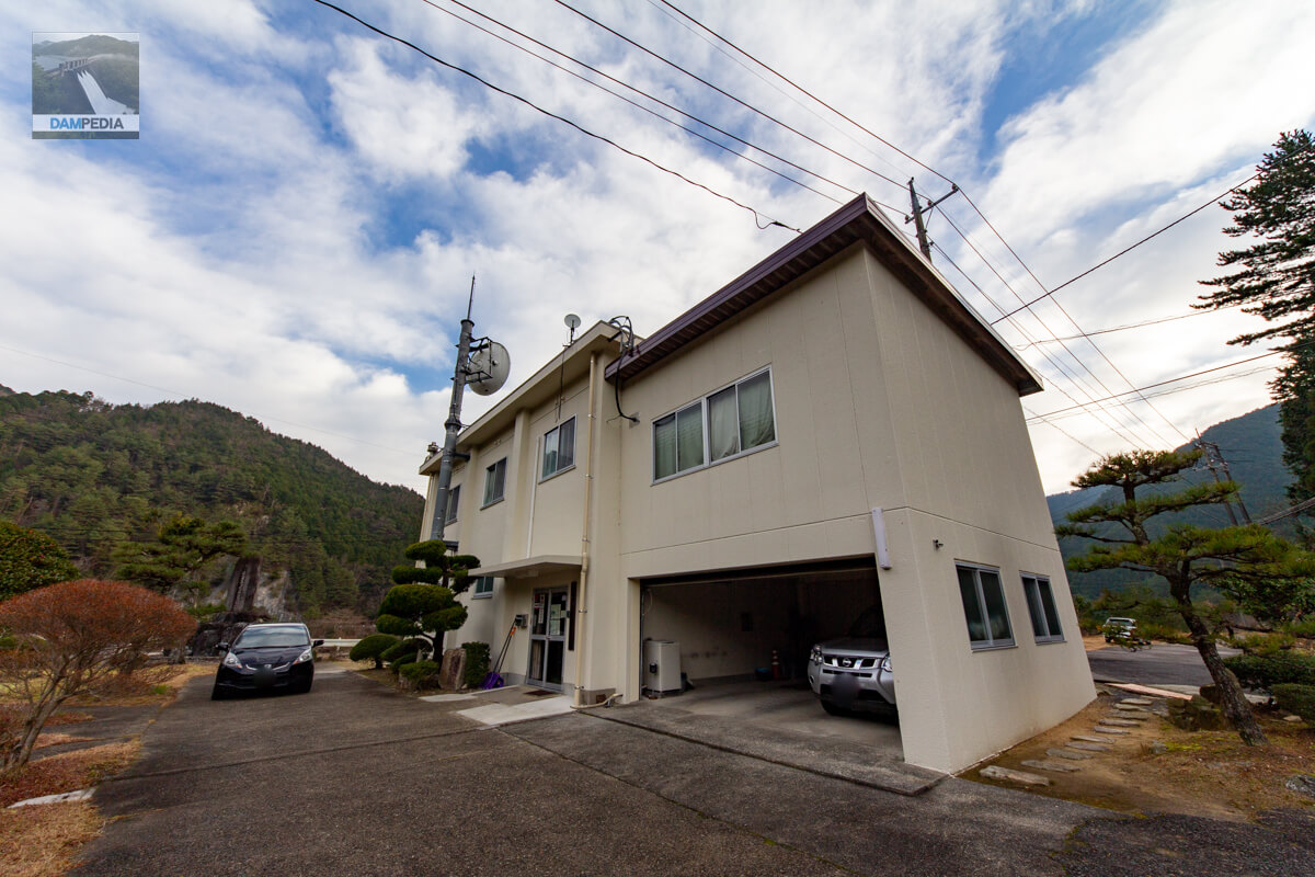
Kuroki Dam Management Office
This is the Kuroki Dam management office. Since it was only 8:00 a.m., I did not receive a dam card.
It would have been best if the view from downstream was better, but it was still an austere Kuroki Dam of smoldering silver.
Kuroki Dam Specifications
| Location | Kuroki, Kamo-cho, Tsuyama City, Okayama Prefecture |
| River Name | Kurami River, a tributary of the Kamo River in the Yoshii-gawa River system |
| Objective | F (flood control, agricultural disaster prevention) A (irrigation water) W(Water for water supply) P(Power generation) |
| Model | G(gravity-fed concrete dam) |
| Bank height | 53m |
| Bank length | 193m |
| Dam volume | 139,000 m3 |
| Watershed Area | 80.2 km2 (direct: 49.2 km2, indirect: 31 km2) |
| Reservoir area | 34 ha |
| Total storage capacity | 6,000,000 m3 |
| Effective water storage capacity | 5,075,000 m3 |
| Dam operator | Okayama prefecture (Chuugoku area) |
| Main body constructor | Kumagai Gumi |
| Year of launch | 1963. |
| Year Completed | 1967. |
| Name of Dam Lake | - |
Other facilities/observations
The observation deck is rated as △ because the view is not good.
| Parking lot | ○ |
| Toilet | ○ |
| Park | ○ |
| PR Exhibition Hall | × |
| Fishing | ○? |
| Viewing platform | △ |
Map around Kuroki Dam
Weather around Kuroki Dam
Accommodations that may be close to Kuroki Dam
Comment