
Date of interview: Wednesday, 12/10/2014
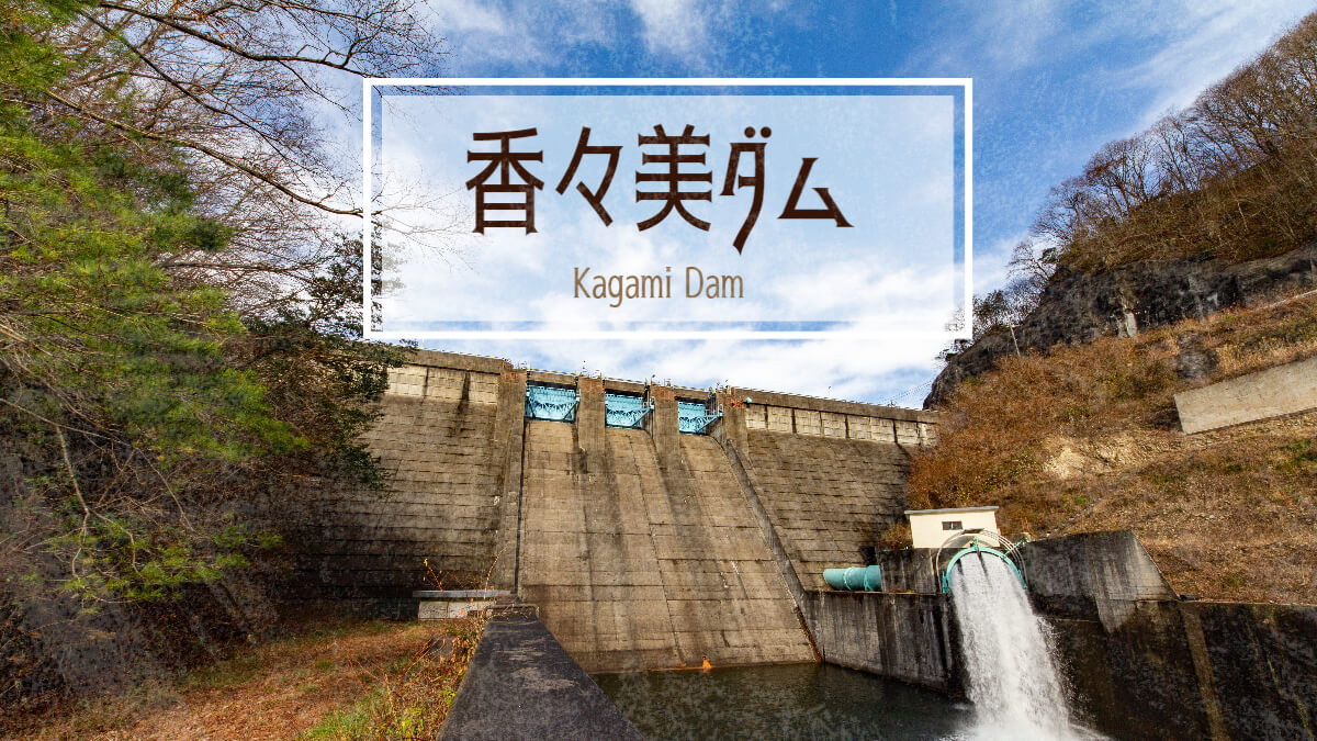
We came to the main purpose of this day's dam tour, the Kanami Dam. Like the Tsugawa Dam and Kuroki Dam, this dam is also operated by Okayama Prefecture. From the Kuroki Dam, we tried to go to the Kanami Dam via Prefectural Routes 75 and 68 while wandering around the scene of the horrific Tsuyama Incident, but we were forced to move southward to the Sakushu Highway because the road was closed during the winter season.
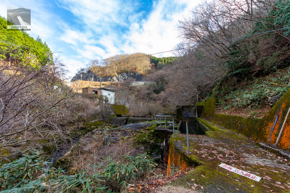
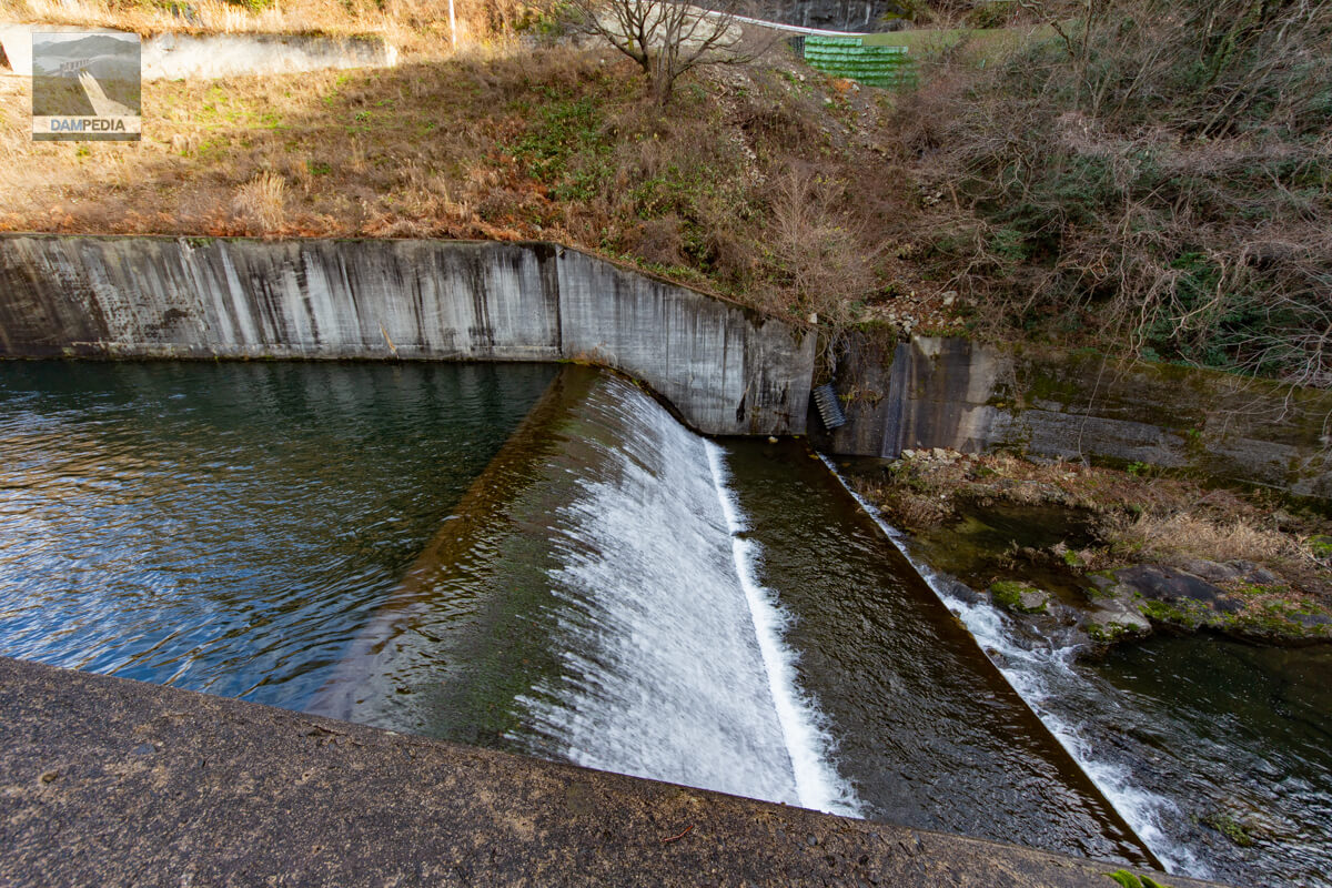
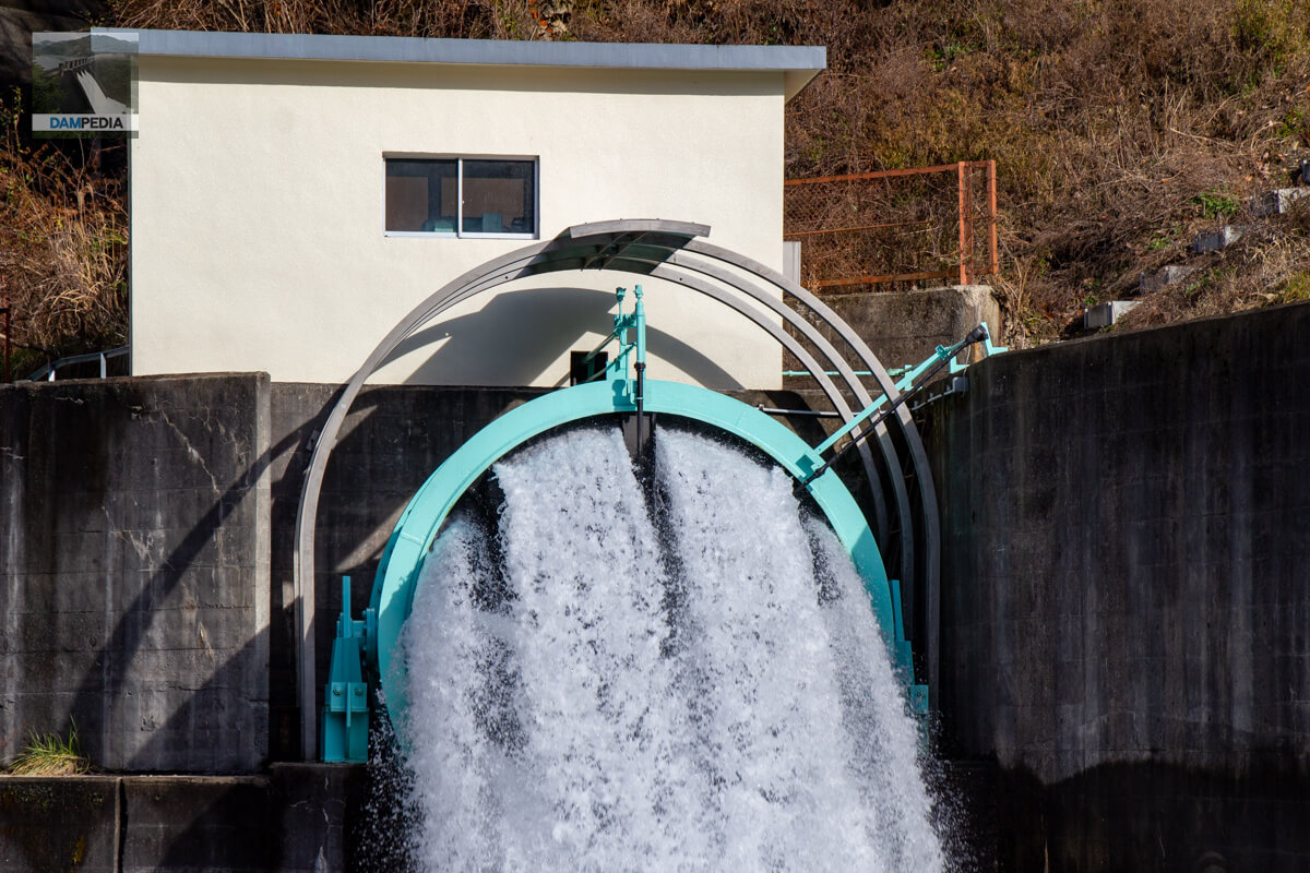
Kanami River Land Improvement District Kanami Power Plant Intake Weir
We looked for a point where we could see the embankment from downstream, and this was the first thing we saw as soon as we arrived. I thought it might be a sub-dam, but it is an intake weir of the Kanami Power Plant, and water is supplied to the power plant through a conduit from the right side of the photo. The white building on the other side of the river is the Koshihata Power Station, a dam-type power station operated by the Okayama Prefectural Bureau of Public Enterprises.
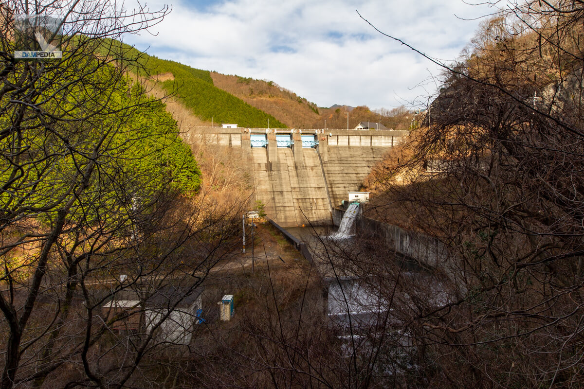
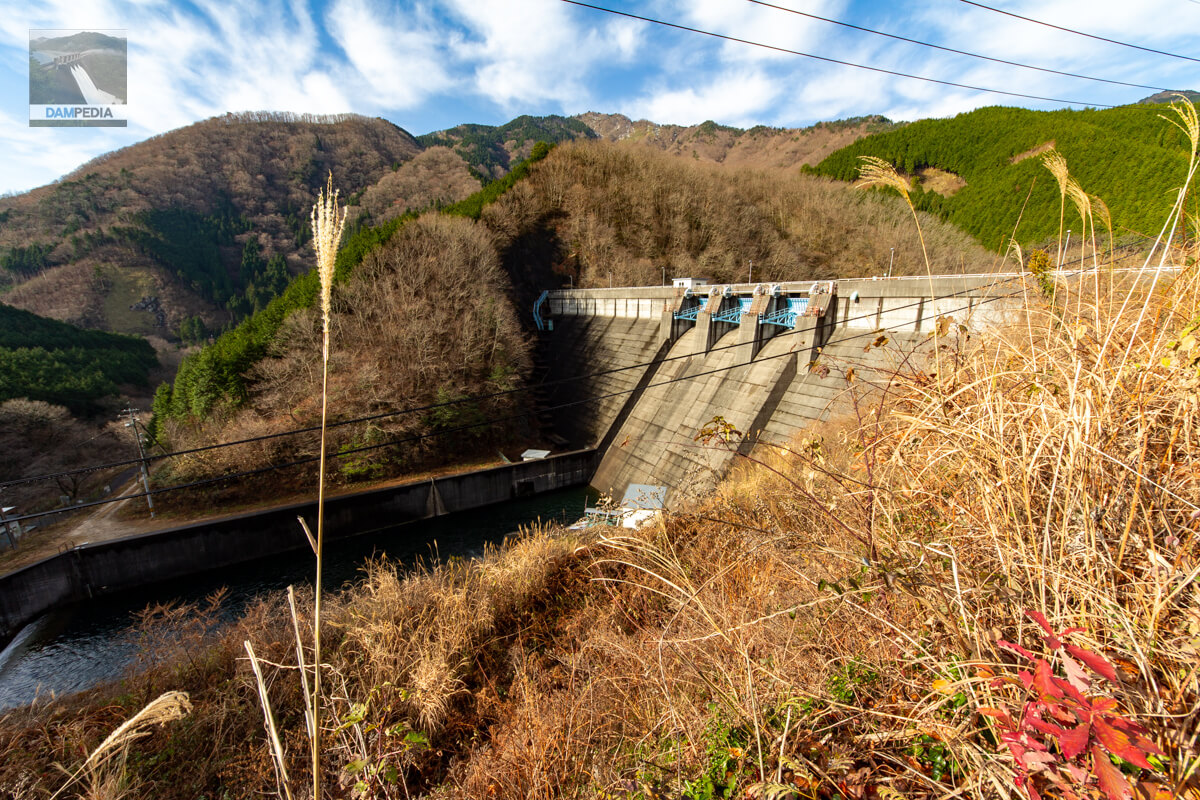
Downstream view of the levee from the left bank road
As you drive from the intake weir back to the left bank road, you can see the Kanami Dam peeking out from among the trees. You can also see the discharge of water from the hollow jet valve on the left bank.
Incidentally, Okayama Prefecture has two types of dams: those managed by the Public Works Department and those managed by the Agriculture, Forestry and Fisheries Department. The Kanami Dam is positioned as an agro-forestry dam managed by the Department of Agriculture, Forestry and Fisheries.
Looking downstream from the left bank
There is a slope on the side of the left bank road, but it was blocked by chains and appeared to be off-limits, so I took this photo from in front of it.
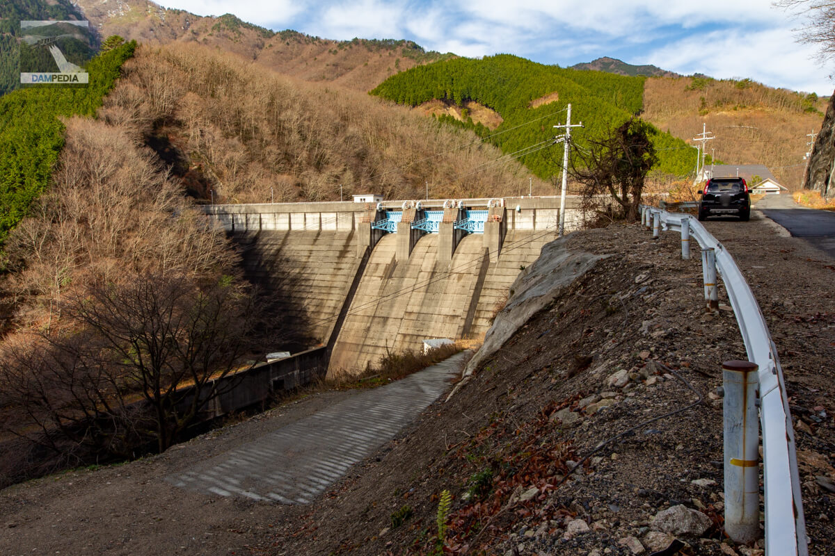
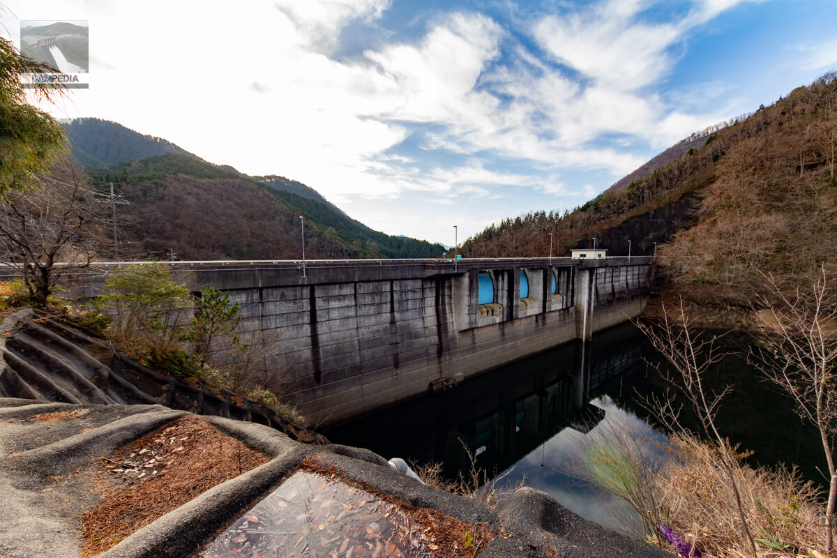
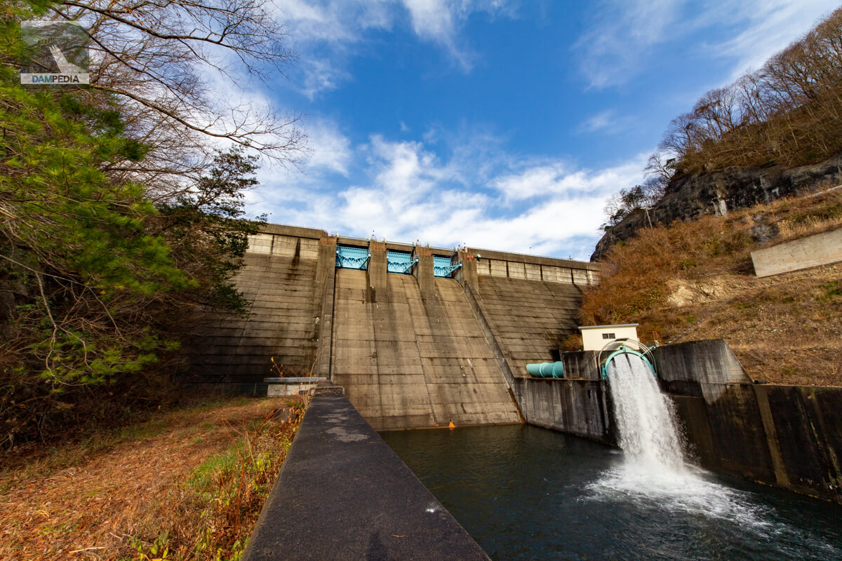
View of the downstream face of the embankment and reduction works from the left bank
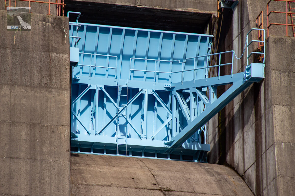
The crest of the Kanami Dam has three radial gates.
Looking downstream from the left bank
If you look closely, you can see that the hydraulic iron pipes, the door at the entrance to the audit corridor, and the stairs on the right bank are all light blue to match the color of the crest gate.
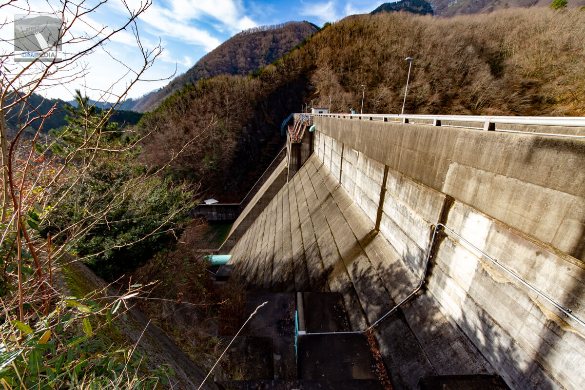
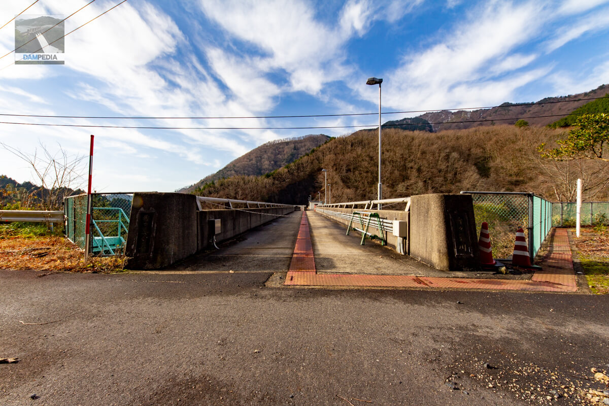
View of the top edge from the left bank
The top edge was chained and usually off-limits.
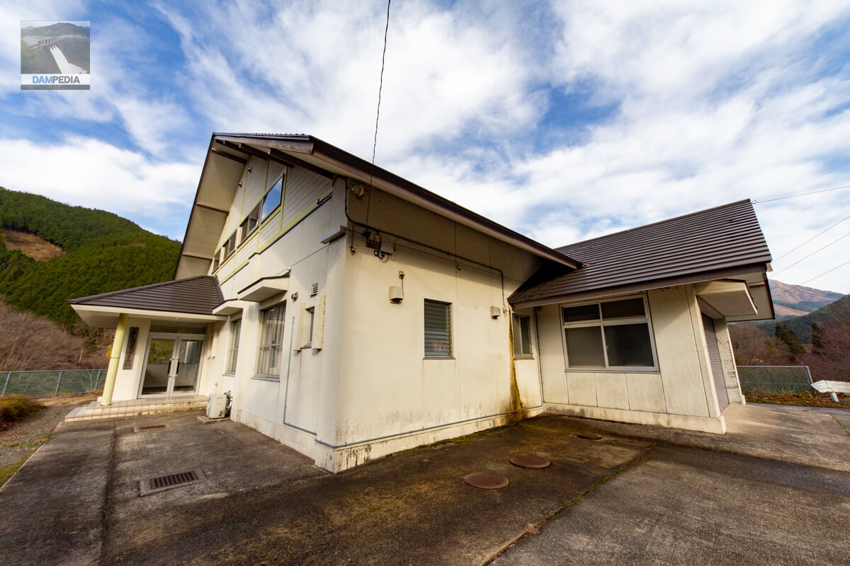
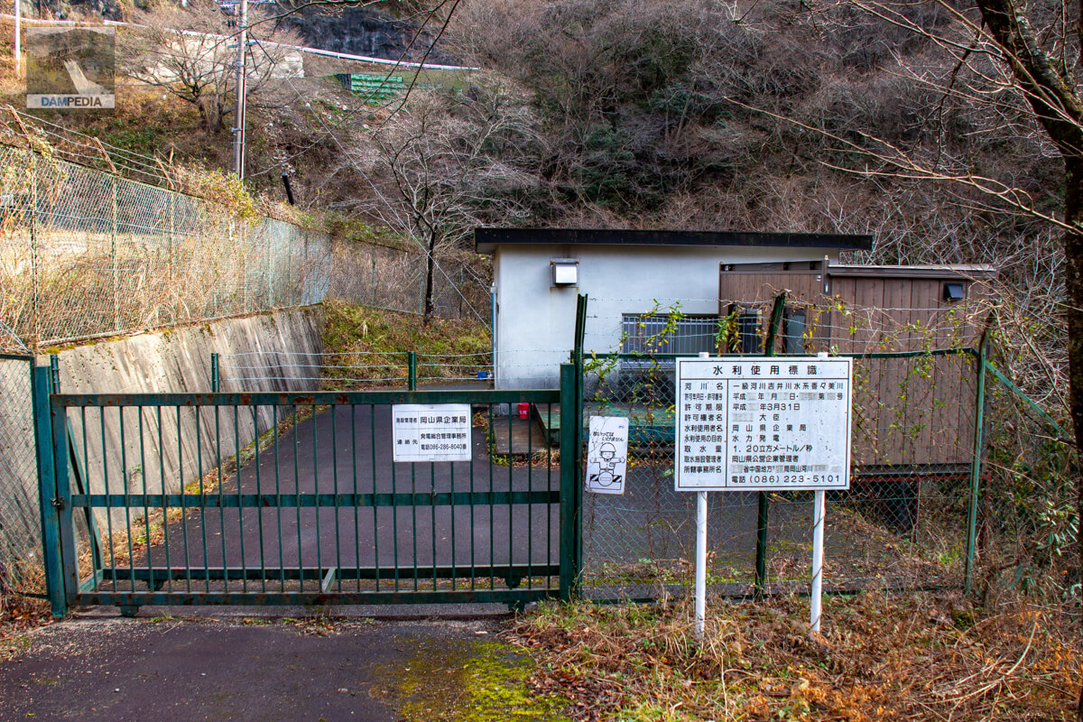
Kanami Dam Management Office
The photo below may be an older one, as we have information that the administration office will be bidding for renovation in 2022.
Looking upstream from the left bank
Water intake facilities are located on both sides of the crest gate. The right side is an intake facility for power generation, which takes in 1.20 m3/s of water, which is then sent to the Koshibata Power Station of the Okayama Prefectural Bureau of Public Enterprises directly below. The left side is slightly submerged and difficult to see, but it is an intake facility for valve discharge used for irrigation. 0.519 m3/s of water is taken to irrigate an area of 499.9 ha.
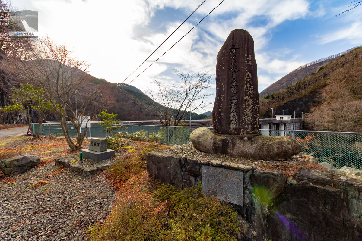
Kanami Dam Completion Monument and Cenotaph
In front of the control center, a monument commemorating the completion of the Kanami Dam and a cenotaph stand guard over the upstream face of the embankment.
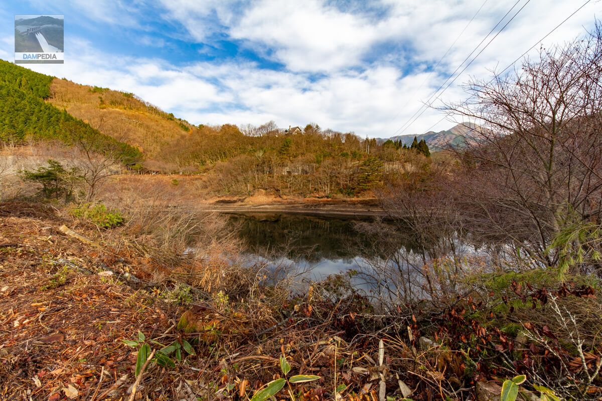
View of the reservoir from the left bank
It is a simple reservoir, but I am more interested in the building with a chimney roof that stands on the hill on the opposite bank. Is it a private residence or a villa?
View of the sub-dam from the right bank
From the dam site, we moved downstream again and crossed further to the right bank. The road is not very good, so depending on the type of vehicle, it may be better to move on foot from the middle of the river.
Looking downstream from the right bank
And then this amazing angle was waiting for me.
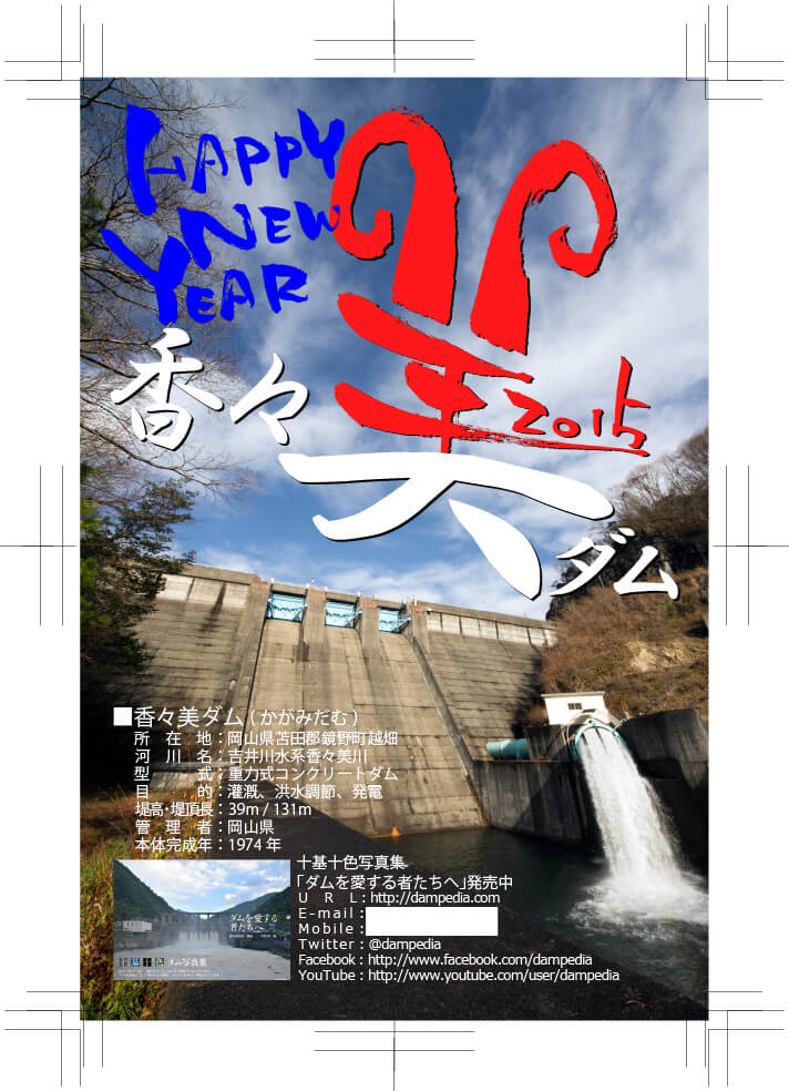
I made a New Year's card using a photo taken from this location at the time. I had originally planned to visit the Gasho Dam in Tottori Prefecture, but it was a bit too far to go on a day trip, and I noticed that part of the "beauty" in "Kanami Dam" looked like a "sheep," so I set this dam as one of my main targets for this day's tour.
radial gate
It would be very impressive to see the crest discharge from here.
Hollow jet valve
It is a sight that is not often seen, and I was so lost in admiration that I forgot about the passage of time.
Koshibata Power Station, Okayama Prefectural Enterprise Bureau
Halfway down the road to just below the dam is a power station where one of the purposes of the Kanami Dam is to generate electricity. A maximum of 200 kW of power is generated.
We visited this dam for a New Year's greeting card, but although we could not enter the top end of the dam and the road was bad, we were able to enjoy the view of the embankment from just downstream and the discharge from the hollow-jet valve from the front.
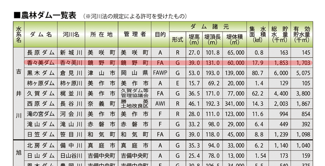
Kanami Dam Specifications
| Location | Koshihata, Kagamino-cho, Tomata-gun, Okayama |
| River Name | Yoshii River System Kakami River |
| Objective | F (flood control, agricultural disaster prevention) A (irrigation water) P(Power generation) |
| Model | G(gravity-fed concrete dam) |
| Bank height | 39m |
| Bank length | 131m |
| Dam volume | 60,000 m3 |
| Watershed Area | 17.9km2 |
| Reservoir area | 16 ha |
| Total storage capacity | 1,853,000 m3 |
| Effective water storage capacity | 1,703,000 m3 |
| Dam operator | Okayama prefecture (Chuugoku area) |
| Main body constructor | foundation |
| Year of launch | - |
| Year Completed | 1974 |
| Name of Dam Lake | - |
Other facilities/observations
Restrooms were originally located along the prefectural road on the right bank, but they seem to have been closed due to aging, and visitors are supposed to use the restrooms at Koshibata Furusato Village.
| Parking lot | × |
| Toilet | ○ |
| Park | × |
| PR Exhibition Hall | × |
| Fishing | ○? |
| Viewing platform | × |
Map around Kanami Dam
Weather around Kanami Dam
Accommodations that may be close to Kanami Dam

Comment