
Location: Aza-伐跡,Nakanokata-cho, Ena-shi, Gifu-ken
Date of interview: 2006/02/19
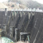
View of the levee from Prefectural Road 68
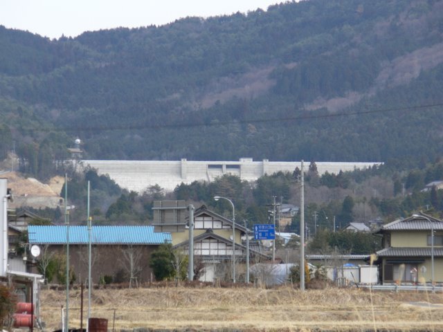
Kasagi DamThe Nakanokata Dam can be seen as you walk northward from the The peaceful landscape of a farming village spreads out just below the embankment. It sits on top of the dam as if it were spreading its wings.
Roadblocks...
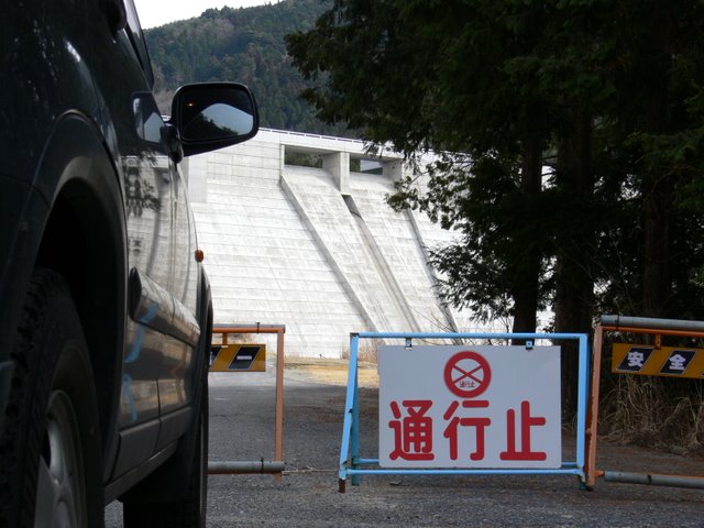
We drove directly under the dam and.......well, it seems that we cannot go any further. At the time of the interview, the dam was almost completed, but construction was not yet finished.
View of the levee from the downstream side of the right bank
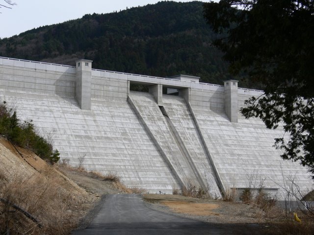
The embankment was just completed, or rather, in the process of being built, so it is very beautiful.
View of the downstream bank from the right bank
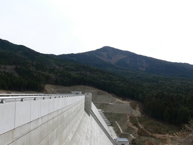
The mountain in the back is Mt. It looks as if it is looking down on Nakanokata Dam.
View of the embankment on the lake side from the right bank

The dam lake was at its highest level after the test flooding was completed two days prior to the interview. The water level was just barely at the edge on the day of the interview. If we had come a little earlier, we might have been able to see the test discharge.
View of the top edge from the right bank
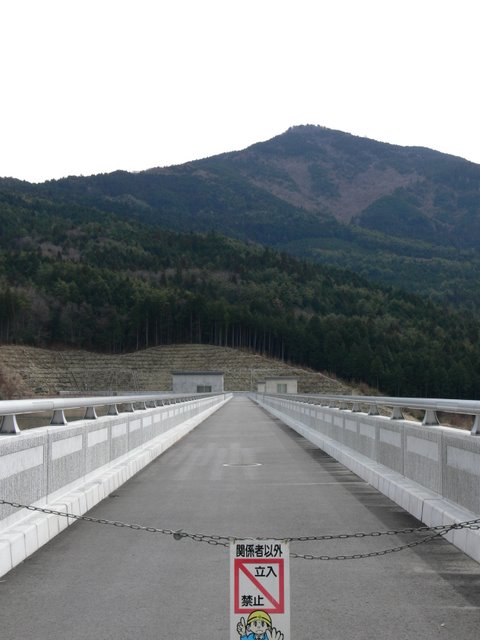
The top edge of the building is off-limits because it is under construction. However, a few groups of visitors broke the prohibition and entered....
View of the monument and embankment from the right bank
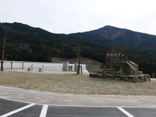
There is a parking lot and a space to worship the levee. There are still a few areas under construction, but I am sure it will be easier to visit when it is completed.
View of the dam lake and embankment from the right bank
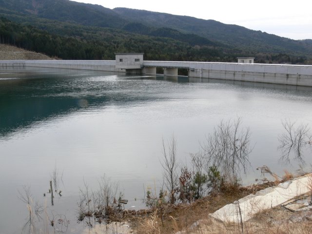
It is a quiet dam lake only in winter.
View of the dam lake from the right bank
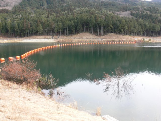
It is almost full of water, so the water feels quite close. The dam lake is 1.1 km in circumference and is quite small. It is also said to be a jogging course.
View of the administration office
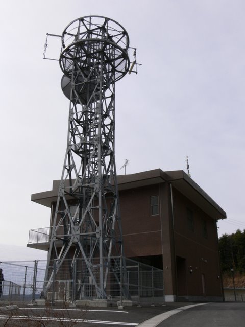
The control center is magnificent, but so are the antennas.
View of the levee from downstream

After leaving the top edge, we returned downstream again. The right bank downstream was off-limits, but for some reason we were able to enter the left bank.
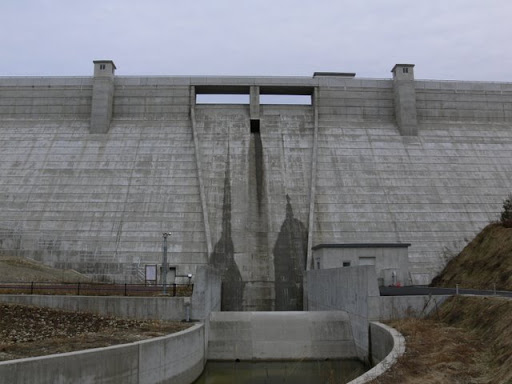
View of the reduction work
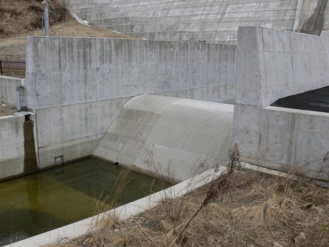
The approach from the left bank side. The width of the reduction work is narrow compared to the scale of the project. The concrete is pure white, as if it were a new construction.
Looking downstream from the force-reducing structure

The river is much narrower. You can also see that the abatement works are slightly curved.
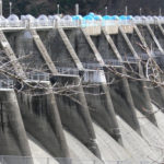
View of the levee from downstream

Why is the middle of the dike wet.... I wonder why. Let's take a closer look.
Leakage from levee

Noooo. What is this! Water is spurting out from the gaps in the concrete! Is it safe even though it is still under construction? Is it because it can no longer withstand the water pressure, or is it simply leaking? There is no indication that it is being discussed in the media, etc., and it seems that the construction work has been completed and the plant is now in actual operation, so it must have been repaired and completed without any particular problems.
cascade

Despite my worries, I continue to shoot.... I am very nervous... There is a cascade like this downstream, and I am sure that the downstream area will be developed as a park.
Looking downstream

Further downstream, there is a weir that looks like a sub-dam, like an erosion control dam, but judging from its color, it is probably an existing one.
View of the levee from downstream

Wow, I got so wet like that...
dam characteristics
| River Name | Nakanogata River, Kiso River System |
|---|---|
| Objective | Flood control, agricultural disaster prevention, unspecified water, river maintenance water, water supply water |
| Model | gravity-fed concrete dam |
| Bank height | 41.7m |
| Bank length | 390m |
| Dam volume | 139,000m3 |
| Watershed Area | 1.6 km2 |
| Reservoir area | 3 ha |
| Total storage capacity | 411,000m3 |
| Effective water storage capacity | 371,000m3 |
| Dam operator | Gifu prefecture (Chuubu area) |
| Main body constructor | Shimizu, Dainippon, Giken, Nakajima |
| Year of launch | 1990 |
| Year Completed | 2005 |
Other facilities/observations
| Parking lot | ○ | It was unfinished at the time of the interview, but at the time this article was uploaded It's already been four years since it was completed, so It is considered to be quite well maintained. Restrooms are located in the administration office, which is said to be unmanned, but only the toilets are open to the public. |
|---|---|---|
| Toilet | ○ | |
| Park | ○ | |
| PR Exhibition Hall | × | |
| Fishing | ○? |
Comment