

Location: Koganezawa Domuro, Oaza Seto, Shichiho-cho, Otsuki City, Yamanashi Prefecture
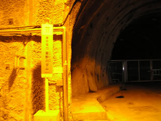
Approach to the levee
The Kuzunogawa Dam (the upper dam is the Kamihigawa Dam) functions as the lower dam for pumped storage power generation. To my surprise, its effective drop-off is the largest in the world at 714 meters!
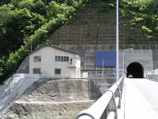
The embankment is located beside a national road tunnel, making it an unusual dam in terms of location.
Unfortunately, the site is now off limits and visitors are no longer free to enter and exit. (Added 6/7/2020)
Tunnel leading to the dike
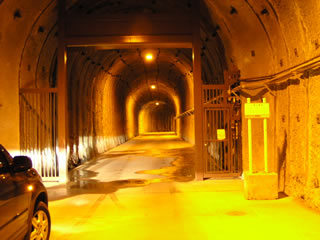
Is there really a dam behind this? It is a tunnel that makes you wonder.
The embankment is said to be made of aggregate from the rocks created during the construction of this tunnel.
They are not only using the tunnel, but also the rocks created during the construction of the underground power plant. This reduces the amount of rock extraction and contributes to the preservation of nature.
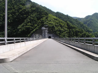
View of the top edge from the left bank
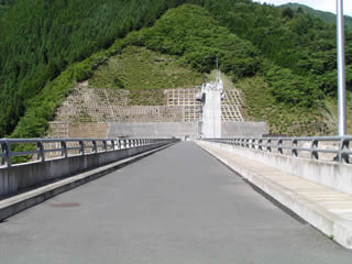
As soon as you exit the tunnel, you will see the top end. The top end is passable by car. However, the right bank is a dead end.
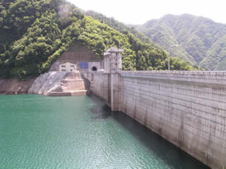
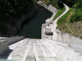
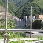
View of the levee (downstream side) from the right bank
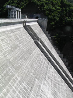
It was completed in 1999, so the white concrete is dazzling.
The embankment height is over 100 meters, which is high enough, but perhaps because of the steep angle of the conduit wall, it seems much taller.
Boring specimens...
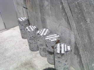
There was a specimen of a borehole survey on the right bank. It was as if they were asking us to please take them home (don't take them home!).
View of the embankment (lake side) from the right bank
It is very quiet and secluded.
...but while we were covering the event, a microbus came and a dozen or so visitors got out and toured the dike. It seems there was just an event or something going on. I wanted to listen to the person explaining the event, but since I was not a participant myself and the next dam was waiting for me, I continued my own coverage.
View of the top edge from the right bank
Now, it is time to go back to the left bank.
On the way back, several carcasses of beetles with their heads and thoraxes and below severed were lying around, creating a rather eerie atmosphere.
Did a crow or something (maybe a bird of prey this deep in the mountains?) Did they tear it apart?
Water intake building and gate facilities
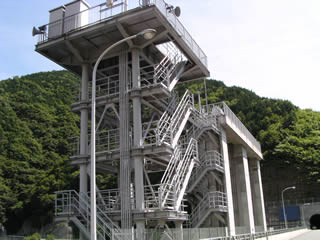
Since the interview was done a year ago (sweat), I completely don't remember what this was, but the facility with the stairs in the foreground is probably the selective intake building. Maybe...
For your information, the gate specifications are as follows
- Model: Steel roller gate
- Net diameter x door height: 6.300 m x 8.440 m
- Number of gates: 2
- Opening/closing speed: 03.m/min
- Door weight: 44.0t
- Production: Sakai Ironworks Co.
View from the top of the levee
It is quite high. I would love to see them released.
View from the center of the top edge to the left bank
The building on the left is supposed to be the control center, but despite being such a large dam, it is a small and cozy control center.
View of the dam lake from the top
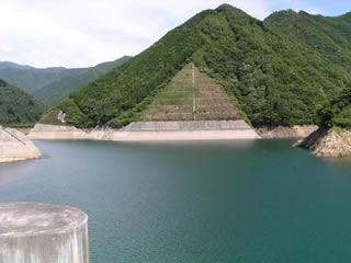
The dammed lake is really beautiful when you reach here.
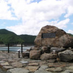
Stone monument inscribed with the name of the dam lake
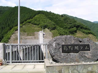
This is the end of the Kuzunogawa Dam. Even so, it seems a bit wasteful that the only purpose of such a large dam is to generate electricity.
dam characteristics
| da mu | Model | gravity-fed concrete dam |
|---|---|---|
| Objective | generation (e.g. power) | |
| Bank height | 105.2m | |
| Bank length | 263.5m | |
| levee length and width | 7.5m | |
| Dam volume | 622,000m3 | |
| savings water (esp. cool, fresh water, e.g. drinking water) pond | Watershed Area | 13.5km2 |
| Reservoir area | 43 ha | |
| Total storage capacity | 11,500,000m3 | |
| Effective water storage capacity | 8,300,000m3 | |
| River Name | Sagami River System Tsuchimuro River | |
| Year of launch | 1991 | |
| Year Completed | 1999 | |
| Name of Dam Lake | Lake Shohime | |
| Access to D@M | Get off at Otsuki IC of Chuo Expressway turning left at the light Go east on Route 20. Turn left at Takatsukibashi Iriguchi intersection Follow Route 139 northward. The dam that appears when you are tired is Fukashiro Dam. From Fukashiro Dam, take Route 139 further north. There are signs to guide you the rest of the way, so you can get there without any problems. | |
Other facilities/observations
| Parking lot | ○ | I thought the toilets left the water running, as I recall. It's not that it's broken, it's just the way it's designed. What the heck is the reason for doing so when it's not freezing season.... The TEPCO Kuzunogawa PR Center is located not far from the center of Otsuki City. |
|---|---|---|
| Toilet | ○ | |
| Park | × | |
| PR Exhibition Hall | ○ | |
| Fishing | ? |
Comment