

Location: Tagokura, Tadami-cho, Minamiaizu-gun, Fukushima Prefecture
Date of interview: 2009/06/20
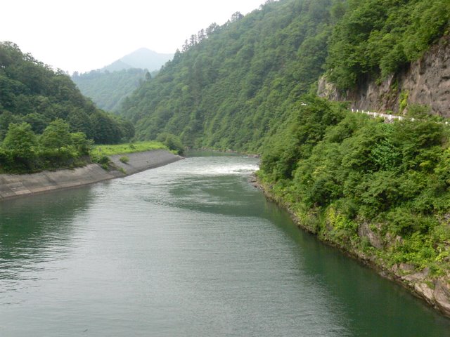
View of the dam lake and embankment from a microbus window
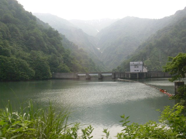
We arrived at the Otori Dam on the back of a Power Development Corporation microbus. Again, I had not done any advance study, so I visited the dam without knowing all the details.
Generator Unit 2 water intake
Before reaching the dike, a huge intake tower and intake greeted us all. This is the intake for Generator Unit 2, which was newly constructed in 2003, so it was relatively new and clean.
View of the top edge from the right bank
The top end is quite simple. The gravity arch, of which there are only 12 in Japan, is a very rare type.
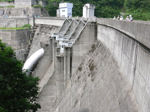
View of the levee from the downstream side of the right bank
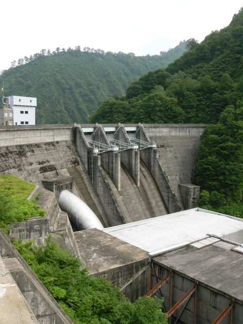
Although the entire embankment cannot be seen due to the power plant building, the stately appearance of the embankment is unique to gravity-type arches. The white object hanging down from the right bank of the embankment is a hydraulic pipe for power generation. It is a little regrettable that the pipe is so thick and out of balance with the embankment. However, it is striking because it is so thick.
View of the bridge downstream from the right bank
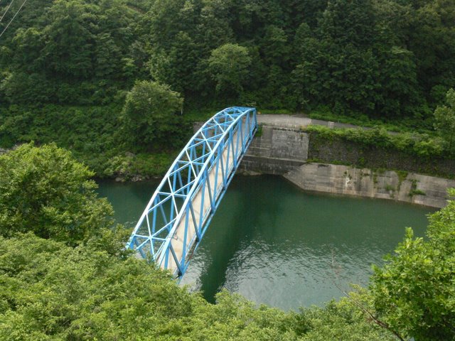
There is a bridge downstream. Later we will be looking directly at the levee from the side of that bridge.
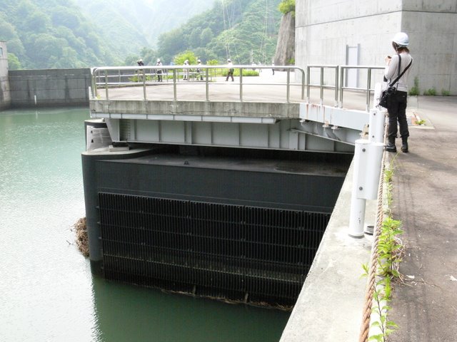
Hollow jet valve

There was a hollow jet valve on the left bank side of the dike.
hydraulic iron pipe
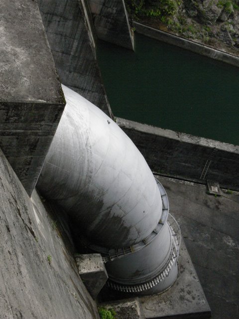
It is thick. It looks like a "worm".
View of the water intake and intake tower of Generator Unit 2 from the top edge
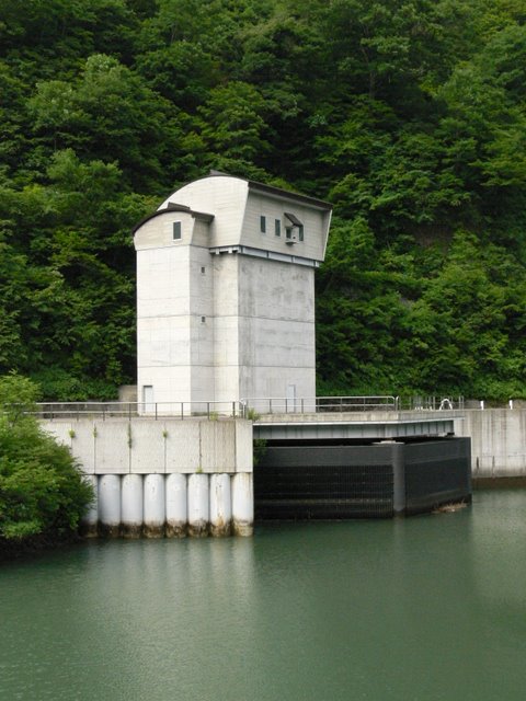
This is a water intake tower for a generator. If this were installed in a ranch, it might be mistaken for a silo.
View of the top of the tower from near the intake tower of Unit 1
In this way, it does not look like a bridge. Piers and bridge girders. That is the impression. But this is the top end of a gravity-type arch.
View of the dam lake from the top
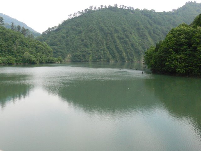
It is very quiet. I saw some fishermen along the way, but they did not seem to be in this area and kept the quietness. By the way, this area is off-limits.
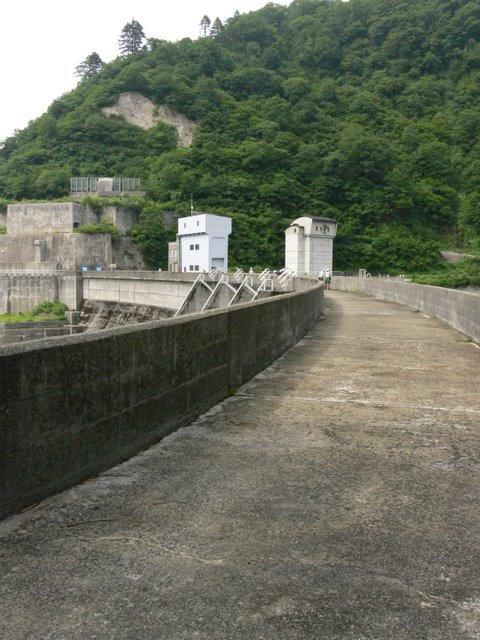
View of the crest gate from the top
If the embankment was simple, the downstream side was also simple, with no kind of reduction works.
View of the downstream bank from the left bank
Sorry, I wanted to show more beautiful arches in my photos. This is the best I could do. But still, I couldn't help but notice the hydraulic iron pipe.
View of the top edge from the left bank
Do you see this arch?
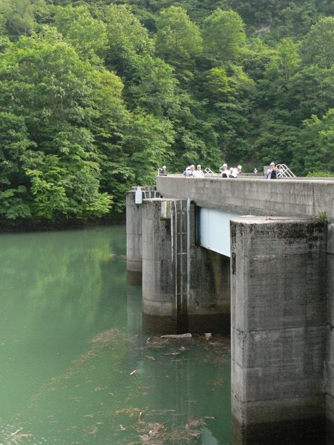
View downstream from the bridge
From the bank, the river turns to the right and flows through a bridge to this downstream. Ahead of it, there is a whitecap.
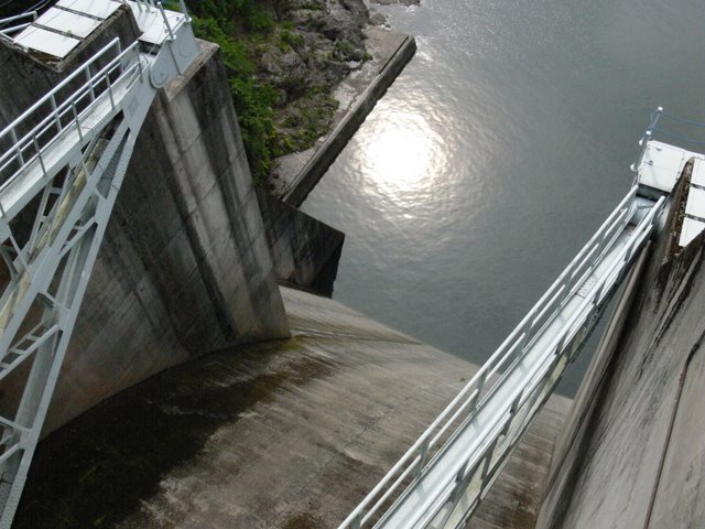
Discharge from Unit 2
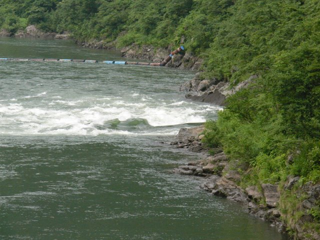
This is the discharge from the power plant (Unit 2). The water is discharged at a very high rate. It is said that they made a mistake in the position of the discharge at the design stage. They realized this during construction, but they could not change the plan, and the impact was considered insignificant, so they built the plant as it was.
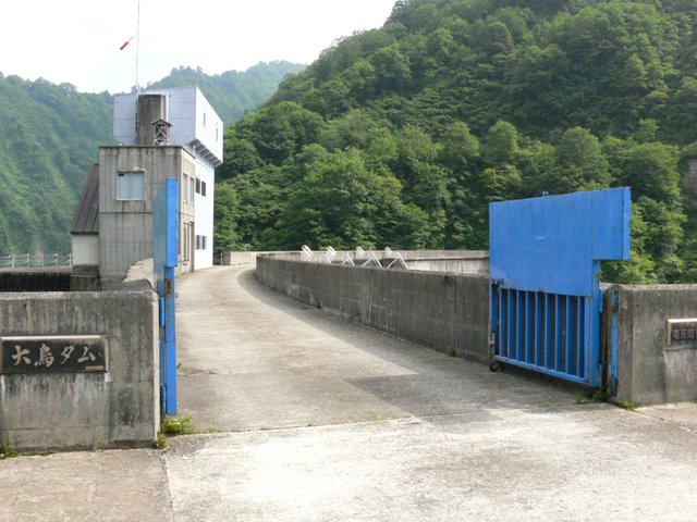
View of the levee and Unit 1 power plant from the downstream left bank

This is the levee from the foot of the bridge downstream. The levee is hidden by the power plant...
corridor connecting an annex to a pond-side building (in traditional palatial-style architecture)
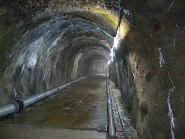
This is an audit corridor leading to the Unit 2 power plant. It has a good taste unique to hand-dug construction.
Inside the Unit 2 power plant
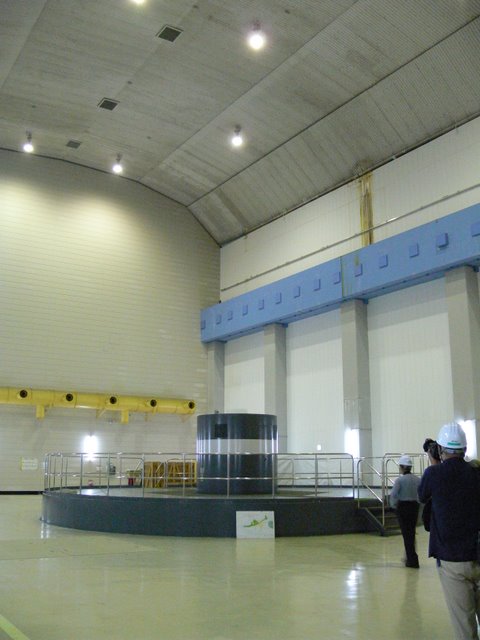
It is like a huge gymnasium. It must have been very difficult to create such a large space.
Generator No. 2
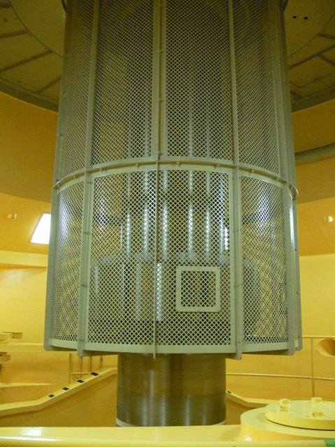
The generator made by Hitachi, Ltd. is called a "vertical-shaft rotating field magnet totally closed and internally cooled type. The water turbine is called a "vertical-shaft spiral Kaplan turbine.
Giant spanner

A huge wrench was hung by the power plant. Cigarettes (Mild Seven) were placed to give a sense of its size.
Giant spanner (No. 2)
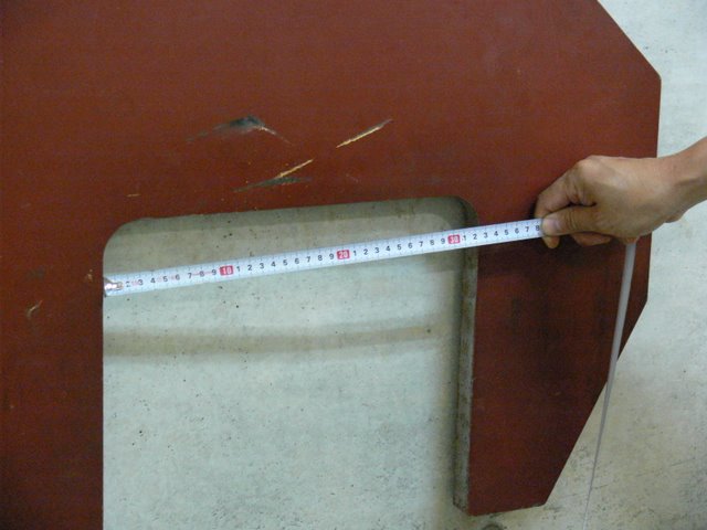
The person accompanying me took out a measuring tape and measured. Wow, that's amazing. Do you usually have a measuring tape!
Giant spanner (No. 3)
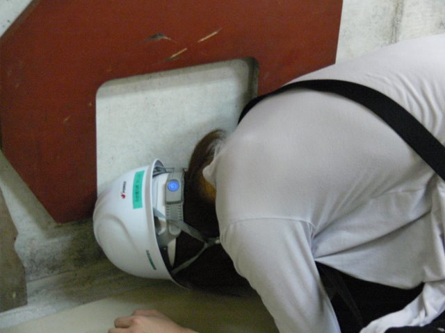
And the handsome guy wonders which is bigger than his head...................................... Your parents will cry.
dam characteristics
| River Name | Agano River System Tadami River |
|---|---|
| Objective | generation (e.g. power) |
| Model | Gravity Arch |
| Bank height | 83m |
| Bank length | 187.9m |
| Dam volume | 160,000m3 |
| Watershed Area | 656.9 km2 |
| Reservoir area | 89ha |
| Total storage capacity | 15,800,000m3 |
| Effective water storage capacity | 5,000,000m3 |
| Dam operator | Power Development Co. |
| Main body constructor | Maeda Corporation |
| Year of launch | 1961 |
| Year Completed | 1963. |
Other facilities/observations
| Parking lot | × | The public is not allowed to enter. The tour is to be visited by a tour group. Naturally, there's no parking lot, restrooms, or exhibition hall. I think we will use Okutadami dam. Also, fishing is prohibited in the area, so naturally fishing is also prohibited. I saw a few people entering.... |
|---|---|---|
| Toilet | × | |
| Park | × | |
| PR Exhibition Hall | × | |
| Fishing | × |

Comment