
Date of the interview: Sunday, September 16, 2012
The day after visiting Ishibuchi Dam and Isawa Dam, I decided to go on a tour of dams in Tohoku with fellow dam enthusiasts. The first of these was the Ishibane Dam.
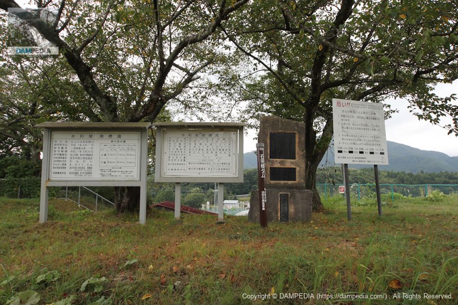
Water use signs, discharge warning signs and stone monuments, etc.
Informative signs and stone monuments. The water use sign is for irrigation on the left and for power generation by Tohoku Electric Power Company on the right. The dam itself is used for power generation, but water is also taken directly under it for irrigation.
View of the embankment from slightly upstream on the left bank
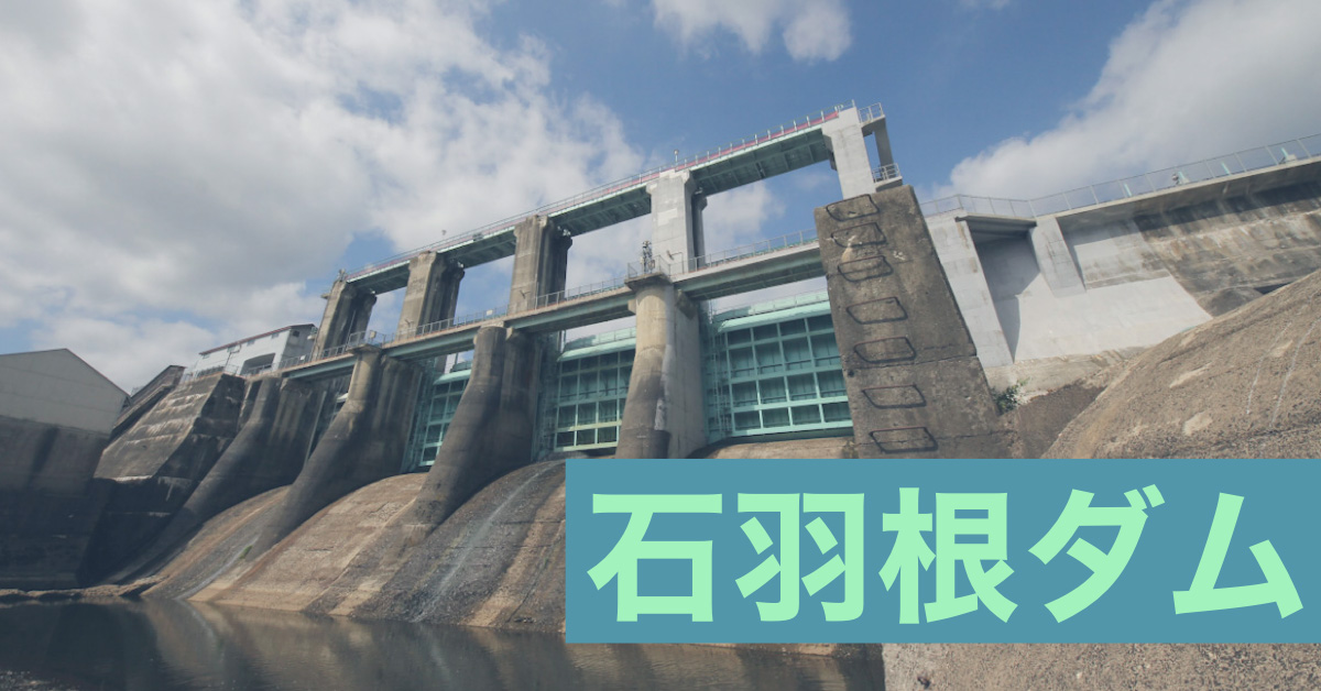
From here, it looks like a common power generation embankment. It looks like a gravity concrete dam, but the right bank seems to be an earth dam, and the gravity concrete/fill combined dam (combine dam(1) and (2).
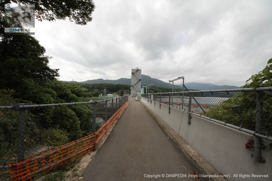
View of the top edge from the left bank
Walk along the top edge.
View of agricultural canal from the top
The left bank side is a gate for agricultural water.
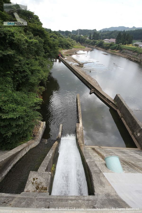
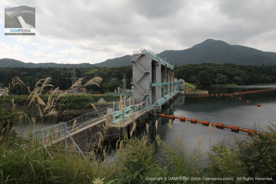
View downstream from the top
This is the power reduction work on the power generation side.
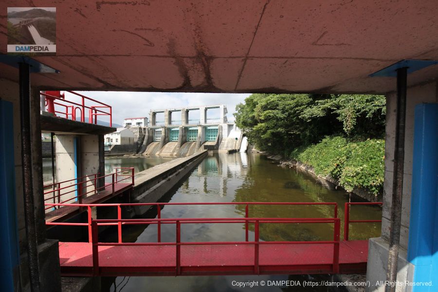
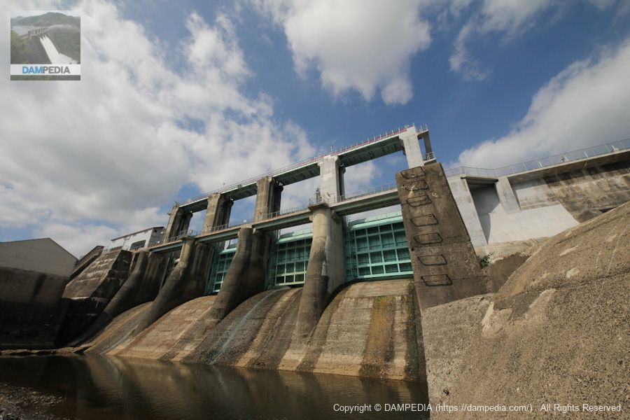
View of Gate Pier from the left bank
Ishibane Dam is equipped with four roller gates, but it is such a huge gate pier.
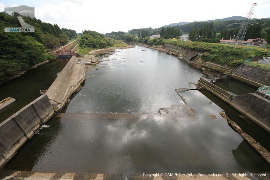
View of the levee from a sluice gate for agricultural use downstream
The levee is seen from the agricultural sluice installed downstream. I should have looked at the structure of this area more properly. Also, I didn't take any pictures of the dam lake or the right bank side...I'll have to revisit.
View downstream from near a sluice gate for agricultural water
Water for enriching the land in Kitakami.

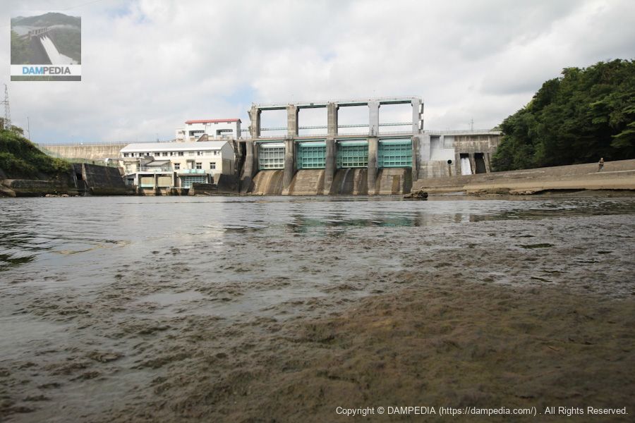
View of the levee from downstream
Because the flow was low, we were able to get fairly close to the levee by following a structure that appeared to be part of the flow-reducing works.

View of the levee from downstream
Although it is in the river, the bedrock allows for many different angles of view.
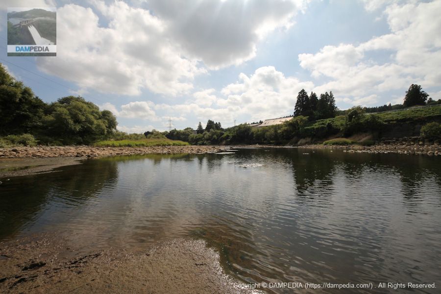
Looking downstream
The downstream side of the river looks much more filled with water from Google satellite photos, but the water was quite low at this time of the year.
Close-up view of the levee from downstream
Large roller gate.
The Ishibane Dam is a small dike but useful to the local community for power generation and irrigation. I would definitely like to visit again.
Ishibane Dam Specifications
| Location | 4, Yokogawame, Waga-cho, Kitakami-shi, Iwate |
| River Name | Kitakami River System Waga River |
| Objective | P(Power generation) |
| Model | G(gravity-fed concrete dam) |
| Bank height | 20.5m |
| Bank length | 283m |
| Dam volume | 38,000m3 |
| Watershed Area | 725km2 |
| Reservoir area | 51ha |
| Total storage capacity | 4,050,000m3 |
| Effective water storage capacity | 1,580,000m3 |
| Dam operator | Tohoku Hydro Geothermal Co. |
| Main body constructor | Nishimatsu Construction |
| Year of launch | 1952 |
| Year Completed | 1953. |
| Name of Dam Lake |
Other facilities/observations
| Parking lot | × |
| Toilet | × |
| Park | × |
| PR Exhibition Hall | × |
| Fishing | ? |


Comment