
Date of interview: 2005/06/18
Location: Aza Miyasaka, Aimata, Minakami-cho, Tone-gun, Gunma
View of the top edge from the left bank

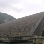
The Ainomata Dam is located near the Sarukagyo Hot Springs, which is also a popular destination for hot spring visitors. Although this is the Omata Dam, it does not look like a dam from this photo. I will explain the reason later...
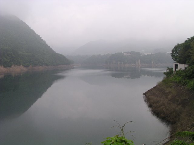
View of the dam lake from the left bank

It was a relatively early morning and the rain that had been falling since last night had managed to stop. However, it was extremely foggy. The dam lake of the Aimata Dam suddenly narrows here. If the dam lake were a bust, this would be just the waist of the lake.
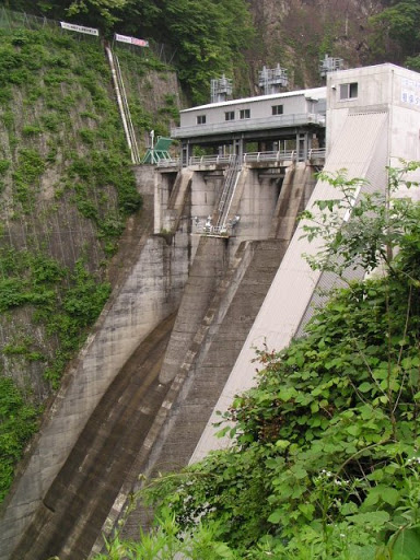
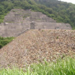
Looking downstream from the left bank

This is downstream taken from the bridge in the first photo. The downstream side becomes narrower. It looks like "bonk, kyu-kyu-kyu" instead of "bonk, kyu-kyu" (meaning unknown). Incidentally, there is a structure on the side of the flow-conducting wall, so you cannot see the flow-conducting wall and the downstream side itself. It is said that the incline is stored in this structure.
View from the left bank to the back of the top edge

The back of the top edge is fenced off and you cannot go deeper. In other words, you cannot see completely downstream.
View of the water intake tower

If you go back and look at the dam lake, you will see the intake tower. It may be a little hard to see, but there is a tunnel at the far right. I am not sure where it is connected to, but I would like to go through it. However, it has not actually been used since its construction and is only used for lighting and as a pedestal for surveillance cameras.
View of the downstream bank from the left bank

It is very thin. And it is very steep. I have never seen a dam like this before.
Omata Dam Information Center
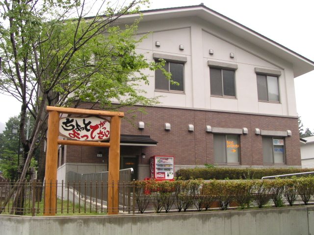
After leaving the embankment, we returned to the "Omata Dam Information Center," which is an exhibition hall to promote the Omata Dam. However, it was too early in the morning to open. I would like to visit there again someday.
Assy appears in Akaya Lake!
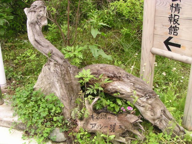
There is this object near that information center. It is unknown if his best friend has a messie or not. But this story is already old....
Wooden objet d'art

It is quite a surreal object. I am sure there is a wave motion gun coming out of the hole in its belly...
Left bank with water leakage during test flooding
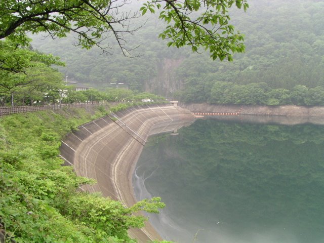
One of the features of the Aimata Dam is its left bank. When it was constructed, Gunma Prefecture was in charge of the construction work, but during the test flooding, the left bank leaked much more than planned, and the project was hastily transferred from the prefecture to the national government, which did its utmost to stop the leakage.
View of the dam lake from the left bank
The Omata Dam offers a glimpse of such history. Although small in scale, the passion of the people of that time can be felt.
dam characteristics
| River Name | Akaya River, Tone River system |
|---|---|
| Objective | Flood control, agricultural disaster prevention, unspecified water, river maintenance water, power generation |
| Model | Gravity Concrete |
| Bank height | 67m |
| Bank length | 80m |
| Dam volume | 63,000m3 |
| Watershed Area | 110.8km2 |
| Reservoir area | 98 ha |
| Total storage capacity | 25,000,000m3 |
| Effective water storage capacity | 20,000,000m3 |
| Dam operator | Kanto Regional Construction Bureau |
| Main body constructor | Kumagai Gumi |
| Year of launch | 1952 |
| Year Completed | 1959 |
| Name of Dam Lake | Akaya Lake |
Other facilities/observations
Despite the small size of the dam, the facilities are quite extensive. Of course, there are many things to see and do. National Route 17 runs along the side of the dam lake, which was also called the Hokkoku Kaido in the old days, and Kenshin Uesugi is said to have passed through here. Nearby is the Sarugakyo Hot Springs.
It would be good to use this place as a base for sightseeing and dam tours.
| Parking lot | ○ |
|---|---|
| Toilet | ○ |
| Park | ○ |
| PR Exhibition Hall | ○ |
| Fishing | ○ |
Comment