
Date of interview: Saturday, August 03, 2013
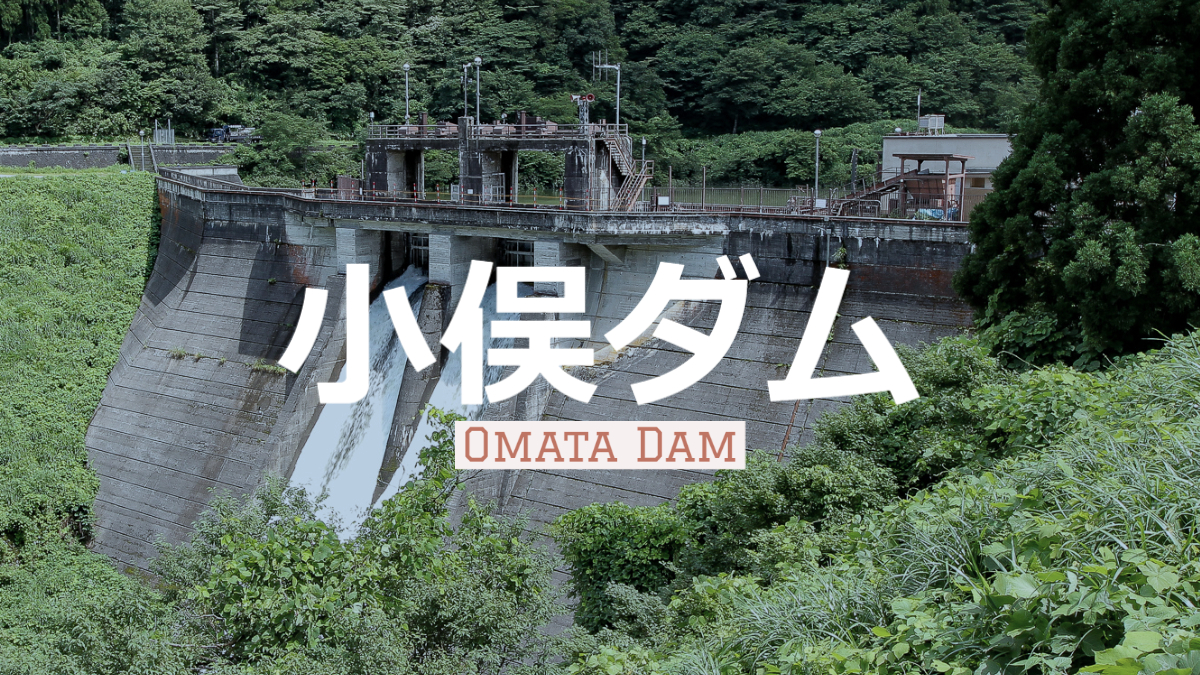
After visiting the Arimine, Sukenobu, and Oguchigawa dams, we passed the Mizusu toll station on the Arimine Forest Road and came to the Omata Dam. Let the map sign that also appeared at Oguchigawa Dam appear again. I think this will help you visualize the location of the power plants.
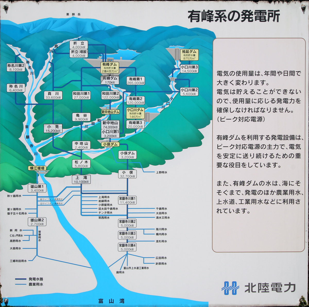
Water taken from the Arimine Dam is delivered to the Wada River No. 1 and Wada River No. 2 power plants, of which water used for the Wada River No. 2 power plant is stored in the Shin-Nakachiyama Dam and used for power generation at the Shin-Nakachiyama Power Plant located upstream from the Omata Dam.
The Oguchi River No. 1 Power Plant, written directly below the Shin-Nakachiyama Power Plant on the sign, generates power using water taken from the Sukenobu Dam and passed through the Oguchi River No. 3 Power Plant, Manatate Dam, and Oguchi River No. 2 Power Plant.
The reason why this Shin-Nakachiyama Power Plant and Oguchigawa No. 1 Power Plant are written as one is because they use the same power plant building.
The Omata Dam Power Station (3,200 kW) is indicated on the lower right of the Omata Dam, making it appear as if power is generated downstream, but in fact it is located on the left bank of the reservoir side of the Omata Dam. The water generated by the Omata Dam Power Station is used by the Omata Power Station, which generates 32,700 kW of electricity.
Looking downstream from the left bank
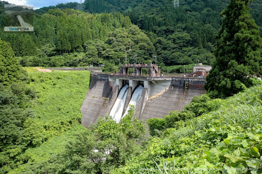
What a surprise, it was released from the crest. The grass was overgrown because it was mid-summer, giving it more of a manmade in nature feel. One of the features of the bank on the right bank is that it is bent in the upstream direction.
Looking downstream from the left bank
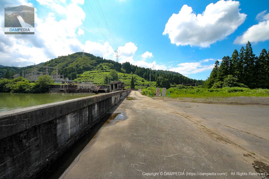
We approach the levee further. Because Crest's administrative bridge is out downstream, the area below it is not exposed to rain, so it is a nice white color.
View of the top edge from the left bank
The top end is open to automobile traffic.
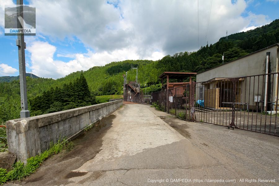
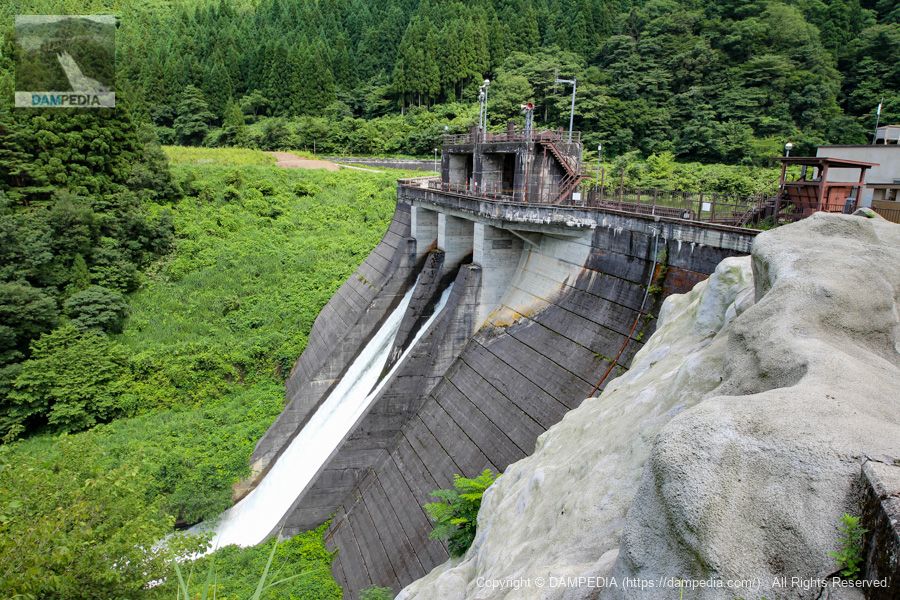
Around Crest Gate
At that time, it seemed to be under renovation, and there were steel plates laid on the top edge. The color of the concrete seems to indicate the harshness of the area, which is deep in snow.

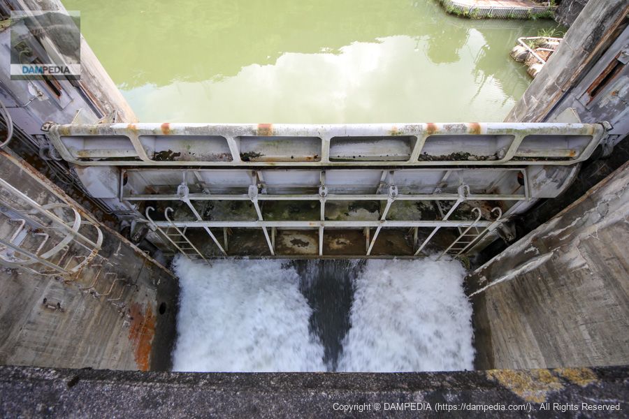
View of the crest gate from the top
The crest gate is a roller gate as you can see. The color of the gate is also austere.
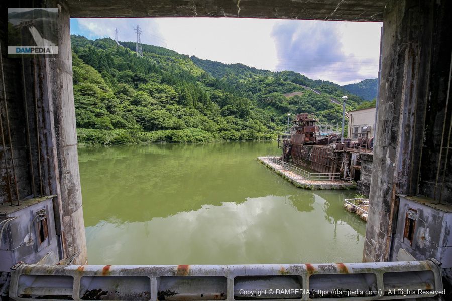
View of the reservoir from the top over the crest gate
The view of the dam is also full, just like the Arimine Dam on this day. Like the Arimine Dam on this day, it is full of water. On the right is the water intake of the Omata Dam power plant.
Looking downstream from the top
It is a dynamic discharge. I happened to be lucky enough to see it.left bank (of a river)(The waterway that looks like a canal (on the left side of the photo) is not a canal for power generation but for agricultural use, so I think this is probably the Ueno water supply shown in the first diagram.

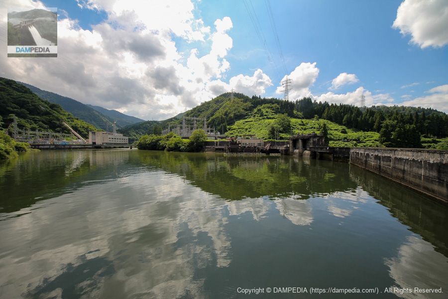
View of the upstream face of the embankment and power plant from the right bank
On the left are the Shin-Nakachiyama Power Station and Oguchi River No. 1 Power Station. Adjacent to the Omata Dam is the Omata Dam Power Plant.
View of the top edge from the right bank
The bank is bent on the right bank side, so the gate pier on the upstream face is facing us.
Located just before the Arimine Forest Road, the advantage of the Omata Dam is that it can be easily viewed at any time. It is best to visit in conjunction with the complex Arimine system of power plants.
Animation of Omata Dam discharge
Omata Dam Specifications
| Location | Saikakuchi, Toyama City, Toyama Prefecture |
| River Name | Joganji River system Oguchi River |
| Objective | P(Power generation) |
| Model | G(gravity-fed concrete dam) |
| Bank height | 37m |
| Bank length | 131.5m |
| Dam volume | 46,000 m3 |
| Watershed Area | 274.6 km2 (direct: 36.6 km2, indirect: 238 km2) |
| Reservoir area | 7ha |
| Total storage capacity | 761,000 m3 |
| Effective water storage capacity | 587,000 m3 |
| Dam operator | Hokuriku Electric Power Co. |
| Main body constructor | Maeda Corporation |
| Year of launch | 1958 |
| Year Completed | 1960. |
| Name of Dam Lake | - |
Other facilities/observations
| Parking lot | × |
| Toilet | × |
| Park | × |
| PR Exhibition Hall | × |
| Fishing | ? |
Comment