

Date of interview: 2005/06/17
Location: Oaza Kawarabatake, Naganohara-machi, Agatsuma-gun, Gunma
Yamba Dam Public Information Center "Yanbakan
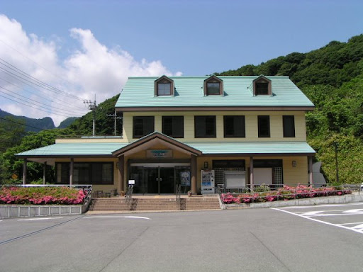
Entering Gunma from the Nagano Prefecture side, passing near Kusatsu Onsen, I had originally planned to head directly to the planned Yamba Dam construction site, but I noticed a public relations facility called the Yanbakan and stopped by on short notice.
The Yamba Dam has always been questioned as to whether it should be built or not, and even now it is being closely watched as a major issue, so much so that it appears in newspaper articles, even in newspapers in the central part of Japan.
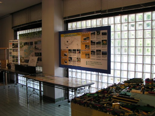
Model of the area around the proposed construction site
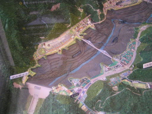
Once inside, a model welcomes you. The model is still interesting. It is quite precisely made.
Yanbakan Interior
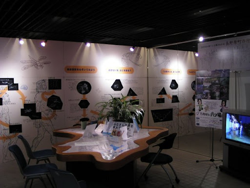
The museum conveys the desperation of the Ministry of Land, Infrastructure, Transport and Tourism. There are many display panels, models, exhibits for children, and much more to see.
Get a number?
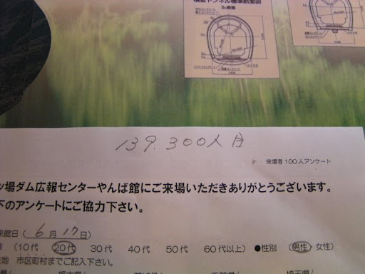
I have cooperated with the survey. The 139,300th person is written on the survey form.
Yanbakan Exhibits
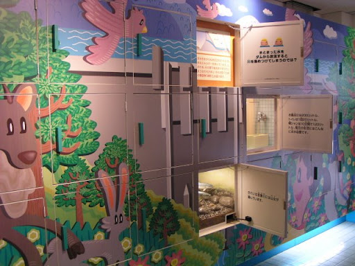
These exhibits for children are also entertaining.
Yanbakan Exhibits

The negative aspects are also displayed well, without hiding them.
Yanbakan Exhibits
In the foreground, there is a toy block like Lego. I think it was something like "Let's build a dam! I think it was supposed to be something like "Let's build a dam", but I remember it was a mess at that time.
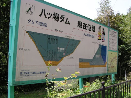
Proposed construction site and publicity signage #1
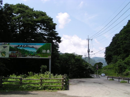
We left the Yanbakan and moved on to the planned construction site. I saw this sign on Mr. Miyajima's website "Dam Mania"! I was deeply moved by the thought of this scenery sinking to the bottom of the dam.... Yes, we will no longer be able to see this scenery. And the Yanbakan I mentioned earlier. Not only that, the hot spring resort of Kawarayu Onsen will also sink to the bottom of the dam.
On the right side of this photo is the national highway, which of course will also sink. A replacement road was already under construction at a higher elevation than this site.
Publicity signboard No. 2
There are many such signs. Maybe they hold information sessions and have an auxiliary role.
Public relations signboard No. 3
Signs are still available.
Public relations signboard No. 4
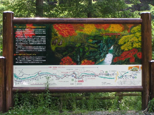
This area is called Azuma Gorge and is famous for its autumn foliage. It was originally located almost in the center of the area where the dam was to be built and was destined to be submerged, but due to persistent opposition, the plan was changed and the levee was moved 600 meters, so that about 3/4 of the dam was left in place.
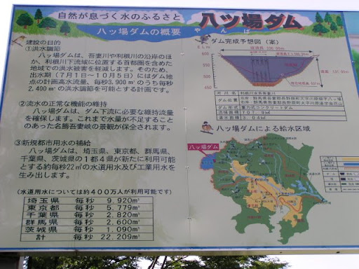
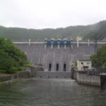
dam characteristics
| River Name | Tone River system Azuma River |
|---|---|
| Objective | Flood control, agricultural disaster prevention, unspecified water, river maintenance water, water supply water, industrial water |
| Model | Gravity Concrete |
| Bank height | 116m |
| Bank length | 285m |
| Dam volume | 910,000m3 |
| Watershed Area | 707.9km2 |
| Reservoir area | 304ha |
| Total storage capacity | 107,500,000m3 |
| Effective water storage capacity | 90,000,000m3 |
| Dam operator | Kanto Regional Development Bureau |
| Year of launch | 1967. |
| Year Completed | 2015 |
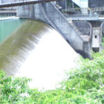
Other facilities/observations
I would love to see the dam again when it is completed, but I don't know what will happen yet. But if it is cancelled, I wonder what will happen to the thoughts of those who have already relocated again...
| Parking lot | ○ |
|---|---|
| Toilet | ○ |
| Park | ○ |
| PR Exhibition Hall | ○ |
| Fishing | ○? |
Comment
I saw it at Bakumon! It was interesting.
I am afraid this article itself is 12 years old. The program itself was good and easy to understand for those who don't know anything about dams!