
Date of the interview: 2011/11/23 (Wednesday/Holiday)
Location: Kamioda, Yamakita-cho, Ashigarakami-gun, Kanagawa Prefecture
The Miho Dam is a Kanagawa Prefecture-owned rock-fill dam built on the Kawachi River in the Sako River system. On this day, I decided to visit the Miho Dam before appearing at the "Dam Mania Exhibition" talk live at the Sagami Lake Exchange Center near the Sagami Dam.
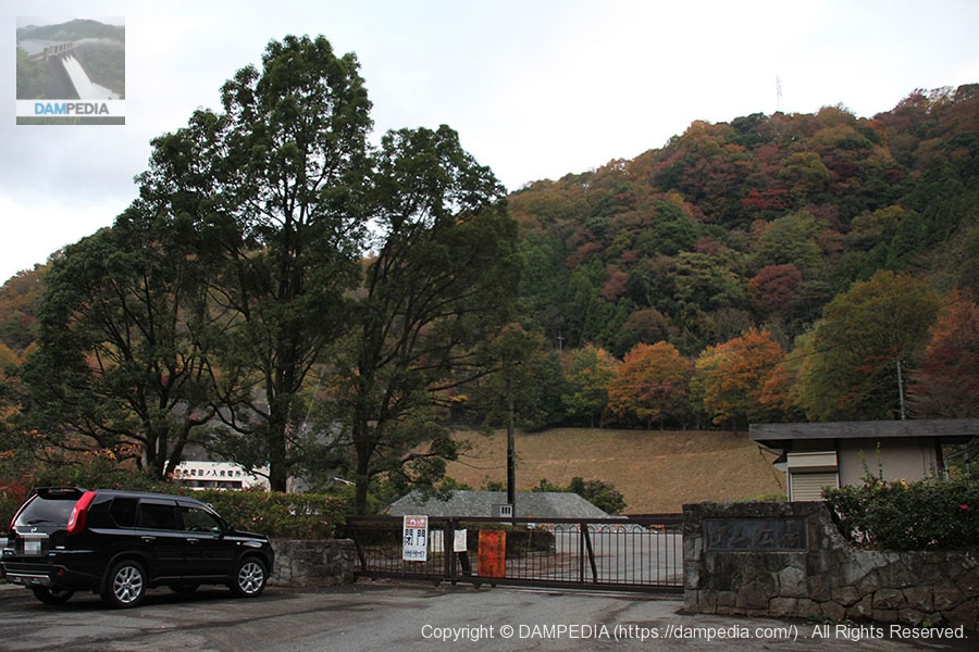
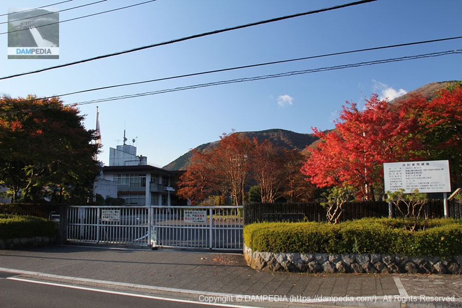
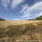
Entrance to the dam square parking lot
The time was a little after 6:30, but the entrance to the parking lot was closed. It was a little early.
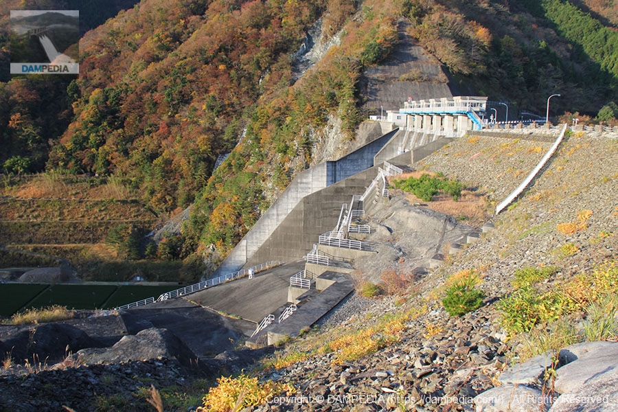
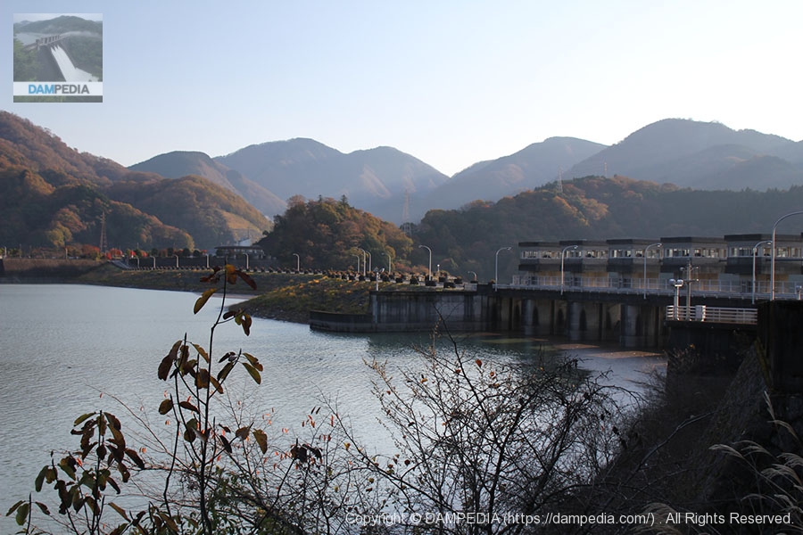
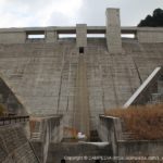
crest gate
The crest gate of the Miho Dam can be seen from a distance.

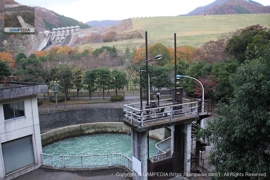
View of the diversion tank and the dike
The first thing that catches your attention when you get out of the car is this cylindrical diversion-like facility. It is a "water diversion tank" that diverts water from the adjacent TEPCO Tanouiri Power Station to the next TEPCO Arashi Power Station and any surplus water to the Kawachi River. The water user is Tokyo Electric Power Company and the maximum water intake is 8.35 m3/s.
Matsuyama Bridge
After that, we will head down to the bottom of the spillway, and next to the diversion tank, we are interested in this bridge. It is a 96.5m-long PC cable-stayed bridge called Matsukeyama Bridge, and is said to be the first PC cable-stayed bridge built overhanging in Japan. For this reason, it received the Tanaka Award from the Japan Society of Civil Engineers and was selected as one of the "100 Best Bridges in Kanagawa" by Kanagawa Prefecture.

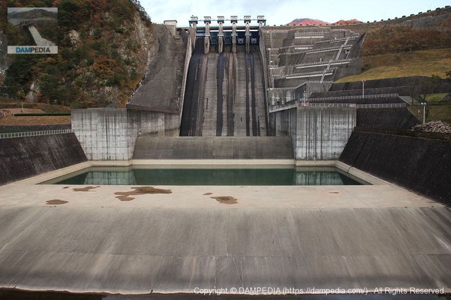
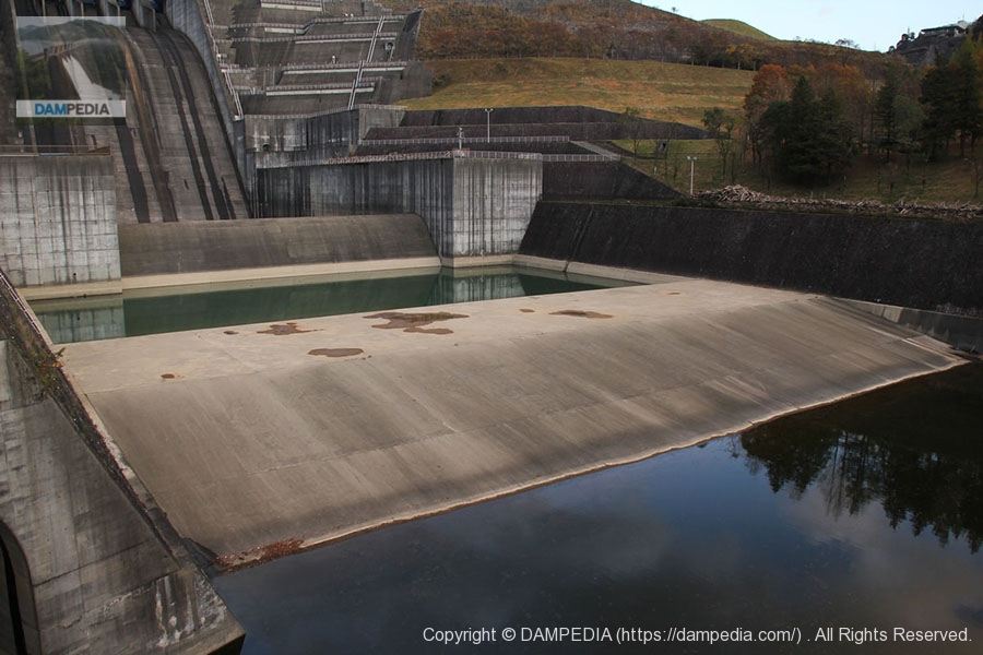
View of the residual water discharge from the Matsukeyama Bridge
It looks cool, but it is a rockfill dam, so the spillway is not the dam itself, but just an incidental facility.
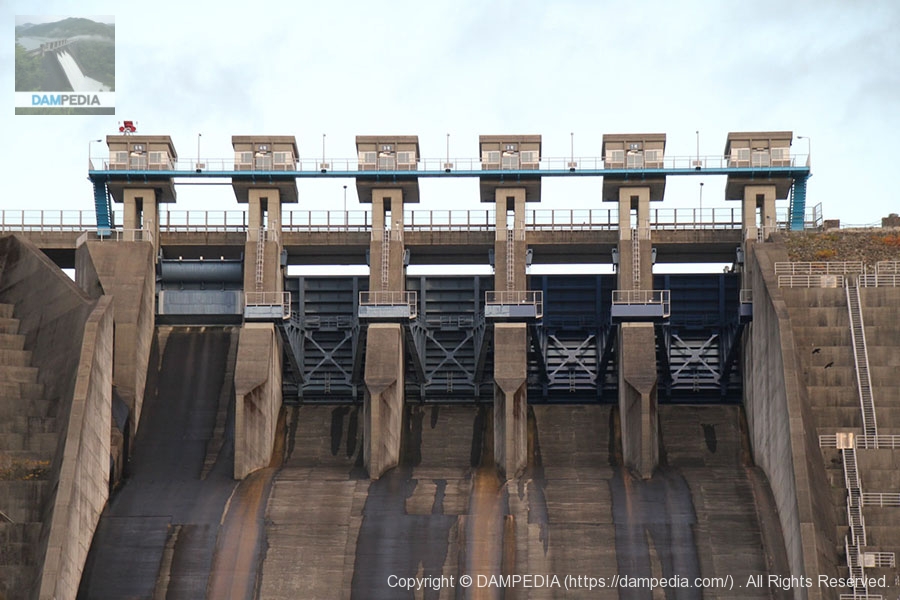
View of Crest Gate
The rightmost gate is No. 1, No. 1 through No. 4 are radial gates, No. 5 is a roller gate, and the leftmost gate is an overflow embankment, which is a little difficult to see in this photo.
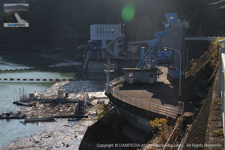
Bottom water outlet
The bottom discharge facility is equipped with one 1,200 mm diameter jet flow gate as the main gate and one 1,200 mm diameter ring holowa gate as the reserve gate.

momentum reducer
A sub-dam is located directly below the residual water discharge, and a structure for force reduction is located further downstream.
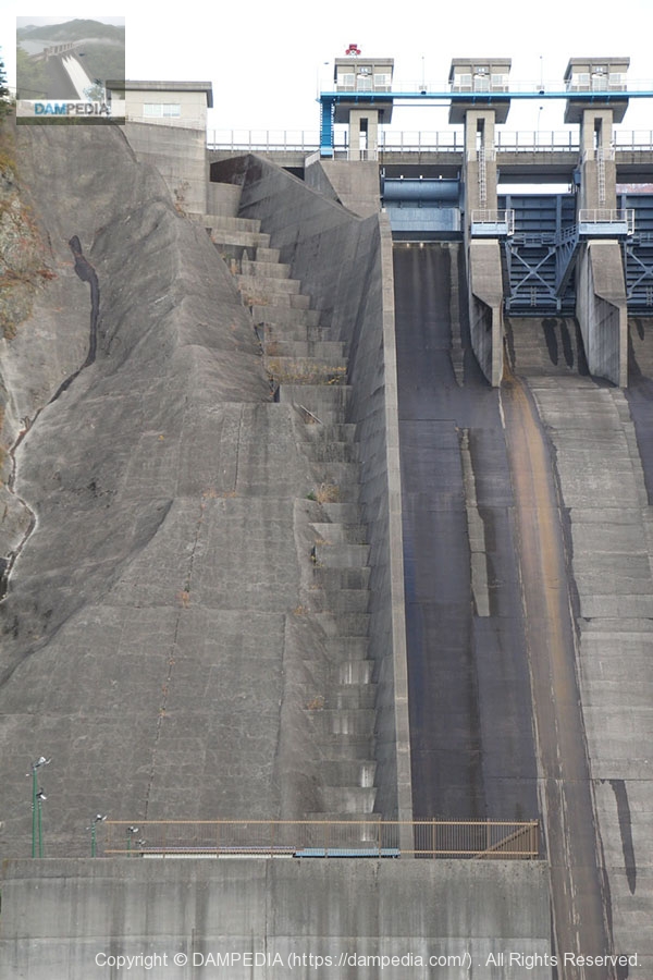
right bank conduit wall
I think it is because I am looking at it from a distance, but the conduction wall seems quite thin.
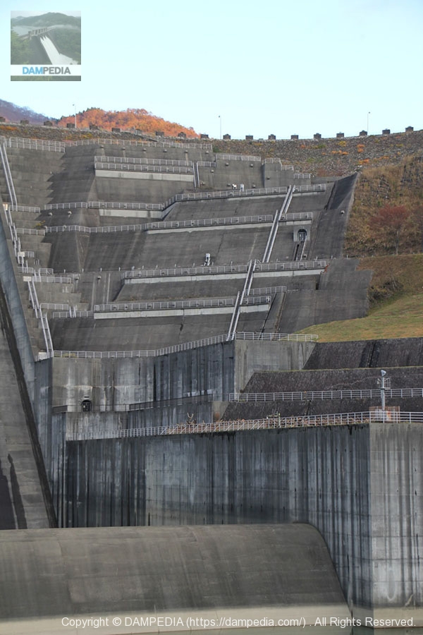
left bank of a river with a spillway
The Miho Dam is a rock-fill dam, but the volume of concrete in this photo as well as in the spillway is quite large. And it looks so cool that it is hard to describe. I think it is hardened so much because it cannot maintain its strength, but this is the moment when the coolness of the appearance surpasses the appearance of the dam.
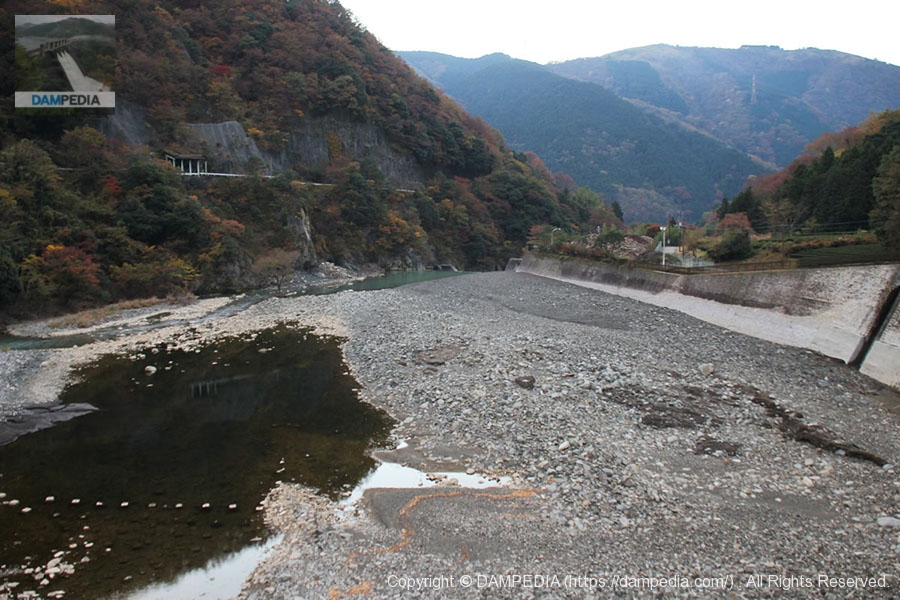
View downstream from Matsukeyama Bridge
Water is low, but water overflowing from the diversion tank is flowing from the left side of the photo.
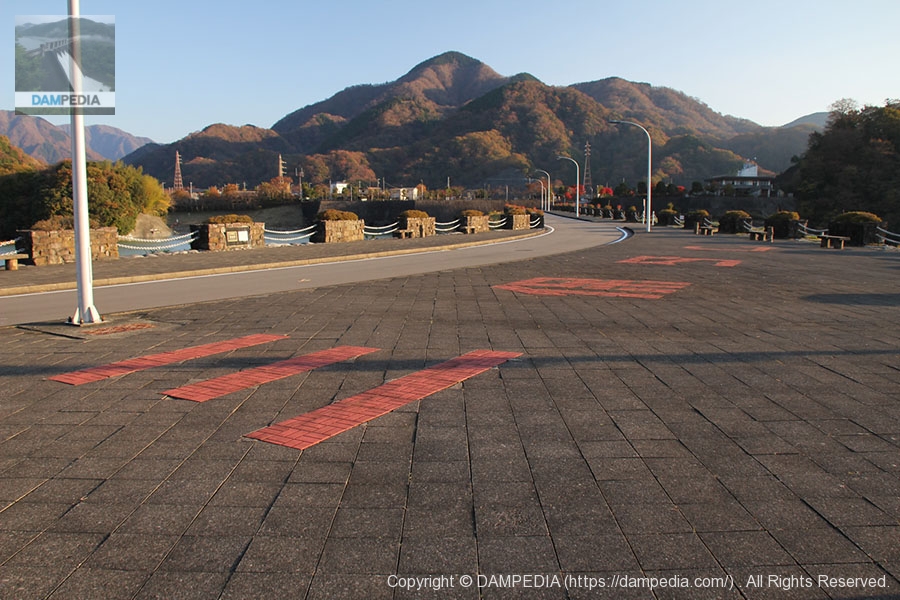
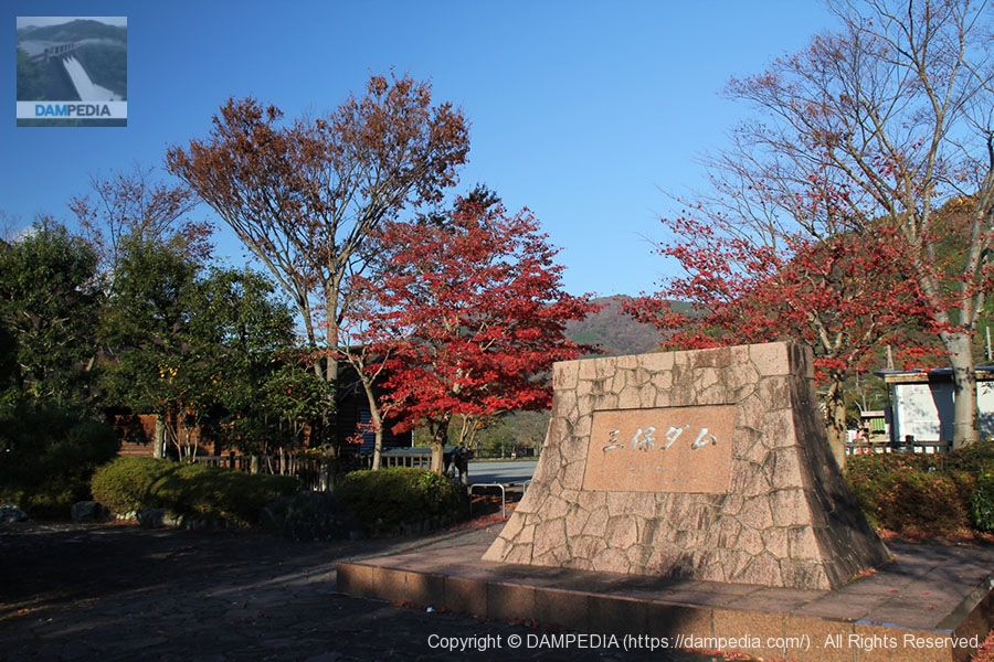
dam square
Before heading to the lock section of the embankment, we strolled around the dam square. This is why the dam square is a dam square: a 1/50 scale model of the Miho Dam is installed in the park. The pond is, of course, Lake Tanzawa. The overflow is discharged through a crest gate. And the fact that we visited during the season of autumn leaves makes for an even better situation.

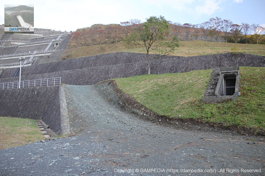
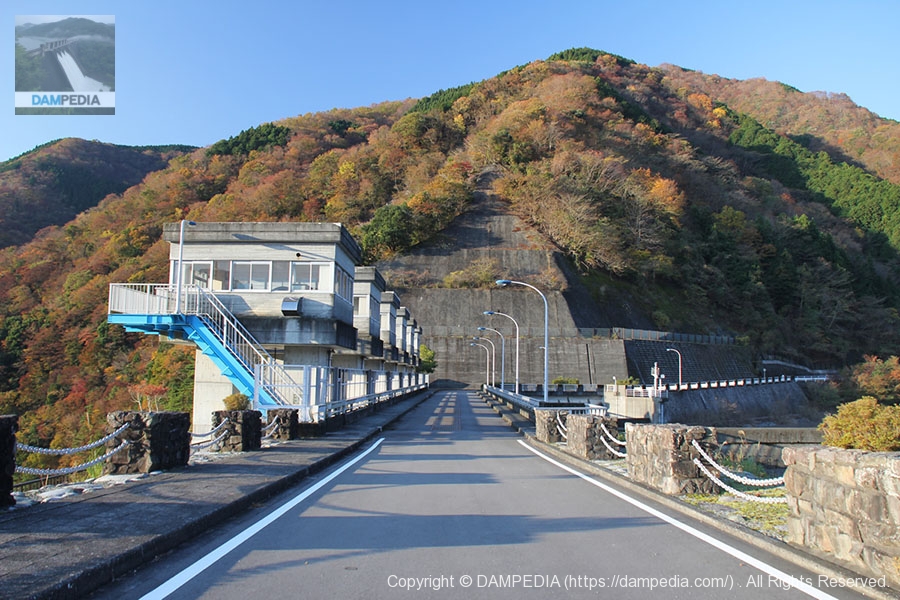
Heading to the levee
As we wandered around just below the spillway on the right bank side, the entrance to the audit corridor suddenly appeared.
Passageway to the top edge
It is maintained as a walking path, so it is like a casual stroll. The ginkgo trees were bright yellow, but unfortunately it was still early in the morning and dark in the shade of the mountains.

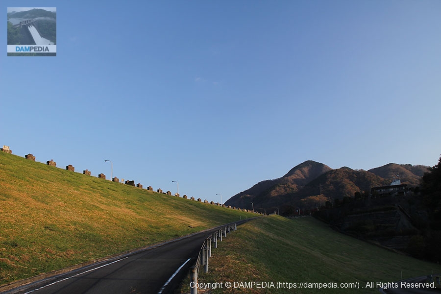
View of the top end from the middle of the dike
We are slowly climbing up the embankment. It is well maintained with asphalt pavement and would be very nice for a walk.
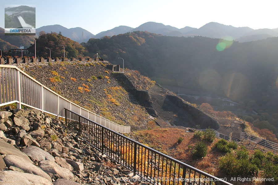
View of the downstream face of the levee from the top
We came to the top end. Looking down, the road seemed quite hilly, but it did not look like a miniature version of a mountain course in the Giro d'Italia or Tour de France. However, bicycles are not allowed on this winding road.
View from the center of the top edge looking downstream from the spillway
The sun was well up as I climbed to the sky's edge.
The words "Miho Dam" written on the top edge
The name "Miho Dam" is written in large red letters on the top edge, perhaps so that it can be seen from the sky.
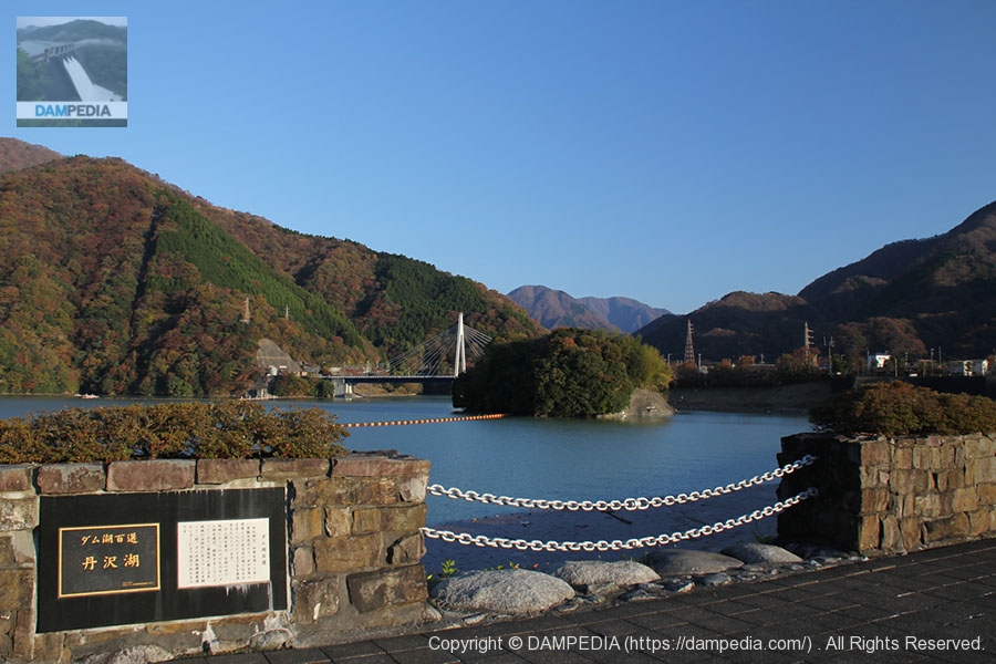
Nameplate of the 100 best dam lakes and dam lake "Lake Tanzawa
Lake Tanzawa, the dammed lake of Miho Dam, has been selected as one of the 100 best dammed lakes. The name of the dam lake may be more famous than the name of the dam.
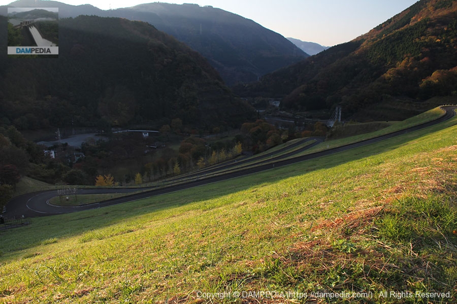
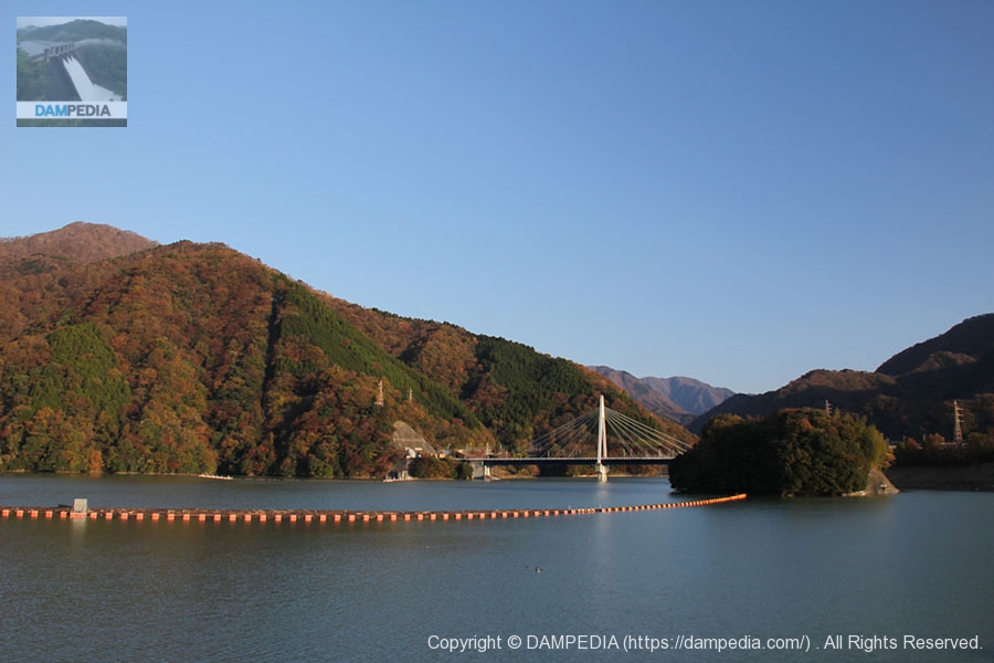
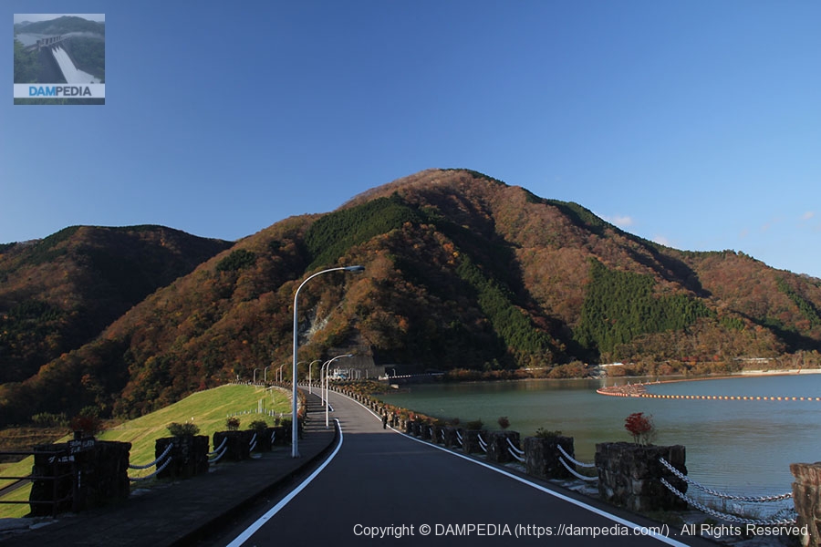
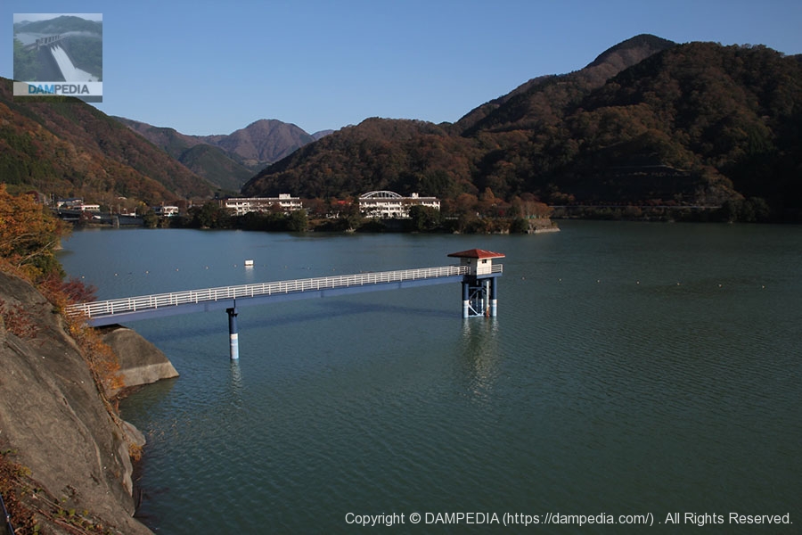
View of the dam lake
I think we were able to visit at a good time of year, just in time for the fall foliage season.
View of the top of the residual water discharge area
I would like to see an observatory built on this mountain.
View of Gate Pier
I have a tendency to want to take one-point perspective shots of things that are regularly lined up.

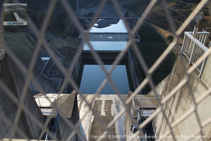
Looking downstream through the wire mesh of the fence
I wanted to experience the height, but unfortunately I can only see it through the wire fence because the fence is more than my height. If there is a tour, will we be allowed to go up to the gate pier?
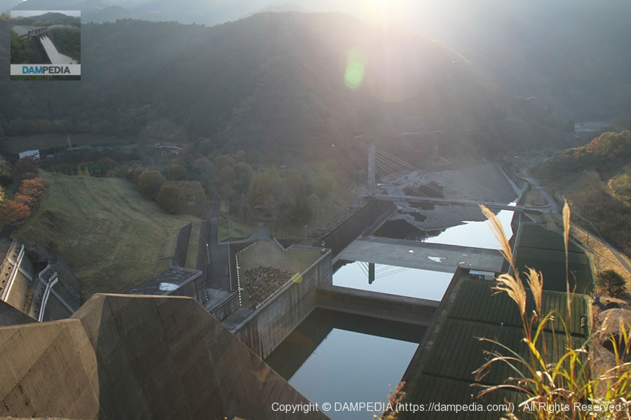
View downstream from the right bank
Aiming downstream through a gap in the right bank. However, it was backlit.
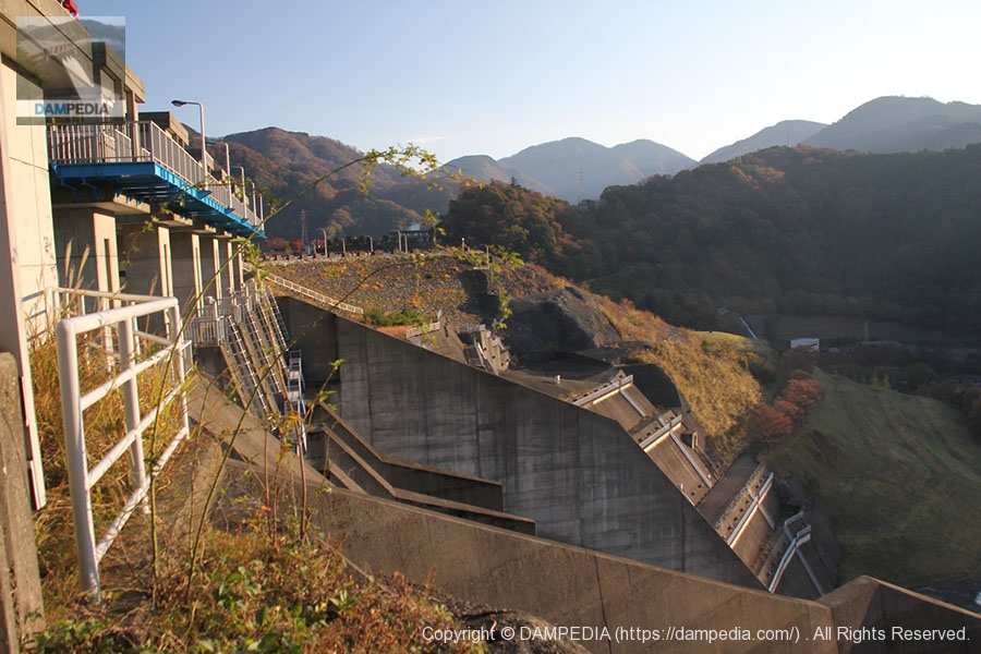
Downstream view of the levee from the right bank
The morning sun shines ochre-colored on the embankment. The structure from the water outlet to the lock section is still very rough and good.
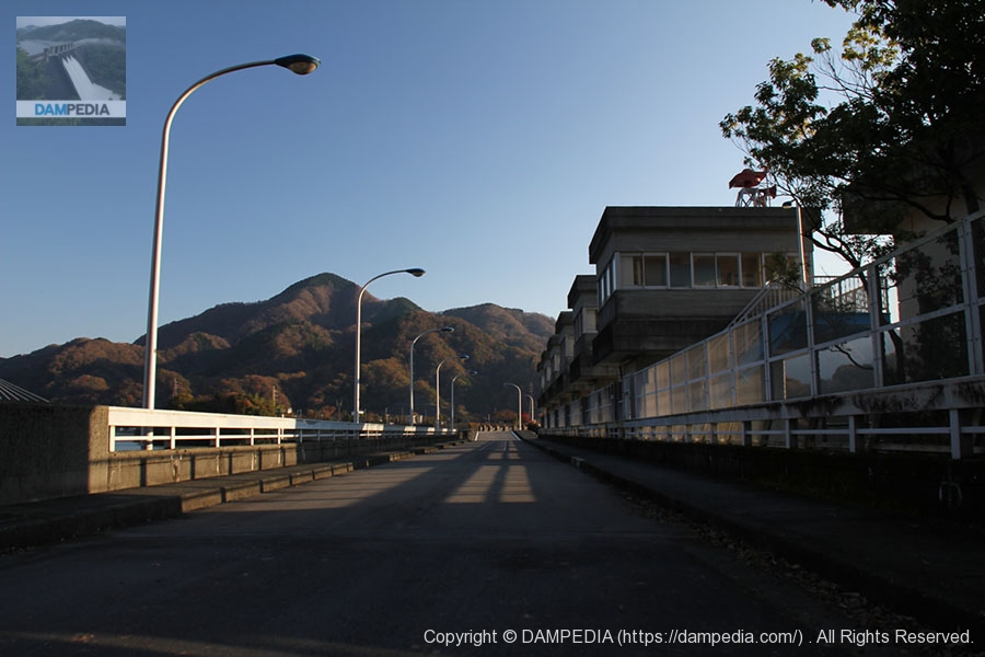
View of the top edge from the right bank
Because the dike is bent in the middle, it is not possible to see all the way to the left bank.
View of the spillway from the right bank on the lake side of the dam
You can see that the gate on the far right bank, which was hidden and difficult to see from downstream, is an overflow embankment.

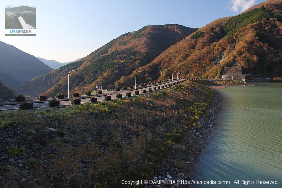
View of the embankment on the lake side from the right bank
It is a relatively large dam, so a walk around it is good exercise.
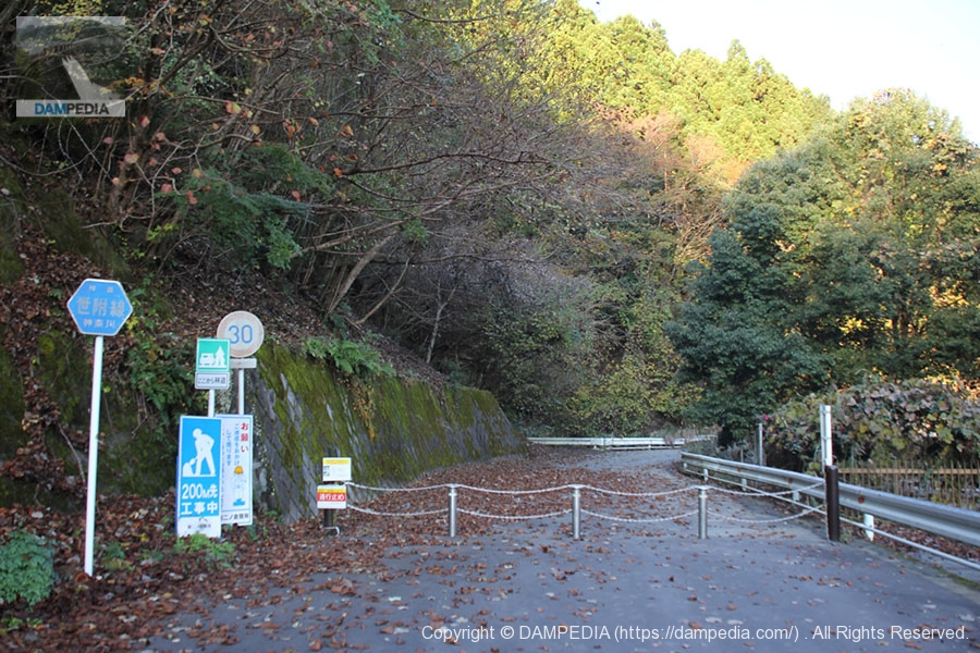
Right-of-way is closed in the middle of the road.
Landslides had prohibited passage beyond this point. At this point, I noticed that the camera lens had a problem and was unable to focus. Still, I managed to continue shooting with manual focus.
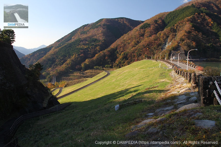
View of the levee downstream from near the spillway
When I came up the hill, it looked like an earth dam, but when I looked at it this way, I realized that it is still a rock-fill dam.
View of the top edge from the left bank
The weather is unusually clear for me. The sun's altitude has risen considerably, and I feel refreshed.
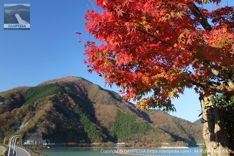
leaves changing color (colour)
Thanks to the PL filter, I was able to capture the red autumn leaves.
Plaza on the left bank
There was a square on the left bank and a stone monument that looked like a dam. But this looks like a gravity concrete dam (laughs).
View of the embankment on the lake side of the dam from the plaza on the left bank
The top edge of the line curves gently from the left bank and then turns at the end of the curve to connect to the spillway.
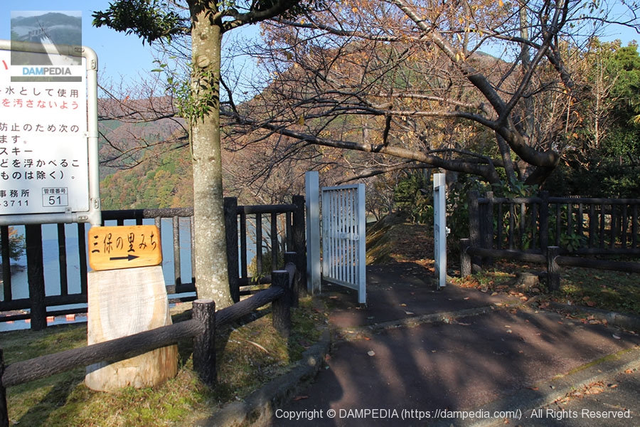
Miho no satomichi
This gate leads from the plaza to the lakeside walking path "Miho no Sato Michi". Visitors can take a leisurely stroll along the lakeside of the dam.
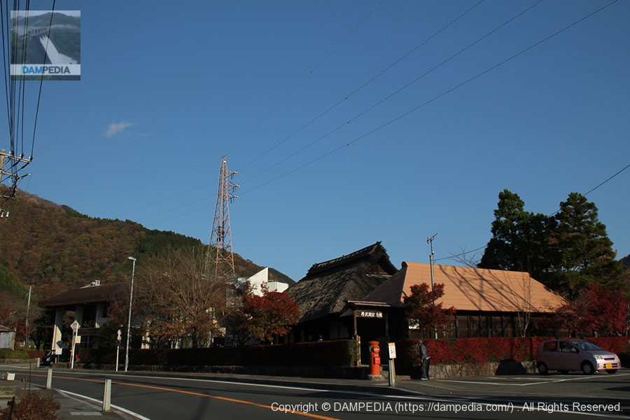
Lake Tanzawa Memorial Hall
However, since I was not familiar with the area, I did not use the "Sanpo no Sato Michi" and took the prefectural road north to the Lake Tanzawa Memorial Museum. You can get a dam card here.

Lake Tanzawa Memorial Museum and Miho House
Adjacent to the Lake Tanzawa Memorial Museum is the House of Miho. sunk in the dam lake.accession (e.g. to a file)It is said to be a relocated minka (private house) from the late Edo period that was used in the district until around 1973.
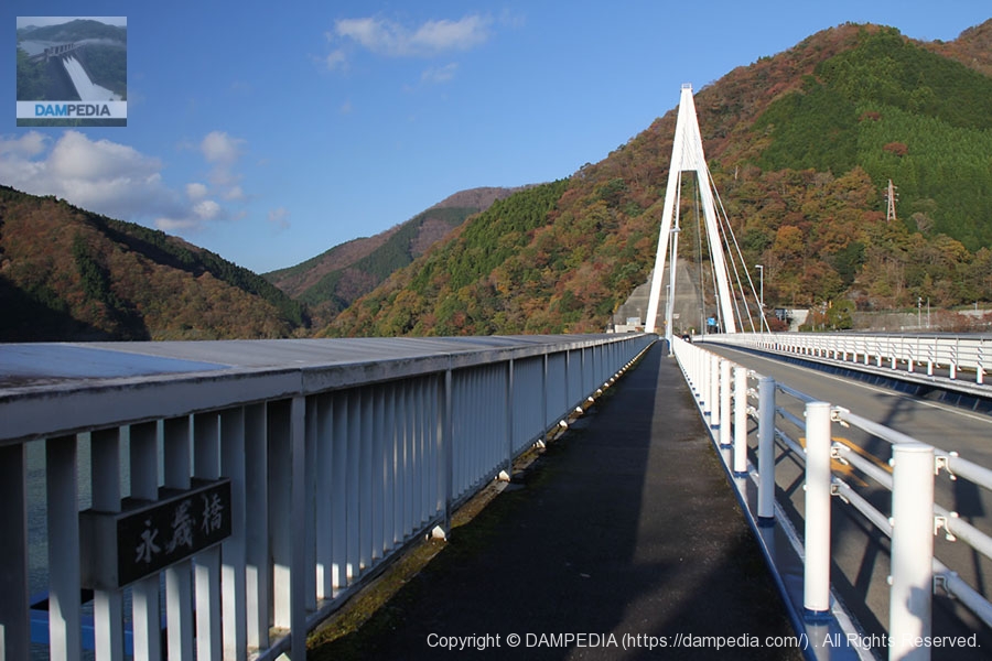
Cable-stayed bridge over Lake Tanzawa, "Eitai Bridge"
The name "Nagatoshi Bridge" was originally taken from the name of a bridge over an old prefectural road that had sunk to the bottom of the lake. This bridge has also been selected as one of the "100 bridges of Kanagawa".
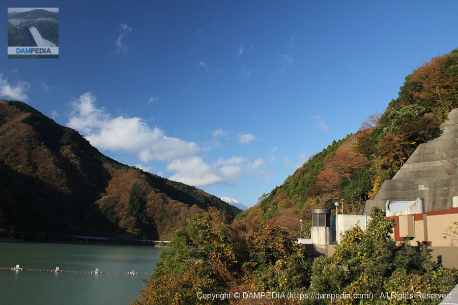
A glimpse of Mt.
Just before crossing the Eitai Bridge, a glimpse of Mt.
View of the levee from the foot of Eitai Bridge
Although the backlighting is quite harsh, a panoramic view of the embankment on the dam lake side can be seen from the foot of the Nagatoshi Bridge.

Tokyo Electric Power Company Ochiai Power Station
Water taken from the Omatazawa Dam upstream is carried by a conduit to this point for power generation. Incidentally, we did not go to the Omatazawa Dam due to time constraints (or rather, we did not do our homework). However, looking at the situation on the right bank, it is possible that the road was closed at that time.
Also, the name "Ochiai Power Plant" is extra complicated because both Chubu Electric Power Company and Chugoku Electric Power Company (and both are abbreviated as Chuden, which is even more complicated. In stock terms, it is abbreviated as Chubu Electric and Chugoku Electric to avoid confusion).

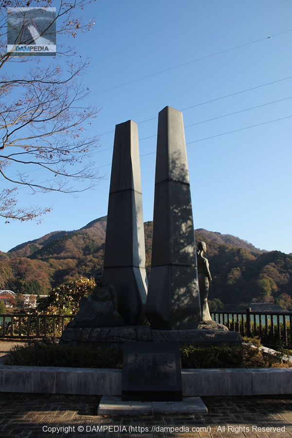
Rinsen" by sculptor Ken Tsuchiya
These monuments have also been installed.
Miho Dam Management Office
It is a large management station for a prefectural dam.
Dust removers and water intake facilities
In the foreground is the dust collector and in the background is the water intake system. The dust collector is located on the other side of the ridge on the left bank of the dike, so at first I was at a loss as to its position.
Miho Dam Water Level Observation Tower
At first glance, I thought this was an intake tower, but it seems to have been a tower for measuring the water level.
Observatory!
When I find a free staircase at the dam site, I do not hesitate to climb it first.

clock tower
Unfortunately, there was no view from the top (as is often the case). (This is a common occurrence.) So, here is the clock tower on the way.

View of the dam lake from the observatory? View of the dam lake from
This was about the limit in the area where the clock tower is located.

View of the levee downstream from the left bank
We gave up on the observation deck and decided to go down the embankment. Still, it looks like an earth dam because of the overgrown grass. But the grass is neatly cut, so I am sure they are aware of being seen.
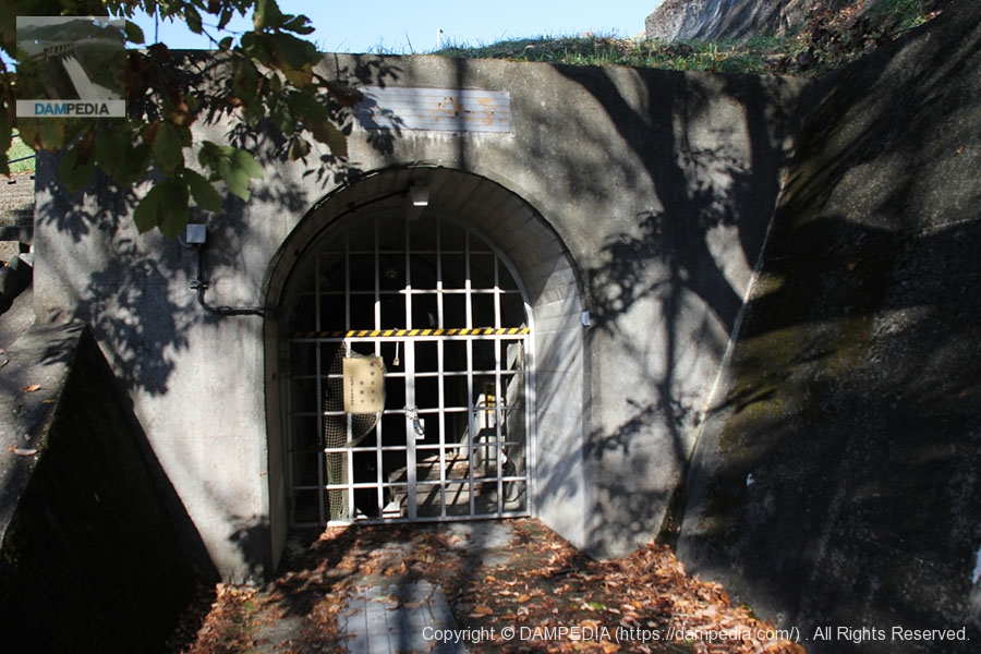
Entrance to the audit corridor?
On the way down from the left bank, there was what appeared to be an entrance to the audit corridor.
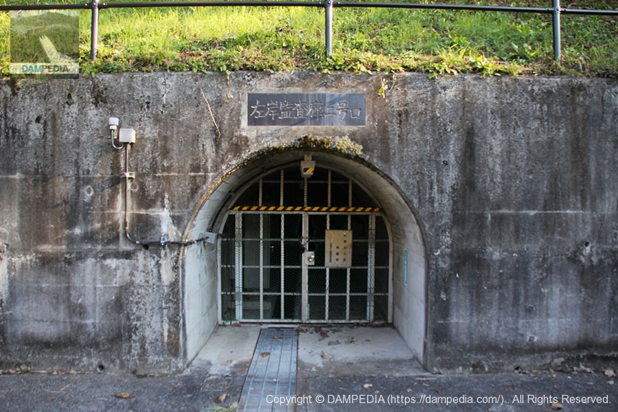
Left bank audit corridor No. 2 entrance
Then there is another similar structure. This one is marked as an audit corridor, so the one in the photo above may not be the entrance to the audit corridor.
Tunnel for Regular Use Discharge
Water taken from the intake facility is discharged through here to the Tanouiri Power Plant.

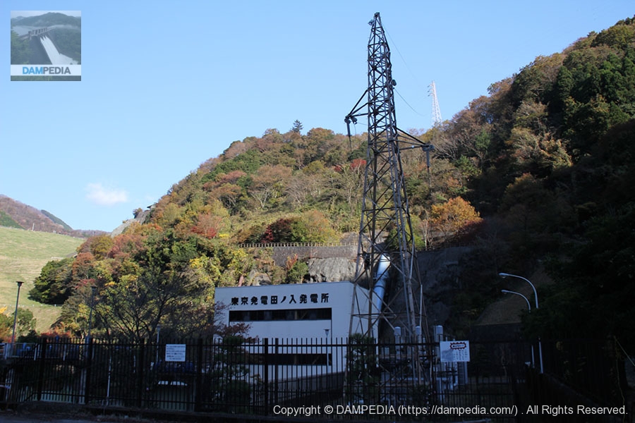
Tokyo Power Tanouiri Power Station
Tanouiri Power Plant with an effective drop of 71.871m and a maximum output of 7400kW.
View of the levee from downstream
The sun's altitude has risen considerably, and the entire levee is now finally covered by the sun's rays.
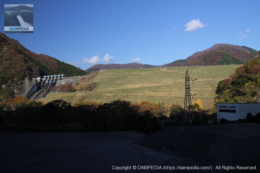
The Miho Dam is a rather large dam, so we recommend that you take your time and take a good look around.
Miho Dam Specifications
| River Name | river in which worshippers wash their hands (and rinse their mouth) prior to entering a shrineWater System Kawachi River |
|---|---|
| Objective | Flood control, water supply, power generation |
| Model | Soil barrier rockfill dam |
| Bank height | 95.0m |
| Bank length | 587.7m |
| Dam volume | 5,816,000m3 |
| Watershed Area | 158.5 km2 |
| Reservoir area | 218ha |
| Total storage capacity | 64,900,000m3 |
| Effective water storage capacity | 54,500,000m3 |
| Dam operator | Kanagawa Prefectural Enterprise Agency |
| Main body constructor | Kajima Construction |
| Year of launch | 1969. |
| Year Completed | 1978 |
| Name of Dam Lake | Lake Tanzawa |
Map around Miho Dam
Other facilities/observations
There is parking on both the downstream side and the top end side, so it is safe for those who are not comfortable walking.
| Parking lot | ○ |
|---|---|
| Toilet | ○ |
| Park | ○ |
| PR Exhibition Hall | ○ |
| Fishing | ○ |
Comment