

Location: Yamada-cho, Kita-ku, Kobe City, Hyogo Prefecture
Date of interview: 2009/10/16
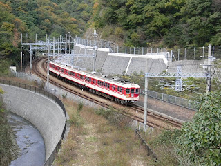
Kobe Electric Railway seen on the way
I participated in the 8th Dam Web Ring off-line meeting [off-line tour of dams on the Karasubara River by Kobe Electric Railway]. The meeting place was Suzurandai station of Kobe Electric Railway. At first I thought of staying in Kobe or taking the Shinkansen, but my schedule was difficult and I was afraid of the new influenza, so I ended up driving to the meeting place. So, we are Kobe Electric Railway, but it seems that you cannot drive up to the embankment, and you can reach the dam by walking along the side of this railway line from Suzurandai station.
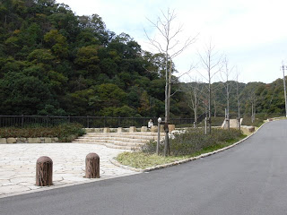
Parks along the way
I had done a little preliminary study beforehand, and I was very curious about the dam because it has "recreation" as its purpose. However, it seems to have fulfilled its purpose, and there were quite a few people taking a walk. This park is on the way to the embankment and is located in the middle of a reasonably sloping slope, so people with weak legs can easily take a rest here. In fact, there was an elderly person taking a rest here.
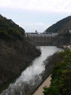
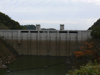
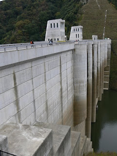
View of the embankment from the lake side of the right bank
I am not an athletic person, so this meeting was quite difficult for me.... I commute by car and am not accustomed to walking. Just when I thought it was getting harder and harder, the embankment finally appeared.
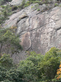
Meigo-iwa (name rock) seen along the way
On the right side of the road, you will see a rock called "Meigo-iwa" (Myogo-iwa) on which is written "Namu Amidabutsu" (Amitabha). It is said to have been carved 150 years ago by a Buddhist monk who prayed for the safety of travelers.
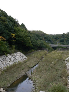
View of the embankment on the lake side from the right bank
We are getting quite close to the levee. The water storage capacity is quite low. Can you see from the natural overflow gate that this is a dam with a top end side channel?
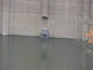
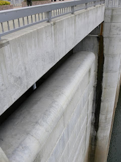
View of orifice gate
The orifice gate intake of the permanent flood discharge is visible due to the low water storage capacity.
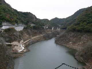
View of the dam lake from the right bank
There is a pathway by the dam lake. At this time, it was not yet open to the public, but when the water volume is not too high, it is possible to walk on it. In case of emergency, it seems that this area will be submerged as well. Incidentally, this passageway was originally used by the Kobe Railway before the dam was built.
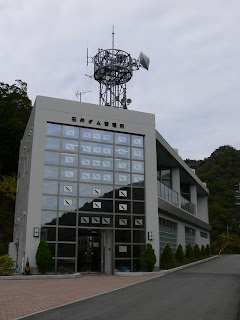
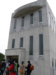
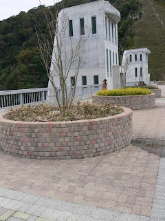
Ishii Dam Management Station
Perhaps because birds fly in and hit the window panes, there are pictures of birds painted on the window panes.
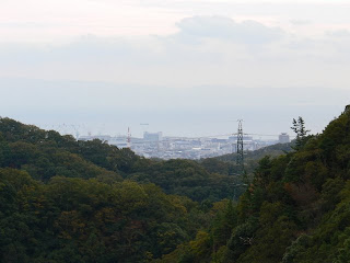
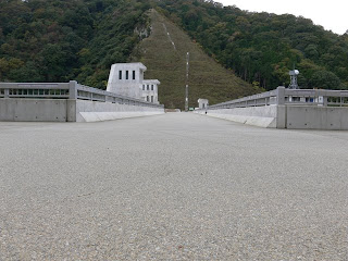
View of Kobe city center and Seto Inland Sea from the top
What a view of Kobe City and the Seto Inland Sea from the top edge. If the view were a little more open, the night view would be beautiful.
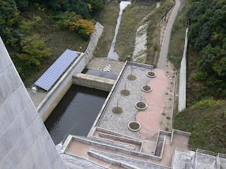
View downstream from the top
As one would expect from a place with a "recreational" purpose, the downstream side of the river is quite well maintained.
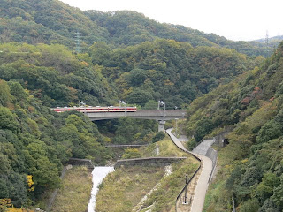
View downstream (Kobe Electric Railway) from the top
The Kobe Railway can be seen directly below the dam. This means that the dam can be seen from the train. It is a very enviable sight for an enthusiast to be able to see the dam while commuting to and from work or school. On the right side, you can see an abandoned tunnel of the Kobe Railway. It used to be connected to the upper stream through here.
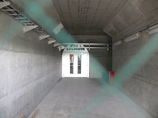
Entrance into the dike
We were allowed to take a special look inside the dike. We entered one after another...
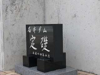
Cornerstone of Ishii Dam
Since this is a new dam, the cornerstone is also new. Also, unusually, it is not embedded in anything, but is set outside, so I am a little worried that it might be taken out without permission.
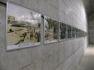
Part of the gallery in the dike
I had heard that there was a gallery inside the embankment, but is this inside a gravity concrete dam? The gallery is so spacious that it makes one wonder if it is inside a gravity concrete dam. The dam itself is managed by Hyogo Prefecture, and the gallery is managed by Kobe City.
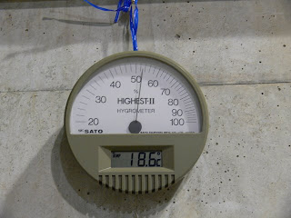
Thermo-Hygrometer
The temperature inside the dam is 18.6 degrees Celsius. Most dams are cold even in summer, but the interior of the Ishii Dam is surprisingly warm. The temperature inside Ishii Dam is surprisingly warm. There are no air conditioners or other air-conditioning systems in the dam.
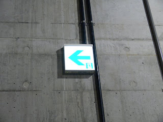
emergency information board
As is typical of a gallery, emergency information boards have been installed in anticipation of public visits.
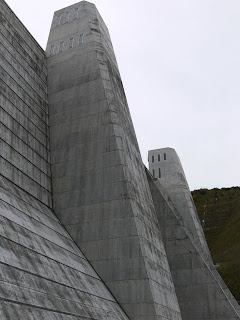
View of the top edge from the left bank
It is very beautiful. A well-maintained dam, that's what it looks like.
View of the embankment on the lake side of the dam from the left bank
On the dam lake side, a semi-cylindrical structure is attached to the dike, which gives a somewhat feminine impression.
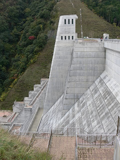
View of the downstream bank from the left bank
But the downstream side looks like a battleship, or rather a bridge of a space battleship.
Planting at the top edge
It was cold, but I felt it would be a great place for a picnic if it were warmer. After this, it was time for lunch, but it was too cold to eat at the top, so we moved downstream where we could shelter from the wind, and ate our lunch while sitting on the bank.
Perhaps because I hadn't walked in a while, I ate a lunch box of a reasonable volume, lol.
Natural overflow emergency flood discharge
This is a flood discharge in the form of a so-called "topside channel". I would like to see water flowing in here.
View of the dam lake from the top
The dam lake looks a little deserted, perhaps because it is approaching late autumn and the weather is cloudy, but I am sure it is beautiful under the summer sky. If possible, I would like to revisit during the warmer season.
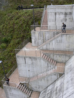
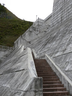
Visitor pathway with footings
Come on, let's go hooting! I was so enthusiastic, but it wasn't that hard because it was downhill. I was taking pictures at a slow pace, but it wasn't that hard. Also, the height of the embankment as well as the kick-up of the stairs is not that high, so the ascent does not seem to be hard either. In this respect, as a dam for recreational purposes, the height may have been designed with visitors in mind.
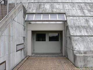
Entrance to the gallery inside the dike from just below the dike
They can enter the dike gallery mentioned earlier from here. Since the frontage is wide, wouldn't it be good for a car dealership? or "Why don't you open a branch office of Kamima's company? and other meaningful suggestions were made to make effective use of the gallery.
Behind the entrance to the gallery inside the dike from just below the dike
The entrance is closed from the top end, as is the entrance to the gallery itself, which is not usually open to the public. It might be a good idea to do something more about the inside so that visitors can tour it relatively freely, as is the case, for example, with the Kosatogawa Dam in Gifu Prefecture. Hyogo Prefecture and Kobe City, please visit the Kosatogawa Dam.
View of the embankment from downstream on the right bank
It still looks masculine from this side because it looks like a naval bridge. However, because it is a new dam, the concrete is white, giving it an intellectual impression rather than an athletic one. For some reason, however, I was reminded of Ardalbert von Fahrenheit from "The Legend of the Galactic Heroes.
View of footing from below
Moderate staircase, moderate height. Even those with weak legs and backs can safely ascend and descend. It is a great way to get rid of lack of exercise. If there were such a dam nearby, you might be able to lose 5 kg. No guarantees, though.
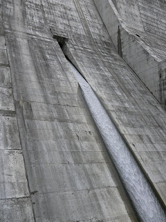
Discharge from orifice
It is not a powerful flow, but it is smooth and silky. There is a conduit gate a little lower down, which is not shown in this photo.
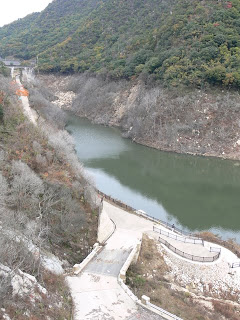
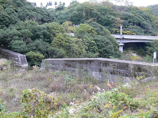
Looking downstream from the right bank
The flow rate is low, but I am sure it will flow the full width of the river when the need arises. It is expected to be especially effective during guerrilla downpours. You can also see an erosion control dam in the back.
View of the erosion control dam from the right bank
This is its erosion control dam. It seems to have existed before the construction of the Ishii Dam. This erosion control dam seems to have a proper name, but the name is unknown because the signboard is illegible due to weathering.
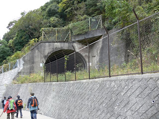
Kobe Electric Railway Abandoned Line Site
On the downstream right bank, the abandoned Kobe Electric Railway tunnel that was seen from the top earlier can be seen up close. As you can see, this tunnel is off-limits, but we would like to find some way to utilize it.
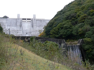
Two shots of Ishii Dam and Erosion Control Dam
Collaboration of a newcomer's high dam and an old erosion control dam. It is unfortunate that the embankment of the Ishii Dam is blown white, but it is actually my favorite of the photos in this issue, lol.
dam characteristics
| River Name | Karasuhara River, Shin-Minato River system |
| Objective | Flood control, agricultural disaster prevention, recreation |
| Model | gravity-fed concrete dam |
| Bank height | 66.2m |
| Bank length | 155m |
| Dam volume | 182,000m3 |
| Watershed Area | 6.9 km2 |
| Reservoir area | 11 ha |
| Total storage capacity | 2,200,000m3 |
| Effective water storage capacity | 2,000,000m3 |
| Dam operator | Hyogo prefecture (Kinki area) (Hyougo) |
| Main body constructor | Nishimatsu Okumura Zenitaka Arai, Yorigami |
| Year of launch | 1972 |
| Year Completed | 2008 |
| Name of Dam Lake | - |
Other facilities/observations
As of October 2009, the road to the embankment is apparently a construction road and has not yet been shared. Therefore, they will transition to a county road after all ancillary work is completed. For this reason, there is no parking lot yet, but a parking lot may be built in the future. But since the purpose is recreation, we would like to come by train and walk from the station instead of coming by car. Just by going to the Ishii Dam, you can be both healthy and environmentally friendly.
| Parking lot | × |
| Toilet | ○ |
| Park | ○ |
| PR Exhibition Hall | × |
| Fishing | × |

Comment