
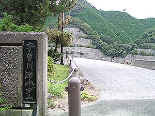
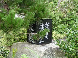
Location: Aza Monkubo, Hirayanagi-cho, Higashiomi-shi, Shiga
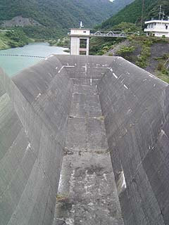
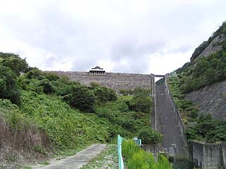
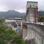
View of the top edge from the right bank
It is called the Uso River flood control dam, but the dam handbook describes it as the Uso River dam. Which is true or false? Or are they both true?
Be that as it may, this Uzogawa Dam is located among the three mountains known as the "Koto Sanzan" (three mountains in the Koto area): Ryueizan "Seimyoji Temple," Shobozan "Kongorinji Temple," and Shakayama "Hyakusaiji Temple," which are also famous for their autumn leaves. It may be a good idea to visit these temples when visiting the dam. Also, it is said that there are many national treasures and important cultural assets in the three mountains of Koto. By the way, naturally (?), since the dam is the main attraction, I will not be visiting these temples. I could not visit these temples because I was mainly interested in the dam.

View of the top edge from the right bank
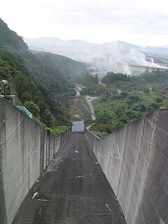
The top end is closed to vehicular traffic.
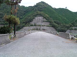
View of the top edge from the right bank
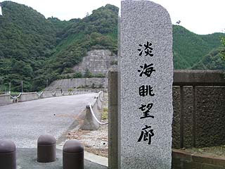
There was a stone monument with the name "Awakai Gazebo Corridor" written on it. Compared to the surrounding area, this monument is relatively new, and although I cannot deny that it seems to have been taken from the original, I thought it had a good name. I thought it might be the name of the bridge at the top, but that does not seem to be the case. Please read about it later.
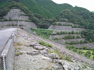
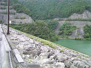
Downstream view of the levee from the right bank
It is a very ordinary riprap. I wonder if it would hurt if I fell from here... Oh, of course.
laying a cornerstone (foundation stone)
Most cornerstones are usually fitted into the railing at the top of the building, but it seems a little unusual to see them alone like this. This cornerstone is also relatively new. However, it is a little hidden, perhaps because the pine trees are not well cared for.
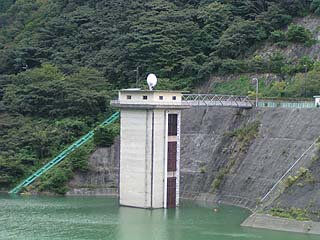
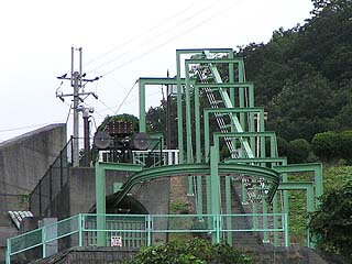
View of the intake tower from the top
Beyond the intake tower is an incline. The green color of the incline looks like the rails of a roller coaster.
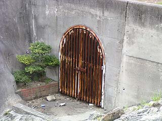
Auditor's corridor entrance
There was an entrance to the audit corridor on the downstream side of the right bank top. However, the door is quite rusted.
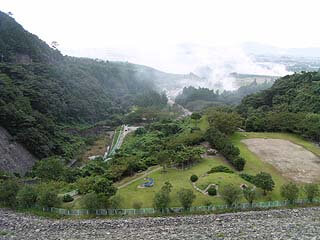
View of the downstream park from the top
A park is set up just below the dike. However, it seems that to get there, one has to walk from the middle (?) of the levee. The right side of the photo seems to be a burial mound, but it is unclear whether it is actually a burial mound or not. In the right side of the photo, there is what looks like a burial mound, but it is not clear if it is actually a burial mound or not.

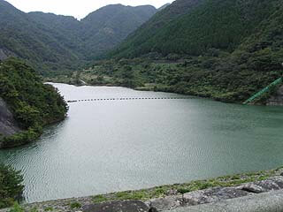
View of the dam lake from the top
It is a beautiful dammed lake. I thought it was fitting to call it "Awamai."
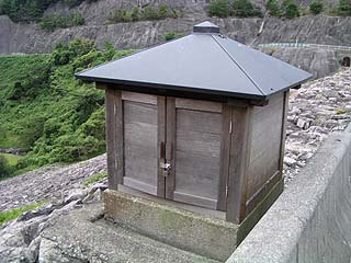
Mystery Box
This box is not very large, but it is unknown because the door is locked and there was no description of what it contains. It looks like it might contain a Buddha statue or something. Does it contain a dam god? If so, I would love to see the principal image.
Viewing platform
What an observation deck has been set up at the top end. This is the first time I have seen such a magnificent observation deck installed at the top.
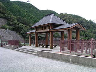
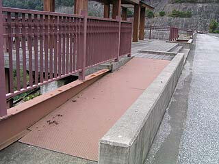
Slope to the observation deck
The observation deck is equipped with a ramp, allowing wheelchair users to go up to the observation deck. I am very impressed that the dam is barrier-free.
View downstream from the top
On the downstream side of the river, there is an open fire going on and it is quite smoky. You can smell the burning smell around the levee. If it is a fine day, you can see as far as Lake Biwa. I wonder what the night view would be like since it is not in an urban area.
View of emergency flood discharge (dam lake side)
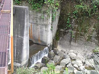
This is a natural overflow flood discharge. It looks very large. Incidentally, the permanent flood discharge was described as an "orifice-type tunnel type," so it seems that a water-conducting tunnel is installed underground.
Emergency flood discharge (downstream)
It appears to be a large slide. It is not wet at all, so there seems to be no sign of recent activity.
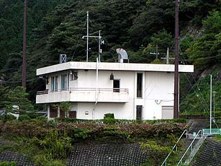
dam control center
Lift?
On the left bank, what looked like a cableway for a ski lift was set up. Since the area beyond this point was off-limits to all concerned, it was shrouded in mystery, but moving downstream seemed to have solved the mystery a bit.
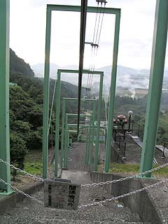
Lift?
This is a photo of the lift taken from downstream. It is probably still a lift, since there is what looks like an audit corridor in the lower left corner. However, it is unclear whether it carries people or supplies.
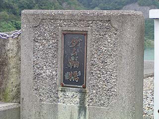
Nameplate installed on the top edge parapet
This is the reason why the aforementioned "Awami View Corridor" is not the name of the dam end bridge. The name of the dam end bridge is "Dam Axis Bridge". It is just as it should be.
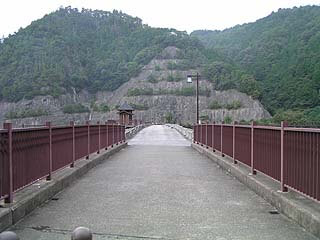
View of the top edge from the left bank
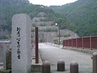
A stone monument similar to the "Awami View Corridor" on the right bank reads "Suzuka no Kokoro Seimei no Hane" (The Heart of Suzuka: Wings of Life). There is something deeply moving about this monument.
View of the top edge from the left bank
View of the embankment from the left bank of the dam
Water flow from the permanent flood discharge
After shooting at the top end, we arrived at the park on the downstream side of the river.
The water must have come through the water conduit tunnel. The amount of water discharged is not so large.
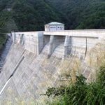
View of the levee from downstream
Uzogawa Dam Specifications
| Model | rockfill dam |
| Objective | Flood control, agricultural disaster prevention, unspecified water, river maintenance water |
| Bank height | 56m |
| Bank length | 192.8m |
| Dam volume | 980,000m3 |
| Elevation of non-overflow area | 263.5m |
| Watershed Area | 7.8km2 |
| Reservoir area | 17 ha |
| Total storage capacity | 2,900,000m3 |
| Effective water storage capacity | 2,600,000m3 |
| Discharge type | Orifice type tunneling type |
| discharge (e.g. of water from a dam) | 25m3/s |
| Gate type | Jet Flow Gate phi1,300mm x 2 gates |
| River Name | Yodo River System Uso River |
| Year of launch | 1971 |
| Year Completed | 1979 |
| Access | After getting off at the Hikone Interchange on the Meishin Expressway, turn left on National Route 306, go south on Route 306, enter Hadasou Town, Aichi County, and just before entering Koto Town, Aichi County, turn left at the signboard that guides you to the dam. In fact, I overlooked it and passed it by. |
Other facilities/observations
It is quite well maintained and there are a good number of people who come to play. I was surprised to find that the license plate number of the car of one such visitor was the same as my own. I was surprised to find that the license plate number of the car of one of the visitors was the same as my own. There is a water park downstream from the dam site, but it seemed to be in the process of being developed.
I hope they will continue to maintain it more and more.
| Parking lot | ○ |
| Toilet | ○ |
| Park | ○ |
| PR Exhibition Hall | × |
Accommodations that may be close to Uzogawa Dam
Comment
[Auto-post] Damapedia Archives - Please take a look at it in your spare time - 1362-Uso River Dam/Usogawadamu http://t.co/pMjcu5jTlq