
Date of interview: Wednesday, 1/28/2015
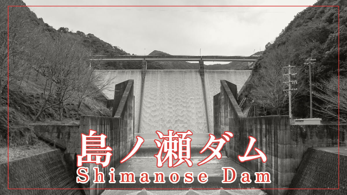
After leaving the Kirimegawa Dam, we visited the Shimanose Dam. This was the fourth dam of the day. The Shimanose Dam is under the jurisdiction of the Ministry of Agriculture, Forestry and Fisheries and is used for agricultural water as Nanki Water. The region's specialties are of course Kishu plums, Nanko plums, and mandarin oranges, so the water from the Shimanose Dam supports those brands.
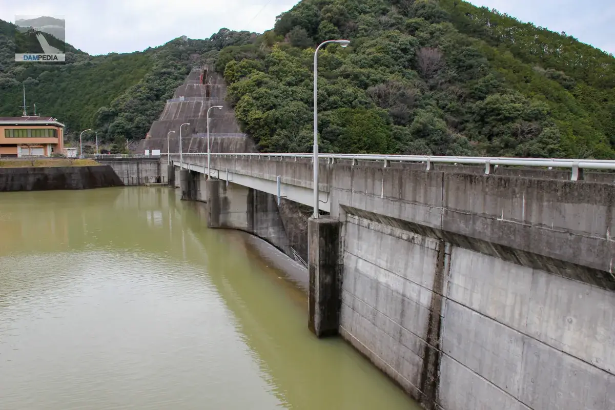
Start with the left bank.
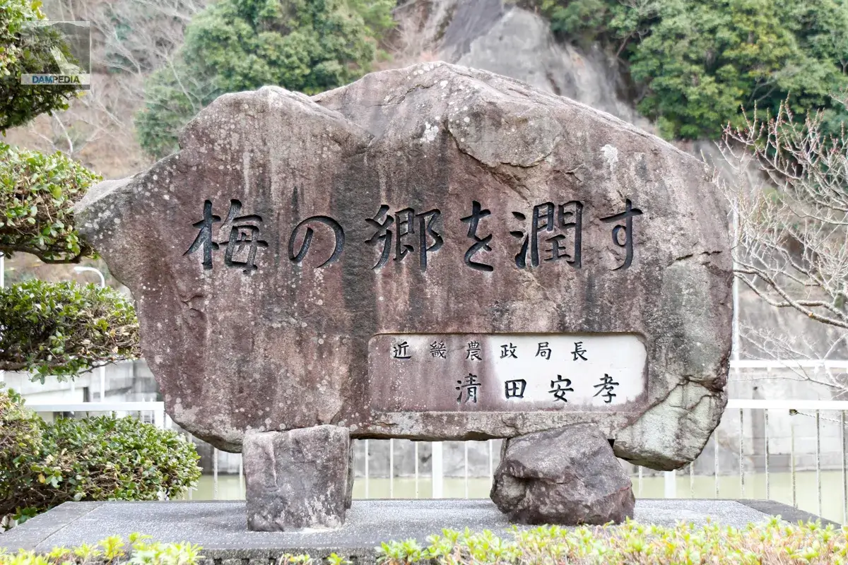
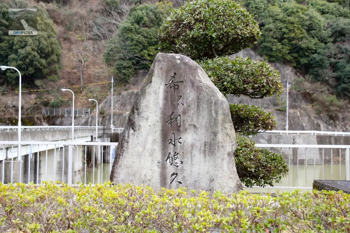
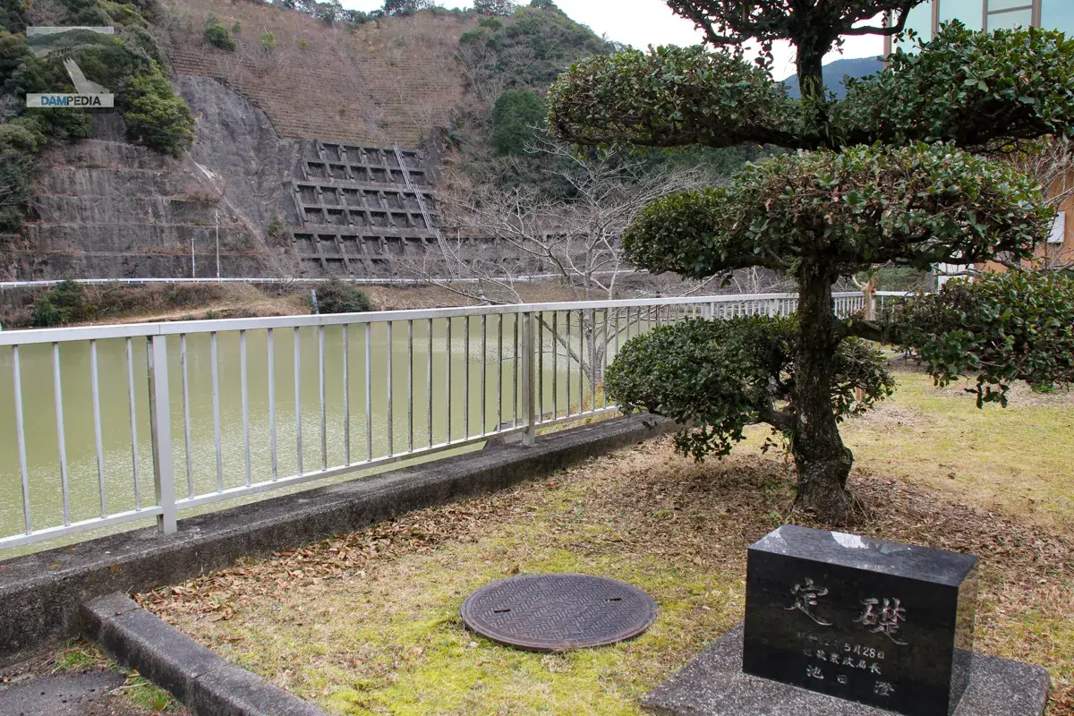
There is a management office on the left bank. Stone monuments and other structures are collectively located next to it.

The monument was written by the then Director General of the Kinki Agricultural Administration Bureau, who was proud of the fact that ume (Japanese apricot) is a specialty of the region.
There is another stone monument with the words "Kiku wa risui yukyu" written on it. The word "Kiku wa" is read as "Koinegawa wa," meaning "I strongly hope that water will still be beneficial even after a long time has passed.
The cornerstone is located here.
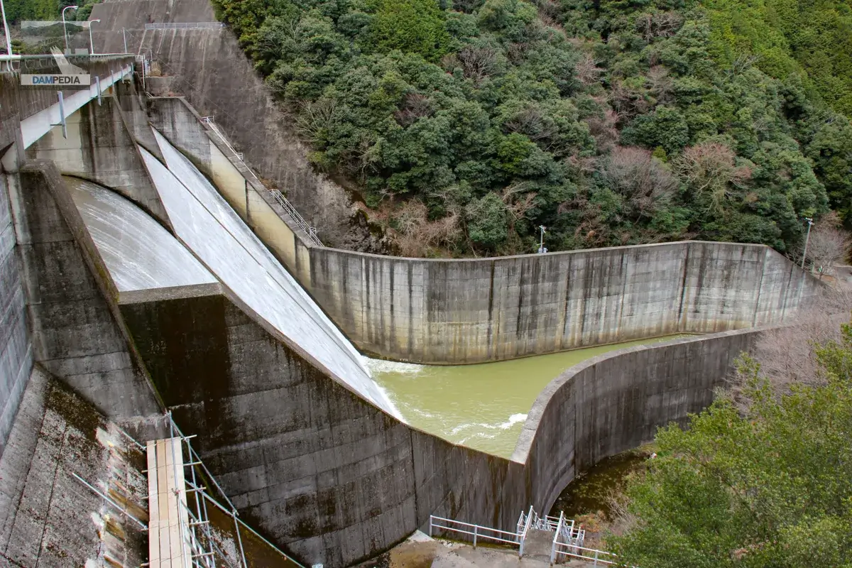
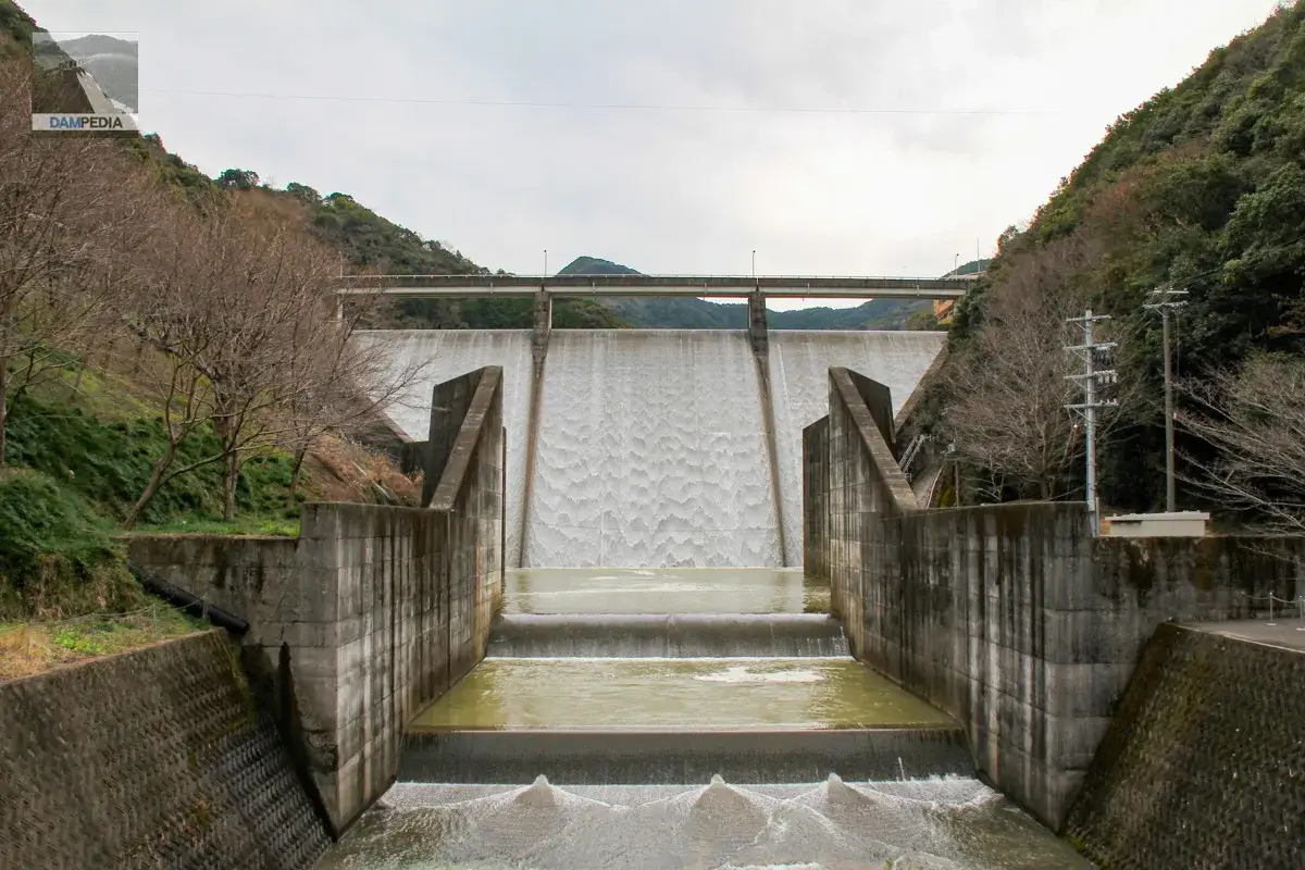
And, as if in response to the Kirimegawa Dam, the Shimanose Dam was also overflowing on that day.
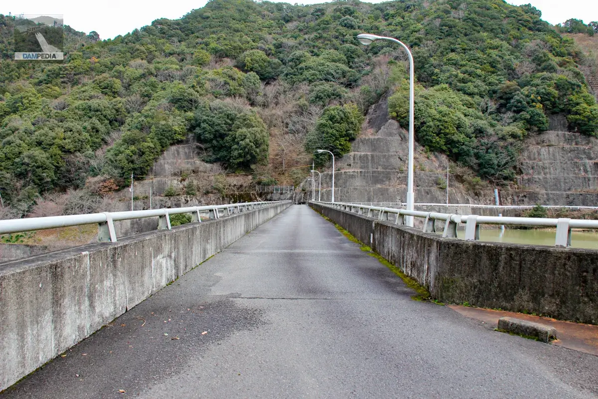
The top end is open to automobile traffic, as the control center must be approached from the right bank.
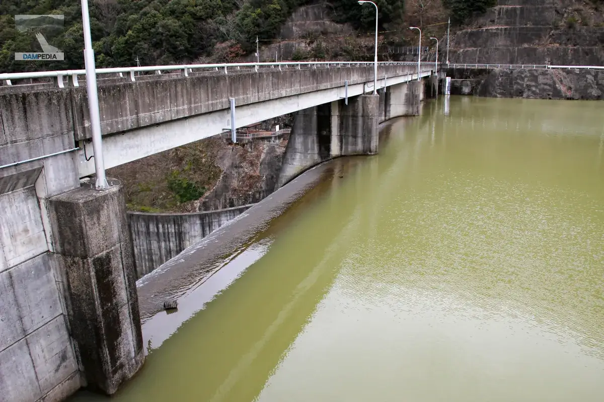
This is the best we can do as we cannot move any further downstream from the left bank. Even so, we can see that the river is somehow overflowing.
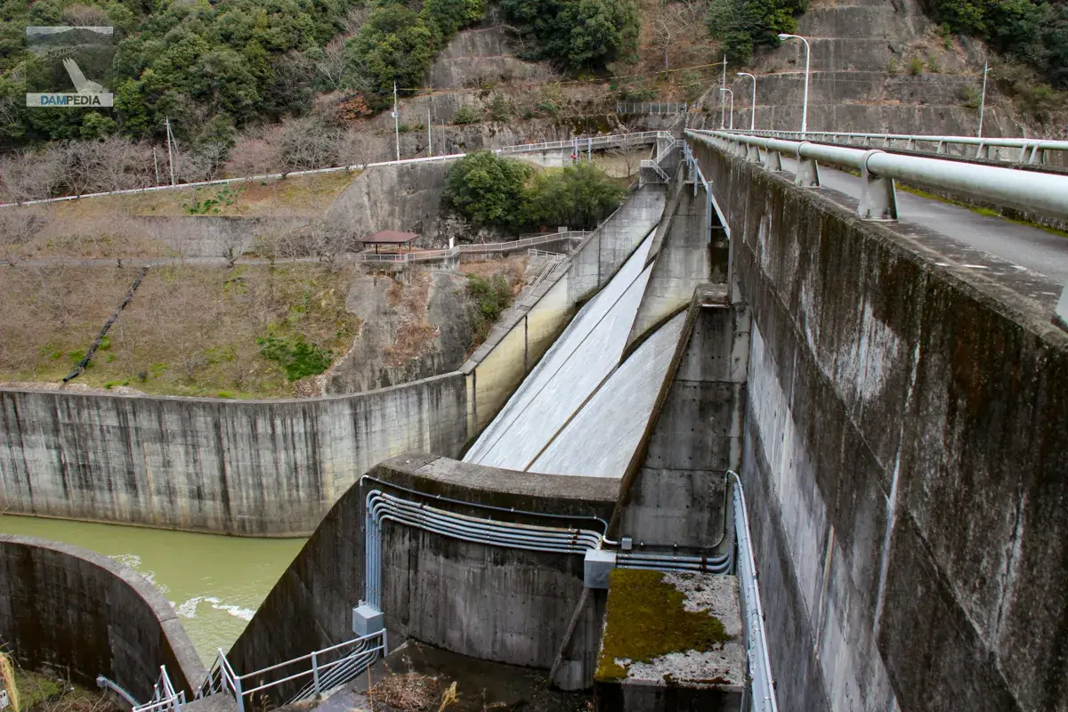
Looking downstream from the top
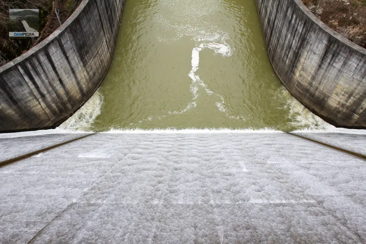
The flow rate is high, and the flow pattern is beautiful.
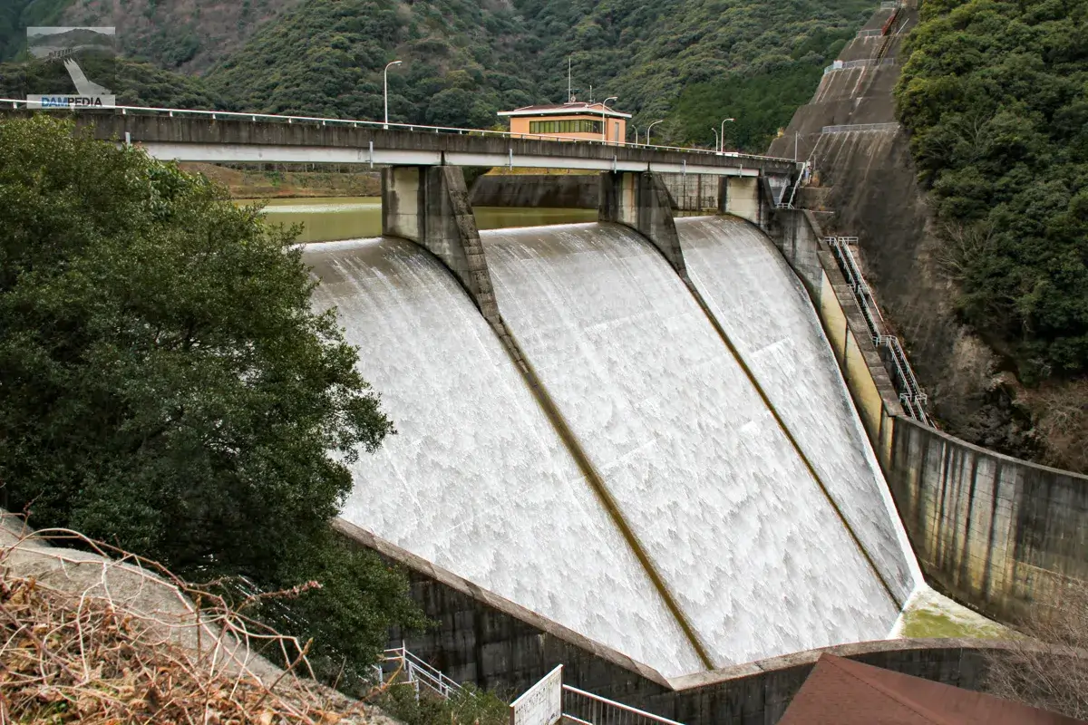
From the right bank
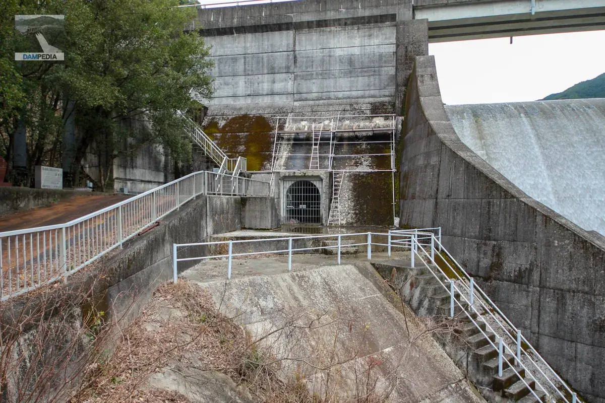
You can see stairs on the slope on the left bank, but unfortunately they are not open. It is a pity, because it looks like a good observation point.

That said, it is nice to see the levee from various angles.
The sidewalls of the reduction works seem to be built high for the size of the embankment. This may be because the left bank is particularly susceptible to the influence of the landslide.
It is a wonderful overflow from any angle. Incidentally, Shimanose Dam is also known as a cherry blossom viewing spot, and carp streamers are displayed above the top edge, so it is definitely worth a visit in the spring.
The right bank can be accessed by footing stairs, and at the end of the stairs, on the right hand side, there was a row of stone monuments. The rightmost one is the remains of some kind of stone monument. The middle one is a stone monument erected by the mayor of the former Minabegawa village in the hope that the dam would help develop the village's industry. The leftmost stone monument commemorates the completion of the dam by Goyo Construction Company and Tokyu Construction Company, which were in charge of the construction.

As I have said many times, it is really nice to see the levee from various angles. Moreover, the overflow is wonderful.
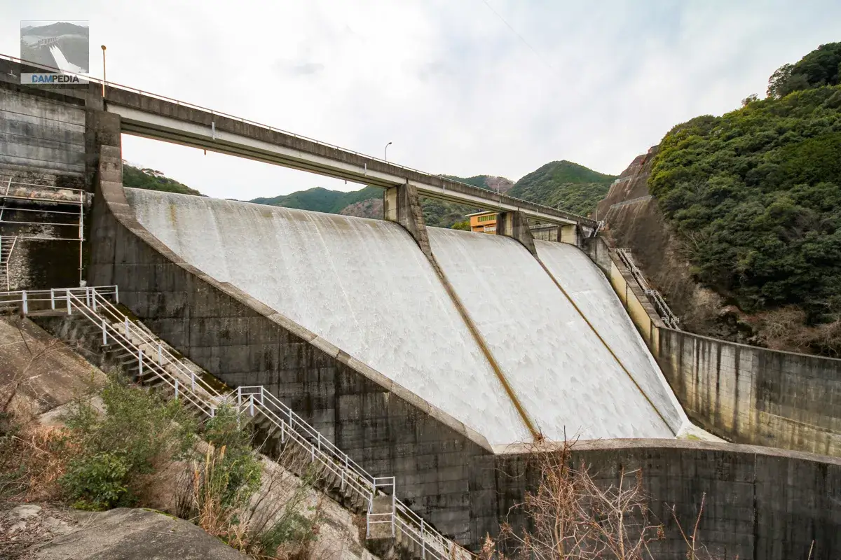
The approach from the footing stairs looks like this. On this day, scaffolding was being erected to repair the upper part of the audit corridor entrance.
To the left bank again.
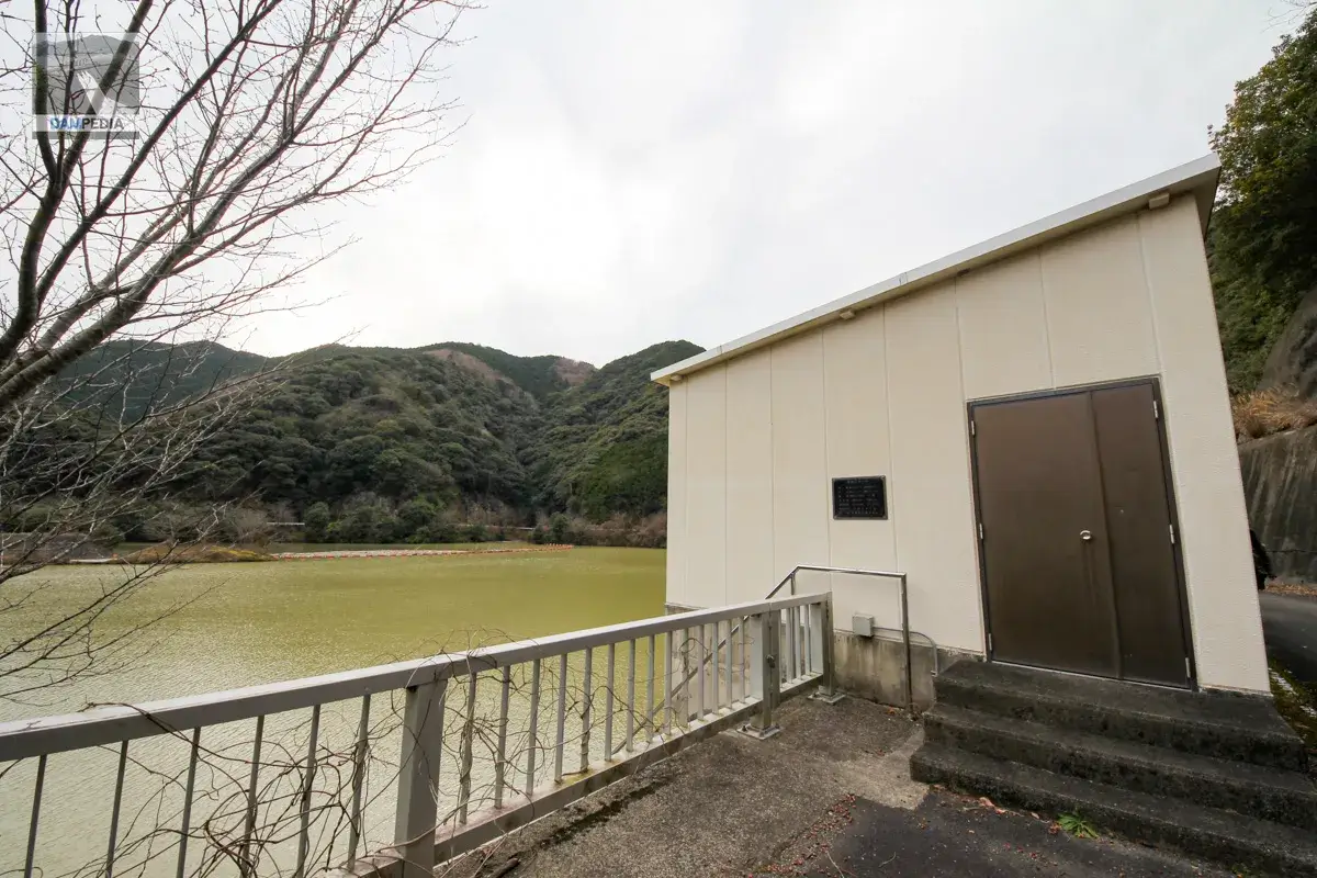
After enjoying the right bank for a while, I went back to the left bank to get my car. There is a restroom on the left bank, but suddenly the atmosphere here has changed, with a unique design.

Further to the left is a water intake facility. It is a slant-flume type with four multi-level gates, and the maximum intake capacity is 1.3 m3/s.
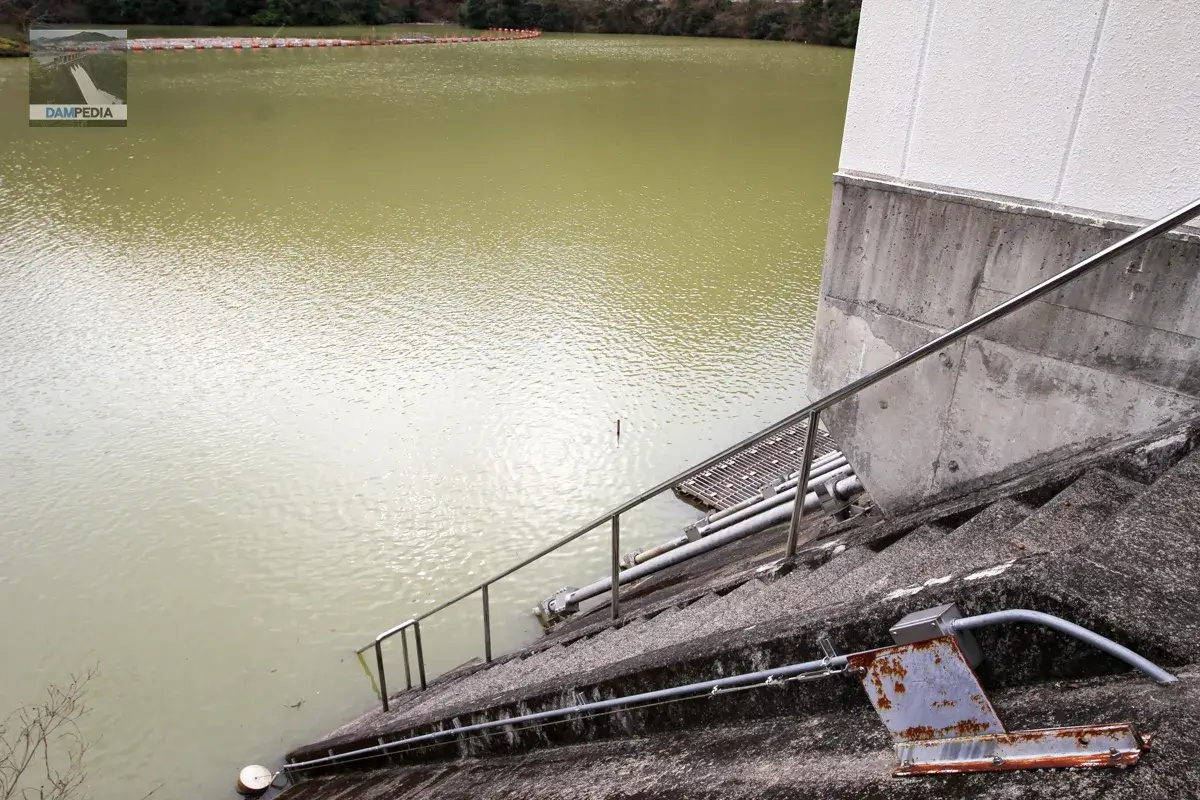
View water intake facilities and reservoirs.
Detailed specifications of the water intake facilities are as follows
| name | Water intake gate | Bottom security gate |
| form (something takes) | Steel roller gate | Steel roller gate |
| volume | 4 gates (No.1 to No.4) | (one) gate |
| Effective diameter | 800mm dia. | 800mm dia. |
| Opening and closing speed | 0.3m/min | 0.1m/min |
| Date of manufacture | February 1990 | February 1990 |
| production | Sato Ironworks Co. | Sato Ironworks Co. |
Move downstream of the levee
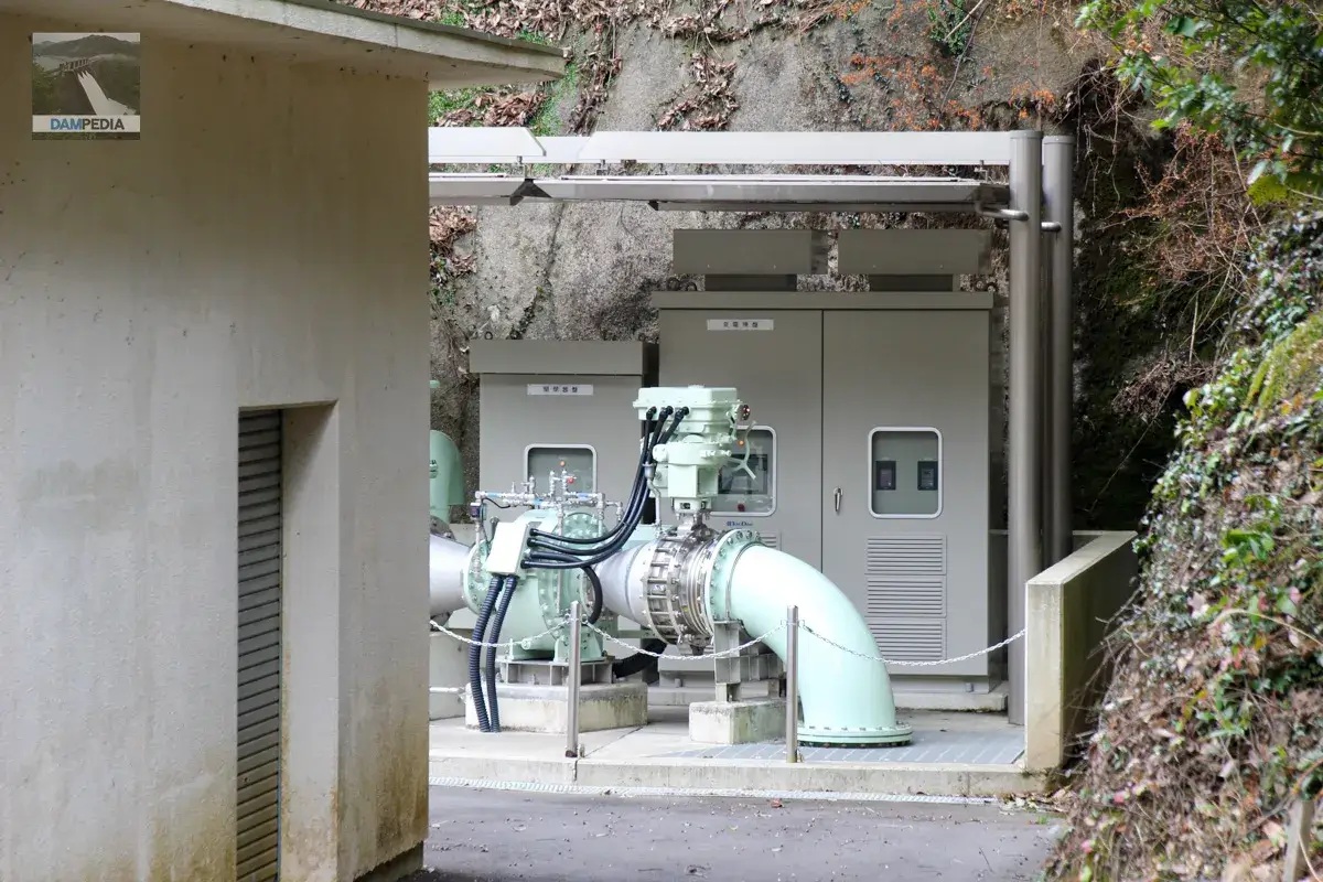
I went to the parking lot on the left bank of the levee to pick up my car, and this time I came to the downstream of the levee. There is a discharge facility downstream, and the water was also being discharged. Since 2012, the Shimanose Dam has installed a small-scale hydroelectric power generation system in the discharge facility, generating a maximum of 140 kW of electricity. The water discharged here is the water after passing through the small-scale hydroelectric power generation system.
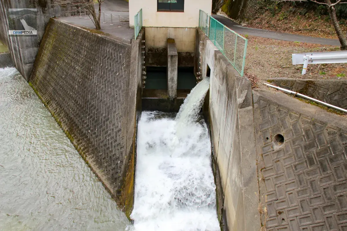
The small hydroelectric facility can be seen at the far left bank on the downstream side of the dike. My memory is a little fuzzy, but I think the reason this photo looks like a hidden shot is because it was off-limits.
It was great to see the unexpectedly wonderful discharge of water. There are many places to visit, and I would like to visit Shimanose Dam again during the cherry blossom season.
Movie of Shimanose Dam discharge
Shimanose Dam Specifications
| Location | Aza Kuromatsu, Oaza Higashikannogawa, Minabe-cho, Hidaka-gun, Wakayama |
| River Name | Minabe River, Minabe River System |
| Objective | A (irrigation water) |
| Model | G(gravity-fed concrete dam) |
| Bank height | 44.5m |
| Bank length | 131.5m |
| Dam volume | 84,500 m3 (local signboard) (Dam Handbook: 87,000 m3) |
| Watershed Area | 29.4 km2 |
| Reservoir area | 24.4 ha |
| Total storage capacity | 3,070,000 m3 |
| Effective water storage capacity | 2,480,000 m3 |
| Dam operator | Kinki Agricultural Administration Bureau |
| Main body constructor | Goyo Construction, Tokyu Corporation |
| Year of launch | 1970 |
| Year Completed | 1991 |
| Name of Dam Lake | – |
Other facilities/observations
| Parking lot | ○ |
| Toilet | ○ |
| Park | × |
| PR Exhibition Hall | × |
| Fishing | ○ |
| Viewing platform | × |
Map around Shimanose Dam
Weather around Shimanose Dam
Accommodations that may be close to Shimanose Dam


Comment