
Location: Aza-weibara, Oaza-Shinoguri, Sasaguri-machi, Kasuya-gun, Fukuoka Prefecture (Date of interview: 2010/03/05)
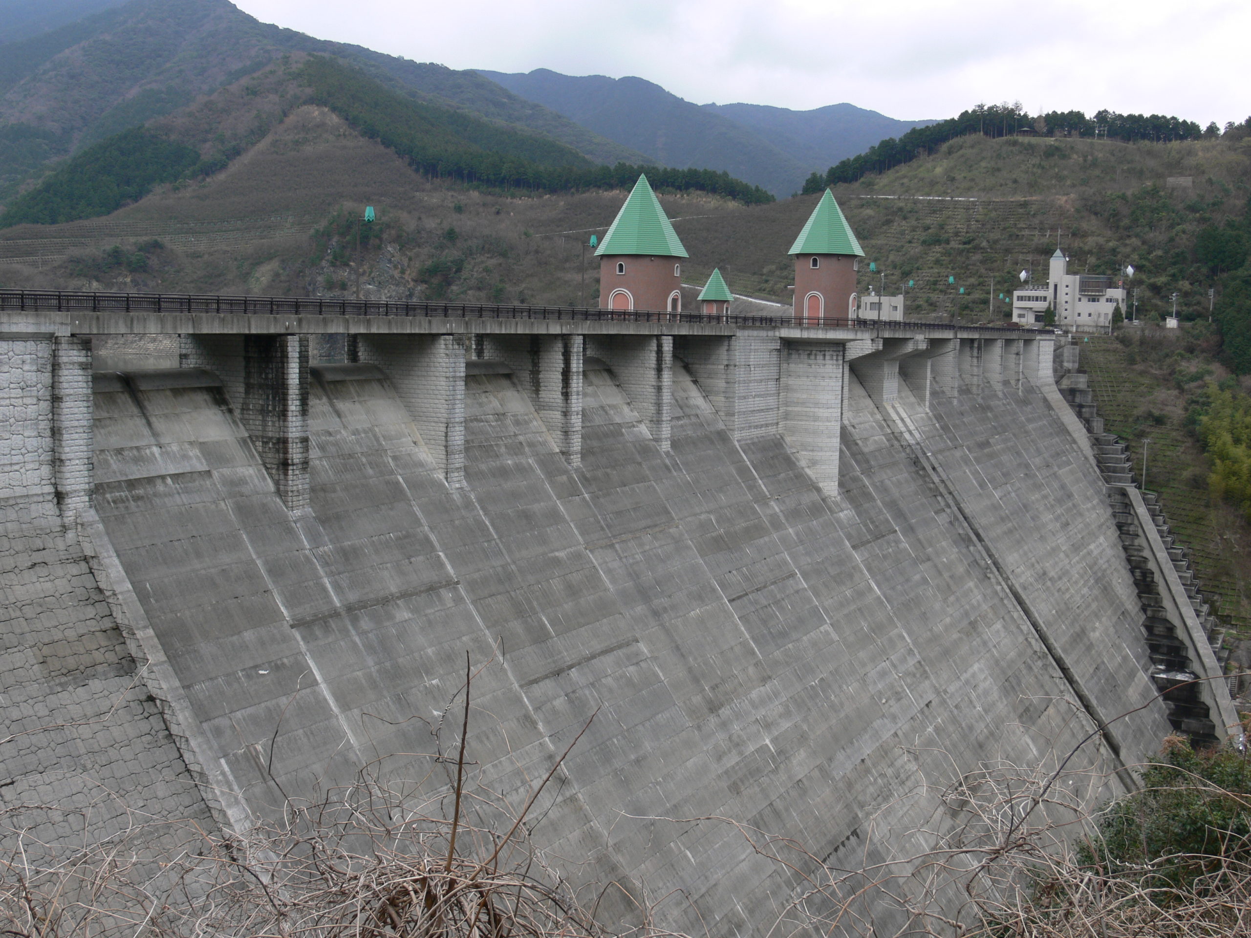
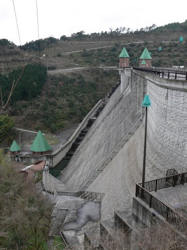
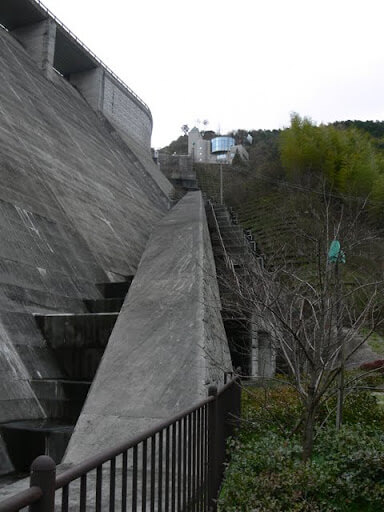
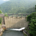
View of the downstream bank from the right bank
Finally, our first dam in Fukuoka Prefecture! Thinking about it, we have come a long way. I was able to visit during a business trip to Fukuoka, but let's just say I got lost on the way to the city and ended up here (laughs)!
Now, Narubuchi Dam is a multi-purpose dam operated by Fukuoka Prefecture for the purpose of flood control and water supply. It was completed relatively recently, in 2001, and its fairy-tale design in various parts is one of the major features of this dam.
The Narubuchi Dam was planned to prevent the frequent flooding of the Tadara River, which is located close to Fukuoka City, and to meet the growing population in the area, including Fukuoka City, which led to a tight demand for water.
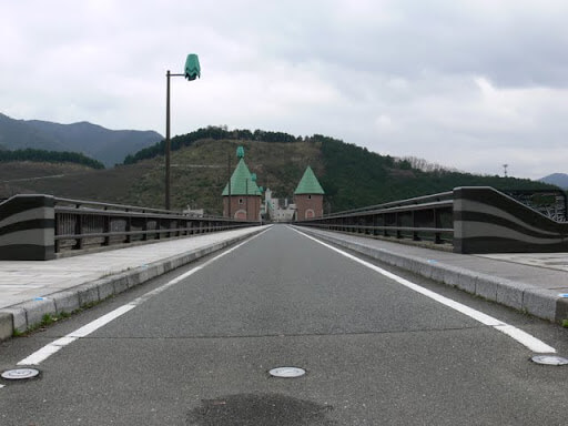
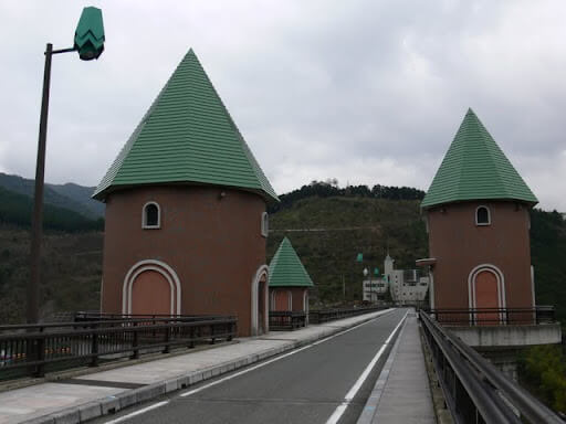
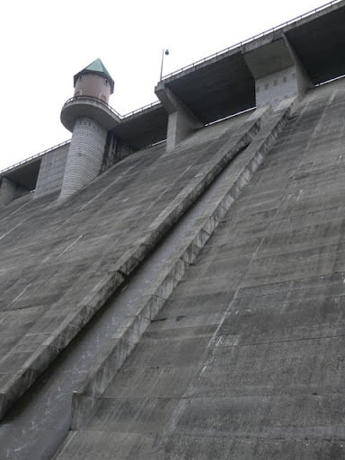
View of the top edge from the right bank
It is interesting to say the least, but to tell the truth, I don't think it was necessary to design so much. It seems to be popular with children, though...
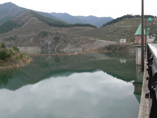
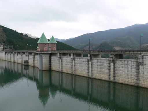
View of the dam lake from the right bank
The dam lake was quite quiet. Some businessmen were taking a break during business hours, making it a great place to take a break in a quiet environment.
Gate operation room, etc.
Well, I can't deny that it looks somewhat out of place. This is probably the only dam in the country with a design like this. In my own opinion, whether it is good or bad, I have heard some negative opinions about it, so I am not sure what to say. Honestly, I don't know what to say. Even the street lights have the same design.
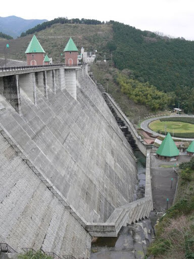
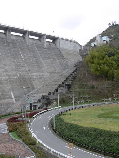
View of the downstream loop from the top
What interested me when I visited this dam, in addition to its design, was this looped road. At first I thought it was a "loop bridge," but it was not a bridge because it was well embanked before the bridge. It seems that the loop was made to cut the height of the dam.
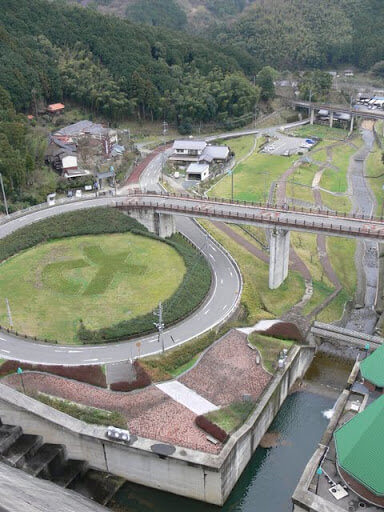
Incidentally, the symbol in the middle of the loop is the symbol of Sasaguri Town.
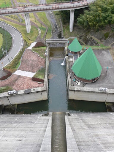
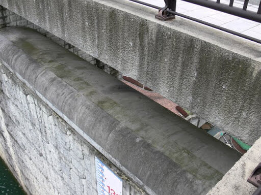
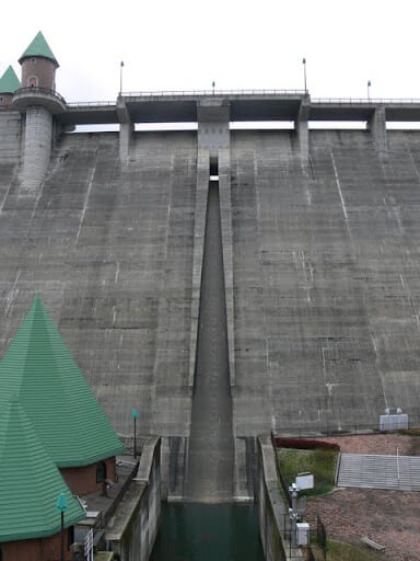
View of the reduction work from the top edge
The flow-conducting wall is high, but it is unexpectedly narrow downstream. I wondered if it was too narrow for the size of the dam. I wondered if it was too narrow for the size of the dam.
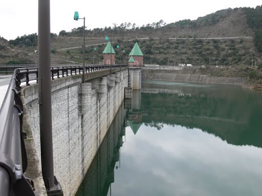
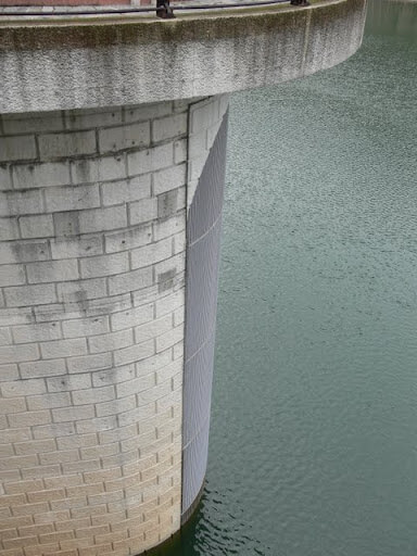
View of the embankment on the lake side from the left bank
Every detail of the embankment is decorated with fairy tales.
View of the levee downstream from the left bank
A fairy tale wherever you look. It is the dam of Wonderland.
View of the embankment on the lake side from the left bank
Sorry the photos are so dark, it looks like it's going to rain already. The weather managed to hold out during the shoot, but at night it started pouring down rain....
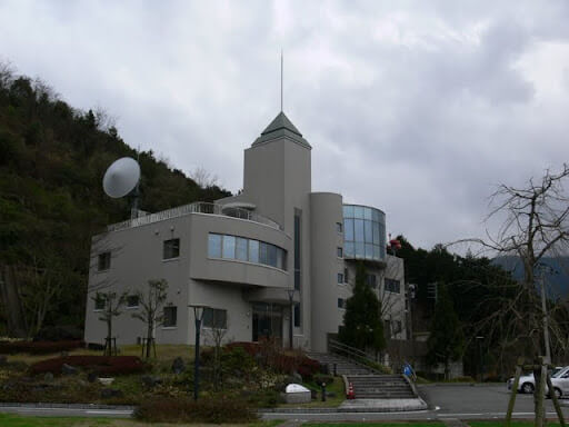
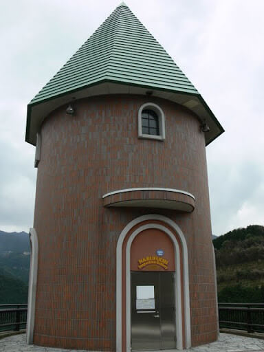
Narubuchi Dam Management Station
Wonderland's castle. No, it is the management office of Narubuchi Dam. Surprisingly, the management office is not that fairy-tale-like.
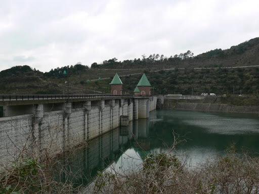
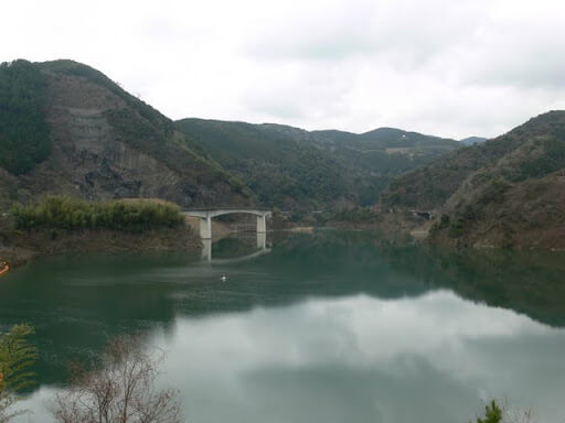
View of the dam lake from the left bank
There is a magnificent bridge on the right bank. It is called Yabakei Bridge. This area is called Shinoguri Yabakei, but is it related to Oita's Yabakei?
Selective water intake?
It seems to be a selective intake facility, but it is unknown.
Natural overflow flood discharge
The natural overflow type flood discharge allows a glimpse of the downstream side.
Entrance to the internal viewing corridor of the Narubuchi Dam
The Narubuchi Dam is open to visitors who wish to learn about the inside of the embankment. However, reservations must be made at least one week in advance of the scheduled visit date. However, if you do not know when you will be able to arrive at the site and cannot make a reservation in advance, as I did, they will consult with you.
Contact: Narubuchi/Ino Dam Management Sub-branch 092-947-4896 (weekdays 8:30-17:00)
Visiting hours: 10:00-12:00 and 13:00-16:00 on weekdays except year-end and New Year holidays (30 minutes)
*Visiting on weekends and holidays also seems to be difficult.
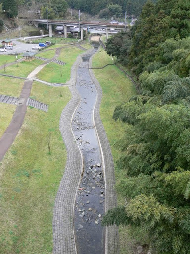
Downstream water park
Downstream is a water park, but no one was there.... It looks lonely. I hope there will be lots of people and children on holidays.
View of the levee downstream from the bridge downstream
Since we came with a 2-ton long truck, we could not drive from place to place like a private car, so we decided to walk from the top to downstream. Walking downstream, you can see the dam from various angles.
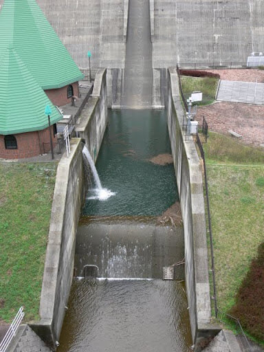
View of the reduction work
Water is flowing from the facility on the left, which appears to be a river maintenance discharge. However, the design of the facility is not so good...
View of footing from downstream bridge
What caught my attention from downstream was this footing. It is very large and long. It extends to the center of the embankment. I would like to take a closer look at it later.
View of the levee from downstream
If only that roof wasn't there.... Too bad.

Looking downstream from the loop
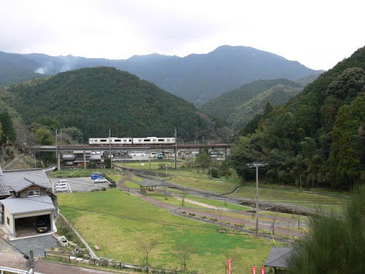
Downstream, in addition to the water park mentioned earlier, there is a plaza, and JR Kyushu's Sasaguri Line (Fukuhoku Yutaka Line) runs along an elevated track. It is somewhat reminiscent of the Ishii Dam in Kobe.
footing
Perhaps because the flow-conducting wall and footing are integrated, they look extraordinarily large. From here, it looks like a straight line to the control center.
conduit
The water is flowing smoothly through the orifice gate, but I would also like to see the water flowing from the emergency flood discharge with natural overflow.
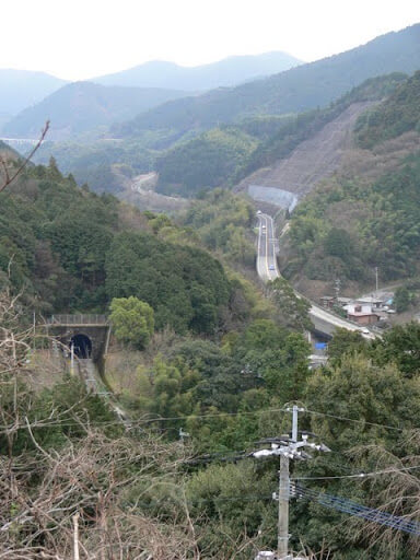
View of the Sasaguri Line and Route 201 from high ground on the right bank
Now, back to the top edge. On the way back, the trees in the foreground are a bit in the way, but you can see this wonderful view. National Route 201 winding into the distance and the Sasaguri Line.
View of the embankment on the lake side from the right bank
Returning to the top end, we were indeed out of breath, but it was a good break. We had some time left before our appointment, so we took a break in the truck, enjoying the dam and the dam lake.
dam characteristics
| River Name | Tatara River system Tatara River |
| Objective | Flood control, agricultural disaster prevention, unspecified water, river maintenance water, water supply water |
| Model | gravity-fed concrete dam |
| Bank height | 67.4m |
| Bank length | 308m |
| Dam volume | 402,000m3 |
| Watershed Area | 6.8km2 |
| Reservoir area | 19ha |
| Total storage capacity | 4,400,000m3 |
| Effective water storage capacity | 4,160,000m3 |
| Dam operator | Fukuoka prefecture (Kyushu) |
| Main body constructor | Nishimatsu, Kumagaya, Matsumoto |
| Year of launch | 1978 |
| Year Completed | 2001 |
Other facilities/observations
If you don't mind the fairy tale, it is a dam with a lot to see.
| Parking lot | ○ |
| Toilet | ○ |
| Park | ○ |
| PR Exhibition Hall | × |
| Fishing | ○ |

Comment