
Date of interview: Saturday, May 18, 2013
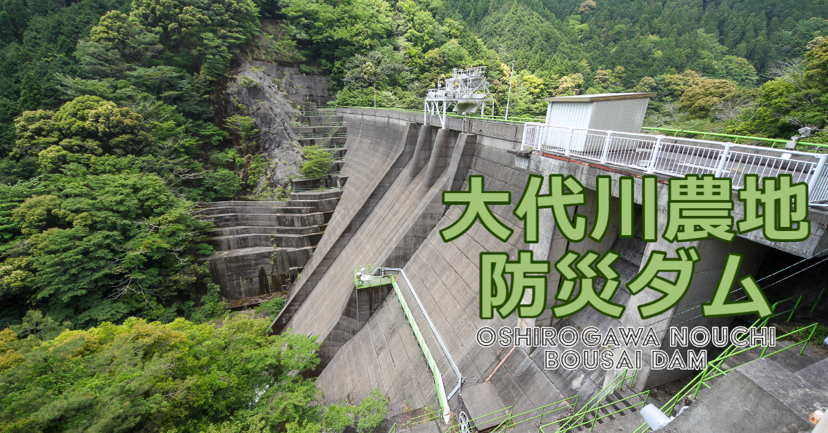
Like the nearby Harano Valley River Dam, the purpose of the Ojiro River Farmland Disaster Prevention Dam is flood control and farmland disaster prevention, and it is a perforated dam that does not normally store water. I visited the Harano valley river dam on my way to the dam. (I can't say that I went to the Harano Valley River Dam to practice singing and dancing. (I did write about it, though.)
The Ojiro River flows through the center of Kanaya, the hub of the Oigawa Railway, and empties into the Oigawa River. The Ojiro River Farmland Disaster Prevention Dam is designed to protect farmland and residents in the Kanaya area.
Incidentally, the dam name is "Oshiro-gawa", but locals seem to call the river "Ojiro-gawa". This site uses "Oshiro-gawa" in accordance with the dam handbook.
View of the upstream face of the embankment
Somehow, we took the wrong road and entered from the forest road near "Narakoko no Sato" and attacked from upstream, so we started photographing from upstream. If you approach from downstream, the entrance to the forest road seems to be closed by a gate, so you will have to walk from there.
The upstream face is completely backlit because the embankment faces southeast. The crest has three free overflowFlood dischargeThe lower part of the structure is equipped with a permanent flood discharge.
View of the upstream face of the embankment from the dam lake
Although it is called a dam lake, it does not usually hold water, so it is like walking on a riverbed. (Never approach the dam during flooding.) The white building on the left bank at the top end level is the control center (unmanned).
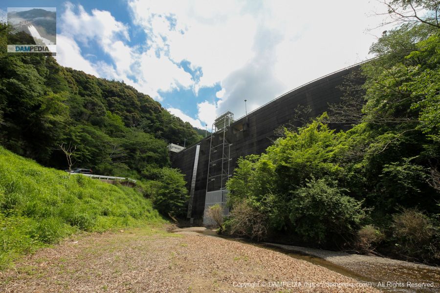
Looking downstream
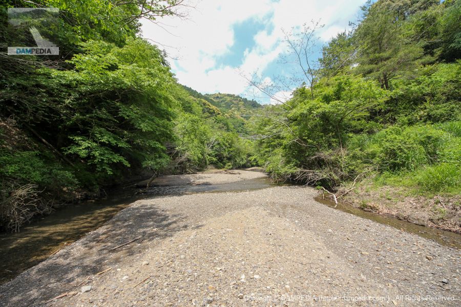
It seems to be a small river that is usually calm, but what will it be like during a flood?
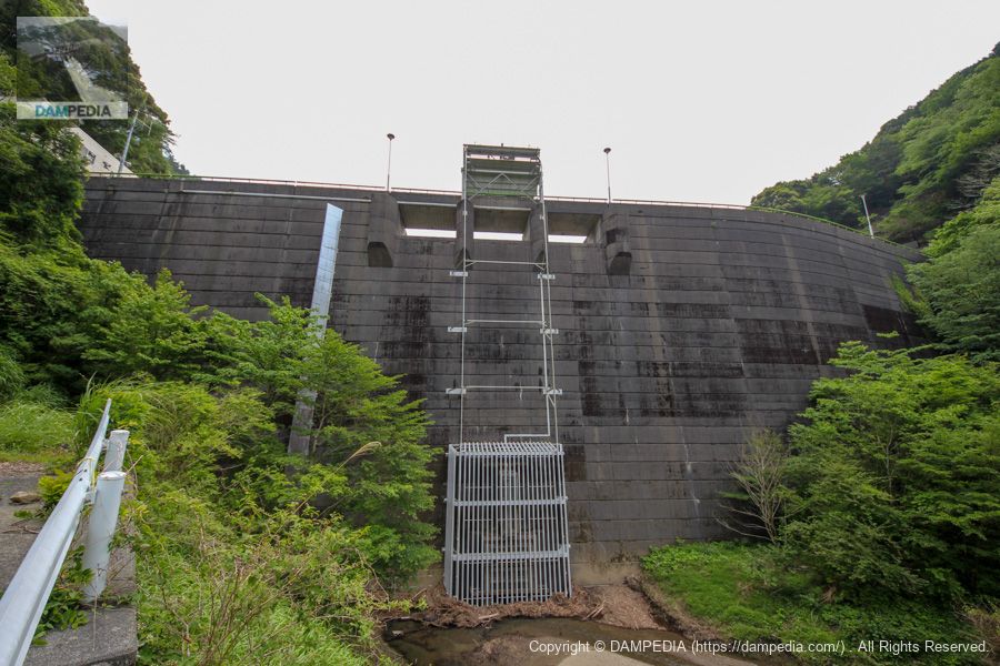
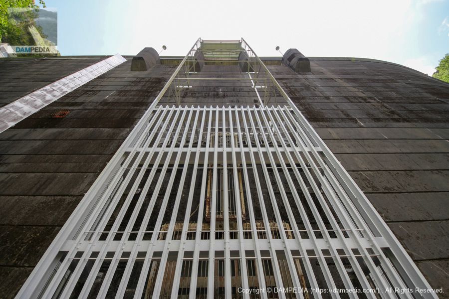
Looking up at the permanent flood discharge
There is a permanent flood discharge at the bottom of the embankment, with an attached screen to prevent it from being filled with driftwood and sediment. In addition, there is a steel frame built at the top, which seems to be made to be raised and lowered by a dust remover in the crest.
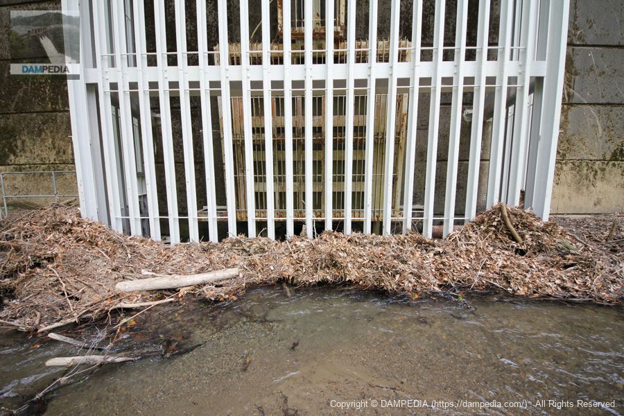
View of the permanent flood discharge
It flows smoothly. (The photo was taken with safety in mind.)
View of the left bank from the permanent flood discharge
The silver panel is a bit of a mystery. Is it a cover for cables? In front of it, there is a red hole in the middle of the dike.
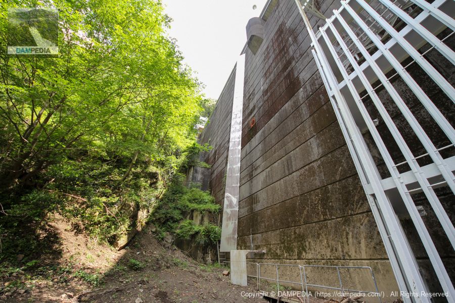
View of the right bank from the permanent flood discharge
The right bank side of the embankment is slightly curved, which is impressive.

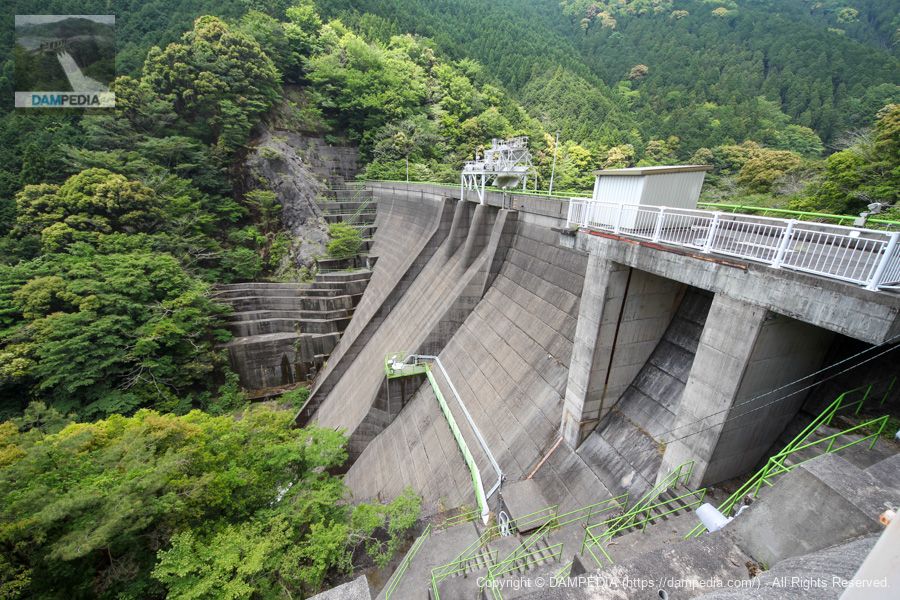
Downstream view of the levee from the left bank
We have moved to the top edge level. It seems that it used to be possible to enter the top end, but it is now off-limits. A dust remover can be seen at the top end, and a structure containing valves can be seen on the mid-left conduit wall of the dike. The rounded bucket curve and gate piers are quite beautiful. The green railings also match the fresh greenery very well.
It was an Ojiro River farmland disaster prevention dam that protected the farmland and residents of Kanaya.
Ojiro River Agricultural Land Disaster Prevention Dam Specifications
| Location | Shimada City, Shizuoka Prefecture |
| River Name | Ooigawa River System Ojiro River |
| Objective | F (flood control, agricultural disaster prevention) A (irrigation water) |
| Model | G(gravity-fed concrete dam) |
| Bank height | 43m |
| Bank length | 122m |
| Dam volume | 54,000m3 |
| Watershed Area | 5.5km2 |
| Reservoir area | 5 ha |
| Total storage capacity | 620,000m3 |
| Effective water storage capacity | 615,000m3 |
| Dam operator | Shizuoka prefecture (Chuubu area) |
| Main body constructor | Kumagai Gumi |
| Year of launch | 1961 |
| Year Completed | 1968. |
| Name of Dam Lake | - |
Other facilities/observations
| Parking lot | × |
| Toilet | × |
| Park | × |
| PR Exhibition Hall | × |
| Fishing | × |
Comment