
Date of interview: Saturday, May 25, 2013
I came to Shimojogawa Dam via the Chuo Expressway, Nagano Expressway, Joshinetsu Expressway, and Hokuriku Expressway because my dam friends were going to hold a wedding ceremony at Uchikura Dam in Niigata Prefecture. We arrived at 5:00 a.m. early in the morning. It was a long way...
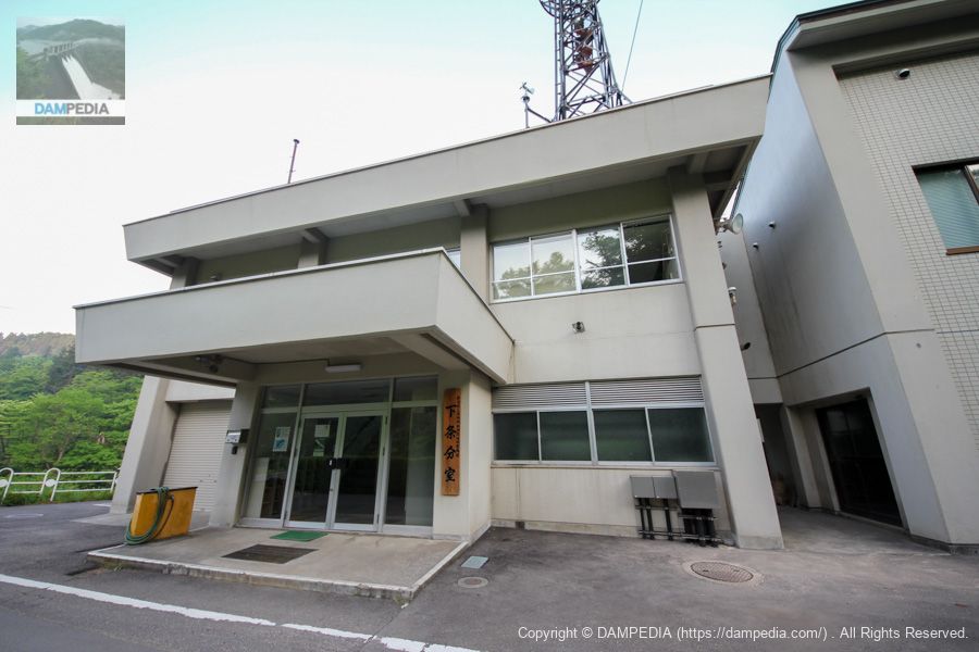
I was wondering if it was called a control center...
I thought it might be the Shimojo River Dam management office, but the signboard reads "Regional Development Department Shimojo Branch Office, Sanjo Regional Development Bureau, Niigata Prefecture. There is no difference in the department that manages the dam, but I find it unusual that the name is different from the management office.
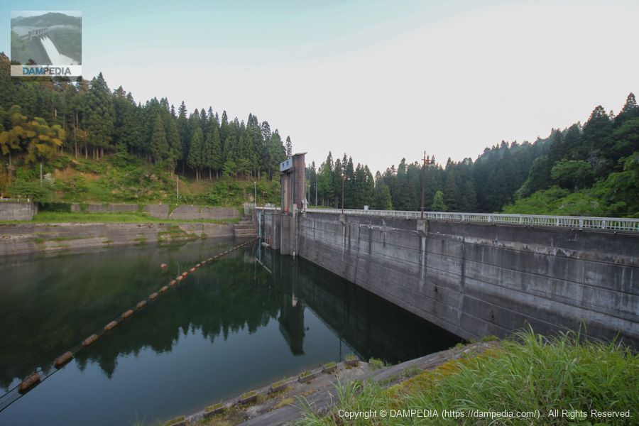
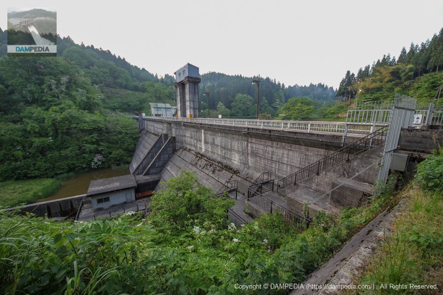
View of the upstream face of the embankment from the right bank
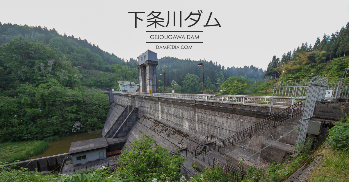
The Shimojogawa Dam is a Niigata Prefecture-operated dam for flood control, with a simple configuration of one crest gate and one hollow-jet valve. It cuts the flow by 100m3/s at the dam site and reduces the flow from 280m3/s before adjustment to 190m3/s at the reference point (near the Shimojogawa Bridge on the Shinetsu Main Line).
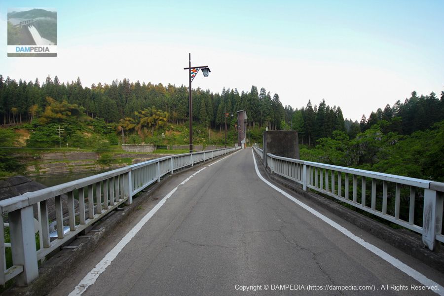
View of the top edge from the right bank
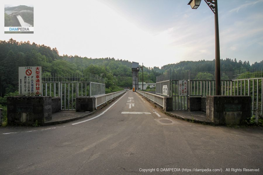
The dam lake can be circled by automobile, and the top end is open to automobile traffic.
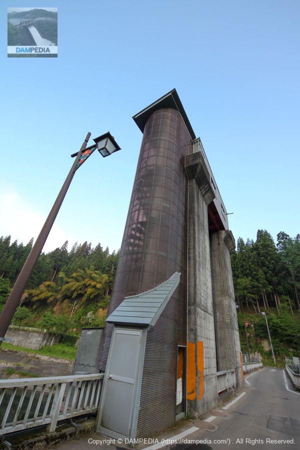
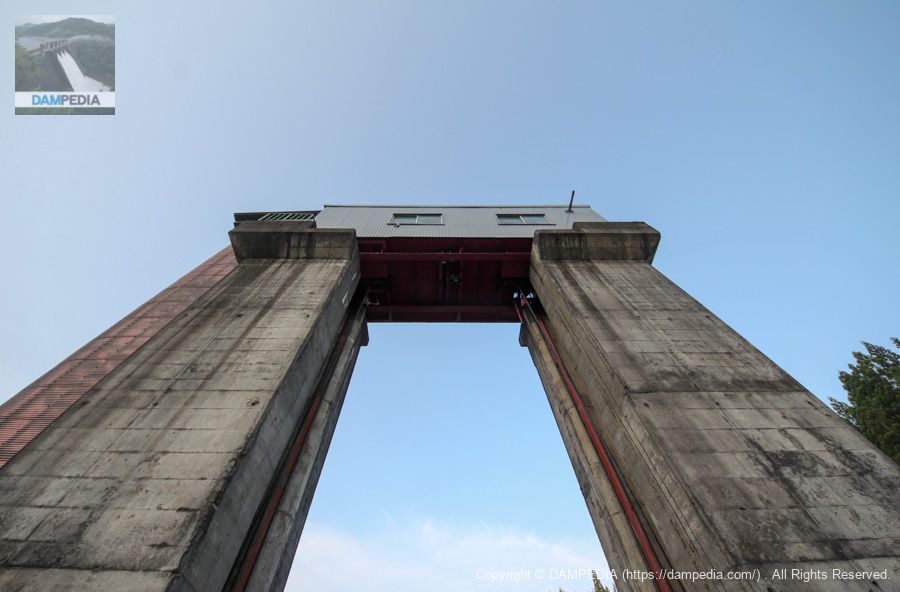
Gate peer
パース付けすぎました💦 雪深いからか螺旋階段はカバーで守られています。ゲート巻き上げ機もむき出しではなく建屋になっています。
View of the gate winder room from the top
The gate pier and gate winder room that looks up at Dawn.
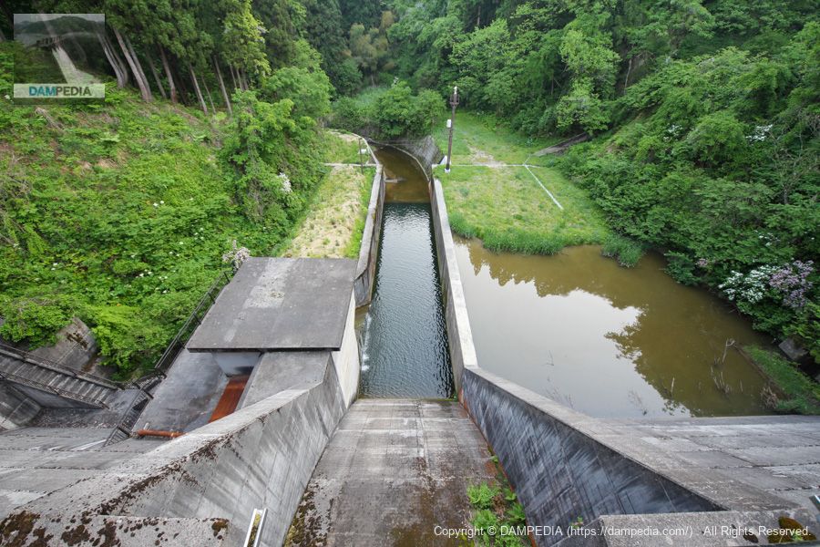
View downstream from the top
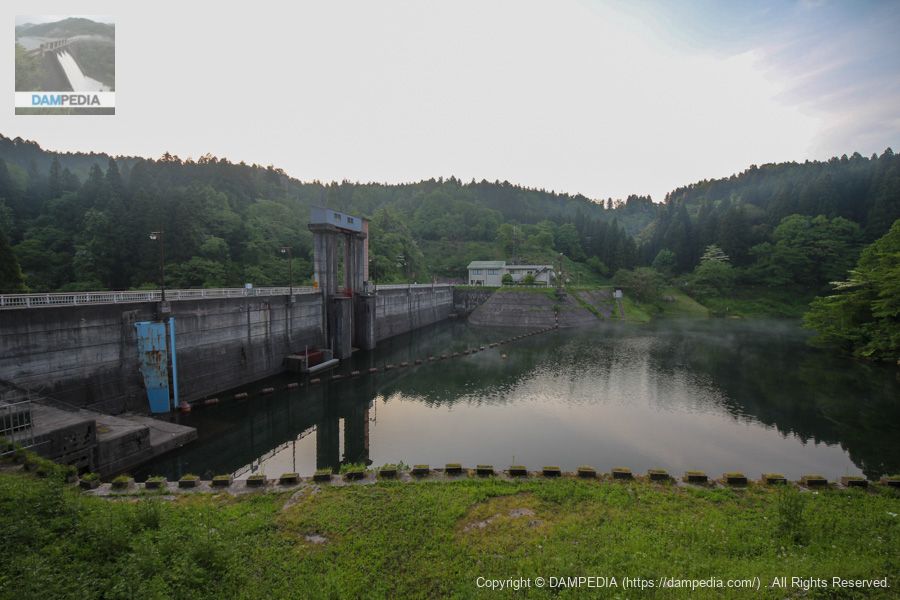
When it rains a lot, the right bank side seems to be submerged. The concrete structure on the left bank houses a Φ1,200 mm hollow-jet valve.
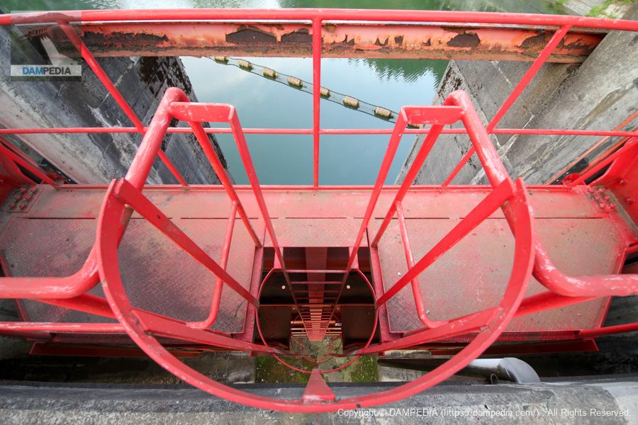
View of the crest gate from the top
The crest gate is a red roller gate. The size is 4.50x9.10m.
View of the top edge from the left bank
The top end was open to automobile traffic but closed to vehicles over 4 tons.
Downstream view of the levee from the left bank
It is a simple dike, but the gate pier is also quite high because the gate is large compared to the size of the dike.
View of the upstream face of the embankment from the left bank
Perhaps because it was early in the morning, there was a slight haze on the dam lake, creating a fantastic atmosphere. This kind of early morning view of the dam is very nice, isn't it?
The Shimojo River is a small river, but once it floods, it causes flood damage in the downstream area, and the area has been affected many times.
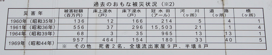
The Shimojo River Dam was built to "effectively achieve flood control objectives" without the need to relocate homes or reduce the area of rice paddies that would be required to make large-scale improvements to the levee system. (Although, in recent years, torrential rain disasters have occurred frequently in many areas, so in the event of heavy rainfall, it is important to evacuate while the Shimojo River Dam is holding back the floodwaters.)
There is also a campground nearby, a nature study center, a biotope ecological garden, and a dragonfly ecological garden. In addition, cherry blossoms are planted around the dam lake, and a crucian carp fishing contest is held every year, making the Shimojogawa Dam a dam that is open to the community and loved by local residents.
Shimojogawa Dam Specifications
| Location | Aza Shimojo, Kamo City, Niigata Prefectureknoll |
| River Name | Shimojo River, Shinano River System |
| Objective | F (flood control, agricultural disaster prevention) |
| Model | G(gravity-fed concrete dam) |
| Bank height | 31m |
| Bank length | 138m |
| Dam volume | 36,000m3 |
| Watershed Area | 6.1 km2 |
| Reservoir area | 22 ha |
| Total storage capacity | 1,530,000m3 |
| Effective water storage capacity | 1,100,000m3 |
| Dam operator | Niigata prefecture (Hokuriku area) |
| Main body constructor | Kagada Gumi (Edo-period Shinto sect founded in 1892 by Toda Kikugoro) |
| Year of launch | 1967. |
| Year Completed | 1973 |
| Name of Dam Lake | - |
Other facilities/observations
| Parking lot | ○ |
| Toilet | ○ |
| Park | ○ |
| PR Exhibition Hall | × |
| Fishing | ○○ (excluding no-take zones) |
Comment