

Location: Oaza Ikuta, Matsukawa-cho, Shimoina-gun, Nagano Prefecture
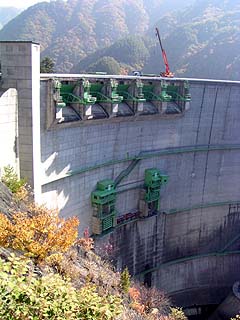
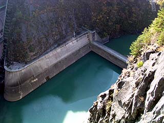
View of the embankment from the right bank
The Kosibu Dam is the first arch-type dam in the Chubu region. It has been a long time since the Kurobe Dam, and this was my first visit to a large arch-type dam. However, on this day, maintenance work was being carried out on the gates, so we could not go beyond the center of the top edge... There are 5 crest gates, 2 coaster gates, and 2 conduit gates.
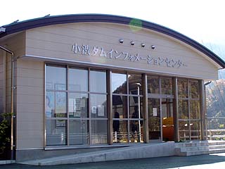
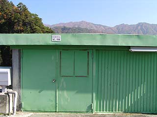
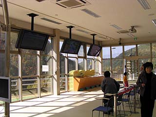
Kosibu Dam Information Center
Since it is a large dam, there is also a PR exhibition hall. We went inside the exhibition hall at the end of our visit.
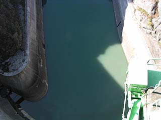
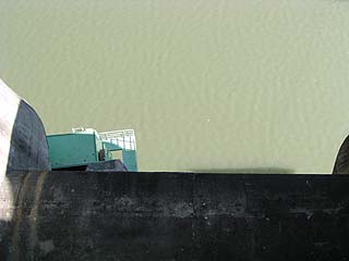
View of the orifice gate from the right bank
People at the coaster gate! (It may be quite small and you can't see it...) ...but it is one of the maintenance works mentioned earlier.
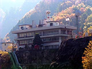
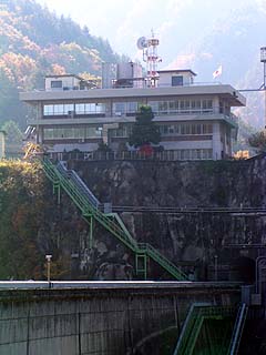
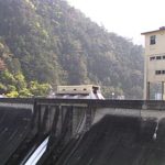
View of the management office from the right bank
The area deeper than the center of the top edge was off-limits, so I could only view it from afar. I was too small-minded to attack the control center, though (lol).
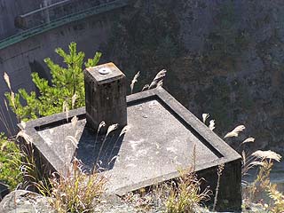
View of the foundation from the right bank
Probably the remains of a cable crane used during the construction of the dike.
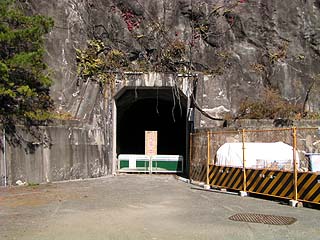
Tunnel at the right bank dam site
I think it probably leads to the prefectural road at the end of this tunnel, but for some reason it was off-limits due to construction. Was there a collapse?
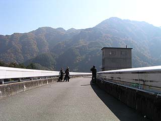
View of the top edge from the right bank
It is quite a large dam, so there were many visitors. As you can see, they were taking commemorative photos. It was also the beautiful season of autumn leaves, so perhaps these people were mainly interested in the autumn leaves rather than the dam....
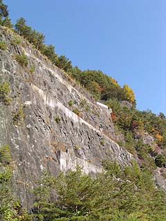
View of the remains from the right bank
The remains of the foundation could be seen on the wall of the mountain, which rises almost at right angles.
View of the reduction work from the top edge
The sub-dam is also of a certain height. The water was a little muddy white because the dam is heavily sedimented.
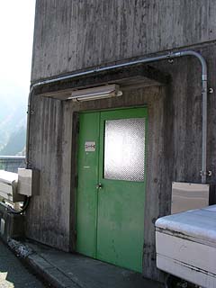
Elevator room
This is an elevator room attached to the top end. This elevator is supposed to be used to enter the area directly below the dam and the audit corridor. Oh, I want to enter...
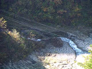
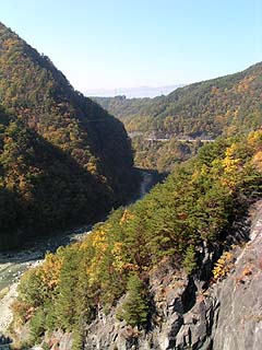
View downstream from the top
There was a stream of water at the far end of the downstream side of the left bank that appeared to be discharging water, but it is unclear if this was a discharge for water diversion. It may have been water flowing out of the valley.
View of the levee downstream from the top
I like the archway. I hate the part where the whole thing doesn't go in...lol...and yet I want to go on to the back of this...
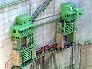
Coaster gate operation room
This is the coaster gate control room, and it is very low. It is lower than my height, and if I were to enter it, I would hit my head against the ladder.
View from the top of the levee directly downstream of the levee
Can you see the cloudy white color?
View downstream from the top
The dam is located deep in the mountains, so it is a treasure house of nature. It is a little early for the autumn leaves in this area, but we can see that the colors are gradually changing.
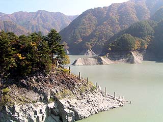
View of the dam lake from the top
You can clearly see that the dam lake is more muddy white than downstream. For a moment, I thought that what I saw in the center of the photo was an incline, but it looks a little different.
View of the crest gate from the top
View of the administration office from the top
It may be difficult to see in the photo because of the darkness, but if you go to the far end of the top and head to the left bank, you will find a tunnel beyond it. I wanted to go through it, but alas. I wonder if you can get to the management office by using the stairs or through the tunnel.
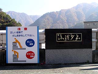
Dam nameplate and caution sign
A correct posture is required to visit the dam. It is advisable to place your elbows on the parapet and your body at 45 to 50 degrees to the ground (a lie).
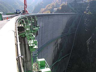
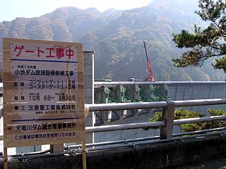
Gate under construction sign and embankment
It appears that the gate construction is being done by Mitsubishi Heavy Industries. And it seems to take almost half a year to do it.
Interior view of the Kosibu Dam Information Center
It is a very beautiful PR exhibition hall. There are also games for children. However, there is no receptionist. Don't go there with high expectations.
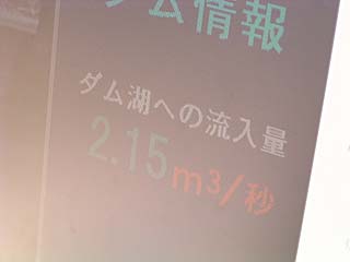
Dam Information Monitor
A lot of information about the dam itself is available to the public, and the amount of water in the dam lake and the inflow can be monitored. The inflow into the dam lake on this day was 2.15m3It was /s.
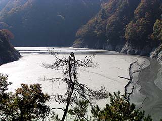
View of the dam lake
Is this a dam lake? The sediment is so bad that it makes you think, "Is this a dam lake? I had heard rumors about it, but I had no idea it was this bad. A bypass tunnel to remove the incoming sand and sediment has been under construction at the Kosibu Dam since 2000, and is scheduled for completion in 2007.
dam characteristics
| Model | arched concrete dam |
|---|---|
| Objective | Flood control, agricultural disaster prevention, unspecified water supply, and Water for river maintenance, irrigation, power generation |
| Bank height | 105.0m |
| Bank length | 293.3m |
| levee length and width | 4.00m |
| Dam volume | 311,000m3 |
| Watershed Area | 288 km2 |
| Reservoir area | 167 ha |
| Total storage capacity | 58,000,000m3 |
| Effective water storage capacity | 37,100,000m3 |
| Name of Dam Lake | Lake Shibu |
| crest gate | 9.5m x 5.6m 5 gates |
| conduit gate | 3.5m x 3.5m 2 gates |
| Planned high water flow rate | 1,500m3/s |
| control volume | 1,000m3/s |
| River Name | Tenryu River System Kosibugawa |
| Year of launch | 1961 |
| Year Completed | 1969. |
| Access to D@M | Get off at Matsukawa Interchange on Chuo Expressway→ Go straight on Prefectural Road 59. Go straight at the intersection with Route 153→. After merging with Prefectural Route 18 and crossing the Tenryu Bridge over the Tenryu River Follow the signs to the dam as they come into view. The rest is just eastward progress. |
Other facilities/observations
It would have been a shame because there is so much to see and do. And the construction period is so long! Hmmm...
| Parking lot | ○ |
|---|---|
| Toilet | ○ |
| Park | × |
| PR Exhibition Hall | ○ |
Comment
It is a pleasure to meet you. After passing the tunnel at the end of the left bank, you will see the power plant on your right, and then go up the hill and turn left to the entrance of the administration office.
The stairs in front of the control center are off-limits.
[auto-post] Damapedia Archives - Please take a look at it at your leisure - 1021 - Kosibu Dam / Kosibu Dam http://t.co/KamT7RqfRH