

Date of interview: 9/17/2012 (Monday)
The Tohoku expedition, which began with a visit to Ishibuchi Dam and Isawa Dam, is finally on its third day. This was the last day of our enjoyable Tohoku expedition. At first, we headed south on the Tohoku highway and came to Naruko Dam. There are many other dams that I would like to visit, but Naruko Dam was the one for me.
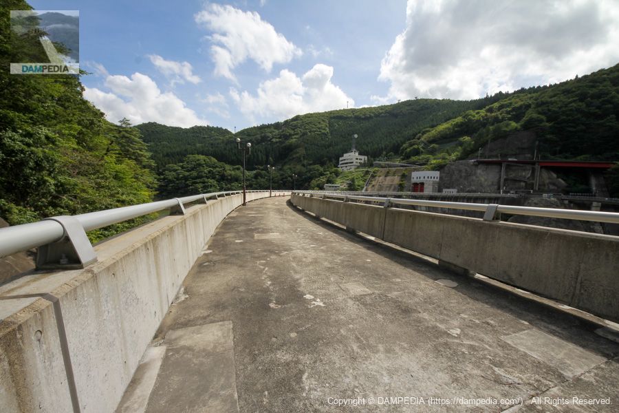
Walkway on the left bank
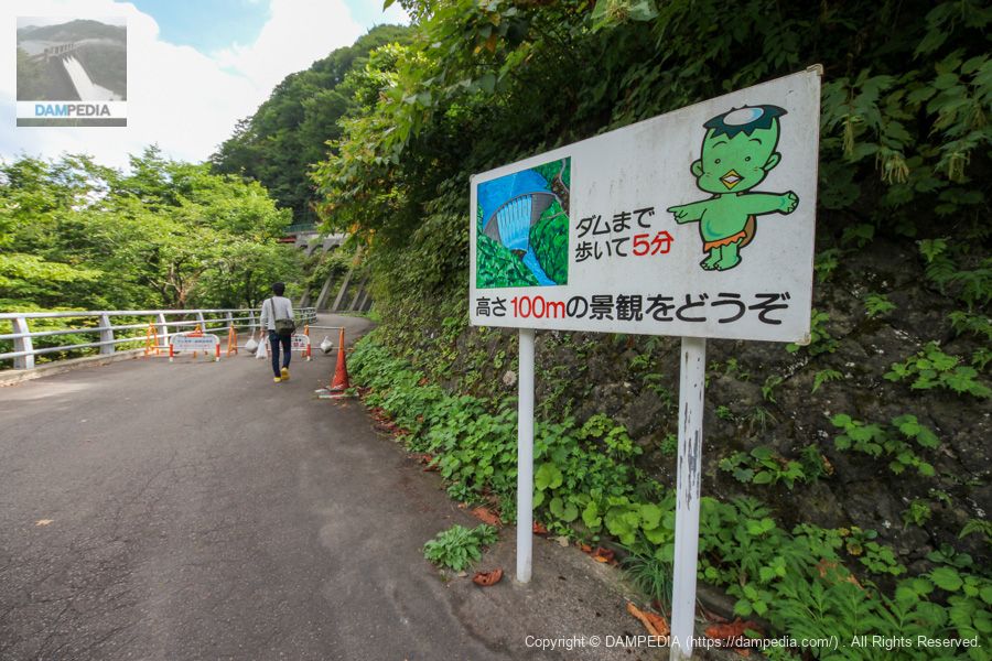
There is a parking lot on the left bank, from where you can reach the top of the mountain on foot. Please note that the skyline is open from 8:00 to 17:00, so please be careful when visiting.
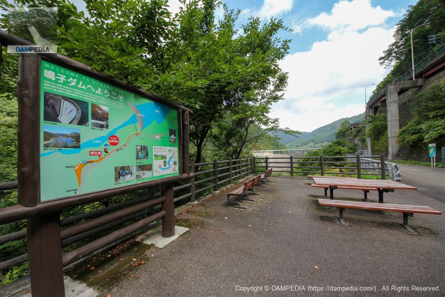
Rest area on the boardwalk on the left bank
There is also a bench set up like this. It is a mystery where one would look when sitting on the bench because it is overgrown with trees, but before the trees grew, one would have had a great view of the lower stream.
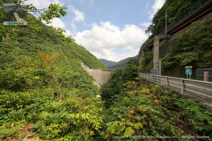
View of the levee downstream from the boardwalk on the left bank
The dike is coming into view. Excitement is building.
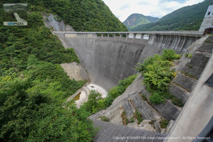
View of the levee downstream from the left bank
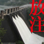
Finally, the Naruko Dam, which I had dreamed of seeing, unfolds before my eyes. If it were possible, I would have liked to come here during the period of the sudare (bamboo screen) discharge.
Howell Banger Valve
The Howell Bunger valve, which was used for about 30 years starting in 1957, is on display.

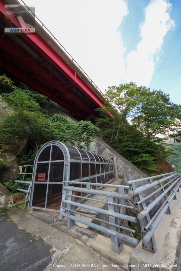
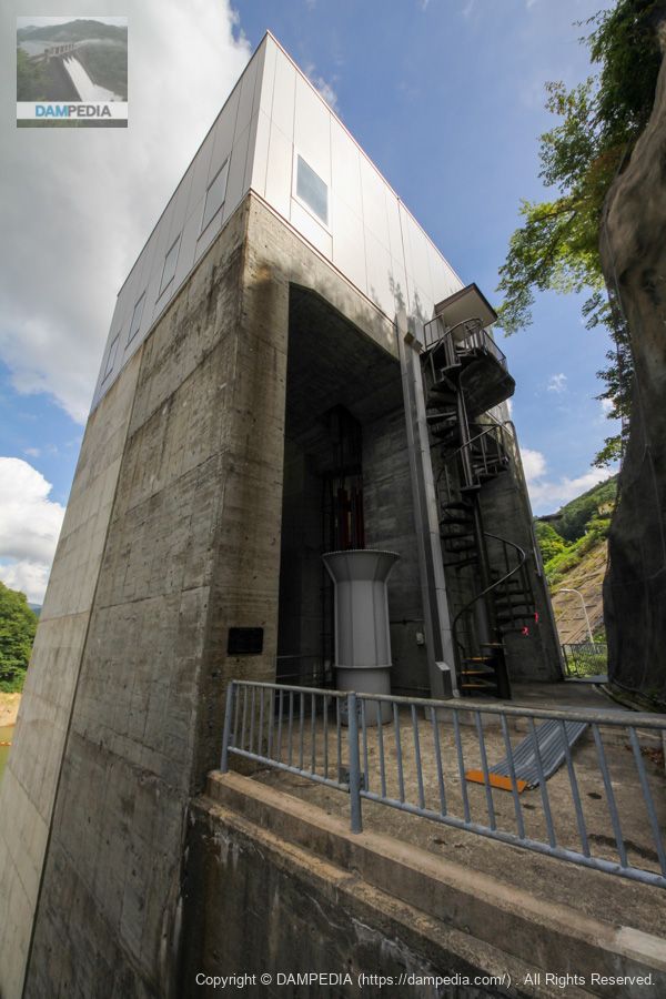
Passage to Incline
The concrete box installed diagonally in the center of the photo is actually an incline. The bridge girder above is the national highway, but there is a tunnel beside it that was once used as a national highway, and the upper boarding area of the incline is inside the tunnel. The photo shows the middle boarding area.
Jishui Eternal Stone Monument
On the left bank of the river is a stone monument that indicates that although the area suffered from a severe drought in 1985, the Naruko Dam resulted in a bountiful harvest.

At first I thought this four-character phrase was "慈水水遠" or "遠水水慈," but upon closer inspection it was "慈水永遠". It means "to love water forever. I see.
View of the top edge from the left bank
Is there a gap under the top rail to allow snow to fall?
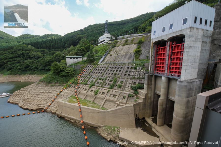
Sakami weir water intake facility (front) and reserve gate (back)
The one in the foreground is the Sakami weir water intake facility, which was used to supply irrigation water before the dam was built. For some reason, it is named Sakami weir. The one in the back is a spare gate for the conduit.
Conduit valve
The round, perforated structure in the upper left of the photo is the conduit's fixture cone valve. It is the so-called Howell Banger valve. It is also described as a "discharge valve" on the brochure.
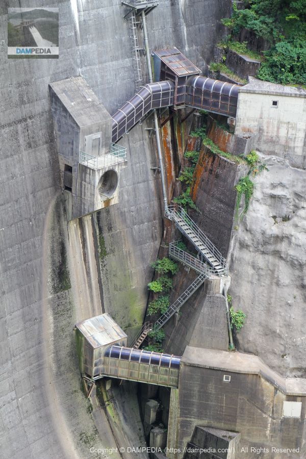
Tunnel flood discharge intake and reserve gate
The Naruko Dam has a tunnel flood discharge beside the left bank of the embankment, but it seems that there was no spare gate at the beginning, and it was added in 2002 after six years of work. The concrete part of the gate pier is half different in color. The part in the front is the new part, and the darker part in the back is the existing part.
Behind the flood discharge gate
This is the back side of that gate. From here you can clearly see that the front is an old structure. The gray trumpet-shaped thing inside is a ventilation hole.
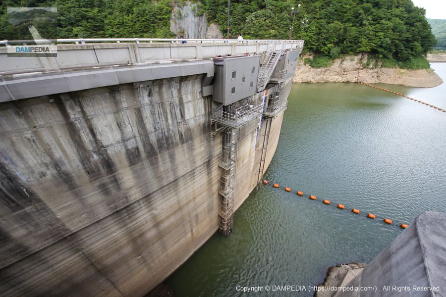
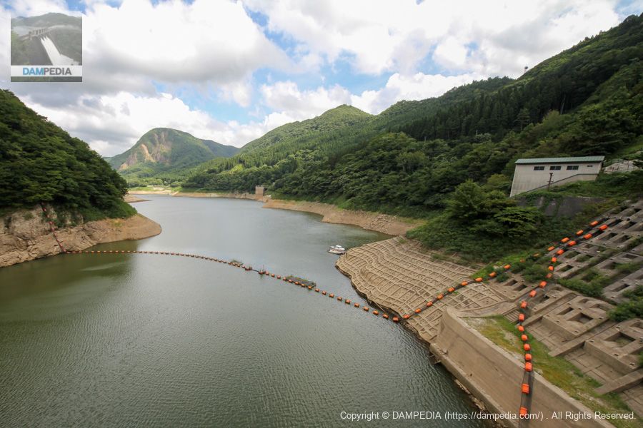
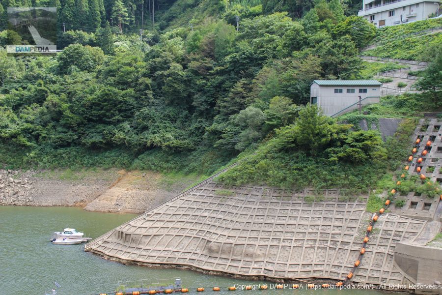
View of the dam lake from the top
The water level was a little low.
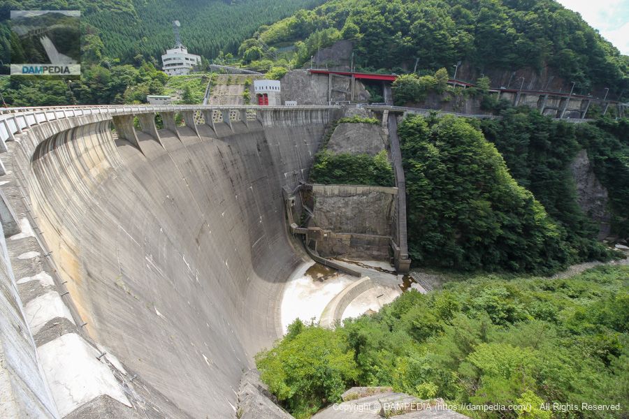
View downstream from the top
The concrete structure leading diagonally downstream from the left is the aforementioned incline. The reduction structure is also a structure I have not seen before, and the footing on the right bank is also quite impressive.
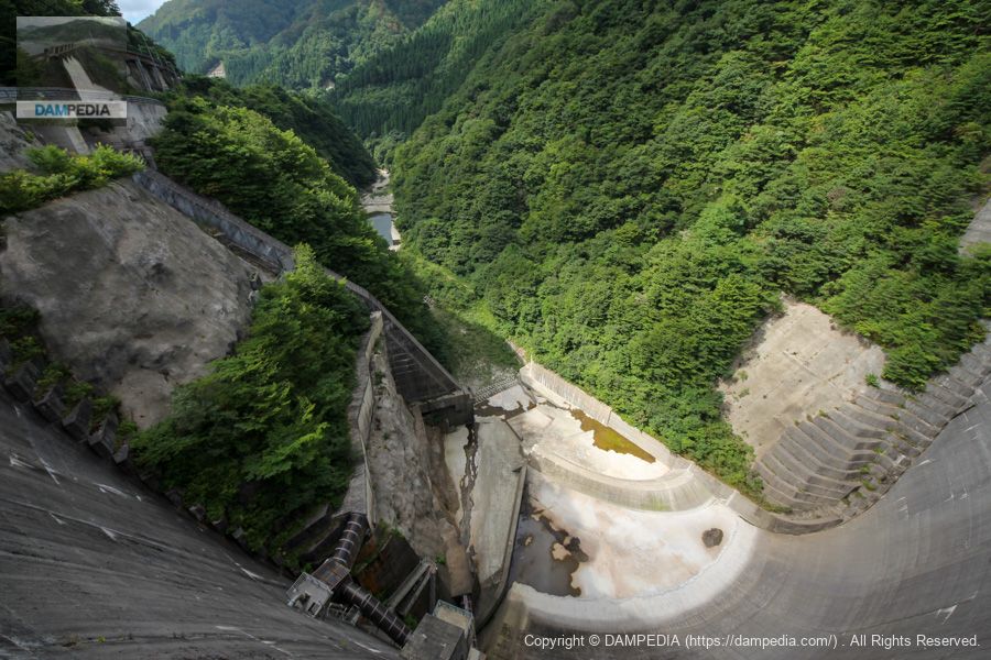
Beyond the Incline?
The Incline appears to be connected to this location.

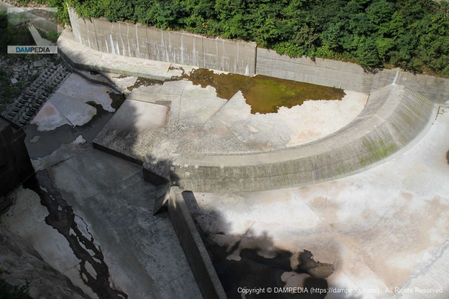
Deflector of momentum reducer
They installed this deflector because the discharge from the crest would flow to the right bank side and could scour the bedrock on the right bank. I would like to see how the water actually flows.
Right bank dam site
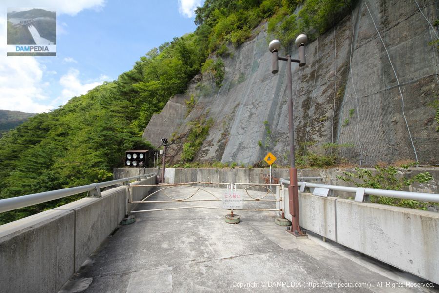
We crossed the top edge and came to the right bank. Unfortunately, the area beyond this point was off-limits.
View of the levee downstream from the right bank
The Naruko Dam is not only a beautiful arch, but also has a glamorous arched structure in the conduit, which I think enhances the beauty of the dam.
View of the crest gate from the right bank
Here, here. Someone once said, "Dam maniacs have poor aesthetic sense or lack the ability to see the essence of things," but don't you have to be a dam maniac to understand the beauty of this place?
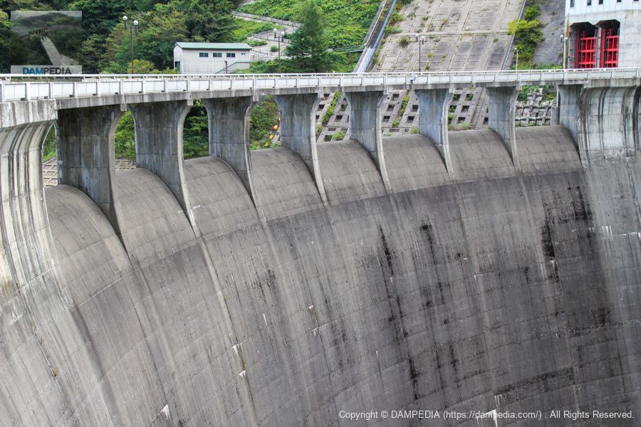
It may be unnecessary to explain now, but Naruko Dam is the first arch dam completed solely by Japanese engineers. I am sure that a lot of trial and error was done through surveys and models, but I can only express my gratitude to the engineers of the time who built such a wonderful dam.
View of the top edge from the right bank
Come to think of it, there is lighting at the top end, but I would like to see the Naruko Dam at night.
Water intake tower for power generation
An intake tower for transporting water to the Tohoku Electric Power Company's Naruko Power Plant is located upstream on the left bank.

Boathouse and Incline
The boatyard and incline are also located on the left bank. It is a bit far from the management office, but it seems to be a bit difficult to move around.
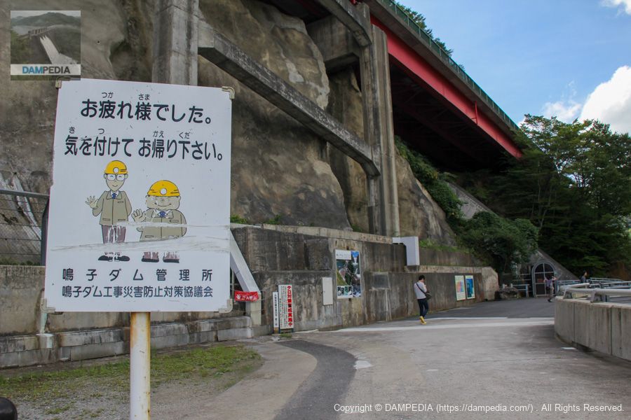
Signboard on the left bank
We left the dike and headed for the administration office. The sign is full of kindness.
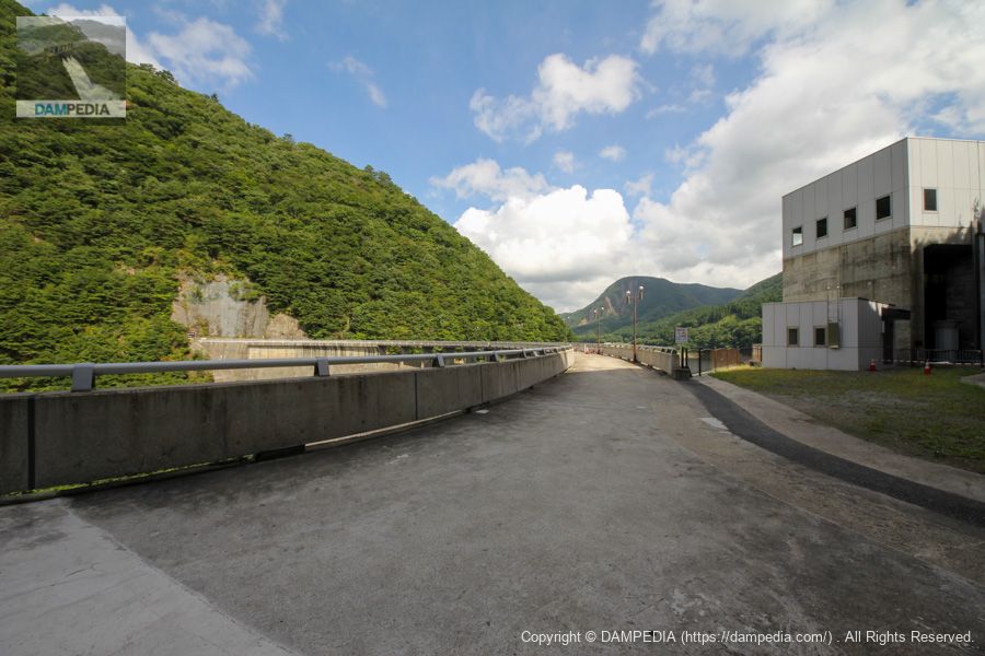
Naruko Dam Management Office
We came to the Naruko Dam control center. Since it is quite far from the embankment, we drove there.

technical transfer
Naruko Dam takes pride in its technology, and a large tarpaulin reading "Technology, Passing Down" hangs at the entrance of the administration office. The fact that the dam was also recognized as a Civil Engineering Heritage Site by the Japan Society of Civil Engineers is probably the result of its reputation for technology.
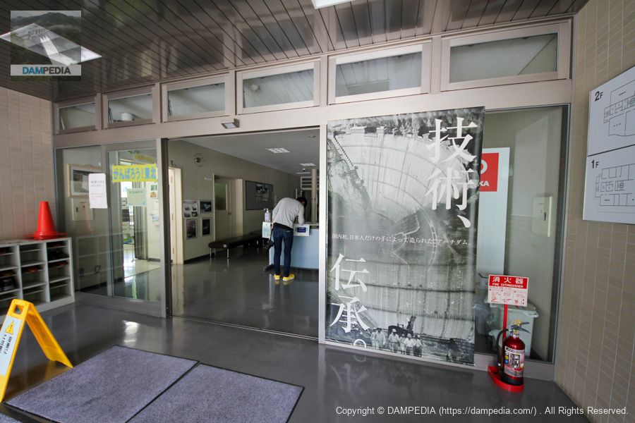
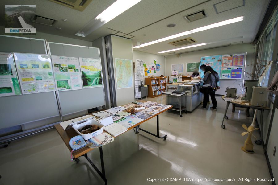
exhibition room (room in a museum, etc.)
There is an exhibition room in the administration office where visitors can view a variety of materials. Pamphlets for the general public, children, and engineers are also available here.
Viewing terrace
A terrace with a view like this is also available.
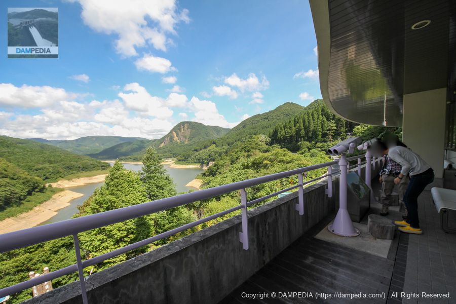
View toward the levee from the observation terrace
Of course, the levee can be seen from the observation terrace.
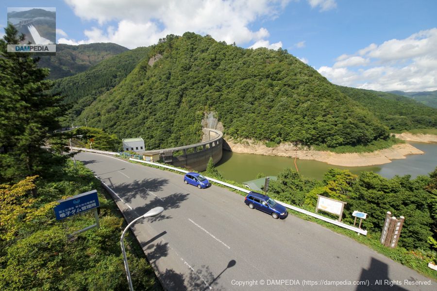
View of the levee downstream from the national highway
The view from the observation terrace is nice, but we wanted to get a bird's eye view of the downstream side, so we left the control center and looked from the national highway.

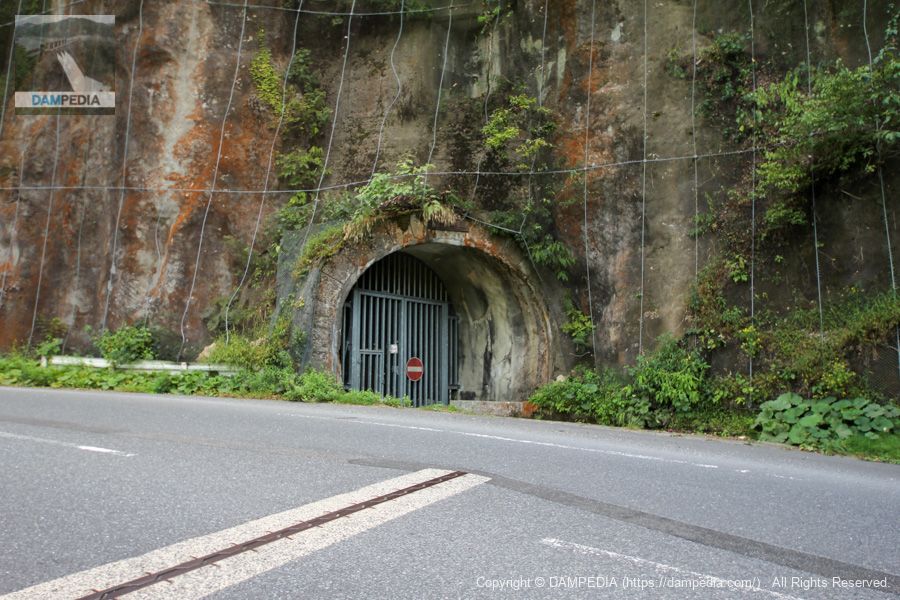
Motoyama Tunnel
The Motoyama Tunnel has been used as a national highway. There appears to be an Incline boarding area behind this tunnel.
I would like to revisit the Naruko Dam next time when the water curtain is discharged. Recently, they seem to be putting a lot of effort into giving tours, such as allowing visitors to see the downstream side of the dam, so I would like to take part in such an opportunity if possible.
Naruko Dam Specifications
| Location | Iwafuchi, Naruko Onsen, Osaki City, Miyagi Prefecture |
| River Name | Kitakamigawa River System Eagogawa |
| Objective | F (flood control, agricultural disaster prevention) A (irrigation water) P(Power generation) |
| Model | A(arch dam) |
| Bank height | 94.5m |
| Bank length | 215m |
| Dam volume | 180,000m3 |
| Watershed Area | 210.1 km2 |
| Reservoir area | 210ha |
| Total storage capacity | 50,000,000m3 |
| Effective water storage capacity | 35,000,000m3 |
| Dam operator | Tohoku Regional Construction Bureau |
| Main body constructor | Kajima Construction |
| Year of launch | 1951 |
| Year Completed | 1958 |
| Name of Dam Lake | Lake Arau |
Other facilities/observations
| Parking lot | ○ |
| Toilet | ○ |
| Park | ○ |
| PR Exhibition Hall | ○ |
| Fishing | ○ |

Comment