

Location: Shimonagao, Nakakawane-cho, Haibara-gun, Shizuoka Prefecture
Parking and storage?
Looking at the map, I thought it was probably a closed dam and I would not be able to see it at all, but surprisingly there was a sign for the dam along Route 362, and with high hopes I broke into the road leading to the dam, but in the end I could not see much. Either you want us to see it or you don't! And I can't shake the feeling that the dam is a bit half-baked.
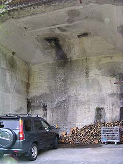
From the sign on Route 362, we descended a narrow, steep slope, praying that no oncoming cars would come. There is a space to turn around, but it is not clear whether it is a parking lot or not. This is the photo on the left, which is probably the remains of a crane foundation from a construction site. It seems to be used as a parking lot and storage space.
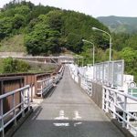
View of the embankment from the left bank
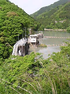
Now, the main issue is the dike. As you can see, there is no levee in front of us.... It seems that you can reach the dike by going down the stairs in front of you, but it is off-limits....
Management Office (?)
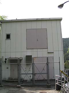
Looking to the left, there was a building that looked like an administration office.... But nothing was written on it, so it may be some kind of machine room. What the machine room is for is unknown. While looking for a way to approach the dike, I noticed a narrow passage to the left of this building. Further back, there was a staircase, and we did not know where it led, but we decided to go down it anyway.... I was not very enthusiastic because the path was overgrown with grass and snakes....
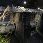
View of the levee from the downstream side of the left bank
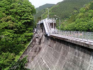
As I descended the stairs, I saw the dike in front of me. Oh, I thought, if I can make it this far, I will be able to get to the other side, but unfortunately I could not go to the right bank.
View of the top edge from the left bank

I got a little closer to the levee and managed to take a shot from the top edge by extending my arm toward the top edge. This is the best I could do, since the inside of the top edge is off-limits....
dam characteristics
| da mu | Model | gravity-fed concrete dam |
|---|---|---|
| Objective | generation (e.g. power) | |
| Bank height | 34.2m | |
| Bank length | 83.8m | |
| Dam volume | 27,000m3 | |
| savings water (esp. cool, fresh water, e.g. drinking water) pond | Watershed Area | 823.7 km2 |
| Reservoir area | 11 ha | |
| Total storage capacity | 1,173,000m3 | |
| Effective water storage capacity | 343,000m3 | |
| River Name | Oigawa River System Sakai River | |
| Year of launch | 1939. | |
| Year Completed | 1943. | |
| Access to D@M | Get off at Sagara Makinohara IC of Tomei Expressway The rest of the way is National Route 473 heading north toward Kawane Town. After entering Kawane Town and eating taiyaki at Ieyama, head north again on Route 473. After driving for a while, you will hit a T intersection with Route 362, and turn left at the intersection. After a short drive, turn left at the sign. | |
Other facilities/observations
| Parking lot | △ | I'd like some more information... I wanted to cross the skyline.... |
|---|---|---|
| Toilet | × | |
| Park | × | |
| PR Exhibition Hall | × |
Comment