
Date of interview: Saturday, March 1, 2014
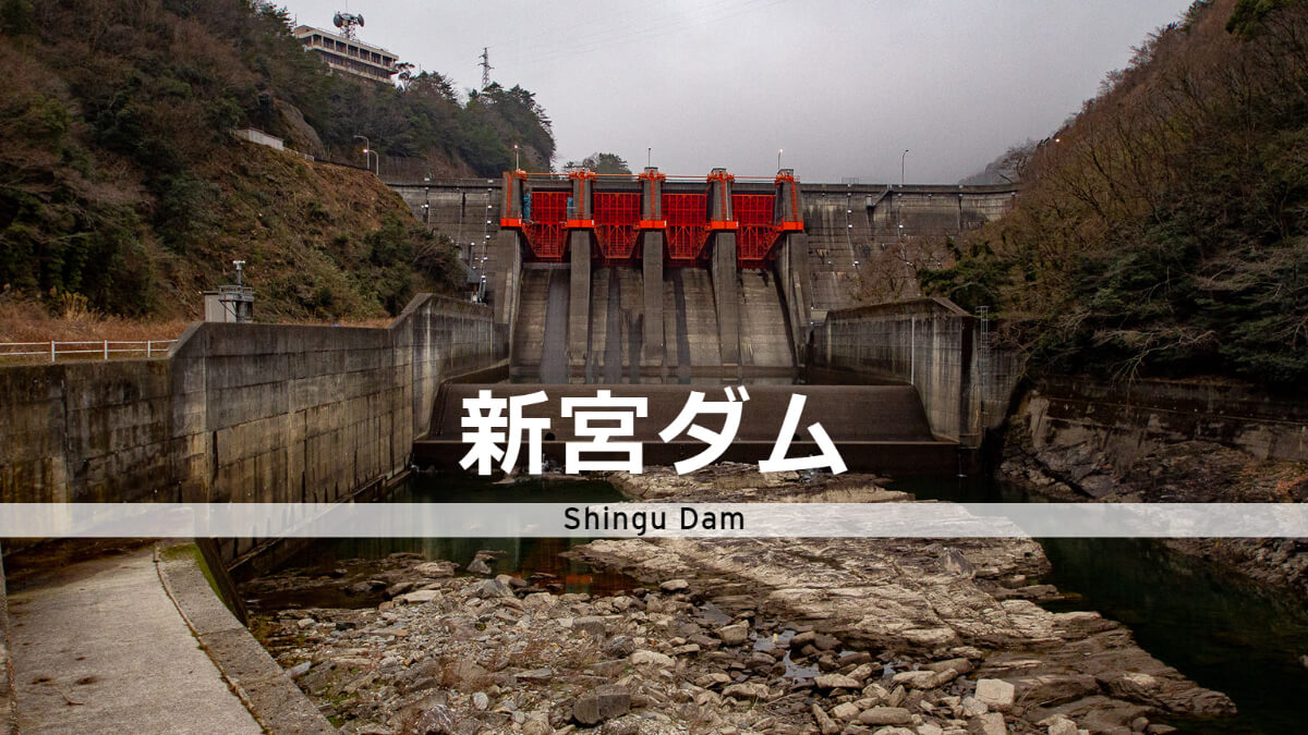
On this day, I came to Shikoku to participate in the "Meeting in Praise of the Hayamaura Dam" organized by dam enthusiast Mr. Yajaku, and stopped by this Shingu Dam on the way to the venue, the Hayamaura Dam. The Shingu Dam is a gravity-type concrete dam constructed by the Japan Water Agency on the Doyama River, a tributary of the Yoshino River.
downstream face of embankment
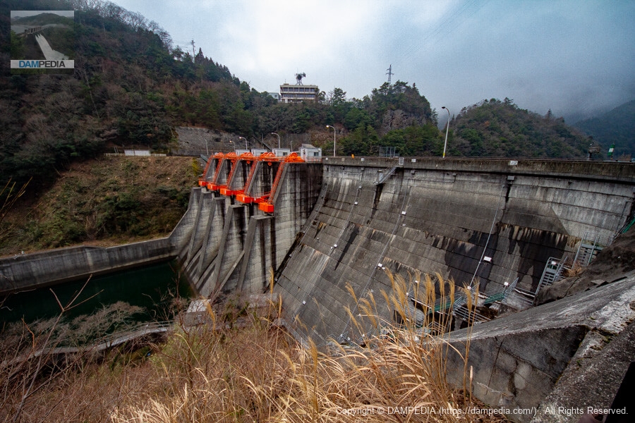
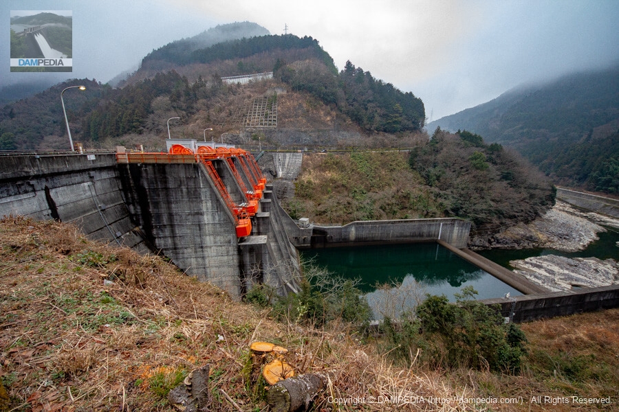
The main dish is suddenly here. There is a road on the right bank side, from which you can admire the embankment. The height of the embankment is 42m, which is a medium-sized embankment, but the huge, bright red four crest gates are eye-catching, and together with the design of the ledge wall and sub-dam, they give a very massive impression. The crest gates measure 14.05m high by 10.00m wide.

Looking downstream from the left bank
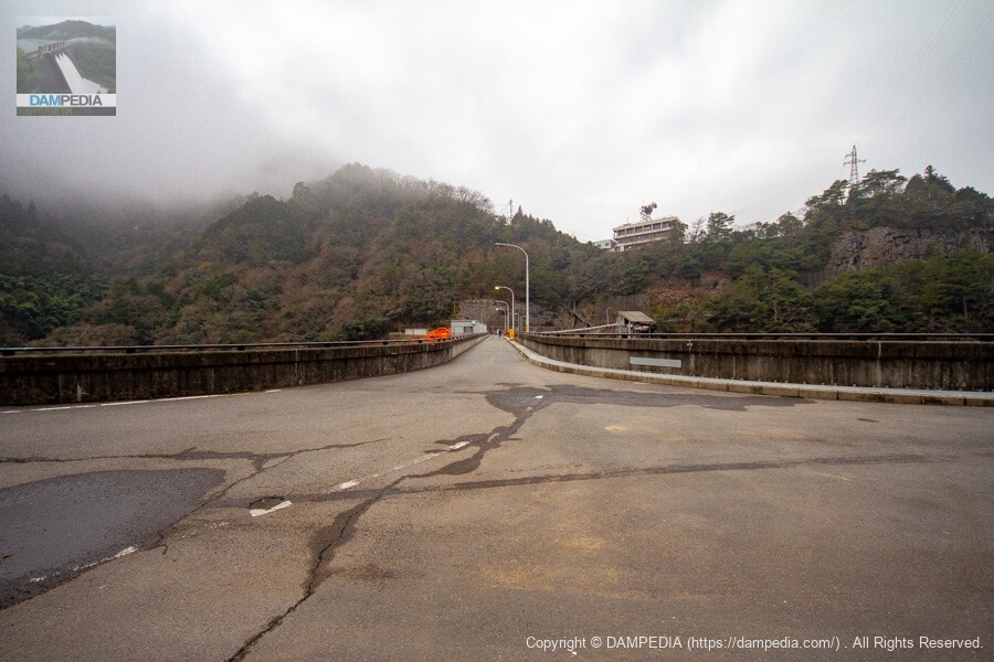
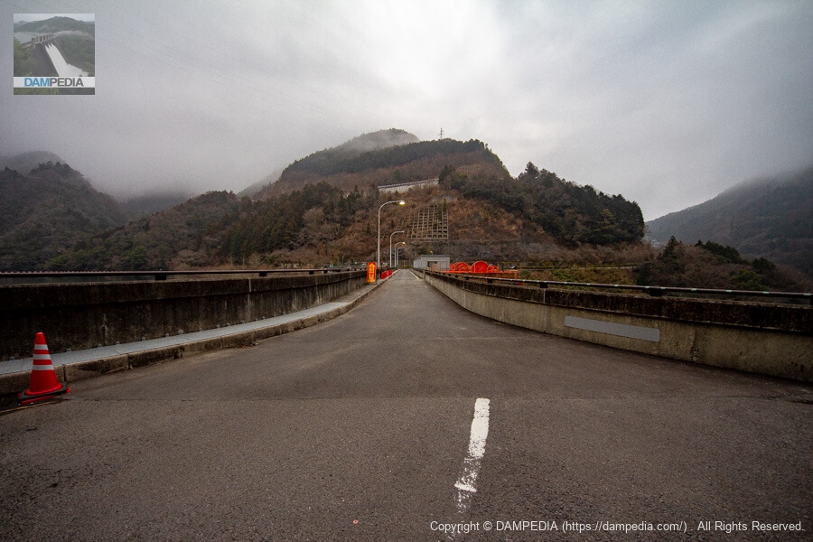
We came to the left bank of the top level. There is a parking lot on the left bank.
View of the top edge from the left bank
The top edge is open to automobile traffic. The building on the mountain on the right will be the administration office.
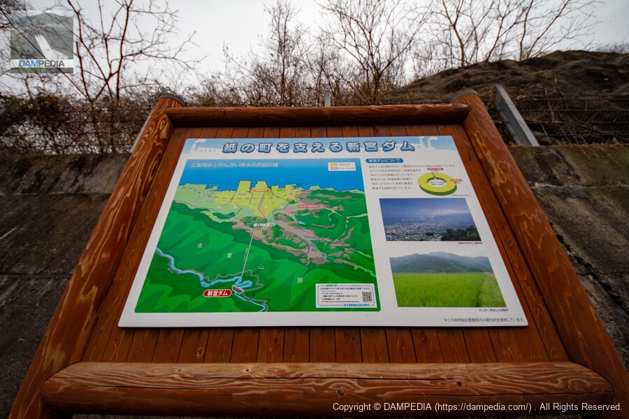
Shingu Dam supporting a paper town
Shikokuchuo City is also a paper town, ranking first in Japan in the amount of paper products shipped. The Shingu Dam supplies industrial water to the Uma area, where there is a paper mill, and is also used for irrigation. Flood control is also carried out as a flood control project in the Yoshino River system.
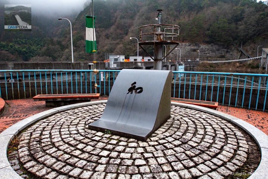
Monument of "Wa
This is a monument in the shape of a levee with the word "Wa" written on it on the left bank. The Uma district of Shikokuchuo City, facing the Seto Inland Sea, has long suffered from water shortages, and access to the abundant water of the Dosan River beyond the Hoho Mountains has been a long-held wish since the Edo period.
The Shingu Dam was built after many twists and turns, but Tokushima Prefecture, which has water rights downstream, had long opposed the use of water upstream because it would deprive them of their own water. The monument with the word "Wa" on it must have been built in the spirit of reconciliation between Ehime and Tokushima prefectures.
The Shingu Dam also draws water from the adjacent tributary Madachigawa River, and water is stored in the reservoir via a water conduit tunnel, indicating that it is a valuable water resource. Upstream of the Shingu Dam are the Yanase Dam and Tomigo Dam, which also serve as water reservoirs for Shikokuchuo City.
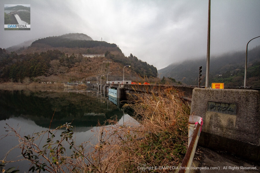
Looking upstream from the left bank
It was March, but the water level was high. Can you see the square drop in the gate at the far end (light blue area)? (The light blue part) At that time, the gate was undergoing maintenance work.
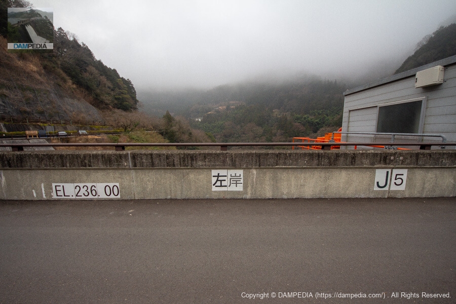
Easy-to-understand indications written on the top edge railings
It indicates the left bank and the top elevation is EL.236.00m, which is easy to understand, but it is unclear whether it is for construction, visitors, or new staff at the control center. Other indications included "upstream" and "downstream" and "No. 1," which indicates the gate number.
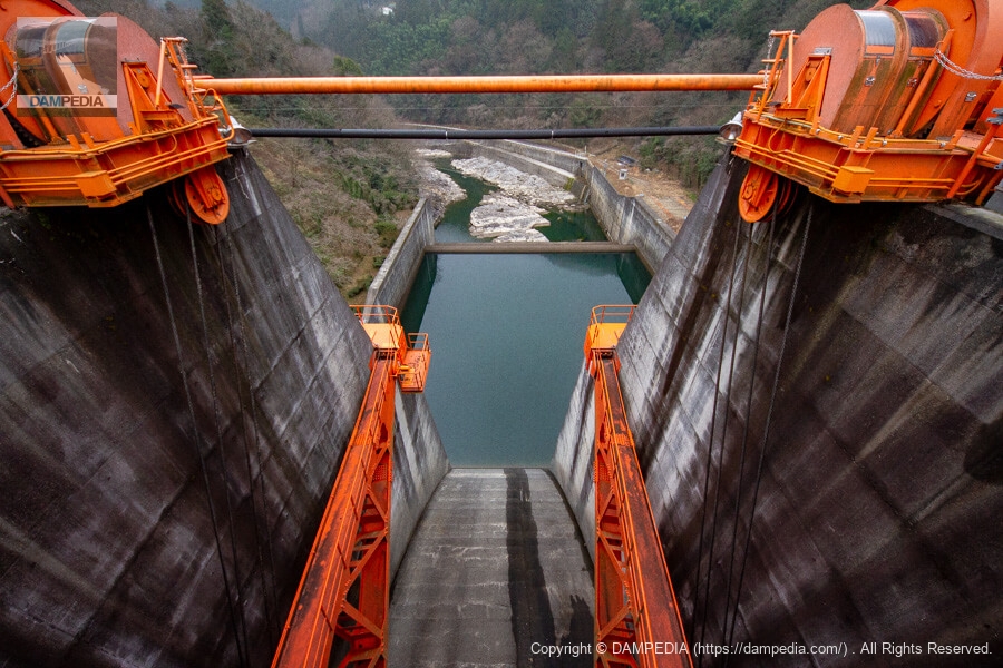
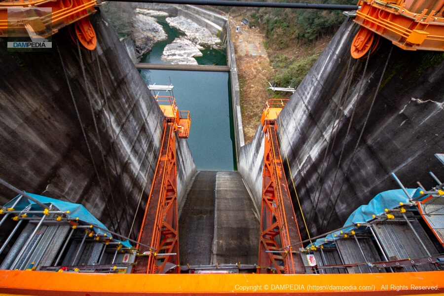
Looking downstream from the top through the crest gate
The orange crested gate is very eye-catching from the top edge.
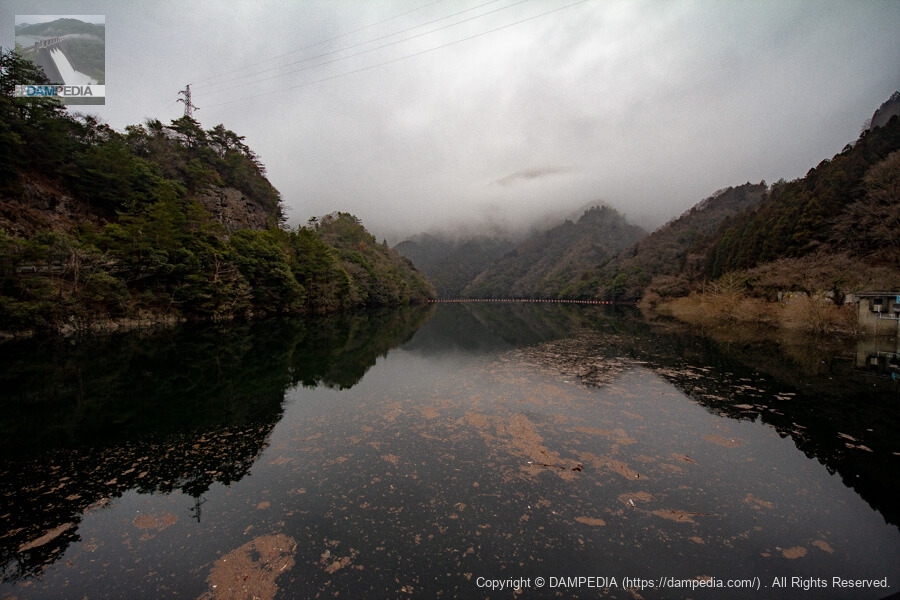
View of the dam lake from the top
The Copper River has a winding channel, and in the photo below, the upstream end cannot be seen because of the large left turn at the back of the river.
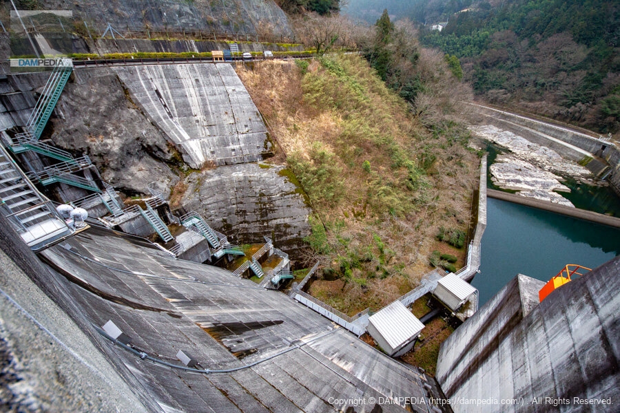
Looking downstream from the top through the rightmost gate
This is the gate closest to the right bank of the four crest gates. Scaffolding has been erected for repairs.
View of the rightmost bank and reservoir side crest gate from the top
This is the opposite side of the photo above. The corner ochiai is in place. This is a rare sight that can only be seen when repairs are being made.
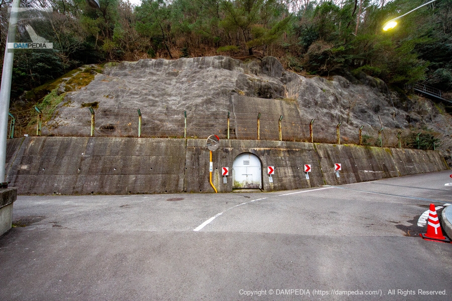
Rim Tunnel on the right bank
The rim tunnel is on the right bank. The road leads to the administration office on the right.
Looking downstream from the right bank
I am glad to see that the trees have recently been cut down and a viewpoint has been secured. Incidentally, the Shingu Dam can be viewed from various places, including the national highway on the left bank (in the photo below, the white area halfway up the mountain on the opposite bank) and an observation deck further upstream on the national highway (not visited at this time). (Not visited at this time).
View of the top edge from the right bank
The top edge seems to be illuminated at night, so it may be possible to photograph the dam at night if one tries hard.
Looking upstream from the right bank
The nameplate of the Shingu Dam was found on the parent pillar on the right bank. From this point of view, the water level is below the upper second level of the corner drop, but you can see in the previous photo that there is no water leaking from the corner drop.
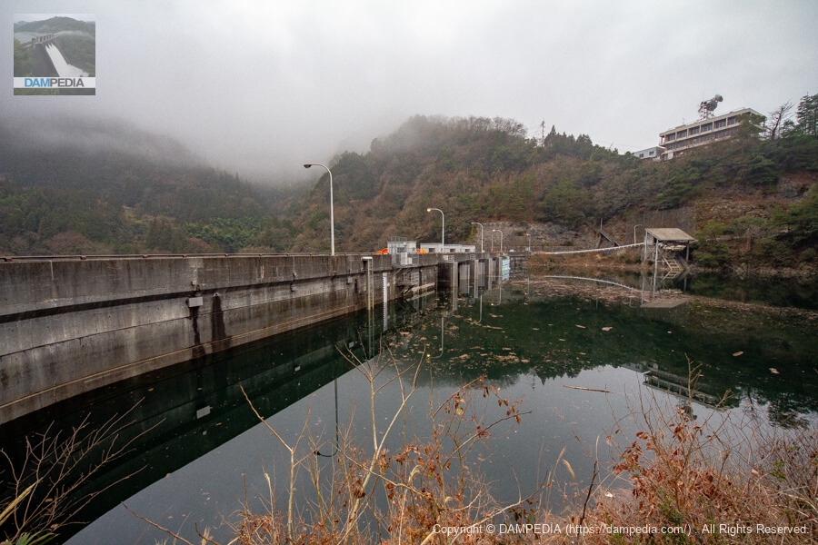
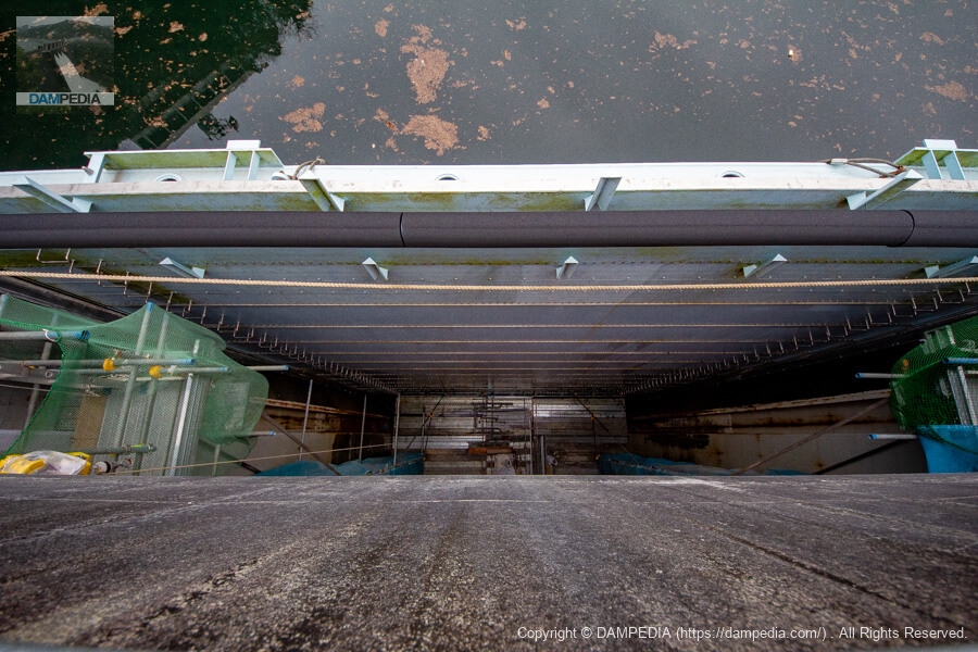
Left bank footing and each valve chamber
I was going to get a dam card at the management office, but it was only 7:30 in the morning, so I decided to go to Yanase Dam once and then to the management office of Shingu Dam on the way back, so I returned to the left bank parking lot to get my car for now.
The photo below is one I took on my way back to the parking lot on the left bank. Underneath the footing, two valve chambers are lined up in front of and behind each other toward the force reducer. The front one is a through valve chamber and the back one is a howell banger valve chamber. The drawing shows that the water is discharged through a sand discharge pipe.
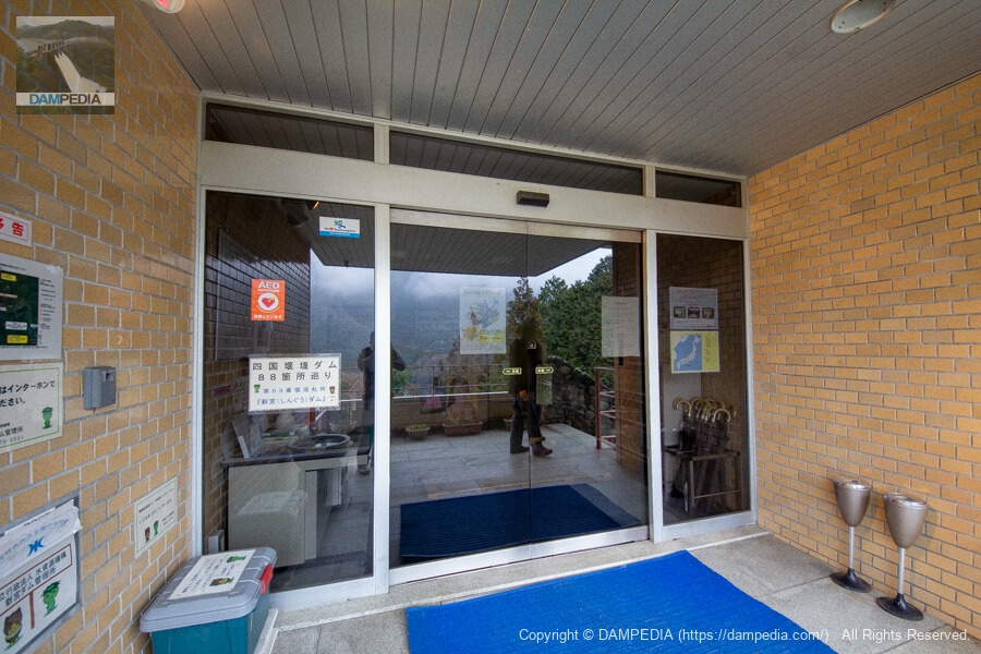
Entrance to Shingu Dam Management Office
We returned from Yanase Dam and went to the control center to get a dam card. The time was exactly 9 o'clock. The other person in the picture with me at the automatic glass door is Kaiyu, a fellow dam enthusiast from Yamaguchi Prefecture.
Structure located by the control center
There was this sturdy-looking concrete structure by the administration office. It may be the remains of the foundation of a crane used during construction.

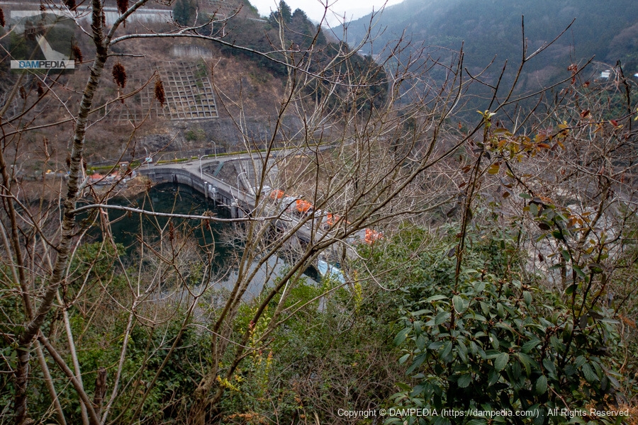
View of the levee from the side of the control center
Since the control center was visible from the dam, I thought I could see the levee from around the control center, but I was naive 😓.
From the upper floors or rooftops of the control center, it could have been seen clearly.
Leveecrest gateThe overall appearance of the reduction works is so well balanced that when seen from downstream, one can hear the "oohs" and a glimpse of the history of the great efforts to maintain the balance of Shikoku's water environment...such was the history of the Shingu Dam.
Shingu Dam Specifications
| Location | Umadachi, Shingu-cho, Shikokuchuo City, Ehime Prefecture |
| River Name | Yoshino River System Doyama River |
| Objective | F (flood control, agricultural disaster prevention) A (irrigation water) I (industrial water) P(Power generation) |
| Model | G(gravity-fed concrete dam) |
| Bank height | 42m |
| Bank length | 138m |
| Dam volume | 80,000 m3 |
| Watershed Area | 254.3 km2 (direct: 214.9 km2, indirect: 39 km2) |
| Reservoir area | 90 ha |
| Total storage capacity | 13,000,000 m3 |
| Effective water storage capacity | 11,700,000 m3 |
| Dam operator | Shikoku Land Construction → Water Authority of Japan, 1st Engineering Dept. |
| Main body constructor | Taiho Construction |
| Year of launch | 1969. |
| Year Completed | 1975. |
| Name of Dam Lake | - |
Other facilities/observations
Restrooms and parking are located at the dam site on the left bank. Restrooms are also located at the entrance of the stairs upstream to the observation deck.
| Parking lot | ○ |
| Toilet | ○ |
| Park | × |
| PR Exhibition Hall | × |
| Fishing | ○○ (excluding no-take zones) |

Comment