
Location: Momoya, Tottori City, Tottori Prefecture
Date of interview: 2011/04/04 (Monday)
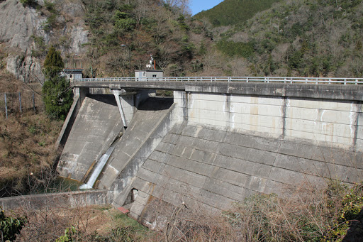
View of the embankment from downstream on the right bank
This is my first visit to Tottori. Tottori is famous for its sand dunes, but I did not pay attention to the dunes, but rather toured the dam. This Momotani Dam is located eastward along the Sanin Line from the center of Tottori City. First, we looked downstream on the right bank to see the embankment, but we decided not to go any further because of the trees in the way.
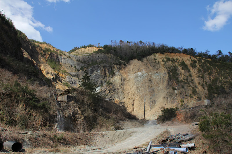
Quarry downstream
There is a quarry on the right bank, but it is quite large and I couldn't resist snapping the shutter.
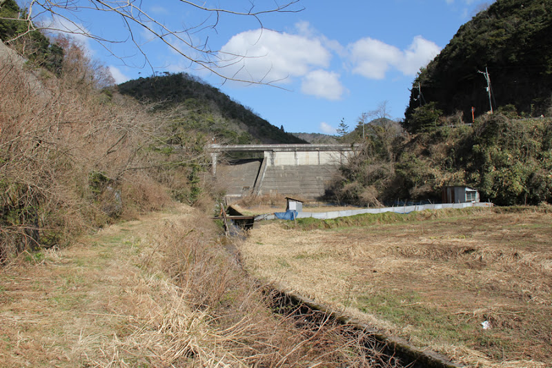
View of the levee from downstream
This time, we tried to go straight down from the left bank side, but this was also the best we could do. We gave up and headed for the top level.
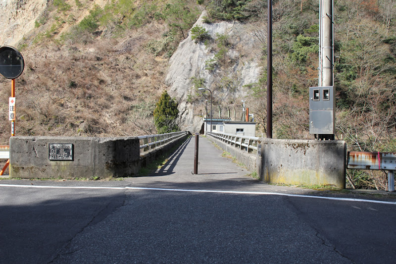
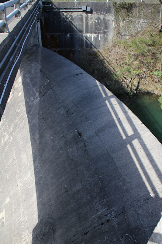
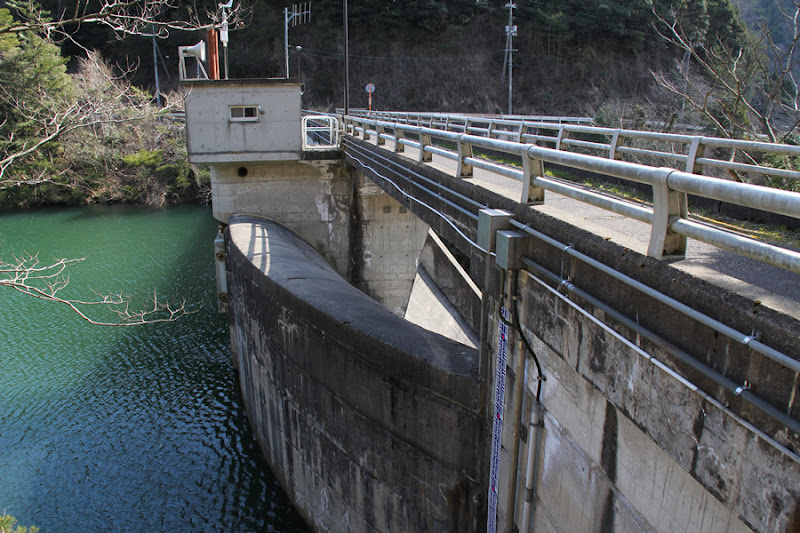
View of the top edge from the left bank
It is a narrow top end. Of course, no automobile traffic is allowed.
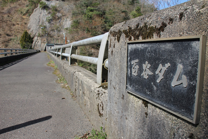
View of the dam nameplate attached to the top rail on the lake side of the dam from the left bank
The Momoya Dam is a gravity concrete dam owned by Tottori Prefecture for flood control and unspecified water use.
View of the levee downstream from the left bank
If written as above, it may look like an ordinary gravity concrete dam, but the flood discharge of this dam has a unique shape. However, it may be a little difficult to see in the photo of the downstream side.

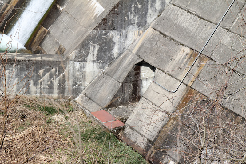
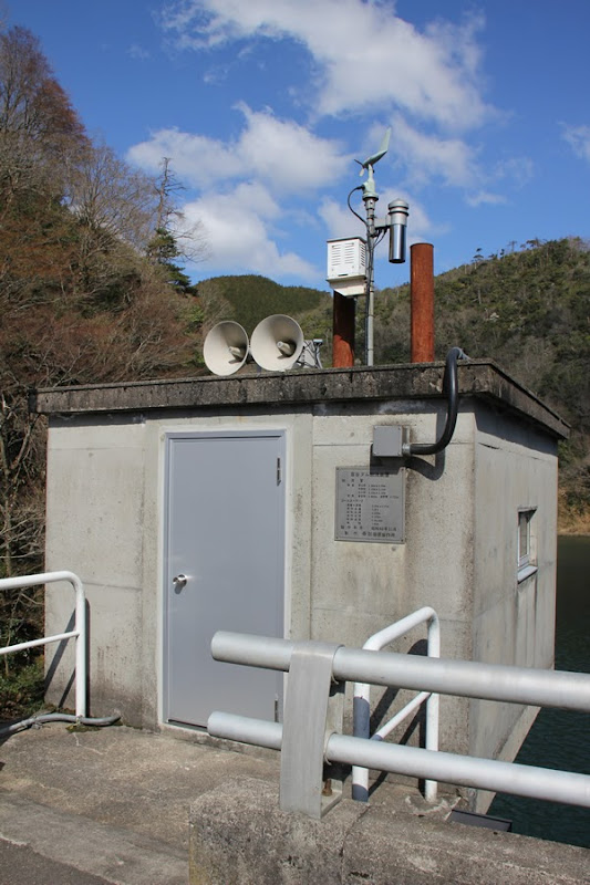
Entrance to audit corridor? View of the entrance to the audit corridor
What appears to be the entrance to the audit corridor can be seen on the downstream side. It seems that there is an audit corridor even though it is small in scale.
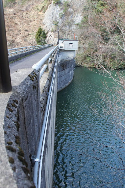
View of the embankment on the lake side from the left bank
Now, this is the characteristic flood discharge, but can you see in this photo that it protrudes from the lake side of the dam?
View of the dam lake from the top
The dam lake is small, so if you have time, you may be able to complete a lap around the dam lake in a short time.

View of the Momoya Dam discharge facility
The specifications of the discharge facility are as follows
■Discharge pipe
Cross-sectional drinking mouth 1.99m X 1.99m
Cross-sectional middle section 1.33m X 1.33m
Cross-sectional exit 1.33m X 1.23m
Pipe length Straight section 1.842m Bent section 3.712m
■Coaster Gate
Door width X door height 2.15m X 2.27m
Door body dead weight 2.30t
Design water depth 5.235m
Operating depth 4.535m
Opening/closing speed 0.1m/min
Lift 2.60m
Produced by TAHARA MFG.
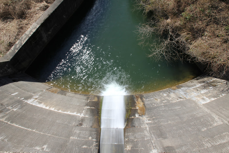
View of the flood discharge from the top
This is it. The Momoya Dam is actually the first dam in Japan with a free overflow crest. Moreover, it is the first dam in Japan to have a free overflow crest that protrudes from the dam lake.Flood dischargeThe following is a list of the most common problems with the
View of the reduction work from the top edge
And then it became fan-shaped as well, perhaps matching the shape of the flood vomit.momentum reducer....... The water that flows out is from the coaster gate.
Baekdani Dam staff station
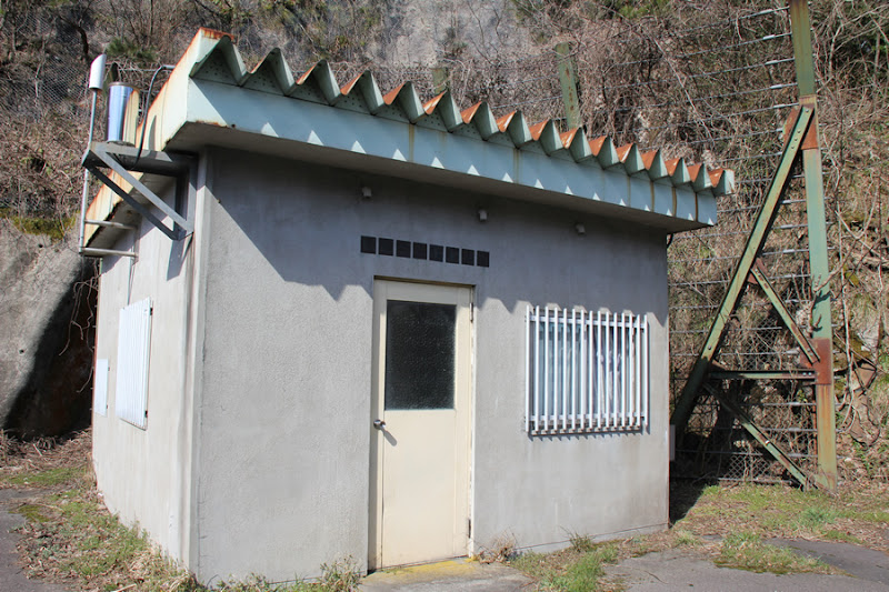
Tsumesho, not management office. It is quite an unusual name. But I guess it is not usually used.
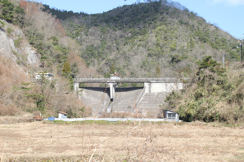
View of the embankment on the lake side from the right bank
Although the dam does not normally store much water, this shape was apparently chosen to ensure efficient flow in the event of flooding.
View downstream from the top
Downstream, a long, quiet countryside spreads out. The season is spring, and spring has just finally arrived. The winter of this year brought quite a heavy snowfall to Tottori, but I am sure the rich green will be spreading from now on.
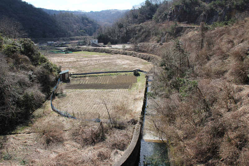
Incidentally, daffodils are planted on the backwater side of the dam, which will surely show their beautiful flowers and delight our eyes when spring comes. I would like to visit the dam a little later in the spring.
Baekdani Dam Specifications
| River Name | Tenjin River, Chiyogawa River system |
| Objective | Flood control, unspecified water |
| Model | gravity-fed concrete dam |
| Bank height | 18m |
| Bank length | 79m |
| Dam volume | 9,000m3 |
| Watershed Area | 2.5 km2 ( Direct: 2.5 km2 ) |
| Reservoir area | 5 ha |
| Total storage capacity | 280,000m3 |
| Effective water storage capacity | 242,000m3 |
| Dam operator | Tottori prefecture (Chuugoku area) |
| Main body constructor | Konoike Group |
| Year of launch | 1969. |
| Year Completed | 1973 |
Other facilities/observations
There is space for cars to park on the upstream side of the dam lake. The dam site can also accommodate at least one car.
| Parking lot | △ |
| Toilet | × |
| Park | × |
| PR Exhibition Hall | × |
| Fishing | ○? |

Comment
Oota Toshiaki Syunmyou liked this on Facebook.
Fumihiro Ito liked this on Facebook.
Masaki Fujihara liked this on Facebook.
Japanese yellow loosestrife (Lysimachia japonica) liked this on Facebook.