
Date of interview: Sunday, 7/18/2021
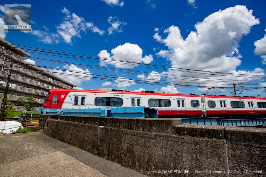
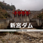
The Yamazaki River, which flows through Nagoya City, is a second-class river known for its cherry blossoms in some sections, but it is also a typical urban river that frequently overflows. Meitetsu (Nagoya Railroad) runs through parts of Aichi and Gifu prefectures, and the Yamazaki River Bridge is built at the intersection of the Meitetsu Nagoya Main Line and the Yamazaki River, with a station called Yobitsugi adjacent to it.
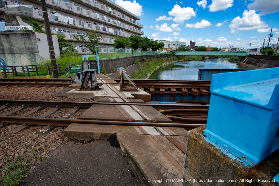
Left bank crossing (looking upstream from downstream)
The Yamasaki River Bridge was completed in 1917. However, the area was flooded by Typhoon Isewan in 1959. Concrete levees were constructed, but the height of the bridge was left unchanged.
The tracks are laid in a notch in the embankment, so when the Yamasaki River floods, water overflows the notch, causing flooding damage to the surrounding area.
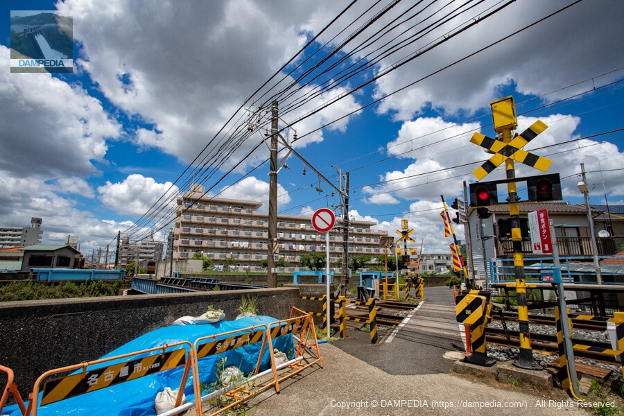
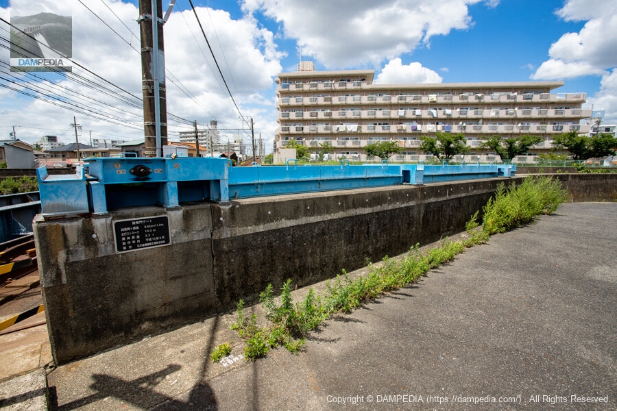
Level crossing on the left bank (at the intersection with the land lock)
Therefore, land locks were installed in 1964, and the gates were closed only when the Yamazaki River overflowed and the risk of overflow increased.
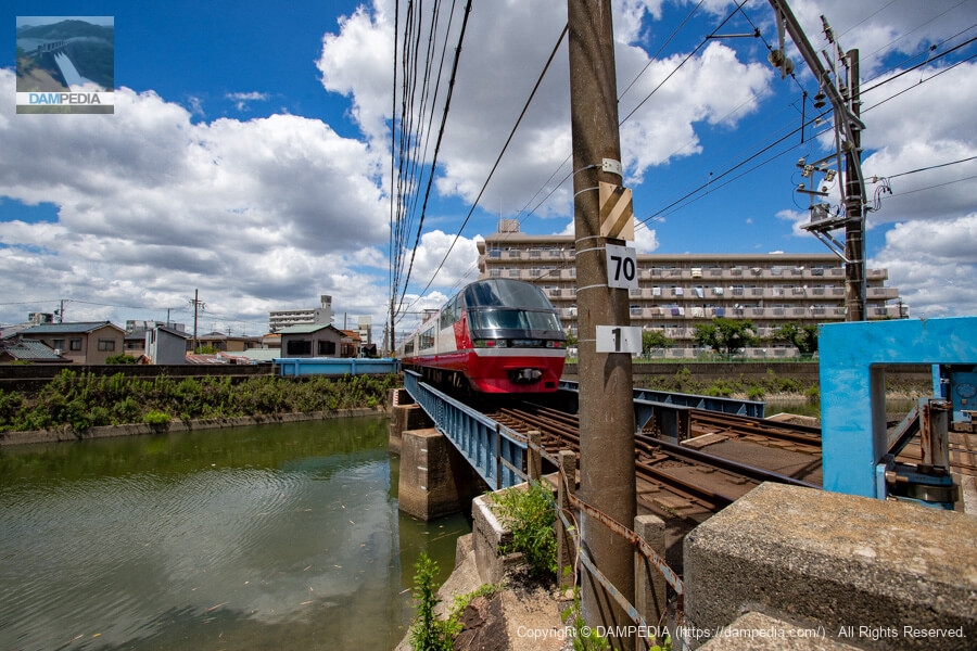
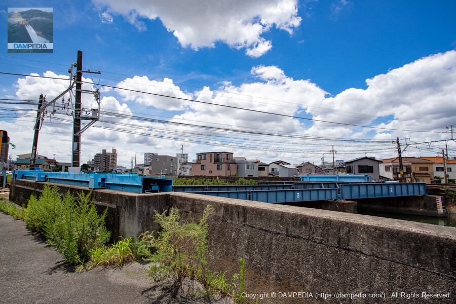
View of the Yamasaki River Bridge from the downstream side of the left bank
Land locks are naturally installed on both the left and right banks. The land lock gates are closed mainly by Meitetsu employees, and of course the Meitetsu Nagoya Line is closed at that time.
There are several land locks that intersect with railroads in Kanto, and there used to be one in the Chugoku region on the JR Mie line, which was discontinued in March 2018, but I think this is probably the only one in the Tokai region. (Sorry if I'm wrong.)
This land lock intersects with such a rare railroad, but we decided to visit it this time because it may disappear in the near future. As mentioned above, the Yamasaki River has flooded in the past, and the replacement of the Yamasaki River bridge is included in the river improvement plan planned by Nagoya City.
The bridge has three piers, which may obstruct the flow of water during a flood, and the land locks are closed by human judgment, which increases the risk of overflowing if a wrong decision is made or there is a delay in closing the locks. For this reason, they are planning to replace the bridge.
Originally, Nagoya City had planned a multi-level crossing project between Sakura Station and Hon Hoshizaki Station, but it was decided to proceed separately from the bridge replacement because it may take time to acquire land for the project, and the flood control project has a higher priority in terms of protecting lives and property.
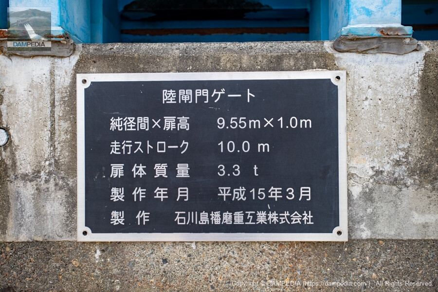
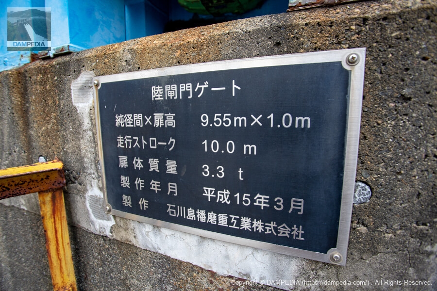
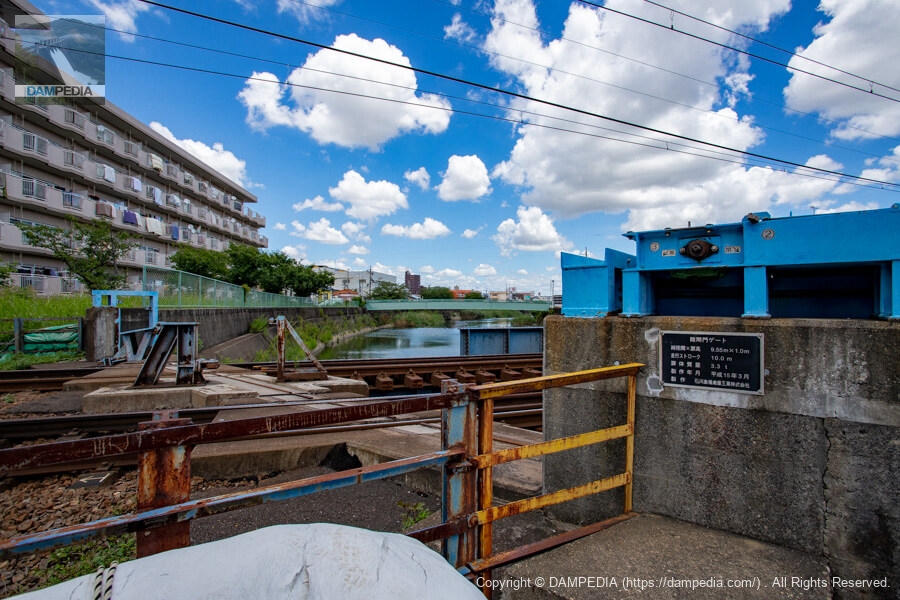
Left bank side land lock gate nameplate
The current land lock gate seems to have been newly installed in 2003 (Heisei 15), but what did it look like before?
Upstream side of the left bank
In normal times, the gate is stored here.
Looking downstream from upstream on the left bank
Land locks painted in the same color can be seen on the right bank.
View of the Yamazaki River Bridge from the Shicho Kobashi Bridge
The Yamazaki River Bridge is seen from the Shicho Kobashi (humanitarian bridge) located upstream of the land lock.

Looking downstream from upstream on the left bank
The crossing on the left bank is very narrow and is marked for vehicular traffic.
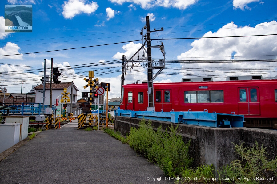
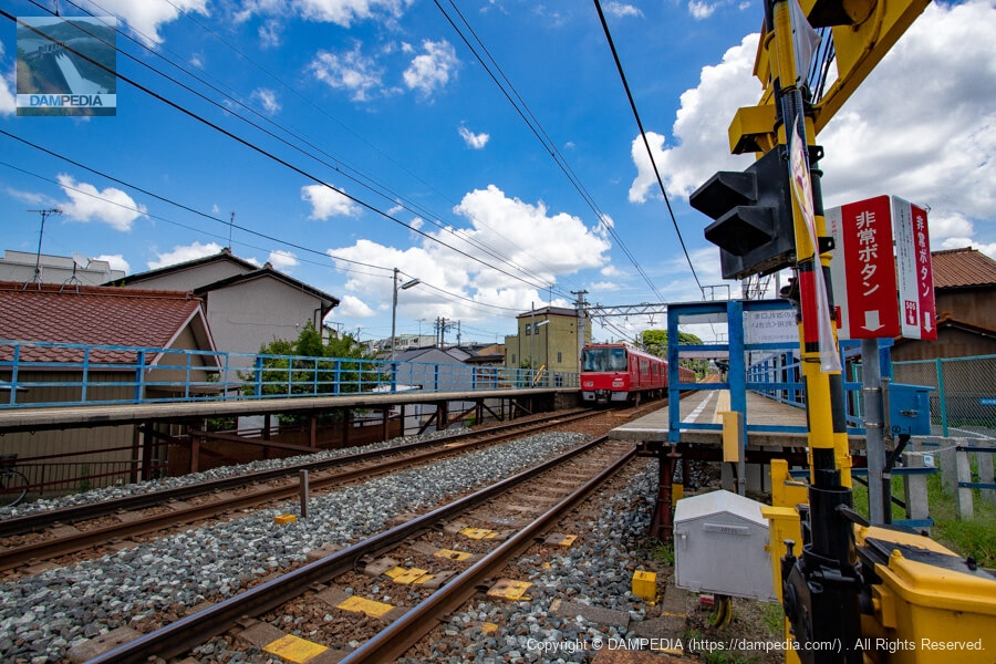
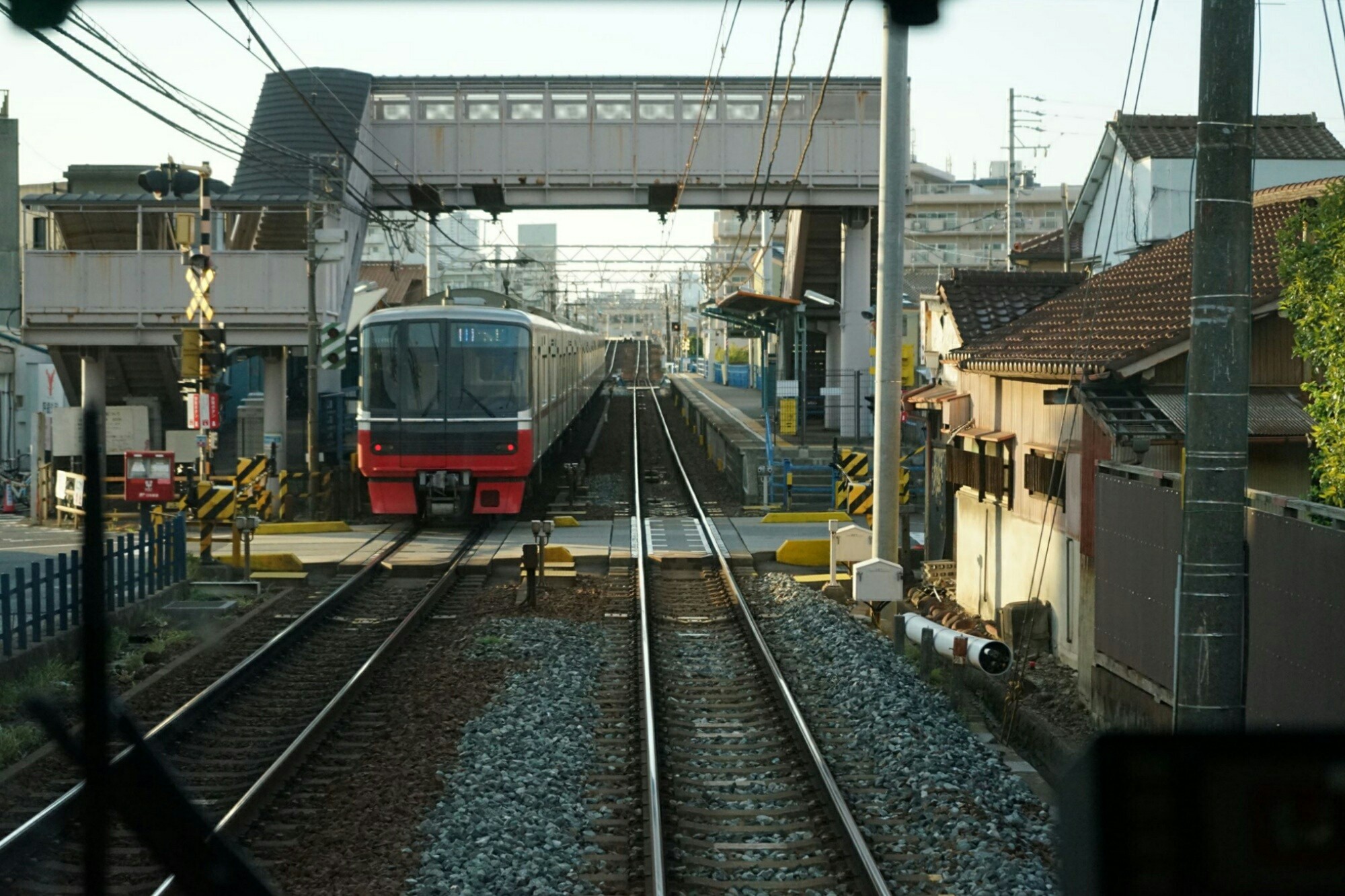
Yobitsugi Station
Yobitsugi Station is located adjacent to the railroad crossing.
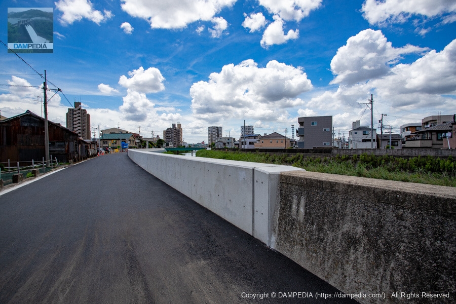
Downstream side of the left bank
The concrete embankment had cracks and other damaged areas and was recently repaired with new concrete.
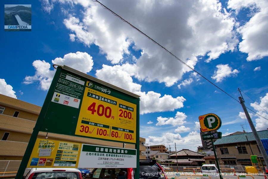
Nearest parking lot
This is the closest parking lot to the land locks. Rates are current as of July 2021. Even if you come to the land lock by train, you can easily visit the property even if you do not have a car because the property is located near the station.
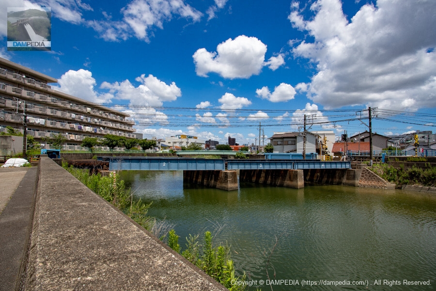
Yamasaki Bridge
The Yamazaki Bridge is located downstream of the Yamazaki River Bridge. It spans the old Tokaido Highway.
View of Yamazaki River Bridge from Yamazaki Bridge
The Yamasaki River Bridge is seen upstream from the Yamasaki Bridge. The repaired levee on the left bank is very secure. It can be seen that the area where the river water hits the embankment during flooding has been preferentially repaired.

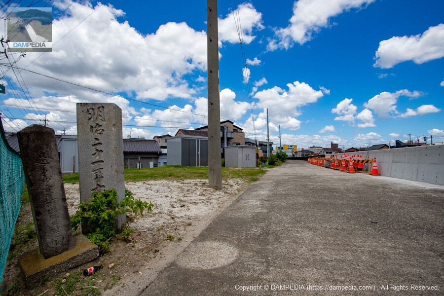
Stone monument standing at the foot of Yamasaki Bridge
Because of its location along the old Tokaido Highway, historical stone monuments have been erected.
View of the Yamazaki River Bridge from downstream on the right bank
However, even if the bridge is to be replaced, how is it going to be done when there seems to be no land available? Moreover, there is a station right next to the bridge, and even to the untrained eye, I have a feeling that raising the position of the bridge and eliminating the piers will be a very difficult construction project.
View of the land lock from downstream on the right bank
The right bank is a dead-end with no railroad crossing.
Right bank land lock gate nameplate
The specifications are exactly the same as the gate on the left bank.
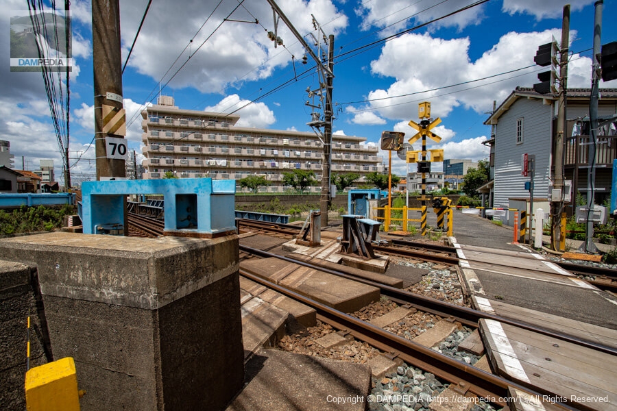
Right bank land lock
This is the intersection of the land lock and the railroad tracks on the right bank side. You can also see a thin rail laid on the concrete part on the land lock side. Perhaps the gate is equipped with something like wheels.
In actual operation, after pulling the gate out to the other side, the gate is lowered so that it is in contact with the ground since it is floating. There will inevitably be a gap in the rail section on the railroad side, but sandbags will be placed to fill the gap. The official blog of the Nagoya City Green Public Works Bureau has an article on the training, so I'll put a link to it at the end of this page.
Right bank land lock
The Yobitsugi land locks have served to protect the community from flooding many times in the past, even though they should never have been used. It is finally coming to the end of its usefulness. Although the construction work is still to come, it would be better to see it while you can, so if you are interested, please do not hesitate to visit as soon as possible.
Reference Links


Comment