
Date of interview: Saturday, 12/31/2012
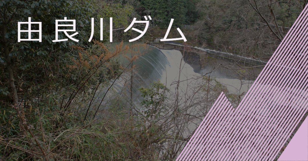
After finishing the first day at the Hata River Dam, we stayed overnight in Ayabe and stopped at the Yura River Dam, the first unit of the second day.
View of the embankment from upstream on the right bank
It was as if the embankment could not be seen. In fact, the entire embankment is of the overflow type, but on this day, the Yura River was completely submerged due to the high water volume. By the way, you can see a bridge over the Yura River, which is a suspension bridge called Benten Bridge.

Move a little downstream
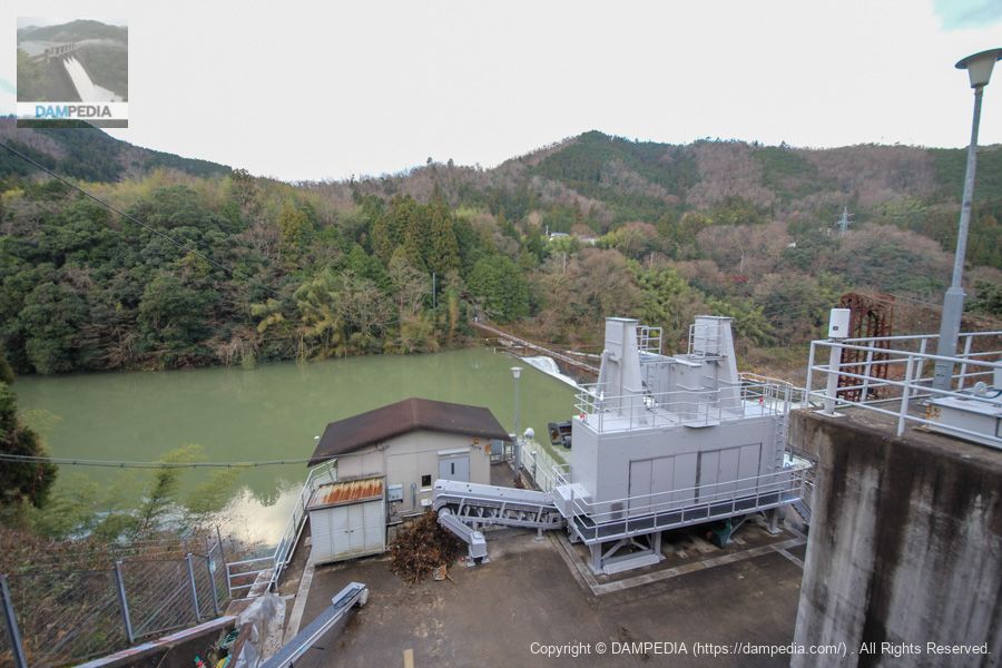
We move a little downstream, but this time the area where the dike is located is hidden by a dust remover? This time, the area where the embankment is located is hidden by a dust collector. Incidentally, the Yuragawa Dam is owned by Kansai Electric Power Co. and its maximum water intake is 38 m3/s.
Move further downstream
Still, the dike is not clearly visible...

Shrine on the way to Benten Bridge
To reach Benten Bridge, move down the slope from the location in the photo above. A shrine is enshrined on the right bank, and I managed to shoot through a gap. However, the grass and trees were in the way.

Saraswati (god of wealth, music, eloquence and water)
Benzaiten was enshrined here.

Where the Wachi River meets the county border, it forms a gorge called Iotsubo Falls. The huge rock island in the middle of the river is a spectacular sight with thousand-year-old green pines. In 1661, the second feudal lord of the Yamaya clan, Tani Daigashira Eimasa, visited this area and enshrined Benzaiten, one of the seven shrines of the Wachi River, on this rock island, which was revered by many. In 1922, the construction of the Yura River power plant transformed the waterfall head into a large weir, creating a great spectacle. In 1953, the shrine was severely damaged by wind and flood damage, and was moved to the foot of Benten Bridge to protect the dam by removing an island of rocks.
Benzaitenkyu signboard
Tonase-cho Neighborhood Association
The wind and flood damage of 1953 is the flood damage caused by Typhoon No. 13. This typhoon caused 36 deaths, 5,307 houses flooded above floor level, and 2,458 houses flooded below floor level in Fukuchiyama City, Ayabe City, and Oe Town. This sign reminds us of the history of even a single dam.
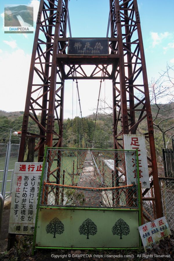
View of Benten Bridge from the right bank
This is the Benten Bridge, but unfortunately it was no longer crossable due to aging. I would have loved to see the Yura River Dam from the bridge. Crossing over to the left bank, there is Tachiki Station on the Sanin Main Line, so the residents on the right bank must have crossed this bridge to get to the station.
If it has not been renovated and left unattended, it may have lost most of its users...but I would like to see it renovated and made crossable at some point.
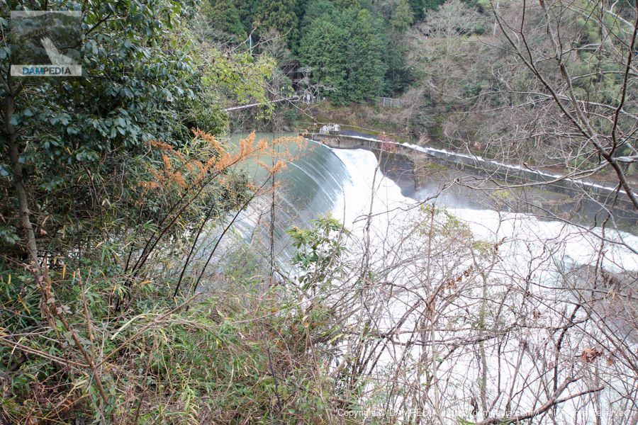
View of the levee from the side of Benzaiten
I managed to find a point where I could photograph the embankment, but this was the limit... Still, it is an amazing overflow.
New Yuragawa Power Plant
The former Yura River Power Station, which began operation in 1924, was located farther downstream, but was reborn as the New Yura River Power Station in 1991 through redevelopment.

The overflow is very powerful, but it also has the disadvantage of not being able to see the embankment, so I would definitely like to revisit the Yurakawa Dam when it is not overflowing. (I also hope that the Benten Bridge will be restored someday.)
Yura River Dam Video
The video of the overflow is available for your viewing.
Yura River Dam Specifications
| Location | Hayashinaka, Shimogaechi Town, Ayabe City, Kyoto |
| River Name | Yura River System Yura River |
| Objective | P(Power generation) |
| Model | G(gravity-fed concrete dam) |
| Bank height | 15.2m |
| Bank length | 89.7m |
| Dam volume | 9,000m3 |
| Watershed Area | 595km2 |
| Reservoir area | 19ha |
| Total storage capacity | 958,000m3 |
| Effective water storage capacity | 302,000m3 |
| Dam operator | Kansai Electric Power Co. |
| Main body constructor | Kawakita Electric |
| Year of launch | 1922. |
| Year Completed | 1924. |
| Name of Dam Lake | - |
Other facilities/observations
| Parking lot | × |
| Toilet | × |
| Park | × |
| PR Exhibition Hall | × |
| Fishing | × |
Comment