
Location: Takane-cho, Takayama City, Gifu Prefecture
View of the embankment from the right bank

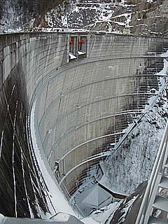
It is located along Route 361 between Takayama and Kisofukushima. As you can see, this photo was taken in winter. In winter, National Route 361 is extremely difficult to navigate unless you were born in a snow country. Moreover, the road around the dam is narrow, so caution is required. In winter, the road is narrow due to snow, and many cars are in a hurry to get to the ski resort. Therefore, we strongly recommend that you visit the dam outside of the winter season. If you must, and are not used to snow-covered roads, please prepare studless tires or chains. However, the road is being widened considerably, so the width of the road will not be a problem in the near future.
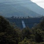
View of the levee from downstream
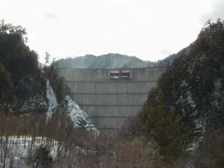
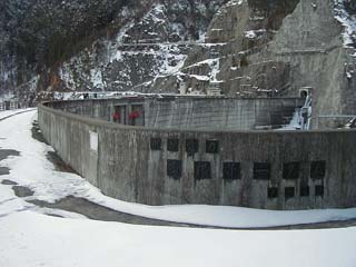
Photo of the nameplate from the right bank embankment (sorry it is difficult to distinguish)
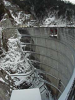
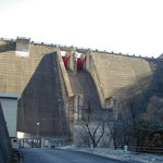
View of the embankment from the left bank
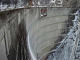
View of the embankment from the right bank
dam characteristics
| form (something takes) | arched concrete dam |
| Bank height | 133m |
| Bank length | 276.4m |
| Dam volume | 330,000m3 |
| Watershed Area | 159.8 km2 |
| Reservoir area | 117 ha |
| Total storage capacity | 43,568,000m3 |
| Effective water storage capacity | 34,013,000m3 |
| Year Completed | 1969. |
Other facilities/observations
Restrooms are closed for the winter.
When I was there, it was pretty much deserted with no one around.
I guess you could call it an unexplored region.
It is quite dangerous during the winter months.
If you are not used to snow-covered roads, it is safer not to go there.
(Added 6/23/2018: a new tunnel is being built, etc.)
It is becoming quite accessible.
(Still, I think it snows heavily in the winter...)
| Parking lot | ○ |
| Toilet | ○ |
| Park | ○ |
| PR Exhibition Hall | × |
Comment