
I wanted to see a precious sight that is only available now, and I wanted to feel firsthand the situation that can only be understood on site and the real struggles being made, so on Sunday, May 22, I visited the Meiji Water Headworks, which is in a difficult situation due to the leakage problem. Thank you, it's time for the Dam Log.
It was broadcast on the local news every day in the Tokai region, and many people came to see the "rare and precious sight," not only local Toyota and Mikawa license plates, but also cars with license plates from the surrounding area.
Also, I had not visited the Meiji Water Headworks for a long time, so my intention was to take another look at it.
Please refer to the following, which is an older article about the Meiji Water Headworks and Headworks.
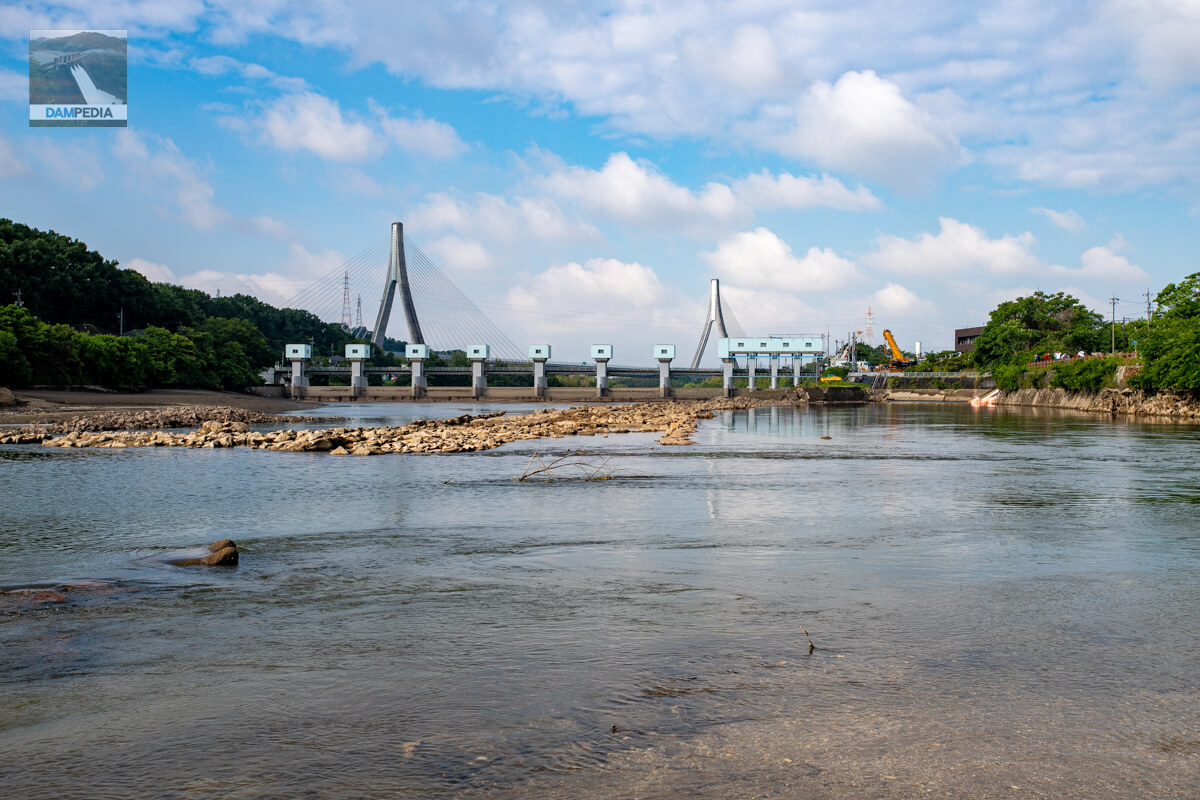
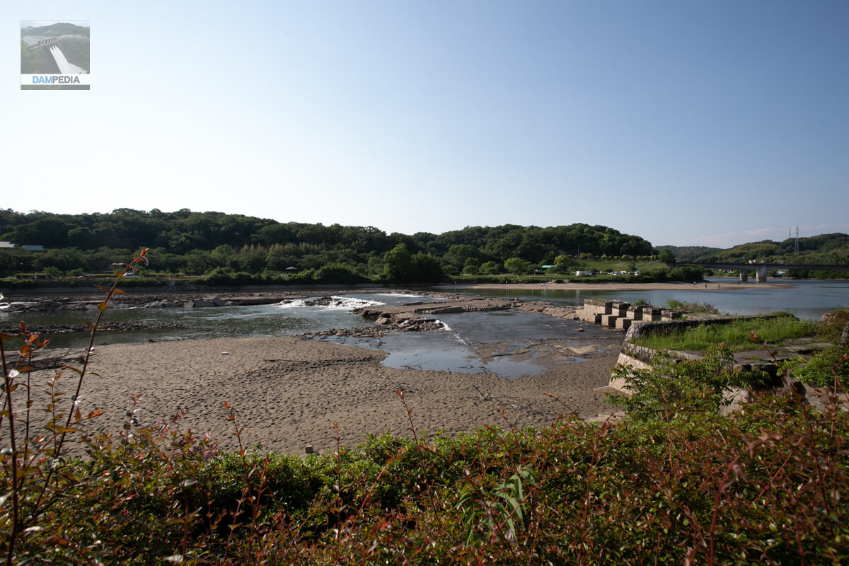
View of the old headworks and embankment from upstream
The parking lot closest to the levee was full. Since there seemed to be construction vehicles parked there, I quickly moved my car to a parking lot near the Yamamuro Bridge upstream so as not to disturb them. After that, I found a place where I could go down to the riverbank and took pictures from the riverbank. If there had been no water leakage, we would not have been able to get down to the riverbank and the old headworks would not have been so visible.
View of the old Meiji Water Headworks from the right bank
The old headworks of Meiji Waterworks is also recognized as a Heritage of Industrial Modernization.left bank (of a river)) and the boat-through locks on the right hand side as shown in the photo above (right bank (shore)The water conducting embankment can be seen in (1). However, the water level has dropped due to leakage, and the lower part of the old headwall embankment has come into view. Incidentally, the Meiji Waterworks itself is recognized as a World Heritage Site of Irrigation Facilities.
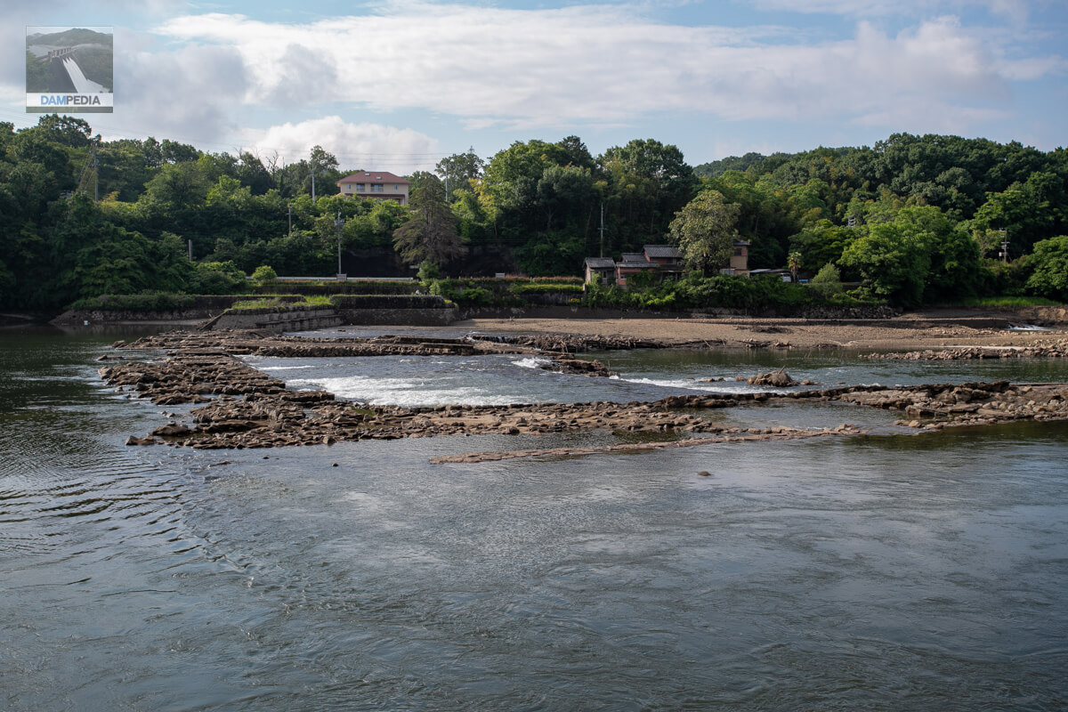
Before concrete construction methods were established for the old headworks, a plastering technique called "tataki" was used, in which weathered granite (masa-do) and lime were mixed, water was added, and the mixture was hardened by beating. The plastering technique was called "tataki," in which weathered granite (masa clay) and lime were mixed, water was added, and then the mixture was beaten into a hardened mass.
In 1966, the Yahagi River became a first-class river, and the old headworks were demolished, but the man-made stone was too strong to be torn down entirely. This episode shows how great the technology for making artificial stone was.
Looking upstream from the right bank
A ton-pack was installed between the right bank and the water conduit embankment to create a simple weir, from which the water was pumped up. At first I thought that the water pumped up from a small river adjacent to the Yahagigawa River was discharged into the Yahagigawa River, but I realized that it was the opposite according to publicly available documents from the Ministry of Land, Infrastructure, Transport and Tourism.

Pump trucks and hoses
The small river Yasunaga River is located at the far end of the photo. Because of the damage caused by the torrential rains in Tokai, the river has been repaired by culverting it into a culvert, and its lower reaches have been replaced, so it is sometimes referred to as the old Yasunaga River.
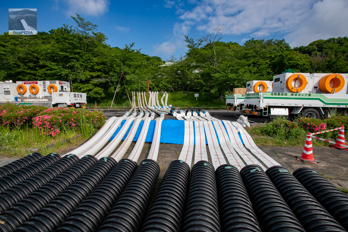
Incidentally, as far as I was able to confirm, the pump trucks on that day were dispatched from the following national agencies.
- Chubu Regional Development Bureau, Ministry of Land, Infrastructure, Transport and Tourism
- Main Ministry of Agriculture, Forestry and Fisheries?
- Kanto Agricultural Administration Bureau, Ministry of Agriculture, Forestry and Fisheries
- Hokuriku Agricultural Administration Bureau, Ministry of Agriculture, Forestry and Fisheries
- Kinki Agricultural Administration Bureau, Ministry of Agriculture, Forestry and Fisheries
As reported daily in the Tokai region, it has been an all-out battle, with several downstream areas pumping up from different rivers.
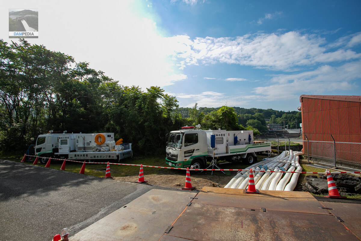
Pump truck on the other side
These two pump trucks are on the opposite side of the road on the right bank of the Yahagi River in the photo above. The hoses were dug out of the road and set up, and steel plates were laid on top of them. In another part of the road, asphalt pavement was also installed. They also hollowed out and removed the fences to let the hoses through, and seemed to be doing everything they could in the emergency situation.
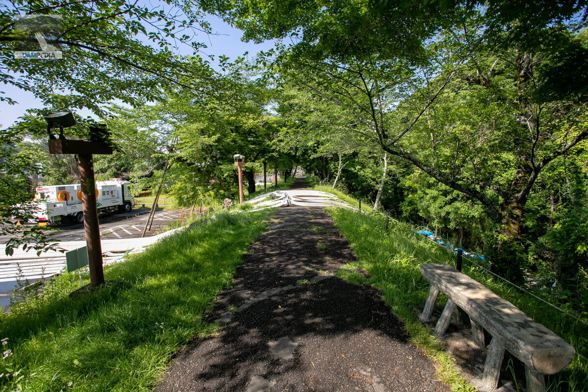
row of cherry trees
This is the situation at the back of the two upper photos. The left side of the photo is the Yahagi River and the right side is the old Yasunaga River. The upstream right bank of the Meiji Water Headworks has been developed as a water source park, and is also a spot famous for its rows of cherry trees. The rows of cherry trees are located along the old Yasunaga River, and a hose was installed across the embankment.
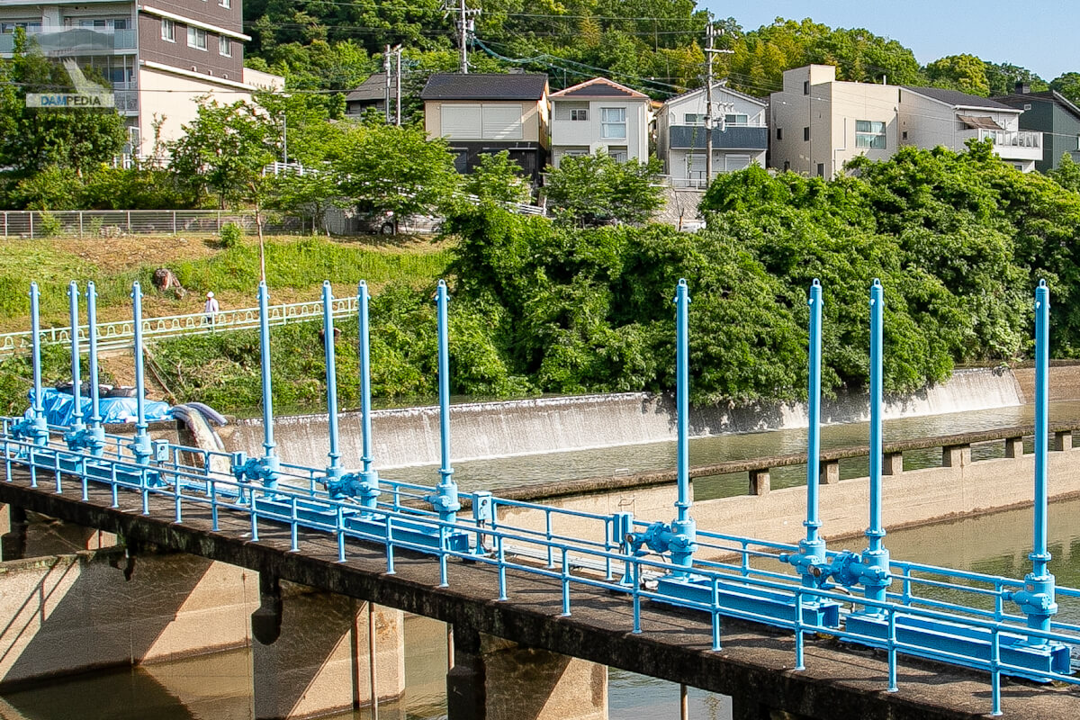
Meiji Water Headworks Sedimentation Basin
In the photo below, in the foreground is the sedimentation basin of the Meiji Waterworks headworks, and behind it is the old Yasunaga River. Normally, the old Yasunaga River would pass under the sedimentation basin and drain out through the flume without merging into the Meiji Irrigation Canal. When this was dammed up with a ton-pack, it was pumped up and overflowed to join the Meiji Waterworks.
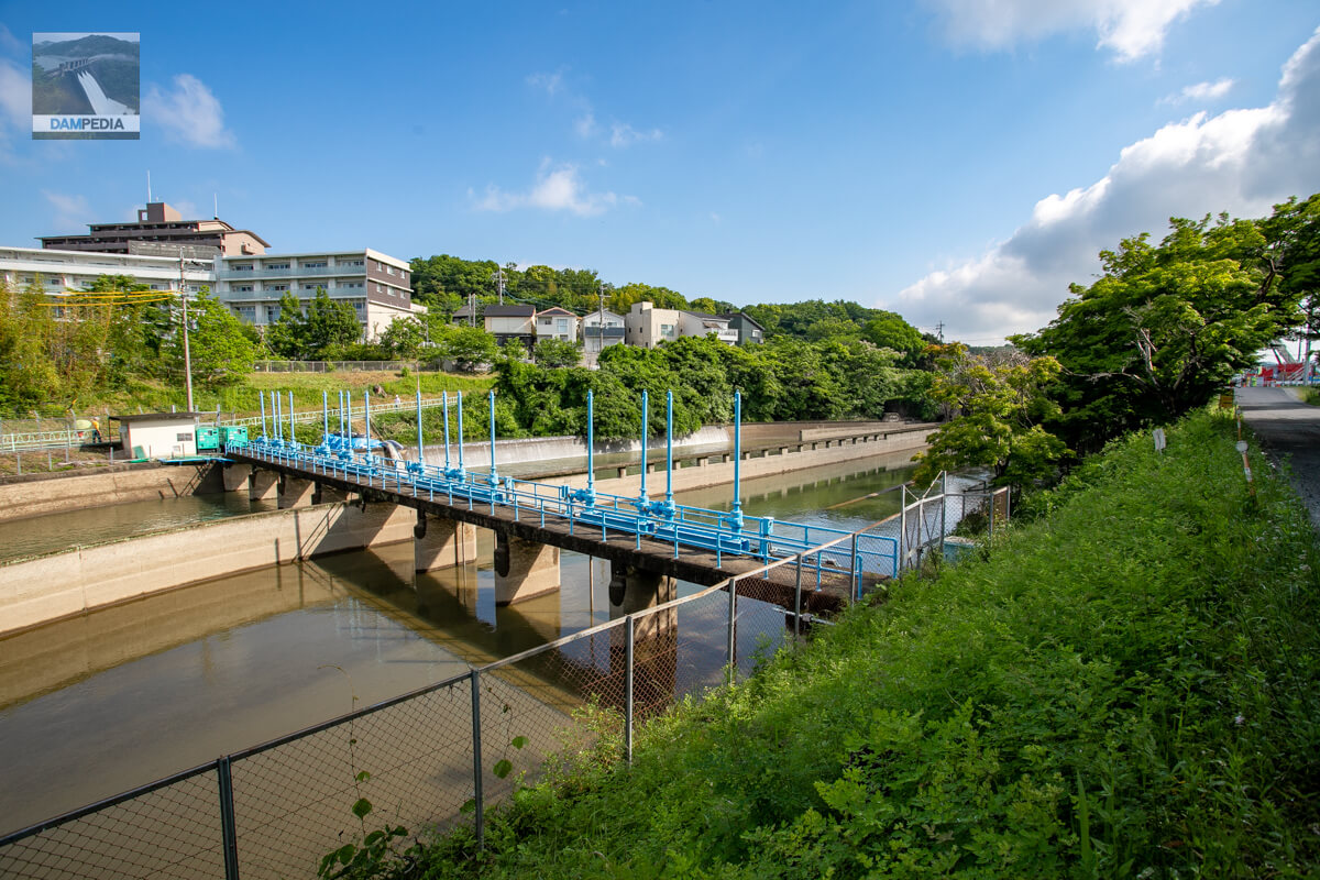
It is difficult to see in the photo above, so if you zoom in, it looks like the photo below.
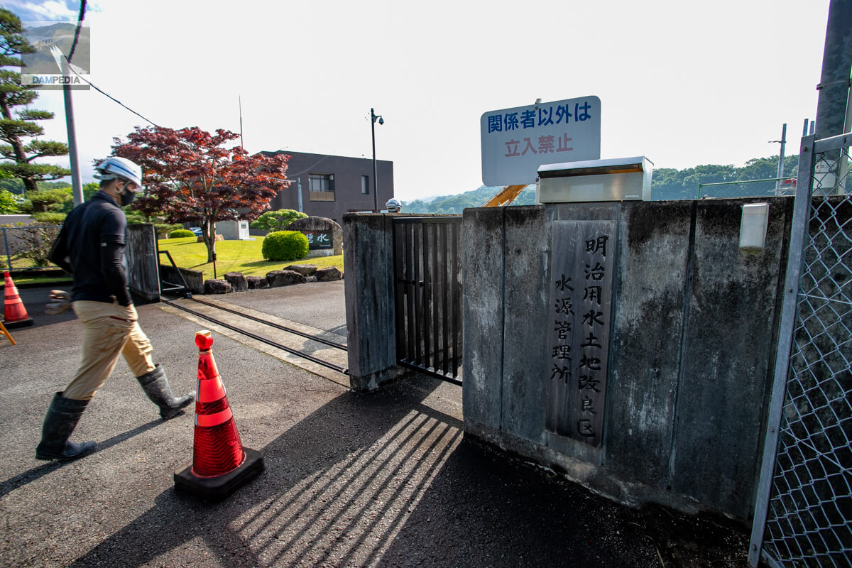
Meiji Water Supply Land Improvement District Water Source Management Office
It was just before 8:00 a.m., but workers were entering one after another. I was only watching from the outside, but I could feel the tension in the air.
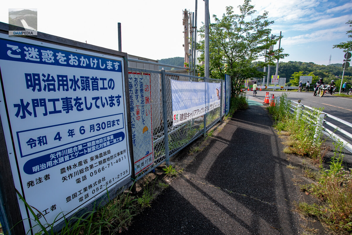
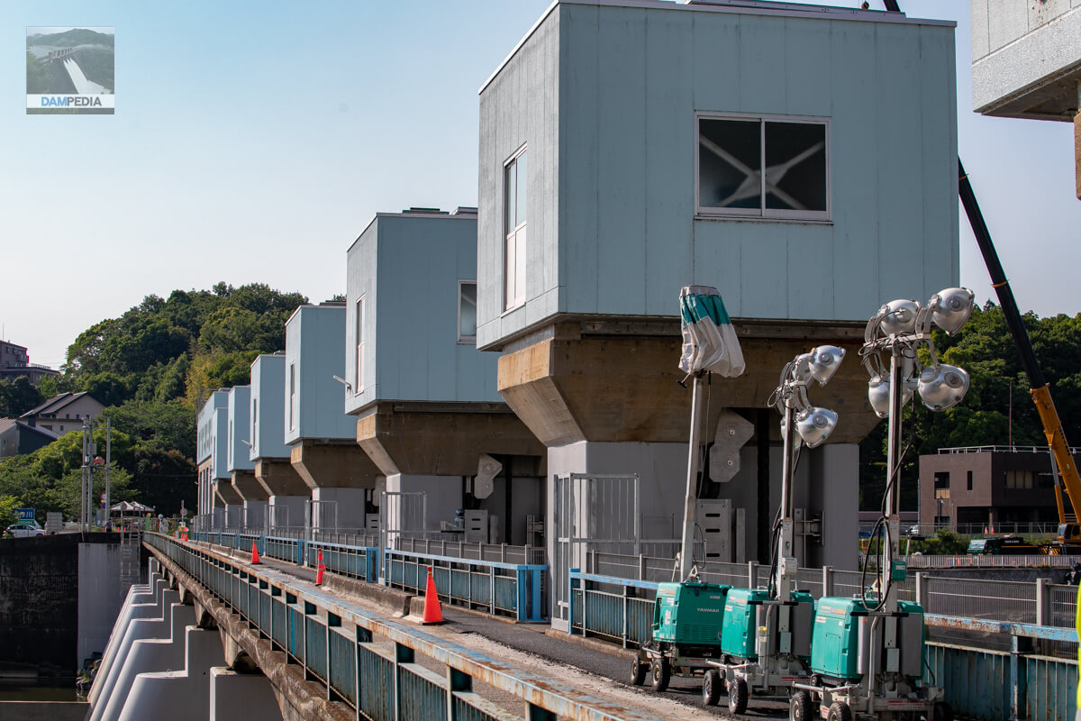
Sluice gate construction sign
Originally, the Meiji Water Headworks was undergoing earthquake-proofing work on the gates as part of the Yahagigawa River Comprehensive Phase II Farmland Disaster Prevention Project, and the leakage accident occurred just before the project was about to end (or rather, almost at the end).
As shown in the figure below, this construction work is to add piles to the bottom of the gate piers so that they can withstand a major earthquake. It is sometimes said that this construction work may have influenced the recent leakage accident, but at this point, the causal relationship between the leakage and the construction work is not clearly known.
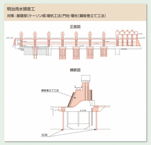
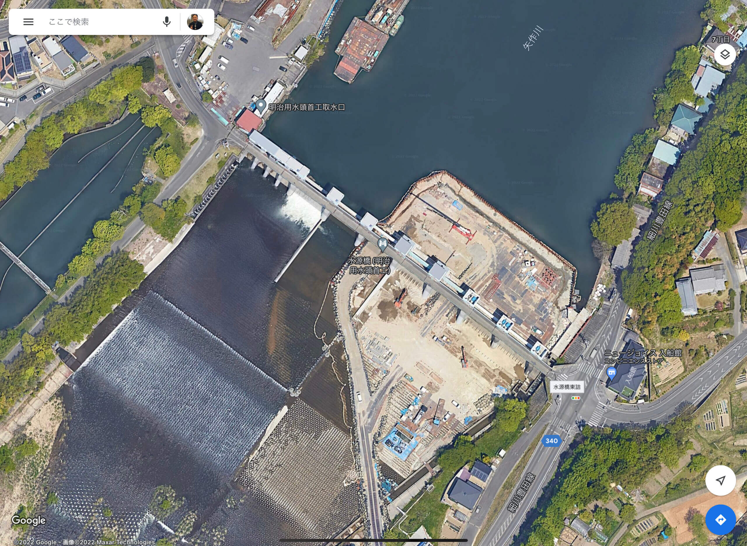
Incidentally, the current Google Maps aerial photo was taken at a time when the building was in the midst of renovation.
View of the piping exit from downstream on the right bank
It is said that this leakage accident may have been caused by a piping phenomenon, in which water flows downstream through the lower part of the embankment after a water channel is formed from upstream. There is a place on the left bank downstream of the headwall that appears to be the outlet of the leak, and water can be seen gushing out from there.
In general, concrete dams are constructed by excavating to the foundation bedrock prior to casting the embankment and injecting cement milk into cracks in the bedrock (this is called grouting) to prevent water from seeping in. The Meiji Water Headwall, however, is a floating weir, which means that the embankment is placed on top of the accumulated sand and gravel. Piping is more likely to occur if the weir is simply placed on top of the gravel, so concrete aprons are constructed in both the upstream and downstream directions to prevent piping from occurring. In the photo above, you can see the concrete floor installed up to the flow-conducting wall.
In addition, in the Meiji Water Headworks, sheet piles with a depth of 4 m are buried as an impervious wall at a location 20 m upstream from the upstream face of the embankment, 10 m deep at the upstream face of the embankment, and 4 m deep at 10.5 m downstream from the center of the gate pier, which will also be effective for piping. (reference data)
Floating weirs are not uncommon, and are often used in small weirs and headworks. The Asamushi Dam in Aomori Prefecture, which has an embankment height of 15 m or higher, is a floating type dam that does not block water because there is a hot spring downstream of the embankment and water from the upstream affects the quality of the spring.
gushing forth (spring water)
It may be hard to tell from a still image, but they keep springing up.

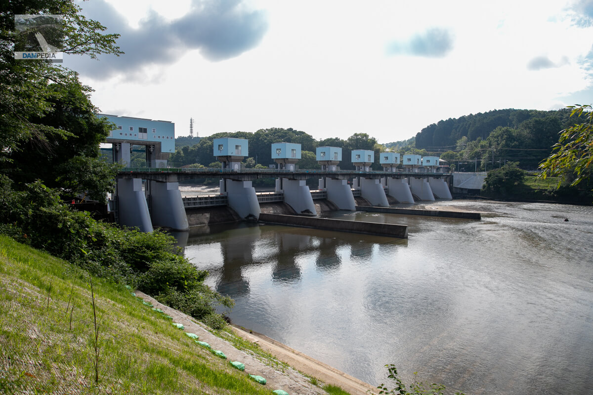
Looking downstream from the right bank
You can clearly see that the seismic work has cleaned up the gate piers.
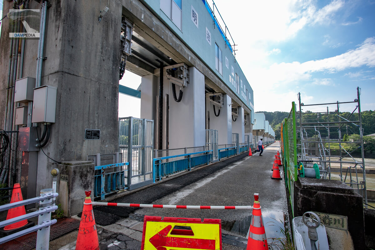
View of the top edge from the right bank
Immediately after the accident, it seemed that visitors could cross the top edge freely, but on this day, it was off limits except for related parties and the media. It seems that those who use the road for commuting to work or school are allowed to pass, but we were not sure how to identify them.
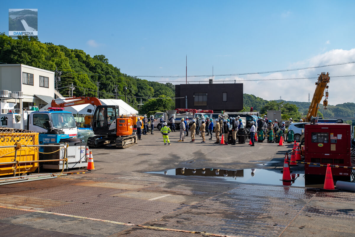
Morning meeting
A morning meeting of construction workers had begun on the grounds of the land improvement district. I guessed that they were communicating how to handle the day's activities, but the expressions on the faces of the participants seemed tense.
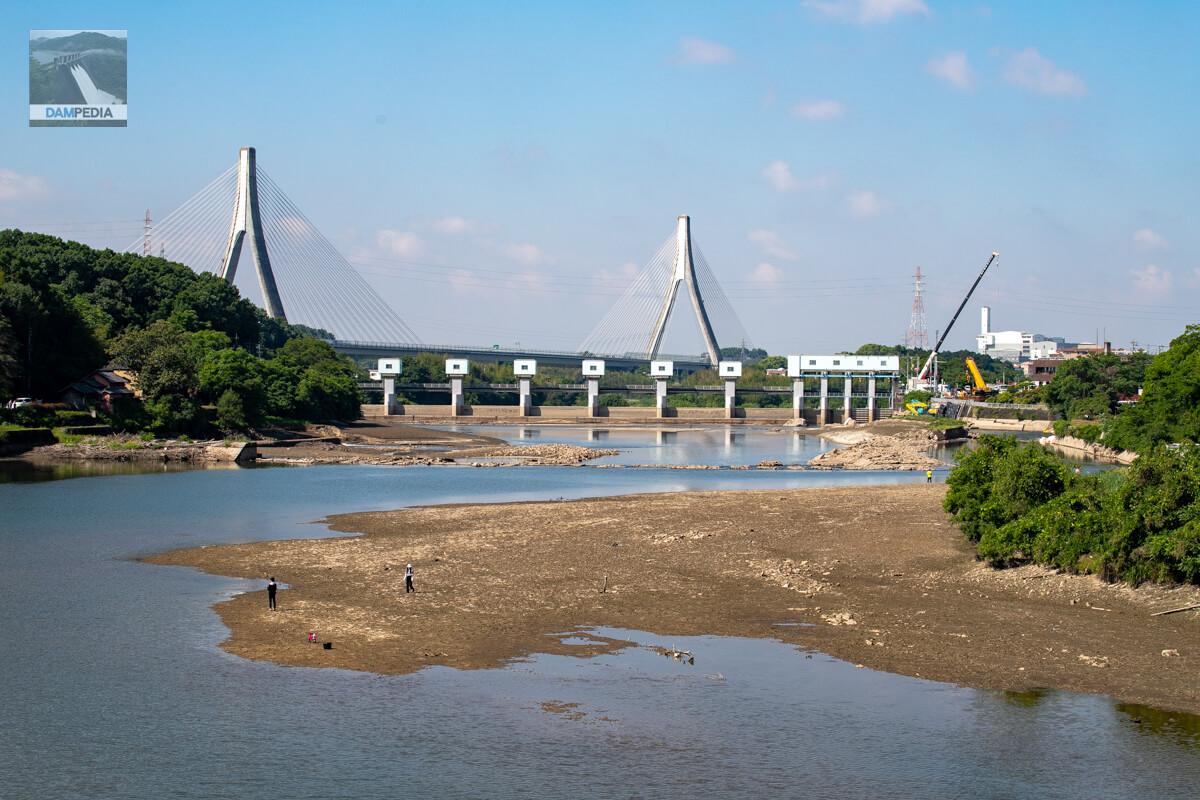
View of the old headworks and the upstream face of the embankment from Yamamuro Bridge
We moved upstream to Yamamuro Bridge. In the background is the Toyota Arrows Bridge on the Ise Bay Highway. On the right bank, a large crane is positioned, carrying pump hoses and ton packs.
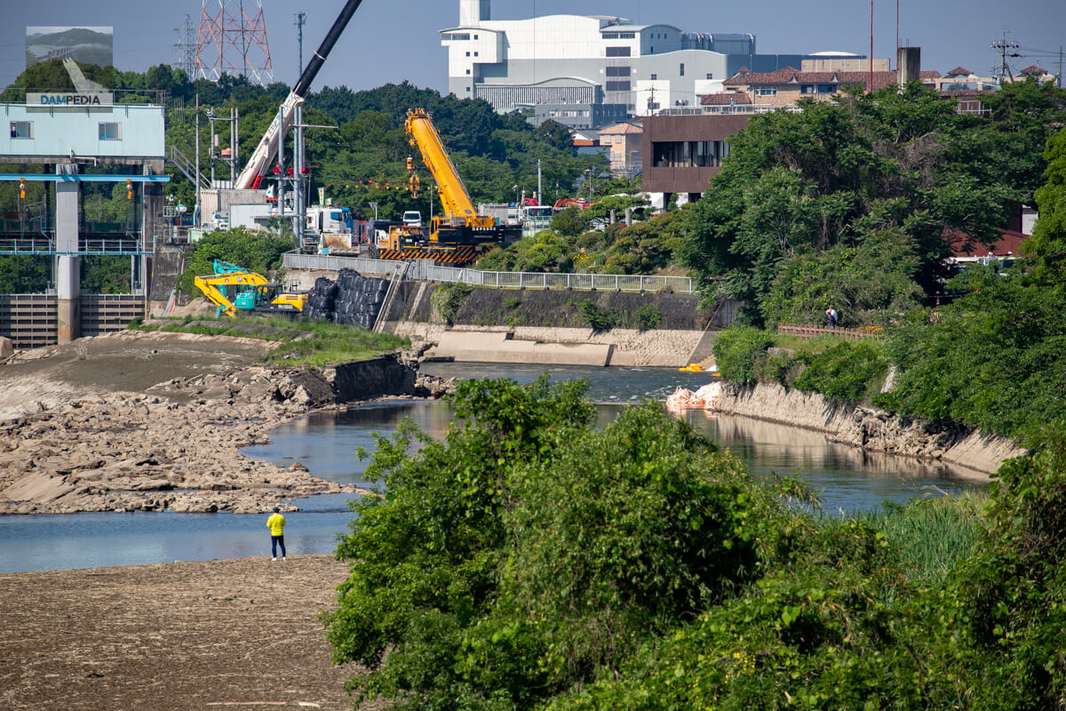
View from Yamamuro Bridge to the right bank
There were also people on the sidewalk of Yamamuro Bridge watching the headworks. After this, I thought about walking to the left bank of the Yahagigawa River, but the left bank road of the Yahagigawa River is quite narrow for walking, even though there is a lot of traffic, and it is a bit far, so I gave up and left. There was no place to park even if we wanted to go by car.
Unable to give up, I went to the left bank.
Once I visited a group of dams upstream of the Yahagi River, I stopped by the left bank of the Meiji Water Headworks before leaving in the evening, unable to give up. I think there are more people visiting than in the morning.
Piping entrance area
From here I could not tell where the piping entrance is. It might be closer to the embankment.
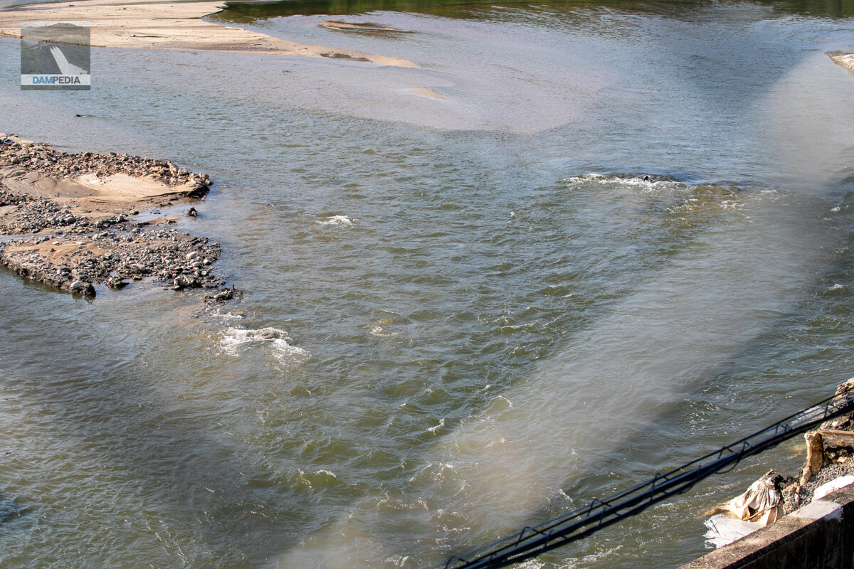
Piping exit seen from the left bank
The water is coming from the middle of the photo, but you can see that it is coming from about four different places.

We have summarized the leakage pattern in a brief video, which may be easier to understand.
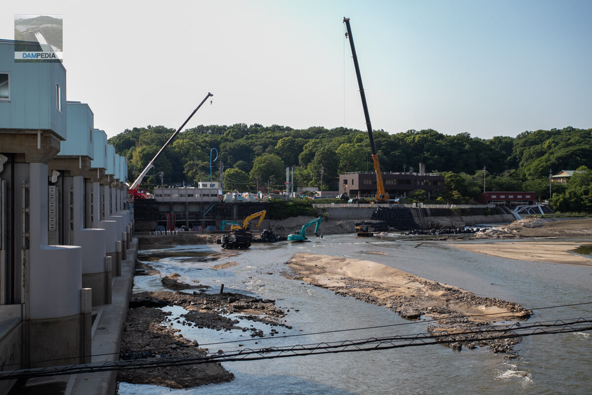
Work by cranes and heavy machinery
Anyway, the site also conveys desperation.
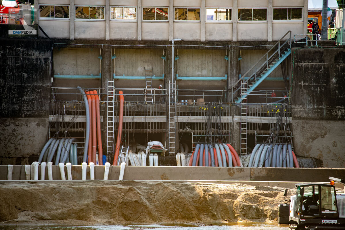
Large number of hoses fed into the water intake
In this accident, the water has been drained, and because the water level does not reach the intake, water cannot be taken in and sent out. The reason why the intake is located slightly higher than the river bottom is because at a lower level, the water intake would be blocked by accumulated sediment, so the only way to pump up the water is to pump up.
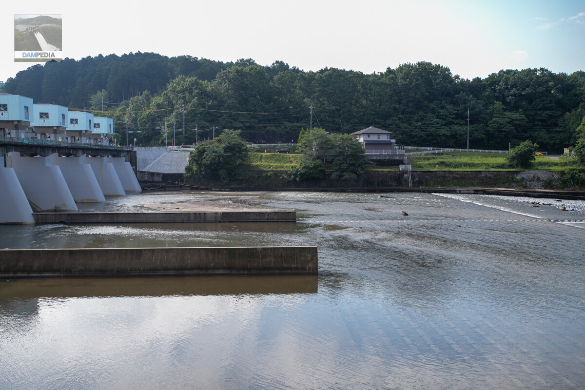
View of the old headworks from the left bank
Finally, we decided to look at the old headworks from the left bank. The left bank is a little more open, and one can see all the way to the other side of the river. There is a signboard on the left bank as well as on the right bank. However, even though the water level has dropped due to the accident, it is still difficult to get down to the riverbed on the left bank, unlike the right bank.
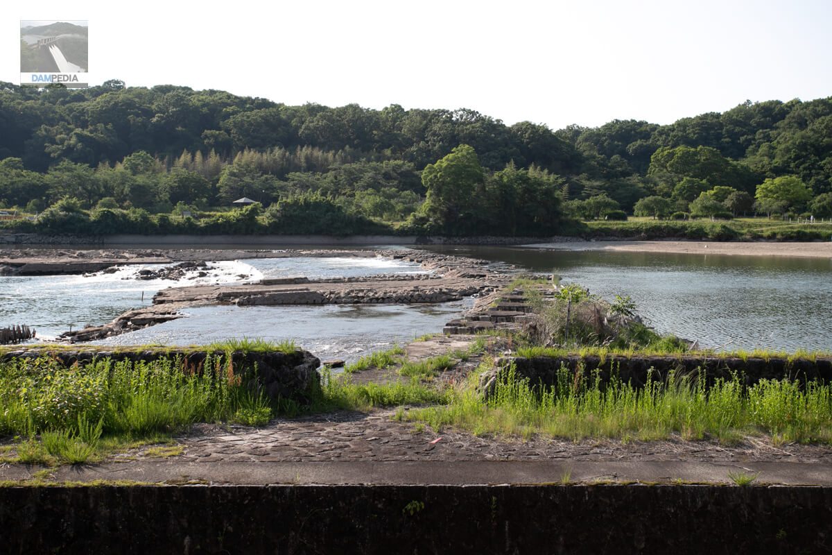
View of the old headworks from the boat passage on the left bank
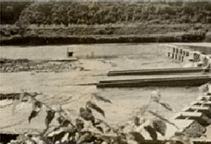
As mentioned above, the boat-through lock in the foreground of the photo can be seen on a regular basis, but the lower part of the embankment behind it can only be seen now, when the water level has dropped. For comparison, a photo of the old headworks of the Meiji Waterworks when it was in service is also quoted below.
The Meiji water supply has a history of being originally constructed for agricultural use, but with the development of Toyota City, it has become an important infrastructure that supplies water to industry as well. That infrastructure has now suffered an unprecedented accident like this one, which is likely to cause significant damage, especially to agriculture.
However, there are people who are working hard to somehow get water supplied to the area. While paying our respects to these people, we also hope that the day will soon come when the water supply will be restored to the farmers involved in the Meiji Water Supply Project, and they will be able to farm with peace of mind.
Also, for those of you who learned of the existence of headworks through this leakage accident. In closing, I would like to say that I hope that this incident will make you take this opportunity to look at various infrastructures, including dams, and reaffirm their importance and the preciousness of water.
Comment